Signs Tagged With Intersection
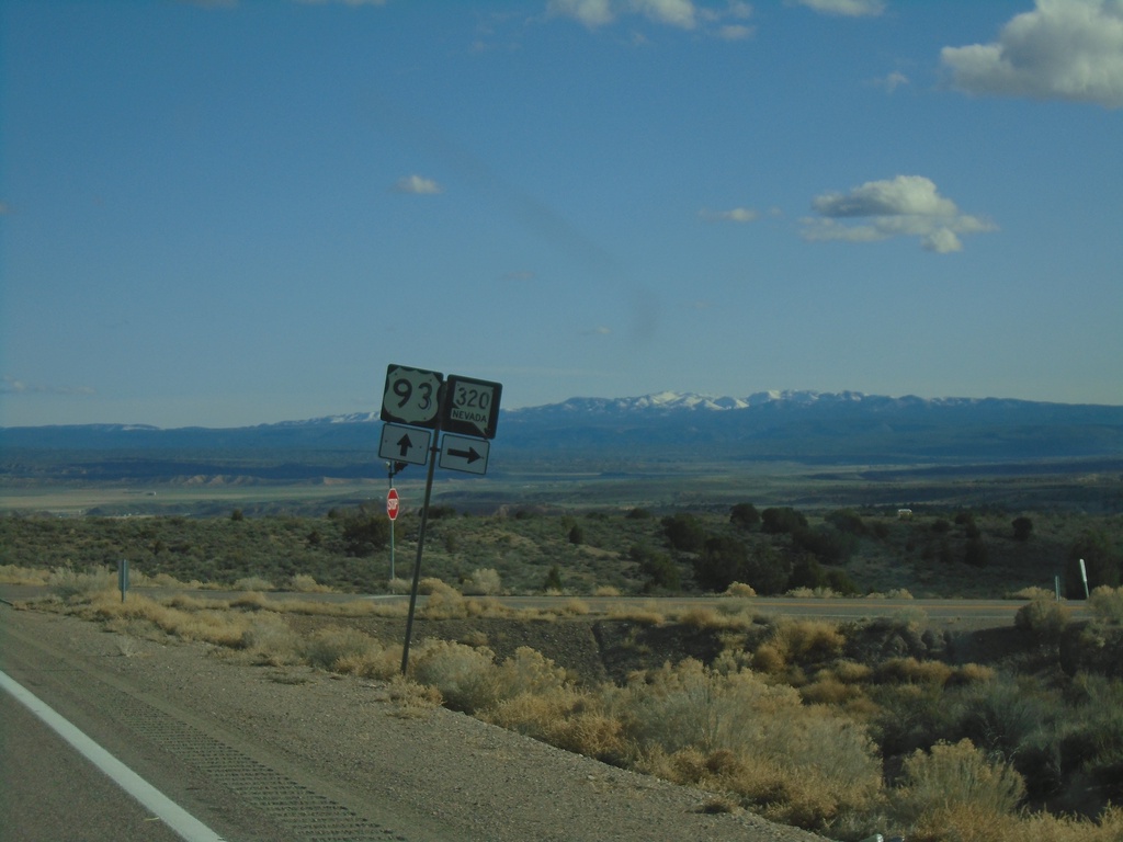
US-93 South at NV-320
US-93 South at NV-320 in Lincoln County.
Taken 03-31-2023

 Pioche
Lincoln County
Nevada
United States
Pioche
Lincoln County
Nevada
United States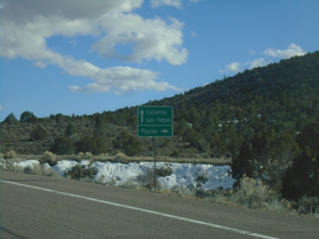
US-93 South at Bus. US-93/NV-321
US-93 South at Bus. US-93/NV-321 at the south side of Pioche. Use Bus. US-93/NV-321 north for Pioche; continue south US-93 for Caliente and Las Vegas.
Taken 03-31-2023

 Pioche
Lincoln County
Nevada
United States
Pioche
Lincoln County
Nevada
United States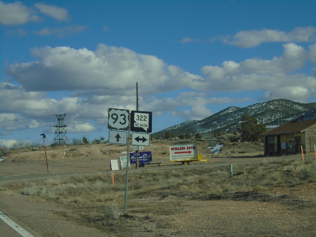
US-93 South at NV-322
US-93 South at NV-322 in Pioche.
Taken 03-31-2023
 Pioche
Lincoln County
Nevada
United States
Pioche
Lincoln County
Nevada
United States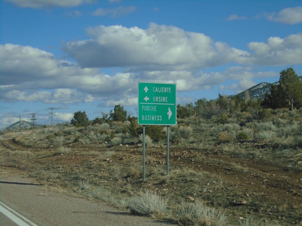
US-93 South at NV-322
US-93 South at NV-322 in Pioche. Use NV-322 west for Pioche Business; use NV-322 east for Ursine. Continue south on US-93 to Caliente.
Taken 03-31-2023
Pioche
Lincoln County
Nevada
United States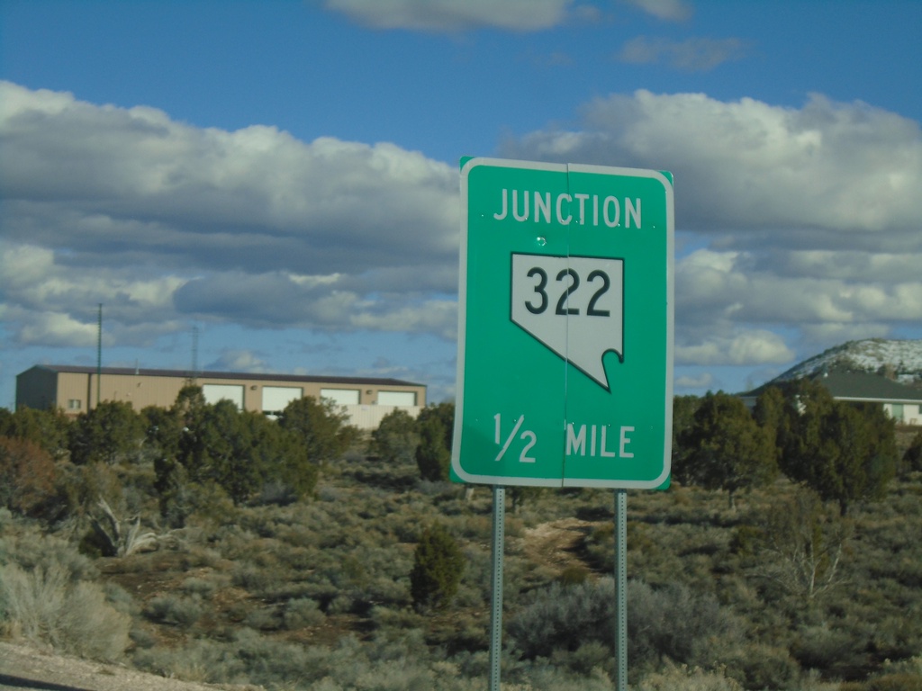
US-93 South Approaching NV-322
US-93 South approaching NV-322 in Pioche.
Taken 03-31-2023
Pioche
Lincoln County
Nevada
United States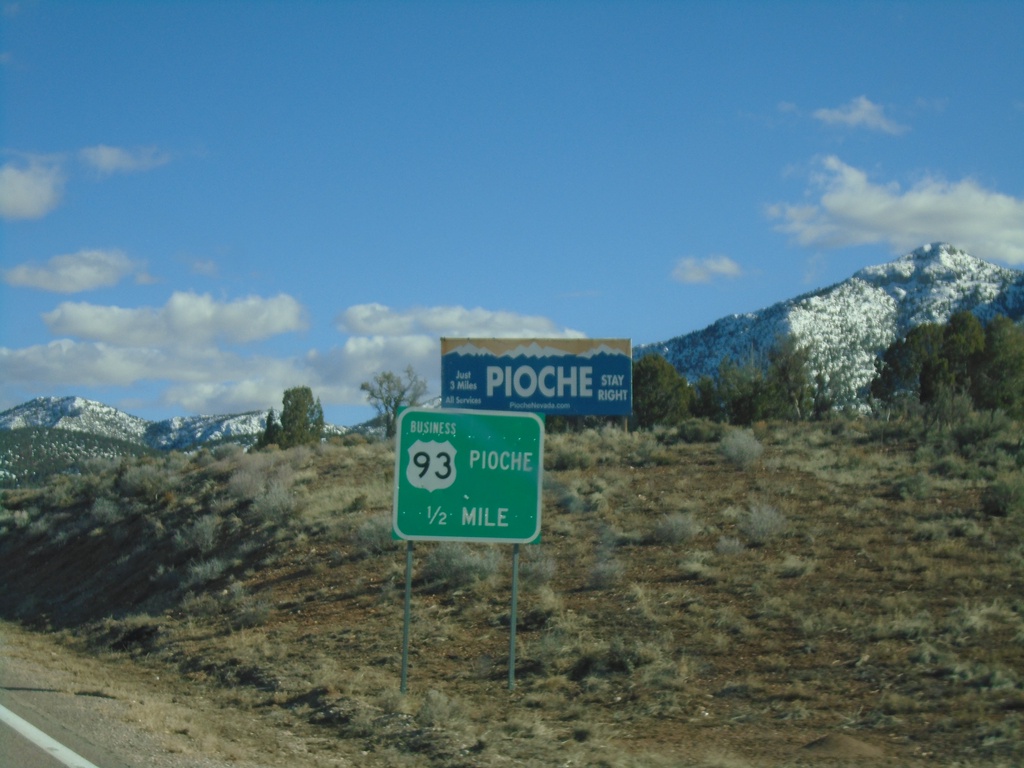
US-93 South Approaching Bus. US-93/NV-321
US-93 South approaching Bus. US-93/NV-321 in Pioche. This is the northern end of the Pioche business loop.
Taken 03-31-2023
Pioche
Lincoln County
Nevada
United States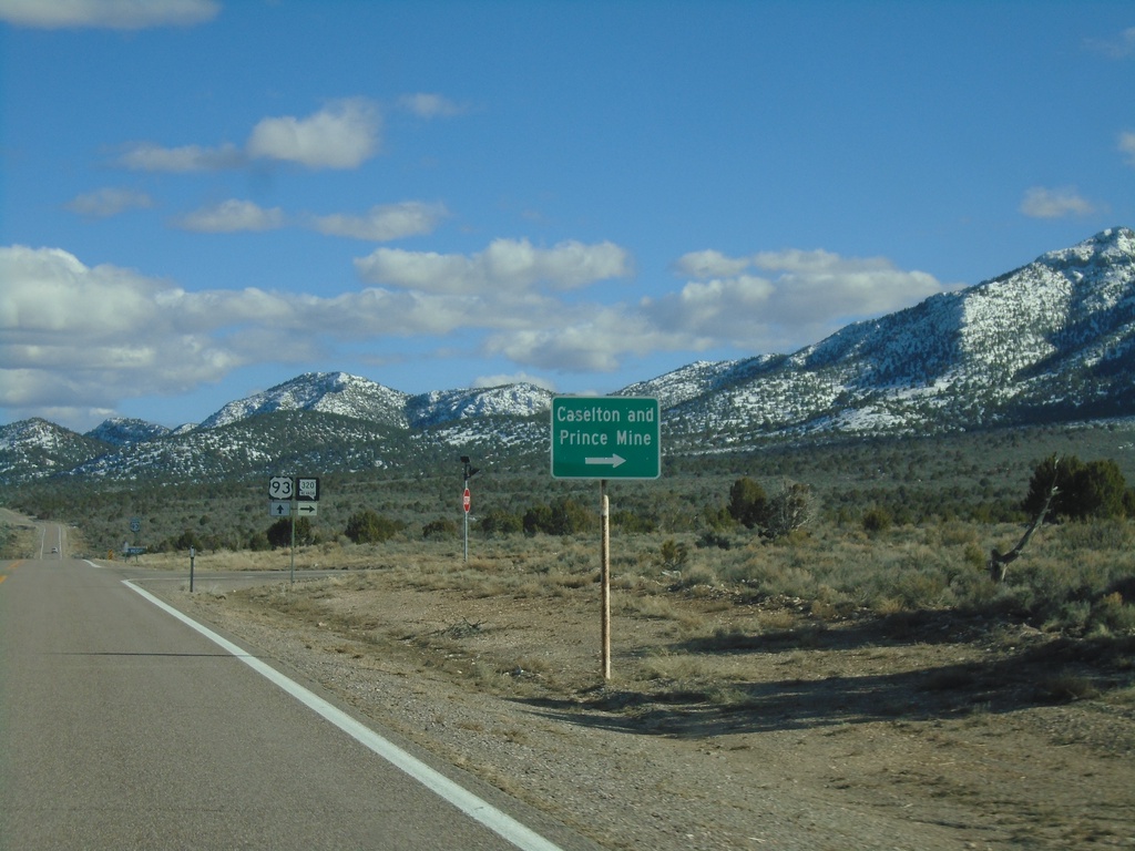
US-93 South at NV-320
US-93 south at NV-320 south to Caselton and Prince Mine.
Taken 03-31-2023
Pioche
Lincoln County
Nevada
United States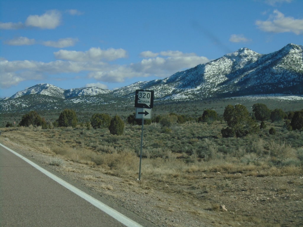
US-93 South Approaching NV-320
US-93 South approaching NV-320 in Lincoln County.
Taken 03-31-2023
Pioche
Lincoln County
Nevada
United States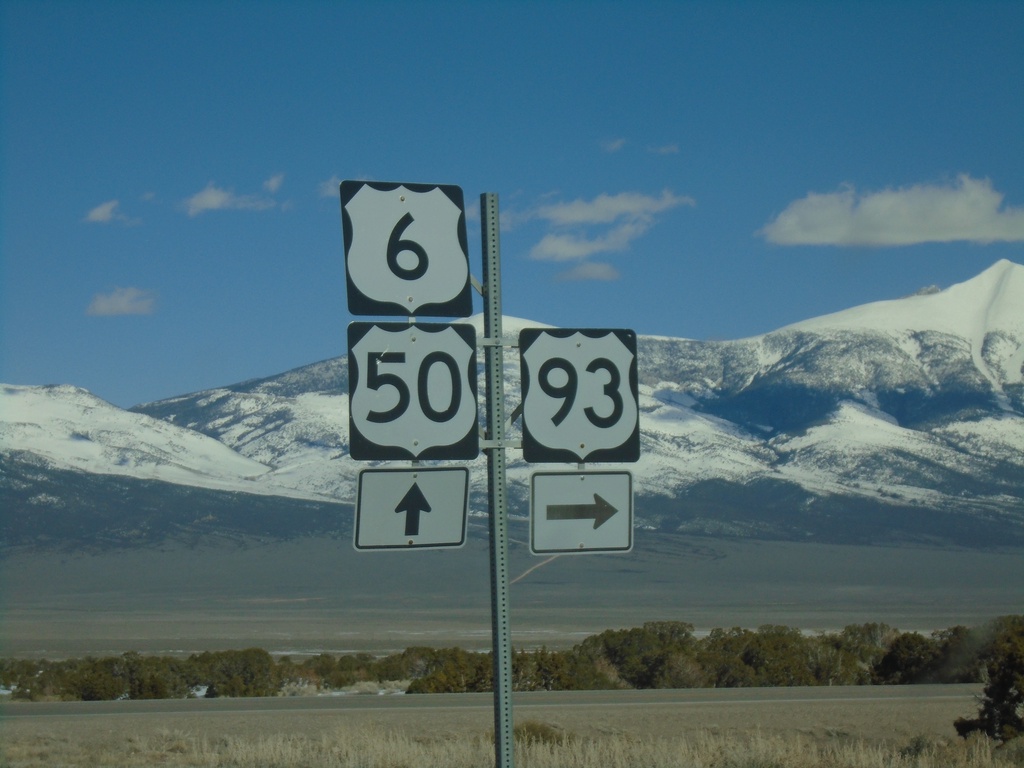
US-50 East/US-6 East/US-93 South at US-93 Junction
US-50 East/US-6 East/US-93 South at US-93 - Majors Junction.
Taken 03-31-2023

 Majors Place
White Pine County
Nevada
United States
Majors Place
White Pine County
Nevada
United States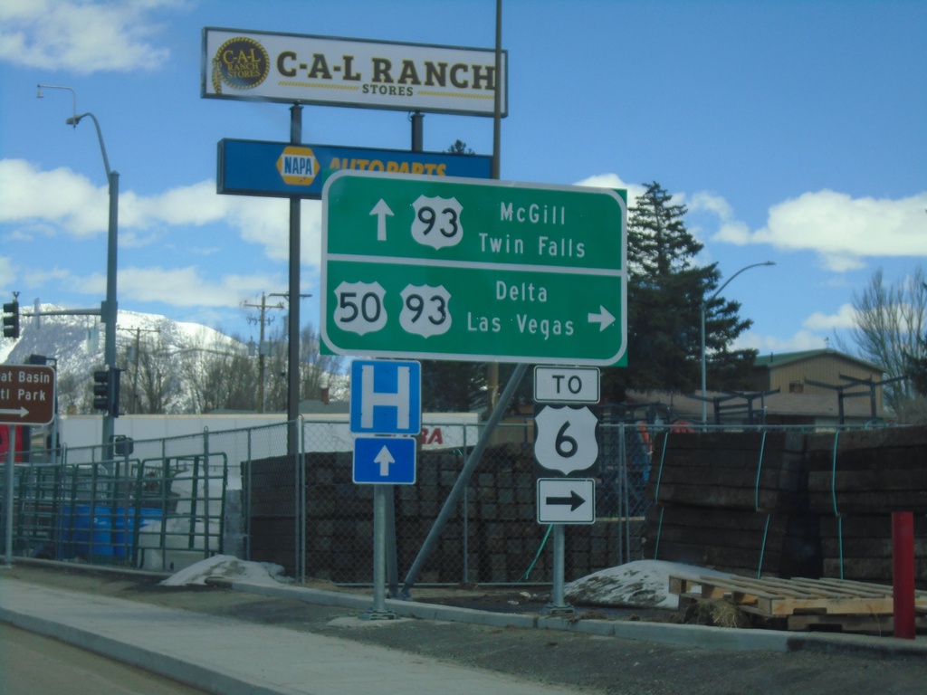
US-50 East at US-93
US-50 east at US-93. Continue ahead for US-93 north to McGill and Twin Falls (Idaho). Turn right for US-93 and US-50 for Delta (Utah, Las Vegas and US-6. US-50 joins US-93 south to Majors Junction.
Taken 03-31-2023
Ely
White Pine County
Nevada
United States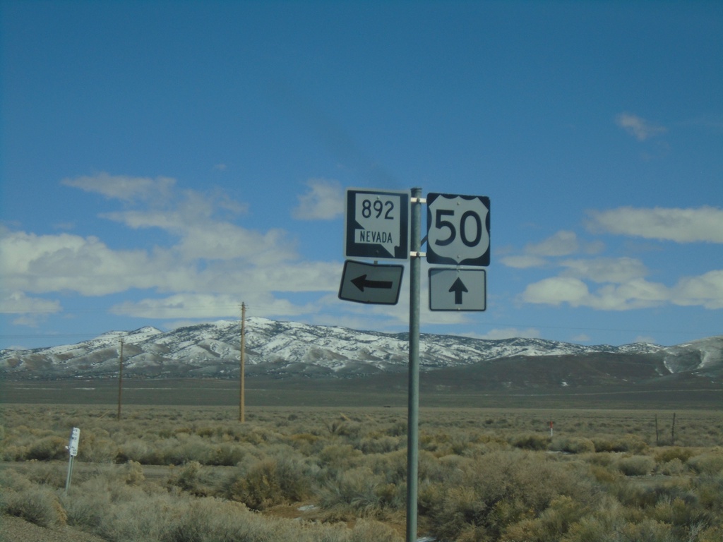
US-50 East at NV-892
US-50 East at NV-892 Junction in White Pine County.
Taken 03-31-2023
 Ely
White Pine County
Nevada
United States
Ely
White Pine County
Nevada
United States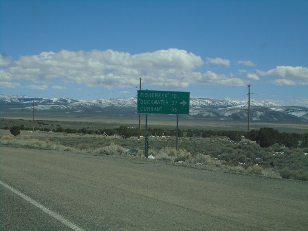
US-50 East - Duckwater Jct.
US-50 East at junction to Fishcreek, Duckwater, and Currant.
Taken 03-31-2023
Eureka
Eureka County
Nevada
United States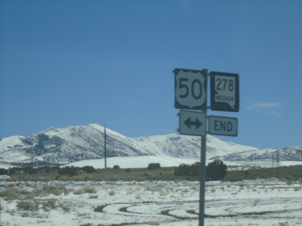
End NV-278 South at US-50
End NV-278 South at US-50 in Eureka.
Taken 03-31-2023
 Eureka
 County
Nevada
United States
Eureka
Eureka County
Nevada
United States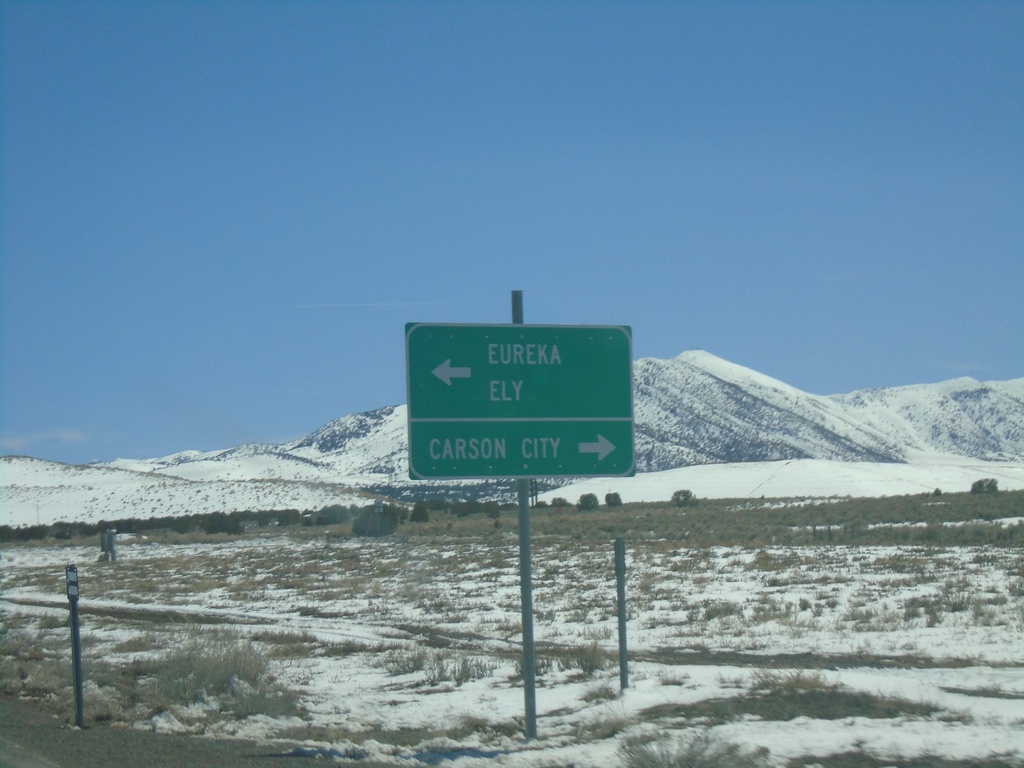
End NV-278 South at US-50
End NV-278 south at US-50. Use US-50 west for Carson City. Use US-50 east for Eureka and Ely.
Taken 03-31-2023
Eureka
Eureka County
Nevada
United States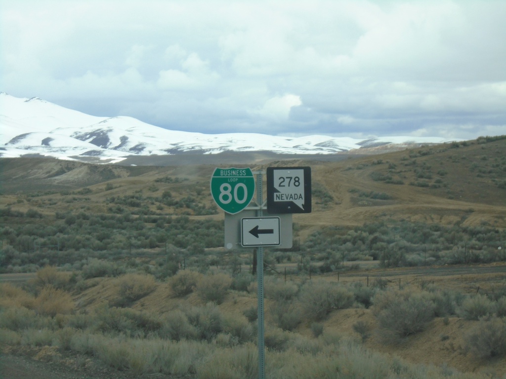
I-80 West - Exit 279 Offramp
I-80 West - Exit 279 Offramp. Turn left for NV-278 South/BL-80 East.
Taken 03-31-2023

 Carlin
Elko County
Nevada
United States
Carlin
Elko County
Nevada
United States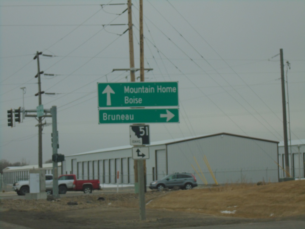
End ID-67 East At ID-51
End ID-67 east at at ID-51. Use ID-51 south for Bruneau. Use ID-51 north for Mountain Home and Boise.
Taken 03-04-2023

 Mountain Home
Elmore County
Idaho
United States
Mountain Home
Elmore County
Idaho
United States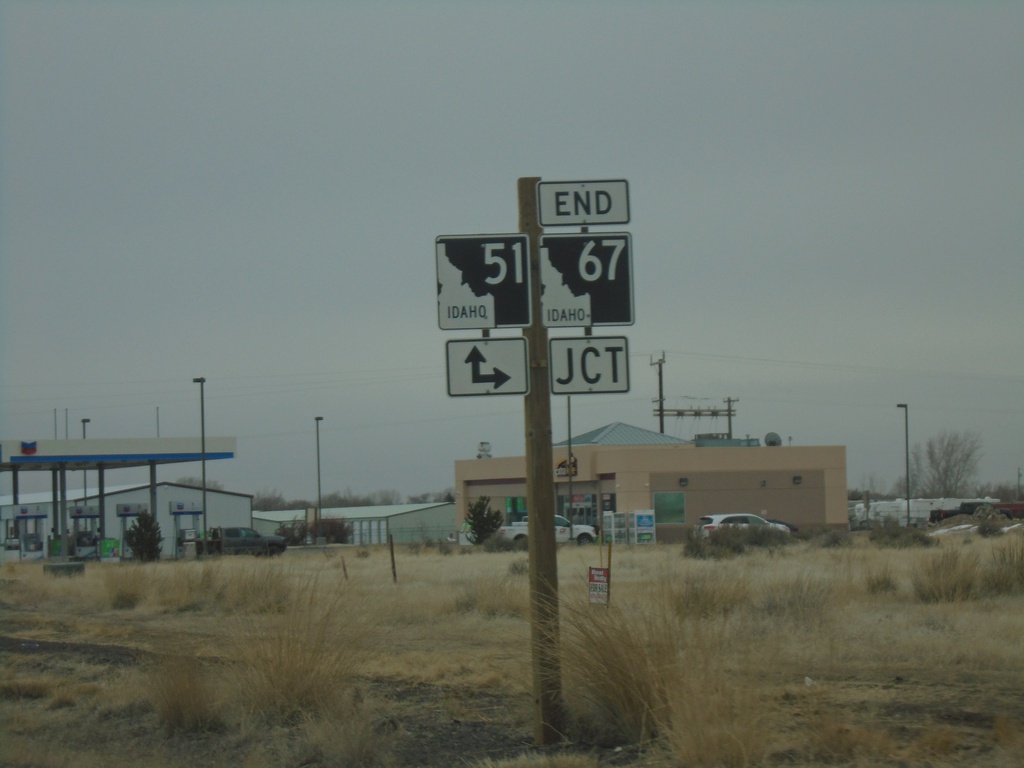
End ID-67 East at ID-51
End ID-67 east at ID-51. Turn right for ID-51 south; continue ahead for ID-51 north.
Taken 03-04-2023
Mountain Home
Elmore County
Idaho
United States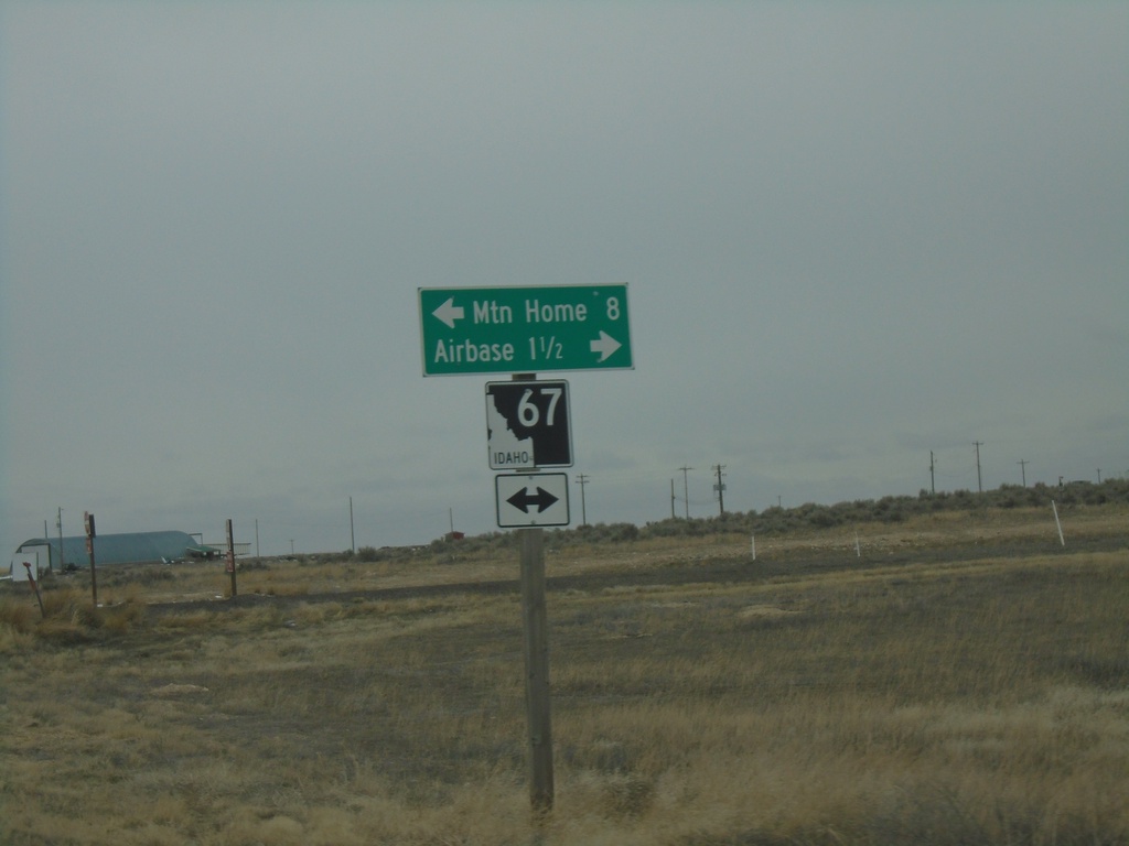
End ID-167 East at ID-67
End ID-167 east at ID-67. Use ID-67 west for the Airbase (Mountain Home AFB). Use ID-67 east for Mountain Home.
Taken 03-04-2023
 Mountain Home Air Force Base
Elmore County
Idaho
United States
Mountain Home Air Force Base
Elmore County
Idaho
United States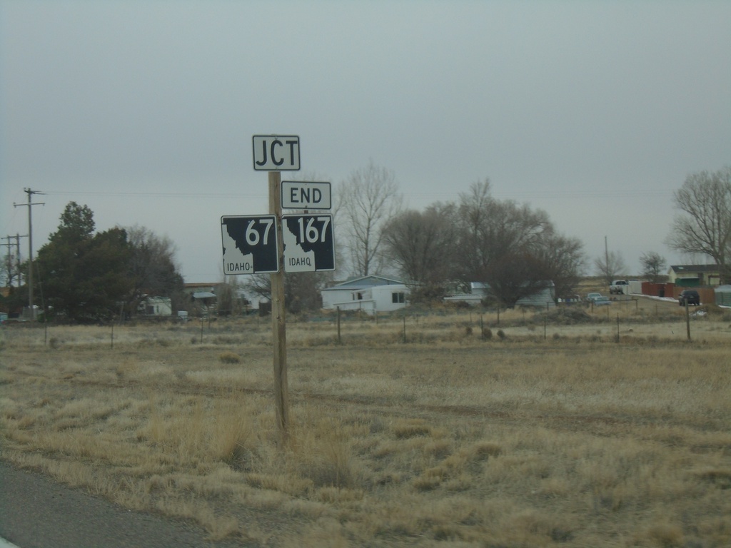
ID-167 East Approaching ID-67
ID-167 east approaching ID-67. ID-167 ends at ID-67.
Taken 03-04-2023
Mountain Home
Elmore County
Idaho
United States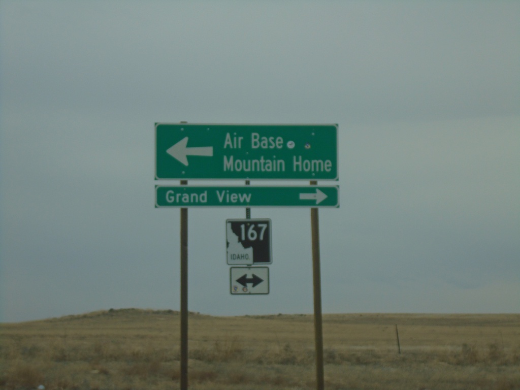
Simco Road South at ID-167
Simco Road South at ID-167. Use ID-167 West to Grand View; ID-167 East to Air Base and Mountain Home.
Taken 03-04-2023
Mountain Home
Elmore County
Idaho
United States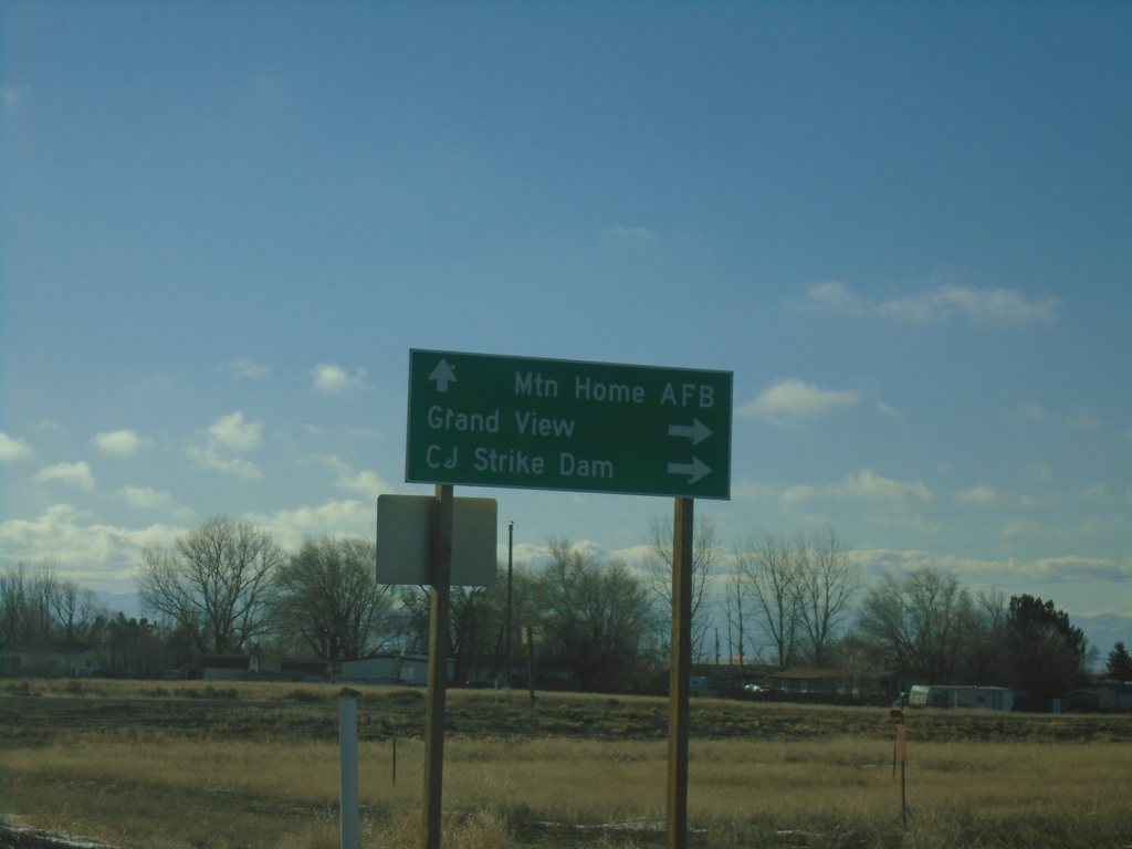
ID-67 West at ID-167
ID-67 West at ID-167. Continue on ID-67 West to Mountain Home AFB. Turn right for ID-167 to Grand View and CJ Strike Dam.
Taken 01-01-2023
Mountain Home
Elmore County
Idaho
United States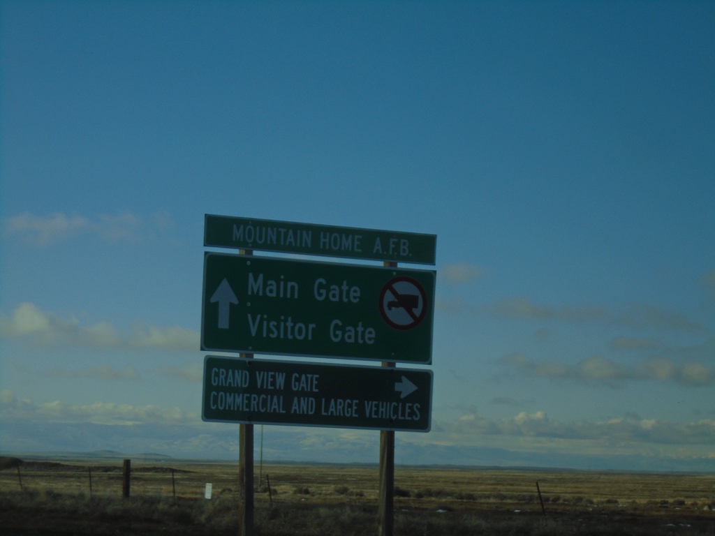
Mountain Home AFB - Gate Information
Mountain Home AFB Gate Information on ID-67 West approaching ID-167.
Taken 01-01-2023
Mountain Home
Elmore County
Idaho
United States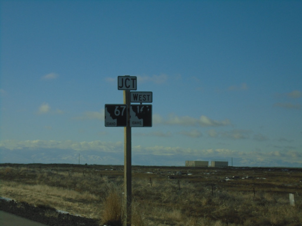
ID-67 West Approaching ID-167
ID-67 West approaching ID-167 West in Elmore County.
Taken 01-01-2023
Mountain Home
Elmore County
Idaho
United States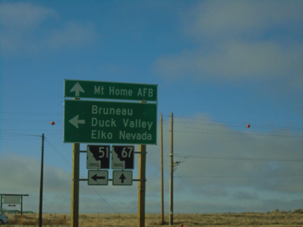
ID-51 South at ID-67 - Mountain Home
ID-51 South at ID-67 in Mountain Home. Turn left to continue on ID-51 South to Bruneau, Duck Valley, and Elko (Nevada). Continue straight for ID-67 to Mountain Home AFB.
Taken 01-01-2023
Mountain Home
Elmore County
Idaho
United States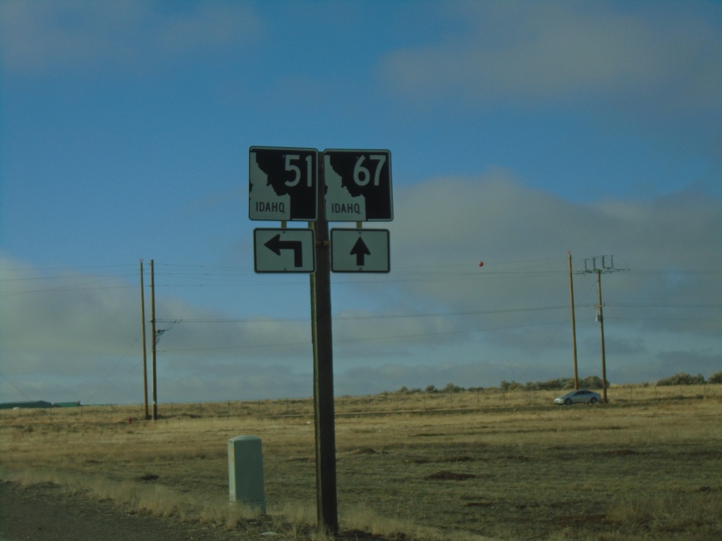
ID-51 South Approaching ID-67
ID-51 South approaching ID-67 in Mountain Home.
Taken 01-01-2023
Mountain Home
Elmore County
Idaho
United States