Signs Tagged With Intersection
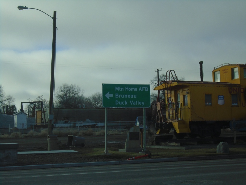
ID-51 - Mountain Home
ID-51 - American Legion Blvd at Old Oregon Trail Road. Turn left to continue on ID-51 to Mountain Home AFB, Bruneau, and Duck Valley.
Taken 01-01-2023
 Mountain Home
Elmore County
Idaho
United States
Mountain Home
Elmore County
Idaho
United States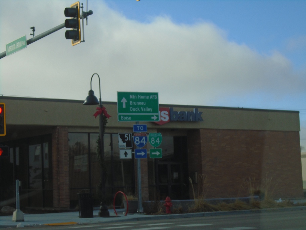
BL-84 West at ID-51 - Mountain Home
BL-84 west at ID-51 in Mountain Home (American Legion Blvd. at N 2nd E). Turn right on N 2nd E to continue west on BL-84 and for I-84 and Boise. Continue straight for ID-51 south to Mountain Home AFB, Bruneau, and Duck Valley (Indian Reservation).
Taken 01-01-2023

 Mountain Home
Elmore County
Idaho
United States
Mountain Home
Elmore County
Idaho
United States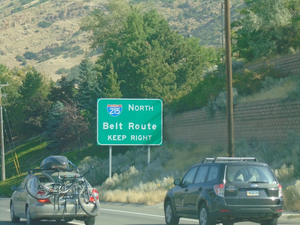
UT-190 West Approaching I-215 North
UT-190 West approaching I-215 North/Belt Route in Holladay.
Taken 09-12-2022

 Holladay
Salt Lake County
Utah
United States
Holladay
Salt Lake County
Utah
United States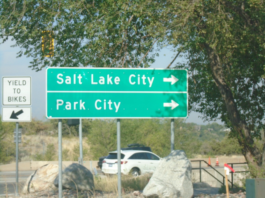
UT-190 West at UT-210 - Cottonwood Heights
UT-190 West at UT-210 in Cottonwood Heights. Turn right to continue on UT-190 West for Salt Lake City and Park City.
Taken 09-12-2022
 Salt Lake City
Salt Lake County
Utah
United States
Salt Lake City
Salt Lake County
Utah
United States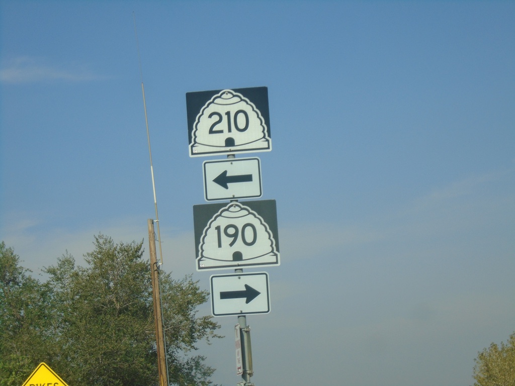
UT-190 West at UT-210 - Cottonwood Heights
UT-190 West at UT-210 in Cottonwood Heights. Turn right on Wasatch Blvd. to continue west on UT-190; turn left on Wasatch Blvd. for UT-210 East.
Taken 09-12-2022
Salt Lake City
Salt Lake County
Utah
United States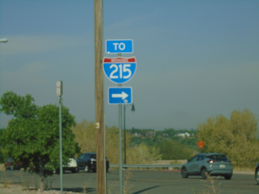
UT-190 West at UT-210 - Cottonwood Heights
UT-190 West at UT-210 in Cottonwood Heights. Turn left to continue west on UT-190 (Wasatch Blvd.) to I-215.
Taken 09-12-2022
Cottonwood Heights
Salt Lake County
Utah
United States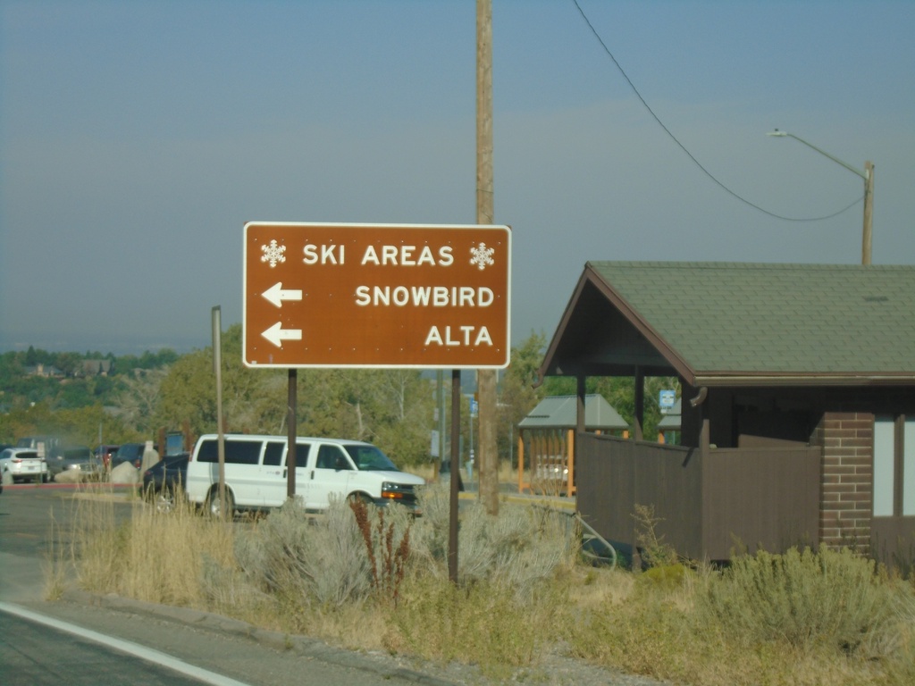
UT-190 West Approaching UT-210 - Ski Areas
UT-190 West approaching UT-210 at mouth of Big Cottonwood Canyon. Use UT-210 East for the Snowbird and Alta ski areas.
Taken 09-12-2022
Cottonwood Heights
Salt Lake County
Utah
United States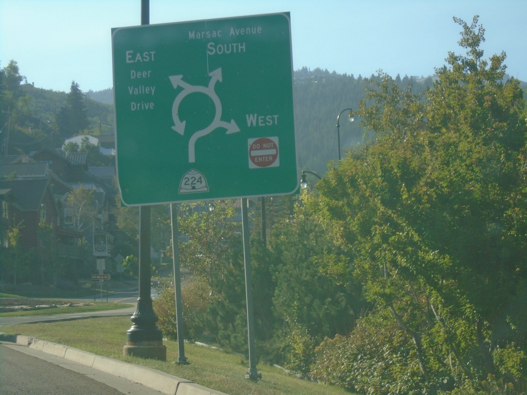
UT-224 at Deer Valley Drive/Marsac Ave. Roundabout
UT-224 at Deer Valley Drive/Marsac Ave. roundabout in Park City.
Taken 09-12-2022
 Park City
Summit County
Utah
United States
Park City
Summit County
Utah
United States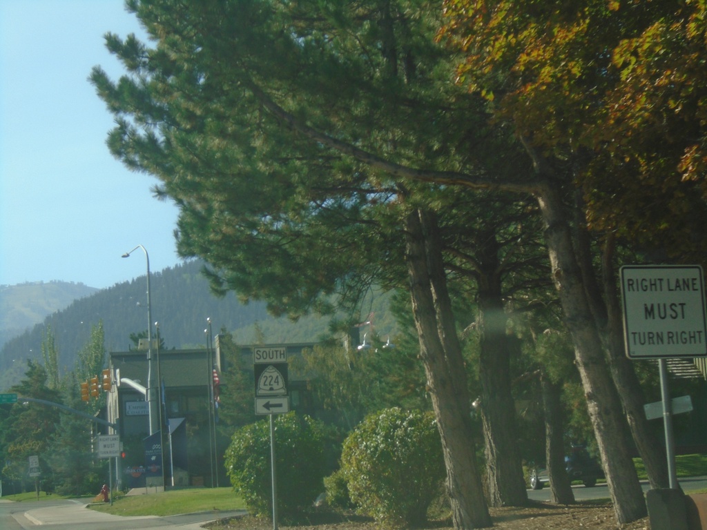
UT-224 South - Park City
UT-224 South - Park Ave. at Deer Valley Drive in Park City. Turn left on Deer Valley Drive to continue south on UT-224.
Taken 09-12-2022
Park City
Summit County
Utah
United States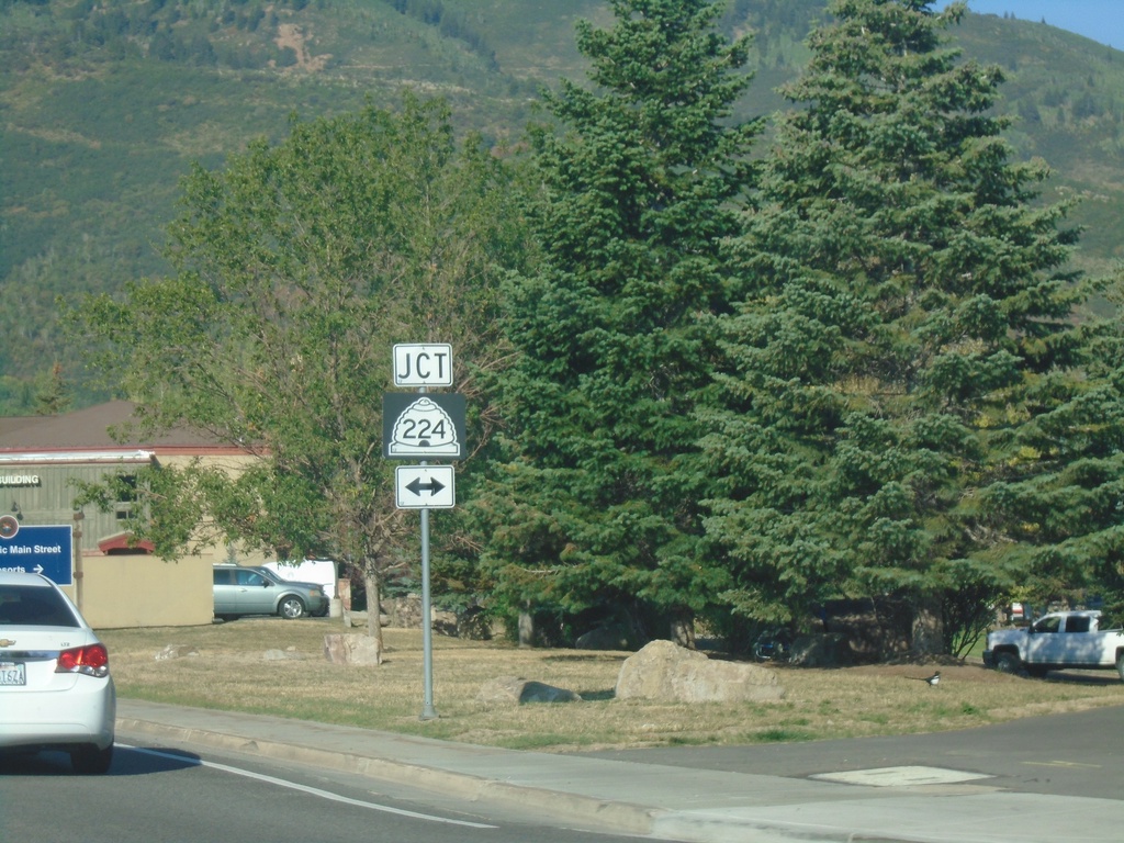
UT-248 West at UT-224 - Park City
UT-248 West (Kearns Blvd.) at UT-224 (Park Ave.) in Park City.
Taken 09-12-2022
 Park City
Summit County
Utah
United States
Park City
Summit County
Utah
United States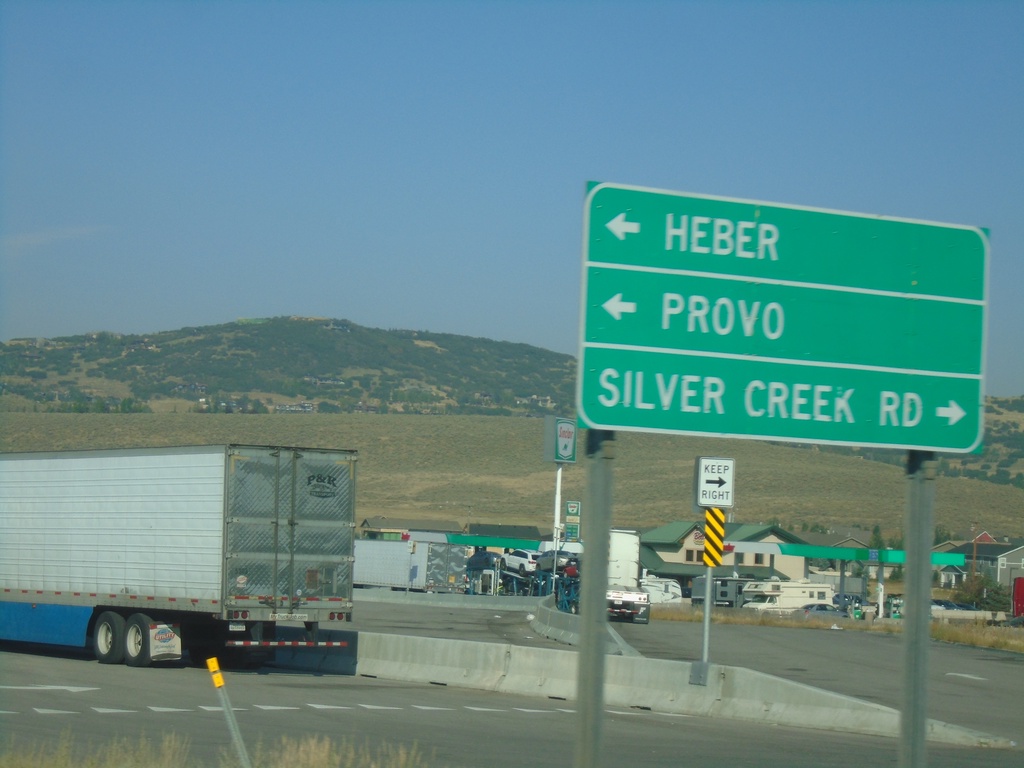
I-80 West Exit 146 Offramp at US-40/US-189
I-80 West Exit 146 Offramp at US-40/US-189. Turn right for Silver Creek Road. Turn left for US-40 East/US-189 South/Heber/Provo.
Taken 09-12-2022


 Silver Summit
Summit County
Utah
United States
Silver Summit
Summit County
Utah
United States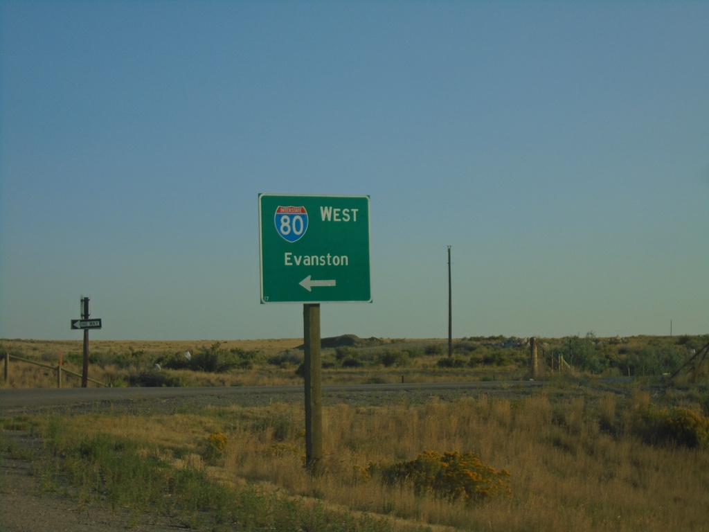
End WY-413 North at I-80 West
End WY-413 North at I-80 West to Evanston
Taken 09-12-2022
 Lyman
Uinta County
Wyoming
United States
Lyman
Uinta County
Wyoming
United States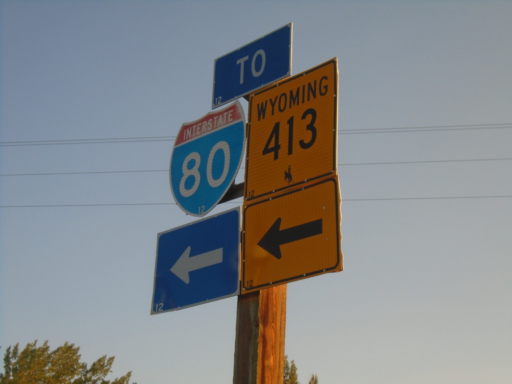
BL-80 East at WY-413
BL-80 East at WY-413/To I-80 in Lyman.
Taken 09-12-2022
 Lyman
Uinta County
Wyoming
United States
Lyman
Uinta County
Wyoming
United States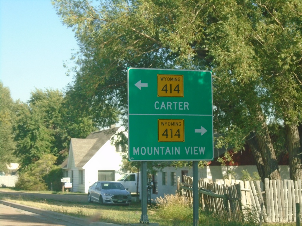
BL-80 East at WY-414 - Urie
BL-80 East at WY-414 in Urie. Use WY-414 north to Carter; WY-414 south to Mountain View.
Taken 09-10-2022
 Lyman
Uinta County
Wyoming
United States
Lyman
Uinta County
Wyoming
United States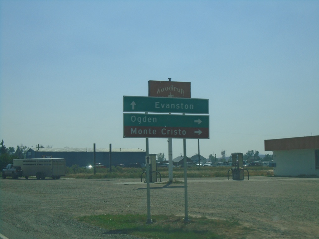
UT-16 South at UT-39 - Woodruff
UT-16 South at UT-39 in Woodruff. Use UT-39 West to Ogden and Monte Cristo. UT-39 is closed in the winter. Continue south on UT-16 for Evanston (Wyoming).
Taken 09-10-2022

 Woodruff
Rich County
Utah
United States
Woodruff
Rich County
Utah
United States
UT-16 South Approaching UT-39 - Woodruff
UT-16 South Approaching UT-39 in Woodruff
Taken 09-10-2022
Woodruff
Rich County
Utah
United States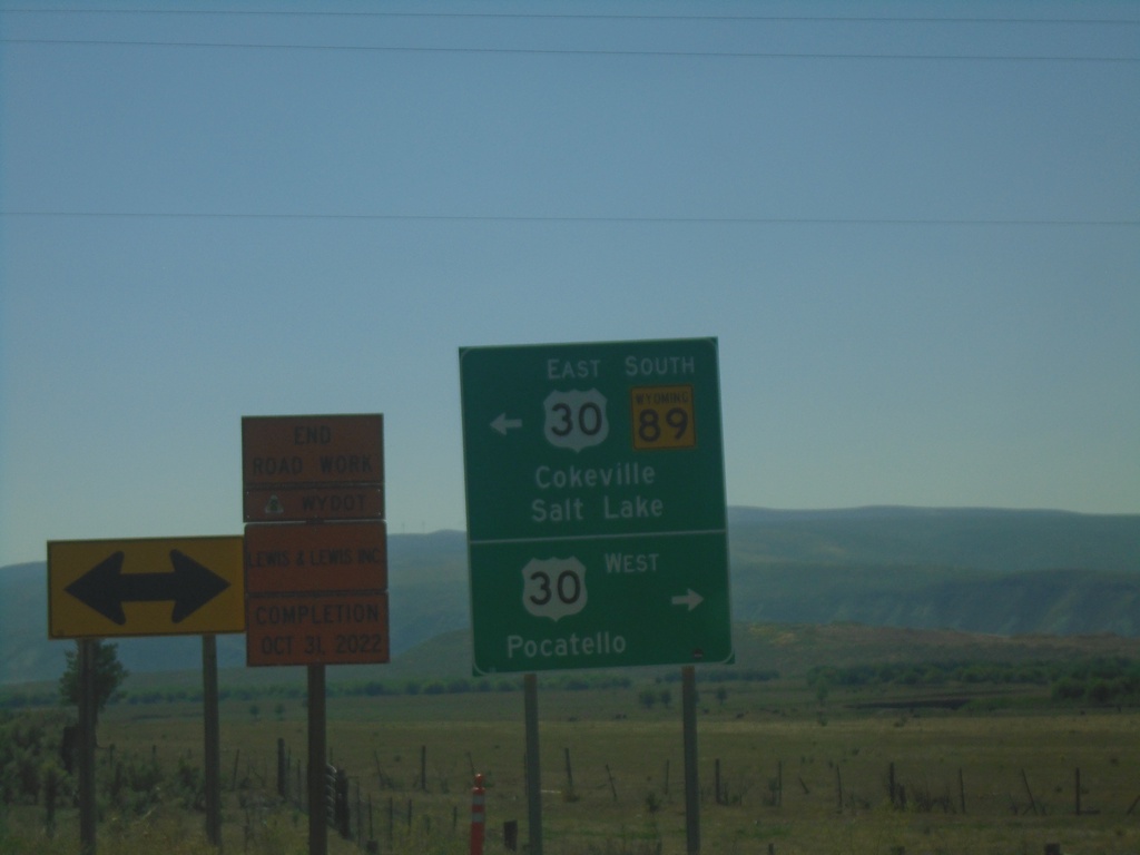
WY-89 South at US-30
WY-89 South at US-30 - Border Junction. Turn right on US-30 West to Pocatello (Idaho); turn left on US-30 East/WY-89 South to Cokeville and Salt Lake (Utah). WY-89 South joins US-30 East to Sage Junction.
Taken 09-10-2022

 Cokeville
Lincoln County
Wyoming
United States
Cokeville
Lincoln County
Wyoming
United States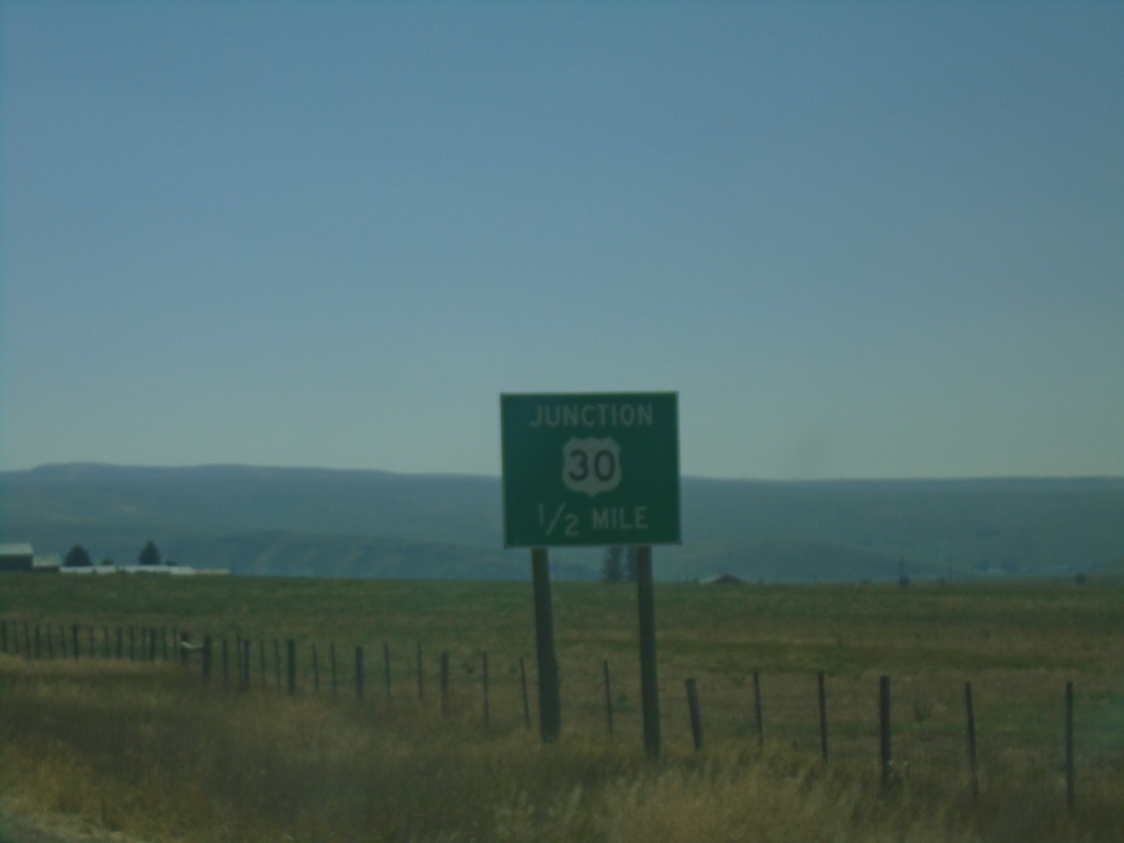
WY-89 South Approaching US-30
WY-89 south Approaching US-30 (Border Junction) in Lincoln County.
Taken 09-10-2022
Cokeville
Lincoln County
Wyoming
United States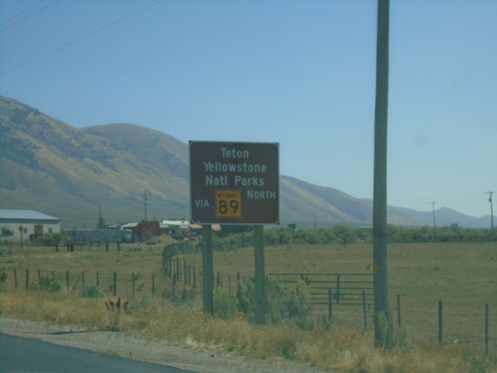
US-30 West - Use WY-89 For Teton and Yellowstone National Parks
US-30 West approaching WY-89. Use WY-89 For Teton and Yellowstone National Parks. These signs are located at most crossings into Wyoming, directing traffic to Yellowstone and Grand Teton National Parks.
Taken 09-10-2022
Cokeville
Lincoln County
Wyoming
United States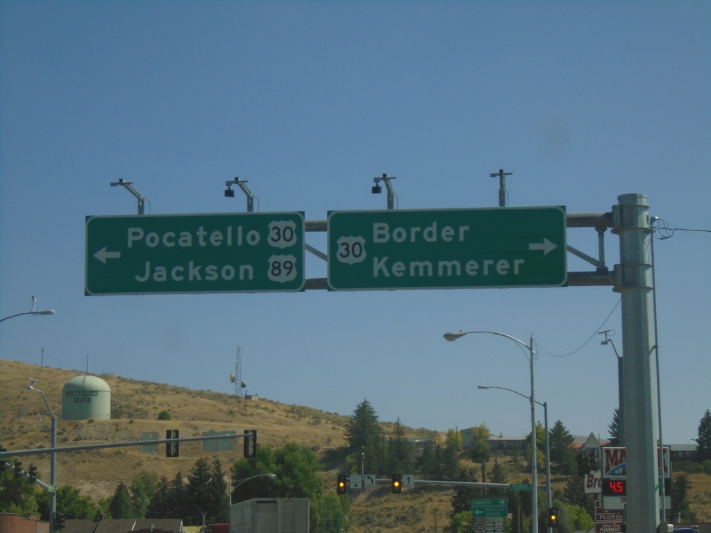
US-89 North at US-30 - Montpelier
US-89 north at US-30 in Montpelier. Use US-30 East for Border and Kemmerer (WY). Use US-30 West to Pocatello and US-89 North to Jackson (WY). US-89 north joins US-30 west through Montpelier.
Taken 09-10-2022
 Montpelier
Bear Lake County
Idaho
United States
Montpelier
Bear Lake County
Idaho
United States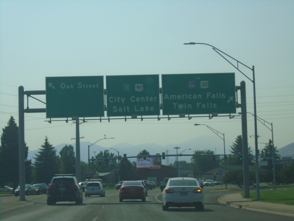
BL-15/US-91 South at US-30
BL-15/US-91 South at US-30 in Pocatello. Turn right for US-30 West/To I-86/Twin Falls/American Falls. Continue straight for US-30 East/US-91 South/BL-15 South/(Pocatello) City Center/Salt Lake. Turn left for Oak St.
Taken 09-10-2022


 Pocatello
Bannock County
Idaho
United States
Pocatello
Bannock County
Idaho
United States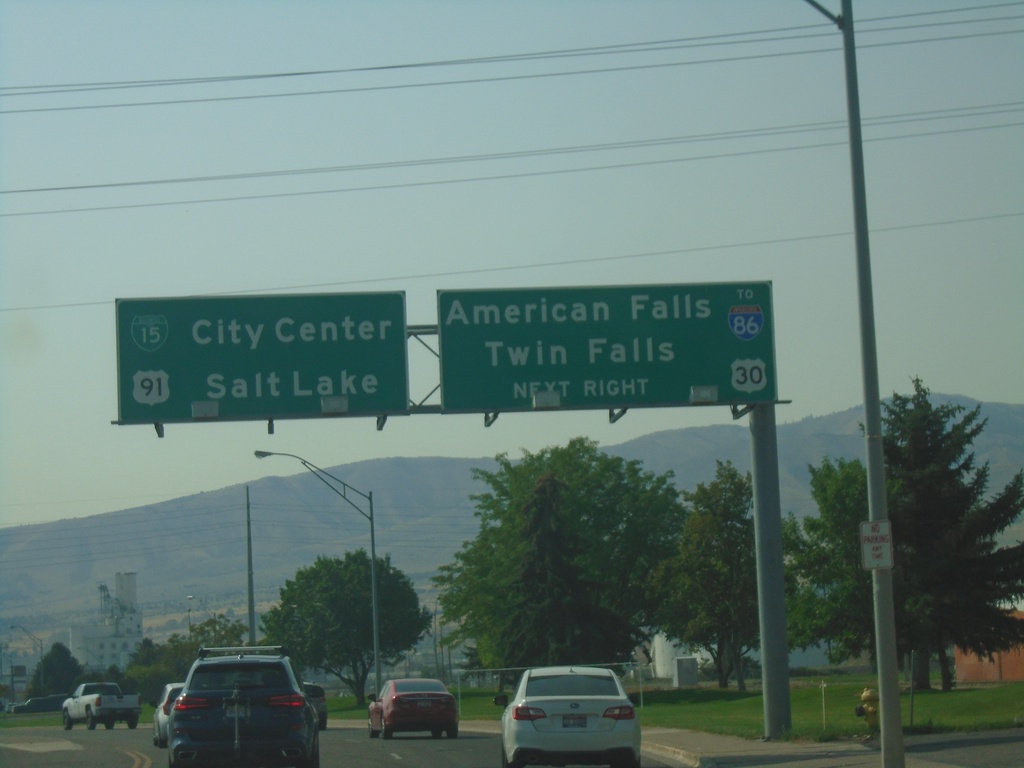
US-91/BL-15 South Approaching US-30
US-91/BL-15 South (Yellowstone Ave.) approaching US-30 (Oak St.) in Pocatello. Use US-30 west for I-86, American Falls, and Twin Falls. Continue south for BL-15/US-91/US-30 East to (Pocatello) City Center and Salt Lake (UT). US-30 east joins BL-15/US-91 southbound.
Taken 09-10-2022
Pocatello
Bannock County
Idaho
United States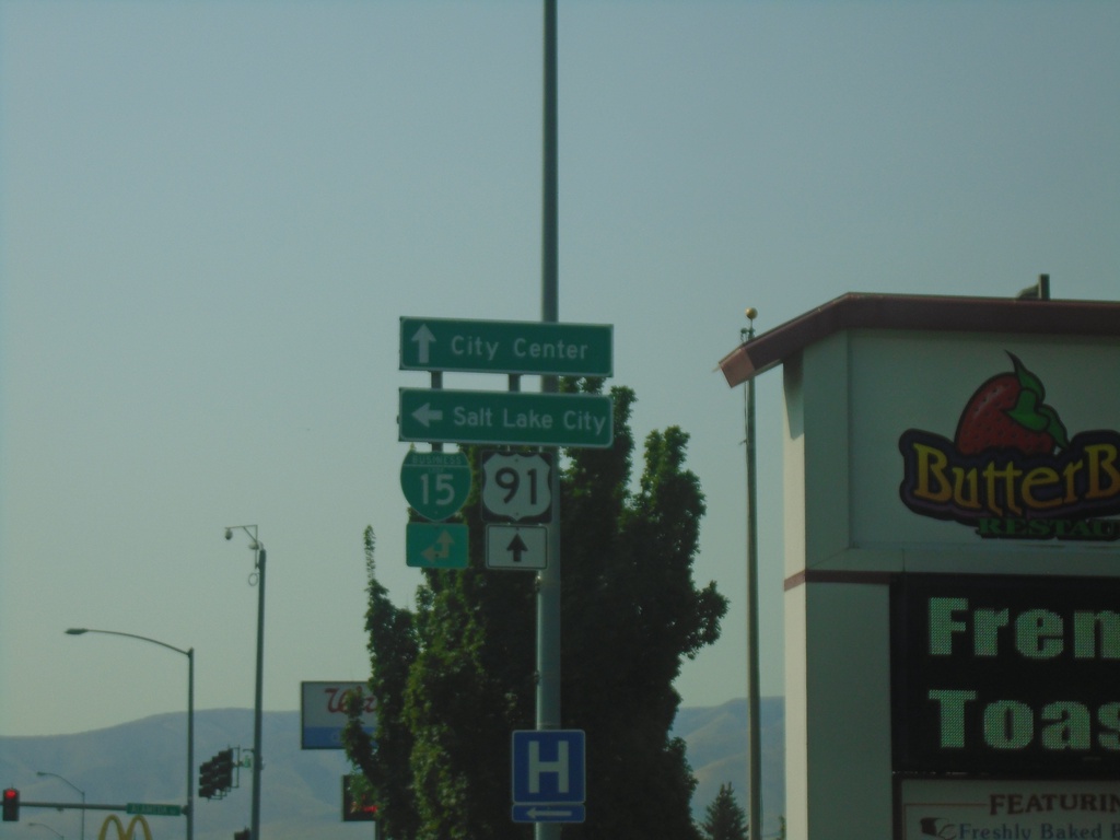
US-91 South at BL-15 - Pocatello
US-91 South (Yellowstone Ave.) at BL-15 (Alameda Road). Turn left on BL-15 North to Salt Lake City; continue straight on BL-15 South/US-91 South to (Pocatello) City Center.
Taken 09-10-2022
Pocatello
Bannock County
Idaho
United States
US-91 South Approaching BL-15
US-91 South (Yellowstone Ave.) approaching BL-15 (Alameda Road.). BL-15 South joins US-91 southbound.
Taken 09-10-2022
Pocatello
Bannock County
Idaho
United States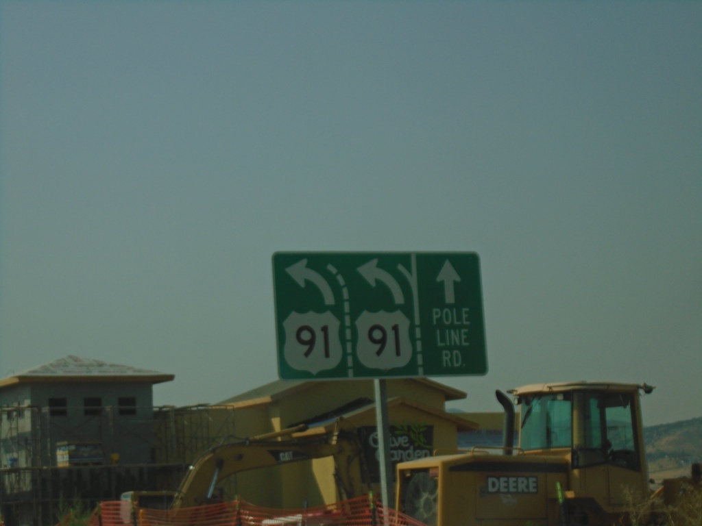
US-91 South at Pole Line Road
US-91 South at Pole Line Road. Merge left to continue south on US-91.
Taken 09-10-2022
Chubbuck
Bannock County
Idaho
United States