Signs Tagged With Intersection
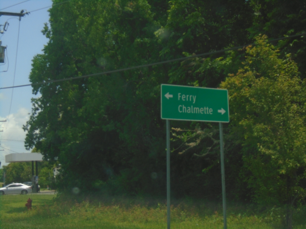
LA-39 North at Belle Chasse Ferry
LA-39 North at Belle Chasse Ferry. Turn right to continue north to Chalmette.
Taken 05-31-2026
 Pointe à la Hache
Plaquemines Parish
Louisiana
United States
Pointe à la Hache
Plaquemines Parish
Louisiana
United States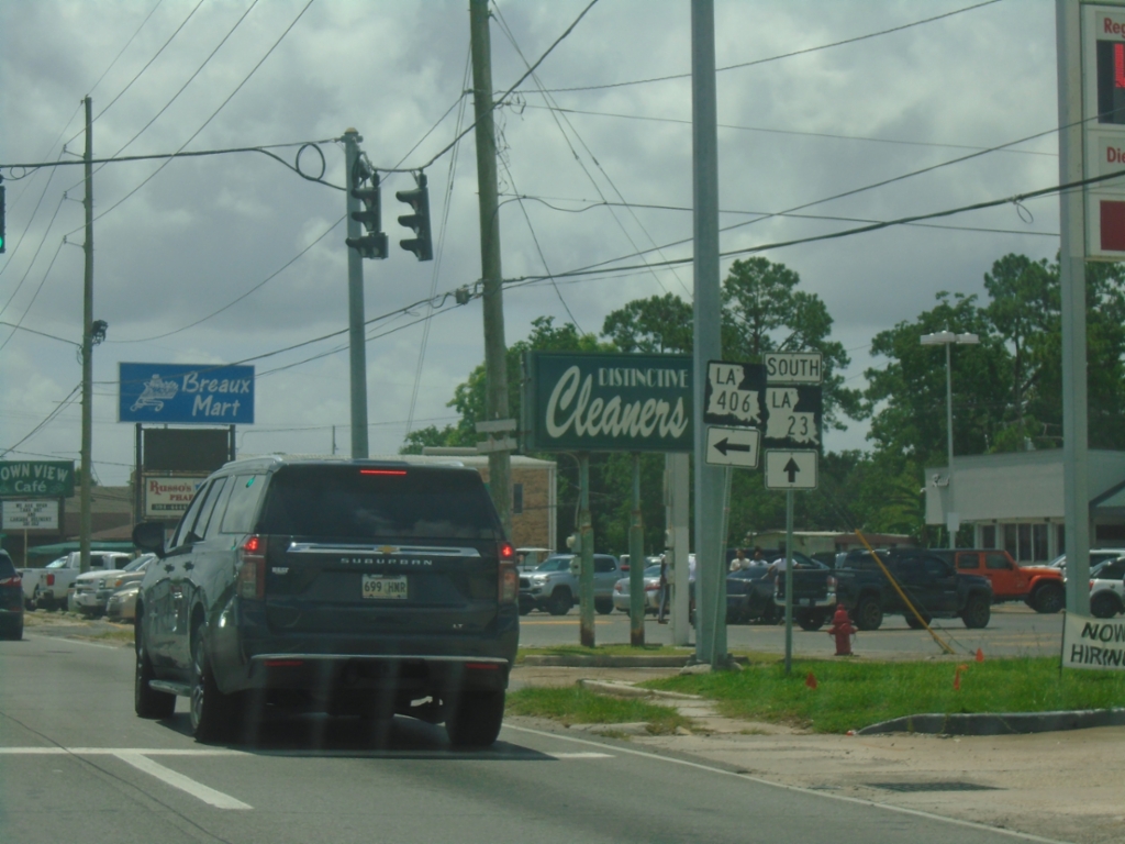
LA-23 South at LA-406 - Belle Chasse
LA-23 South at LA-406 (Woodland Highway) in Belle Chasse.
Taken 05-31-2026

 Belle Chasse
Plaquemines Parish
Louisiana
United States
Belle Chasse
Plaquemines Parish
Louisiana
United States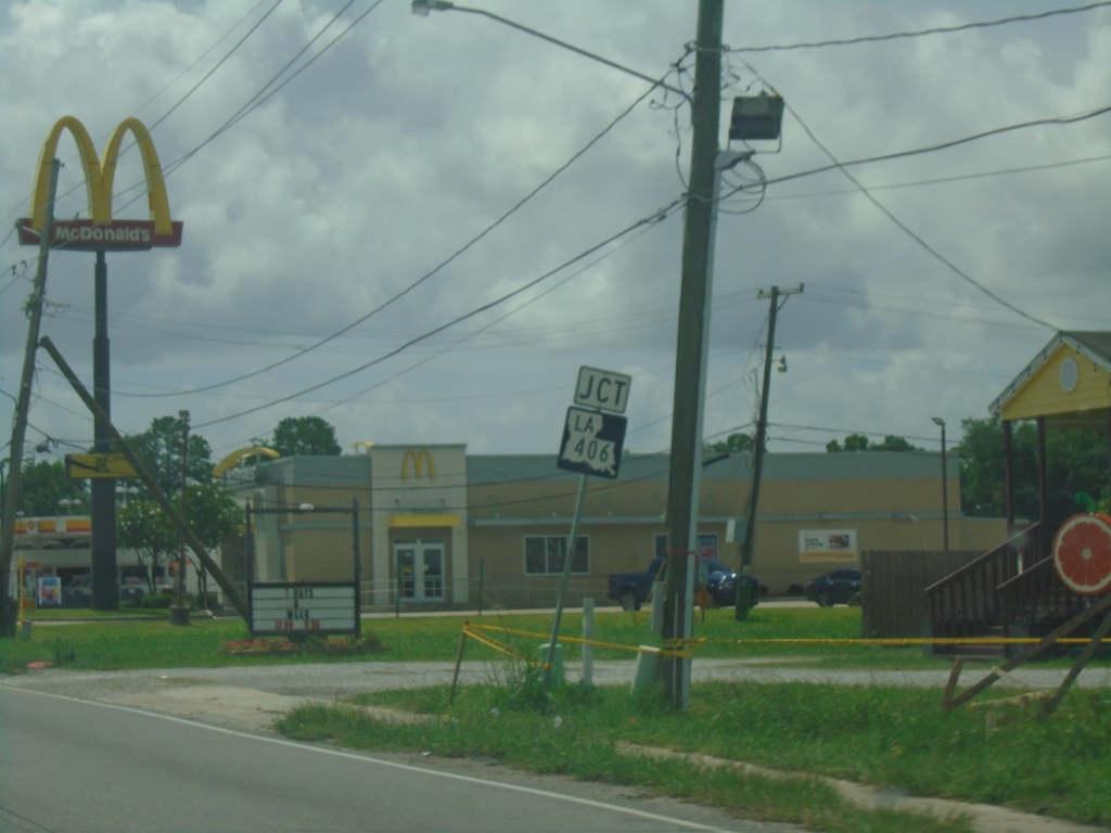
LA-23 South Approaching LA-406
LA-23 South approaching LA-406 (Woodland Highway) in Belle Chasse.
Taken 05-31-2026
Belle Chasse
Plaquemines Parish
Louisiana
United States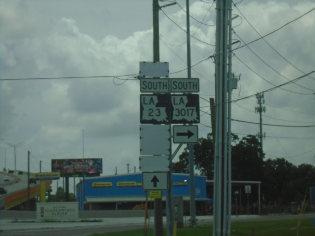
LA-23 South at LA-3017 South
LA-23 South at LA-3017 South (Engineers Road) in Belle Chasse.
Taken 05-31-2026
 Belle Chasse
Plaquemines Parish
Louisiana
United States
Belle Chasse
Plaquemines Parish
Louisiana
United States
LA-23 South Approaching LA-3017
LA-23 South approaching LA-3017/Engineers Road in Belle Chasse.
Taken 05-31-2026
Belle Chasse
Plaquemines Parish
Louisiana
United States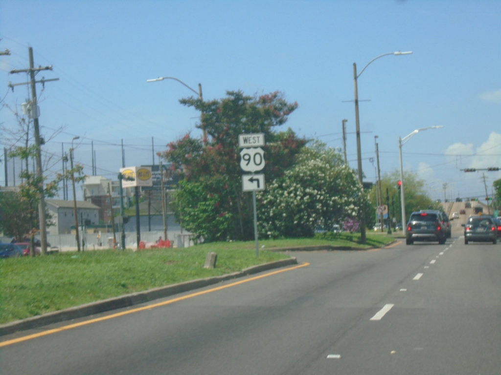
US-90 West (Broad St.) at US-61 (Tulane Ave.)
US-90 West (Broad St.) at US-61 (Tulane Ave.) in New Orleans. Turn left on Tulane Ave. to continue west on US-90. The intersection of Tulane Ave. and Broad Street is the southern terminus of US-61.
Taken 05-31-2026

 New Orleans
Orleans Parish
Louisiana
United States
New Orleans
Orleans Parish
Louisiana
United States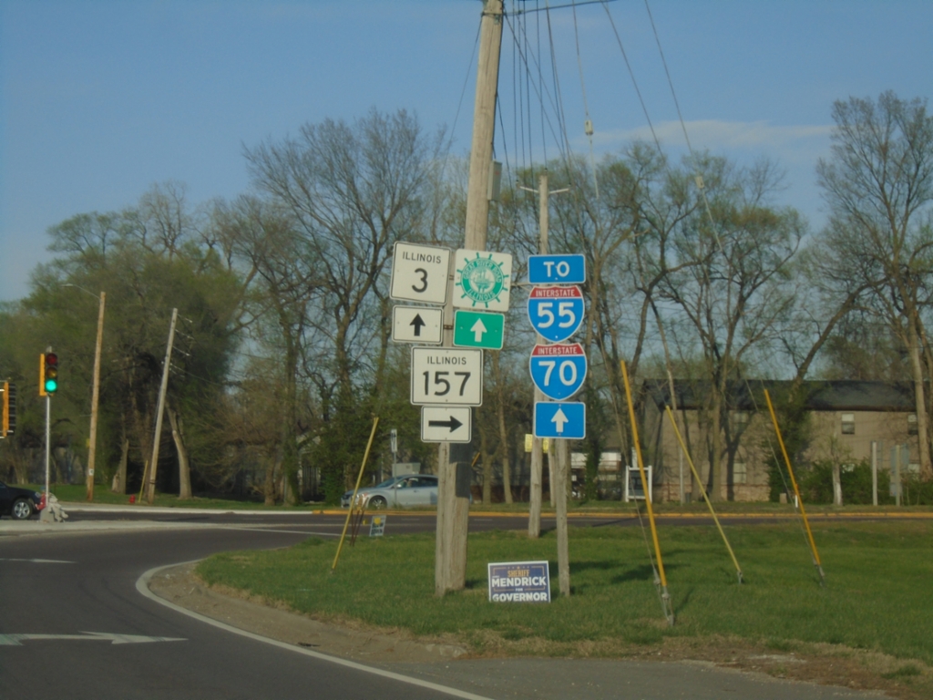
IL-3 North at IL-157
IL-3 North at IL-157 in Cahokia Heights. Continue north on IL-3 for I-55, I-70, and Great River Road.
Taken 03-29-2026


 Cahokia
Saint Clair County
Illinois
United States
Cahokia
Saint Clair County
Illinois
United States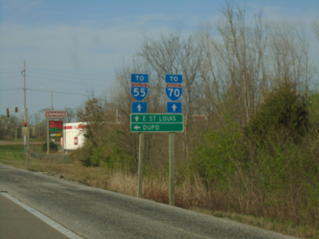
IL-3 North at Main Street
IL-3 North at Main Street in Dupo. Turn left for Dupo; continue north to East Saint Louis and for access to I-55 and I-70.
Taken 03-29-2026
Dupo
St. Clair County
Illinois
United States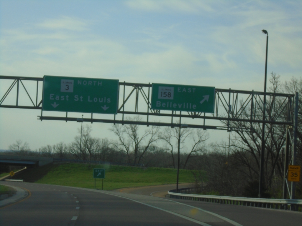
IL-3 North at IL-158 East Interchange
IL-3 North at IL-158 East/Belleville interchange. Continue north on IL-3 to East Saint Louis.
Taken 03-29-2026
 Columbia
Monroe County
Illinois
United States
Columbia
Monroe County
Illinois
United States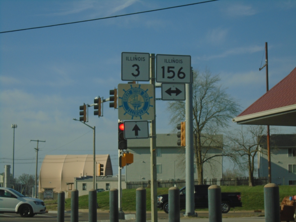
IL-3 North at IL-156
IL-3 North at IL-156 in Waterloo. Continue north on IL-3 for Great River Road.
Taken 03-29-2026
 Waterloo
Monroe County
Illinois
United States
Waterloo
Monroe County
Illinois
United States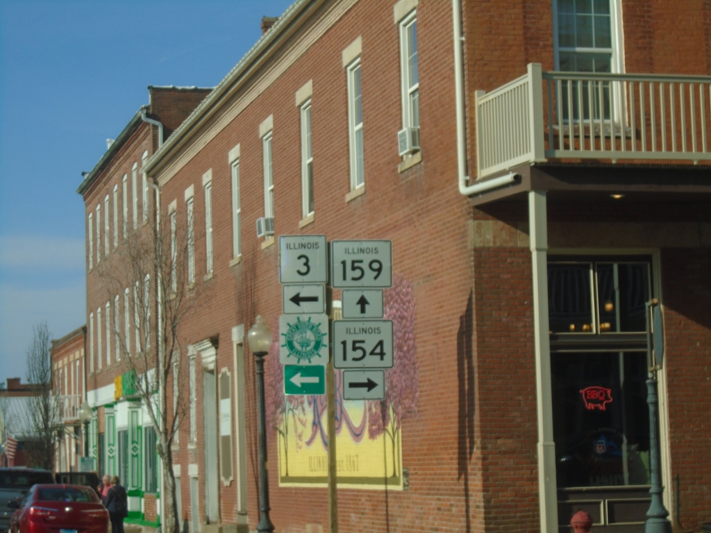
IL-3 North at IL-154 and IL-159
IL-3 North at IL-154 and IL-159 in Red Bud. Turn left to continue north on IL-3 and Great River Road.
Taken 03-29-2026

 Red Bud
Randolph County
Illinois
United States
Red Bud
Randolph County
Illinois
United States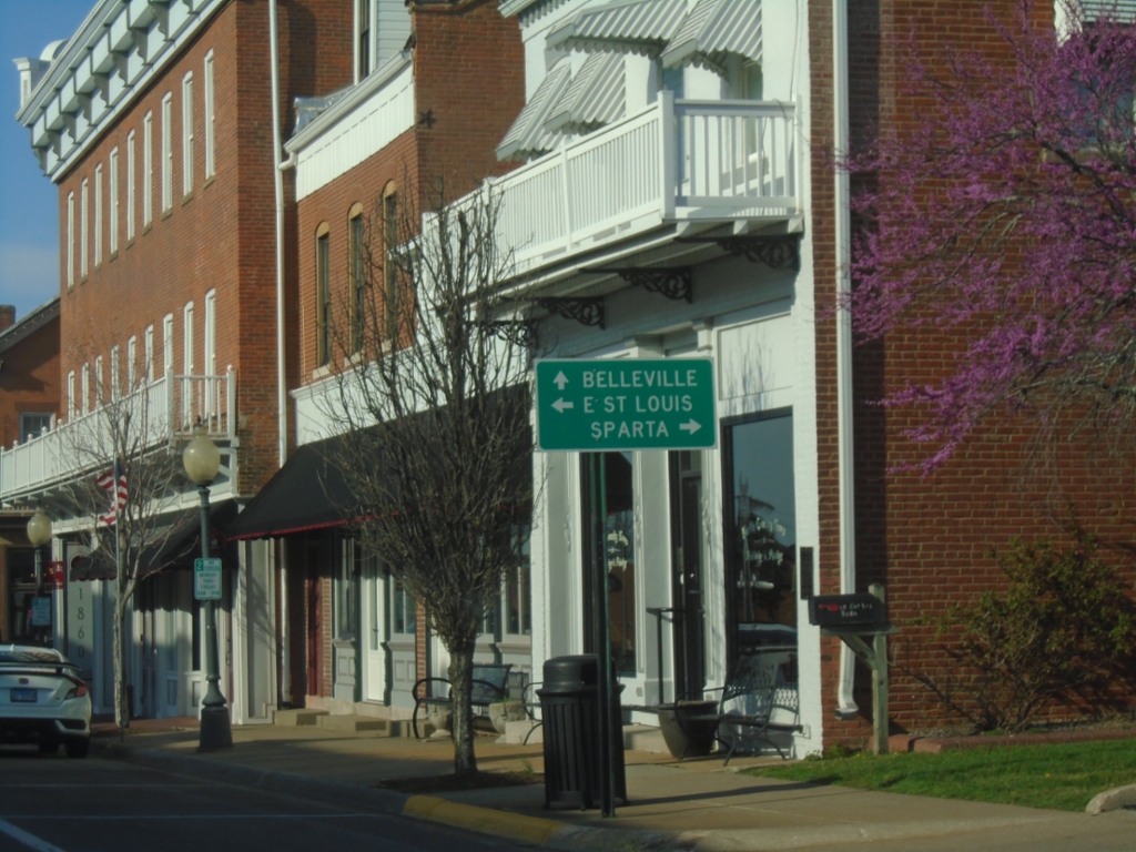
IL-3 North at IL-154 and IL-159
IL-3 North at IL-154 and IL-159 in Red Bud. Use IL-154 to Sparta; IL-159 to Belleville and IL-3 to East Saint Louis. Turn left on Market St. to continue on IL-3 northbound.
Taken 03-29-2026
Red Bud
Randolph County
Illinois
United States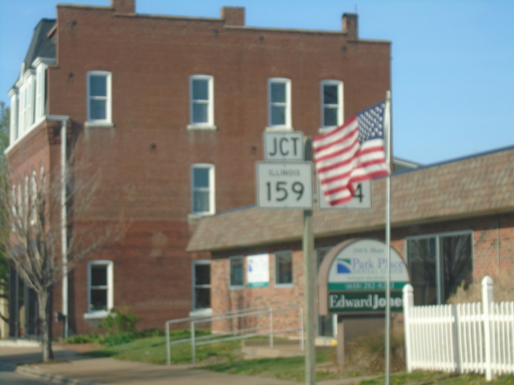
IL-3 North Approaching IL-154/IL-159
IL-3 North approaching IL-154/IL-159 in Red Bud.
Taken 03-29-2026
Red Bud
Randolph County
Illinois
United States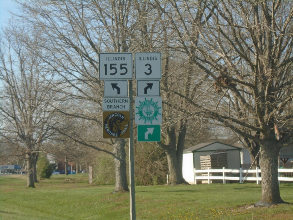
IL-3 North Approaching IL-155
IL-3 North approaching IL-155. Use IL-155 North for Lincoln Heritage Trail; IL-3 North for Great River Road.
Taken 03-29-2026
 Red Bud
Randolph County
Illinois
United States
Red Bud
Randolph County
Illinois
United States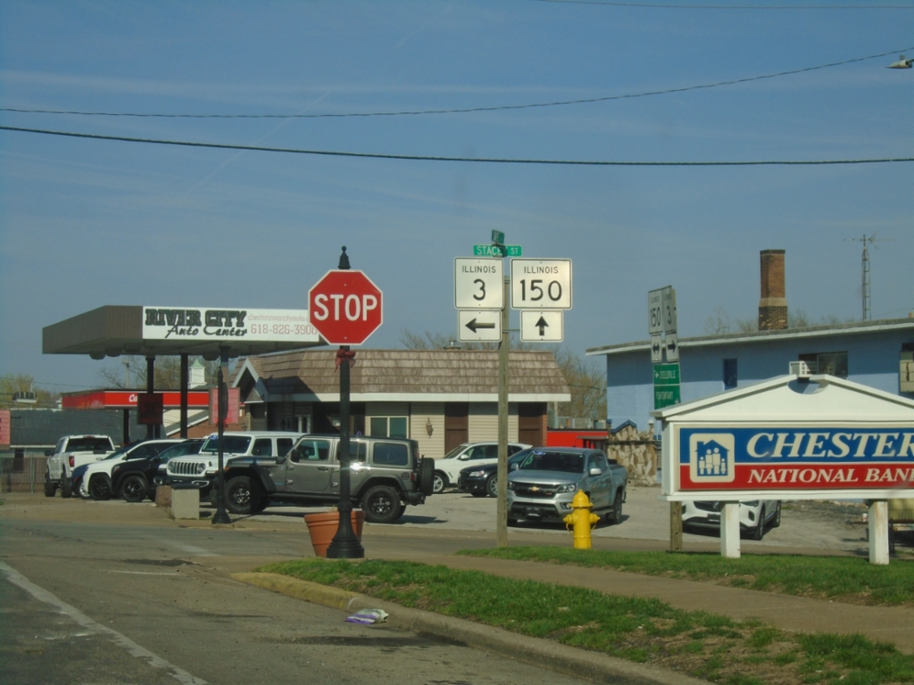
IL-3 North/IL-150 East at IL-3/IL-150 Split
IL-3 North/IL-150 East at IL-3/IL-150 split in Chester. Turn left for IL-3 North (W Holmes St.); continue straight for IL-150 East (State St.).
Taken 03-29-2026
 Chester
Randolph County
Illinois
United States
Chester
Randolph County
Illinois
United States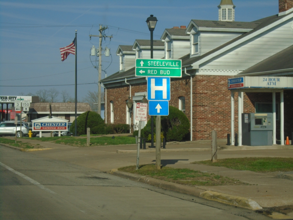
IL-3 North/IL-150 East at IL-3/IL-150 Split
IL-3 North/IL-150 East at IL-3/IL-150 split in Chester. Use IL-150 East to Steeleville; IL-3 North to Red Bud.
Taken 03-29-2026
Chester
Randolph County
Illinois
United States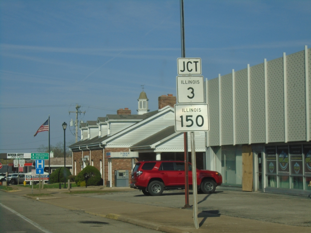
IL-3 North/IL-150 East at IL-3/IL-150 Split
IL-3 North/IL-150 East at IL-3/IL-150 split in Chester.
Taken 03-29-2026
Chester
Randolph County
Illinois
United States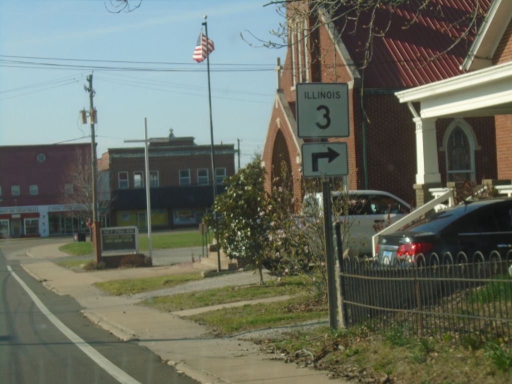
IL-3 North at IL-150
IL-3 North (Opdyke St.) at IL-150 (State St.) in Chester. Turn right to continue north on IL-3. IL-3 North joins IL-150 for a few blocks through the center of Chester.
Taken 03-29-2026
Chester
Randolph County
Illinois
United States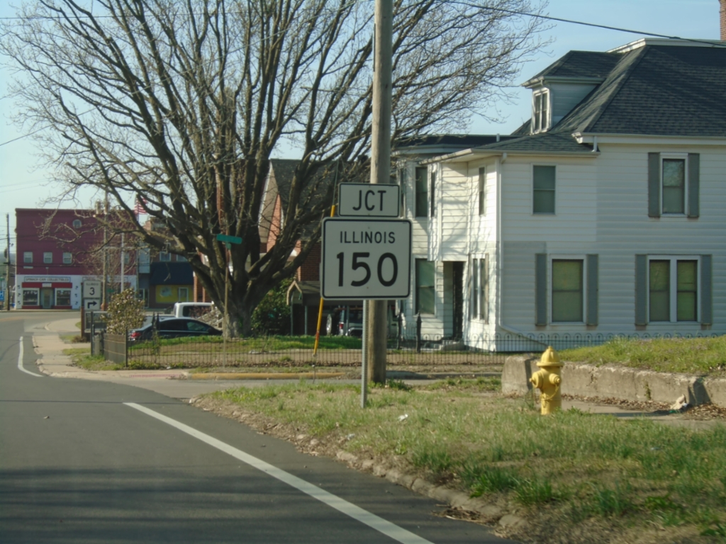
IL-3 North Approaching IL-150
IL-3 North approaching IL-150 in Chester.
Taken 03-29-2026
Chester
Randolph County
Illinois
United States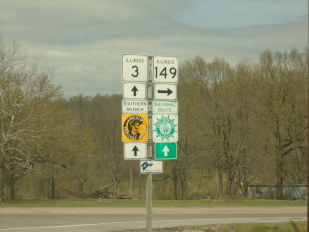
IL-3 North at IL-149
IL-3 North at IL-149 in Jackson County. Continue north on IL-3 for Great River Road and Lincoln Heritage Trail (Southern Branch).
Taken 03-29-2026
 Sand Ridge Township
Jackson County
Illinois
United States
Sand Ridge Township
Jackson County
Illinois
United States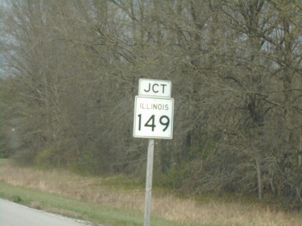
IL-3 North Approaching IL-149
IL-3 North approaching IL-149 in Jackson County.
Taken 03-29-2026
Sand Ridge Township
Jackson County
Illinois
United States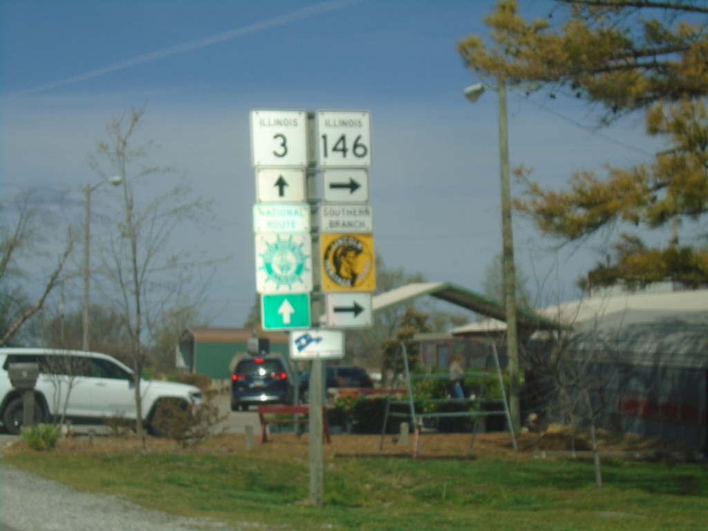
IL-3 North/IL-146 East at IL-3/IL-146 Split in Ware
IL-3 North/IL-146 East at IL-3/IL-146 Split in Ware, The Great River Road follows IL-3 North; Lincoln Heritage Trail (Southern Branch) follows IL-146 East.
Taken 03-29-2026
 Ware
Union County
Illinois
United States
Ware
Union County
Illinois
United States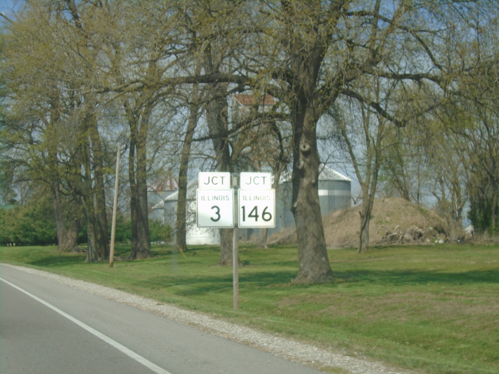
Approaching IL-3 North/IL-146 East Split
Approaching IL-3 North/IL-146 East in Ware.
Taken 03-29-2026
Ware
Union County
Illinois
United States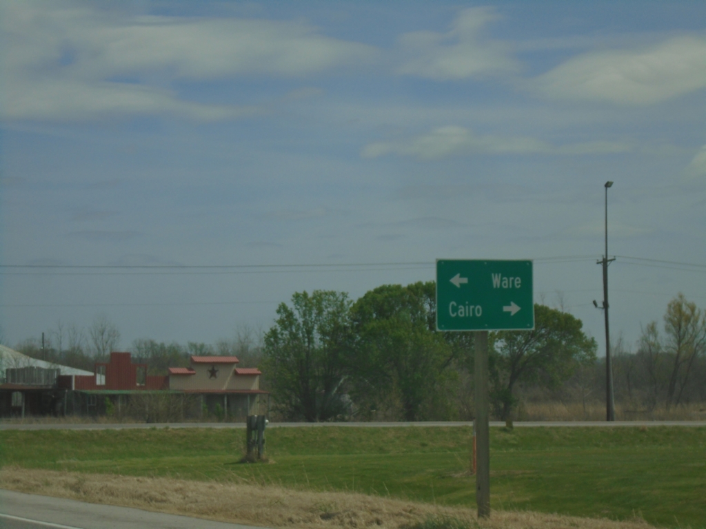
IL-146 East at IL-3
IL-146 East at IL-3 Junction. Use IL-3 South to Cairo; IL-3 North/IL-146 East to Ware.
Taken 03-29-2026
Mcclure
Alexander County
Illinois
United States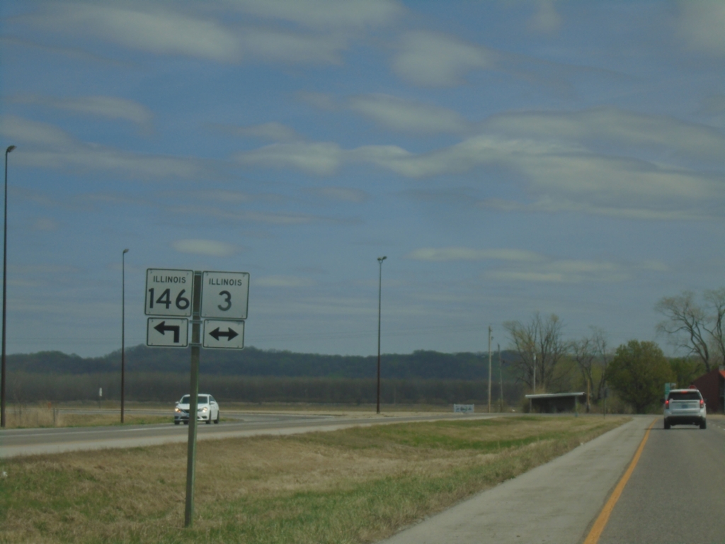
IL-146 East approaching IL-3
IL-146 East Approaching IL-3 in East Cape Girardeau. IL-146 East joins IL-3 northbound to Ware.
Taken 03-29-2026
East Cape Girardeau
Alexander County
Illinois
United States