Signs Tagged With Intersection
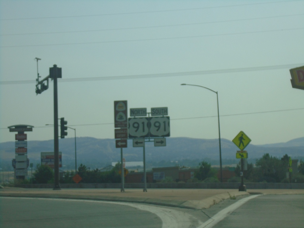
I-86 East Exit 61 Offramp at US-91
I-86 East Exit 61 offramp at US-91 in Chubbuck.
Taken 09-10-2022

 Pocatello
Bannock County
Idaho
United States
Pocatello
Bannock County
Idaho
United States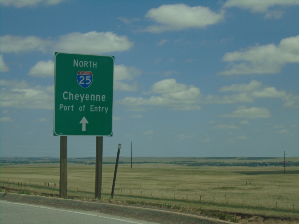
High Plains Road Roundabout At I-25 Onramp
High Plains Road Roundabout at I-25 (Exit 4) onramp at I-25 North/Cheyenne/Port of Entry.
Taken 07-11-2022

 Cheyenne
Laramie County
Wyoming
United States
Cheyenne
Laramie County
Wyoming
United States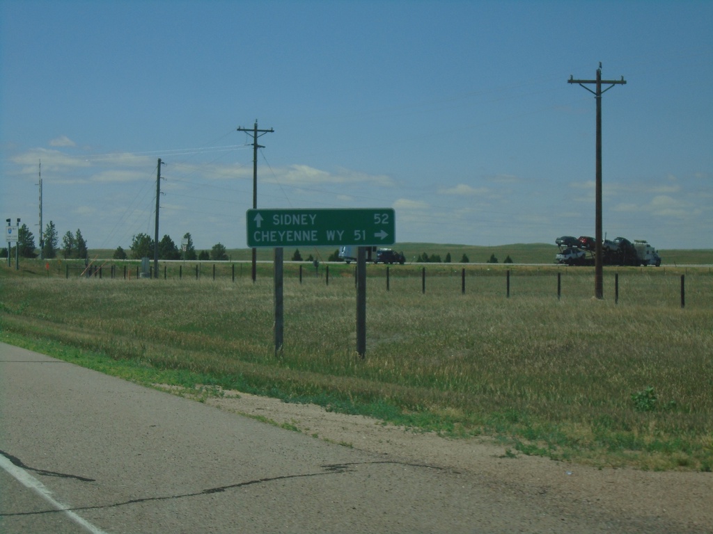
NE-53C Link South Approaching I-80
NE-53C Link South approaching I-80. Use I-80 west to Cheyenne, WY; I-80 east to Sidney.
Taken 07-11-2022

 Bushnell
Kimball County
Nebraska
United States
Bushnell
Kimball County
Nebraska
United States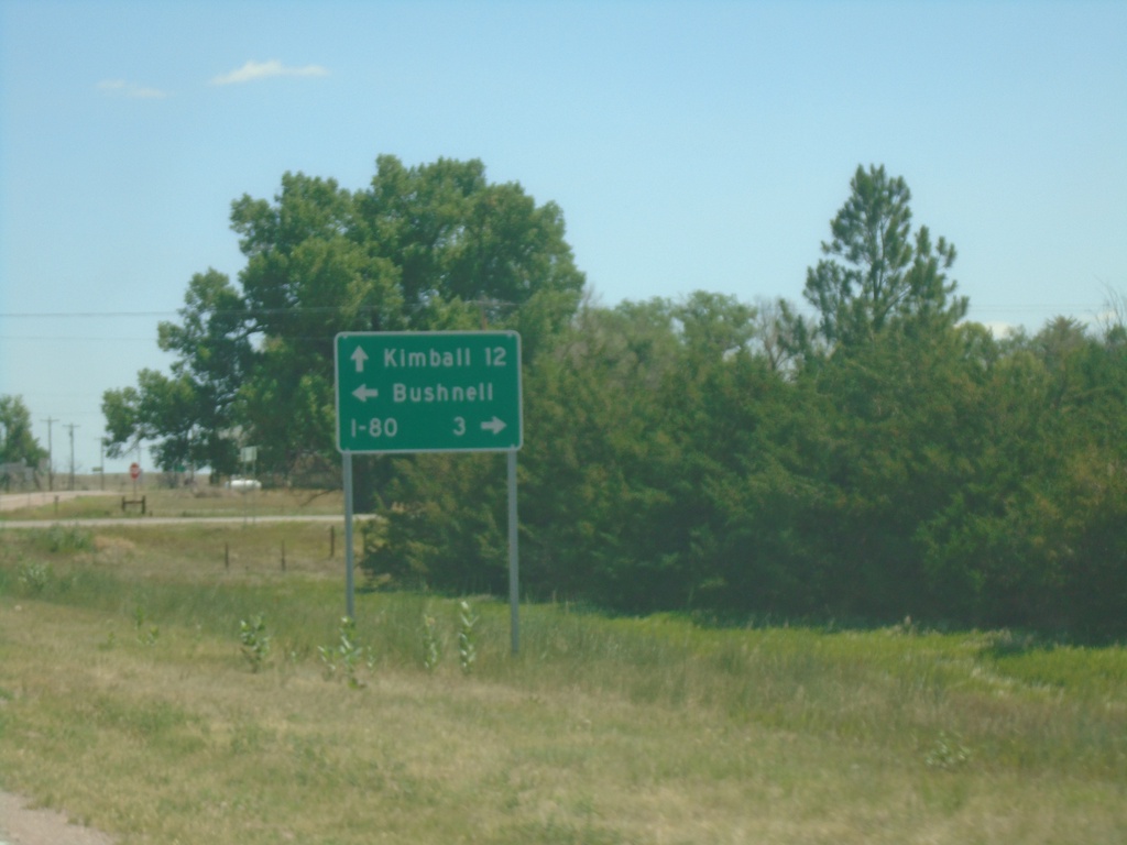
US-30 East at NE-53C Link South - Bushnell
US-30 East at NE-53C Link South in Bushnell. Use NE-53C Link for I-80; continue east on US-30 for Kimball. Turn left for Bushnell.
Taken 07-11-2022
 Bushnell
Kimball County
Nebraska
United States
Bushnell
Kimball County
Nebraska
United States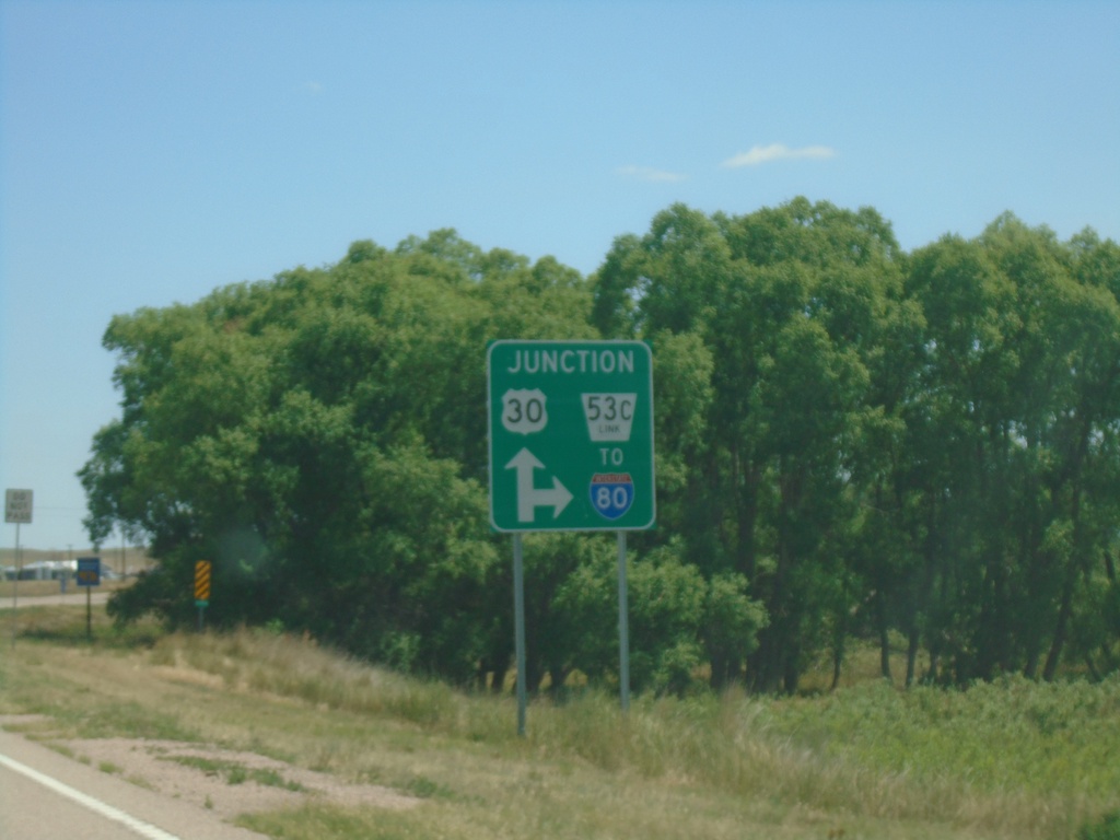
US-30 East Approaching NE-53C Link South
US-30 East approaching NE-53C Link South to I-80
Taken 07-11-2022
Bushnell
Kimball County
Nebraska
United States
US-30 East at NE-53C Link South
US-30 East at NE-53C Link South to I-80
Taken 07-11-2022
Bushnell
Kimball County
Nebraska
United States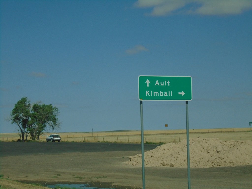
CO-14 West/CO-71 North at CO-71 North
CO-14 West/CO-71 North at CO-71 North. Turn right on CO-71 north for Kimball (Nebraska). Continue west on CO-14 for Ault.
Taken 07-11-2022

 Raymer
Weld County
Colorado
United States
Raymer
Weld County
Colorado
United States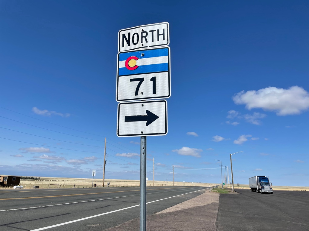
CO-14 West/CO-71 North at CO-14/CO-71 Split
CO-14 West/CO-71 North at CO-14/CO-71 Split in Weld County. Turn right to continue north on CO-71.
Taken 07-11-2022
Raymer
Weld County
Colorado
United States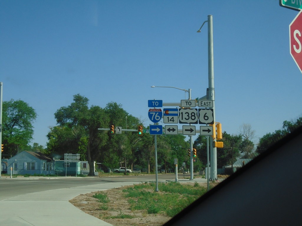
BL-76/US-6 East at CO-14
BL-76/US-6 East at CO-14 in Sterling. Turn left for CO-14 West; right for BL-76/US-6/CO-14 East To US-138/To I-76.
Taken 07-11-2022


 Sterling
Logan County
Colorado
United States
Sterling
Logan County
Colorado
United States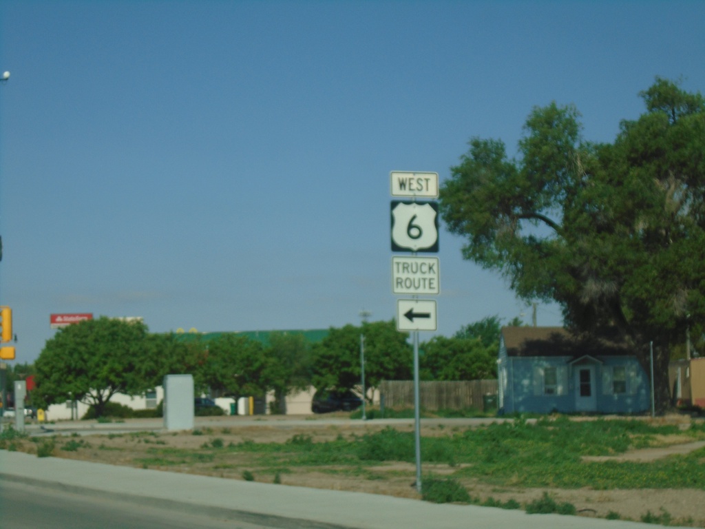
BL-76/US-6/CO-14 West at BL-76/US-6 and CO-14 Split
BL-76/US-6/CO-14 West at BL-76/US-6 and CO-14 Split in Sterling.
Taken 07-11-2022
Sterling
Logan County
Colorado
United States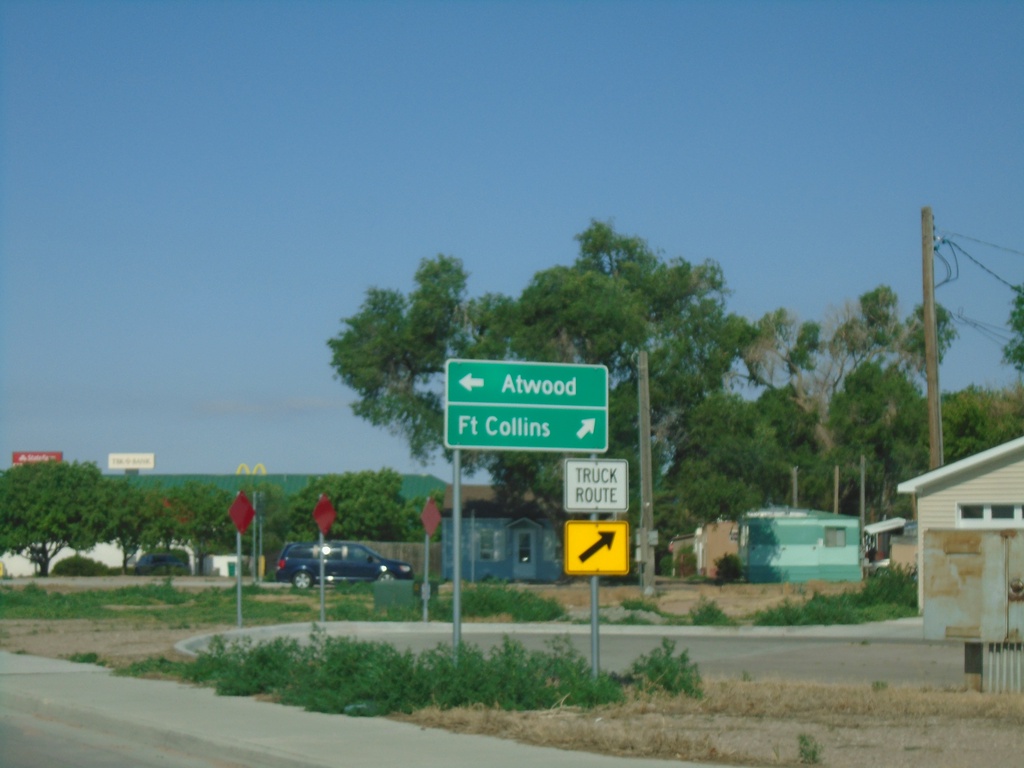
BL-76/US-6/CO-14 West Approaching BL-76/US-6 and CO-14 Split
BL-76/US-6/CO-14 West Approaching BL-76/US-6 and CO-14 Split in Sterling. Continue on CO-14 West to Fort Collins; BL-76/US-6 West to Atwood.
Taken 07-11-2022
Sterling
Logan County
Colorado
United States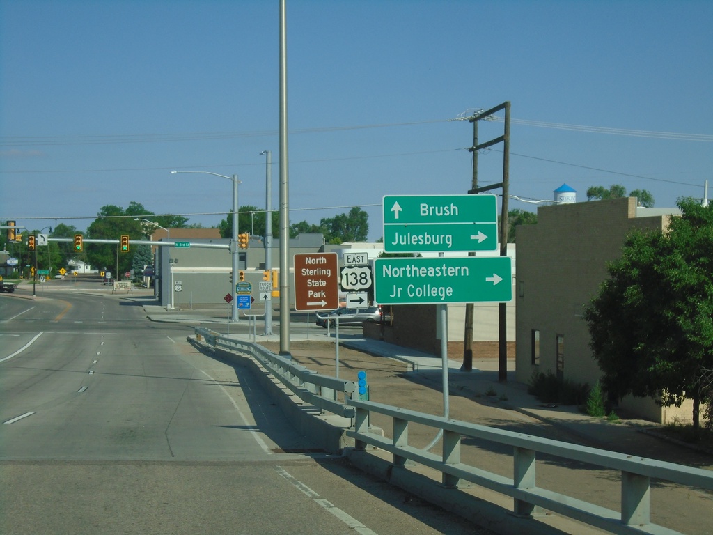
BL-76/US-6 West at CO-14 and US-138
BL-76/US-6 West at CO-14 and US-138 in Sterling. Turn right for US-138 East to Julesburg. Continue straight for BL-76/US-6/CO-14 East to Brush. Both CO-14 and US-138 begin at this intersection.
Taken 07-11-2022
Sterling
Logan County
Colorado
United States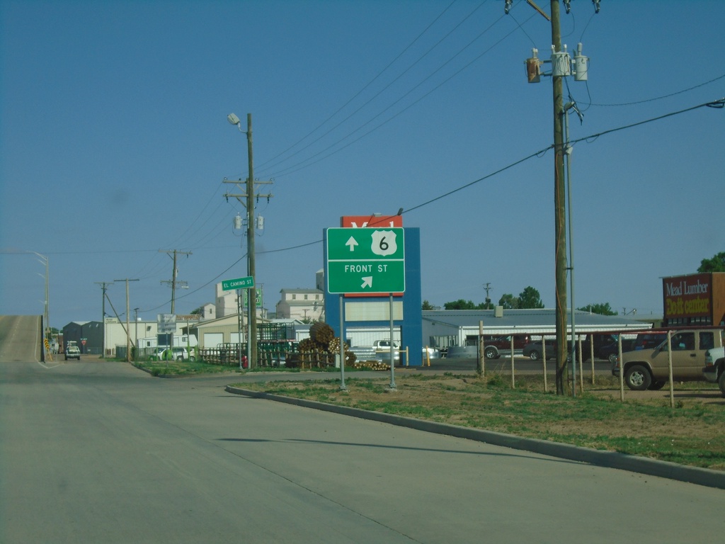
BL-76/US-6 West at Front St
BL-76/US-6 West at Front St ramp in Sterling.
Taken 07-11-2022
Sterling
Logan County
Colorado
United States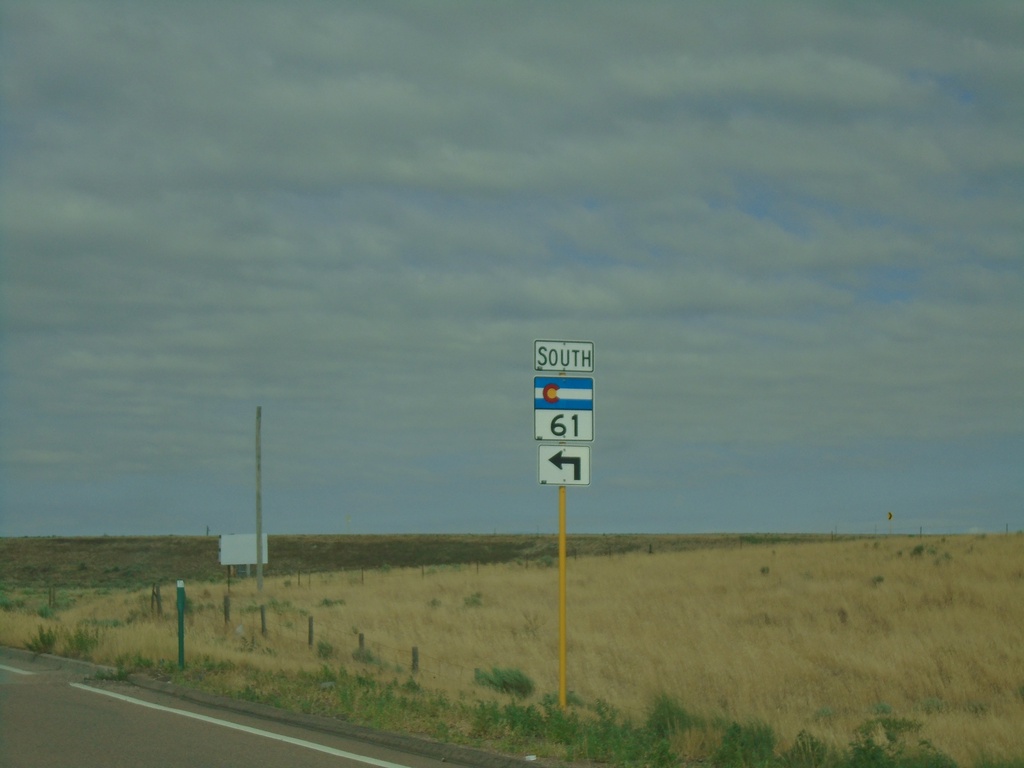
US-6 West at CO-61 South
US-6 West at CO-61 South in Sterling
Taken 07-11-2022
 Sterling
Logan County
Colorado
United States
Sterling
Logan County
Colorado
United States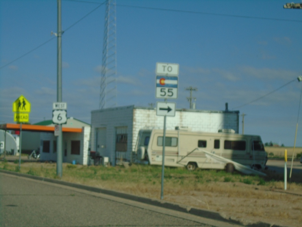
US-6 West - To CO-55
US-6 West approaching Logan Street in Fleming. Use Logan Street north to CO-55.
Taken 07-11-2022
 Fleming
Logan County
Colorado
United States
Fleming
Logan County
Colorado
United States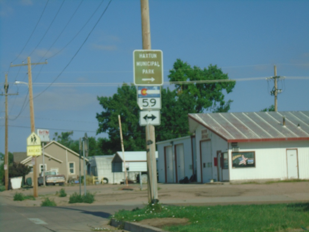
US-6 West at CO-59
US-6 West at CO-59 in Haxtun. Turn right for Haxtun Municipal Park.
Taken 07-11-2022
 Haxtun
Phillips County
Colorado
United States
Haxtun
Phillips County
Colorado
United States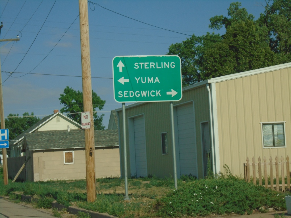
US-6 West Approaching CO-59
US-6 West approaching CO-59 in Haxtun. Use CO-59 North to Sedgwick; CO-59 South to Yuma. Continue west on US-6 for Sterling.
Taken 07-11-2022
Haxtun
Phillips County
Colorado
United States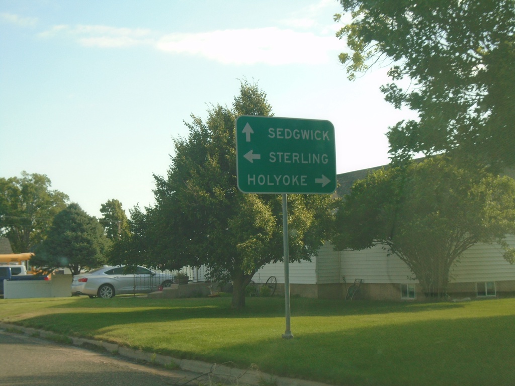
CO-59 North at US-6
CO-59 North at US-6 in Haxtun. Use US-6 West for Sterling; US-6 East for Holyoke. Continue north on CO-59 for Sedgwick.
Taken 07-11-2022
Haxtun
Phillips County
Colorado
United States
CO-59 North Approaching US-6
CO-59 North approaching US-6 in Haxtun.
Taken 07-11-2022
Haxtun
Phillips County
Colorado
United States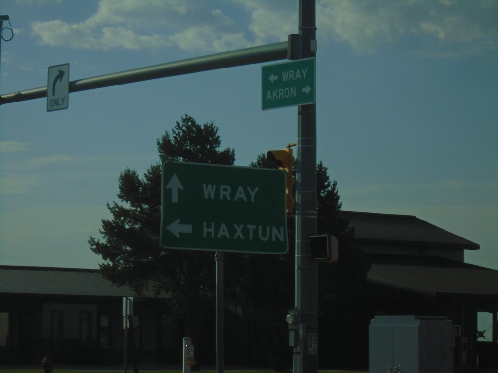
US-34 East at CO-59
US-34 East at CO-59 in Yuma. Use CO-59 North to Haxtun. Continue east on US-34 for Wray.
Taken 07-11-2022
 Yuma
Yuma County
Colorado
United States
Yuma
Yuma County
Colorado
United States
US-34 East Approaching CO-59
US-34 East approaching CO-59 in Yuma
Taken 07-11-2022
Yuma
Yuma County
Colorado
United States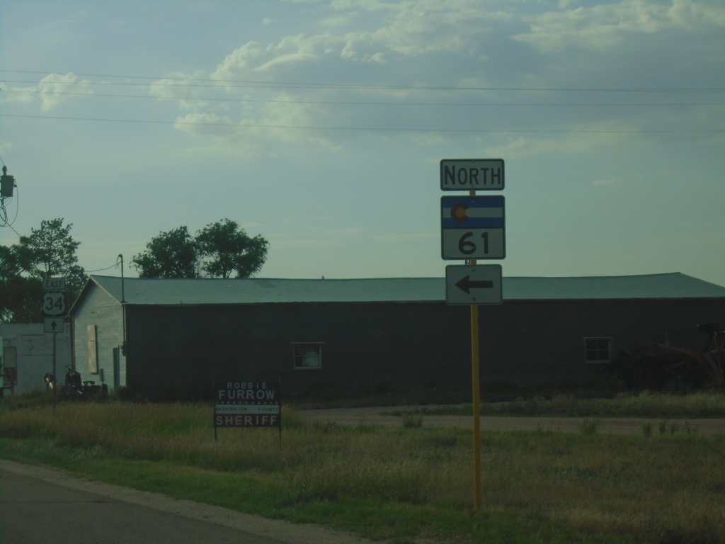
US-34 East at CO-61 North
US-34 East at CO-61 North in Otis.
Taken 07-11-2022
Otis
Washington County
Colorado
United States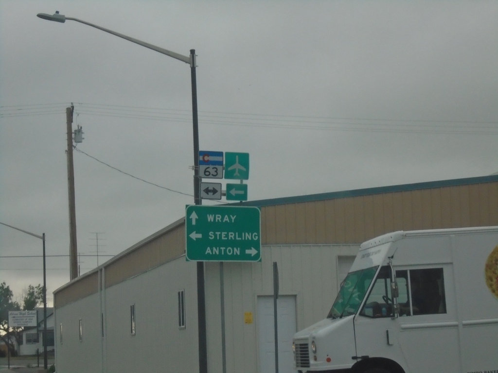
US-34 East at CO-63
US-34 East at CO-63 in Akron. Use CO-63 North to Sterling; use CO-63 South to Anton. Continue east on US-34 to Wray.
Taken 07-11-2022
 Akron
Washington County
Colorado
United States
Akron
Washington County
Colorado
United States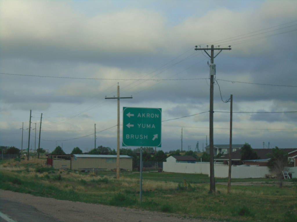
BL-76 West at US-34
BL-76 West at US-34. Use US-34 east to Akron and Yuma; BL-76/US-34 West to Brush.
Taken 07-11-2022
Brush
Morgan County
Colorado
United States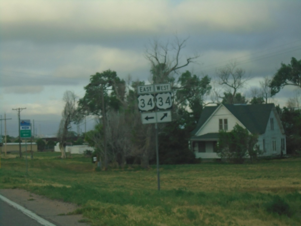
BL-76 West at US-34 - Morgan County
BL-76 West at US-34 in Morgan County
Taken 07-11-2022
Brush
Morgan County
Colorado
United States