Signs Tagged With Intersection
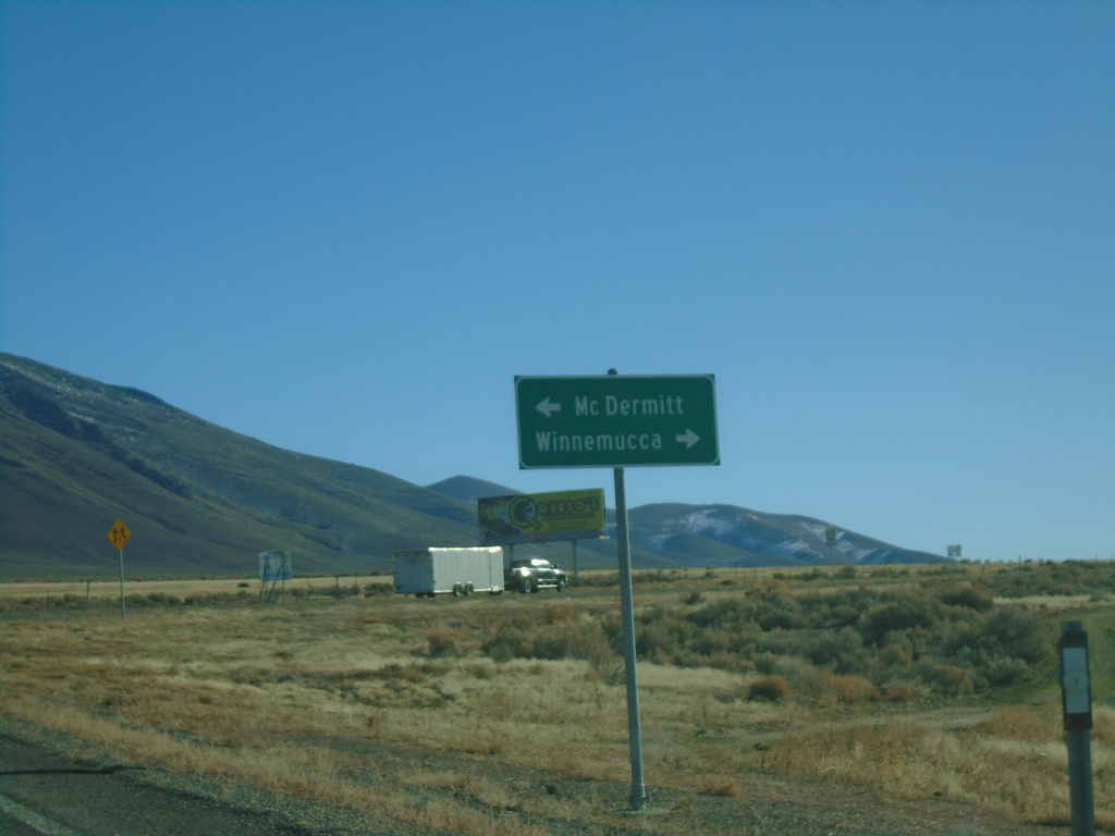
End NV-140 East at US-95
End NV-140 East at US-95. Use US-95 north for McDermitt; US-95 south for Winnemucca.
Taken 01-14-2022

 Winnemucca
Humboldt County
Nevada
United States
Winnemucca
Humboldt County
Nevada
United States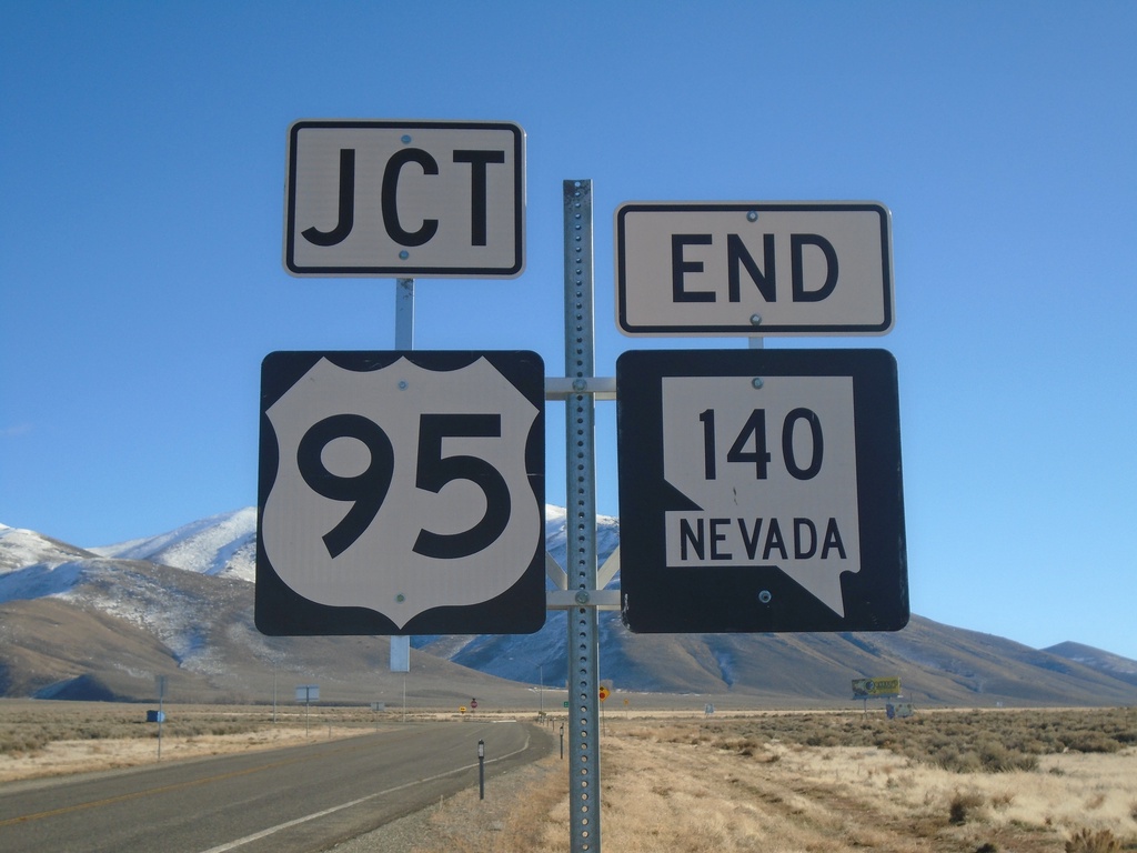
End NV-140 East at US-95
End NV-140 at US-95 in Humboldt County.
Taken 01-14-2022
Winnemucca
Humboldt County
Nevada
United States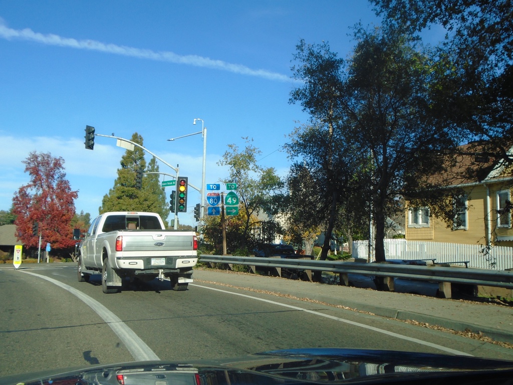
Auburn Folsom Road North at Lincoln Way/Maple St.
Auburn Folsom Road North at Lincoln Way (To CA-49) and Maple St. (To I-80)
Taken 11-27-2021

 Auburn
Placer County
California
United States
Auburn
Placer County
California
United States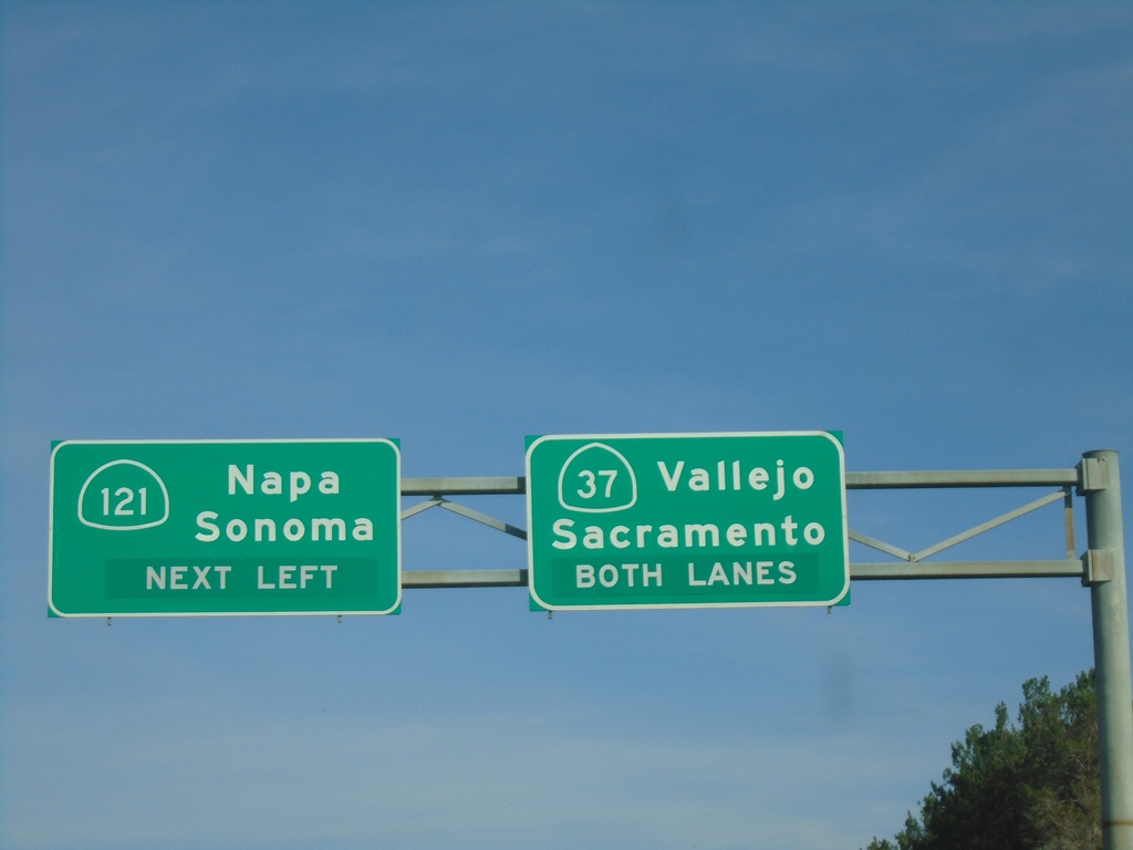
CA-37 East at CA-121
CA-37 east at CA-121 to Napa and Sonoma. Continue east on CA-37 for Vallejo and Sacramento (via I-80).
Taken 11-25-2021

 Sonoma
 County
California
United States
Sonoma
Sonoma County
California
United States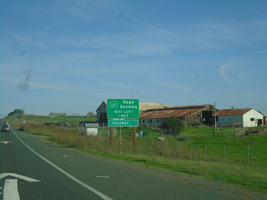
CA-37 East Approaching CA-121
CA-37 East Approaching CA-121 to Napa, Sonoma, and (Sonoma) Raceway.
Taken 11-25-2021
Sonoma
Sonoma County
California
United States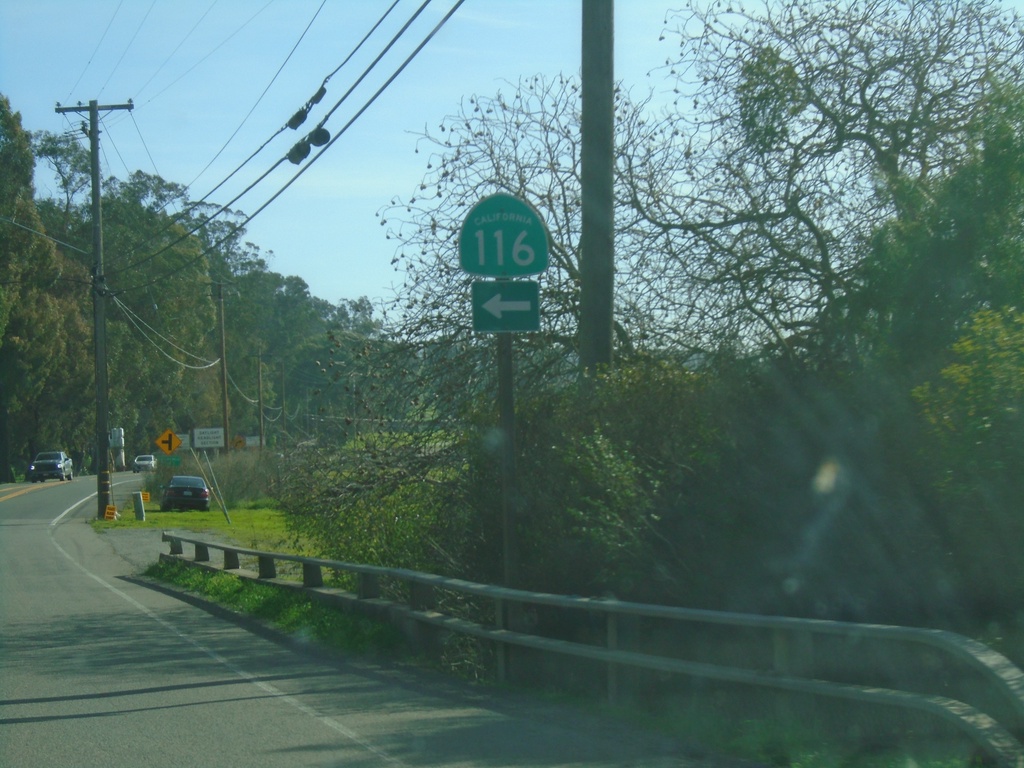
CA-116 East - Lakeview Highway at Stage Gulch Road
CA-116 East - Lakeview Highway at Stage Gulch Road. Turn left on Stage Gulch Road to continue east on CA-116.
Taken 11-25-2021
 Petaluma
Sonoma County
California
United States
Petaluma
Sonoma County
California
United States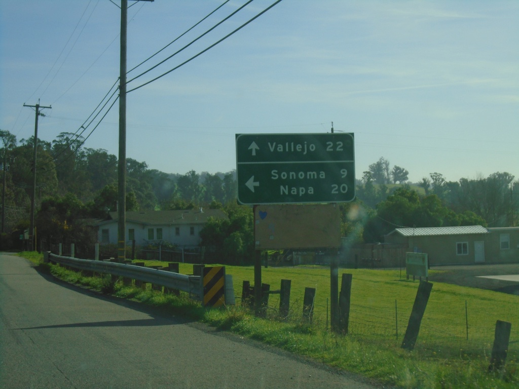
CA-116 East - Lakeview Highway at Stage Gulch Road
CA-116 East - Lakeview Highway at Stage Gulch Road. Turn left on Stage Gulch Road to continue east on CA-116 to Napa and Sonoma. Continue south on Lakeview Highway for Vallejo (via CA-37).
Taken 11-25-2021
Petaluma
Sonoma County
California
United States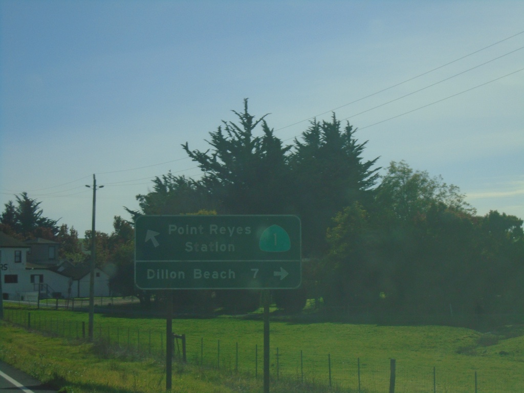
CA-1 South at Valley Ford - Estero Road
CA-1 South at Valley Ford - Estero Road to Dillon Beach. Continue south on CA-1 for Point Reyes Station.
Taken 11-23-2021
 Valley Ford
Sonoma County
California
United States
Valley Ford
Sonoma County
California
United States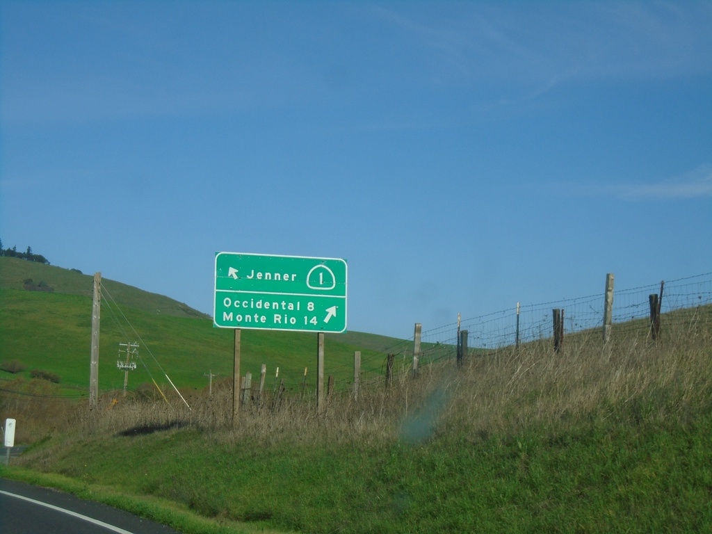
CA-1 North at Freestone-Valley Ford Road
CA-1 North at Freestone-Valley Ford Road. Turn right for Occidental and Monte Rio. Continue on CA-1 for Jenner.
Taken 11-23-2021
Valley Ford
Sonoma County
California
United States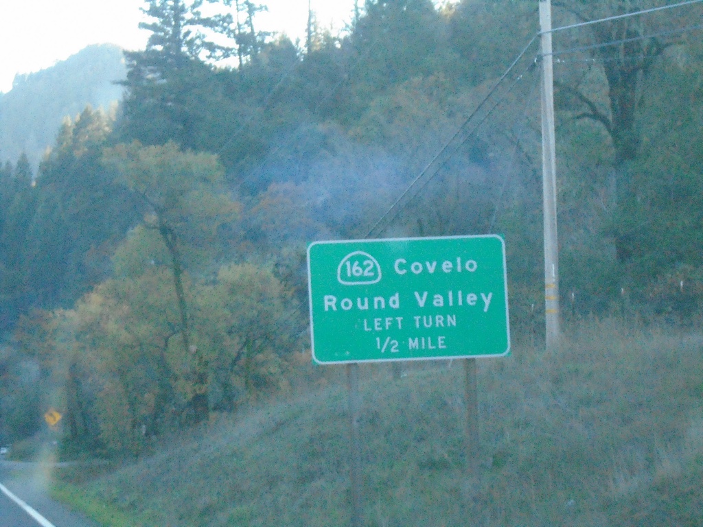
US-101 South Approaching CA-162
US-101 south approaching CA-162 east to Covelo and Round Valley.
Taken 11-21-2021

 Willits
Mendocino County
California
United States
Willits
Mendocino County
California
United States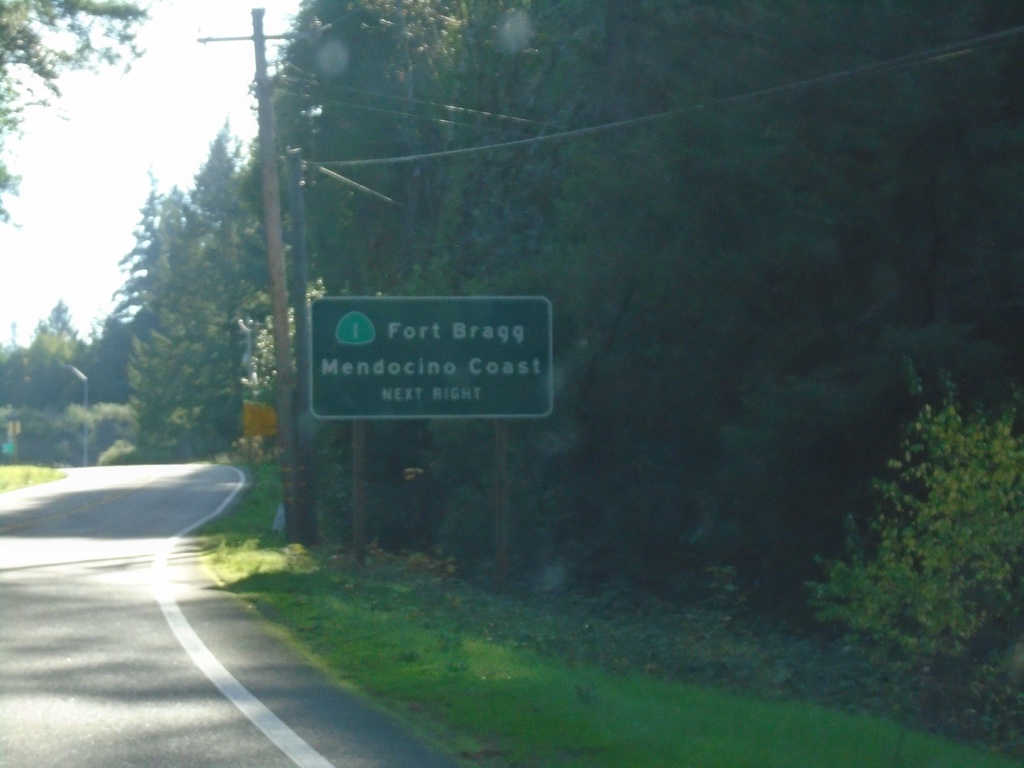
US-101 South Approaching CA-1
US-101 south approaching CA-1/Fort Bragg/Mendocino Coast.
Taken 11-21-2021
Leggett
Mendocino County
California
United States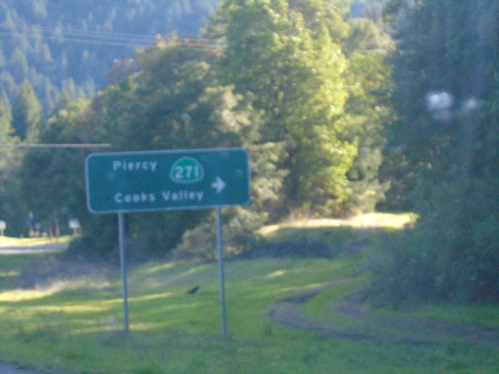
US-101 South at CA-271
US-101 south at CA-271/Piercy/Cooks Valley
Taken 11-21-2021
 Garberville
Humboldt County
California
United States
Garberville
Humboldt County
California
United States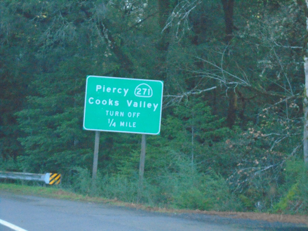
US-101 South Approaching CA-271
US-101 South Approaching CA-271 to Piercy and Cooks Valley.
Taken 11-21-2021
Piercy
Humboldt County
California
United States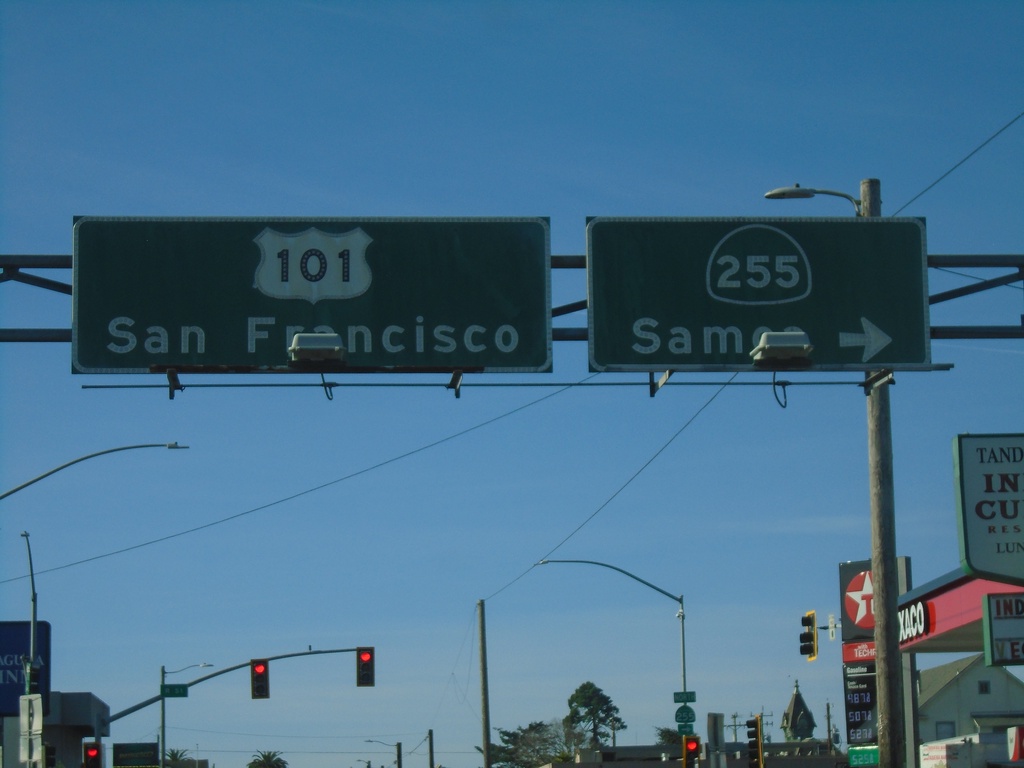
US-101 South At CA-255
US-101 south (4th St.) at CA-255/Samoa in downtown Eureka. Continue on US-101 for San Francisco.
Taken 11-21-2021
 Eureka
Humboldt County
California
United States
Eureka
Humboldt County
California
United States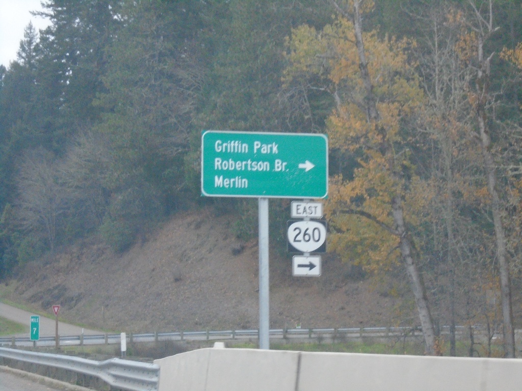
US-199 South at OR-260
US-199 South at OR-260 East to Merlin, Griffin Park, and Robertson Bridge.
Taken 11-20-2021

 Grants Pass
Josephine County
Oregon
United States
Grants Pass
Josephine County
Oregon
United States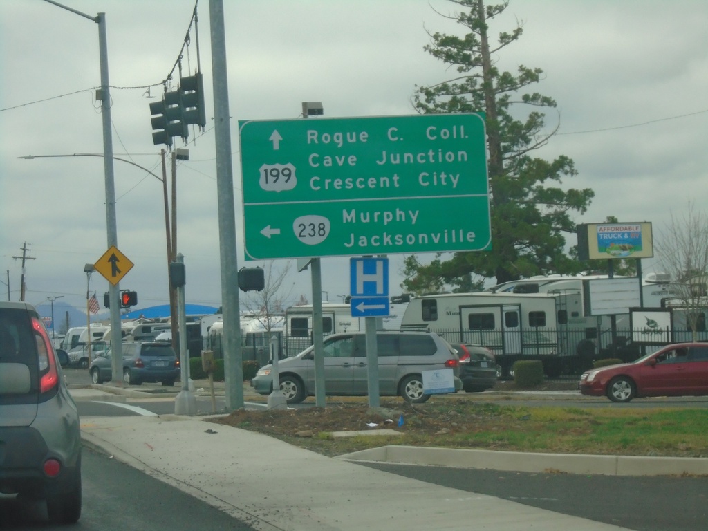
US-199 South at OR-238
US-199 south at OR-238. Turn left on OR-238 for Murphy and Jacksonville. Continue south on US-199 for Rogue Community College, Cave Junction, and Crescent City (California).
Taken 11-20-2021
 Grants Pass
Josephine County
Oregon
United States
Grants Pass
Josephine County
Oregon
United States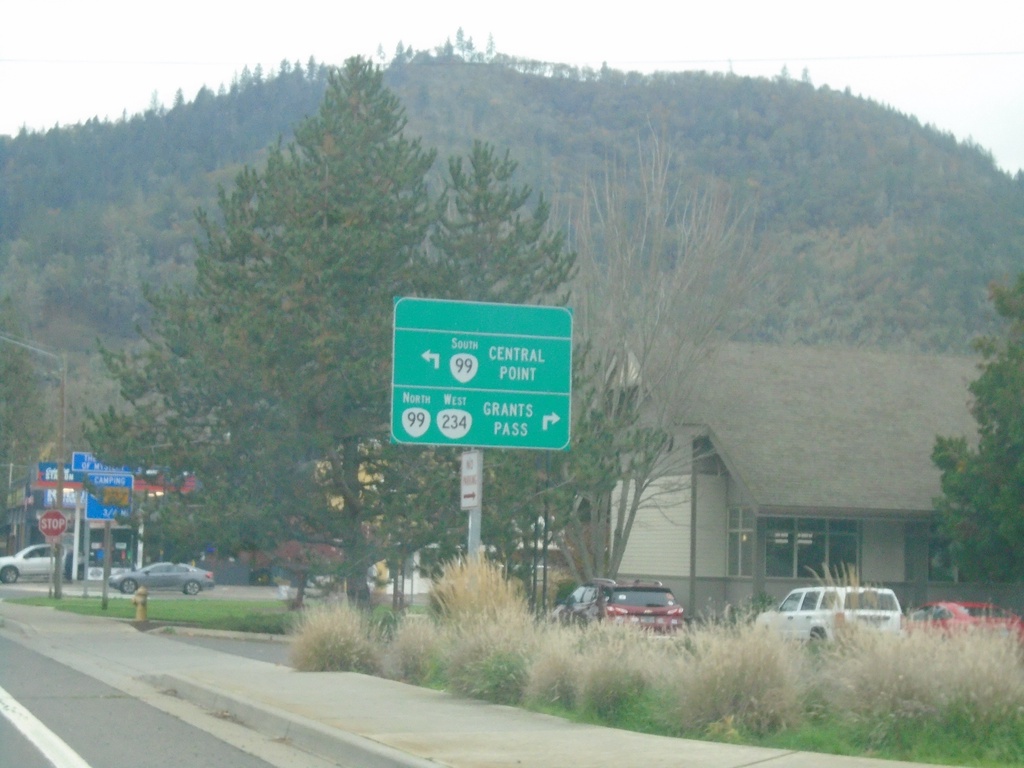
OR-234 West at OR-99 - Gold Hill
OR-234 West at OR-99 in Gold Hill. Use OR-99 South to Central Point; OR-234 West/OR-99 North to Grants Pass.
Taken 11-20-2021

 Gold Hill
Jackson County
Oregon
United States
Gold Hill
Jackson County
Oregon
United States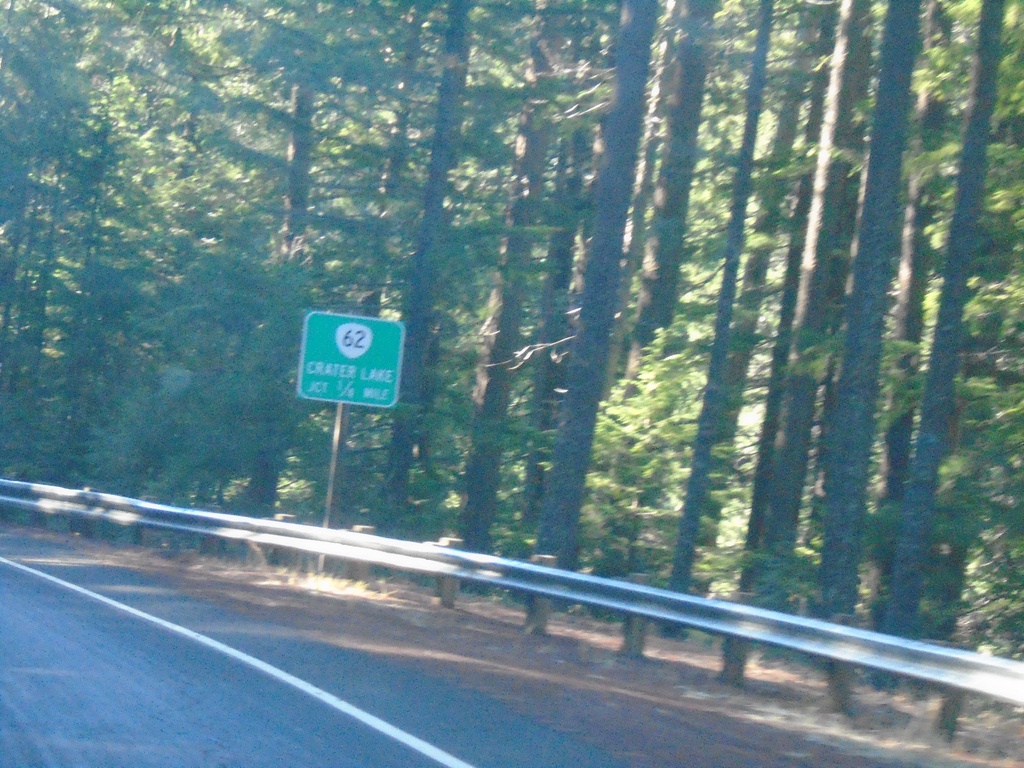
OR-230 West Approaching OR-62
OR-230 West approaching OR-62. Use OR-62 North to Crater Lake.
Taken 11-20-2021

 Prospect
Jackson County
Oregon
United States
Prospect
Jackson County
Oregon
United States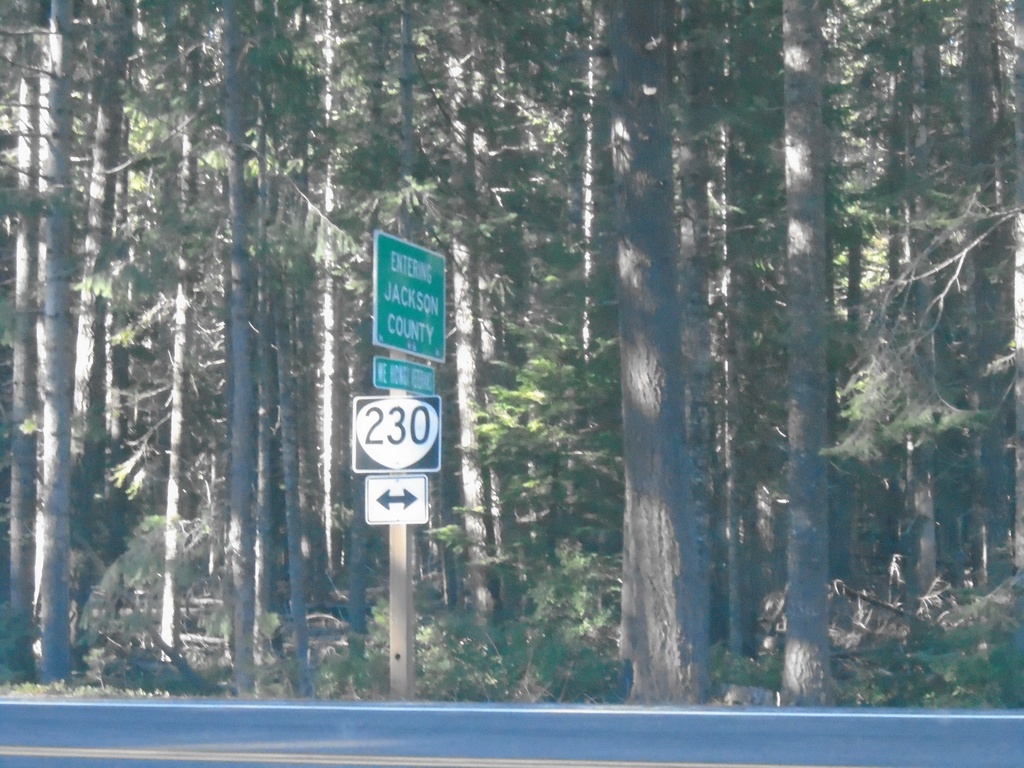
End Forest Road 6530 at OR-230
End Forest Road 6530 at OR-230 at the Jackson/Douglas County Line.
Taken 11-20-2021
Prospect
Jackson County
Oregon
United States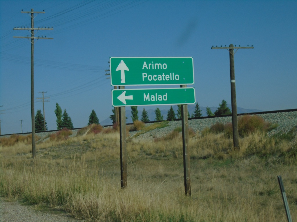
US-91 North at ID-40 West
US-91 north at ID-40 west to Malad. Continue north on US-91 for Arimo and Pocatello.
Taken 09-25-2021

 Downey
Bannock County
Idaho
United States
Downey
Bannock County
Idaho
United States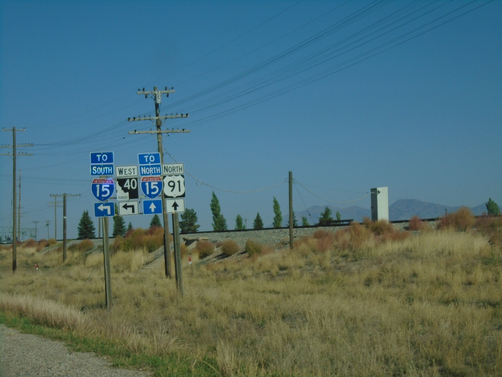
US-91 North Approaching ID-40 West
US-91 North approaching ID-40 West. Continue north on US-91 for I-15 North; use ID-40 west for I-15 south.
Taken 09-25-2021
 Downey
Bannock County
Idaho
United States
Downey
Bannock County
Idaho
United States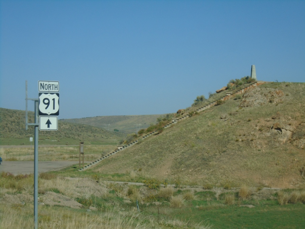
US-91 North at Oxford Highway
US-91 North at Oxford Highway in Bannock County. The intersection is located at Red Rock Pass which was the site of an ancient dam on prehistoric Lake Bonneville. The erosion of this dam created the catastrophic Bonneville Floods which affected much of the Snake River plain of Idaho.
Taken 09-25-2021
Downey
Bannock County
Idaho
United States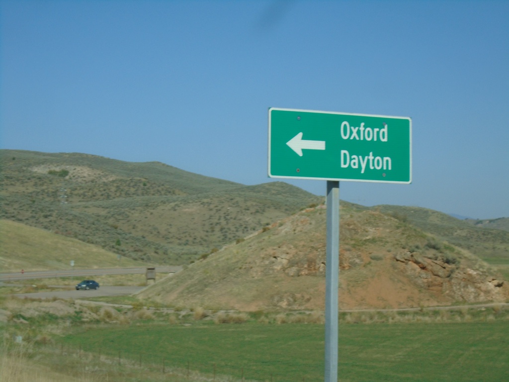
US-91 North Approaching Oxford Highway
US-91 North approaching Oxford Highway south to Oxford and Dayton.
Taken 09-25-2021
Downey
Bannock County
Idaho
United States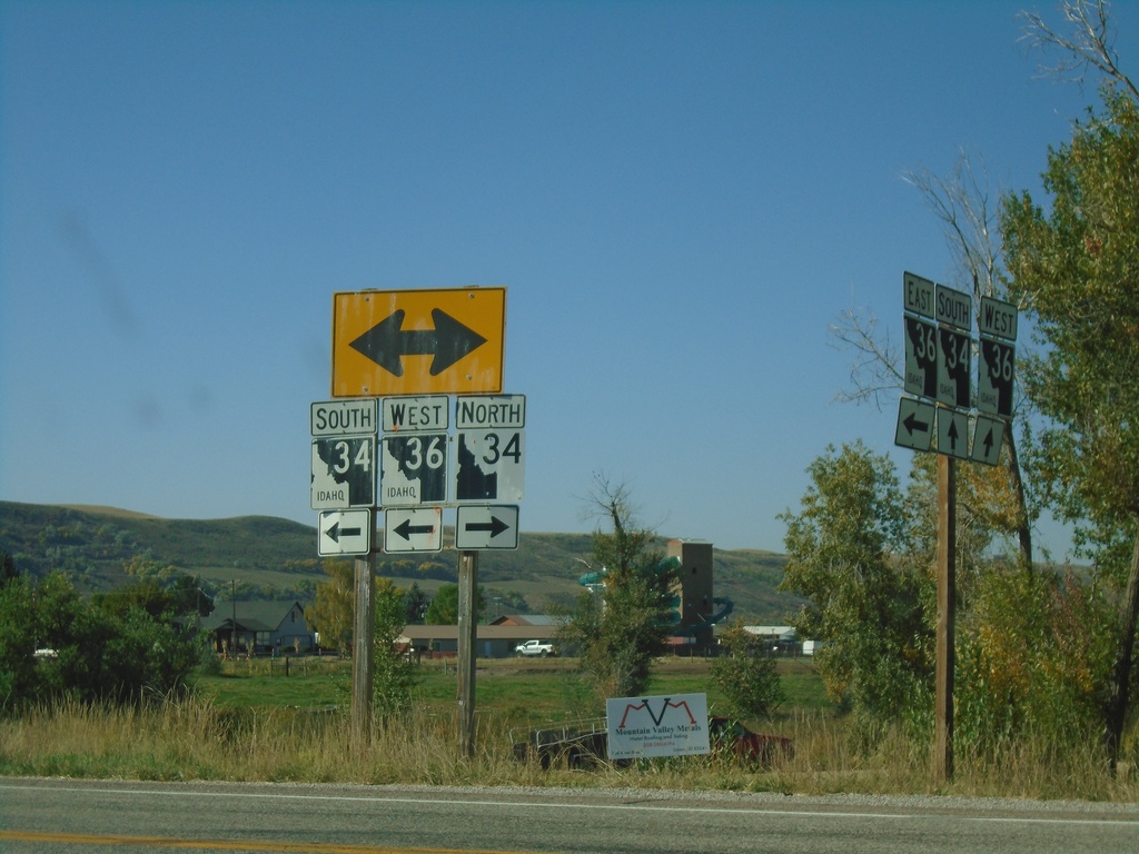
ID-36 West at ID-34 - Franklin County
ID-36 West at ID-34 in Franklin County. Turn right for ID-34 North; turn left for ID-34 South/ID-36 West. Notice the the old and new varieties of Idaho state highway markers (ID-34 North - New, ID-34 South/ID-36 West - Old).
Taken 09-25-2021

 Preston
Franklin County
Idaho
United States
Preston
Franklin County
Idaho
United States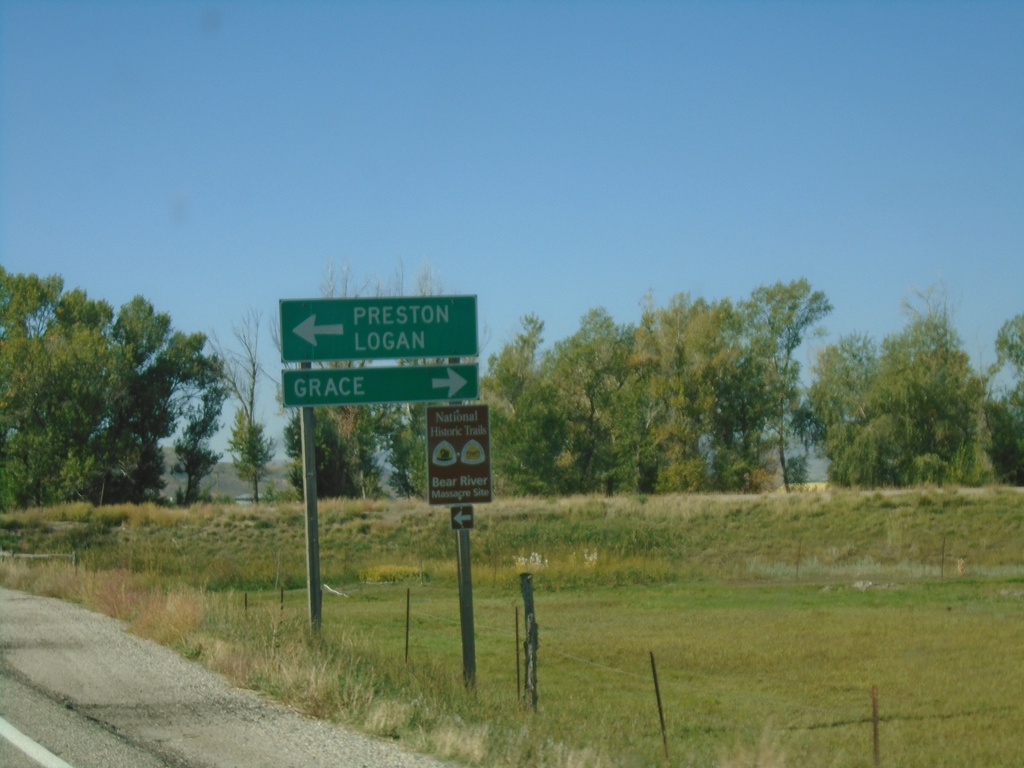
ID-36 West at ID-34 - Franklin County
ID-36 West at ID-34 in Franklin County. Use ID-34 North to Grace; ID-34 South/ID-36 West to Preston and Logan (Utah).
Taken 09-25-2021
Preston
Franklin County
Idaho
United States