Signs Tagged With Intersection
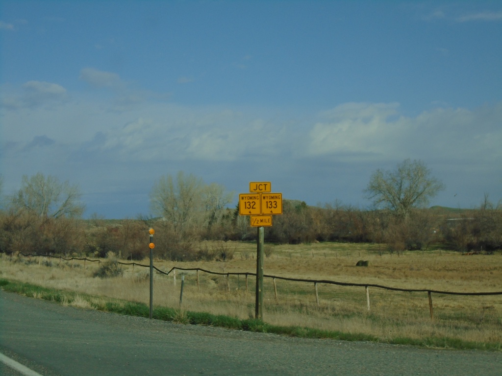
US-26 West Approaching WY-132/WY-133
US-26 West approaching WY-132/WY-133 in Fremont County.
Taken 05-03-2022


 Kinnear
Fremont County
Wyoming
United States
Kinnear
Fremont County
Wyoming
United States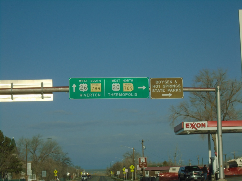
US-20/US-26 West at WY-789 - Shoshoni
US-20/US-26 West at WY-789 in Shoshoni. Turn right for US-20 West/WY-789 North to Thermopolis, Boysen State Park, and Hot Springs State Park. Continue straight for US-26 West/WY-789 South to Riverton.
Taken 05-03-2022

 Shoshoni
Fremont County
Wyoming
United States
Shoshoni
Fremont County
Wyoming
United States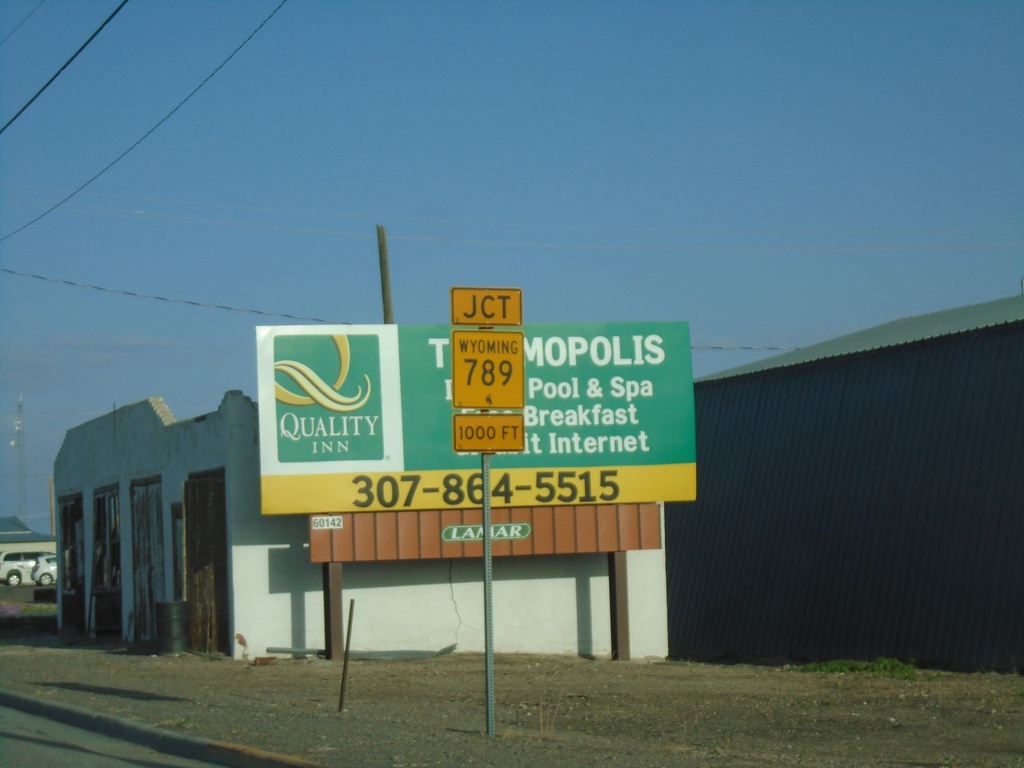
US-20/US-26 West Approaching WY-789
US-20/US-26 West approaching WY-789 in Shoshoni.
Taken 05-03-2022
Shoshoni
Fremont County
Wyoming
United States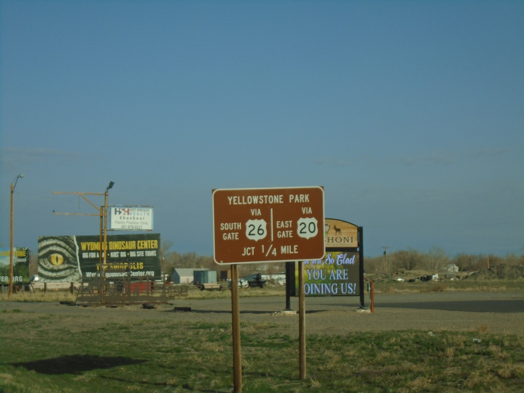
US-20/US-26 West - Yellowstone Park
US-20/US-26 West approaching US-20/US-26 split and WY-789. Use US-20 West for Yellowstone East Gate. Use US-26 West for Yellowstone South Gate.
Taken 05-03-2022
Shoshoni
Fremont County
Wyoming
United States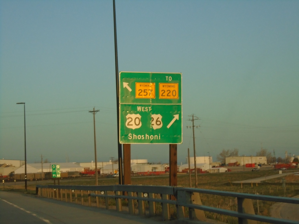
US-20/US-26 West at WY-257/To WY-220
US-20/US-26 West at WY-257/To WY-220 (Casper West Belt Loop) and Bus. US-20/Bus. US-26 (not signed). Turn right to continue west on US-20/US-26 to Shoshoni.
Taken 05-03-2022


 Casper
Natrona County
Wyoming
United States
Casper
Natrona County
Wyoming
United States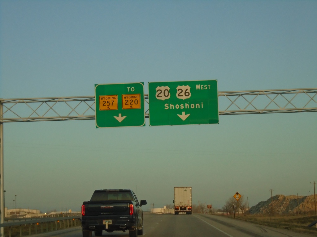
US-20/US-26 West at WY-257/To WY-220 and Bus. US-20/Bus. US-26
US-20/US-26 West at WY-257/To WY-220 and Bus. US-20/Bus. US-26 (not marked) in Casper. Use right lane to continue west on US-20/US-26 to Shoshoni. Continue straight for WY-257/To WY-220 which is the Casper West Belt Route.
Taken 05-03-2022
Mills
Natrona County
Wyoming
United States
US-18/US-20 East Approaching I-25/US-26/US-87
US-18/US-20 East approaching I-25/US-26/US-87 at Orin Junction. US-20 west joins I-25/US-87 North/US-26 West to Glenrock. US-18 ends here.
Taken 05-02-2022


 Douglas
Converse County
Wyoming
United States
Douglas
Converse County
Wyoming
United States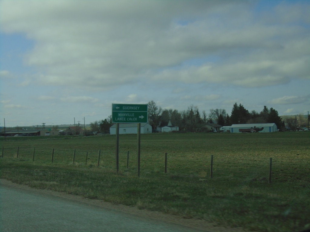
US-20 West/US-18 West at WY-270
US-20 West/US-18 West at WY-270. Use WY-270 north to Lance Creek and Manville. Use WY-270 south to Guernsey.
Taken 05-02-2022
 Lusk
Niobrara County
Wyoming
United States
Lusk
Niobrara County
Wyoming
United States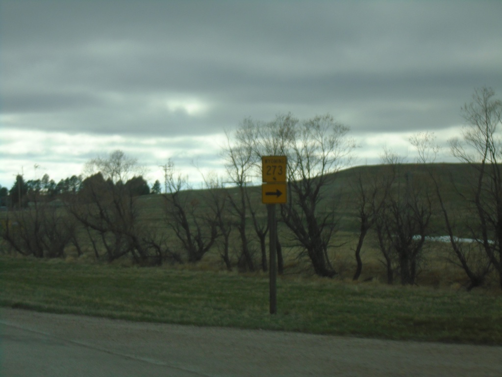
US-18 West/US-20 West at WY-273
US-18 West/US-20 West at WY-273 in Lusk.
Taken 05-02-2022
 Lusk
Niobrara County
Wyoming
United States
Lusk
Niobrara County
Wyoming
United States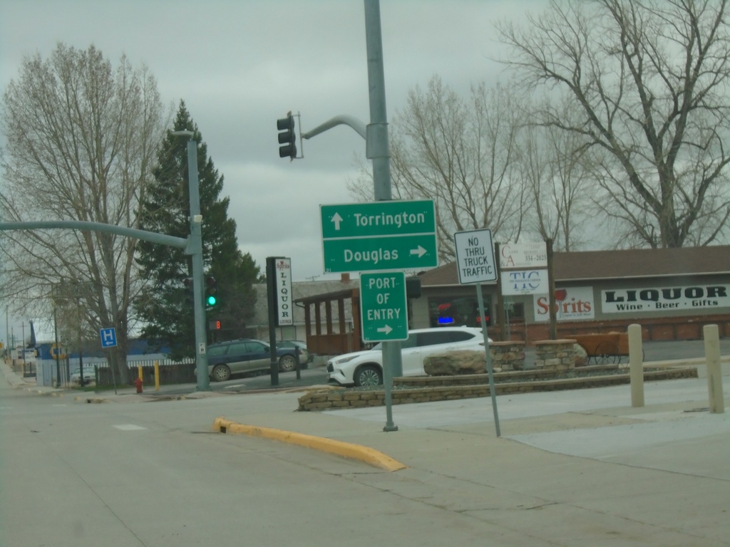
US-18 West/US-20 West/US-85 South at US-18/US-20 Junction
US-18 West/US-20 West/US-85 South at US-18/US-20 junction in Lusk. Turn right for US-18 West/US-20 West to Douglas. Continue south on US-85 for Torrington.
Taken 05-02-2022
 Lusk
Niobrara County
Wyoming
United States
Lusk
Niobrara County
Wyoming
United States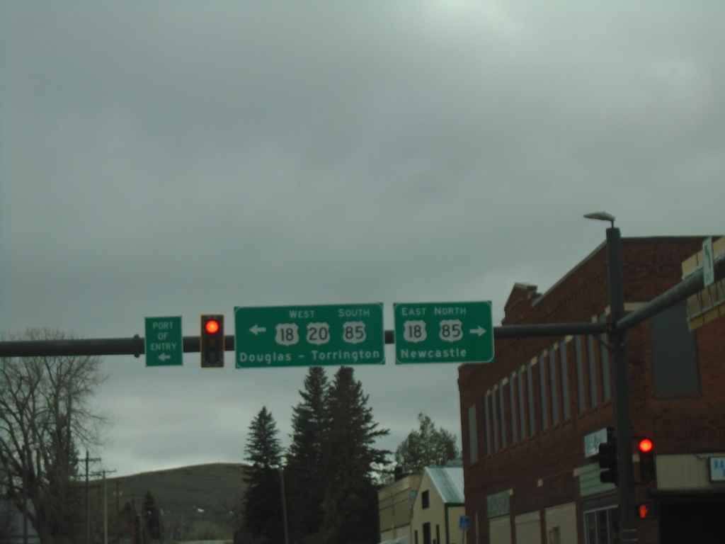
US-20 West at US-18/US-85 - Lusk
US-20 West at US-18/US-85 in Lusk. Use US-18 East/US-85 North to Newcastle. Use US-20 West/US-18-West/US-85 South to Douglas (via US-18/US-20) and Torrington (via US-85).
Taken 05-02-2022
Lusk
Niobrara County
Wyoming
United States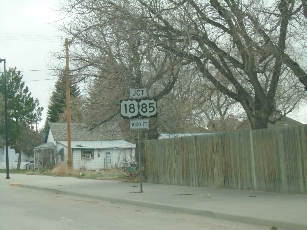
US-20 West Approaching US-18/US-85
US-20 West approaching US-18/US-85 in Lusk.
Taken 05-02-2022
Lusk
Niobrara County
Wyoming
United States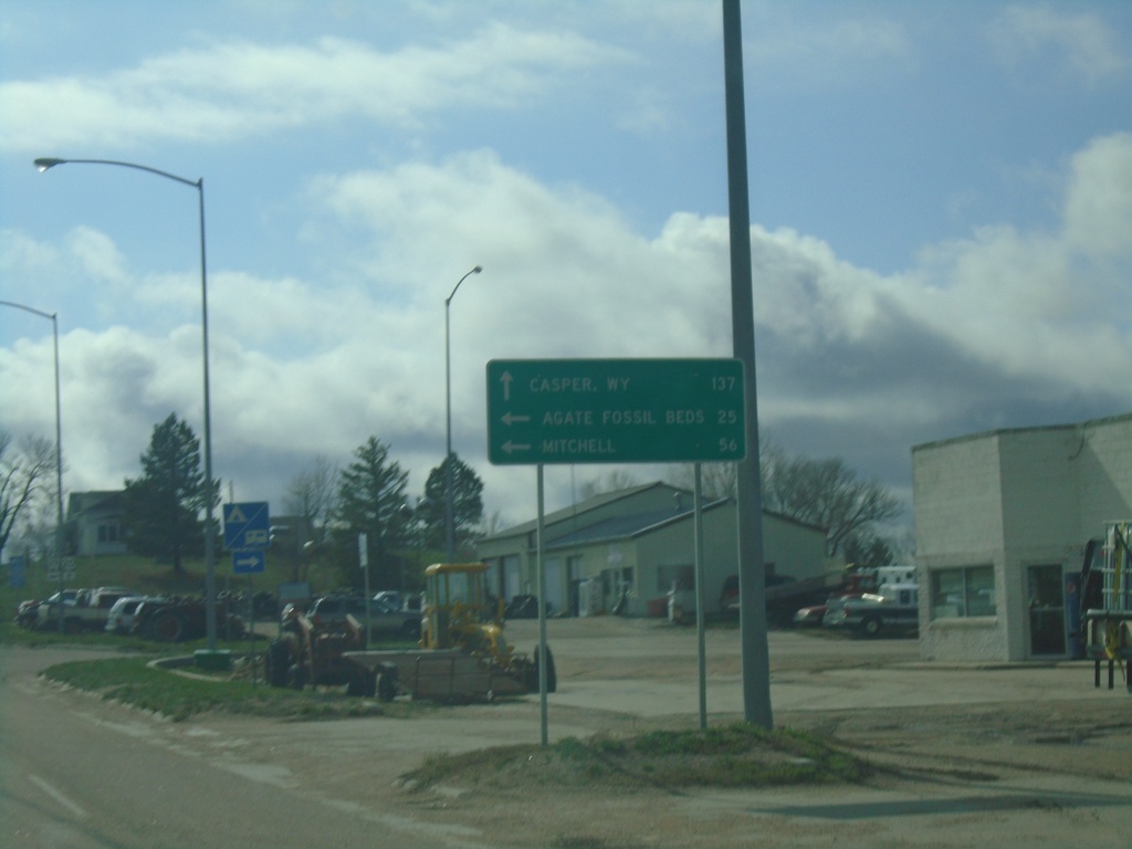
US-20 West Approaching NE-29
US-20 West approaching NE-29 in Harrison. Use US-20 West to Casper, WY. South NE-29 South for Agate Fossil Beds and Mitchell. This is the first appearance of Casper, WY on a distance marker or junction along US-20 in Nebraska.
Taken 05-02-2022
 Harrison
Sioux County
Nebraska
United States
Harrison
Sioux County
Nebraska
United States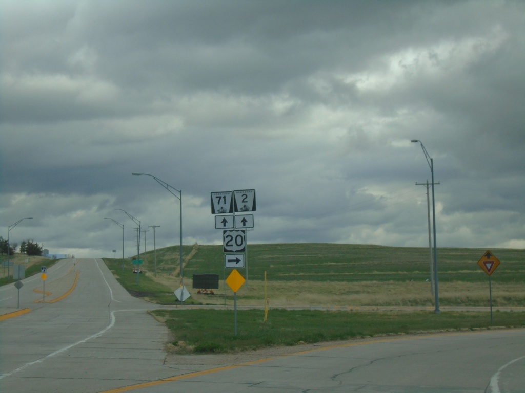
US-20 West/NE-71 South/NE-2 East at NE-71/NE-2
US-20 West/NE-71 South/NE-2 East at NE-71/NE-2 in Crawford.
Taken 05-02-2022

 Crawford
Dawes County
Nebraska
United States
Crawford
Dawes County
Nebraska
United States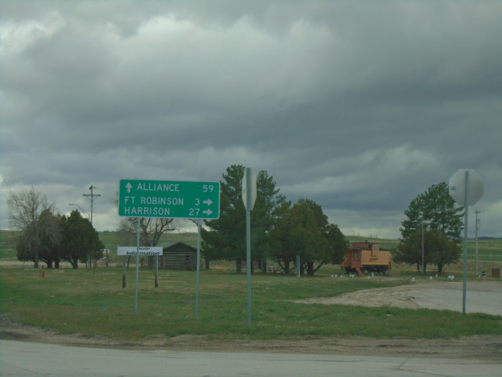
US-20 West/NE-71 South/NE-2 East at NE-71/NE-2
US-20 West/NE-71 South/NE-2 East at NE-71/NE-2 in Crawford. Use NE-71 South/NE-2 East to Alliance; use US-20 West for Fort Robinson and Harrison.
Taken 05-02-2022
Crawford
Dawes County
Nebraska
United States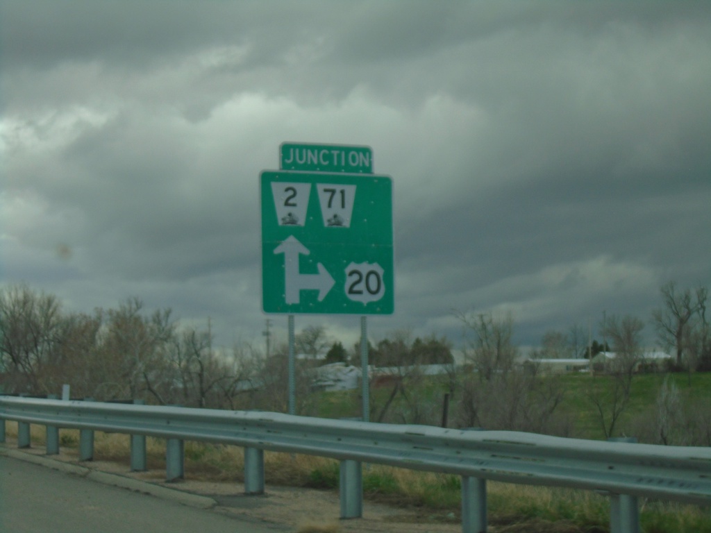
US-20 West/NE-2 East/NE-71 South at NE-2/NE-71
US-20 West/NE-2 East/NE-71 South at NE-2/NE-71 in Crawford.
Taken 05-02-2022
Crawford
Dawes County
Nebraska
United States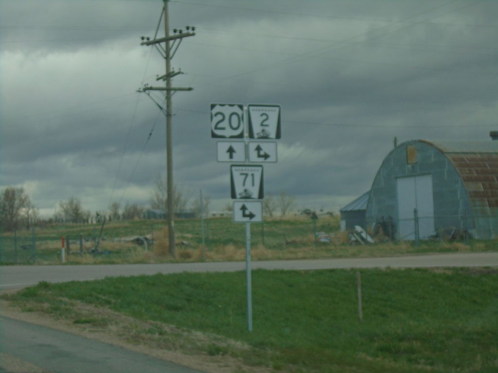
US-20 West at NE-2/NE-71
US-20 West at NE-2/NE-71 in Crawford. NE-2 East/NE-71 South joins US-20 through Crawford.
Taken 05-02-2022
Crawford
Dawes County
Nebraska
United States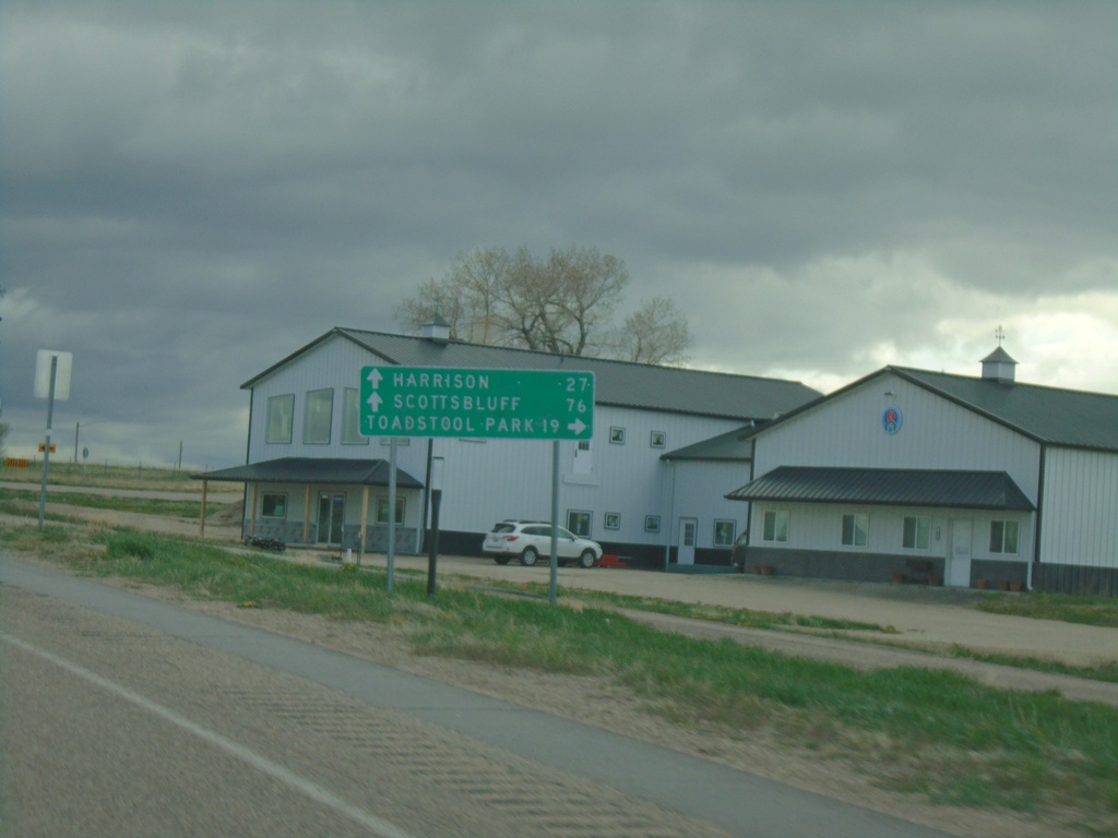
US-20 West Approaching NE-2/NE-71
US-20 West approaching NE-2/NE-71 in Crawford. Use NE-2 West/NE-71 South to Toadstool Park. Continue on US-20 West/NE-2 East/NE-71 South to Harrison (via US-20), and Scotts Bluff (via NE-71/NE-2).
Taken 05-02-2022
Crawford
Dawes County
Nebraska
United States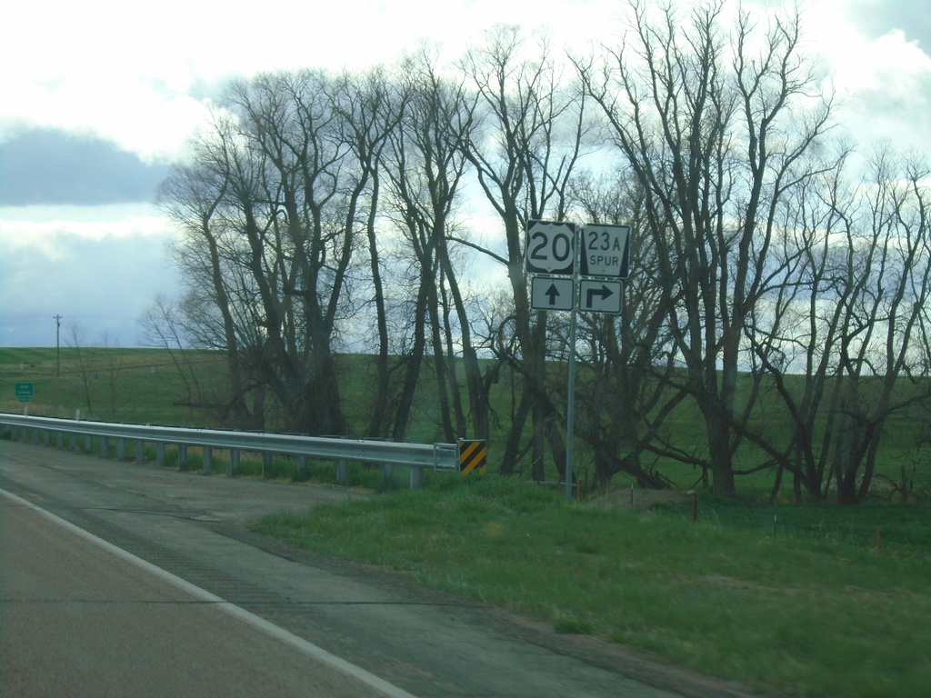
US-20 West at NE-23A Spur
US-20 West at NE-23A Spur in Dawes County.
Taken 05-02-2022
 Whitney
Dawes County
Nebraska
United States
Whitney
Dawes County
Nebraska
United States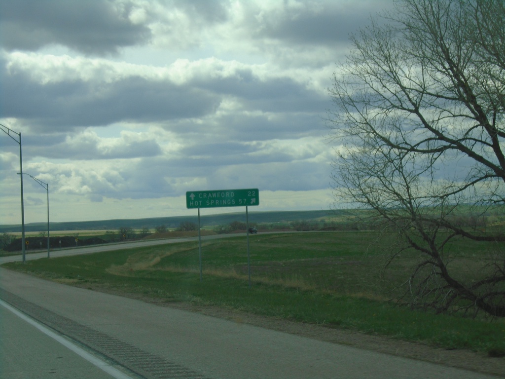
US-20 West/US-385 North at US-20/US-385 Split
US-20 West/US-385 North at US-20/US-385 split in Dawes County. Use US-385 North to Hot Springs, SD; continue west on US-20 for Crawford.
Taken 05-02-2022
 Chadron
Dawes County
Nebraska
United States
Chadron
Dawes County
Nebraska
United States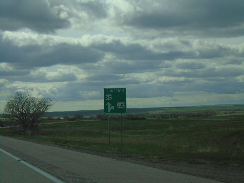
US-20 West/US-385 North Approaching US-20/US-385 Split
US-20 West/US-385 North approaching US-20/US-385 split in Dawes County.
Taken 05-02-2022
Chadron
Dawes County
Nebraska
United States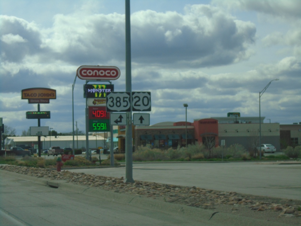
US-20 West at US-385 - Chadron
US-20 West at US-385 in Chadron. US-385 North joins US-20 west through Chadron.
Taken 05-02-2022
Chadron
Dawes County
Nebraska
United States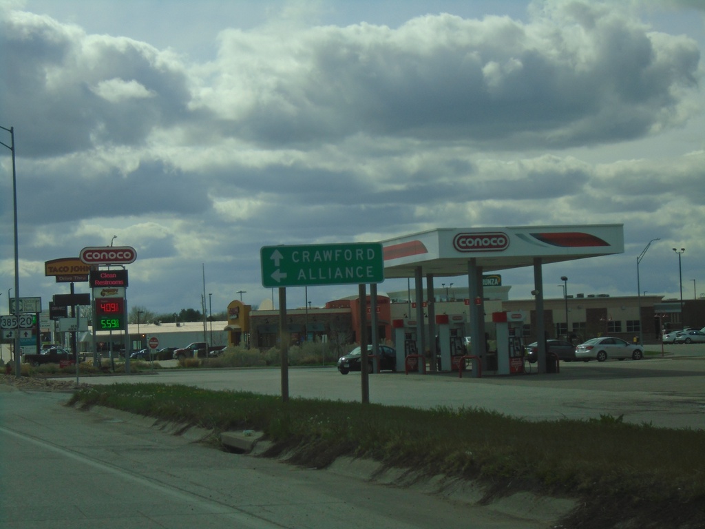
US-20 West Approaching US-385 South to Alliance
US-20 West approaching US-385 South to Alliance. Continue on US-20 west to Crawford. US-385 North joins US-20 westbound.
Taken 05-02-2022
Chadron
Dawes County
Nebraska
United States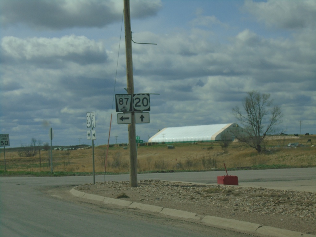
US-20 West/NE-87 South at US-20/NE-87 Split
US-20 West/NE-87 South at US-20/NE-87 split in Hay Springs.
Taken 05-02-2022
 Hay Springs
Sheridan County
Nebraska
United States
Hay Springs
Sheridan County
Nebraska
United States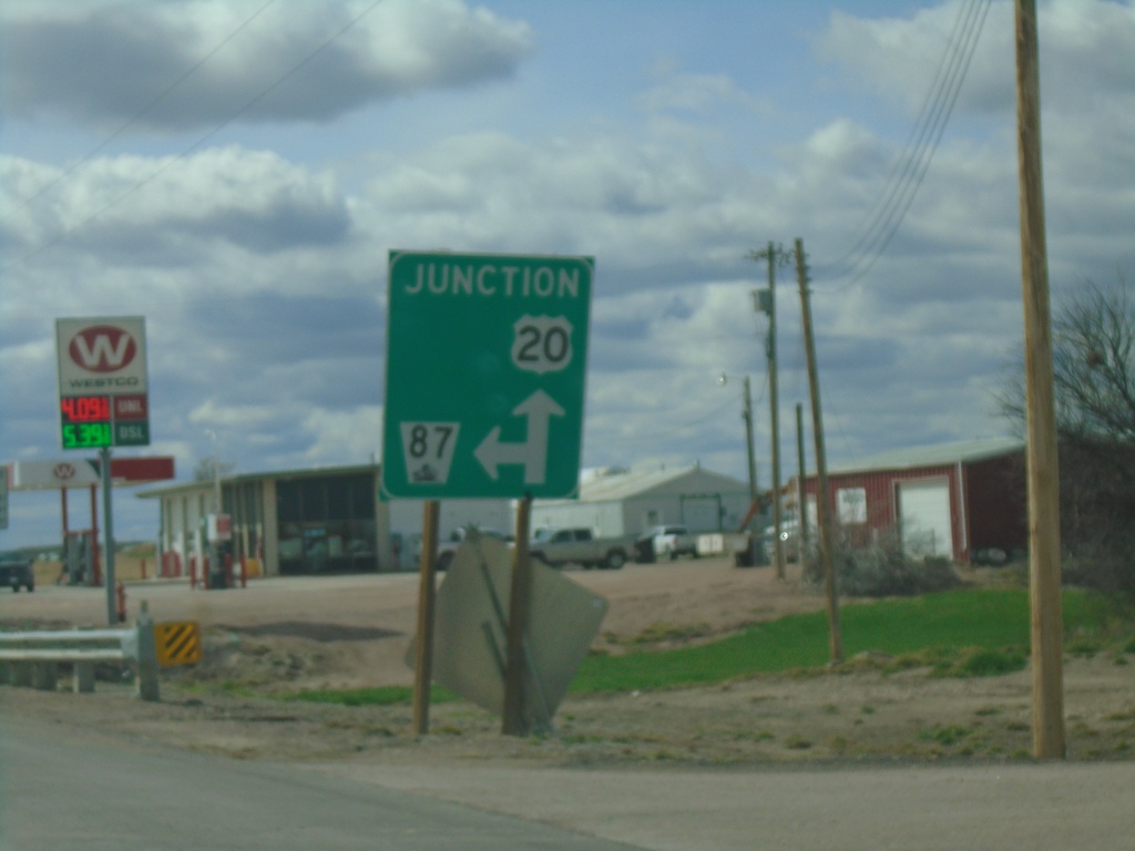
US-20 West/NE-87 South at US-20/NE-87 Split
US-20 West/NE-87 South at US-20/NE-87 split in Hay Springs.
Taken 05-02-2022
Hay Springs
Sheridan County
Nebraska
United States