Signs Tagged With Intersection
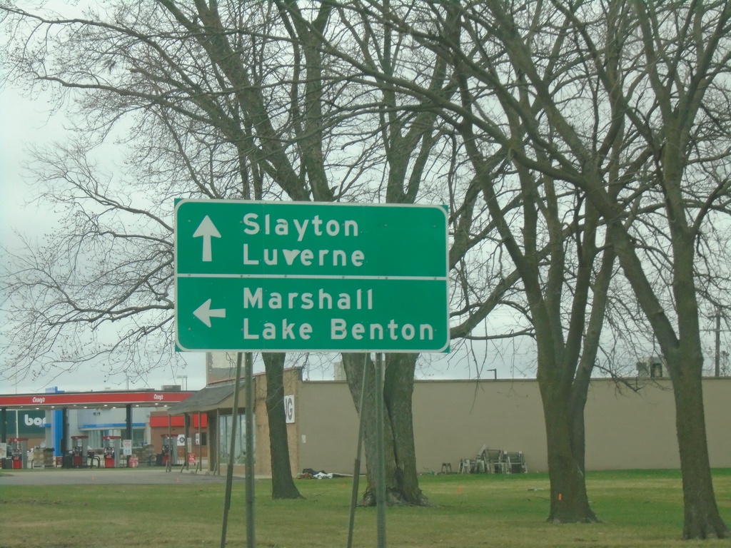
MN-30 East/MN-23 North Approaching US-75/MN-23 North
MN-30 East/MN-23 North approaching US-75/MN-23 North in Pipestone. Use US-75/MN-23 North for Marshall and Lake Benton. Use US-75 South/MN-30 East for Slayton and Luverne. US-75 South joins MN-30 East through Pipestone.
Taken 05-01-2022


 Pipestone
 County
Minnesota
United States
Pipestone
Pipestone County
Minnesota
United States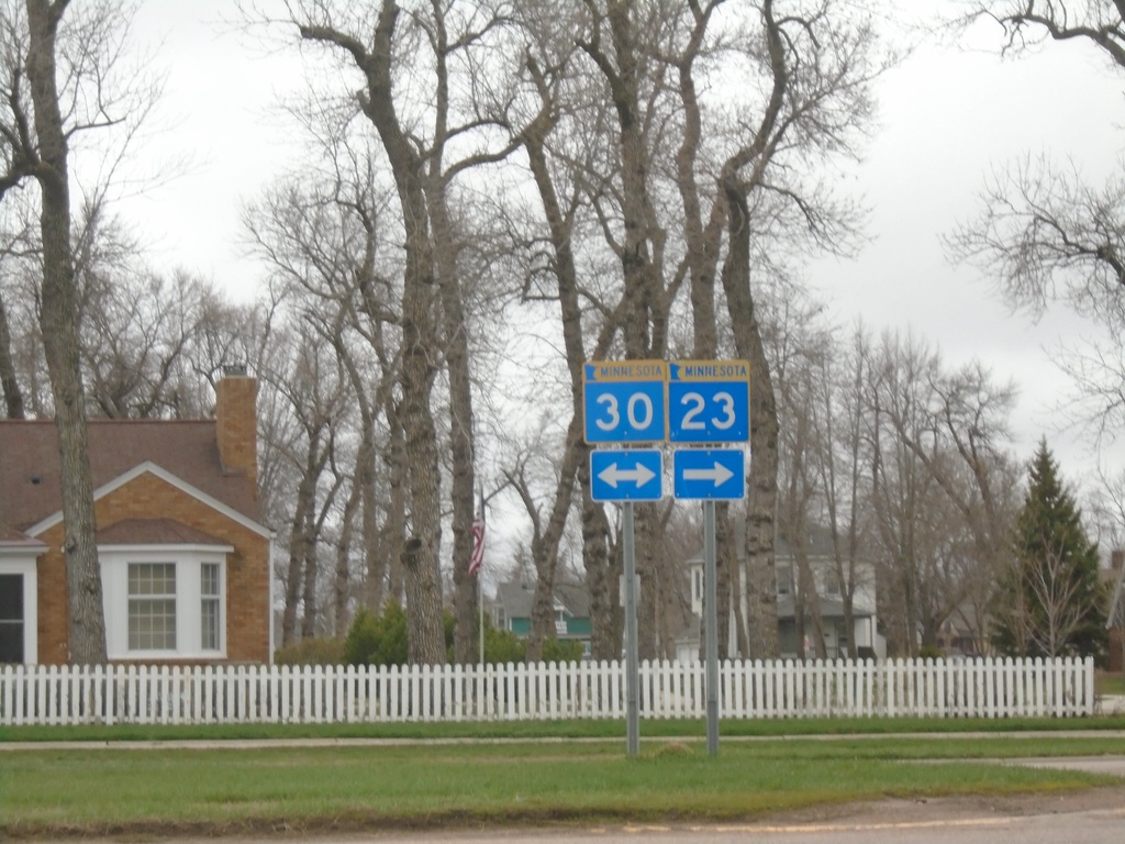
MN-23 North at MN-30
MN-23 North at MN-30 in Pipestone. MN-23 north joins MN-30 east through Pipestone.
Taken 05-01-2022
Pipestone
Pipestone County
Minnesota
United States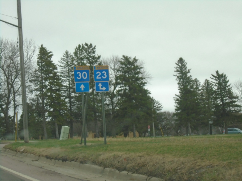
MN-30 East Approaching MN-23
MN-30 East Approaching MN-23 South. MN-23 joins MN-30 through Pipestone.
Taken 05-01-2022
Pipestone
Pipestone County
Minnesota
United States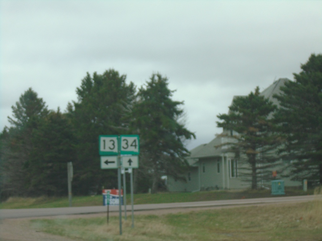
SD-34 East at SD-13 North
SD-34 East at SD-13 North in Moody County.
Taken 05-01-2022

 Flandreau
Moody County
South Dakota
United States
Flandreau
Moody County
South Dakota
United States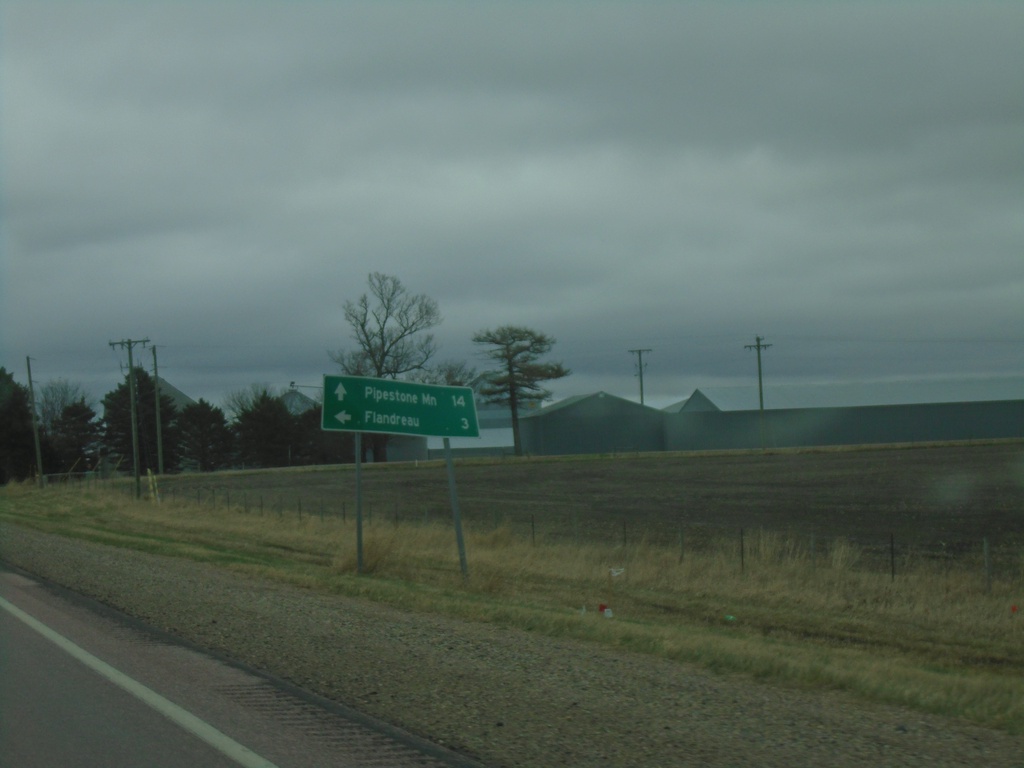
SD-34 East Approaching SD-34
SD-34 East approaching SD-13 north to Flandreau. Continue east on SD-34 for Pipestone, MN.
Taken 05-01-2022
Flandreau
Moody County
South Dakota
United States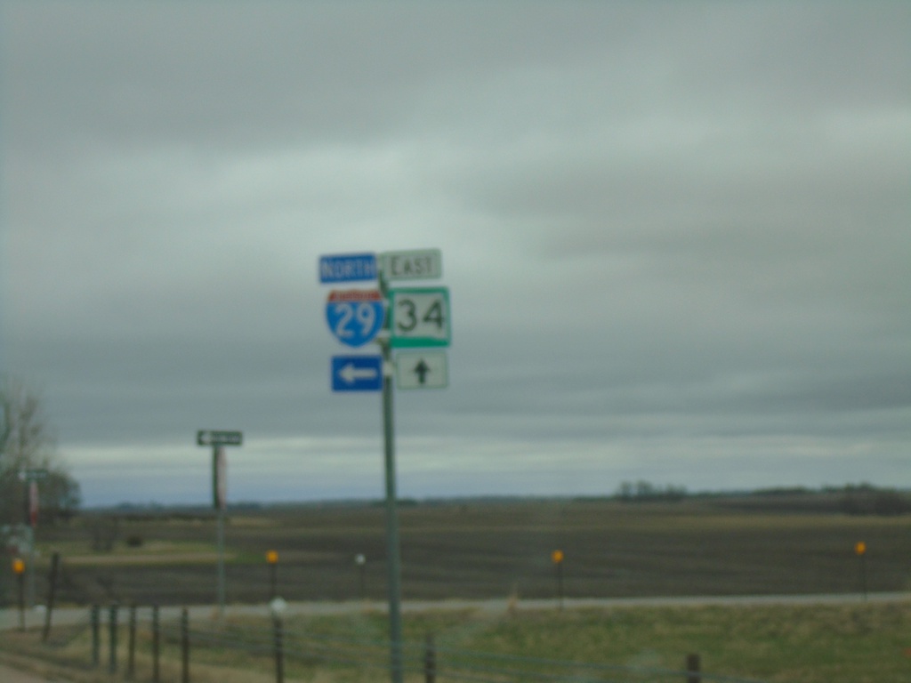
SD-34 East at I-29 North
SD-34 East at I-29 North in Moody County.
Taken 05-01-2022
 Colman
Moody County
South Dakota
United States
Colman
Moody County
South Dakota
United States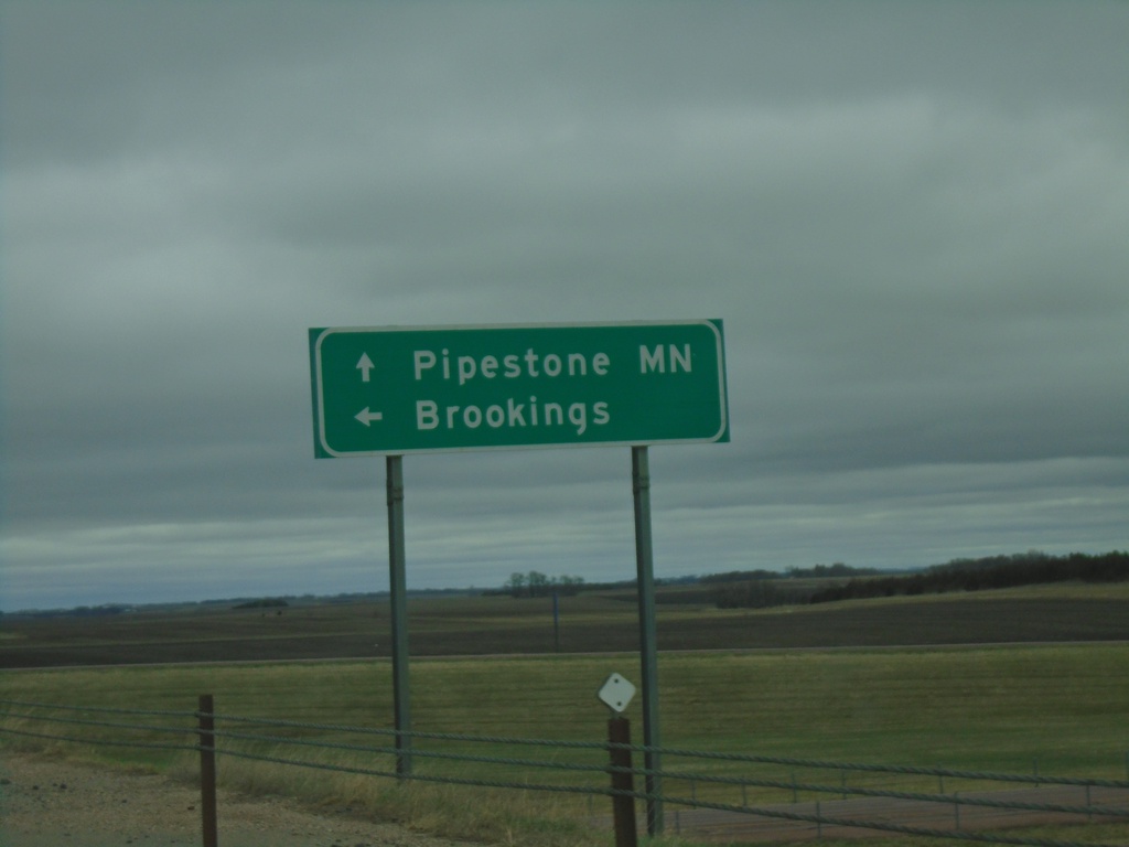
SD-34 East at I-29 North
SD-34 East at I-29 North to Brookings. Continue east on SD-34 for Pipestone, MN.
Taken 05-01-2022
Egan
Moody County
South Dakota
United States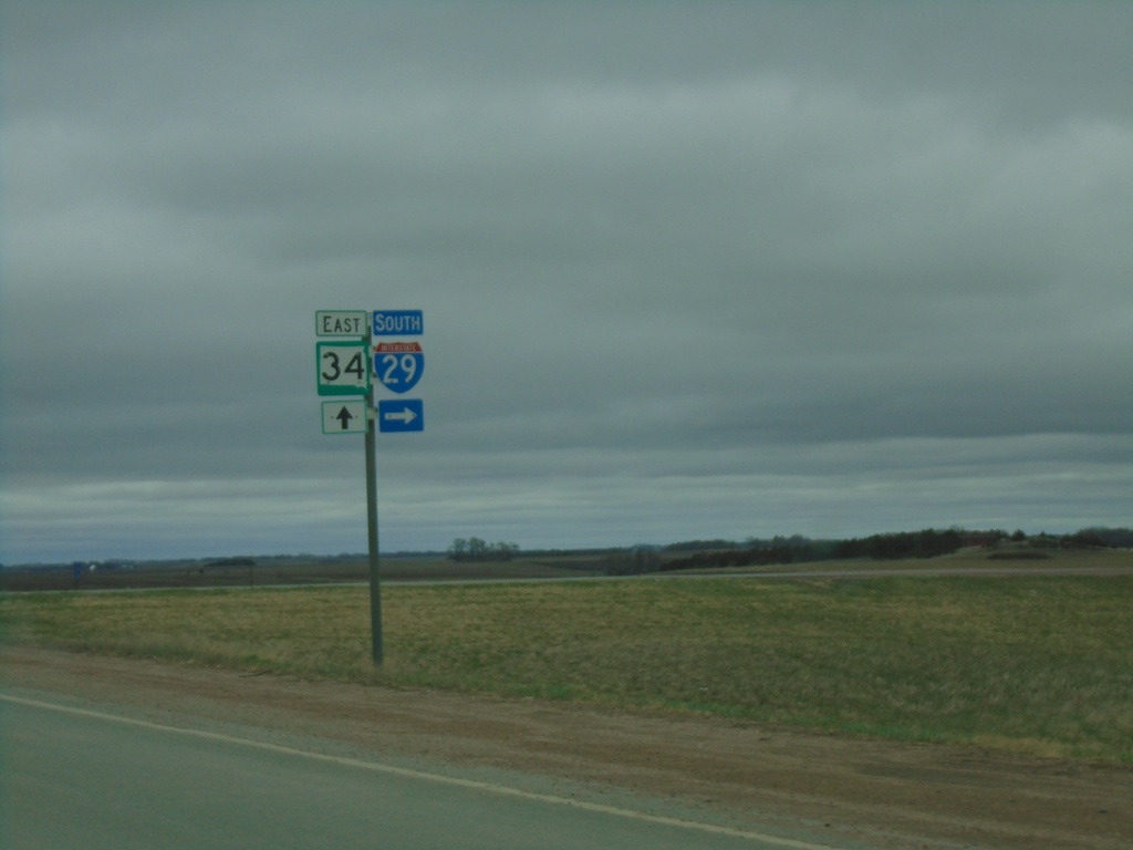
SD-34 East Approaching I-29 South
SD-34 East approaching I-29 South in Moody County.
Taken 05-01-2022
Colman
Moody County
South Dakota
United States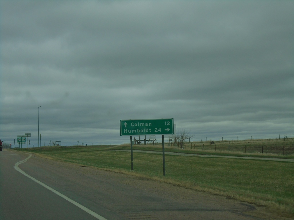
SD-34 East at SD-19
SD-34 East at SD-19 south to Humboldt. Continue east on SD-34 for Colman.
Taken 05-01-2022
 Madison
Lake County
South Dakota
United States
Madison
Lake County
South Dakota
United States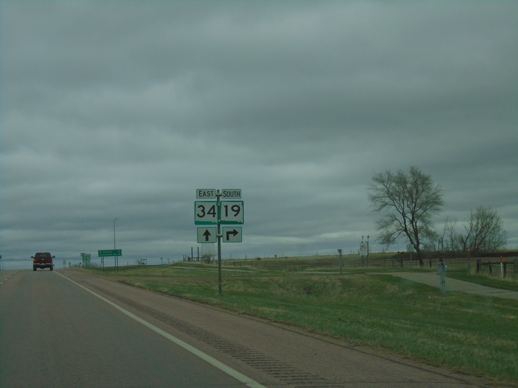
SD-34 East Approaching SD-19 - Lake County
SD-34 East approaching SD-19 in Lake County.
Taken 05-01-2022
Madison
Lake County
South Dakota
United States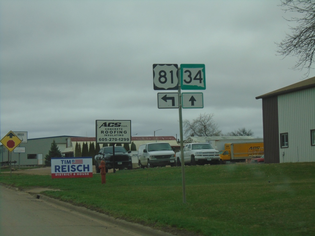
US-81 North/SD-34 East at US-81/SD-34 Split in Madison
US-81 North/SD-34 East at US-81/SD-34 Split in Madison
Taken 05-01-2022
 Madison
Lake County
South Dakota
United States
Madison
Lake County
South Dakota
United States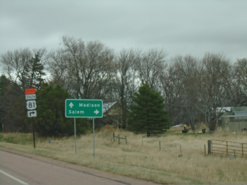
SD-34 East Approaching US-81
SD-34 East approaching US-81 in Miner County. Use US-81 south to Salem. US-81 North joins SD-34 East to Madison.
Taken 05-01-2022
Howard
Miner County
South Dakota
United States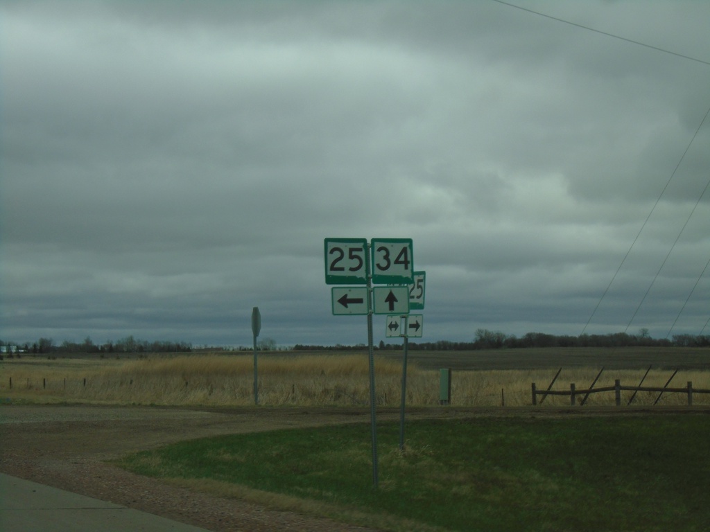
SD-34 East/SD-25 South at SD-34/SD-25 Split
SD-34 East/SD-25 South at SD-34/SD-25 split in Miner County.
Taken 05-01-2022
 Howard
Miner County
South Dakota
United States
Howard
Miner County
South Dakota
United States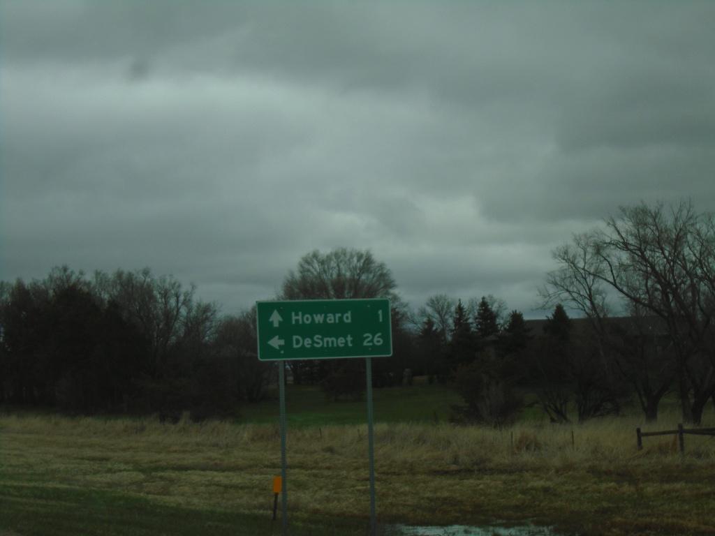
SD-34 East/SD-25 North at SD-34/SD-25 Split
SD-34 East/SD-25 North at SD-34/SD-25 split in Miner County. Use SD-25 North to De Smet; SD-34 East to Howard.
Taken 05-01-2022
Howard
Miner County
South Dakota
United States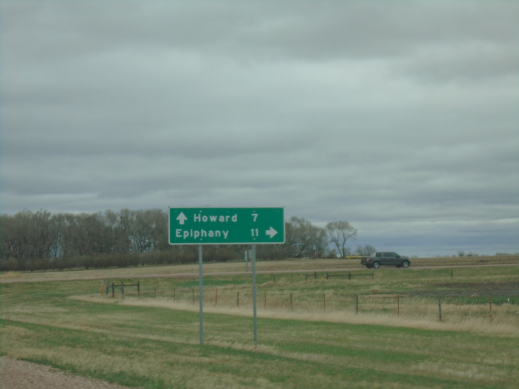
SD-34 East at SD-25 South
SD-34 East at SD-25 South to Epiphany. Continue on SD-34 East/SD-25 North to Howard. SD-25 North joins SD-34 eastbound.
Taken 05-01-2022
Howard
Miner County
South Dakota
United States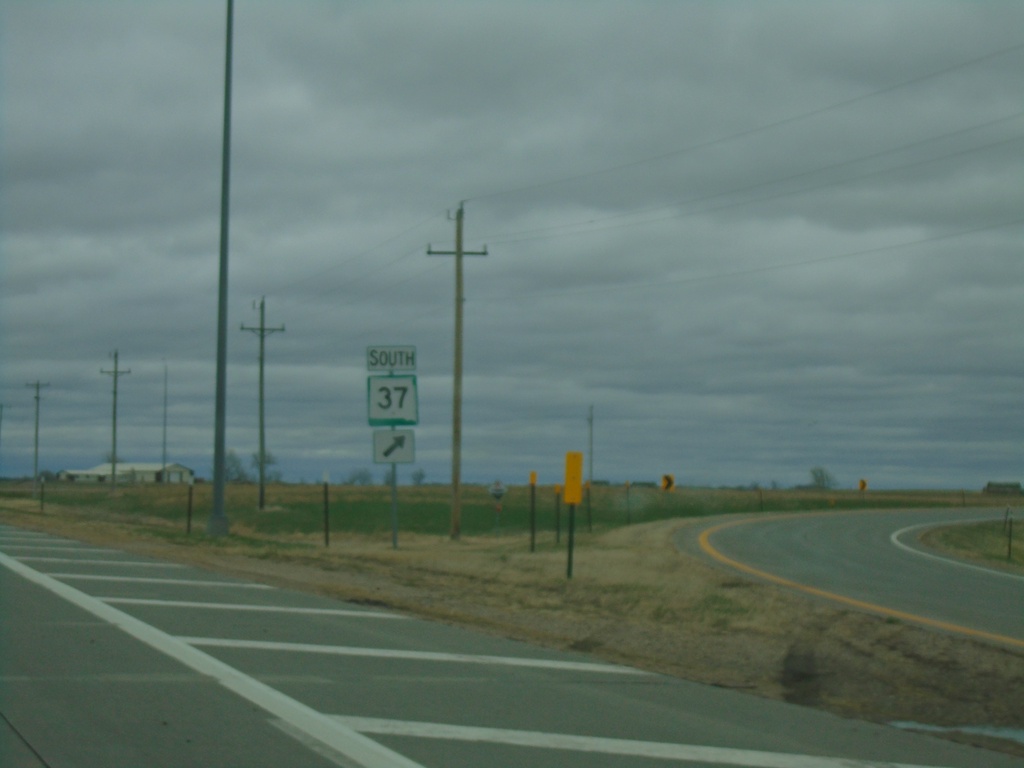
SD-34 East/SD-37 South at SD-34/SD-37 Split
SD-34 East/SD-37 South at SD-34/SD-37 split in Sanborn County.
Taken 05-01-2022
 Artesian
Sanborn County
South Dakota
United States
Artesian
Sanborn County
South Dakota
United States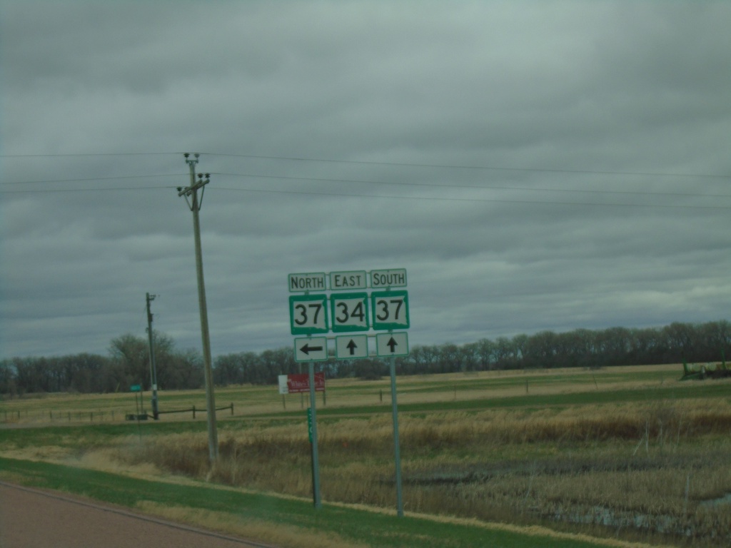
SD-34 East At SD-37
SD-34 East At SD-37 in Sanborn County. SD-37 South joins SD-34 eastbound.
Taken 05-01-2022
Woonsocket
Sanborn County
South Dakota
United States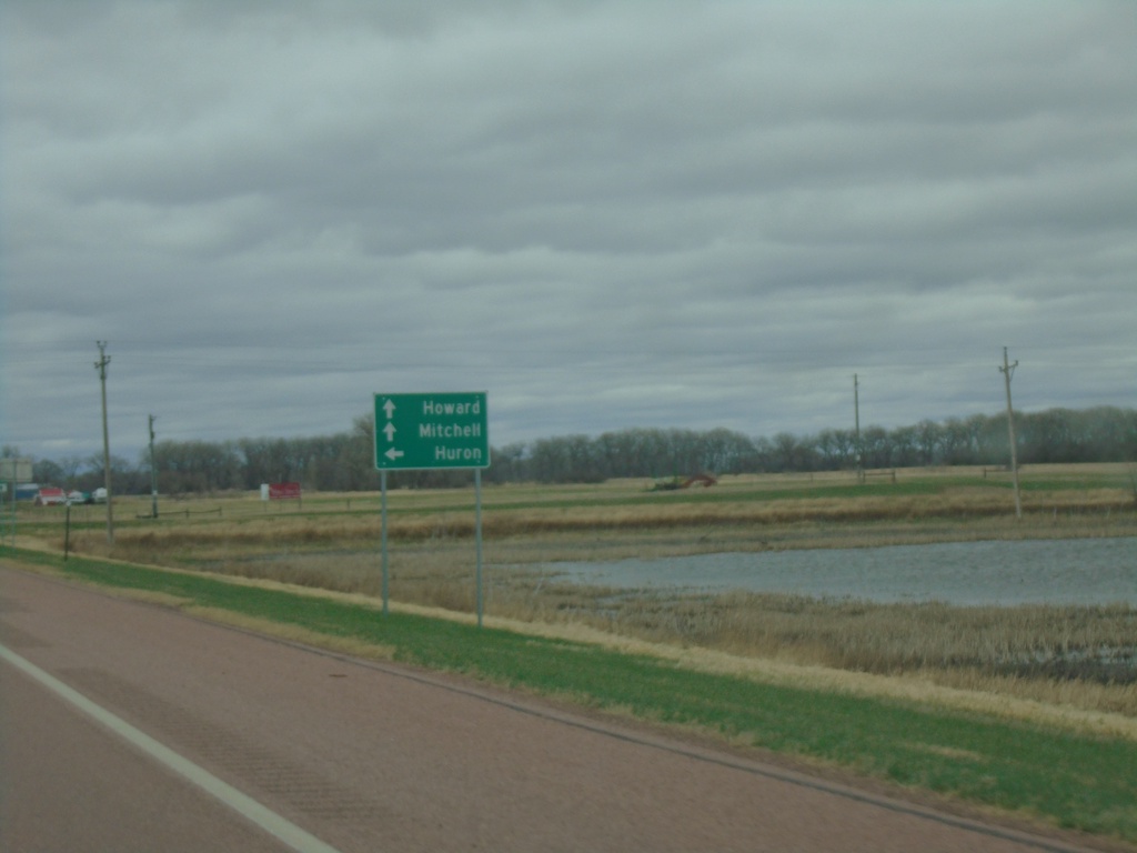
SD-34 East Approaching SD-37
SD-34 East approaching SD-37 in Sanborn County. Use SD-37 North to Huron. Continue on SD-34 East/SD-37 south for Howard and Mitchell. SD-37 South joins SD-34 East.
Taken 05-01-2022
Woonsocket
Sanborn County
South Dakota
United States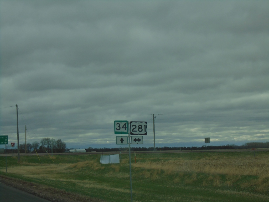
SD-34 East Approaching US-281
SD-34 East approaching US-281 in Jerauld County
Taken 05-01-2022
 Wessington Springs
Jerauld County
South Dakota
United States
Wessington Springs
Jerauld County
South Dakota
United States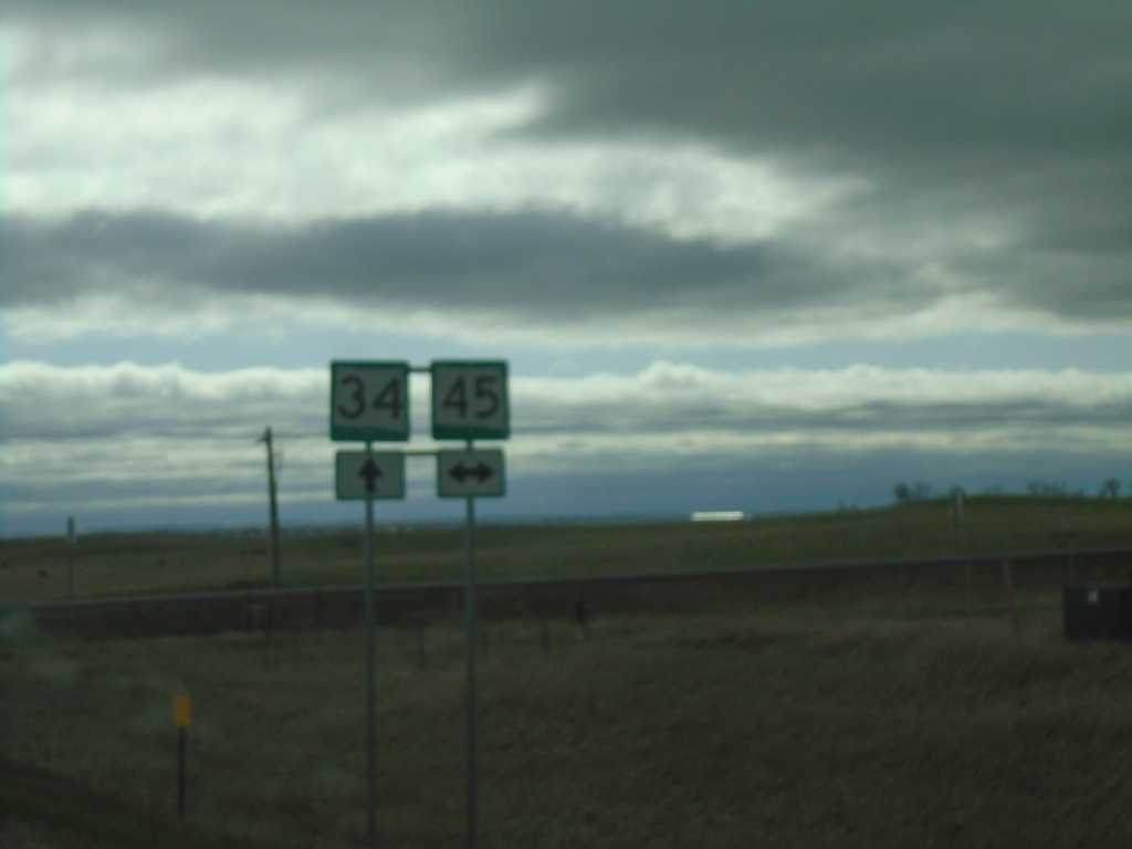
SD-34 East at SD-45
SD-34 East at SD-45 in Buffalo County.
Taken 05-01-2022
 Wessington Springs
Buffalo County
South Dakota
United States
Wessington Springs
Buffalo County
South Dakota
United States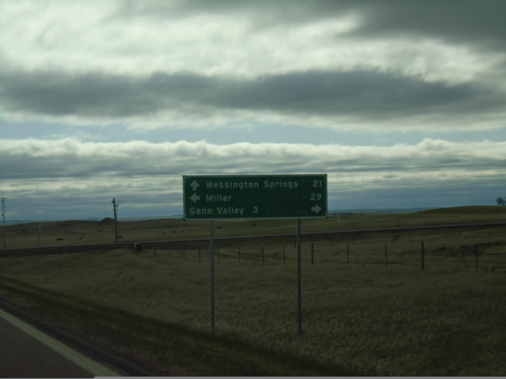
SD-34 East Approaching SD-45
SD-34 East approaching SD-45. Use SD-45 south for Gann Valley; SD-45 north for Miller. Continue east on SD-34 for Wessington Springs.
Taken 05-01-2022
Gann Valley
Buffalo County
South Dakota
United States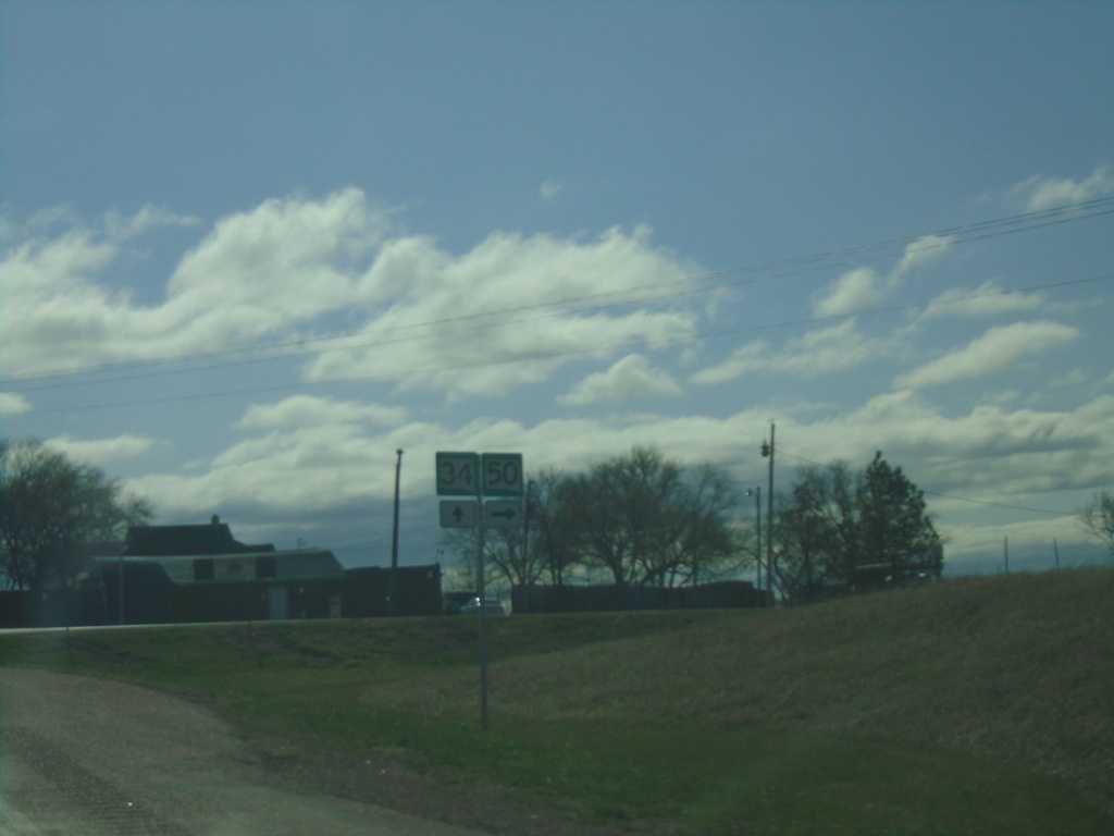
SD-34 East at SD-50 South - Lees Corner
SD-34 East at SD-50 South - Lees Corner.
Taken 05-01-2022
 Chamberlain
Buffalo County
South Dakota
United States
Chamberlain
Buffalo County
South Dakota
United States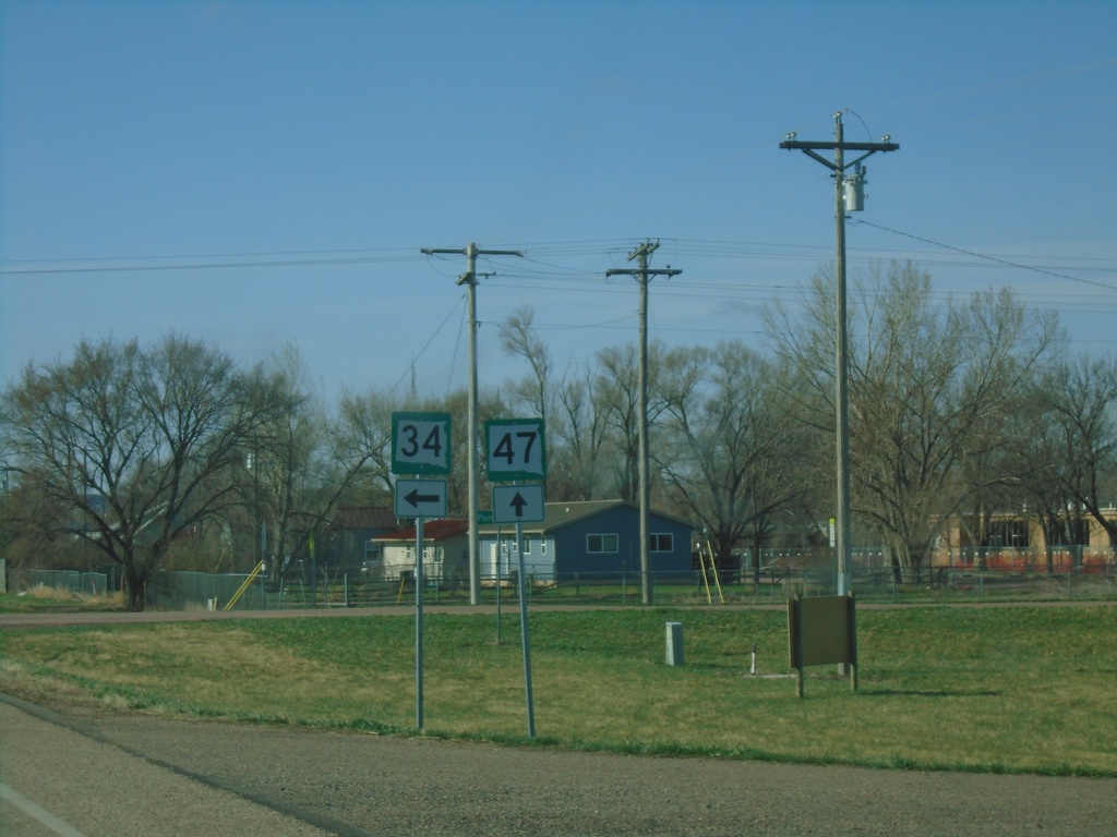
SD-34 East/SD-47 South Split - Fort Thompson
SD-34 East/SD-47 South split in Fort Thompson.
Taken 05-01-2022
 Fort Thompson
Buffalo County
South Dakota
United States
Fort Thompson
Buffalo County
South Dakota
United States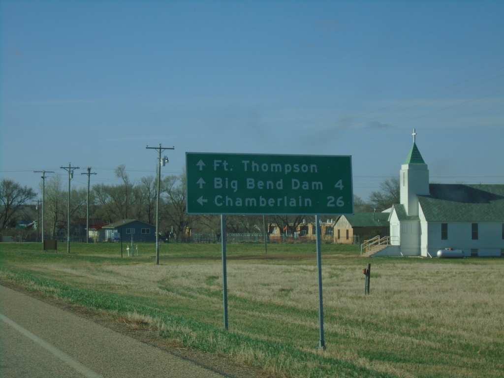
SD-34 East/SD-47 South Approaching SD-34/SD-47 Split
SD-34 East/SD-47 South approaching SD-34/SD-47 split in Fort Thompson. Continue south on SD-47 for Fort Thompson and Big Bend Dam. Turn left for SD-34 east to Chamberlain.
Taken 05-01-2022
Fort Thompson
Buffalo County
South Dakota
United States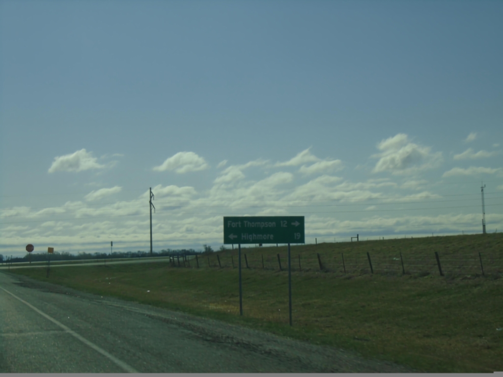
SD-34 East at SD-47 - Hyde County
SD-34 East at SD-47 in Hyde County. Use SD-47 north for Highmore; SD-34 East/SD-47 South for Fort Thompson. SD-47 South joins SD-34 East to Fort Thompson.
Taken 05-01-2022
Highmore
Hyde County
South Dakota
United States