Signs Tagged With Intersection
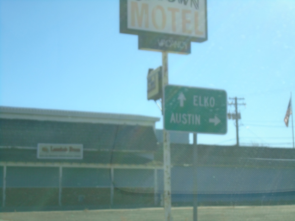
BL-80 East/NV-304 East at NV-305 South
BL-80 East/NV-304 East (Front St.) at NV-305 South (Broad St.) to Austin. Continue on BL-80/NV-304 for Elko.
Taken 01-14-2022


 Battle Mountain
Lander County
Nevada
United States
Battle Mountain
Lander County
Nevada
United States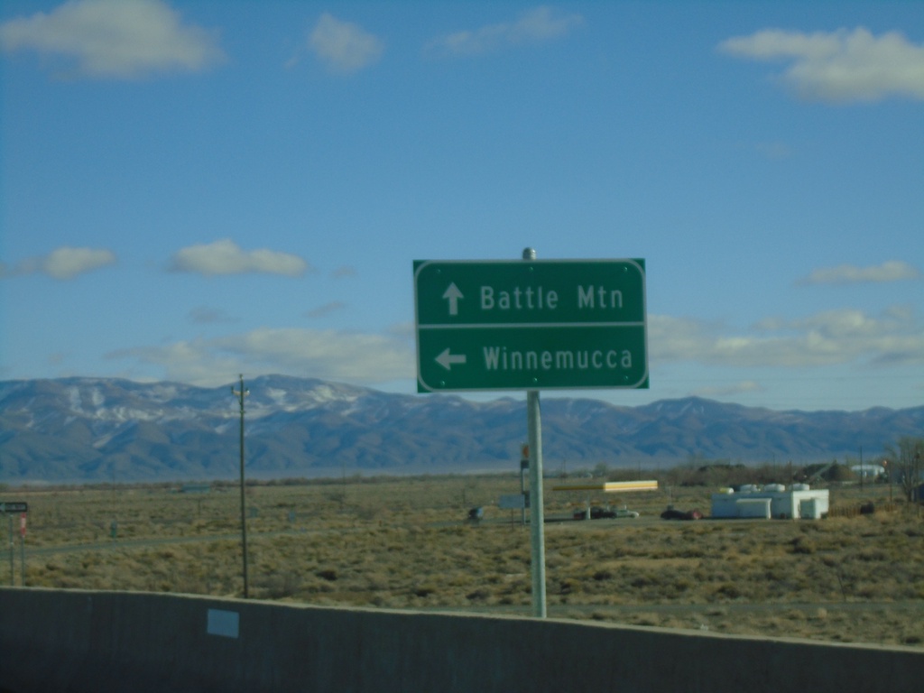
BL-80 East/NV-304 East at I-80 West
BL-80 East/NV-304 East at I-80 West (Exit 229) in Battle Mountain. Use I-80 west for Winnemucca; BL-80/NV-304 East for Battle Mountain. This is the western end of the Battle Mountain business loop.
Taken 01-14-2022
 Battle Mountain
Lander County
Nevada
United States
Battle Mountain
Lander County
Nevada
United States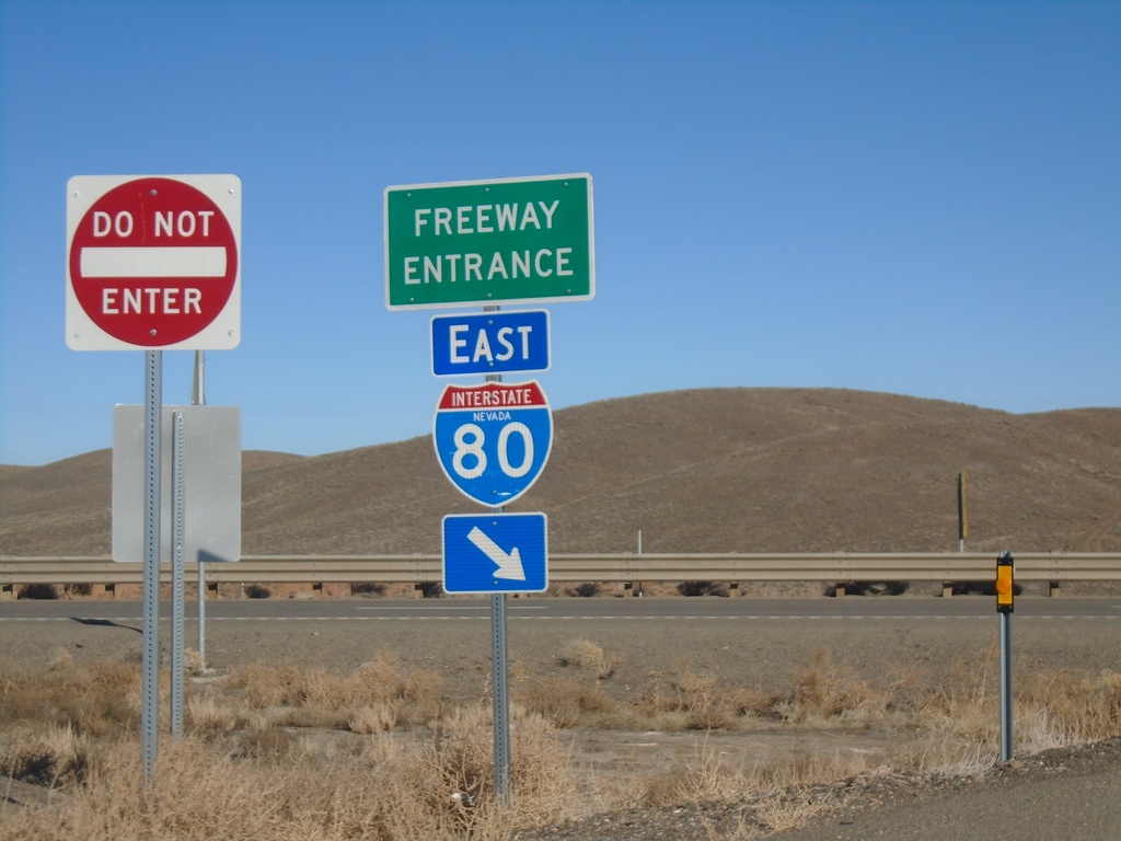
I-80 East Onramp - Exit 203
I-80 East onramp - Exit 203 (Iron Point).
Taken 01-14-2022
Red House
Humboldt County
Nevada
United States
I-80 Exit 203 East Onramp
I-80 east onramp at Exit 203 to Battle Mountain
Taken 01-14-2022
Red House
Humboldt County
Nevada
United States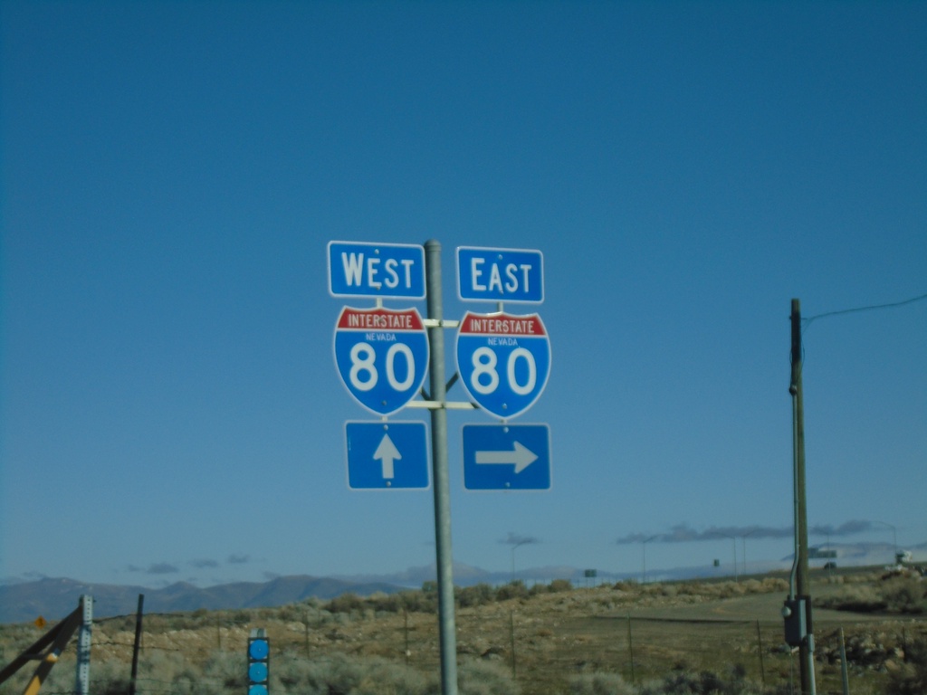
NV-794 East at I-80
NV-794 East at I-80 (Exit 180)
Taken 01-14-2022
 Winnemucca
Humboldt County
Nevada
United States
Winnemucca
Humboldt County
Nevada
United States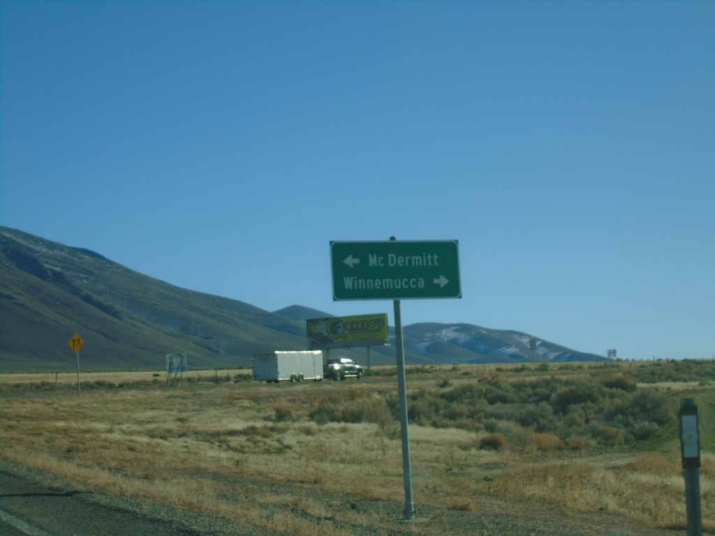
End NV-140 East at US-95
End NV-140 East at US-95. Use US-95 north for McDermitt; US-95 south for Winnemucca.
Taken 01-14-2022

 Winnemucca
Humboldt County
Nevada
United States
Winnemucca
Humboldt County
Nevada
United States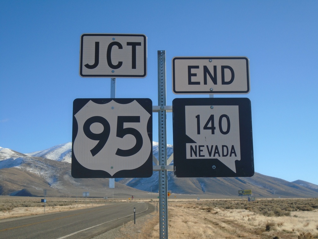
End NV-140 East at US-95
End NV-140 at US-95 in Humboldt County.
Taken 01-14-2022
Winnemucca
Humboldt County
Nevada
United States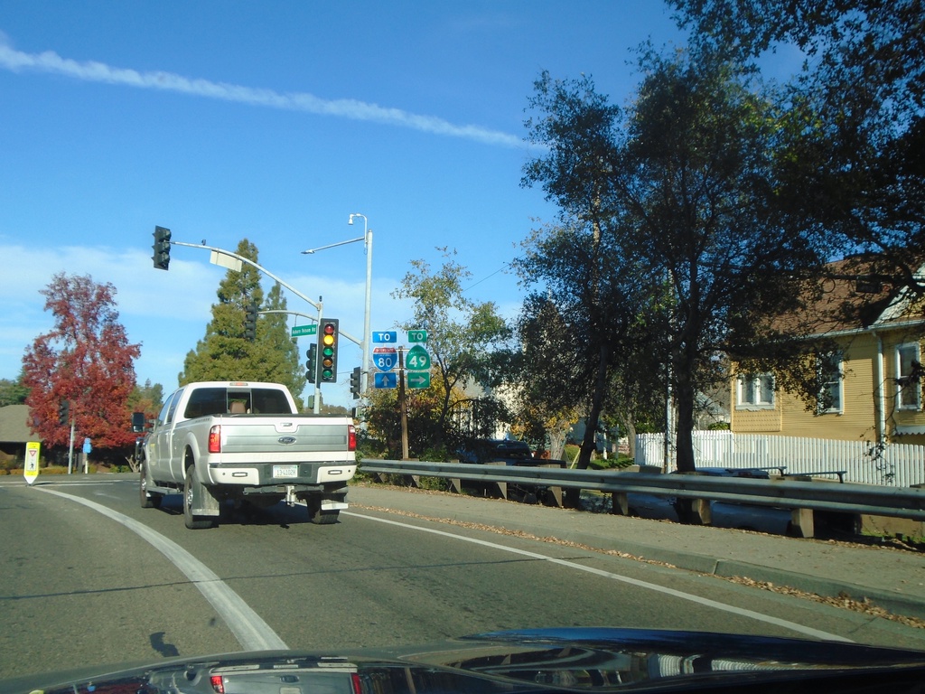
Auburn Folsom Road North at Lincoln Way/Maple St.
Auburn Folsom Road North at Lincoln Way (To CA-49) and Maple St. (To I-80)
Taken 11-27-2021
 Auburn
Placer County
California
United States
Auburn
Placer County
California
United States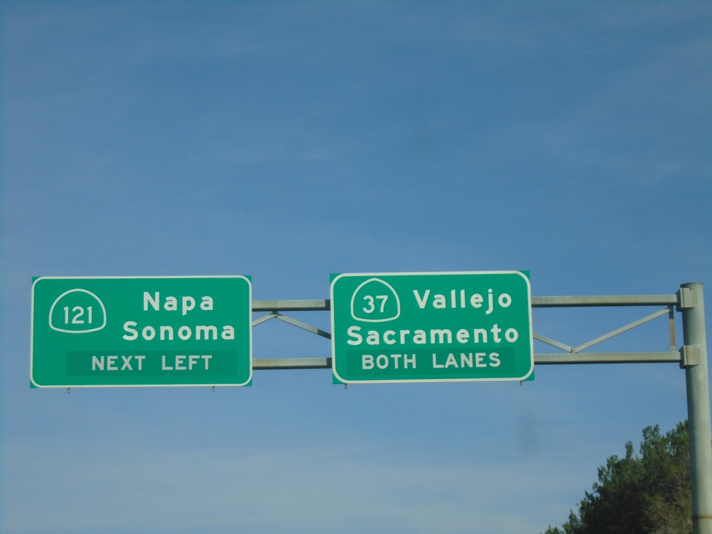
CA-37 East at CA-121
CA-37 east at CA-121 to Napa and Sonoma. Continue east on CA-37 for Vallejo and Sacramento (via I-80).
Taken 11-25-2021

 Sonoma
 County
California
United States
Sonoma
Sonoma County
California
United States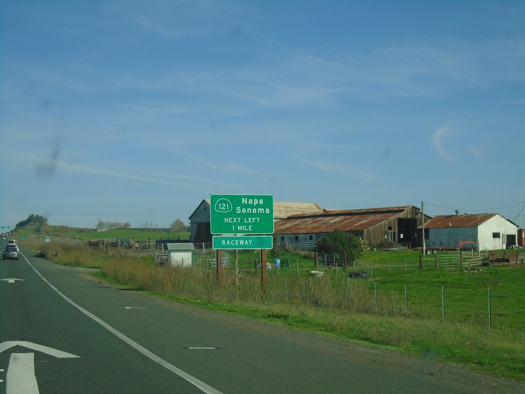
CA-37 East Approaching CA-121
CA-37 East Approaching CA-121 to Napa, Sonoma, and (Sonoma) Raceway.
Taken 11-25-2021
Sonoma
Sonoma County
California
United States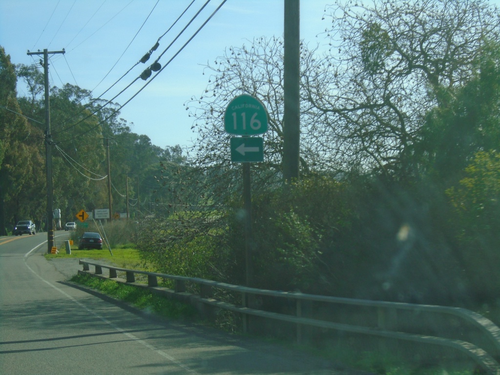
CA-116 East - Lakeview Highway at Stage Gulch Road
CA-116 East - Lakeview Highway at Stage Gulch Road. Turn left on Stage Gulch Road to continue east on CA-116.
Taken 11-25-2021
 Petaluma
Sonoma County
California
United States
Petaluma
Sonoma County
California
United States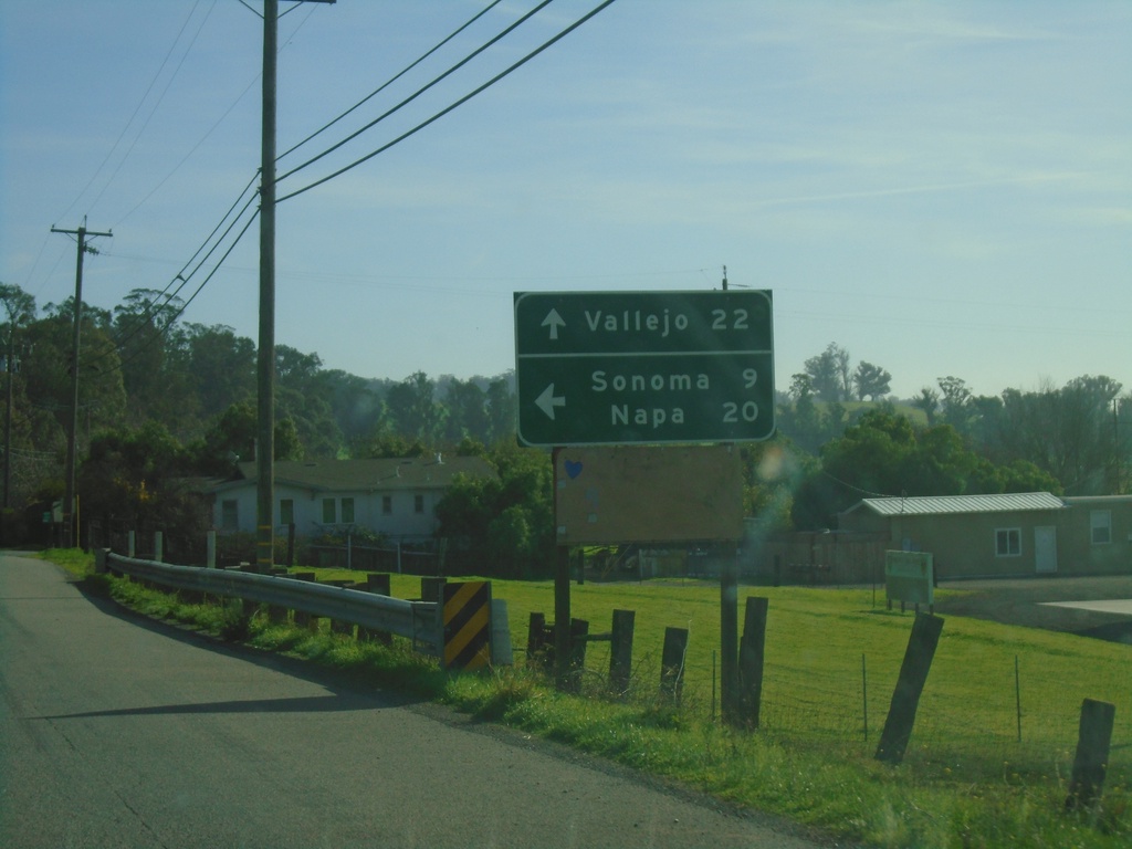
CA-116 East - Lakeview Highway at Stage Gulch Road
CA-116 East - Lakeview Highway at Stage Gulch Road. Turn left on Stage Gulch Road to continue east on CA-116 to Napa and Sonoma. Continue south on Lakeview Highway for Vallejo (via CA-37).
Taken 11-25-2021
Petaluma
Sonoma County
California
United States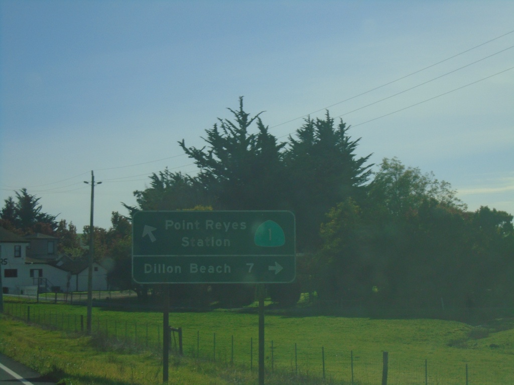
CA-1 South at Valley Ford - Estero Road
CA-1 South at Valley Ford - Estero Road to Dillon Beach. Continue south on CA-1 for Point Reyes Station.
Taken 11-23-2021
 Valley Ford
Sonoma County
California
United States
Valley Ford
Sonoma County
California
United States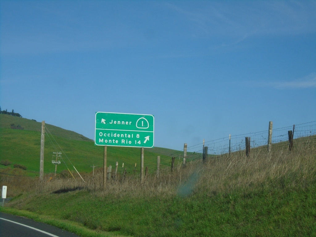
CA-1 North at Freestone-Valley Ford Road
CA-1 North at Freestone-Valley Ford Road. Turn right for Occidental and Monte Rio. Continue on CA-1 for Jenner.
Taken 11-23-2021
Valley Ford
Sonoma County
California
United States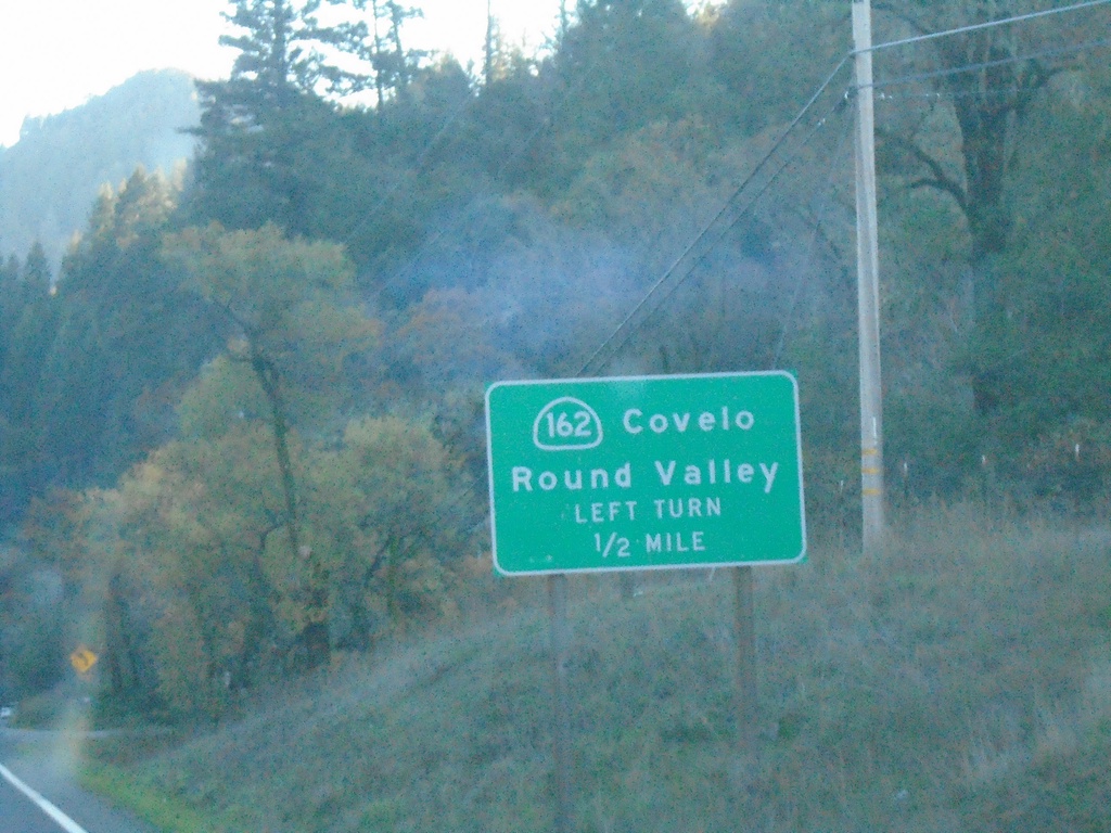
US-101 South Approaching CA-162
US-101 south approaching CA-162 east to Covelo and Round Valley.
Taken 11-21-2021

 Willits
Mendocino County
California
United States
Willits
Mendocino County
California
United States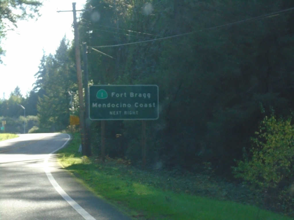
US-101 South Approaching CA-1
US-101 south approaching CA-1/Fort Bragg/Mendocino Coast.
Taken 11-21-2021
Leggett
Mendocino County
California
United States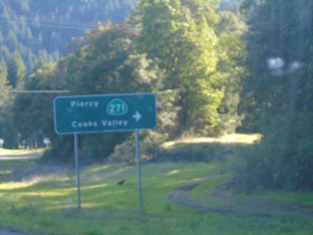
US-101 South at CA-271
US-101 south at CA-271/Piercy/Cooks Valley
Taken 11-21-2021
 Garberville
Humboldt County
California
United States
Garberville
Humboldt County
California
United States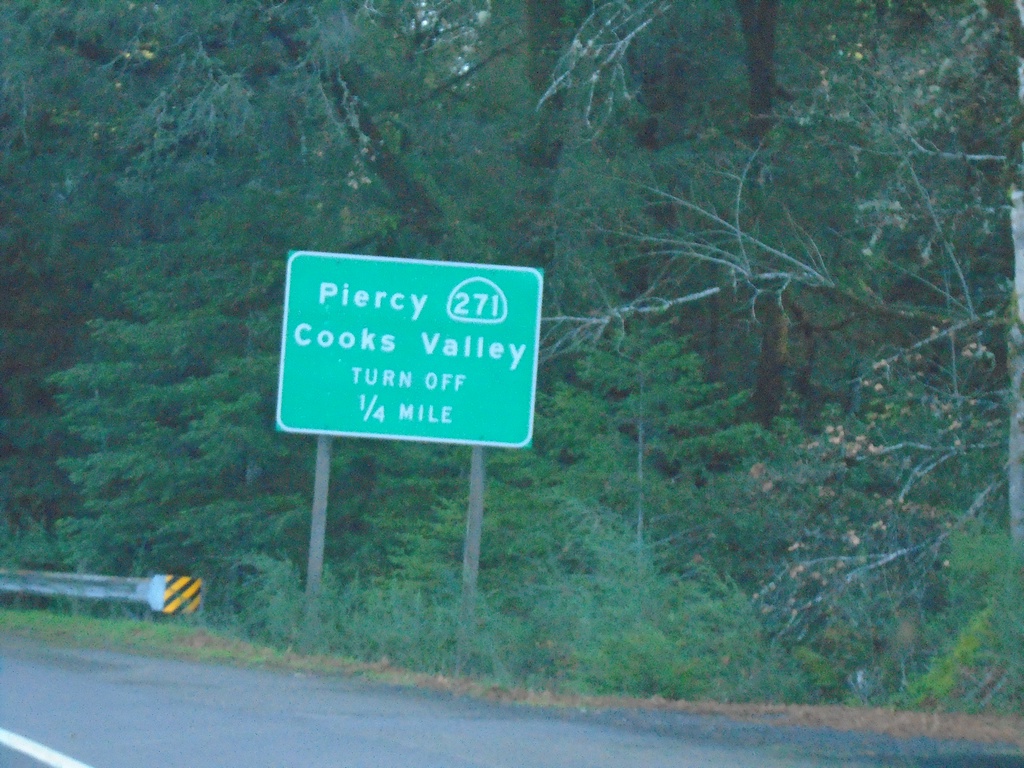
US-101 South Approaching CA-271
US-101 South Approaching CA-271 to Piercy and Cooks Valley.
Taken 11-21-2021
Piercy
Humboldt County
California
United States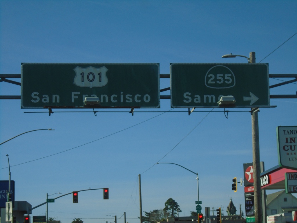
US-101 South At CA-255
US-101 south (4th St.) at CA-255/Samoa in downtown Eureka. Continue on US-101 for San Francisco.
Taken 11-21-2021
 Eureka
Humboldt County
California
United States
Eureka
Humboldt County
California
United States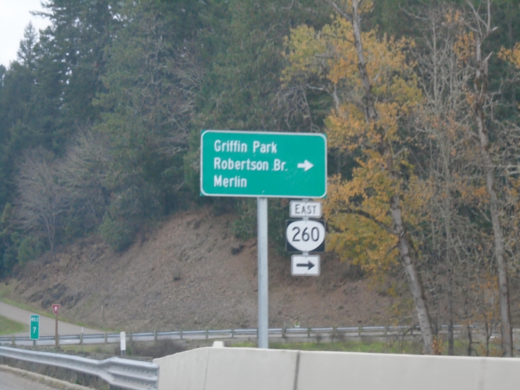
US-199 South at OR-260
US-199 South at OR-260 East to Merlin, Griffin Park, and Robertson Bridge.
Taken 11-20-2021

 Grants Pass
Josephine County
Oregon
United States
Grants Pass
Josephine County
Oregon
United States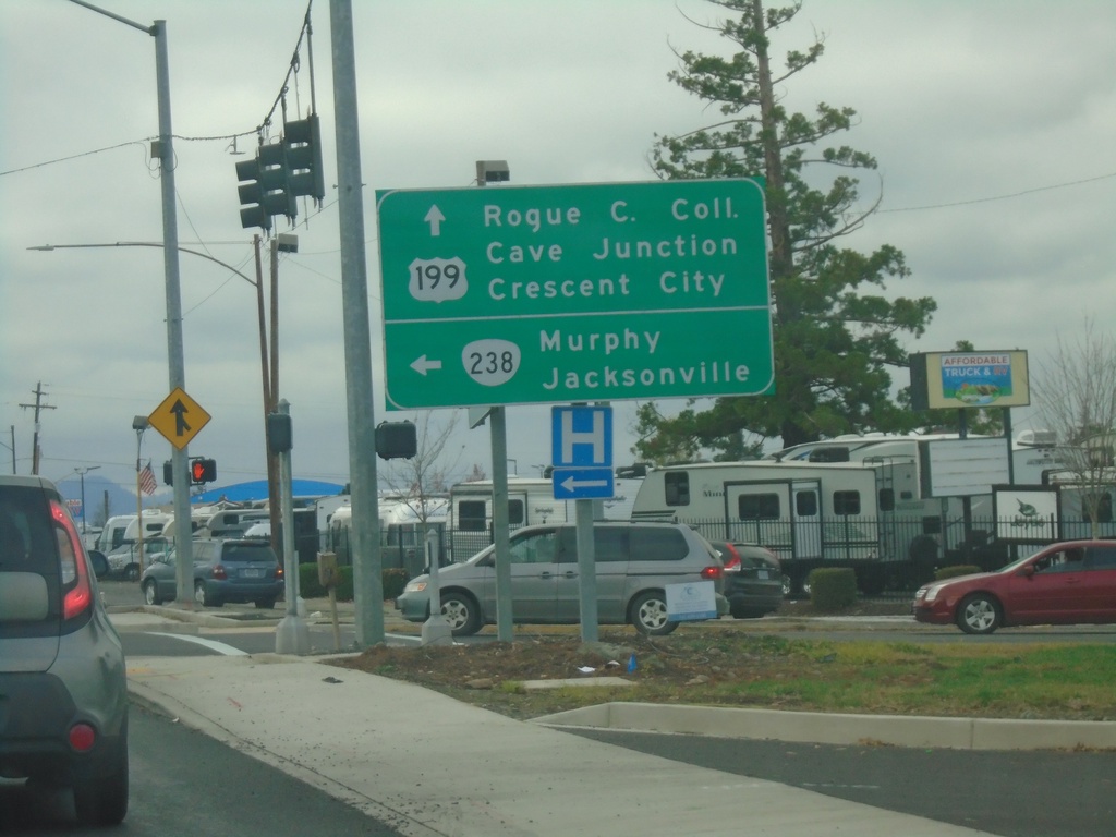
US-199 South at OR-238
US-199 south at OR-238. Turn left on OR-238 for Murphy and Jacksonville. Continue south on US-199 for Rogue Community College, Cave Junction, and Crescent City (California).
Taken 11-20-2021
 Grants Pass
Josephine County
Oregon
United States
Grants Pass
Josephine County
Oregon
United States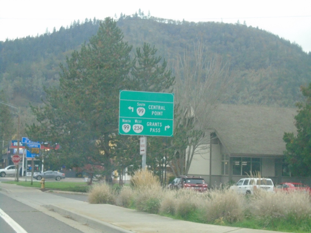
OR-234 West at OR-99 - Gold Hill
OR-234 West at OR-99 in Gold Hill. Use OR-99 South to Central Point; OR-234 West/OR-99 North to Grants Pass.
Taken 11-20-2021

 Gold Hill
Jackson County
Oregon
United States
Gold Hill
Jackson County
Oregon
United States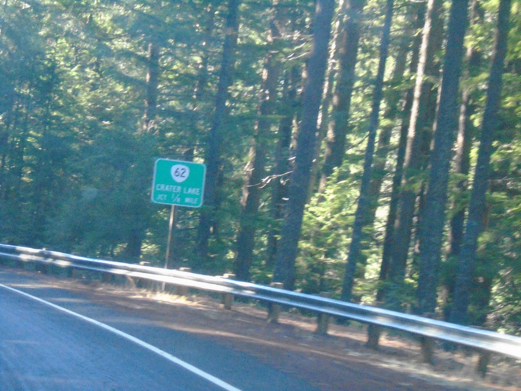
OR-230 West Approaching OR-62
OR-230 West approaching OR-62. Use OR-62 North to Crater Lake.
Taken 11-20-2021

 Prospect
Jackson County
Oregon
United States
Prospect
Jackson County
Oregon
United States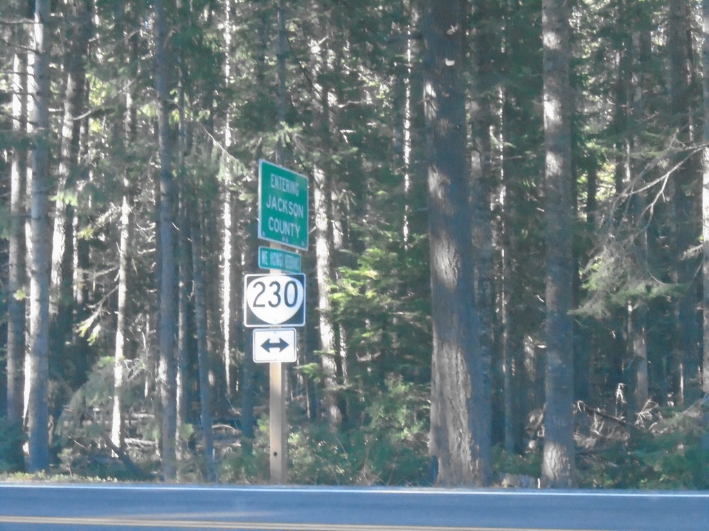
End Forest Road 6530 at OR-230
End Forest Road 6530 at OR-230 at the Jackson/Douglas County Line.
Taken 11-20-2021
Prospect
Jackson County
Oregon
United States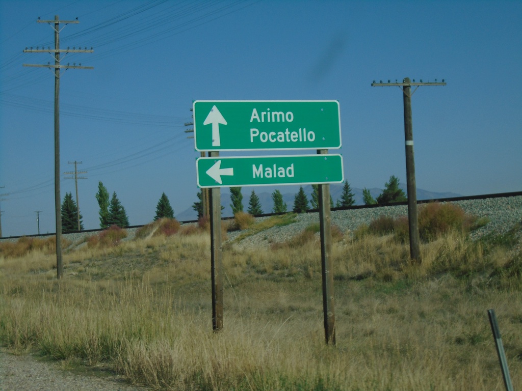
US-91 North at ID-40 West
US-91 north at ID-40 west to Malad. Continue north on US-91 for Arimo and Pocatello.
Taken 09-25-2021

 Downey
Bannock County
Idaho
United States
Downey
Bannock County
Idaho
United States