Signs Tagged With Intersection
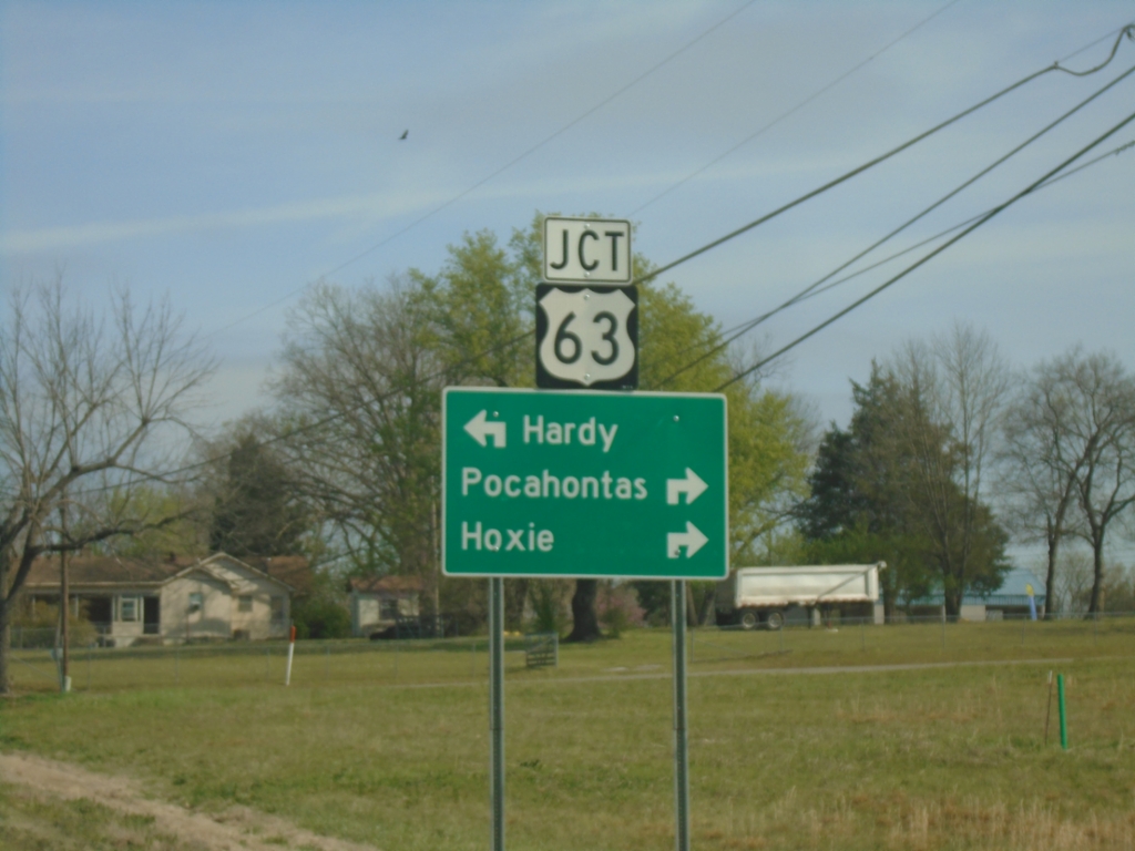
AR-115 North Approaching US-62/US-63
AR-115 North approaching US-62/US-63 in Imboden. Use US-62 West/US-63 North to Hardy; US-62 East/US-63 South to Pocahontas and Hoxie.
Taken 03-29-2026


 Imboden
Lawrence County
Arkansas
United States
Imboden
Lawrence County
Arkansas
United States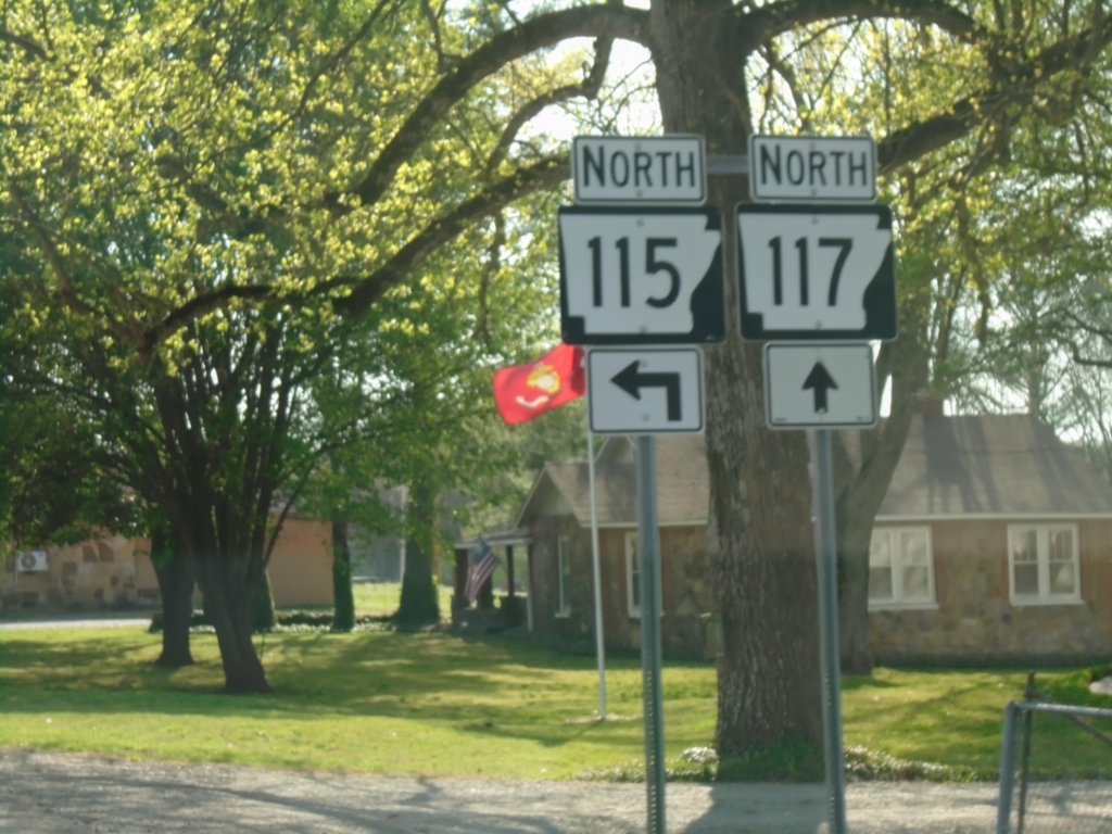
AR-115/AR-117 North at AR-115/AR-117 Split
AR-115/AR-117 North at AR-115/AR-117 split in Smithville.
Taken 03-29-2026
 Smithville
Lawrence County
Arkansas
United States
Smithville
Lawrence County
Arkansas
United States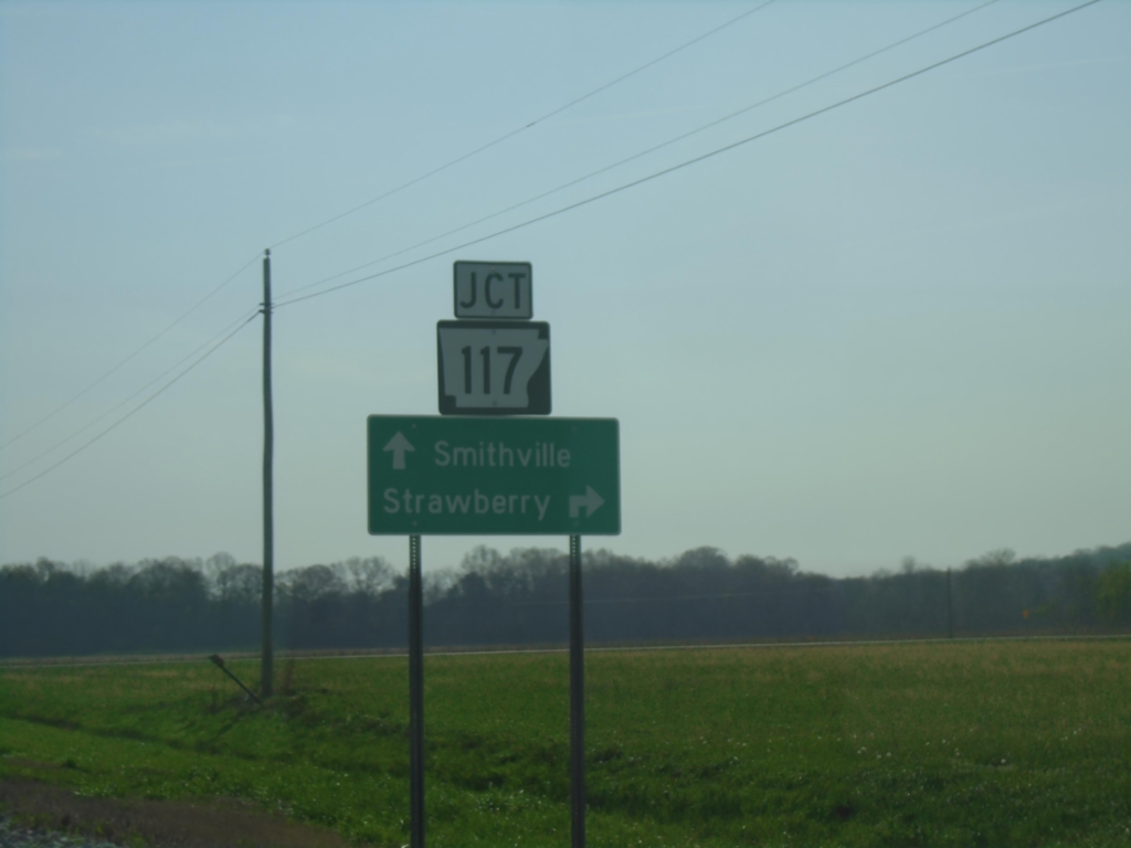
AR-115 North Approaching AR-117
AR-115 North approaching AR-117 south to Strawberry. Continue north on AR-115/AR-117 to Smithville.
Taken 03-29-2026
Lawrence County
Arkansas
United States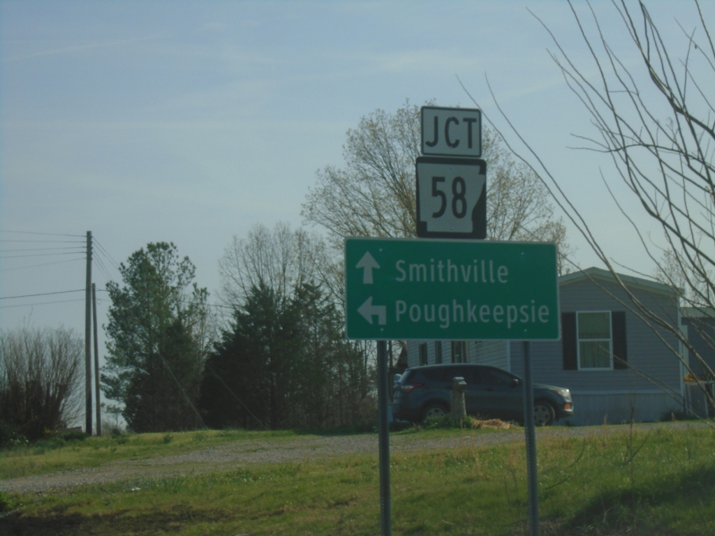
AR-115 North at AR-58
AR-115 North at AR-58 in Sharp County. Use AR-58 North to Poughkeepsie; AR-115 North to Smithville.
Taken 03-29-2026
 Sharp County
Arkansas
United States
Sharp County
Arkansas
United States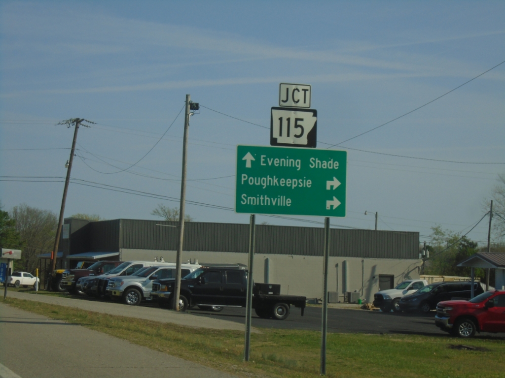
US-167 North at AR-115
US-167 North at AR-115 in Cave City. Use AR-115 East to Poughkeepsie and Smithville. Continue north on US-167 to Evening Shade.
Taken 03-29-2026
 Cave City
Sharp County
Arkansas
United States
Cave City
Sharp County
Arkansas
United States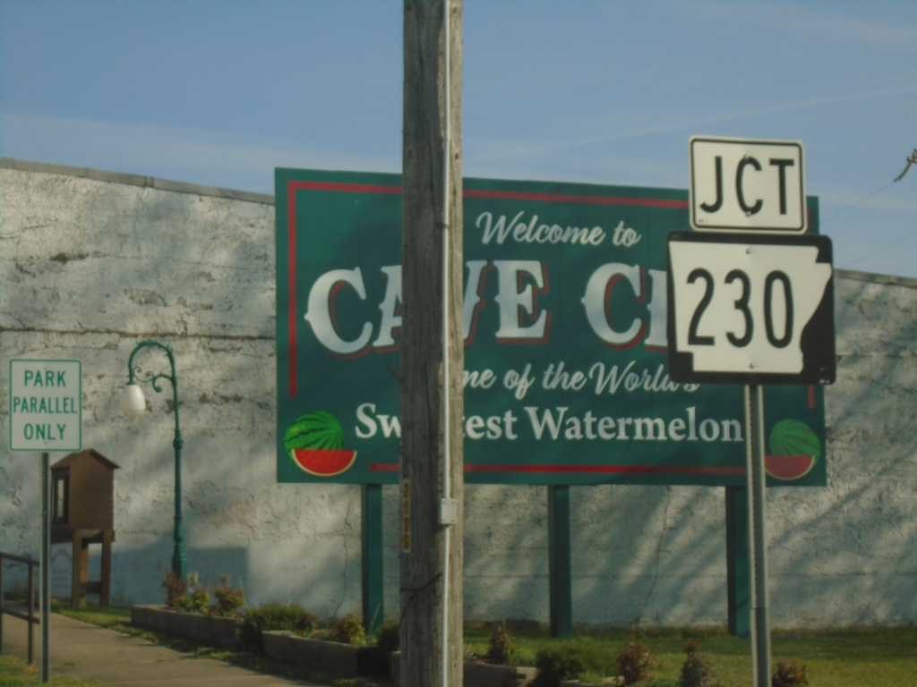
US-167 North Approaching AR-230
US-167 North approaching AR-230 in Cave City.
Taken 03-29-2026
 Cave City
Sharp County
Arkansas
United States
Cave City
Sharp County
Arkansas
United States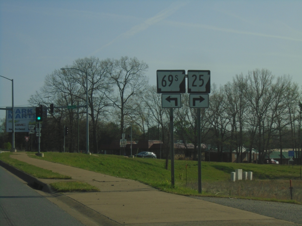
US-167 North at AR-25/AR-69S
US-167 North at AR-25/AR-69S in Batesville.
Taken 03-29-2026

 Batesville
Independence County
Arkansas
United States
Batesville
Independence County
Arkansas
United States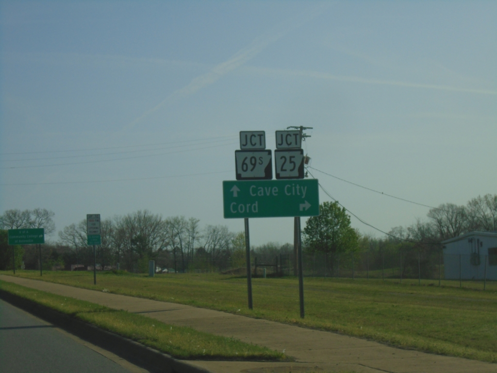
US-167 North at AR-25/AR-69S
US-167 North at AR-25/AR-69S in Batesville. Use AR-25 East to Cord. Continue north on US-167 to Cave City.
Taken 03-29-2026
Batesville
Independence County
Arkansas
United States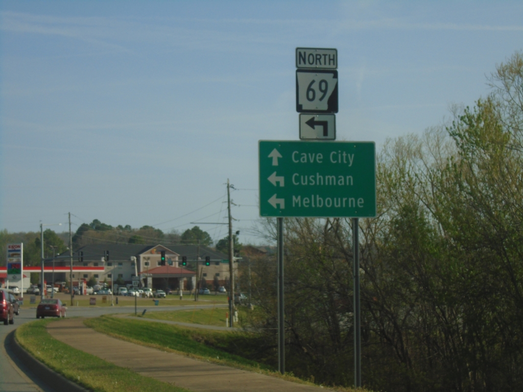
US-167 North at AR-69 North
US-167 North at AR-69 North in Batesville. Use AR-69 North to Cushman and Melbourne. Continue north on US-167 to Cave City.
Taken 03-29-2026
 Batesville
Independence County
Arkansas
United States
Batesville
Independence County
Arkansas
United States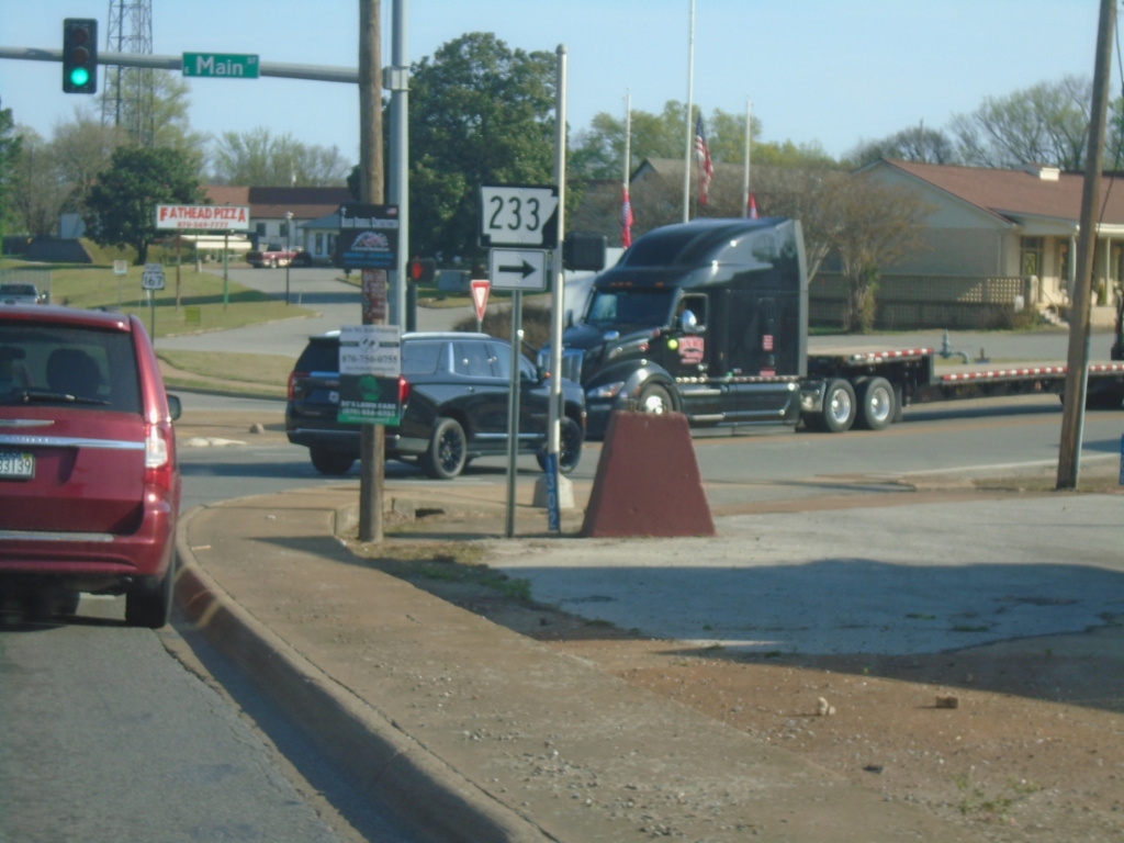
US-167 North at AR-233
US-167 North at AR-233 (Main St.) in Batesville.
Taken 03-29-2026
 Batesville
Independence County
Arkansas
United States
Batesville
Independence County
Arkansas
United States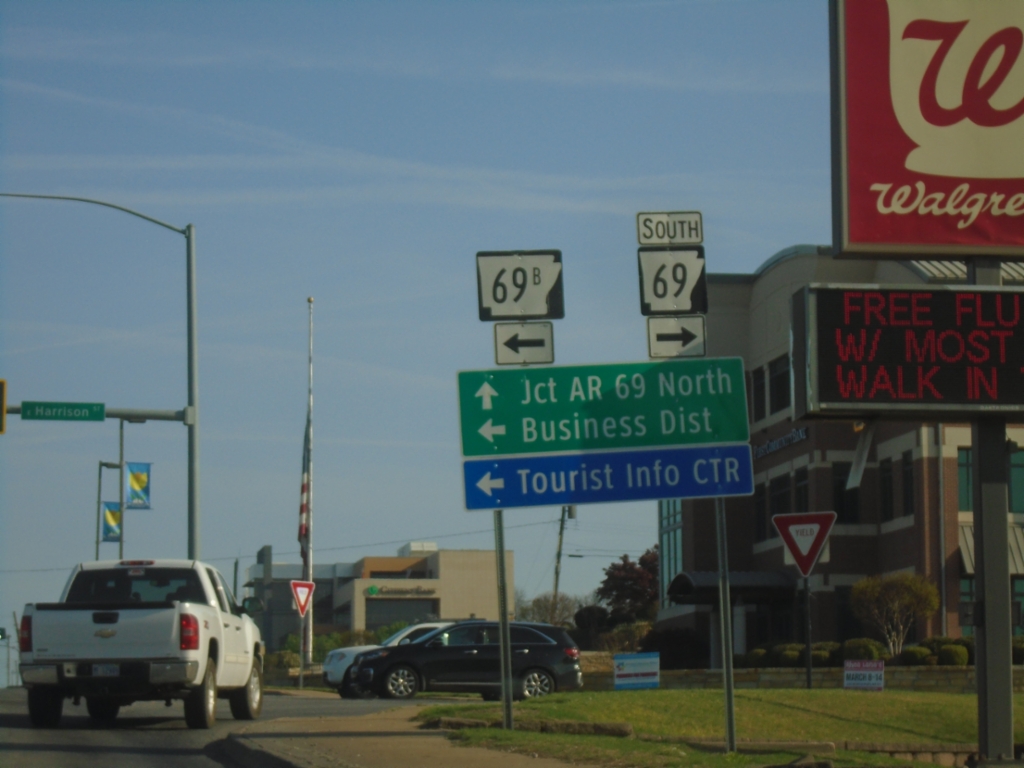
US-167 North at AR-69/AR-69B
US-167 North at AR-69 South/AR-69B (Harrison St.) in Batesville. Turn left for AR-69B to (Batesville) Business District. Continue north on US-167 for AR-69 North.
Taken 03-29-2026
 Batesville
Independence County
Arkansas
United States
Batesville
Independence County
Arkansas
United States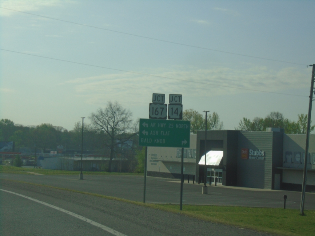
AR-14 East/AR-25 North at US-167
AR-14 East/AR-25 North at US-167 in Southside. Use US-167 South to Bald Knob; US-167/AR-25 North to Ash Flat and Jct. AR-25 North.
Taken 03-29-2026
 Batesville
Independence County
Arkansas
United States
Batesville
Independence County
Arkansas
United States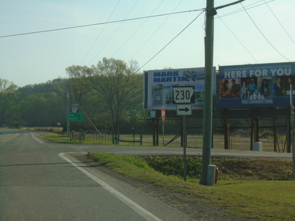
AR-14/AR-25 East at AR-230
AR-14/AR-25 East at AR-230 in Locust Grove.
Taken 03-29-2026
Locust Grove
Independence County
Arkansas
United States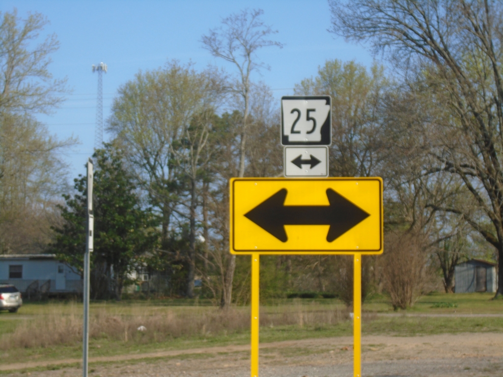
AR-87 North at AR-25
AR-87 North at AR-25 in Concord.
Taken 03-29-2026
 Concord
Cleburne County
Arkansas
United States
Concord
Cleburne County
Arkansas
United States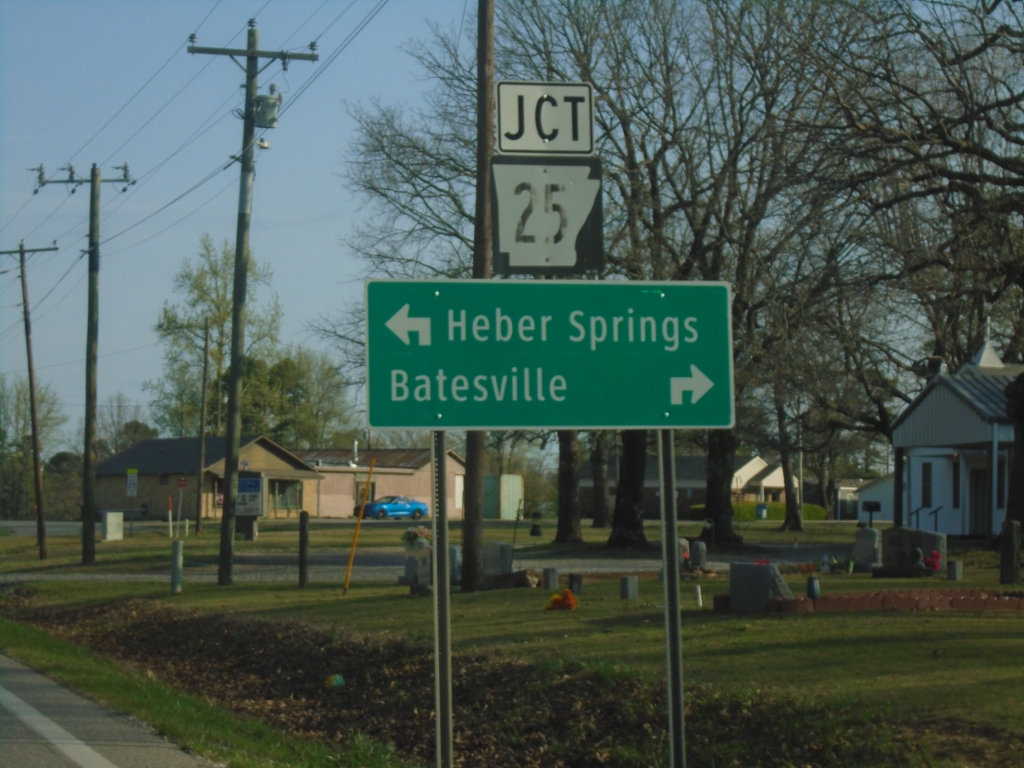
AR-87 North at AR-25
AR-87 North at AR-25 in Concord. Use AR-25 North to Batesville; AR-25 South to Heber Springs.
Taken 03-29-2026
Concord
Cleburne County
Arkansas
United States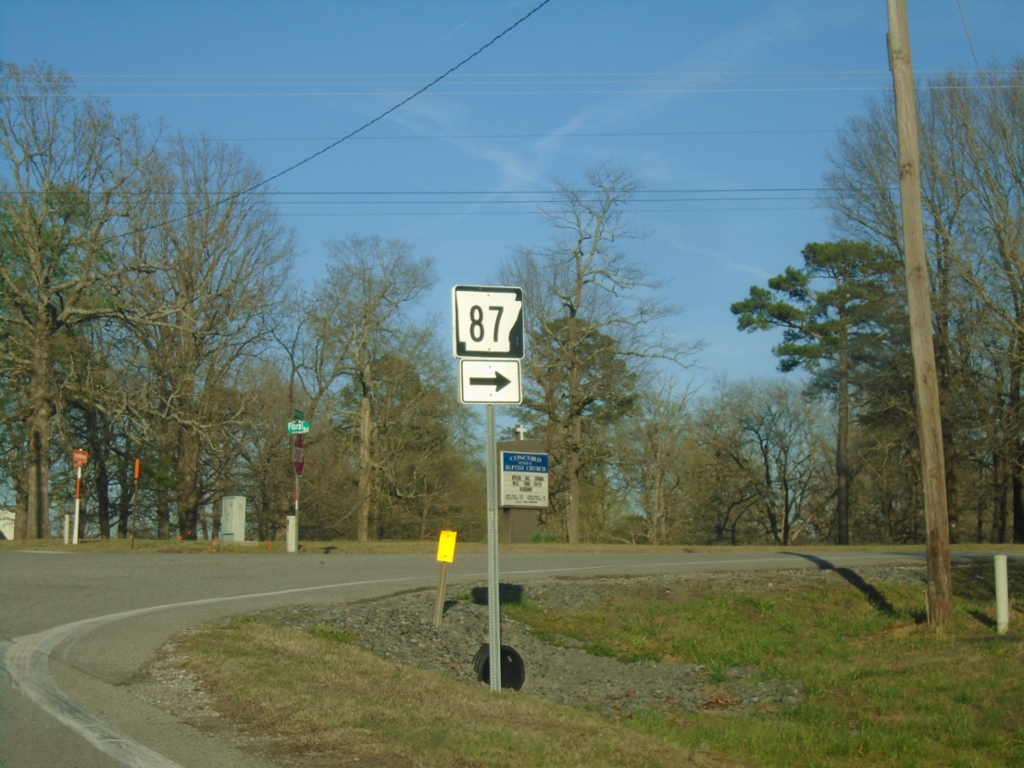
AR-25 North at AR-87
AR-25 North at AR-87 in Concord.
Taken 03-28-2026
Concord
Cleburne County
Arkansas
United States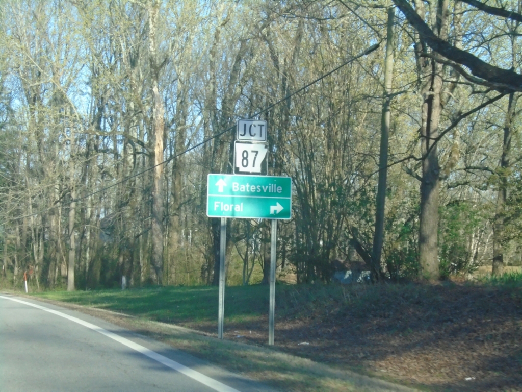
AR-25 North Approaching AR-87
AR-25 North approaching AR-87 in Concord. Use AR-87 South to Floral; continue on AR-25 North to Batesville.
Taken 03-28-2026
Concord
Cleburne County
Arkansas
United States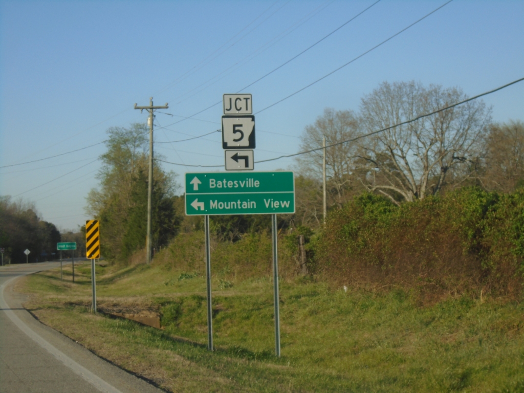
AR-5/AR-25 North at AR-5/AR-25 Split
AR-5/AR-25 North at AR-5/AR-25 Split in Wolf Bayou. Use AR-5 North to Mountain View; AR-25 North to Batesville.
Taken 03-28-2026
 Drasco
Cleburne County
Arkansas
United States
Drasco
Cleburne County
Arkansas
United States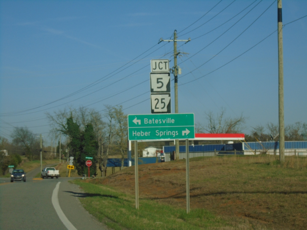
AR-92 East at AR-5/AR-25
AR-92 East at AR-5/AR-25 in Drasco. Use AR-5 North/AR-25 East to Batesville; AR-5 South/AR-25 West to Heber Springs.
Taken 03-28-2026
 Cleburne County
Arkansas
United States
Cleburne County
Arkansas
United States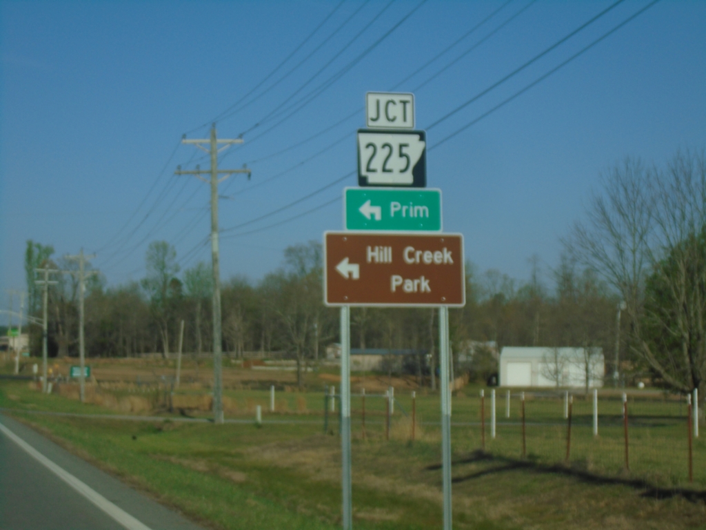
AR-92 East at AR-225
AR-92 East at AR-225 in Cleburne County. Use AR-225 North to Prim and Hill Creek Park.
Taken 03-28-2026
 Greers Ferry
Cleburne County
Arkansas
United States
Greers Ferry
Cleburne County
Arkansas
United States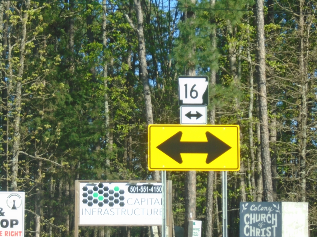
AR-92 East at AR-16
AR-92 East at AR-16 in Cleburne County.
Taken 03-28-2026
 Higden
Cleburne County
Arkansas
United States
Higden
Cleburne County
Arkansas
United States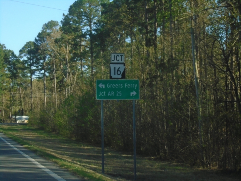
AR-92 East at AR-16
AR-92 East at AR-16 in Cleburne County. Use AR-16 South to AR-25 Junction; use AR-16 North/AR-92 East to Greers Ferry.
Taken 03-28-2026
Higden
Cleburne County
Arkansas
United States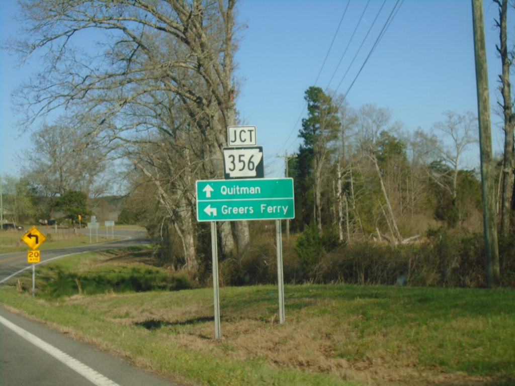
AR-92 East Approaching AR-356
AR-92 East approaching AR-356 in Van Buren County. Use AR-356 to Quitman; AR-92 to Greers Ferry.
Taken 03-28-2026
 Morganton
Van Buren County
Arkansas
United States
Morganton
Van Buren County
Arkansas
United States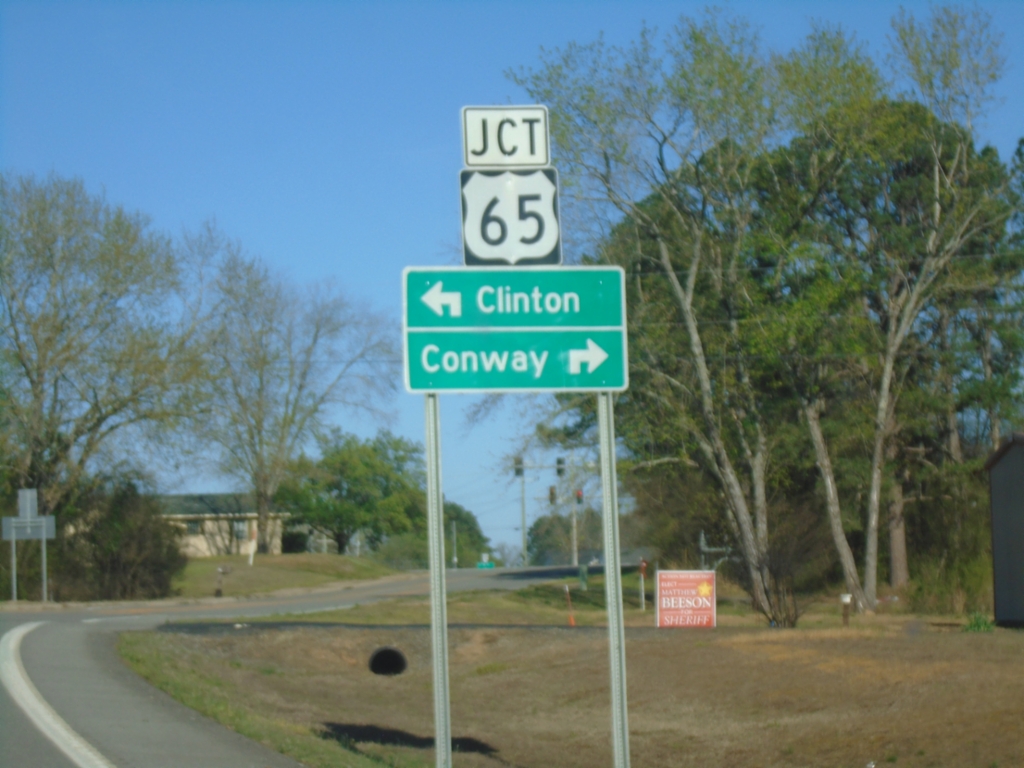
AR-92 East at US-65
AR-92 East at US-65. Use US-65 North to Clinton; US-65 South to Conway.
Taken 03-28-2026
 Bee Branch
Van Buren County
Arkansas
United States
Bee Branch
Van Buren County
Arkansas
United States
AR-92 East at AR-285
AR-92 East at AR-285 in Rabbit Ridge. Use AR-92 East to Bee Branch; AR-285 to Damascus. On the sign assembly Damascus is spelled incorrectly as “Dumascus”
Taken 03-28-2026
 Rabbit Ridge
Van Buren County
Arkansas
United States
Rabbit Ridge
Van Buren County
Arkansas
United States