Signs Tagged With Intersection
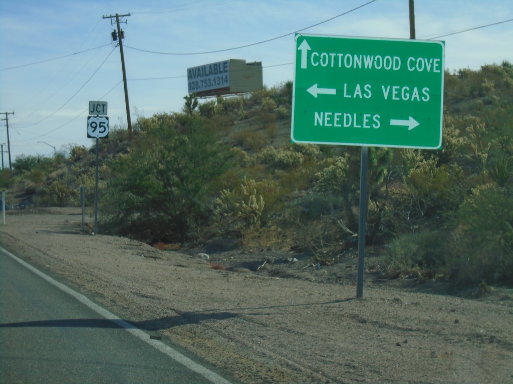
End NV-164 East at US-95
End NV-164 East at US-95 in Searchlight. Turn right for US-95 south to Needles (CA); left for US-95 north to Las Vegas. Continue straight for Cottonwood Cove Road to Cottonwood Cove.
Taken 11-27-2019

 Searchlight
Clark County
Nevada
United States
Searchlight
Clark County
Nevada
United States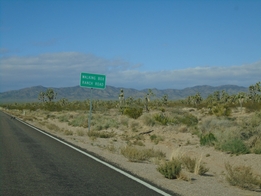
NV-164 West - Walking Box Ranch Road
NV-164 West at Walking Box Ranch Road
Taken 11-27-2019
Searchlight
Clark County
Nevada
United States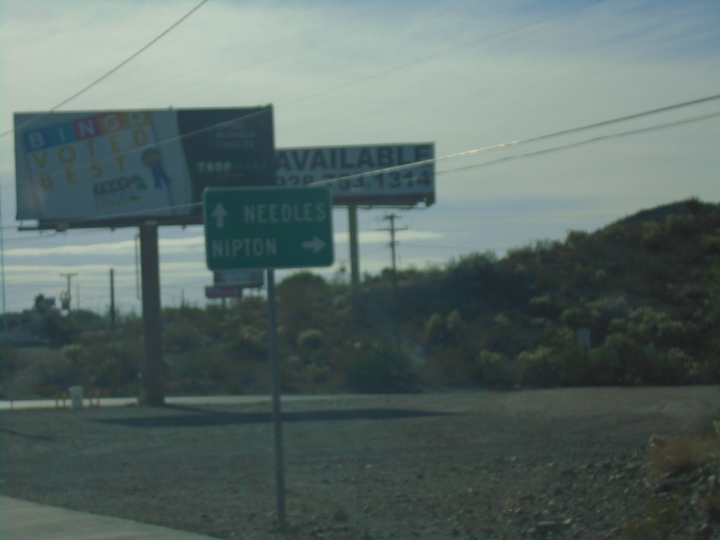
US-95 South at NV-164 West
US-95 South at NV-164 West to Nipton (California). Continue south on US-95 for Needles (California).
Taken 11-27-2019
Searchlight
Clark County
Nevada
United States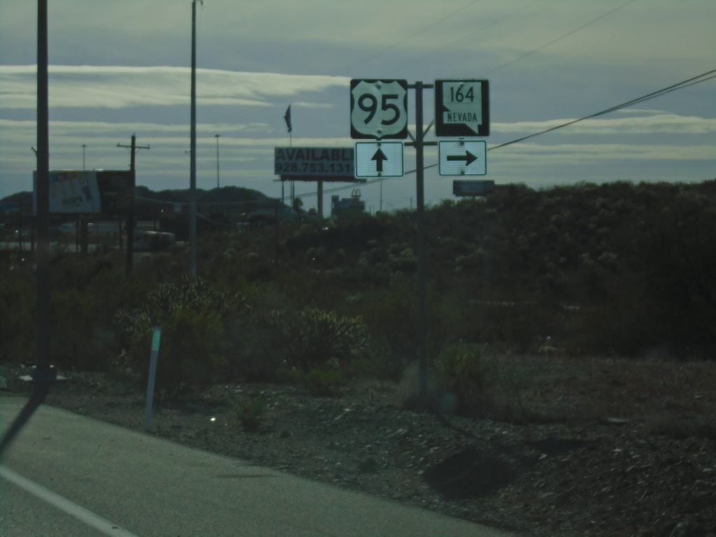
US-95 South Approaching NV-164
US-95 South approaching NV-164 in Searchlight.
Taken 11-27-2019
Searchlight
Clark County
Nevada
United States
End NV-173 South at I-11/US-93/US-95 North
End NV-173 South at I-11/US-93/US-95 North (Exit 14) onramp. Roadway turns into US-95 southbound.
Taken 11-27-2019


 Boulder City
Clark County
Nevada
United States
Boulder City
Clark County
Nevada
United States
End NV-173 South at I-11/US-93/US-95
End NV-173 South at I-11/US-93/US-95 in Boulder City. Use I-11/US-93/US-95 north for Las Vegas; use I-11/US-93 South for Kingman (Arizona); use US-95 south for Searchlight.
Taken 11-27-2019
Boulder City
Clark County
Nevada
United States
Bus. US-93 North at NV-173 to US-95 South
Bus. US-93 North at NV-173 to US-95 South in Boulder City. Turn left for access to US-95. This is the former intersection of US-93 and US-95, before being re-routed with the construction of I-11.
Taken 11-27-2019
 Boulder City
Clark County
Nevada
United States
Boulder City
Clark County
Nevada
United States
Craig Road East at I-15/US-93 South
Craig Road (NV-573) East at I-15/US-93 South (Exit 48)
Taken 11-26-2019

 North Las Vegas
Clark County
Nevada
United States
North Las Vegas
Clark County
Nevada
United States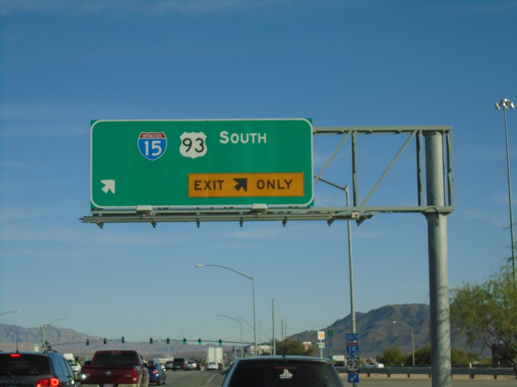
Craig Road East at I-15/US-93 South Onramp
Craig Road East (NV-573) at I-15/US-93 South onramp (Exit 48)
Taken 11-26-2019
North Las Vegas
Clark County
Nevada
United States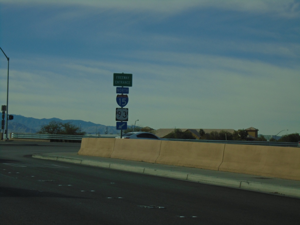
Craig Road West at I-15/US-93 North
Craig Road West (NV-573) at I-15/US-93 North onramp (Exit 48).
Taken 11-26-2019
Las Vegas
Clark County
Nevada
United States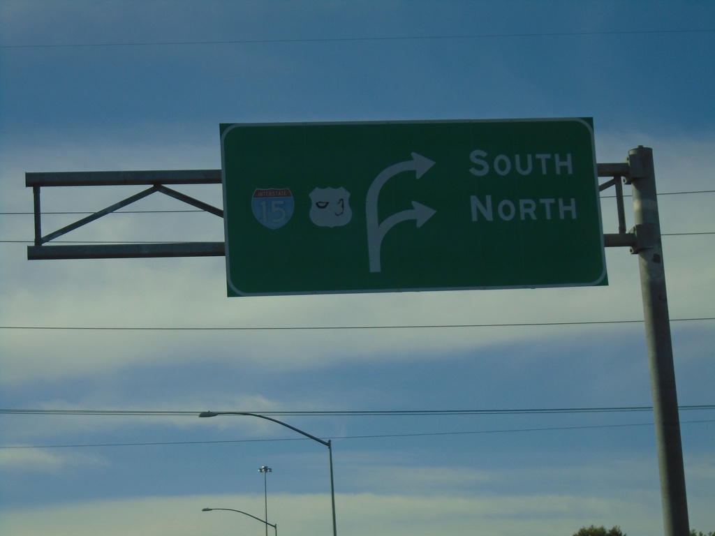
NV-573 West at I-15 (Exit 48)
Craig Road (NV-573) West at I-15/US-93 (Exit 48) in North Las Vegas.
Taken 11-26-2019
Las Vegas
Clark County
Nevada
United States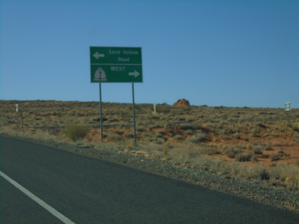
Sand Hollow Road at UT-7 West
Sand Hollow Road at UT-7 west. Turn right for UT-7 west; left to continue on Sand Hollow Road.
Taken 11-26-2019
 Hurricane
Washington County
Utah
United States
Hurricane
Washington County
Utah
United States
Sand Hollow Road at UT-7
Sand Hollow Road at UT-7. Turn right for UT-7.
Taken 11-26-2019
Hurricane
Washington County
Utah
United States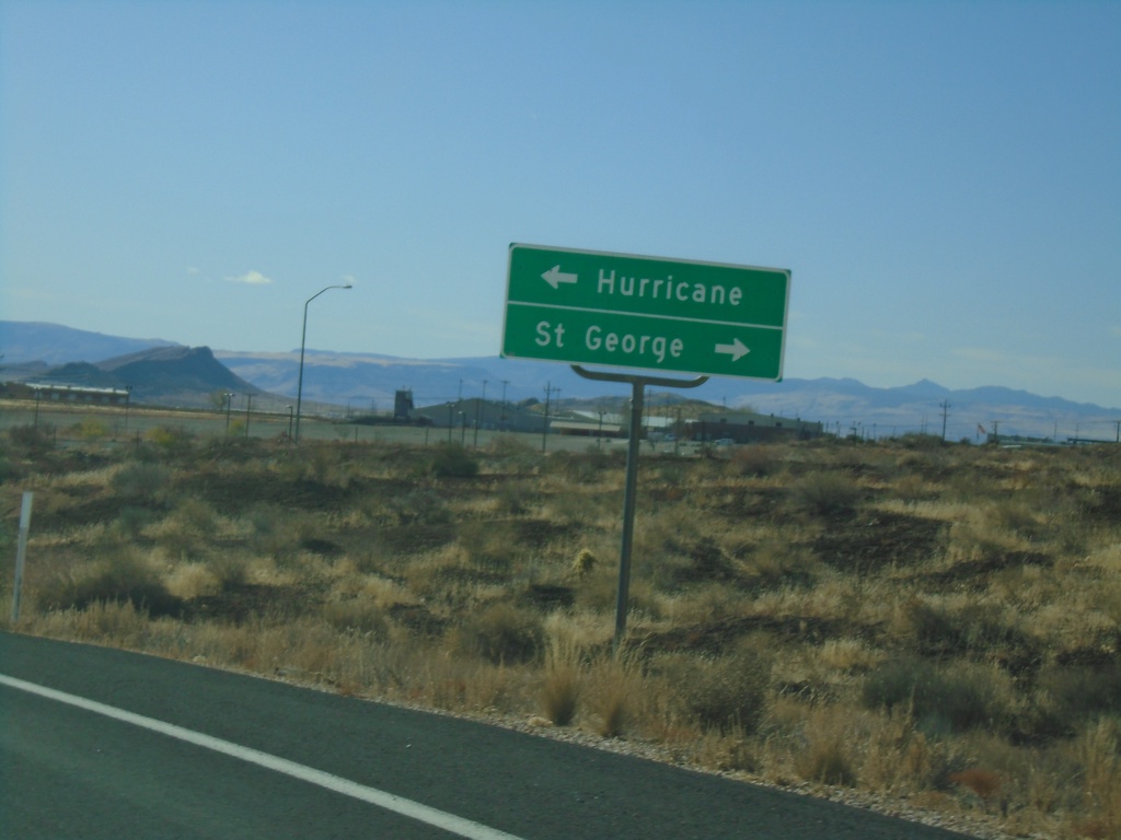
End UT-318 South at UT-9
End UT-318 South at UT-9. Turn left for UT-9 east to Hurricane; right for UT-9 west to St. George (via I-15).
Taken 11-26-2019

 Hurricane
Washington County
Utah
United States
Hurricane
Washington County
Utah
United States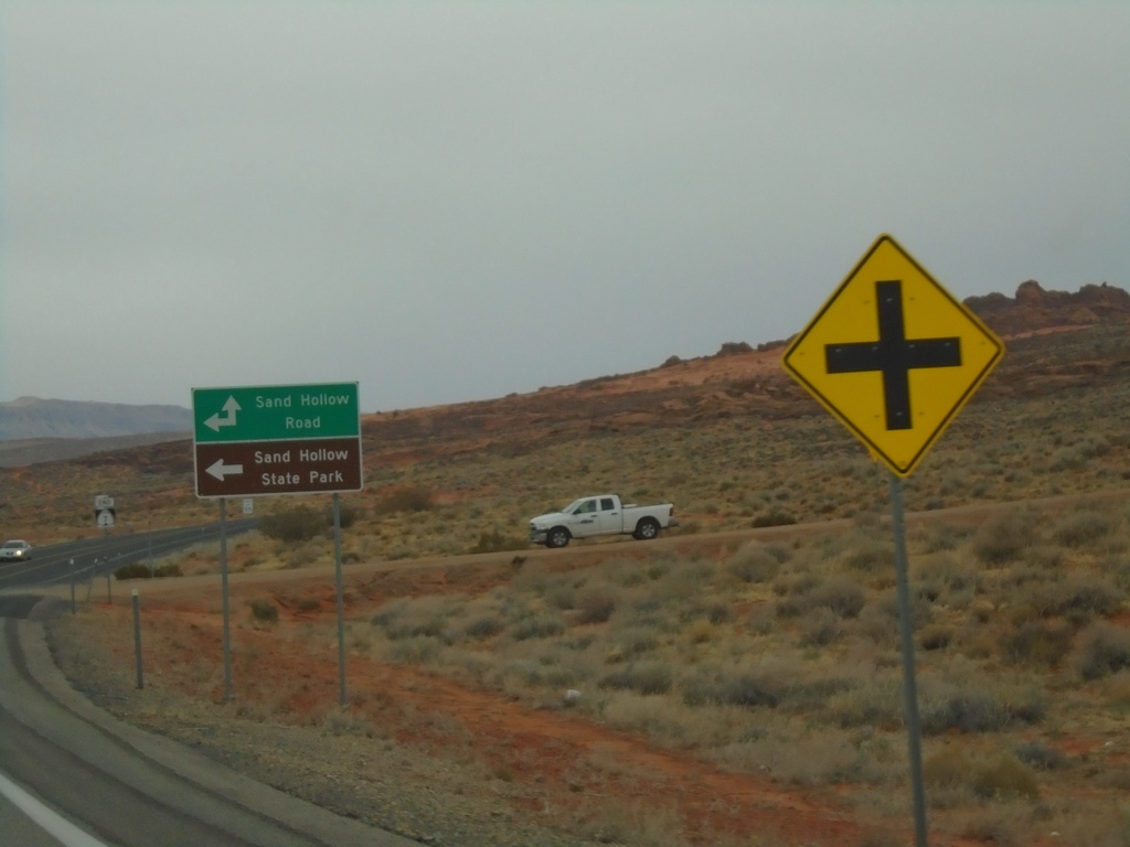
End UT-7 at Sand Hollow Road
End UT-7 (Southern Parkway) at Sand Hollow Road. Turn left on Sand Hollow Road for Sand Hollow State Park.
Taken 11-25-2019
Hurricane
Washington County
Utah
United States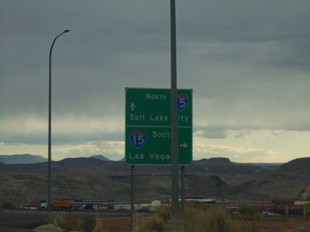
Washington Parkway at I-15
Washington Parkway at I-15 (Exit 13). Use I-15 south for Las Vegas (Nevada); I-15 north for Salt Lake City.
Taken 11-25-2019
Washington
Washington County
Utah
United States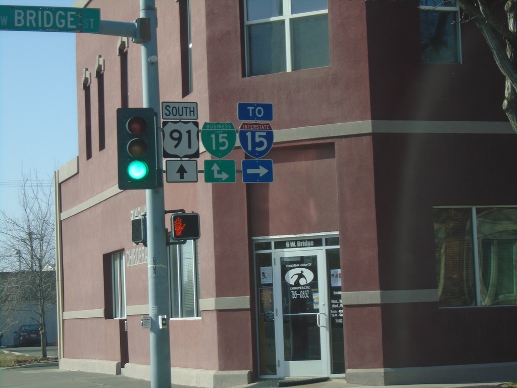
US-91 South at BL-15 - Blackfoot
US-91 South at BL-15 in Blackfoot. Turn right on Bridge St. for BL-15 North/To I-15; continue south for BL-15 South/US-91 South.
Taken 10-27-2019

 Blackfoot
Bingham County
Idaho
United States
Blackfoot
Bingham County
Idaho
United States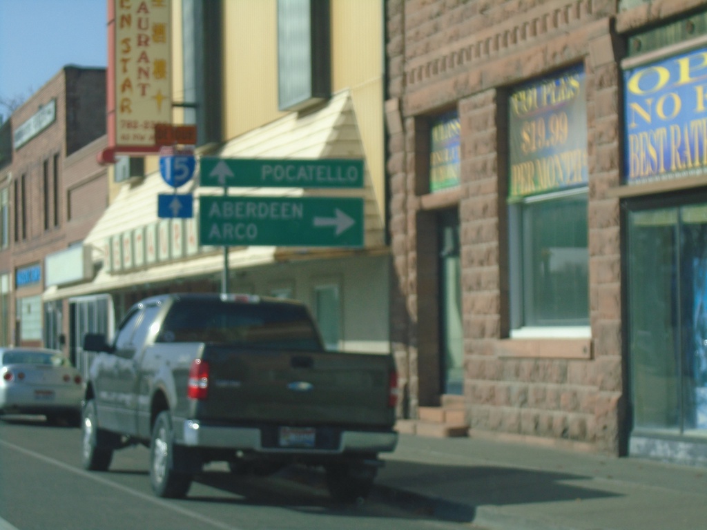
US-91 South at BL-15 - Blackfoot
US-91 South at BL-15 in Blackfoot. Turn right for BL-15 North to Aberdeen (via ID-39) and Arco (via US-26). Continue straight on US-91 South/BL-15 South for Pocatello and I-15.
Taken 10-27-2019
Blackfoot
Bingham County
Idaho
United States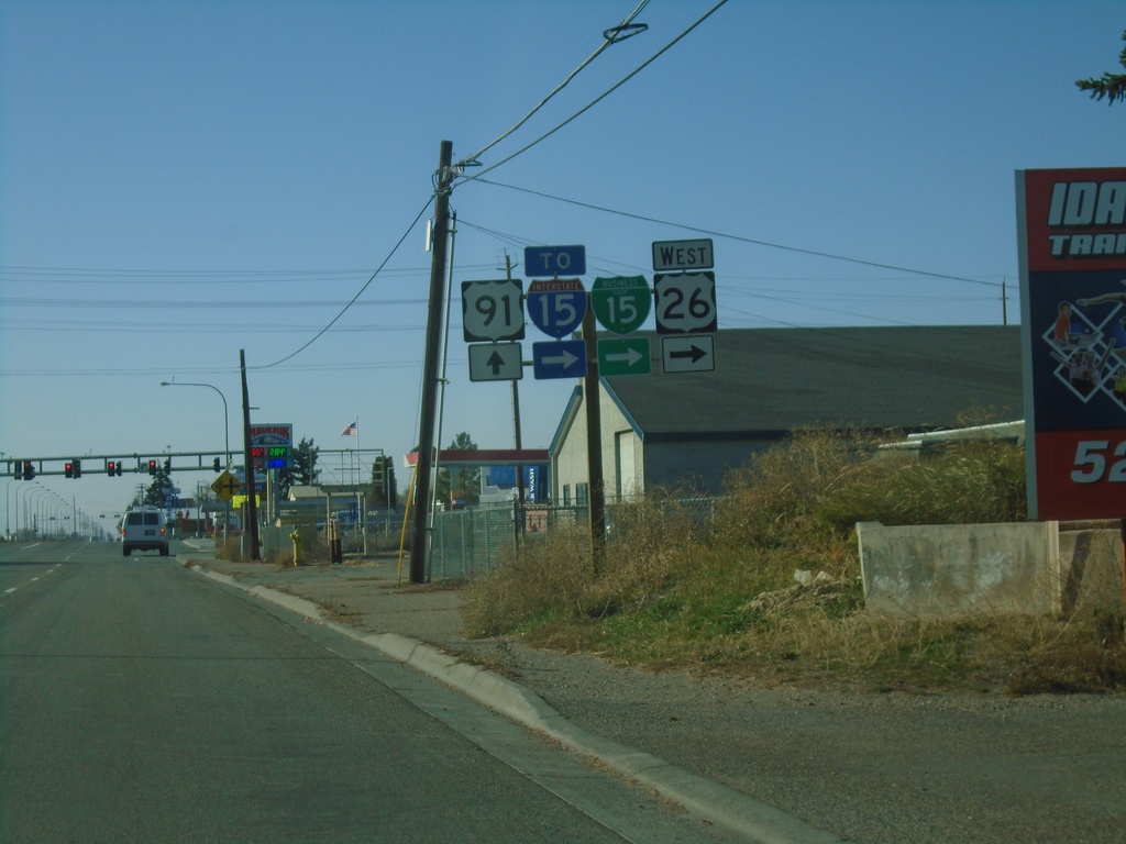
US-26 West/BL-15 South at US-91
US-26 West/BL-15 South (Yellowstone Highway) at US-91. Turn right on Sunnyside Road to continue west on US-26, BL-15 South, and for I-15. Continue straight on Yellowstone Highway for US-91. This is the beginning of US-91 southbound.
Taken 10-27-2019
 Idaho Falls
Bonneville County
Idaho
United States
Idaho Falls
Bonneville County
Idaho
United States
US-26 West/Bus. US-20 West at BL-15
US-26 West/Bus. US-20 West at BL-15/Bus. US-20 (Broadway) in Idaho Falls. Turn right for Bus. US-20 West/BL-15 North - Arco (via US-20). Continue straight for US-26 West/BL-15 South/Blackfoot/Pocatello.
Taken 10-27-2019
 Idaho Falls
Bonneville County
Idaho
United States
Idaho Falls
Bonneville County
Idaho
United States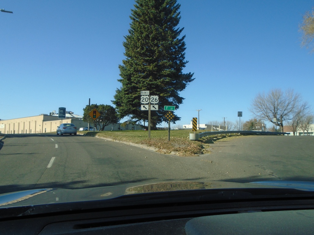
US-26 West/Bus. US-20 West - Idaho Falls
US-26 West/Bus. US-20 West at F St. in Idaho Falls. Merge left to continue on US-26 West/Bus. US-20 West.
Taken 10-27-2019
Idaho Falls
Bonneville County
Idaho
United States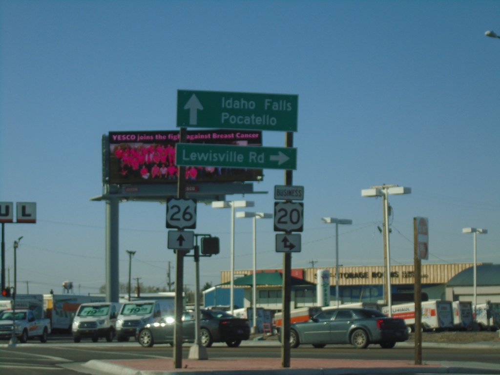
US-26 West at Bus. US-20
US-26 west at Bus. US-20 in Idaho Falls. Turn right for Bus. US-20 East/Lewisville Road. Continue straight for US-20 West/Bus. US-20 West/Idaho Falls/Pocatello.
Taken 10-27-2019
Idaho Falls
Bonneville County
Idaho
United States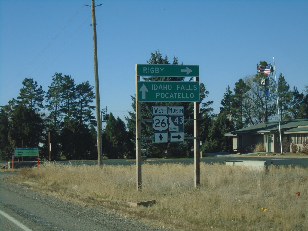
US-26 West at ID-43 North
US-26 West at ID-43 North to Rigby. Continue west on US-26 for Idaho Falls and Pocatello.
Taken 10-27-2019
 Idaho Falls
Bonneville County
Idaho
United States
Idaho Falls
Bonneville County
Idaho
United States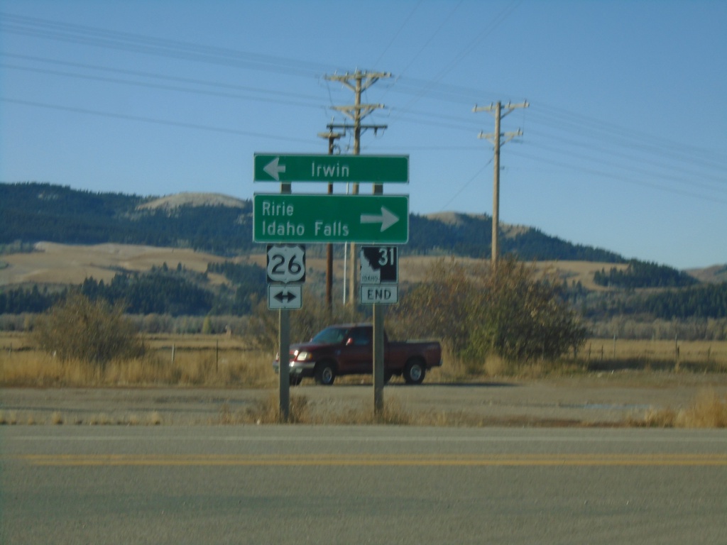
End ID-31 South at US-26
End ID-31 South at US-26 in Swan Valley. Turn left for US-26 East to Irwin; right for US-26 west to Ririe and Idaho Falls.
Taken 10-27-2019
 Swan Valley
Bonneville County
Idaho
United States
Swan Valley
Bonneville County
Idaho
United States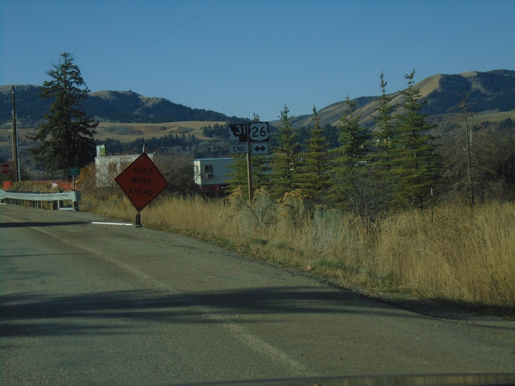
End ID-31 South at US-26
End ID-31 South at US-26 in Swan Valley.
Taken 10-27-2019
Swan Valley
Bonneville County
Idaho
United States