Signs Tagged With Intersection
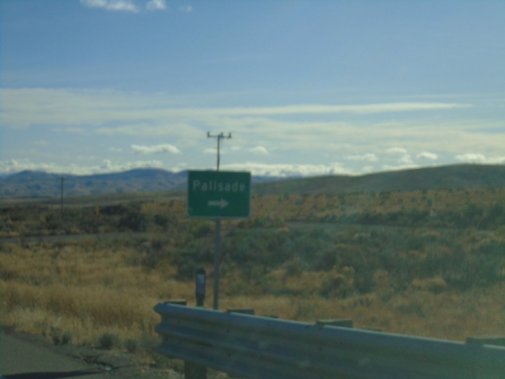
I-80 East - Exit 271 Offramp
I-80 East - Exit 271 Offramp. Turn right for Palisade.
Taken 10-20-2019
 Primeaux
Eureka County
Nevada
United States
Primeaux
Eureka County
Nevada
United States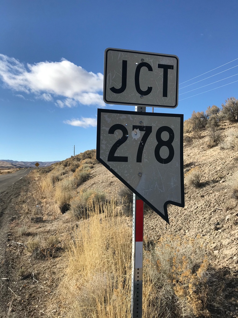
Bush St. West at NV-278
Bush St. West at NV-278 in Carlin. This is an unusual cutout style Nevada state highway shield, that looks more like the style on guide signs.
Taken 10-20-2019
 Carlin
Elko County
Nevada
United States
Carlin
Elko County
Nevada
United States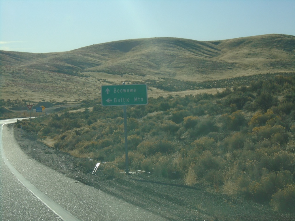
I-80 East Exit 261 Offramp at NV-306
I-80 offramp at NV-306 south to Beowawe. Turn left to return to I-80 west to Battle Mountain
Taken 10-20-2019
 Beowawe
Eureka County
Nevada
United States
Beowawe
Eureka County
Nevada
United States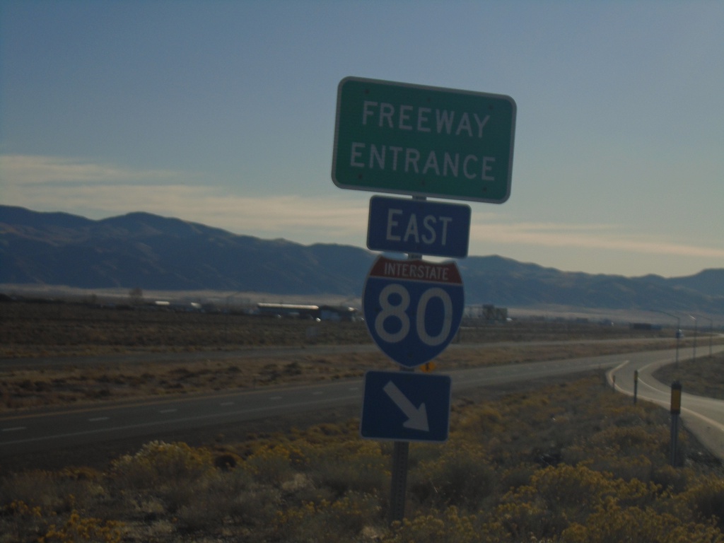
End BL-80/NV-304 East At I-80 East
End BL-80/NV-304 East at I-80 East freeway entrance (Exit 233).
Taken 10-20-2019

 Battle Mountain
Lander County
Nevada
United States
Battle Mountain
Lander County
Nevada
United States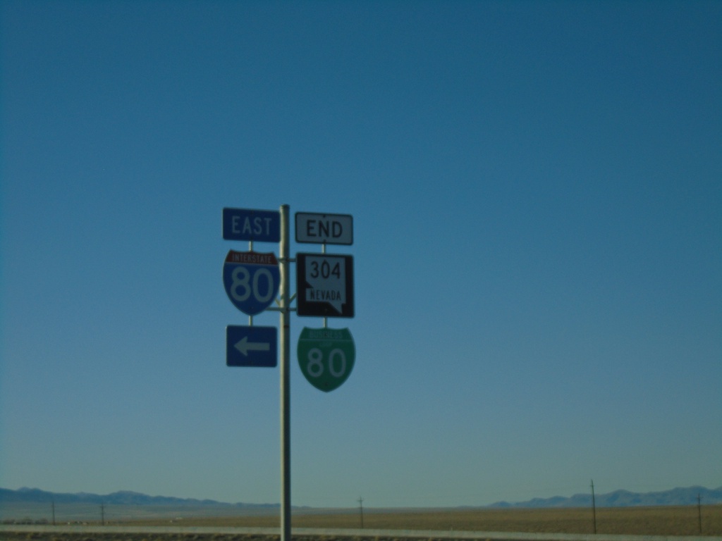
End BL-80/NV-304 East At I-80
I-80 junction (Exit 233) at eastern end of NV-304/BL-80
Taken 10-20-2019
Battle Mountain
Lander County
Nevada
United States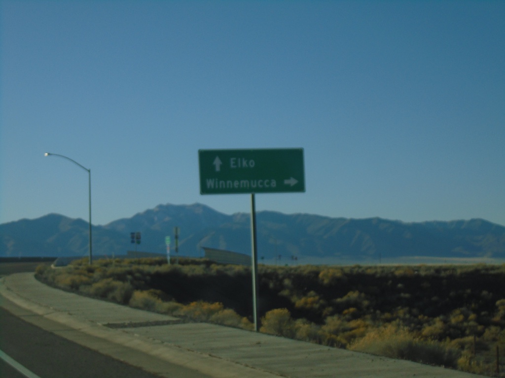
BL-80/NV-304 East at I-80 West
BL-80/NV-304 East at I-80 West to Winnemucca. Use I-80 east for Elko.
Taken 10-20-2019
Battle Mountain
Lander County
Nevada
United States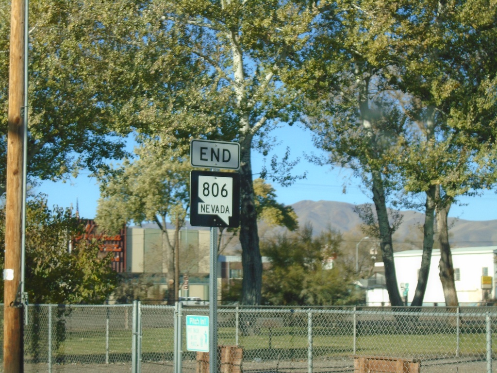
End NV-806 South - Battle Mountain
End NV-806 South (Reese St.) at BL-80/NV-304 in Battle Mountain
Taken 10-20-2019
 Battle Mountain
Lander County
Nevada
United States
Battle Mountain
Lander County
Nevada
United States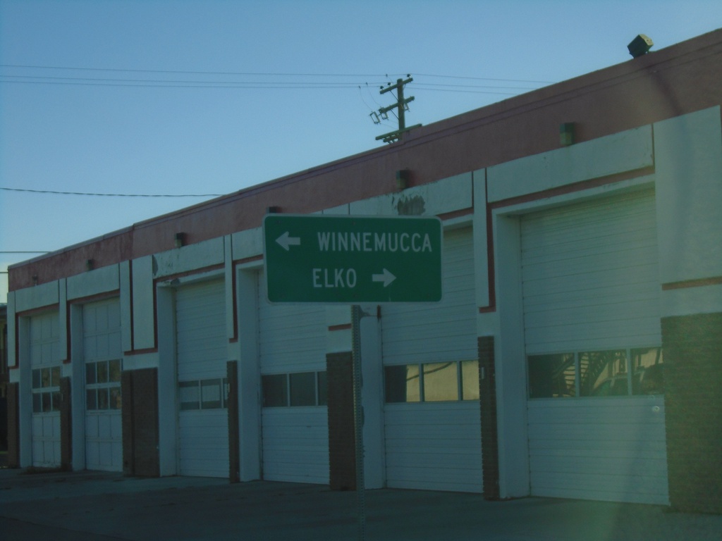
End NV-305 North at BL-80/NV-304
End of NV-305 at BL-80/NV-304. Turn right on BL-80/NV-304 for Elko; turn left on BL-80/NV-304 for Winnemucca.
Taken 10-20-2019
 Battle Mountain
Lander County
Nevada
United States
Battle Mountain
Lander County
Nevada
United States
NV-305 North at I-80 West
NV-305 North at I-80 West in Battle Mountain.
Taken 10-20-2019
Battle Mountain
Lander County
Nevada
United States
NV-305 North at I-80 West
NV-305 North at I-80 West (Exit 231). Use I-80 west for Winnemucca. Continue north on NV-305 for Battle Mountain.
Taken 10-20-2019
Battle Mountain
Lander County
Nevada
United States
Winnemucca Blvd. at I-80 West
Winnemucca Blvd. at I-80 West to Lovelock (Exit 173).
Taken 10-20-2019
Winnemucca
Humboldt County
Nevada
United States
Winnemucca Blvd. West at I-80 (Exit 173)
Winnemucca Blvd. West at I-80 (Exit 173). Use I-80 West for Lovelock; I-80 East for Winnemucca.
Taken 10-20-2019
Winnemucca
Humboldt County
Nevada
United States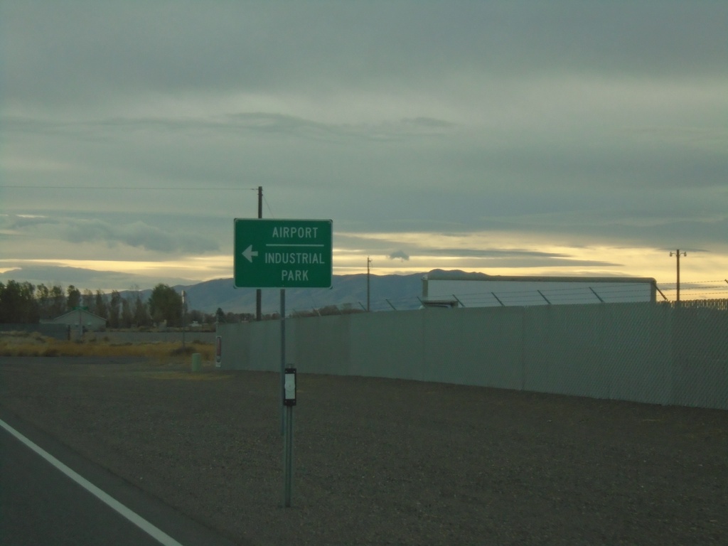
Rose Creek Road West at NV-796
Rose Creek Road West at NV-796 to Airport and Industrial Park.
Taken 10-19-2019
 Winnemucca
Humboldt County
Nevada
United States
Winnemucca
Humboldt County
Nevada
United States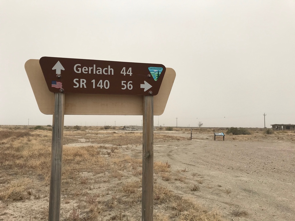
Jungo Road at Jackson Creek Ranch Road
Jungo Road West at Jackson Creek Ranch Road. Use Jackson Creek Ranch Road north for NV-140; continue on Jungo Road west for Gerlach.
Taken 10-19-2019
Sulphur Humboldt County Nevada United States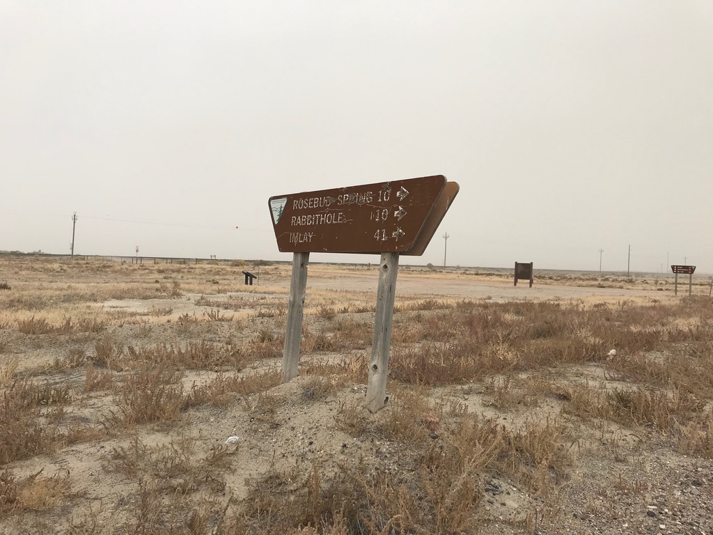
Jungo Road at County Road
Jungo Road at County Road south to Imlay, Rabbithole, and Rosebud Spring. Taken in the ghost town of Sulphur.
Taken 10-19-2019
Winnemucca Humboldt County Nevada United States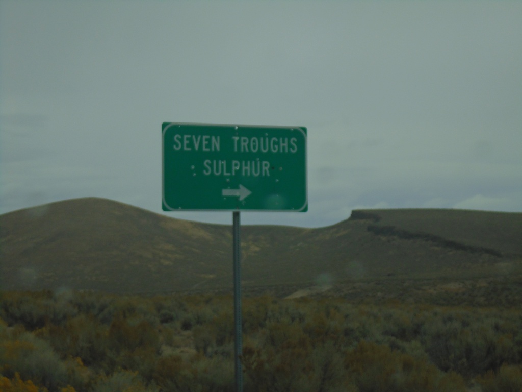
NV-399 West at Seven Troughs Road
NV-399 West at Seven Troughs Road to Seven Troughs and Sulphur
Taken 10-19-2019
 Pershing County
Nevada
United States
Pershing County
Nevada
United States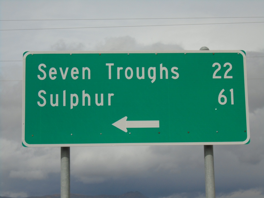
End NV-854 at NV-399
End NV-854 at NV-399 in Pershing County. Use NV-399 west for Seven Troughs and Sulphur.
Taken 10-19-2019
 Lovelock
Pershing County
Nevada
United States
Lovelock
Pershing County
Nevada
United States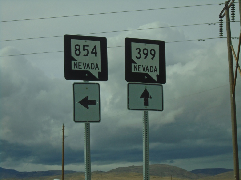
NV-399 West at NV-854
NV-399 West at NV-854 south in Pershing County.
Taken 10-19-2019
Lovelock
Pershing County
Nevada
United States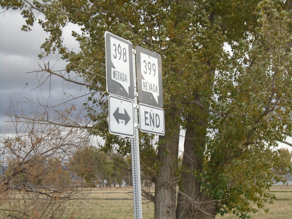
End NV-399 East at NV-398
End NV-399 East (Pitt Road) at NV-398 (N Meridian Road).
Taken 10-19-2019
 Lovelock
Pershing County
Nevada
United States
Lovelock
Pershing County
Nevada
United States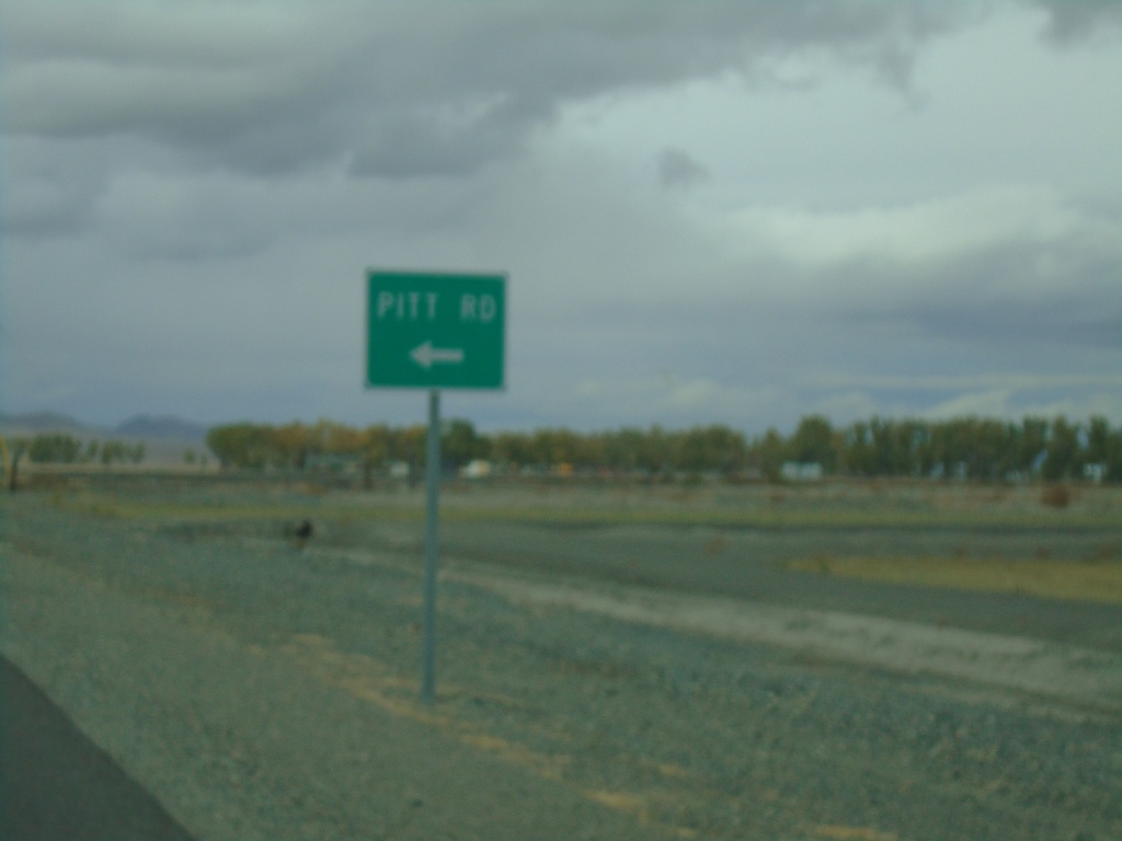
NV-398 North Approaching NV-399
NV-398 North (North Meridian Road) approaching NV-399/Pitt Road.
Taken 10-19-2019
Lovelock
Pershing County
Nevada
United States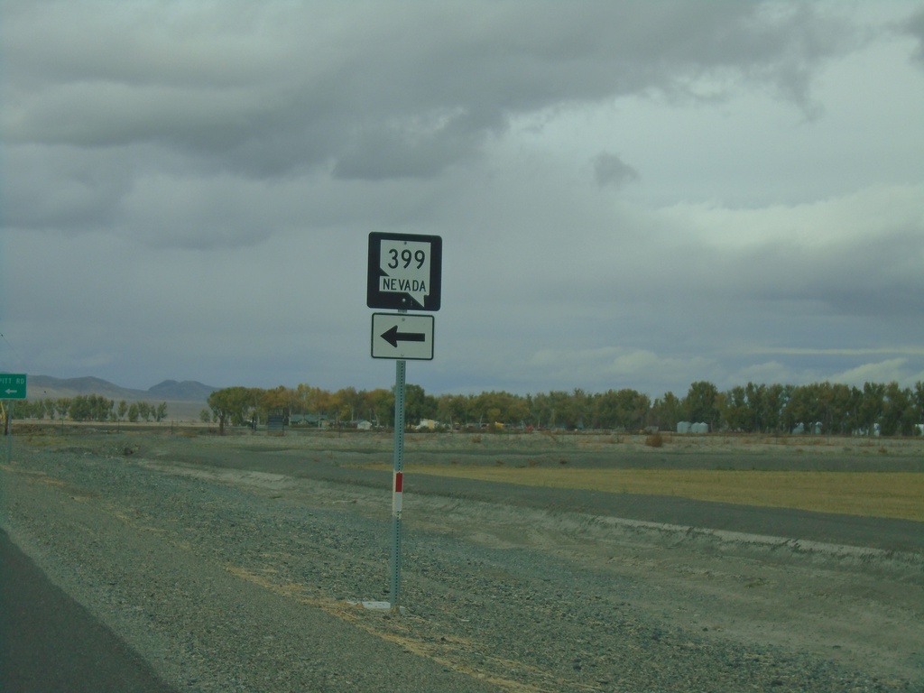
NV-398 North Approaching NV-399
NV-398 North approaching NV-399 in Pershing County
Taken 10-19-2019
Lovelock
Pershing County
Nevada
United States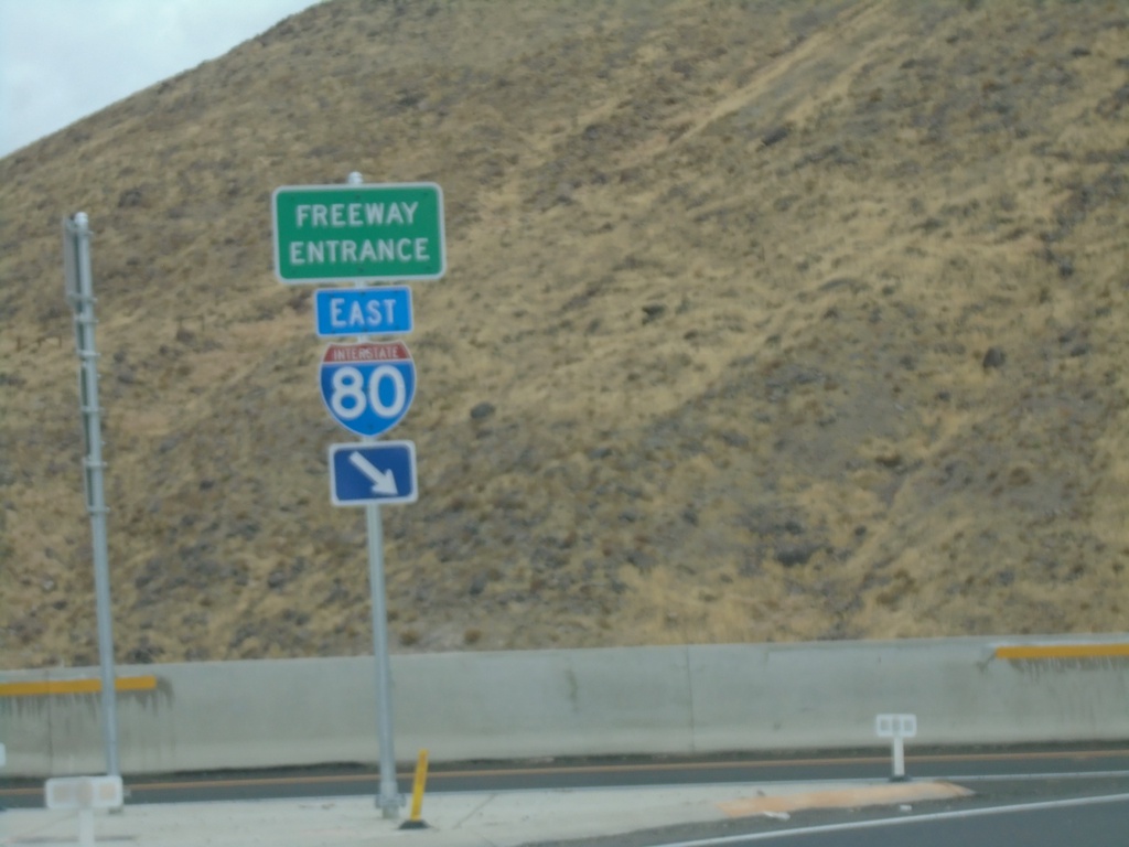
End NV-439 North at I-80
End NV-439 North at I-80 East (Exit 32)
Taken 10-19-2019
 Clark
Storey County
Nevada
United States
Clark
Storey County
Nevada
United States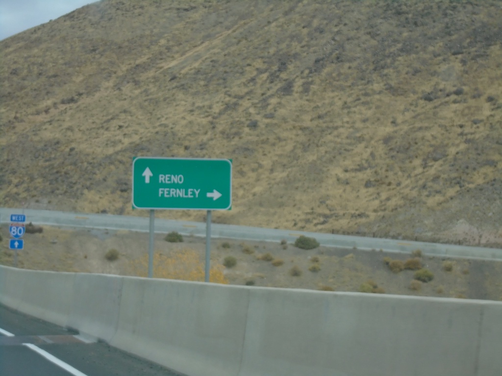
NV-439 North approaching I-80
NV-439 North approaching I-80. Use I-80 west for Reno; I-80 east for Fernley.
Taken 10-19-2019
Clark
Storey County
Nevada
United States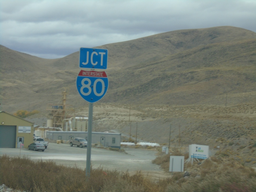
NV-439 North Approaching I-80
NV-439 North Approaching I-80 (Exit 32)
Taken 10-19-2019
Sparks
Storey County
Nevada
United States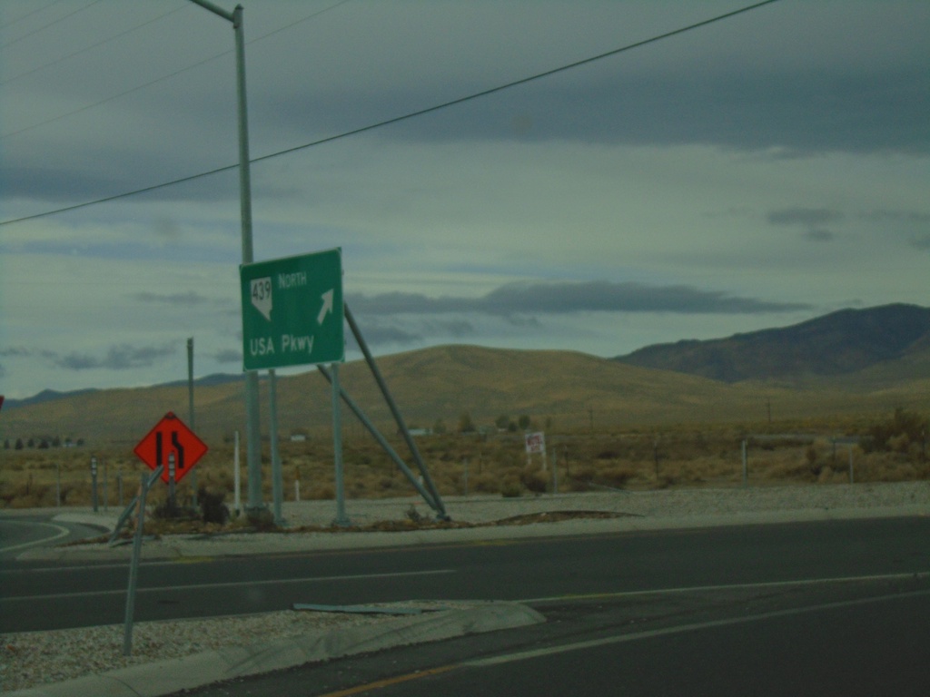
US-50 West at NV-439 North
US-50 West Roundabout at NV-439 North/USA Parkway
Taken 10-19-2019
 Silver Springs
Lyon County
Nevada
United States
Silver Springs
Lyon County
Nevada
United States