Signs Tagged With Intersection
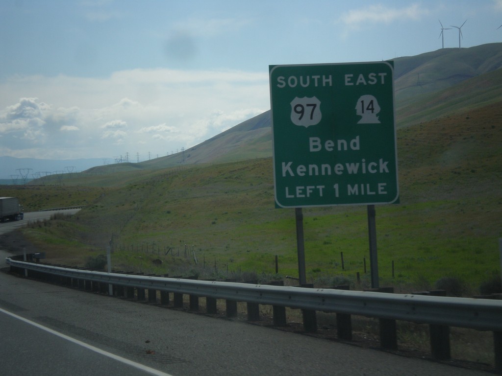
US-97 South Approaching WA-14
US-97 South approaching WA-14 in Klickitat County. Use US-97 South/WA-14 East to Bend (Oregon - via US-97) and Kennewick (via WA-14).
Taken 04-30-2018

 Goldendale
Klickitat County
Washington
United States
Goldendale
Klickitat County
Washington
United States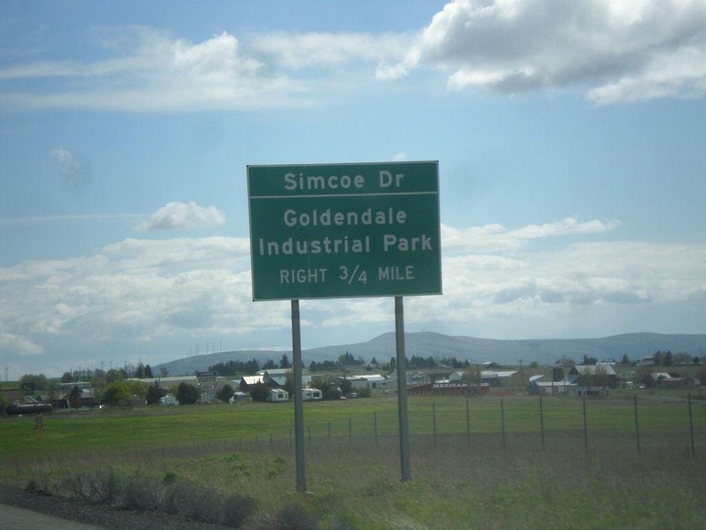
US-97 South Approaching Simcoe Road
US-97 South approaching Simcoe Road to Goldendale Industrial Park.
Taken 04-30-2018
Goldendale
Klickitat County
Washington
United States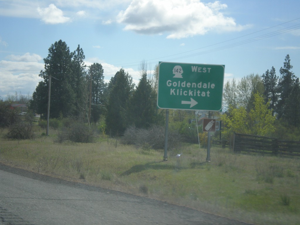
US-97 South at WA-142 West
US-97 South at WA-142 West to Goldendale and Klickitat.
Taken 04-30-2018
 Goldendale
Klickitat County
Washington
United States
Goldendale
Klickitat County
Washington
United States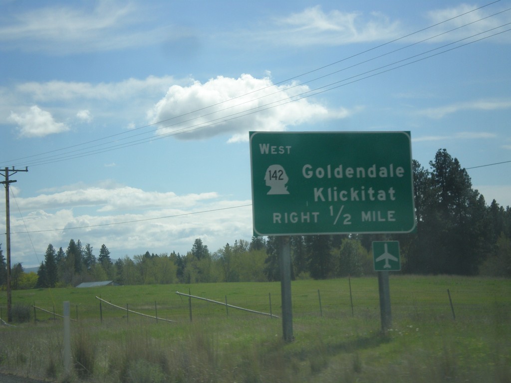
US-97 South Approaching WA-142
US-97 South approaching WA-142 west to Goldendale and Klickitat.
Taken 04-30-2018
Goldendale
Klickitat County
Washington
United States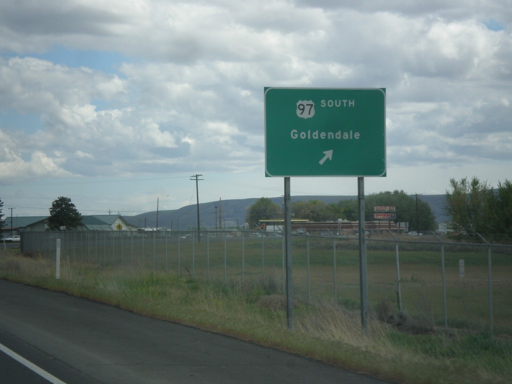
US-97 South at WA-22
US-97 South at WA-22 junction. Turn right to continue south on US-97 to Goldendale.
Taken 04-30-2018
 Toppenish
Yakima County
Washington
United States
Toppenish
Yakima County
Washington
United States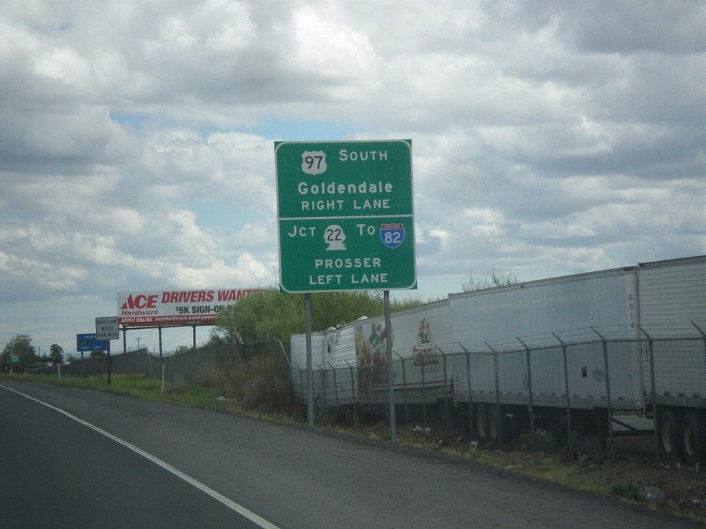
US-97 South Approaching WA-22
US-97 South approaching WA-22. Turn left on WA-22 West for Prosser and I-82. Turn right to continue south on US-97 towards Goldendale. Continue straight on the Yakima Valley Highway for WA-22 east.
Taken 04-30-2018
 Toppenish
Yakima County
Washington
United States
Toppenish
Yakima County
Washington
United States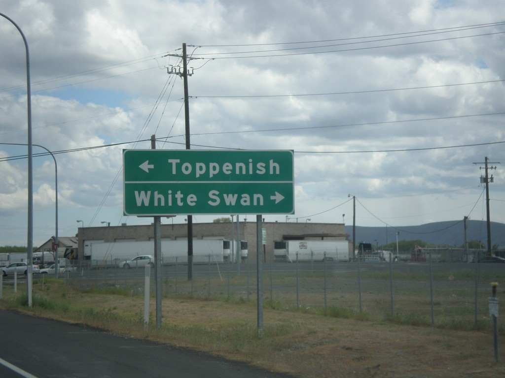
US-97 South - Fort Road Jct.
US-97 South at Fort Road Jct. Turn right for White Swan; left for Toppenish.
Taken 04-30-2018
Toppenish
Yakima County
Washington
United States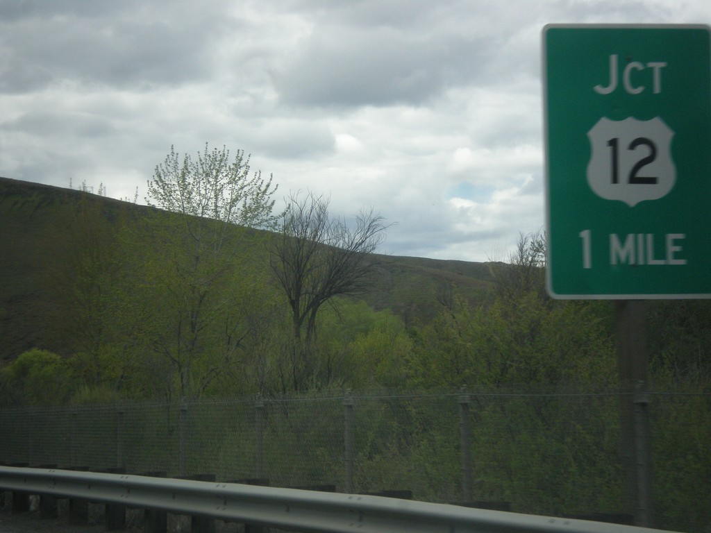
I-82 East approaching US-12 Jct.
I-82 East approaching US-12 Jct. in Yakima County.
Taken 04-30-2018
 Yakima
 County
Washington
United States
Yakima
Yakima County
Washington
United States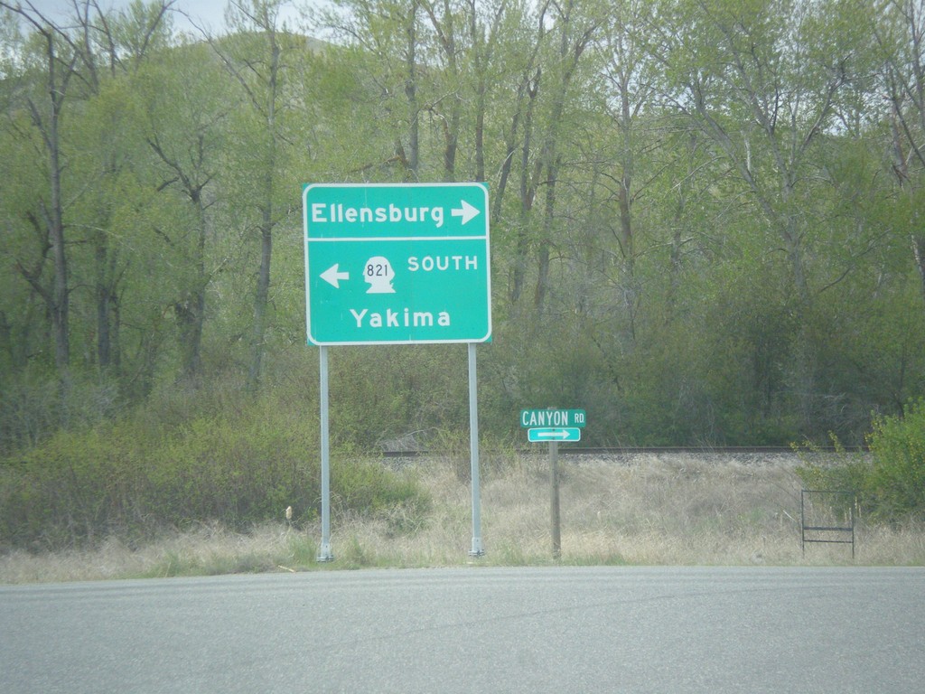
WA-821 South - Thrall Road at Canyon Road
WA-821 South (Thrall Road) at Canyon Road. Turn left on Canyon Road to continue south on WA-821 and Yakima. Turn right for Ellensburg.
Taken 04-30-2018
 Ellensburg
Kittitas County
Washington
United States
Ellensburg
Kittitas County
Washington
United States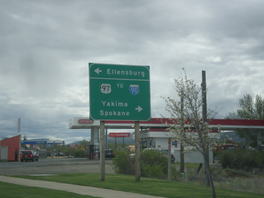
US-97 South at University Way
US-97 south at University Way in Ellensburg. Turn right on University Way for US-97 South To I-90, Yakima, and Spokane. Turn left for Ellensburg.
Taken 04-30-2018
 Cle Elum
Kittitas County
Washington
United States
Cle Elum
Kittitas County
Washington
United States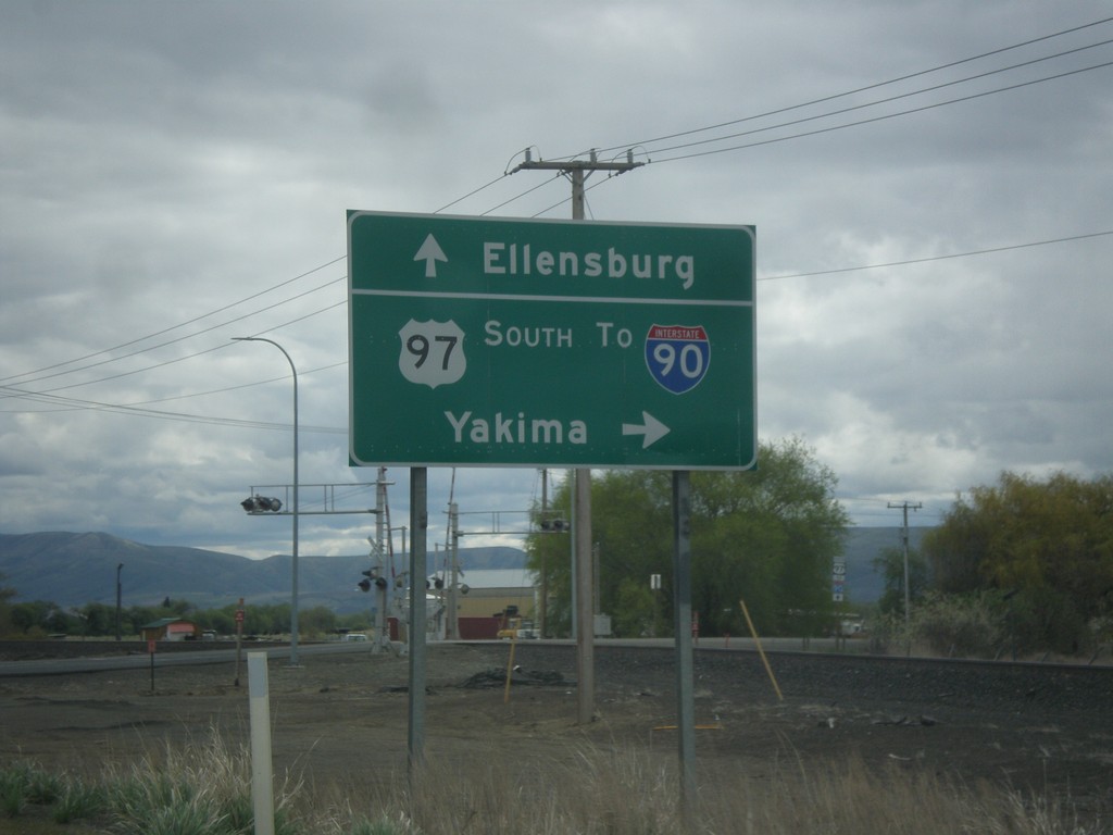
US-97 South at Faust Road
US-97 South at Faust Road in Ellensburg. Turn right to continue south on US-97 towards I-90 and Yakima. Continue straight on Old Highway 10 for Ellensburg.
Taken 04-30-2018
Ellensburg
Kittitas County
Washington
United States
US-97 South In Ellensburg
US-97 South In Ellensburg approaching Faust Road. Turn right on Faust Road to continue south on US-97 towards Yakima.
Taken 04-30-2018
Ellensburg
Kittitas County
Washington
United States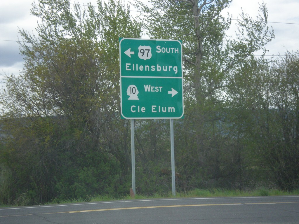
US-97 South at WA-10
US-97 South at WA-10 in Kittitas County. Turn right for WA-10 west to Cle Elum; left to continue south on US-97 to Ellensburg.
Taken 04-30-2018
 Ellensburg
Kittitas County
Washington
United States
Ellensburg
Kittitas County
Washington
United States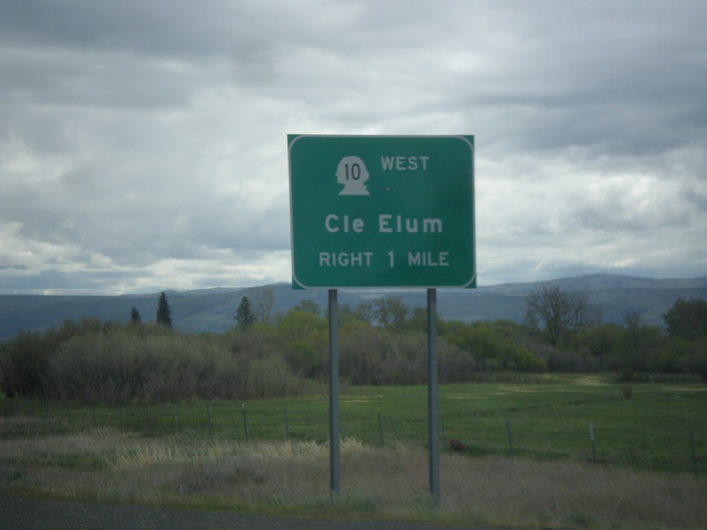
US-97 South Approaching WA-10
US-97 South approaching WA-10 west to Cle Elum in Kittitas County.
Taken 04-30-2018
Ellensburg
Kittitas County
Washington
United States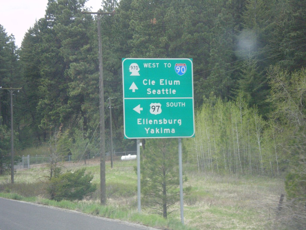
US-97 South at WA-970 (To I-90)
US-97 South at WA-970 in Kittitas County. Use WA-970 West for I-90, Cle Elum, and Seattle. Turn left to continue south on US-97 towards Ellensburg and Yakima.
Taken 04-30-2018
 Cle Elum
Kittitas County
Washington
United States
Cle Elum
Kittitas County
Washington
United States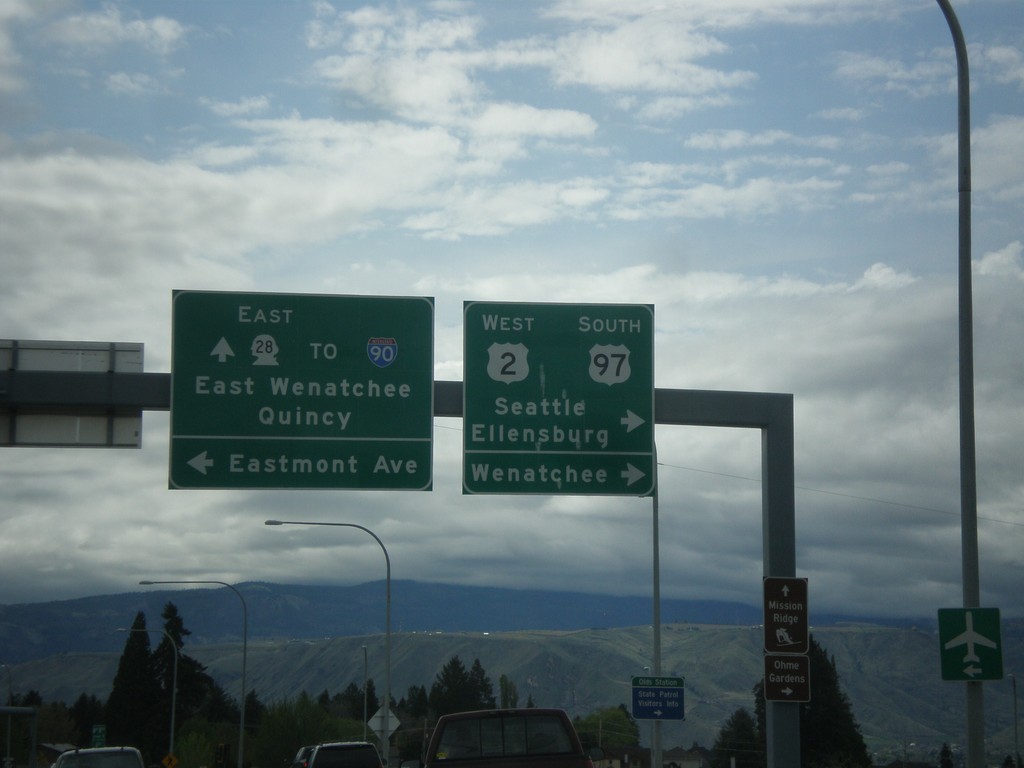
US-2 West/US-97 South at WA-28
US-2 West/US-97 South at WA-28 in Douglas County. Turn right to continue on US-2 West/US-97 South towards Ellensburg, Seattle, and Wenatchee (on the other bank of the Columbia River). Continue straight for WA-28 East to Quincy, East Wenatchee and I-90. Turn left for Eastmont Ave.
Taken 04-30-2018

 East Wenatchee
Douglas County
Washington
United States
East Wenatchee
Douglas County
Washington
United States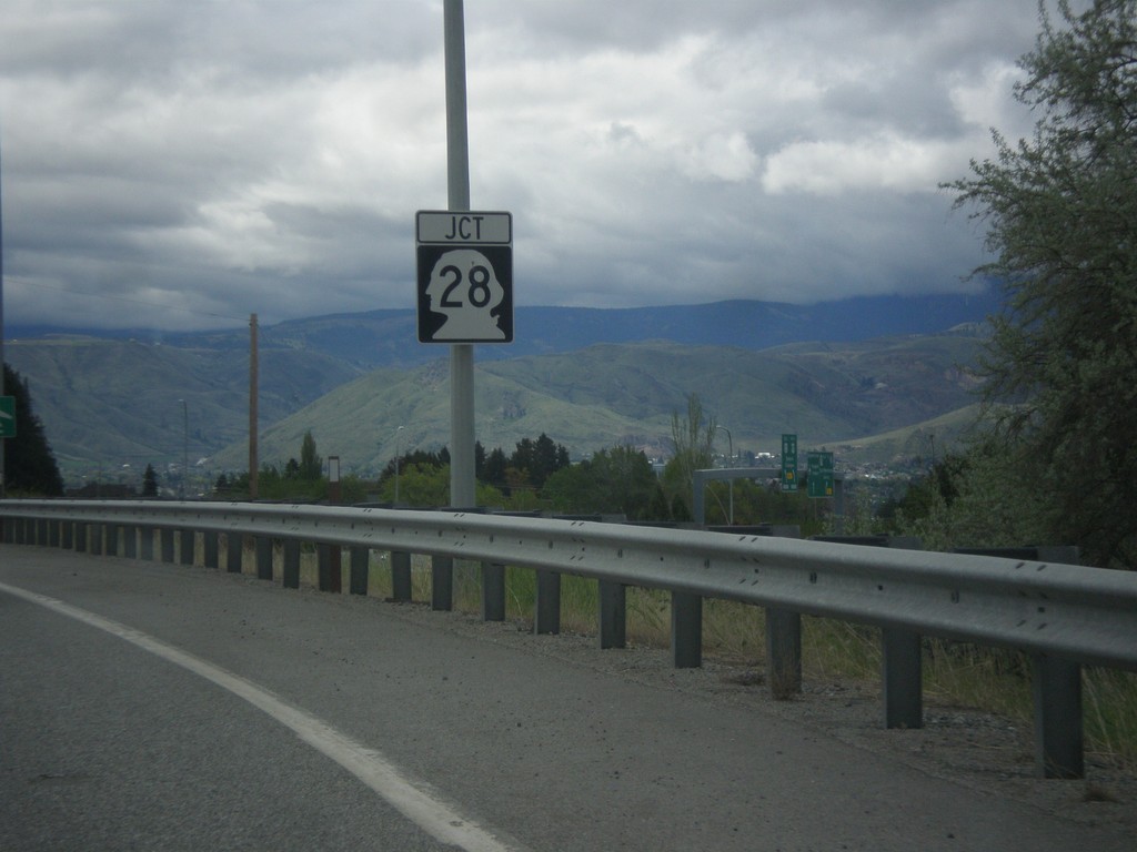
US-2 West/US-97 South Approaching WA-28
US-2 West/US-97 South approaching WA-28 in Douglas County.
Taken 04-30-2018
East Wenatchee
Douglas County
Washington
United States
US-2 West/US-97 South Approaching WA-28
US-2 West/US-97 South approaching WA-28 in Douglas County. Use US-2 West/US-97 South for Seattle and Ellensburg.
Taken 04-30-2018
East Wenatchee
Douglas County
Washington
United States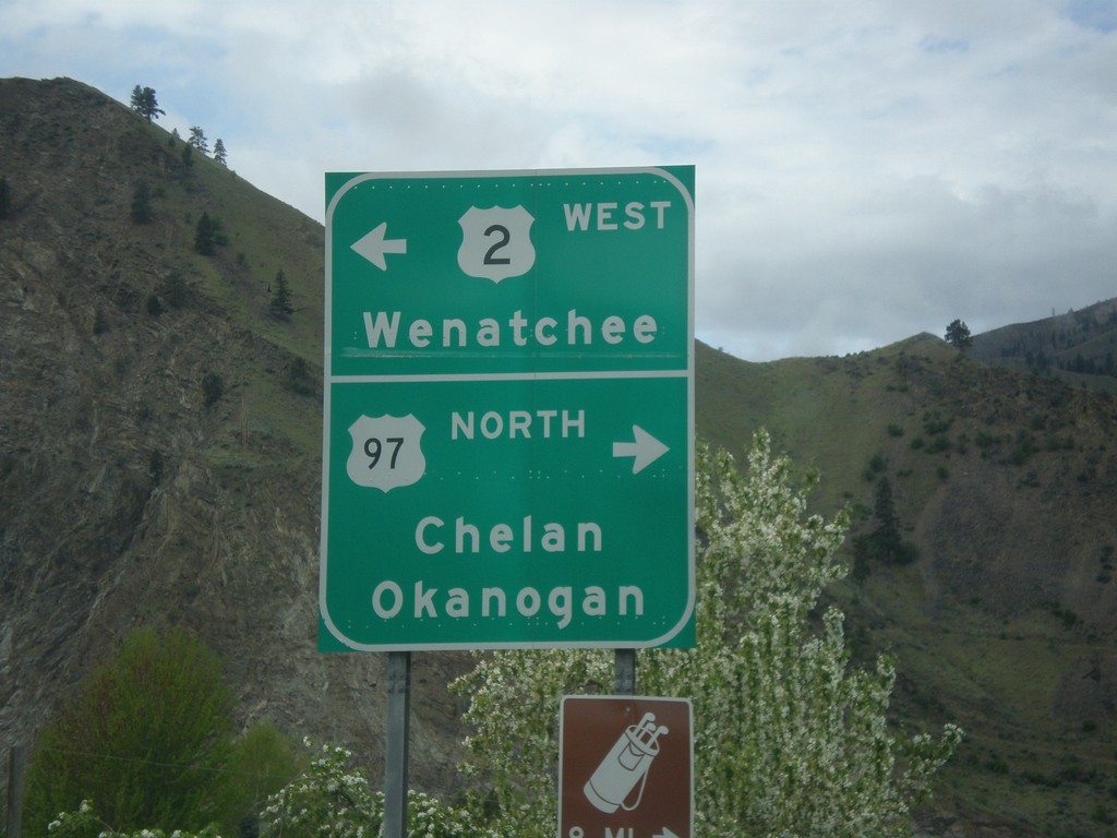
US-2 West at US-97
US-2 West at US-97 in Orondo. Turn right for US-97 north to Chelan and Okanogan. Turn left for US-2 West/(US-97 South) to Wenatchee. US-97 south joins US-2 west to Cashmere.
Taken 04-30-2018
Orondo
Douglas County
Washington
United States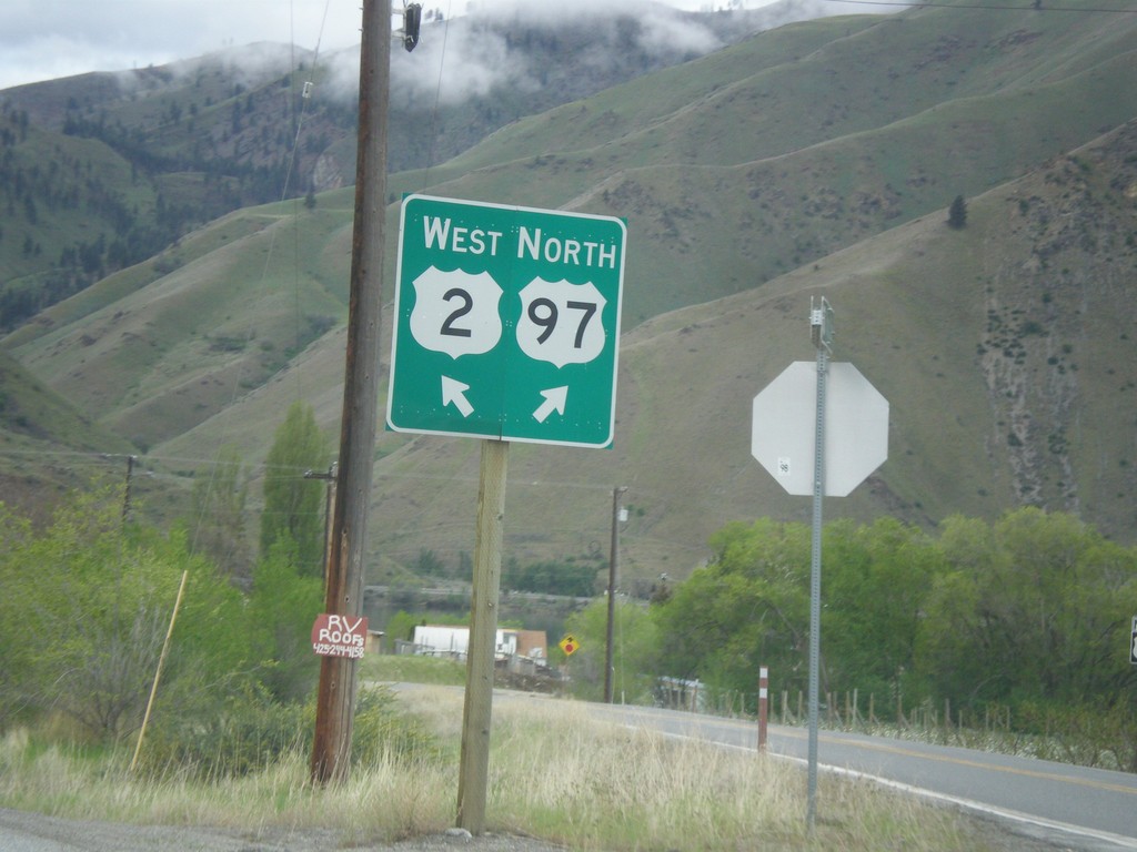
US-2 West at Connection to US-97 North
US-2 West at connection to US-97 North in Orondo. Turn right for US-97 north; left for US-2 west.
Taken 04-30-2018
Orondo
Douglas County
Washington
United States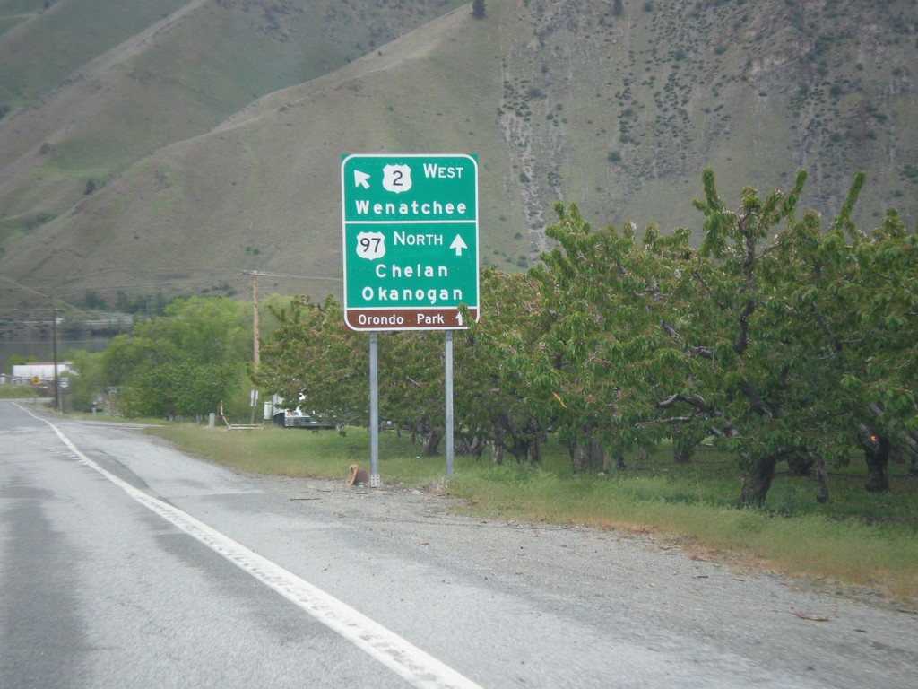
US-2 West at US-97 North
US-2 West at US-97 North. Turn right for connection to US-97 North/Chelan/Okanogan. Merge left for US-2 West towards Wenatchee.
Taken 04-30-2018
Orondo
Douglas County
Washington
United States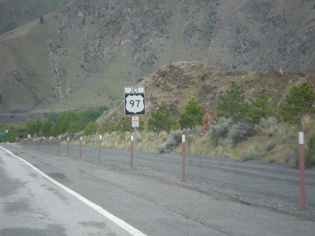
US-2 West Approaching US-97
US-2 West approaching US-97 in Orondo.
Taken 04-30-2018
East Wenatchee
Douglas County
Washington
United States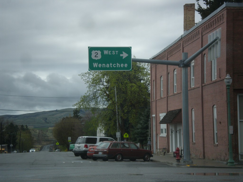
US-2 West - Waterville
US-2 west (Chelan St.) at Locust St. Turn right on Locust St. to continue west on US-2 towards Wenatchee.
Taken 04-30-2018
Waterville
Douglas County
Washington
United States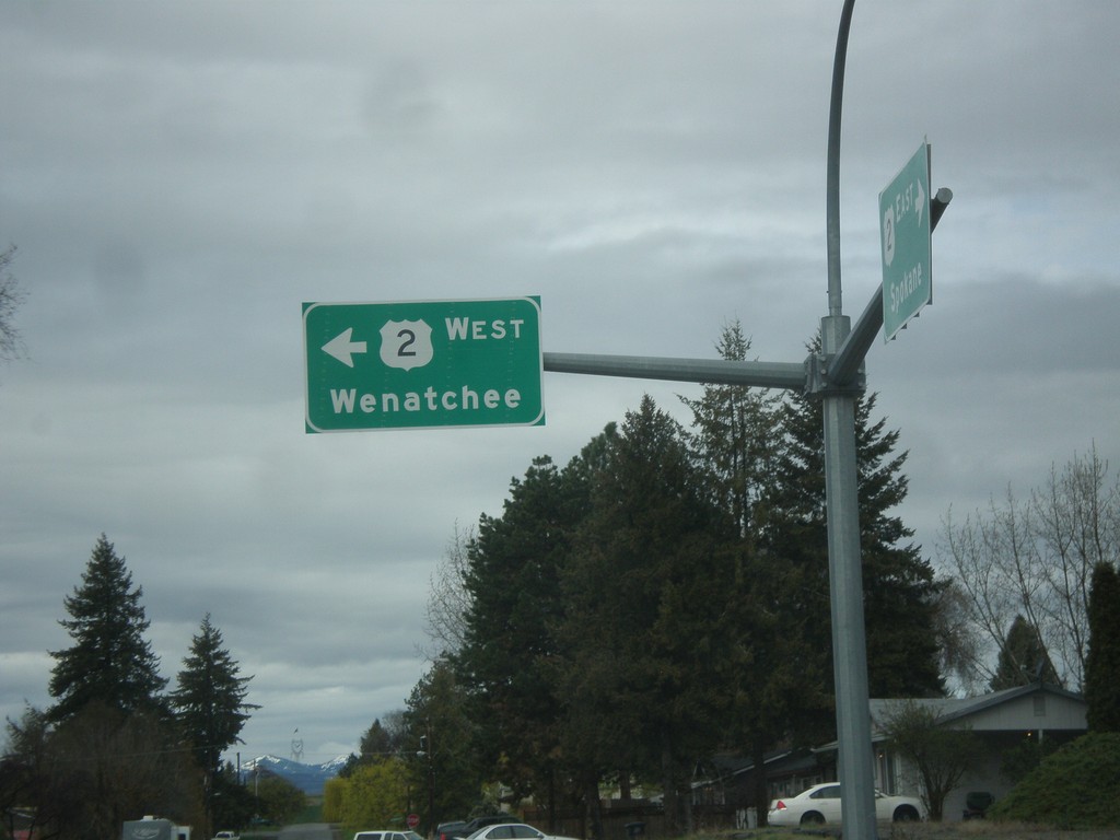
US-2 West - Waterville
US-2 west (Poplar Ave.) at Chelan St. in Waterville. Turn left on Chelan St. to continue west on US-2 towards Wenatchee.
Taken 04-30-2018
Wenatchee
Douglas County
Washington
United States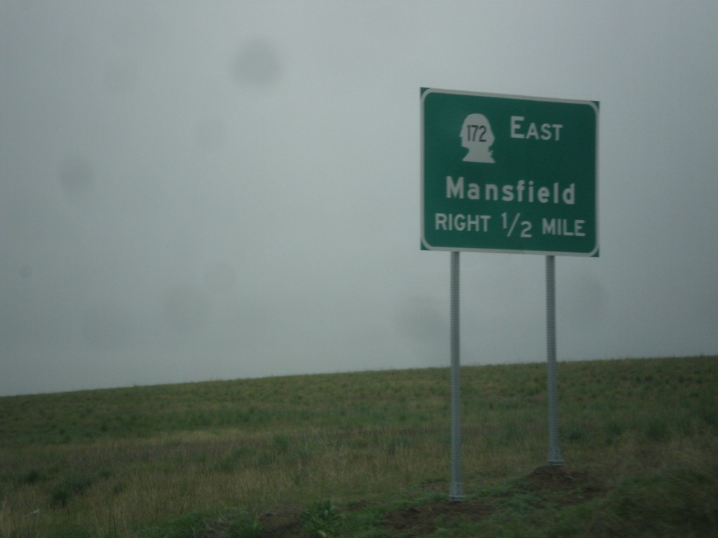
US-2 West Approaching WA-172
US-2 West approaching WA-172 East to Mansfield.
Taken 04-30-2018
 Waterville
Douglas County
Washington
United States
Waterville
Douglas County
Washington
United States