Signs Tagged With Milemarker
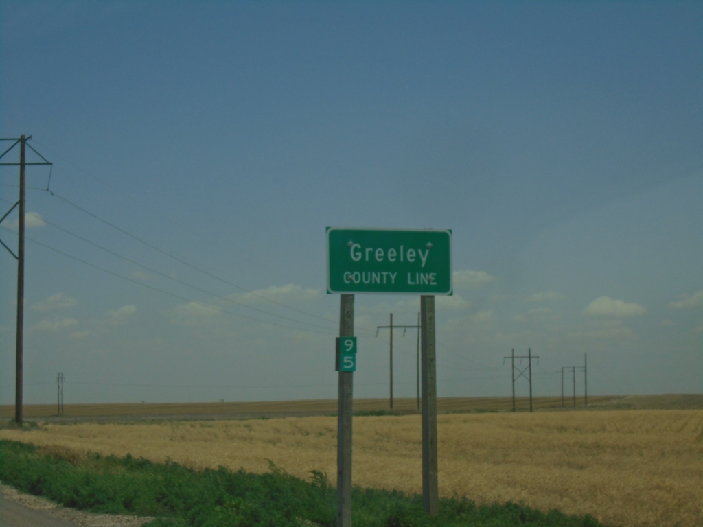
KS-27 North - Greeley County
Greeley County Line on KS-27 North. Milemarker 95.
Taken 06-20-2026
 Tribune
Greeley County
Kansas
United States
Tribune
Greeley County
Kansas
United States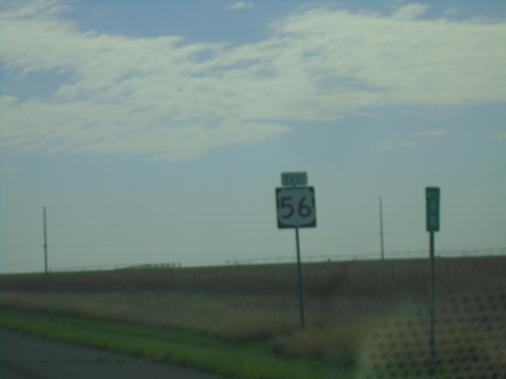
US-56/(US-64)/(US-412) East - Union County
US-56 East - Union County. US-64 and US-412 are omitted from this shield assembly.
Taken 06-20-2026


 Union County
New Mexico
United States
Union County
New Mexico
United States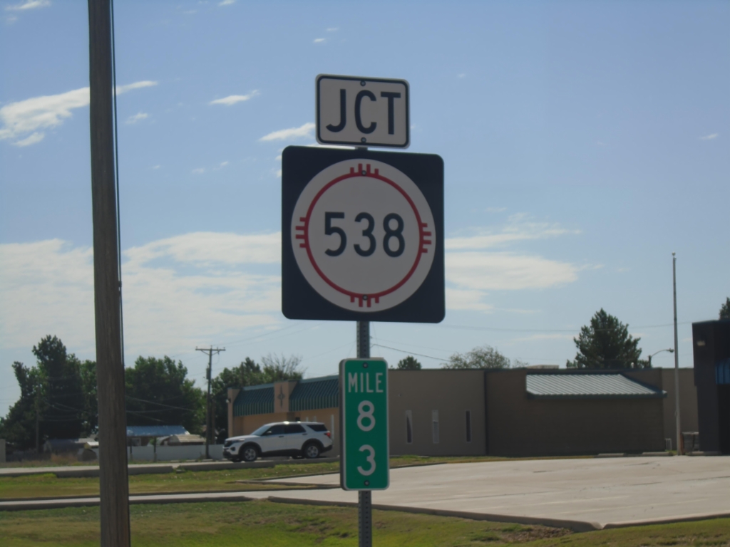
US-56/US-64/US-412 East at NM-538
US-56/US-64/US-412 East at NM-538 in Clayton. Mile 83.
Taken 06-20-2026
 Clayton
Union County
New Mexico
United States
Clayton
Union County
New Mexico
United States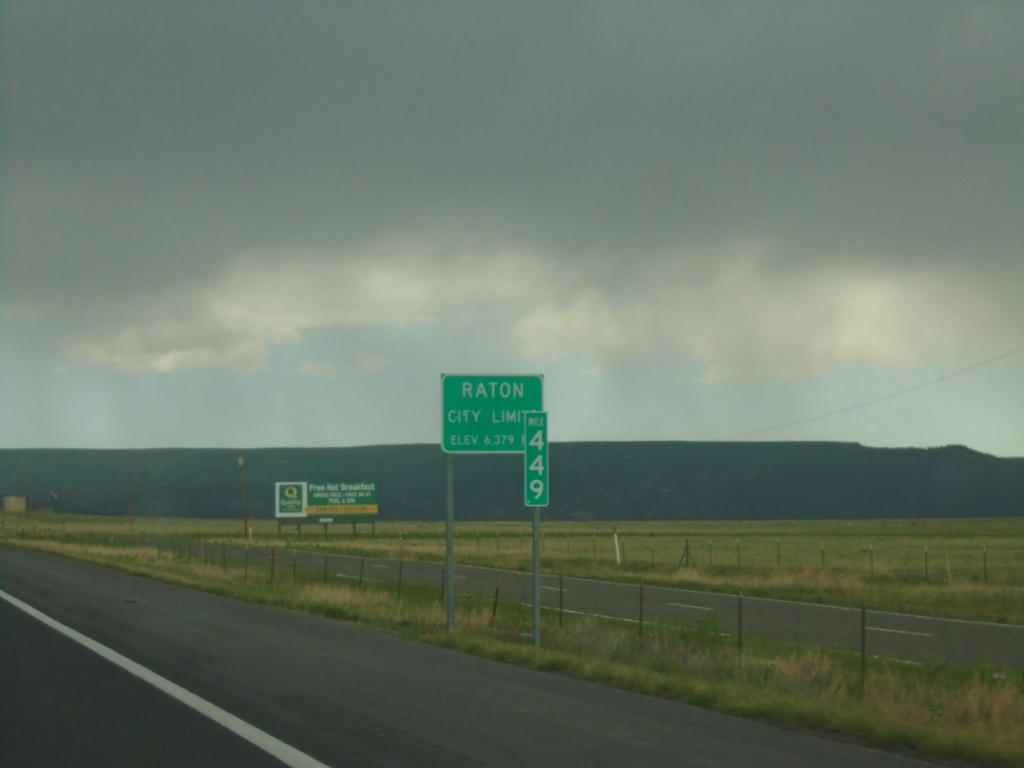
I-25 North - Entering Raton
Raton City Limit - Elevation 6279 Feet on I-25 North. Mile 449.
Taken 06-19-2026

 Raton
Colfax County
New Mexico
United States
Raton
Colfax County
New Mexico
United States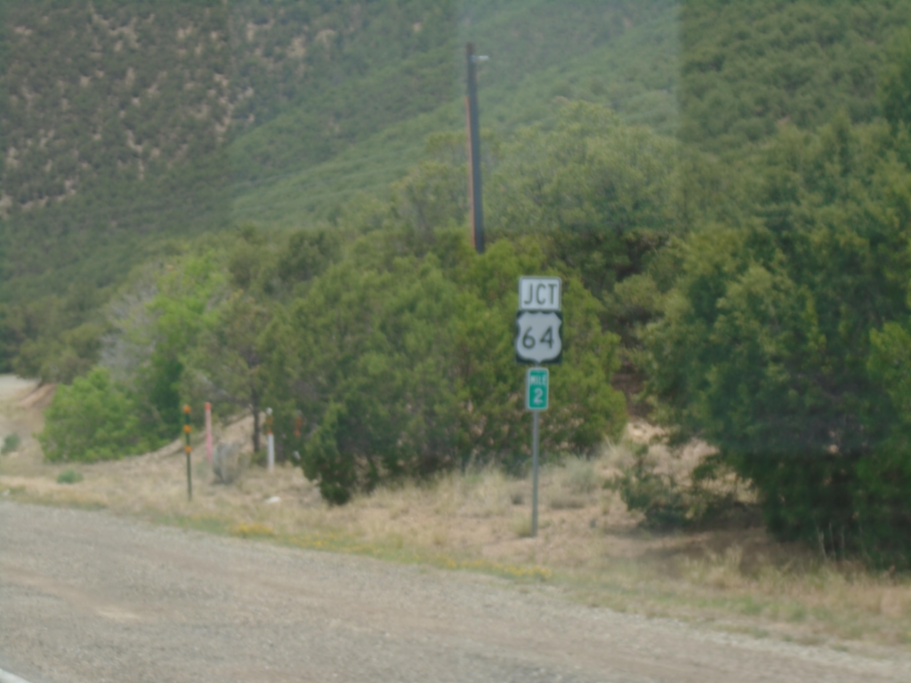
NM-585 East Approaching US-64
NM-585 East (Paseo Del Cañon East) approaching US-64 in Taos.
Taken 06-19-2026
 Taos
Taos County
New Mexico
United States
Taos
Taos County
New Mexico
United States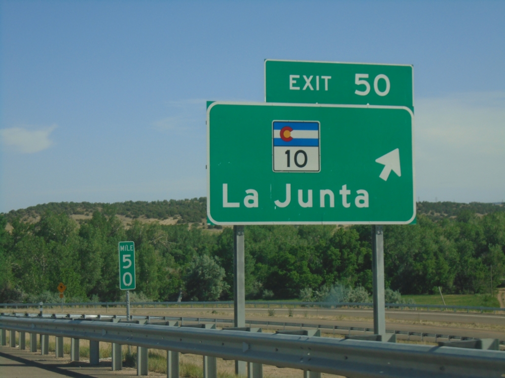
I-25 South - Exit 50
I-25 south at Exit 50 - CO-10/La Junta. US-160 joins I-25 south here to Trinidad.
Taken 06-18-2026


 Walsenburg
Huerfano County
Colorado
United States
Walsenburg
Huerfano County
Colorado
United States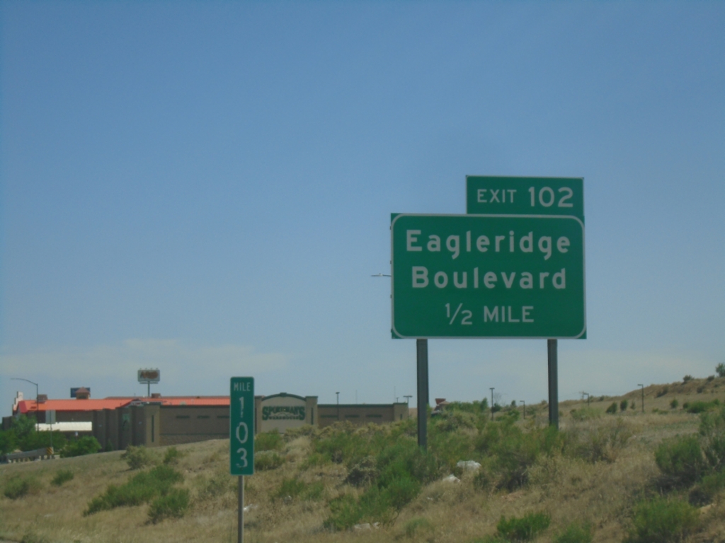
I-25 South - Exit 102
I-25 south approaching Exit 102 - Eagleridge Blvd.
Taken 06-18-2026
Pueblo
Pueblo County
Colorado
United States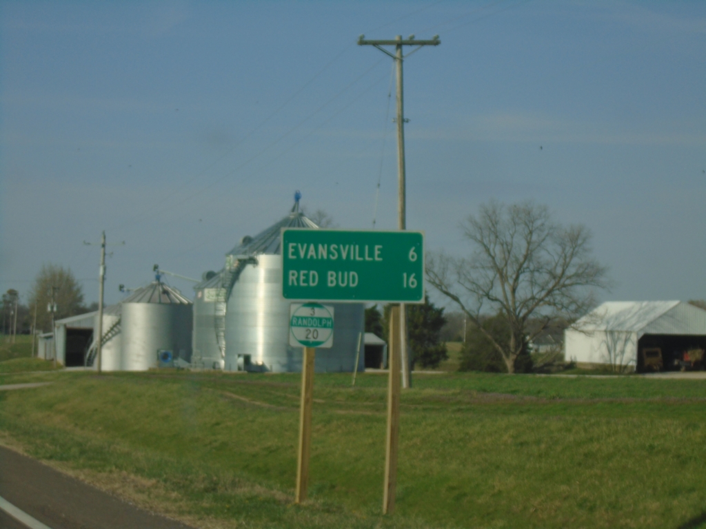
IL-3 North - Distance Marker/Milemarker
Distance marker on IL-3 North. Distance to Evansville and Red Bud. Milemarker 20 (Randolph County).
Taken 03-29-2026
 Ellis Grove
Randolph County
Illinois
United States
Ellis Grove
Randolph County
Illinois
United States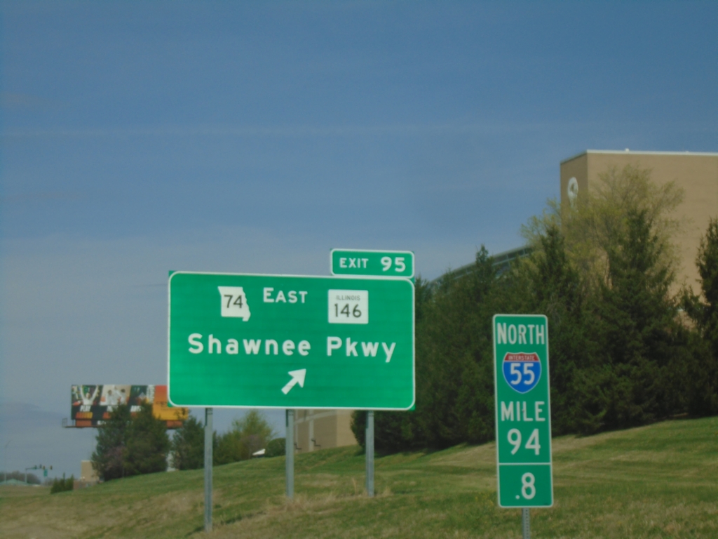
I-55 North - Exit 95
I-55 North/MO-74 East at Exit 95 - MO-74 East/IL-146/Shawnee Parkway. Milepost 94.8.
Taken 03-29-2026


 Cape Girardeau
 County
Missouri
United States
Cape Girardeau
Cape Girardeau County
Missouri
United States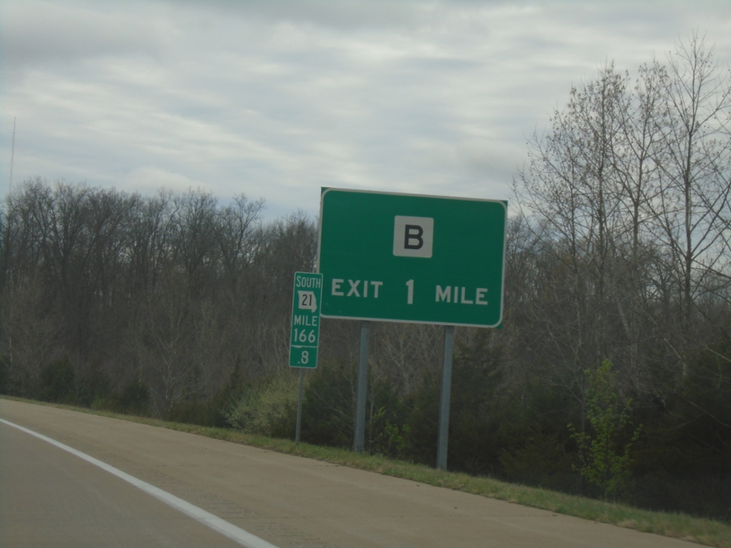
MO-21 South - MO-B Interchange
MO-21 South approaching MO-B Interchange.
Taken 03-27-2026

 Central Township
Jefferson County
Missouri
United States
Central Township
Jefferson County
Missouri
United States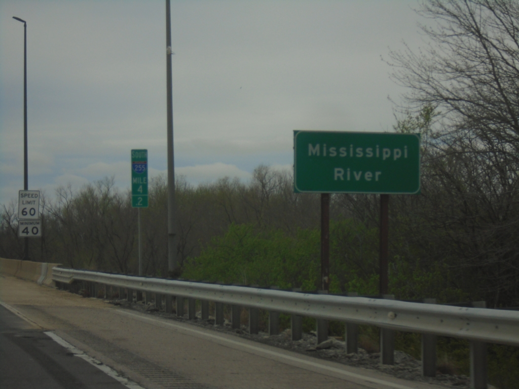
I-255 South - Mississippi River
I-255 South/US-50 West at the Mississippi River at the Missouri/Illinois State Line. This is the southernmost bridge over the Mississippi River in the Saint Louis metro area.
Taken 03-27-2026

 Columbia
Monroe County
Illinois
United States
Columbia
Monroe County
Illinois
United States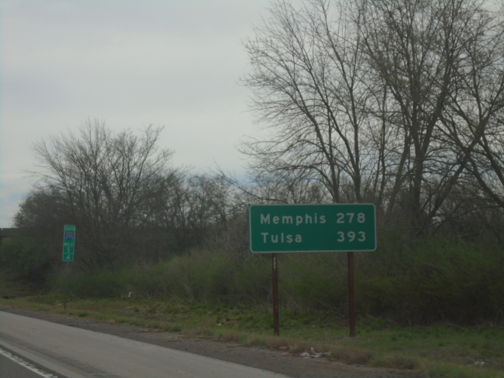
I-255 South - Distance Marker
Last distance marker in Illinois on I-255 South. Distance to Memphis (Tennessee via I-55) and Tulsa (Oklahoma via I-44).
Taken 03-27-2026
Columbia
Monroe County
Illinois
United States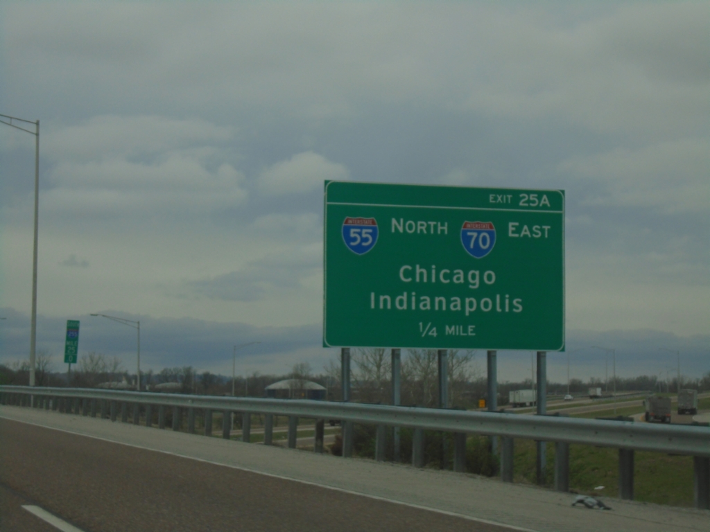
I-255 South - Exit 25A
I-255 south approaching Exit 25A - I-55 North/I-70 East/Chicago/Indianapolis (IN).
Taken 03-27-2026

 Collinsville
Madison County
Illinois
United States
Collinsville
Madison County
Illinois
United States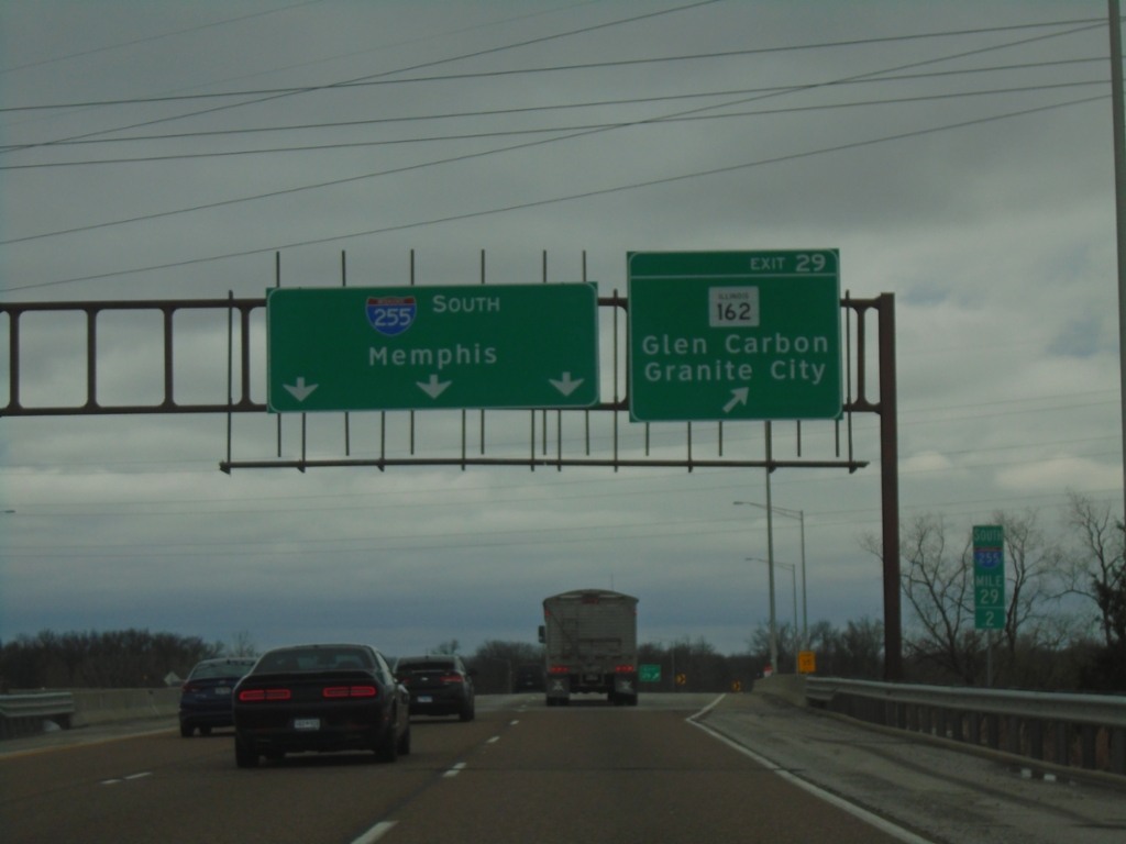
I-255 South - Exit 29
I-255 South at Exit 29 - IL-162/Glen Carbon/Granite City. Continue south on I-255 for Memphis (TN).
Taken 03-27-2026
 Pontoon Beach
Madison County
Illinois
United States
Pontoon Beach
Madison County
Illinois
United States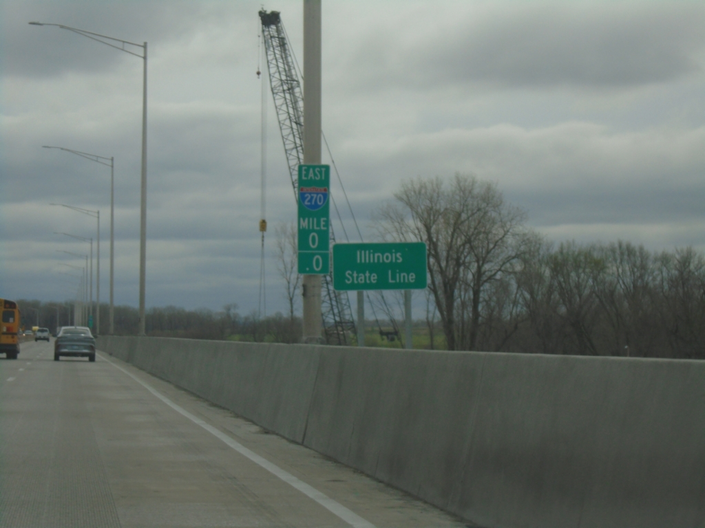
I-270 East - Illinois State Line
Illinois State Line on the Mississippi River bridge. Milemarker 0.0.
Taken 03-27-2026
 Madison
 County
Illinois
United States
Madison
Madison County
Illinois
United States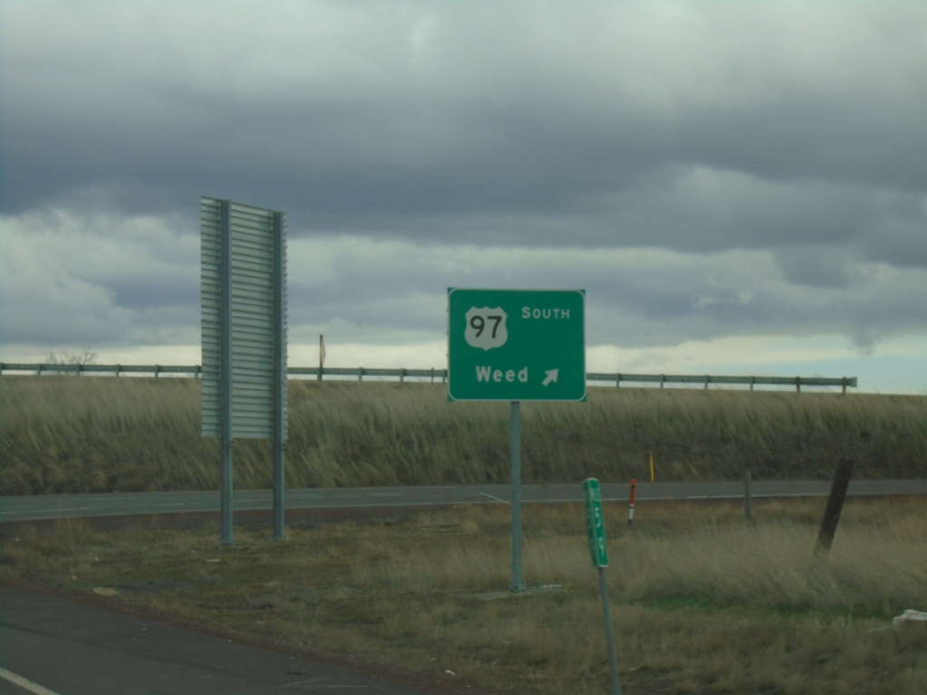
OR-66/OR-140 East at US-97 South
OR-66/OR-140 East at US-97 South to Weed (California).
Taken 02-15-2026

 Klamath Falls
Klamath County
Oregon
United States
Klamath Falls
Klamath County
Oregon
United States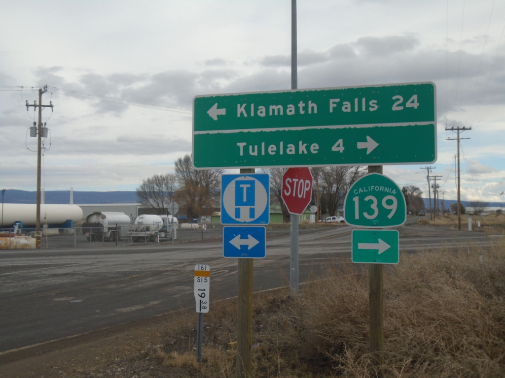
End CA-161 East at CA-139
End CA-161 East at CA-139. Turn right for CA-139 South to Tulelake; left for OR-39 North to Klamath Falls (Oregon). CA-161 runs along the stateline of Oregon and California.
Taken 02-15-2026

 Merrill
Klamath County
Oregon
United States
Merrill
Klamath County
Oregon
United States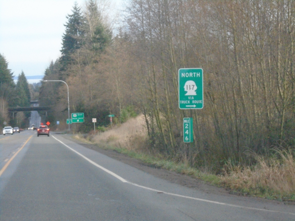
US-101 East Approaching WA-117 North
US-101 East approaching WA-117 North/(Tumwater) Truck Route in Port Angeles.
Taken 12-23-2025

 Port Angeles
Clallam County
Washington
United States
Port Angeles
Clallam County
Washington
United States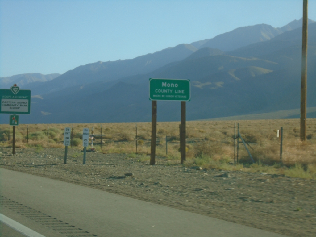
US-6 East - Mono County
Mono County Line on US-6 East.
Taken 07-22-2025
 Chalfant
Mono County
California
United States
Chalfant
Mono County
California
United States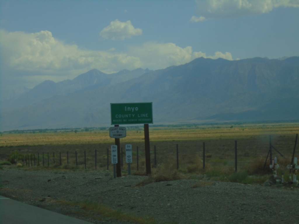
US-6 West - Inyo County Line
Inyo County Line on US-6 west. US-6 is part of the Grand Army of the Republic Highway. Taken at the Mono-Inyo county line.
Taken 07-20-2025
Bishop
Inyo County
California
United States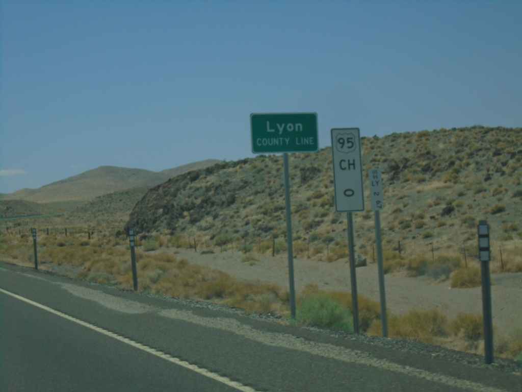
US-95 South - Lyon County
Lyon County Line on US-95 South. Mile 0 US-95 Churchill (CH) County. US-95 runs through a short 2 mile stretch of Lyon County.
Taken 07-20-2025
 Fallon
Churchill County
Nevada
United States
Fallon
Churchill County
Nevada
United States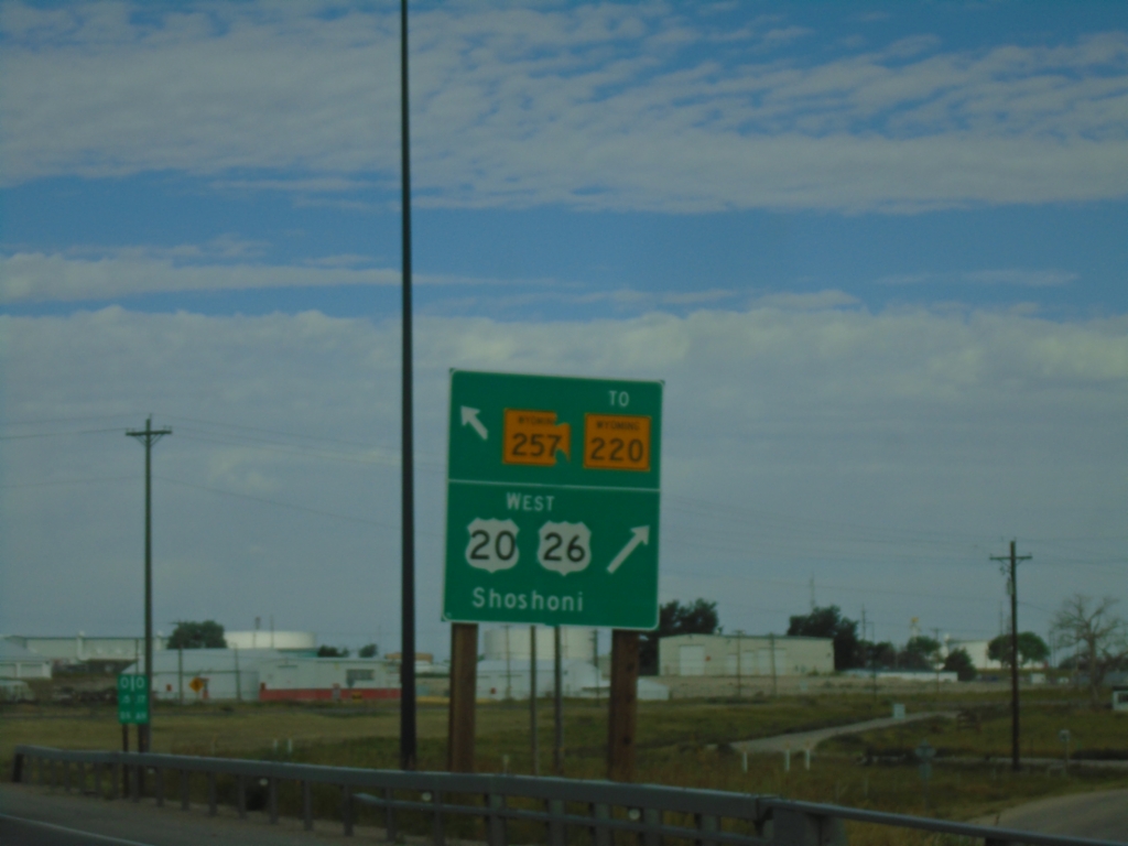
US-20/US-26 West at WY-257/To WY-220
US-20/US-26 West at WY-257/To WY-220 (Casper West Belt Loop) and Bus. US-20/Bus. US-26 (not signed). Turn right to continue west on US-20/US-26 to Shoshoni.
Taken 07-04-2025


 Casper
Natrona County
Wyoming
United States
Casper
Natrona County
Wyoming
United States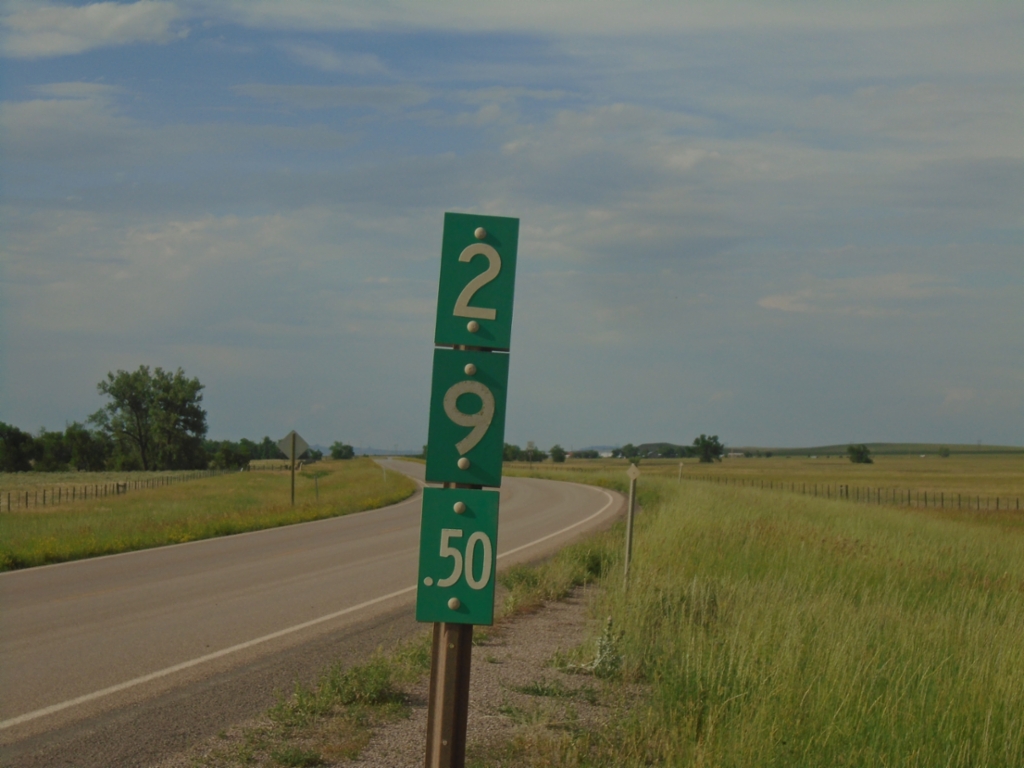
WY-112 North - Milemarker
Milemarker 29.5 on WY-112 at the Wyoming-Montana State Line. Looking north into Montana in this photograph.
Taken 07-03-2025
 Crook County
Wyoming
United States
Crook County
Wyoming
United States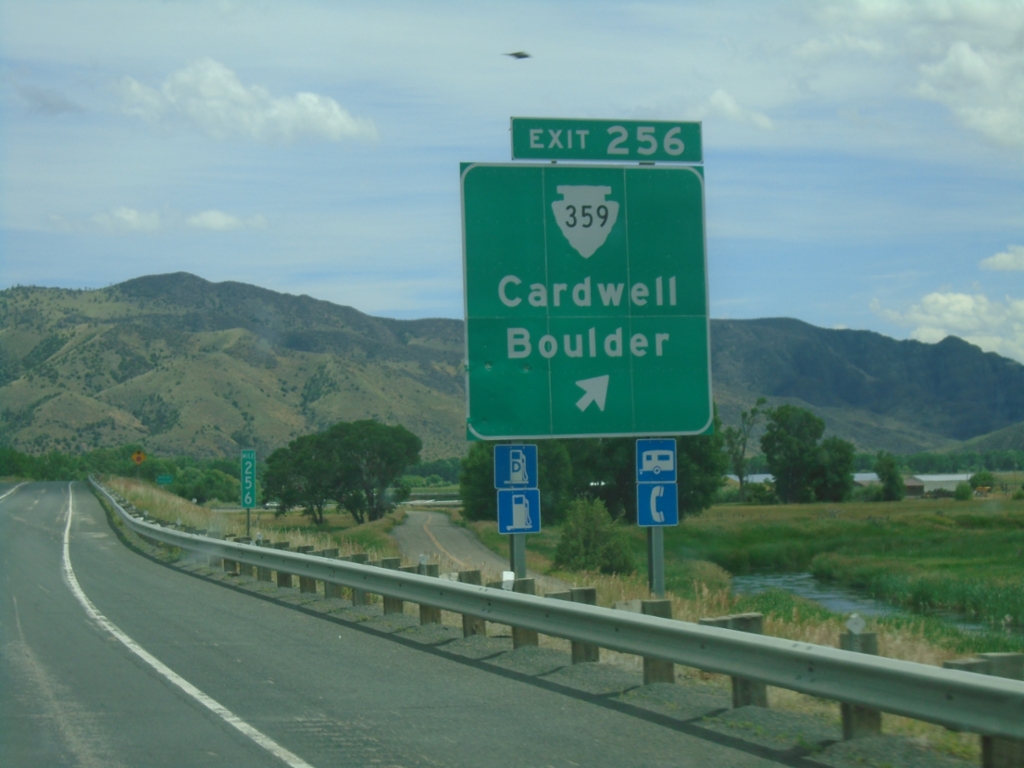
I-90 East - Exit 256
I-90 east at Exit 256 - MTS-359/Cardwell/Boulder.
Taken 06-28-2025

 Whitehall
Jefferson County
Montana
United States
Whitehall
Jefferson County
Montana
United States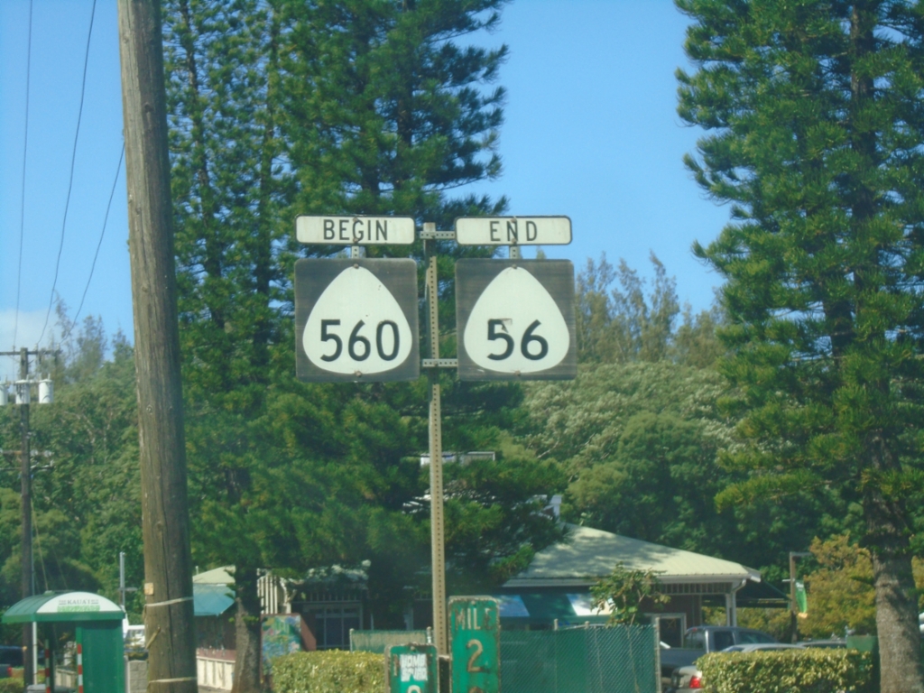
End HI-56/Begin HI-560 - Princeville
End HI-56/Begin HI-560 in Princeville. Both routes are part of the Kūhiō Highway.
Taken 02-20-2025

 Princeville
Kauai County
Hawaii
United States
Princeville
Kauai County
Hawaii
United States