Signs Tagged With Milemarker
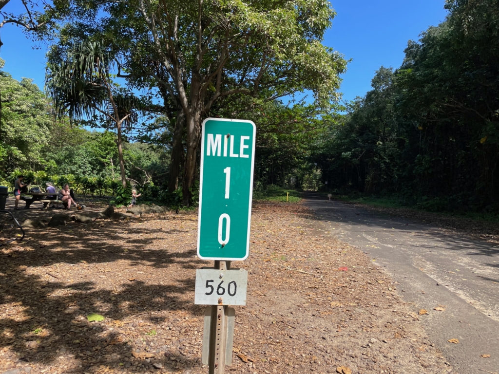
Mile 10 - Begin/End of HI-560
Mile 10 - HI-560 in Ha’ena State Park. The mile markers in Hawaii have the route number listed on a separate sign at the bottom of the mile marker assembly. This is the end/beginning of HI-560 and is the end of the road system on the northwest side of the island of Kauaʻi.
Taken 02-19-2025
 Haena
Kauai County
Hawaii
United States
Haena
Kauai County
Hawaii
United States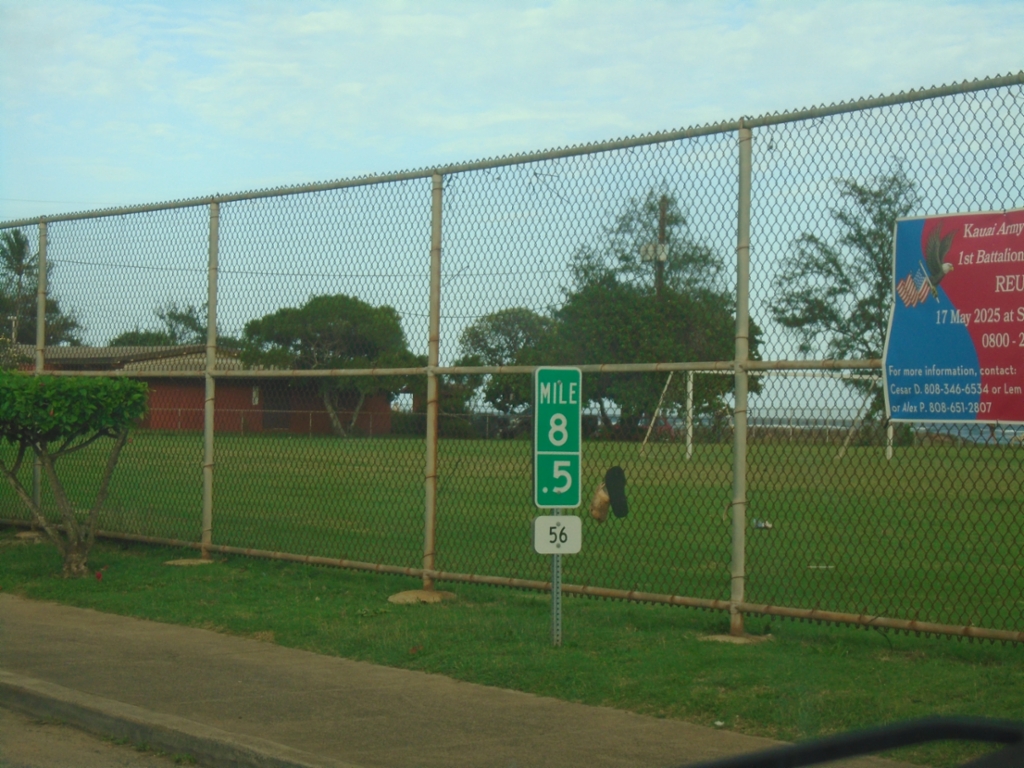
HI-56 North - Milemarker
Mile 8.5 on HI-56 North (Kūhiō Highway) in Kapa’a.
Taken 02-18-2025
 Kapaʻa
Kauai County
Hawaii
United States
Kapaʻa
Kauai County
Hawaii
United States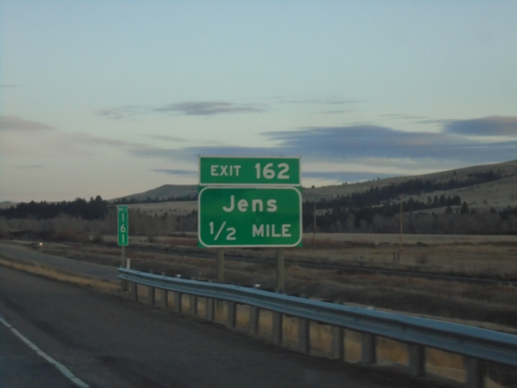
I-90 East - Exit 162
I-90 east approaching Exit 162 - Jens.
Taken 11-30-2024

 Goldcreek
Powell County
Montana
United States
Goldcreek
Powell County
Montana
United States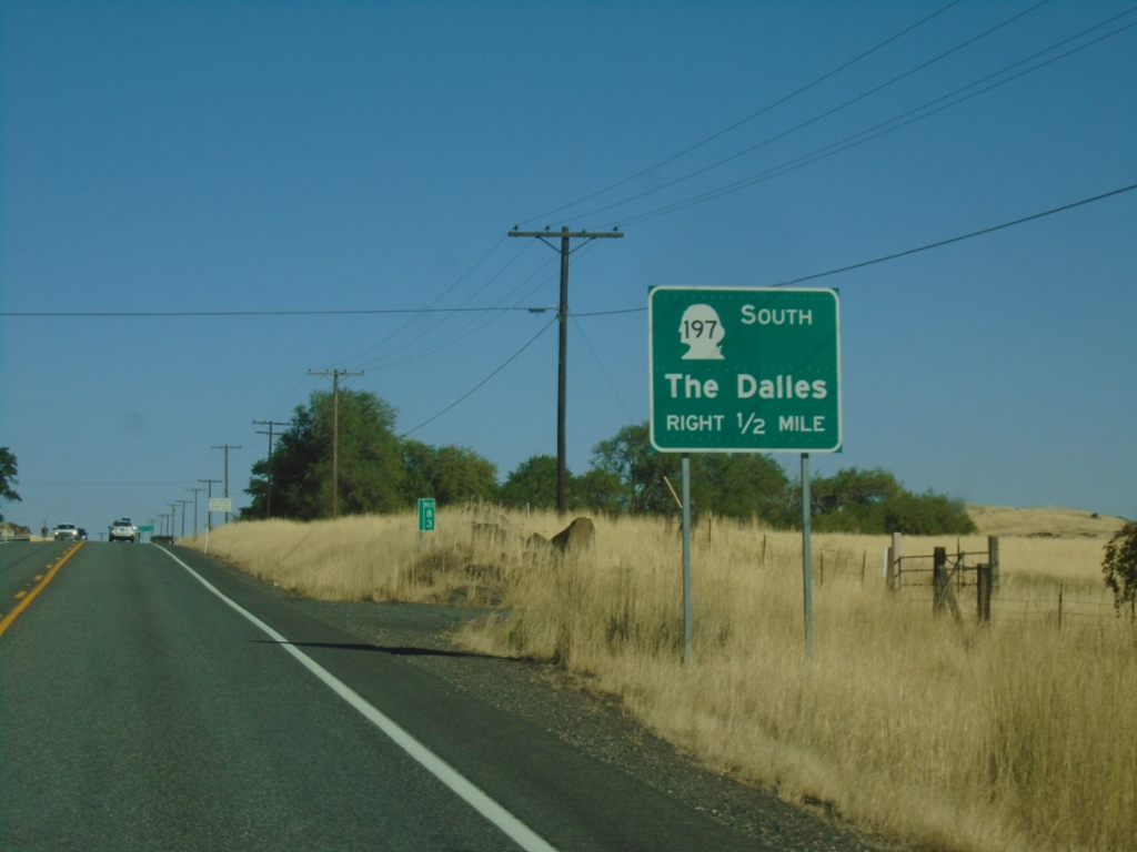
WA-14 East Approaching US-197
WA-14 East approaching US-197 south to The Dalles (OR). The US-197 shield is incorrectly displayed as a Washington state highway shield.
Taken 09-28-2024

 Lyle
Klickitat County
Washington
United States
Lyle
Klickitat County
Washington
United States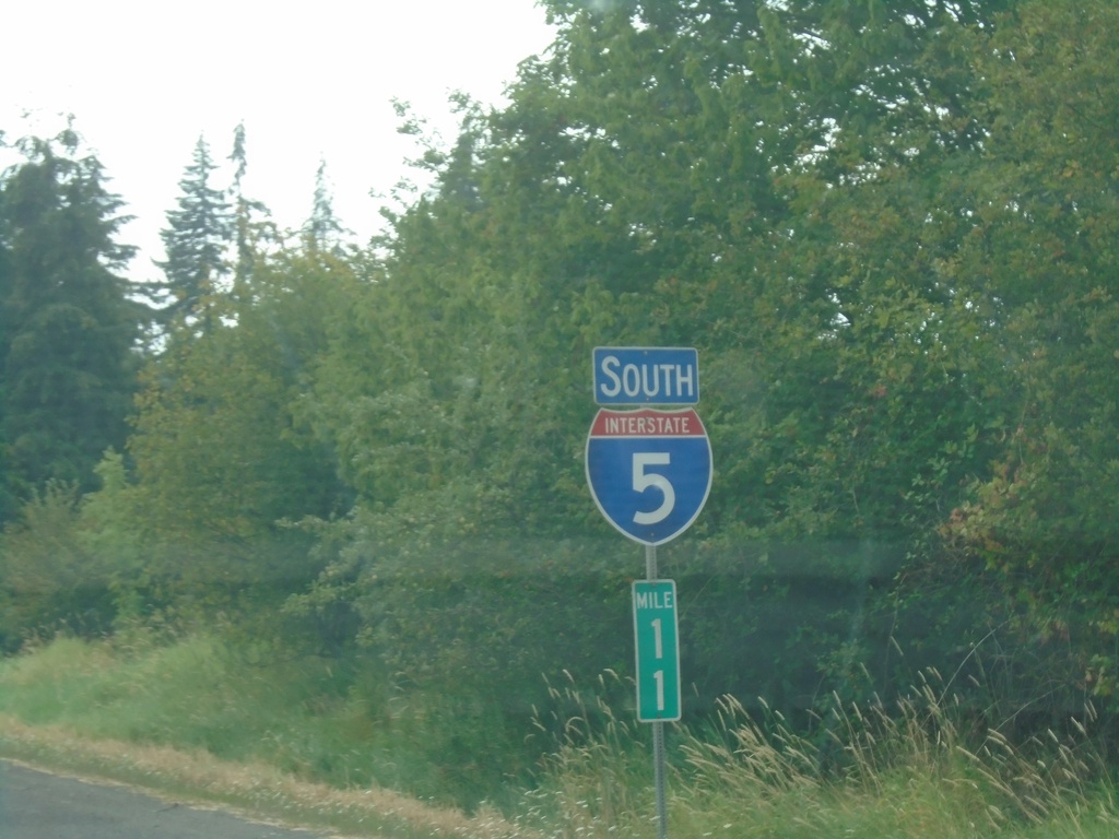
I-5 South - Clark County
I-5 South / Mile 11 in Clark County.
Taken 08-09-2024
 Ridgefield
Clark County
Washington
United States
Ridgefield
Clark County
Washington
United States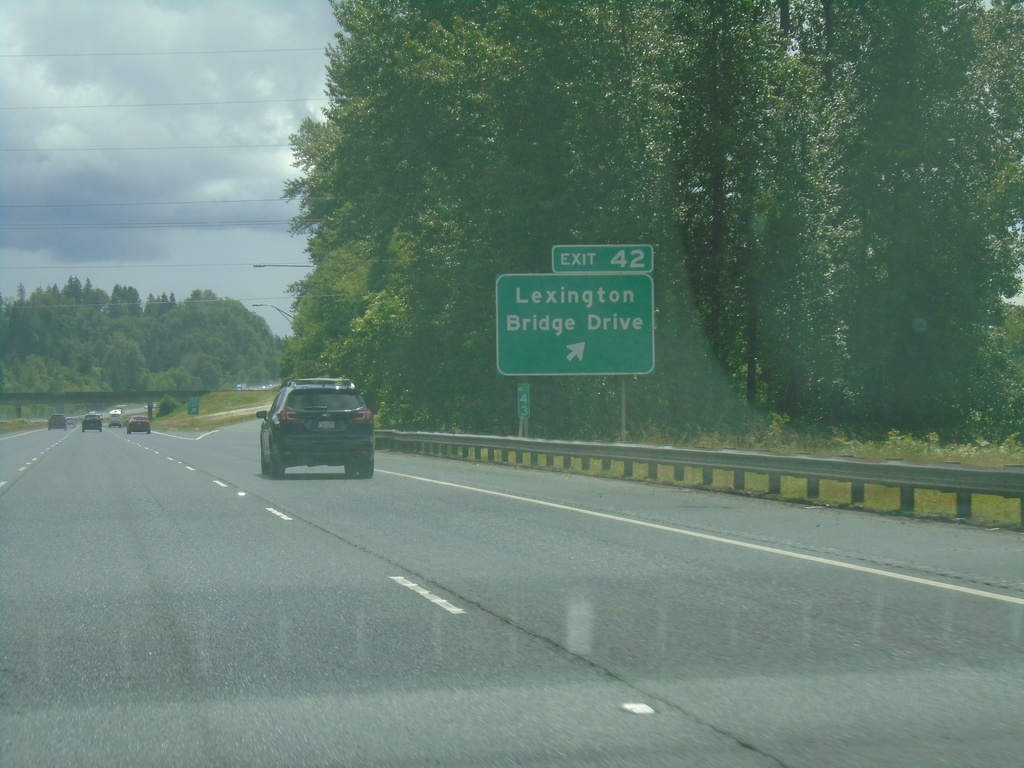
I-5 South - Exit 42
I-5 south at Exit 42 - Lexington Bridge Drive.
Taken 06-15-2024
Kelso
Cowlitz County
Washington
United States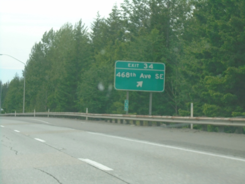
I-90 West - Exit 34
I-90 west at Exit 34 - 468th Ave SE
Taken 06-13-2024
North Bend
King County
Washington
United States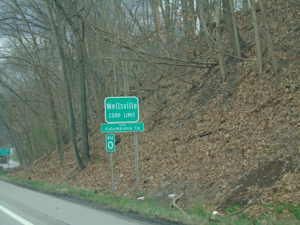
OH-7 North - Enter Columbiana County / Wellsville
OH-7 North - Enter Columbiana County / Wellsville Corporation Limit.
Taken 04-01-2024
 Wellsville
Columbiana County
Ohio
United States
Wellsville
Columbiana County
Ohio
United States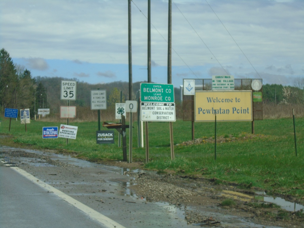
OH-7 North - Enter Belmont County
Enter Belmont County/Leave Monroe County on OH-7 North. Welcome to Powhatan Point.
Taken 04-01-2024
Powhatan Point
Belmont County
Ohio
United States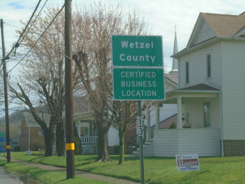
WV-2 North - Wetzel County
Entering Wetzel County on WV-2 North.
Taken 04-01-2024
 Paden City
Wetzel County
West Virginia
United States
Paden City
Wetzel County
West Virginia
United States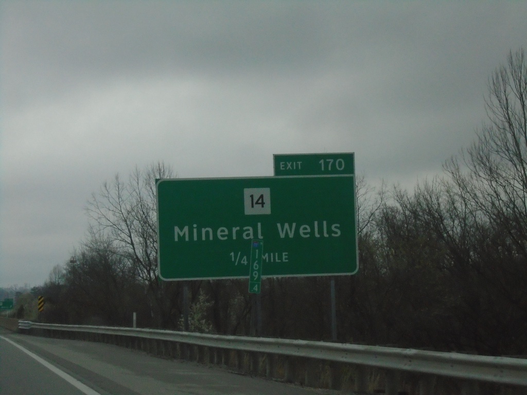
I-77 North - Exit 170
I-77 north approaching Exit 170 - WV-14/Mineral Wells.
Taken 04-01-2024

 Mineral Wells
Wood County
West Virginia
United States
Mineral Wells
Wood County
West Virginia
United States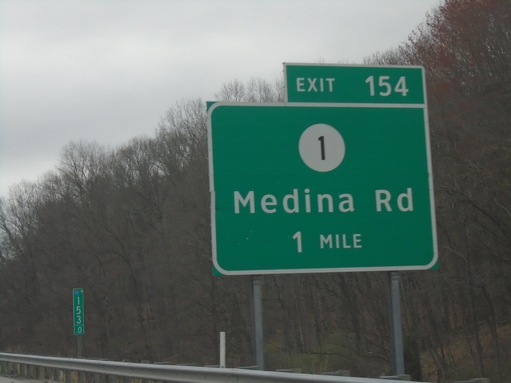
I-77 North - Exit 154
I-77 north approaching Exit 154 - WVCR-1/Medina Road.
Taken 04-01-2024
 Ravenswood
Jackson County
West Virginia
United States
Ravenswood
Jackson County
West Virginia
United States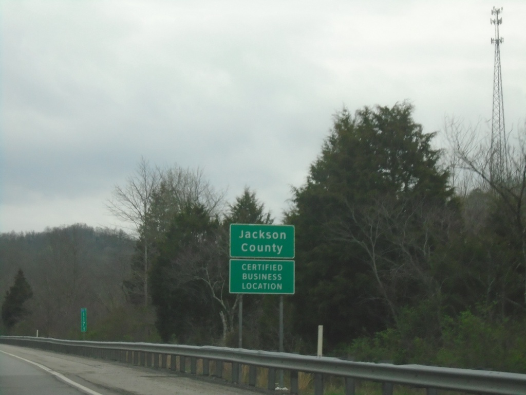
I-77 North - Jackson County
Entering Jackson County on I-77 North.
Taken 04-01-2024
Kenna
Jackson County
West Virginia
United States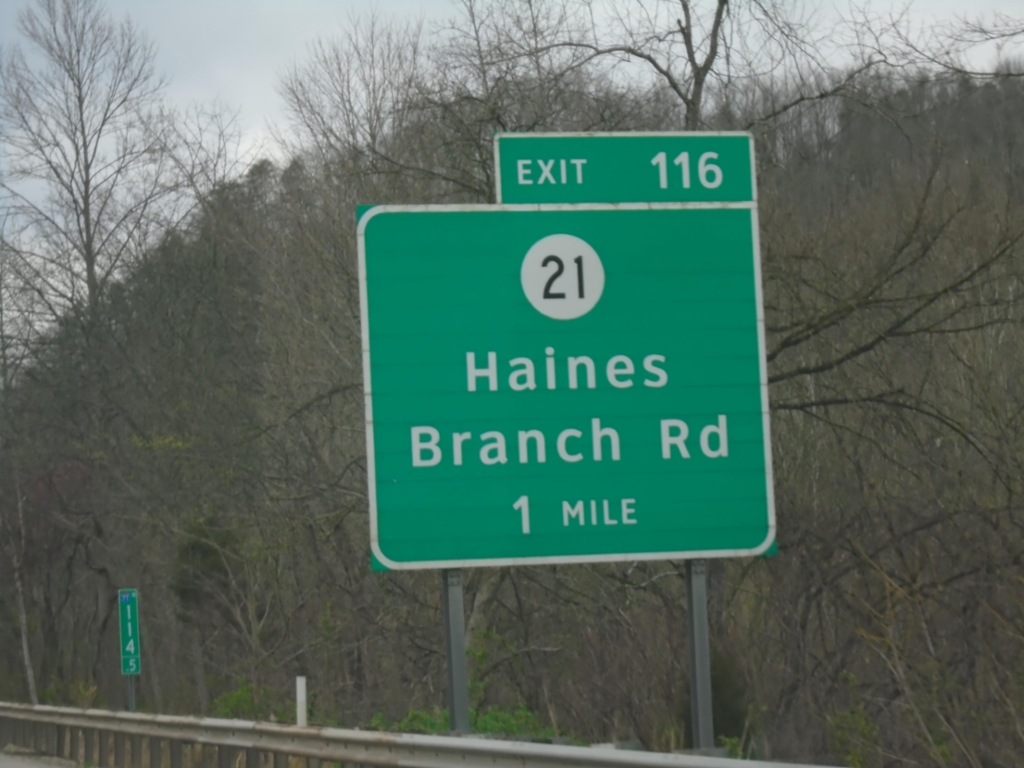
I-77 North - Exit 116
I-77 north approaching Exit 116 - WVCR-21/Haines Branch Road.
Taken 04-01-2024
 Charleston
Kanawha County
West Virginia
United States
Charleston
Kanawha County
West Virginia
United States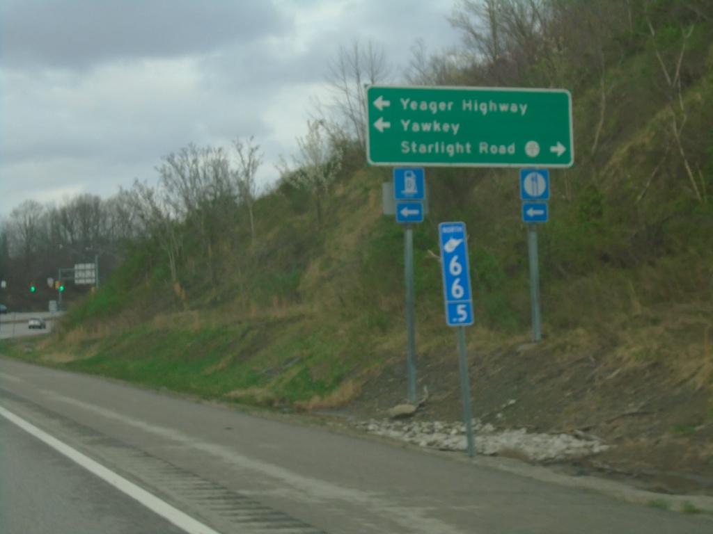
US-119 North at Yeager Highway Junction
US-119 North at Yeager Highway junction. Turn left To WV-214, Yeager Highway, and Yawkey. Turn right for WVCR-119/6 / Starlight Road. Blue mile marker is used for Appalachian Corridor highways. US-119 is part of Corridor G.
Taken 03-31-2024


 Alum Creek
Lincoln County
West Virginia
United States
Alum Creek
Lincoln County
West Virginia
United States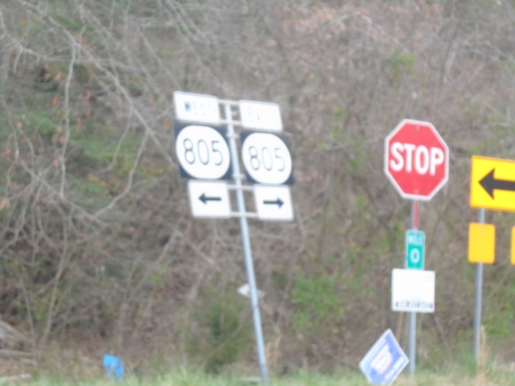
End KY-197 West at KY-805
End KY-197 West at KY-805 at Shelby Gap.
Taken 03-31-2024

 Jenkins
Pike County
Kentucky
United States
Jenkins
Pike County
Kentucky
United States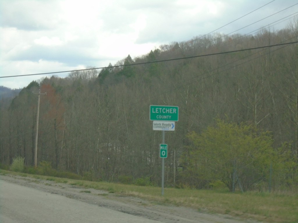
US-119 North - Letcher County
Entering Letcher County on US-119 North. The mile markers in Kentucky reset at county lines, on non interstate highways.
Taken 03-31-2024
Cumberland
Letcher County
Kentucky
United States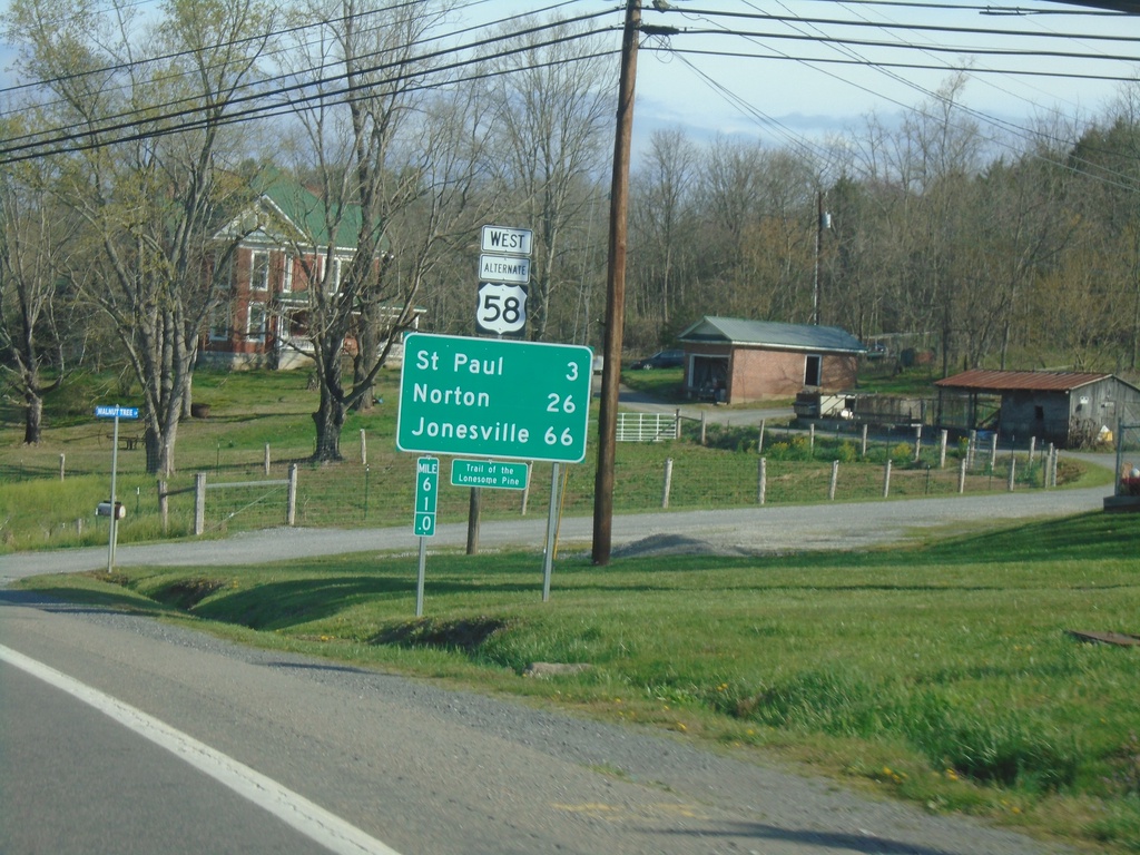
Alt. US-58 West - Distance Marker
Distance marker on Alt. US-58 West. Distance to St Paul, Norton, and Jonesville.
Taken 03-31-2024
 Castlewood
Russell County
Virginia
United States
Castlewood
Russell County
Virginia
United States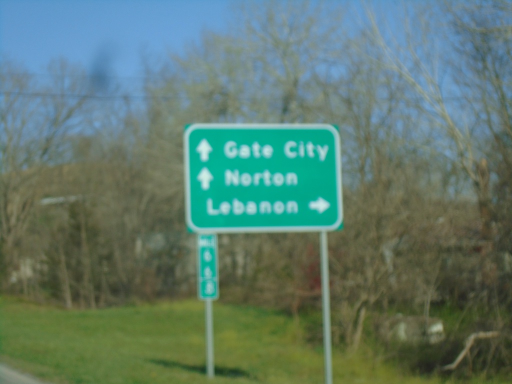
Alt. US-58 West at VA-71
Alt. US-58 West at VA-71. Use VA-71 North to Lebanon. Continue west on Alt. US-58 West/VA-71 South to Gate City and Norton.
Taken 03-31-2024
 Castlewood
Russell County
Virginia
United States
Castlewood
Russell County
Virginia
United States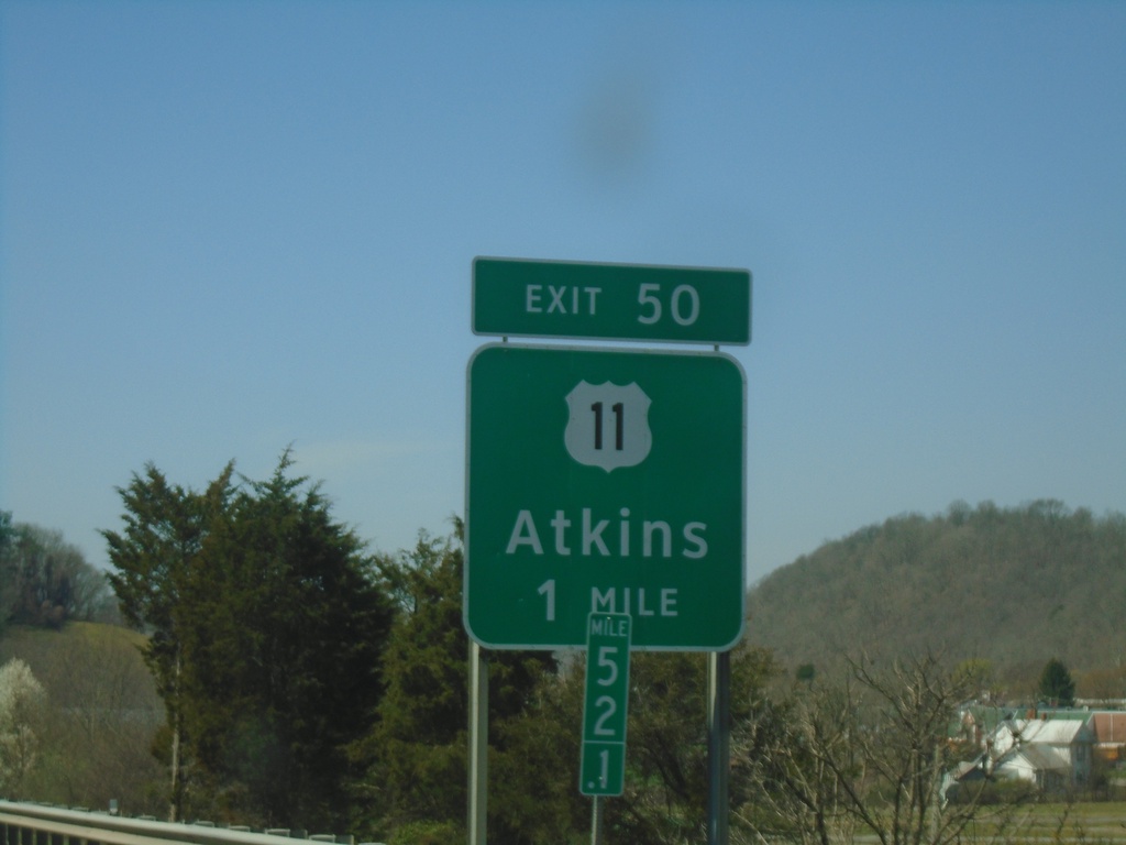
I-81 South - Exit 50
I-81 south approaching Exit 50 - US-11/Atkins.
Taken 03-30-2024


 Marion
Smyth County
Virginia
United States
Marion
Smyth County
Virginia
United States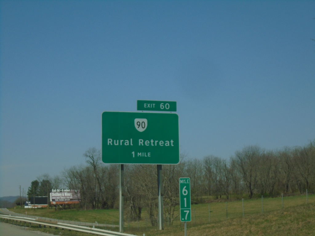
I-81 South - Exit 60
I-81 south approaching Exit 60 - VA-90/Rural Retreat
Taken 03-30-2024
 Rural Retreat
Wythe County
Virginia
United States
Rural Retreat
Wythe County
Virginia
United States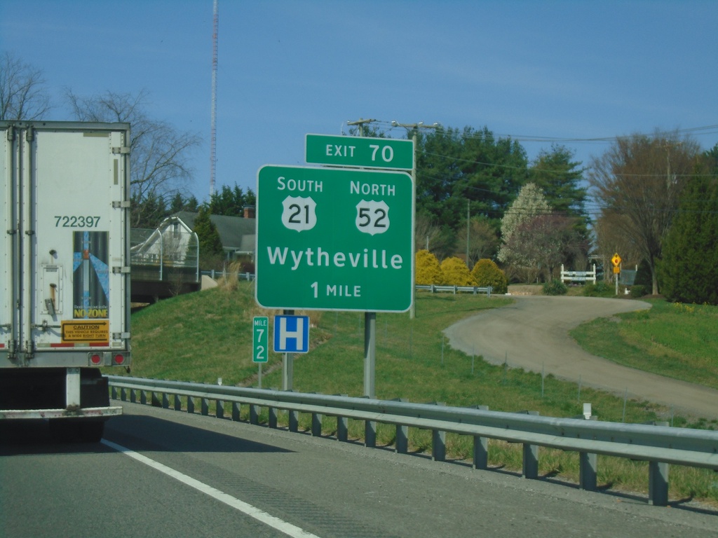
I-81 South - Exit 70
I-81 south approaching Exit 70 - US-52 North/US-21 South/Wytheville.
Taken 03-30-2024

 Wytheville
Wythe County
Virginia
United States
Wytheville
Wythe County
Virginia
United States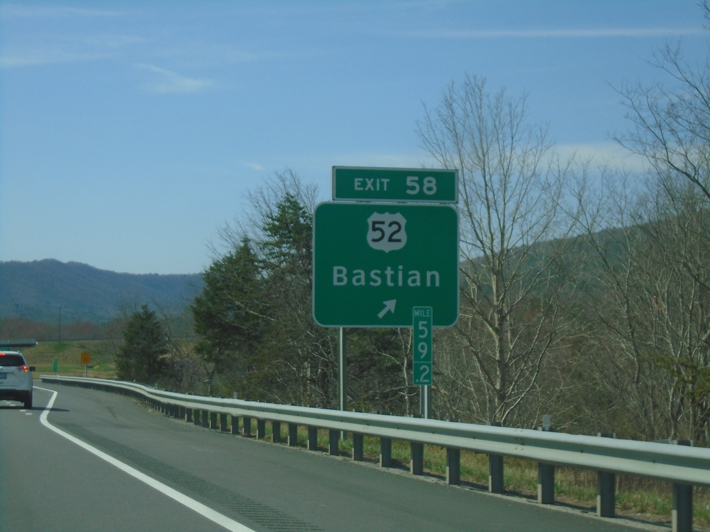
I-77 South - Exit 58
I-77 south at Exit 58 - US-52/Bastian.
Taken 03-30-2024
Bastian
Bland County
Virginia
United States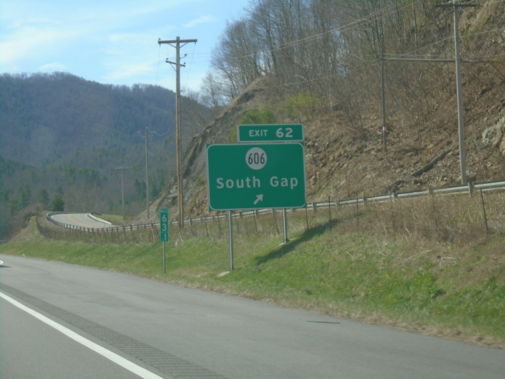
I-77 South - Exit 62
I-77 south at Exit 62 - VAS-606/South Gap.
Taken 03-30-2024
 Bastian
Bland County
Virginia
United States
Bastian
Bland County
Virginia
United States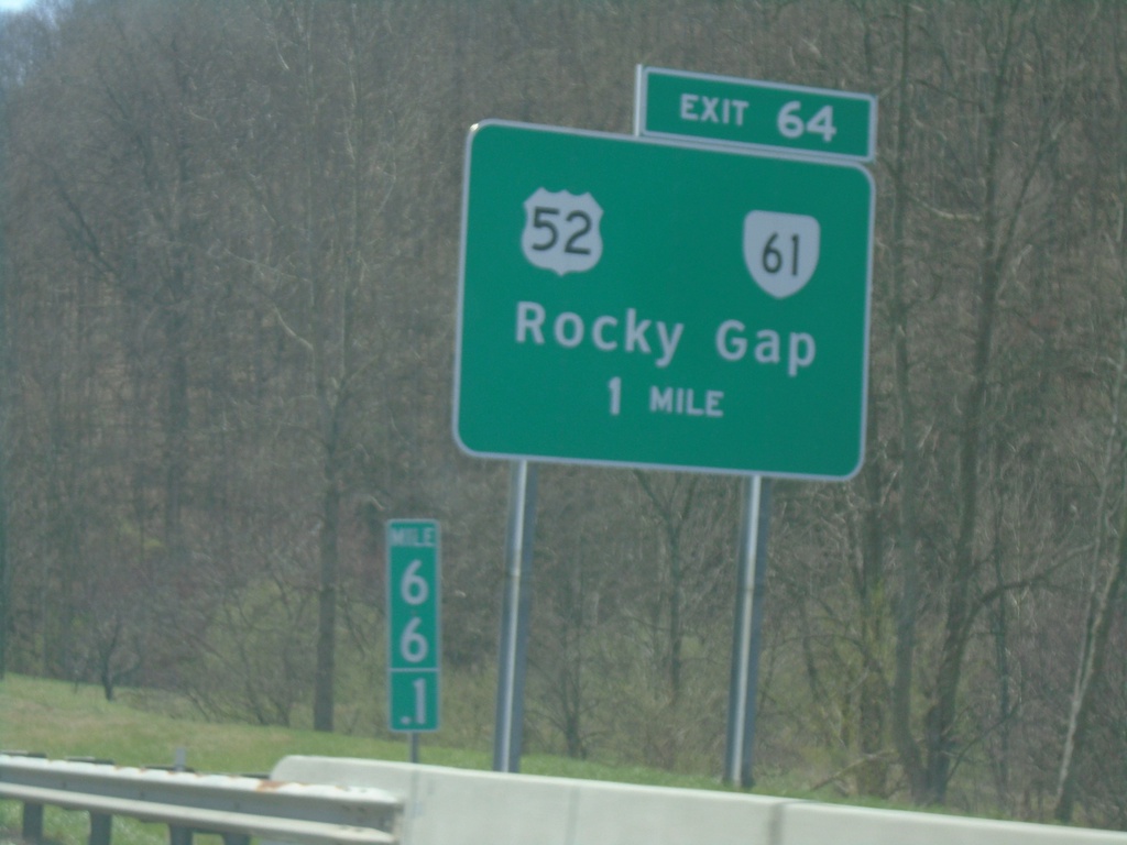
I-77 South - Exit 64
I-77 south approaching Exit 64 - US-52/VA-61/Rocky Gap.
Taken 03-30-2024
 Rocky Gap
Bland County
Virginia
United States
Rocky Gap
Bland County
Virginia
United States