Signs Tagged With Milemarker
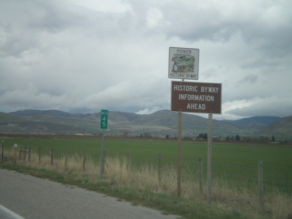
US-91 North - Historic Byway Information
Pioneer Historic Byway information on US-91 north approaching the Idaho State line. Pioneer Historic Byway is within the state of Idaho.
Taken 05-01-2010
 Cove
Cache County
Utah
United States
Cove
Cache County
Utah
United States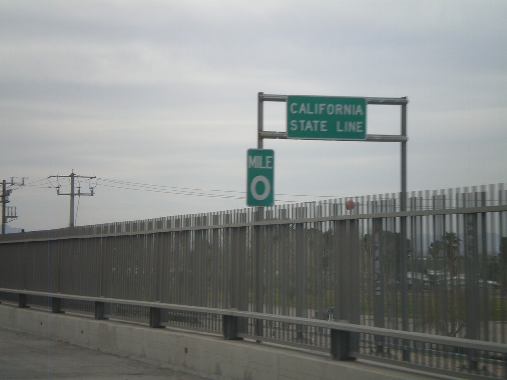
I-10 West - California State Line
California State Line on I-10 west crossing the Colorado River, at the Arizona-California Border.
Taken 03-22-2010

 Blythe
Riverside County
California
United States
Blythe
Riverside County
California
United States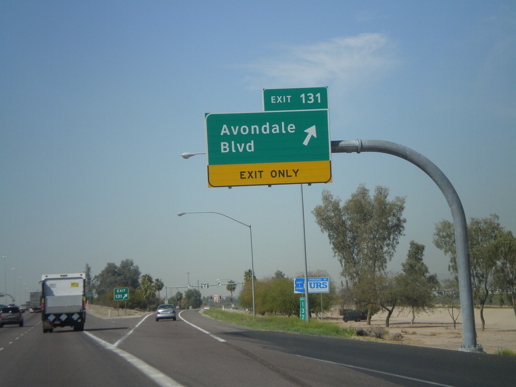
I-10 West - Exit 131
I-10 west at Exit 131 - Avondale Blvd
Taken 03-22-2010
Avondale
Maricopa County
Arizona
United States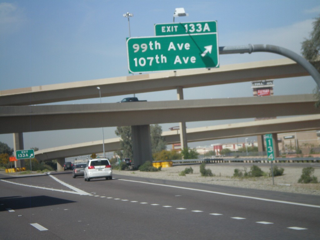
I-10 West at Exit 133A
I-10 west at Exit 133A - 99th Ave/107th Ave
Taken 03-22-2010
Tolleson
Maricopa County
Arizona
United States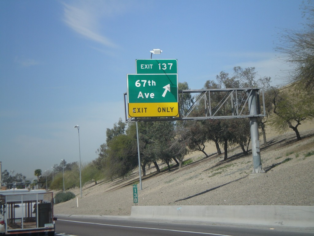
I-10 West - Exit 137
I-10 west at Exit 137 - 67th Ave.
Taken 03-22-2010
Phoenix
Maricopa County
Arizona
United States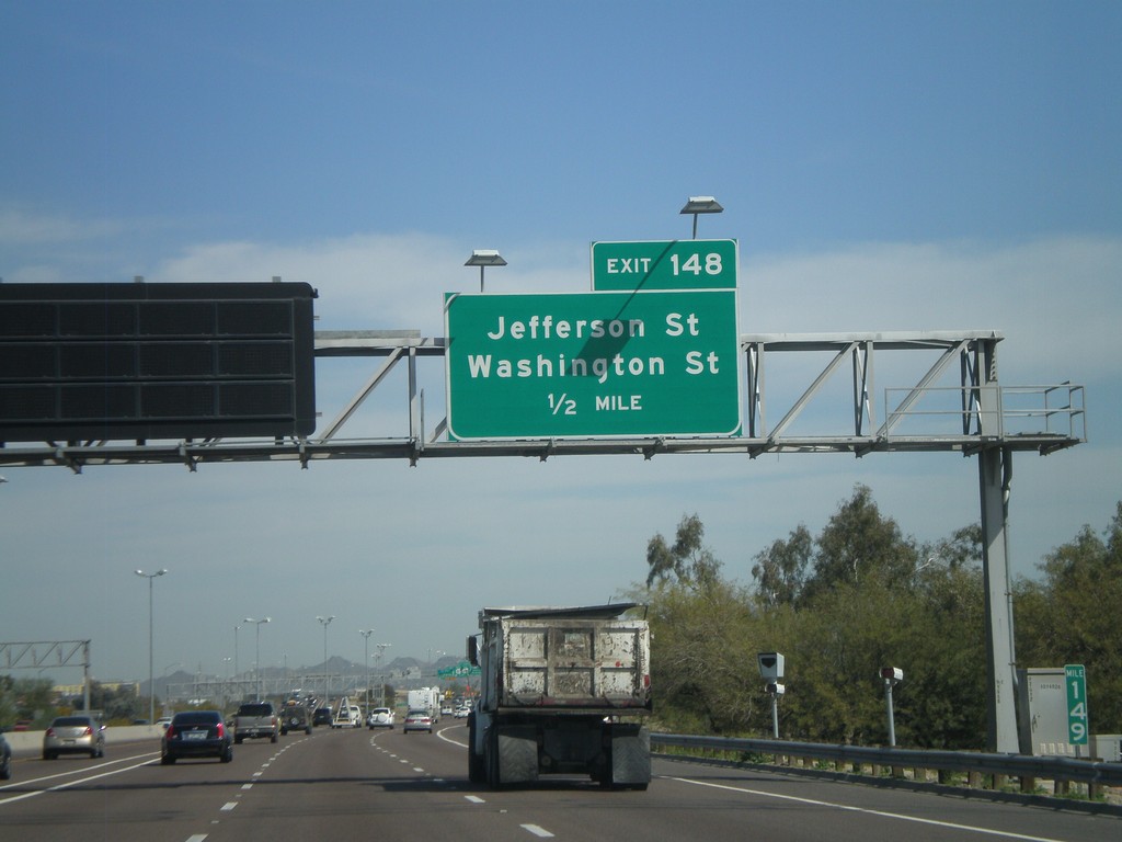
I-10 West Approaching Exit 148
I-10 west approaching Exit 148 - Jefferson St./Washington St.
Taken 03-22-2010
Phoenix
Maricopa County
Arizona
United States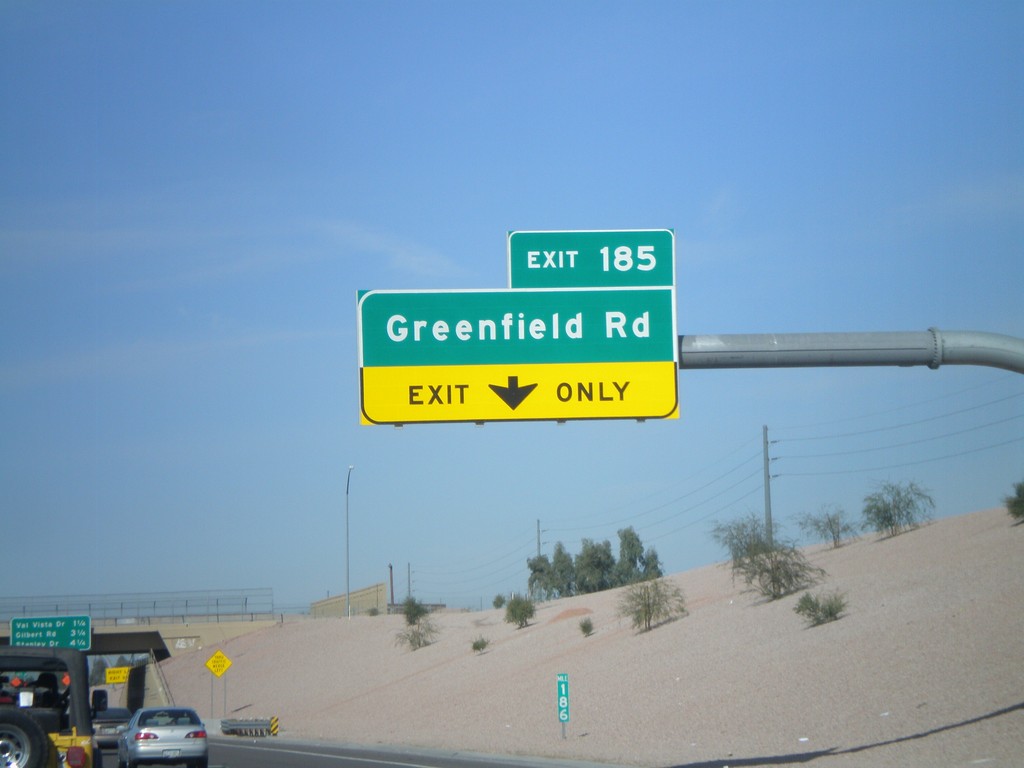
US-60 West - Exit 185
US-60 west at Exit 185 - Greenfield Road
Taken 03-22-2010
 Mesa
Maricopa County
Arizona
United States
Mesa
Maricopa County
Arizona
United States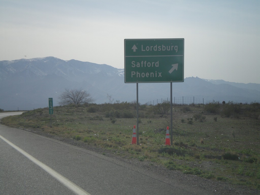
US-191 South Approaching US-70
US-191 south approaching US-70. Use US-70 West/US-191 South for Safford and Phoenix. Use US-70 east for Lordsburg (NM).
Taken 03-21-2010

 San Jose
Graham County
Arizona
United States
San Jose
Graham County
Arizona
United States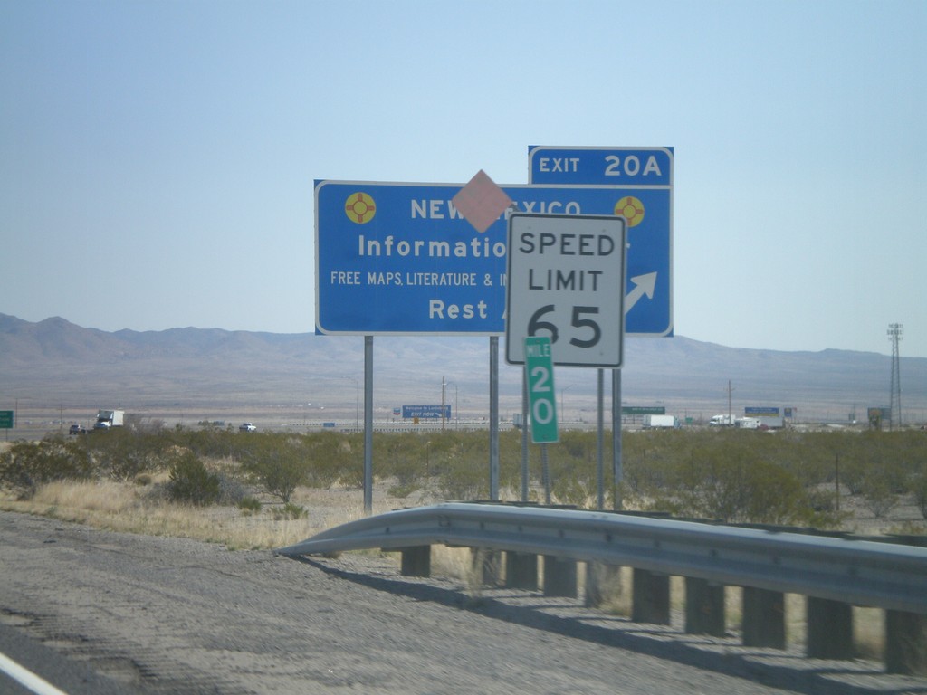
I-10 East - Exit 20A
I-10 west at Exit 20A - New Mexico Information Center/Rest Area. Speed limit drops from 75 MPH to 65 MPH as I-10 enters Lordsburg.
Taken 03-21-2010
Lordsburg
Hidalgo County
New Mexico
United States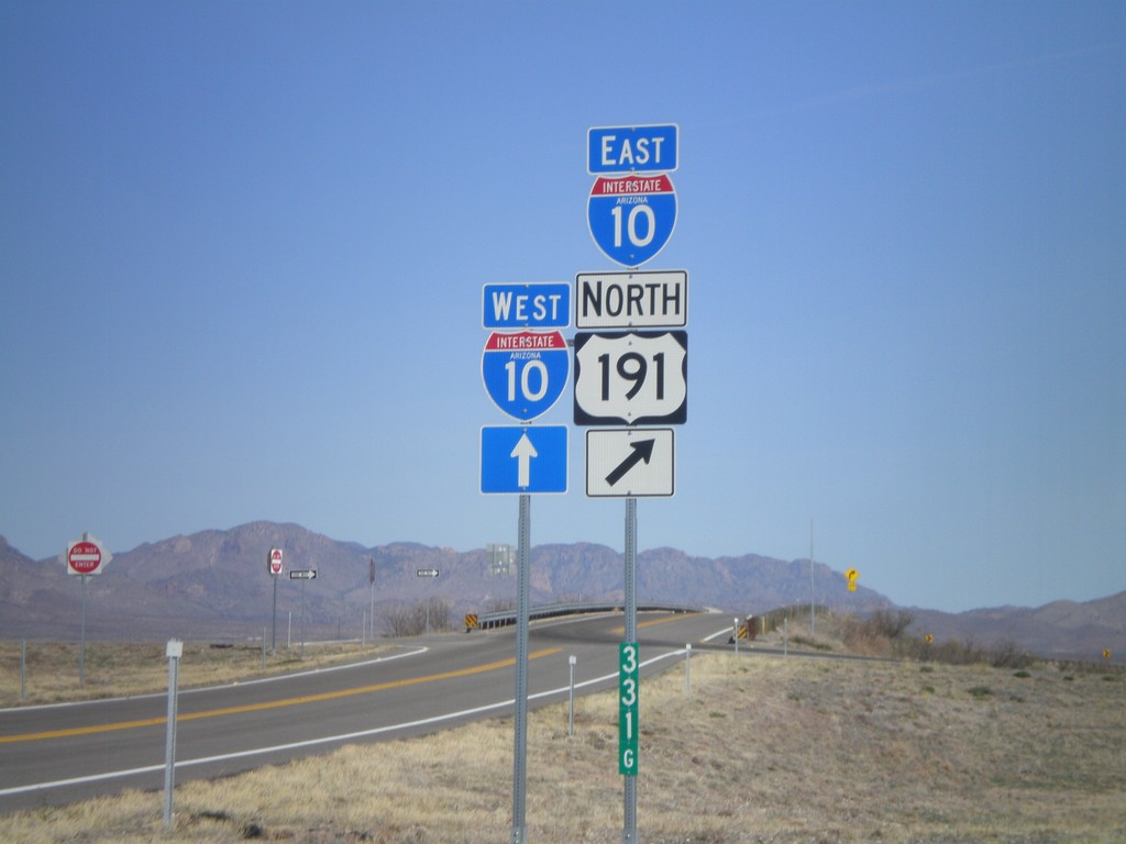
US-191 North at I-10
US-191 north at I-10, Exit 331 onramp. US-191 joins I-10 eastbound.
Taken 03-21-2010
Cochise
Cochise County
Arizona
United States