Signs Tagged With Milemarker
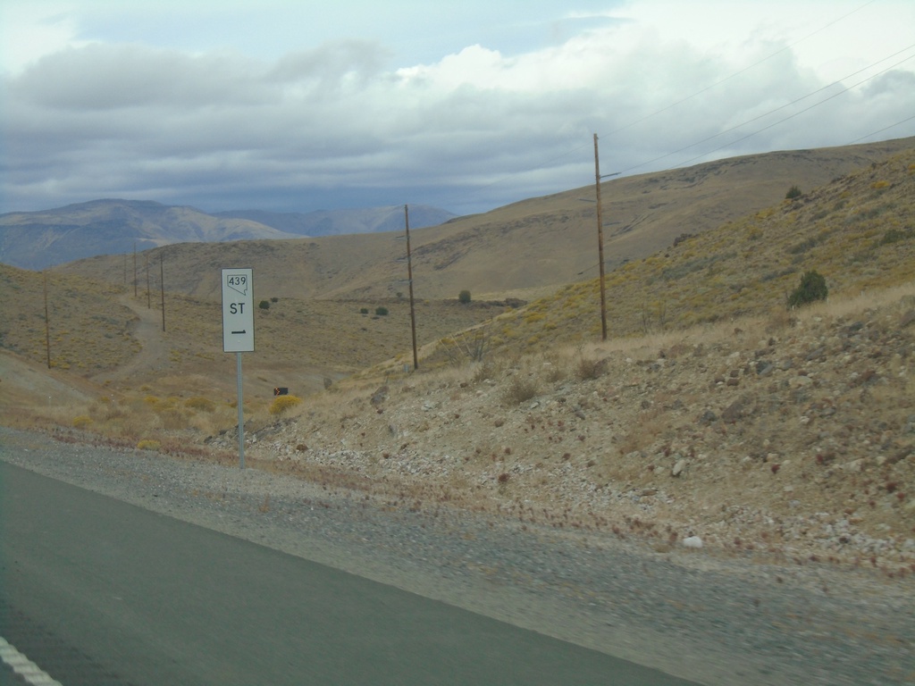
NV-439 North - Mile 1
Storey County Mile 1 on NV-439 North. This type of postmile sign is being rolled out across Nevada. The new style are larger and have the route shield in it.
Taken 10-19-2019
 Fernley
Lyon County
Nevada
United States
Fernley
Lyon County
Nevada
United States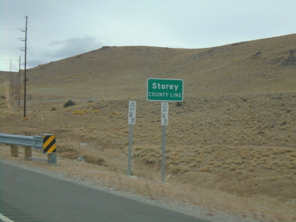
NV-439 North - Storey County
Storey County Line on NV-439 north.
Taken 10-19-2019
Silver Springs
Storey County
Nevada
United States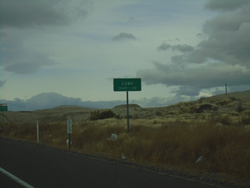
Alt. US-50 West - Lyon County
Lyon County Line on Alt. US-50 West
Taken 10-19-2019
 Fernley
Lyon County
Nevada
United States
Fernley
Lyon County
Nevada
United States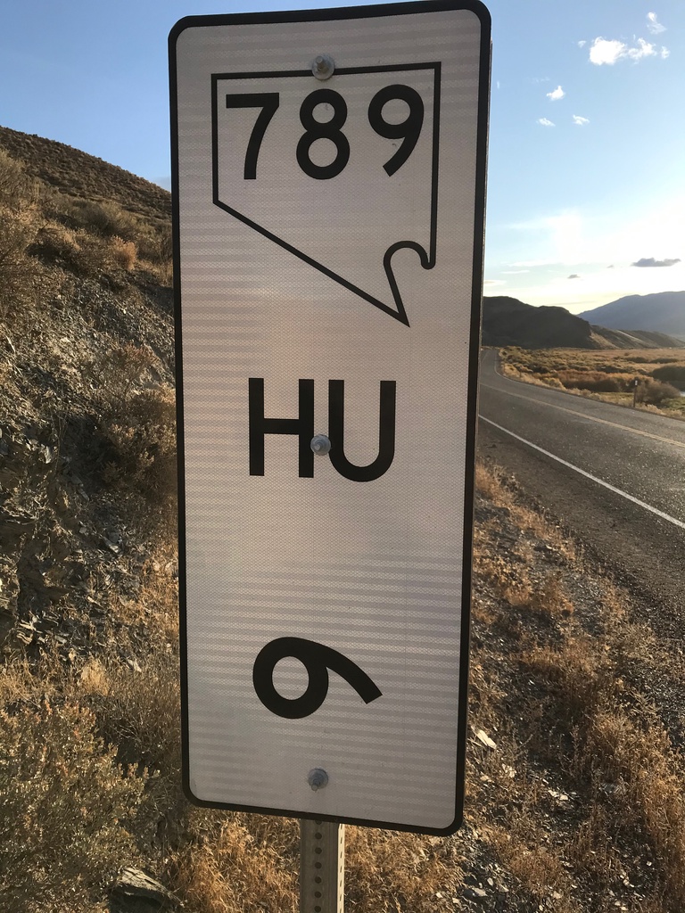
NV-789 - Postmile 6
NV-789 - Humboldt County Postmile 6
Taken 10-18-2019
 Golconda
Humboldt County
Nevada
United States
Golconda
Humboldt County
Nevada
United States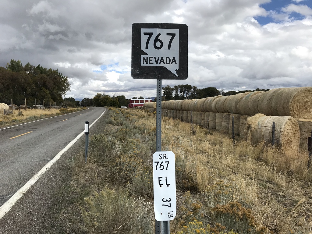
Begin NV-767 North
Begin NV-767 North in the Ruby Valley. Milepost 37.18 Elko County.
Taken 09-28-2019
 Ruby Valley
Elko County
Nevada
United States
Ruby Valley
Elko County
Nevada
United States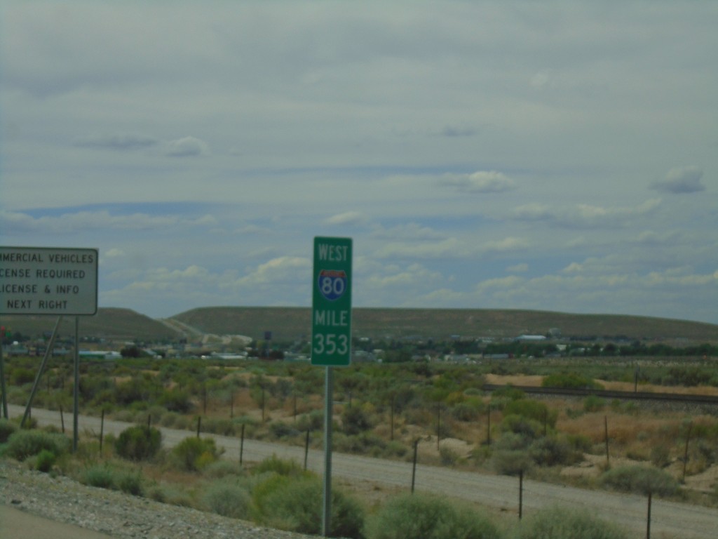
I-80 West - Mile 353
I-80 West - Mile 353. These types of mileposts with the route shield have been showing up more and more in Nevada recently.
Taken 08-03-2019


 Wells
Elko County
Nevada
United States
Wells
Elko County
Nevada
United States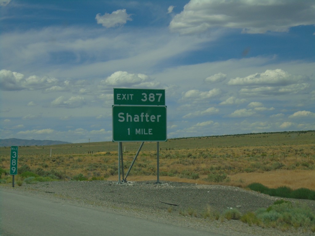
I-80 West - Exit 387
I-80 west approaching Exit 387 - Shafter. Taken at Milemarker 389.
Taken 08-03-2019
Montello
Elko County
Nevada
United States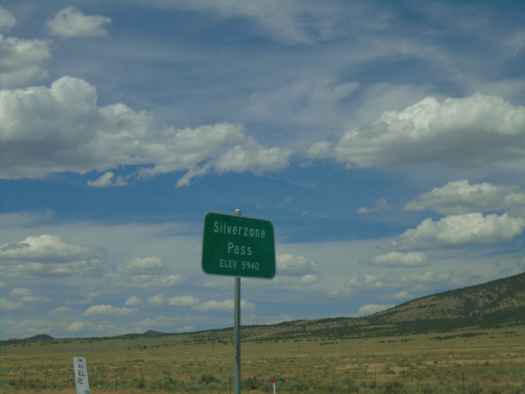
I-80 West - Silver Zone Pass
I-80 west at Silver Zone Pass. Elevation 5940 Feet.
Taken 08-03-2019
Montello
Elko County
Nevada
United States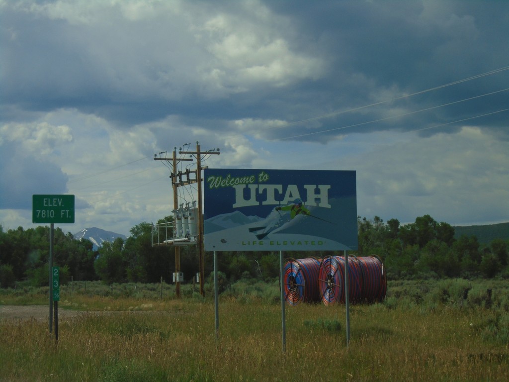
UT-150 South - Welcome To Utah
Welcome To Utah on UT-150 South. Elevation 7810 Feet. The mile marker of 23.56 is from Wyoming WY-150.
Taken 08-03-2019
 Coalville
Summit County
Utah
United States
Coalville
Summit County
Utah
United States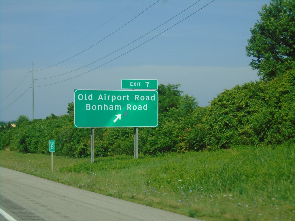
I-81 South - Exit 7
I-81 South at Exit 7 - Old Airport Road/Bonham Road.
Taken 06-24-2019

 Bristol
Virginia
United States
Bristol
Virginia
United States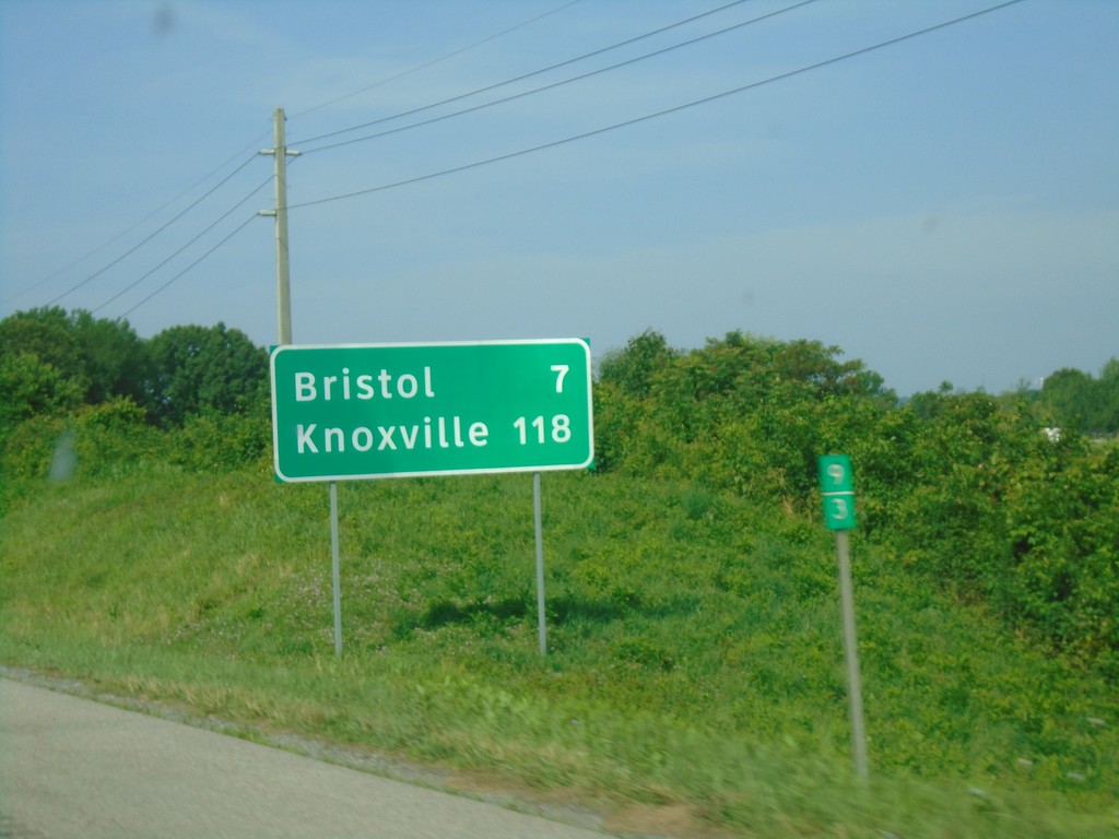
I-81 South - Distance Marker
Distance marker on I-81 south. Distance to Bristol and Knoxville (TN).
Taken 06-24-2019
Bristol
Washington County
Virginia
United States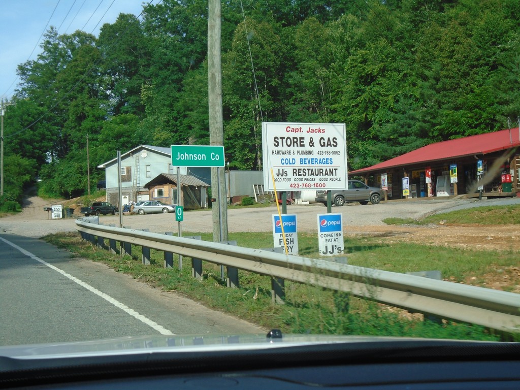
TN-67 East - Johnson County
Entering Johnson County on TN-67 east.
Taken 06-23-2019
 Butler
Johnson County
Tennessee
United States
Butler
Johnson County
Tennessee
United States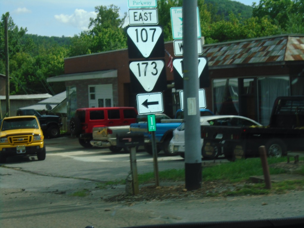
TNS-173 East at TNS-107
TNS-173 East at TNS-107. Turn left for TNS-173 East/TNS-107 East. Continue straight for TNS-107 West.
Taken 06-23-2019

 Unicoi
 County
Tennessee
United States
Unicoi
Unicoi County
Tennessee
United States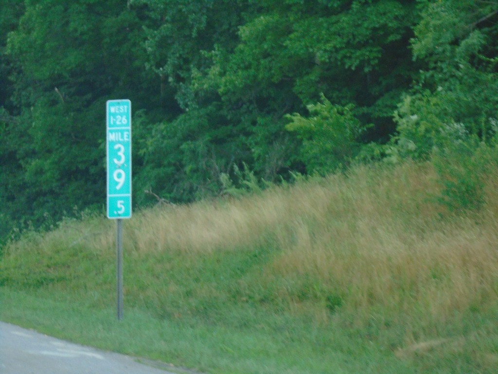
I-26 West - Milepost 39.5
I-26 west at Milepost 39.5
Taken 06-23-2019

 Arden
Buncombe County
North Carolina
United States
Arden
Buncombe County
North Carolina
United States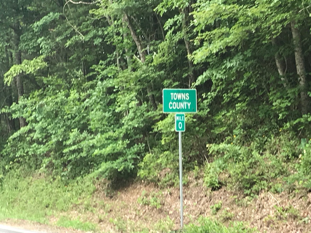
GA-180 East - Towns County
Towns County on GA-180 East at Milepost 0. The Mileposts in Georgia reset at each county line on state highways.
Taken 06-22-2019
 Blairsville
Union County
Georgia
United States
Blairsville
Union County
Georgia
United States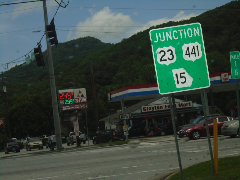
US-76/GA-2 East at US-23/US-441/GA-15 - Clayton
US-76/GA-2 East at US-23/US-441/GA-15 in Clayton. US-76/GA-2 East joins US-23/US-441/GA-15 South through Clayton.
Taken 06-22-2019


 Clayton
Rabun County
Georgia
United States
Clayton
Rabun County
Georgia
United States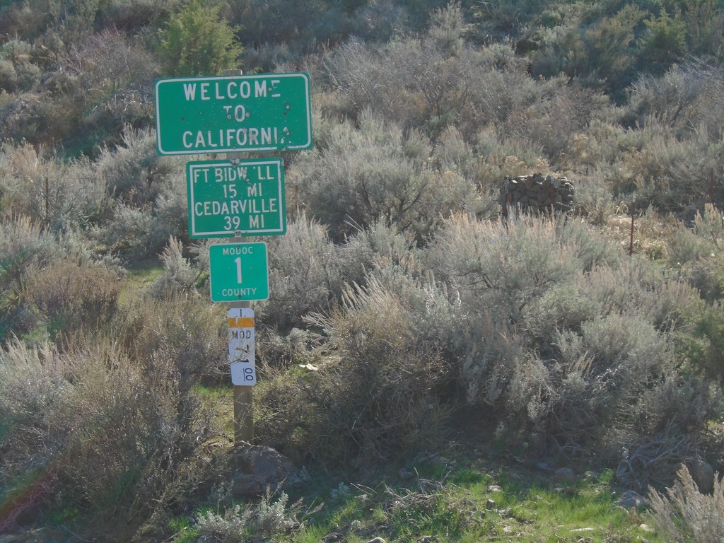
Entering California - Modoc County Highway 1
Entering California on Modoc County Highway 1 south. Distance to Fort Bidwell and Cedarville. Taken on the road between Adel, Oregon and Cedarville, California.
Taken 04-27-2019
 Adel
Modoc County
California
United States
Adel
Modoc County
California
United States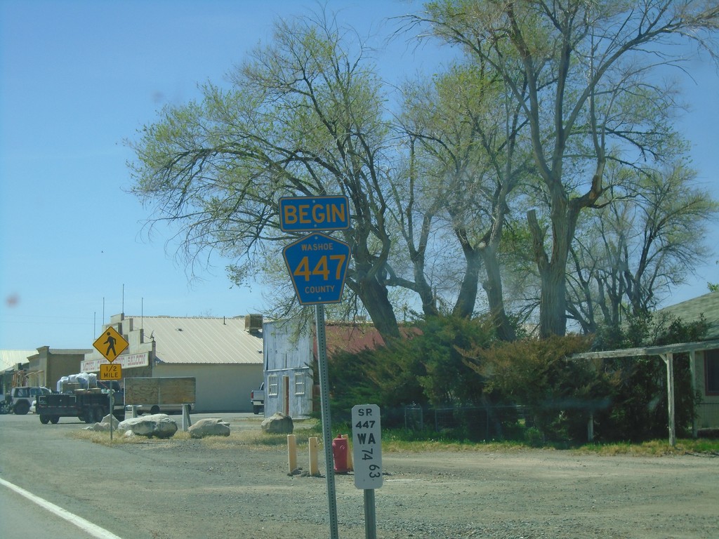
Begin Washoe County 447 - Gerlach
Begin Washoe County 447 in Gerlach. NV-447 northbound ends here.
Taken 04-27-2019

 Gerlach
Washoe County
Nevada
United States
Gerlach
Washoe County
Nevada
United States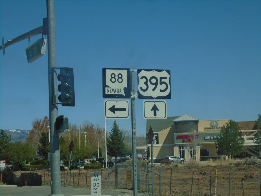
US-395 North at NV-88 - Minden
US-395 North at NV-88 in Minden. Turn left for NV-88 west.
Taken 04-27-2019

 Minden
Douglas County
Nevada
United States
Minden
Douglas County
Nevada
United States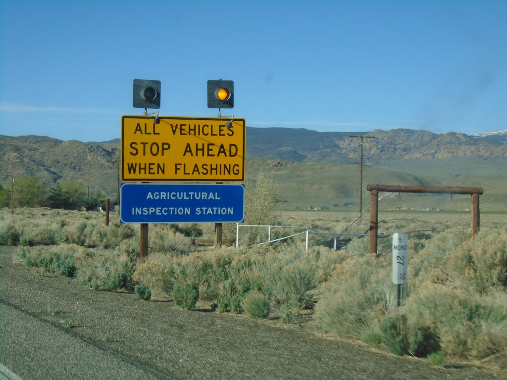
US-6 West - California State Agricultural Inspection
US-6 west approaching the California State Agricultural Inspection Station at Benton. All traffic must stop for inspection.
Taken 04-27-2019
 Benton
Mono County
California
United States
Benton
Mono County
California
United States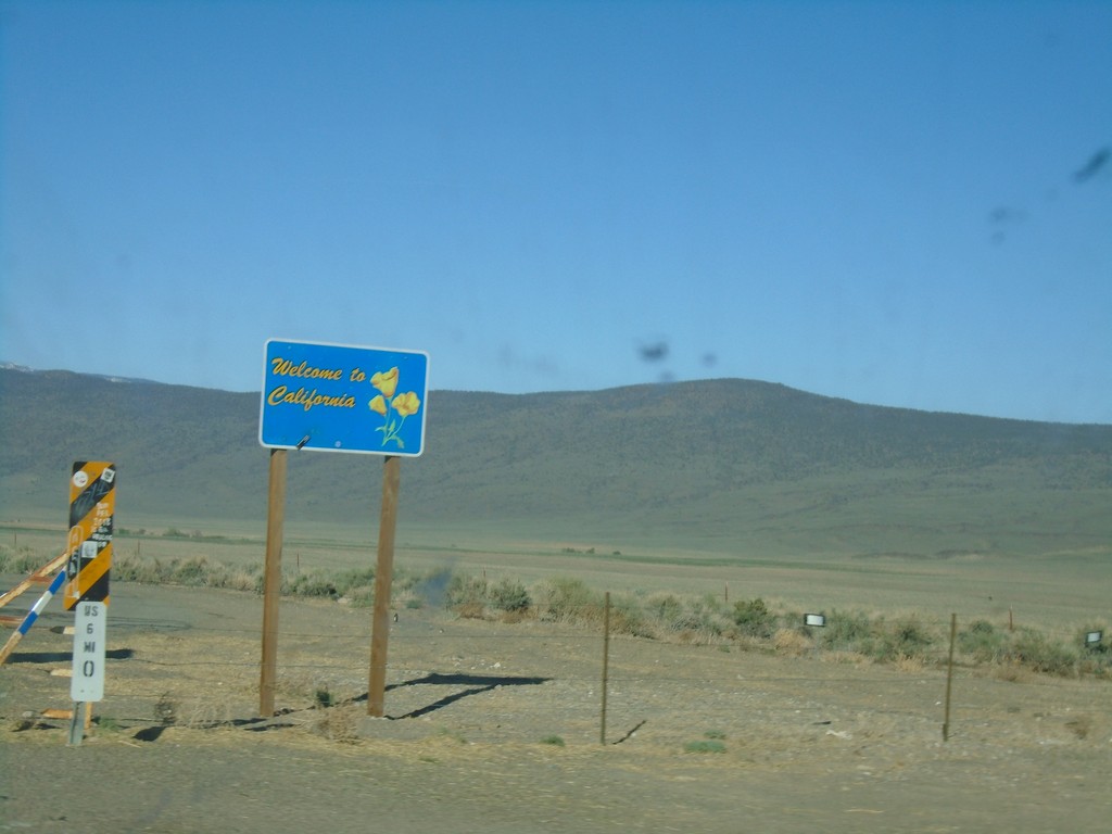
US-6 West - Welcome to California
Welcome to California on US-6 west. Taken at the Nevada-California state line. The cattle guard marks the actual state line.
Taken 04-27-2019
Benton
Mono County
California
United States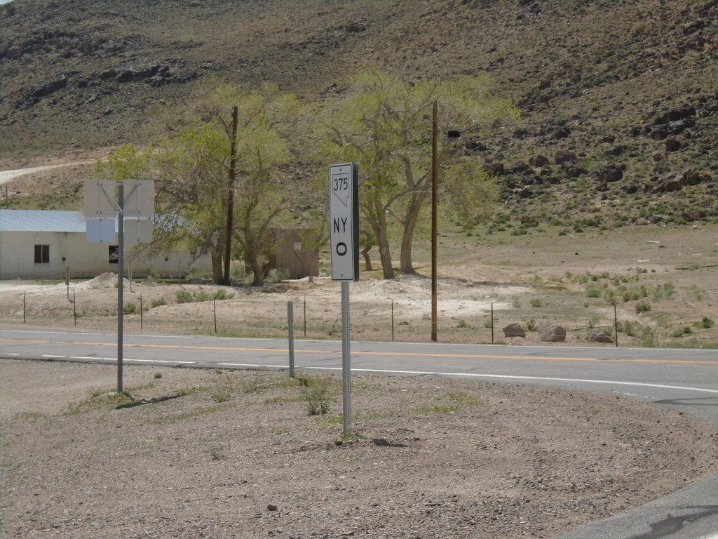
NV-375 - Milepost 0
Milepost 0 (Nye County) on NV-375
Taken 04-26-2019
 Warm Springs
Nye County
Nevada
United States
Warm Springs
Nye County
Nevada
United States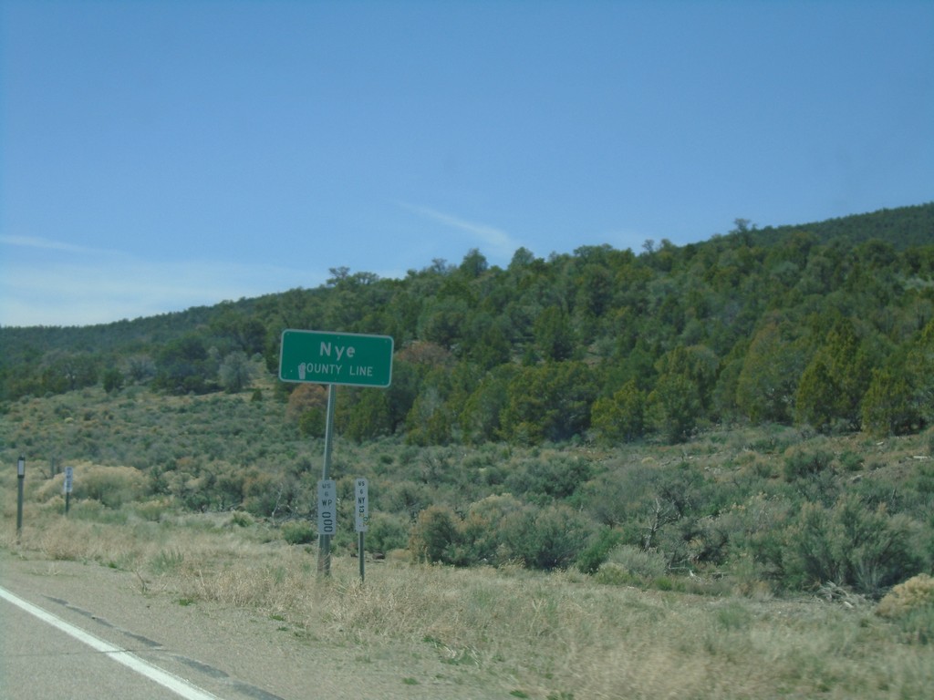
US-6 West - Nye County
Entering Nye County on US-6 West. Nye County is the largest county by area in Nevada and the third largest by area in the United States.
Taken 04-26-2019
Nye County
Nevada
United States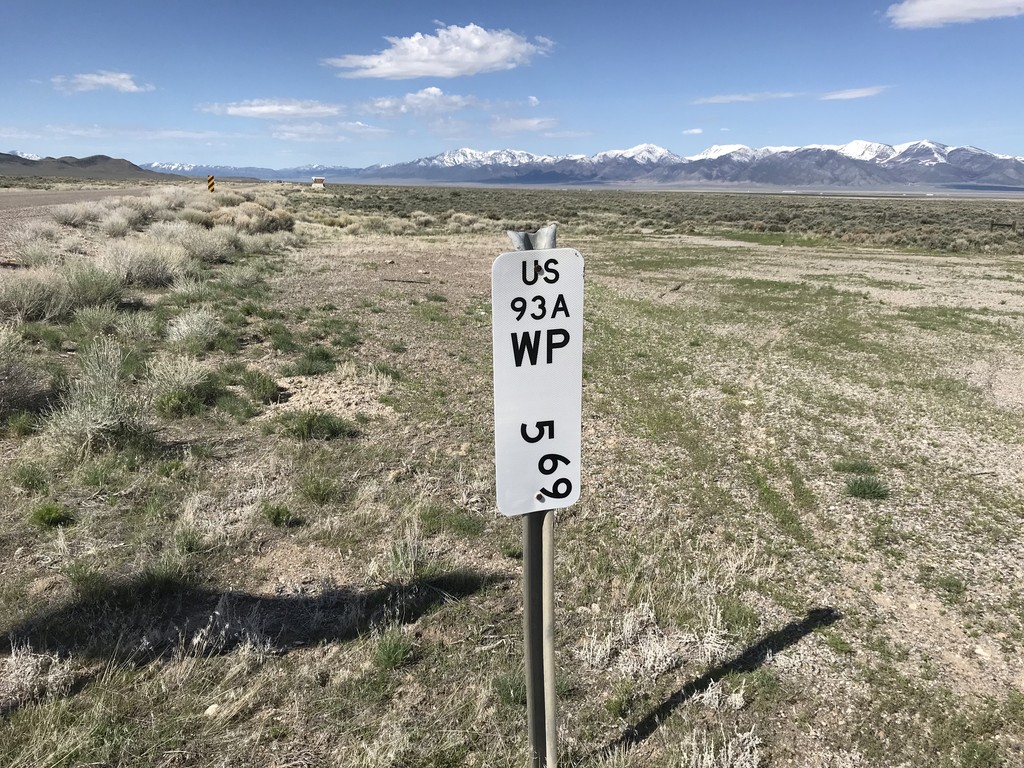
Alt. US-93 South - Postmile
Postmile marker on Alt. US-93 south at the Elko - White Pine County Line. White Pine County 5.69 - US93A.
Taken 04-26-2019
West Wendover
White Pine County
Nevada
United States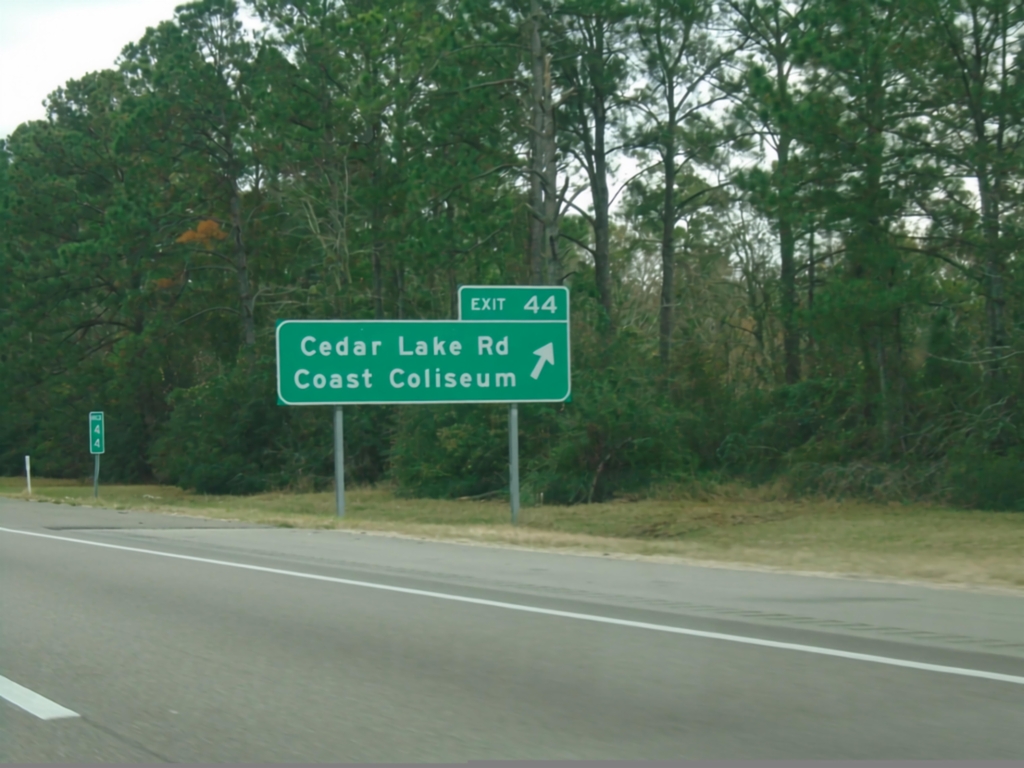
I-10 East - Exit 44
I-10 east at Exit 44 - Cedar Lake Road/Coast Coliseum.
Taken 12-23-2018
 Biloxi
Harrison County
Mississippi
United States
Biloxi
Harrison County
Mississippi
United States