Signs Tagged With Milemarker
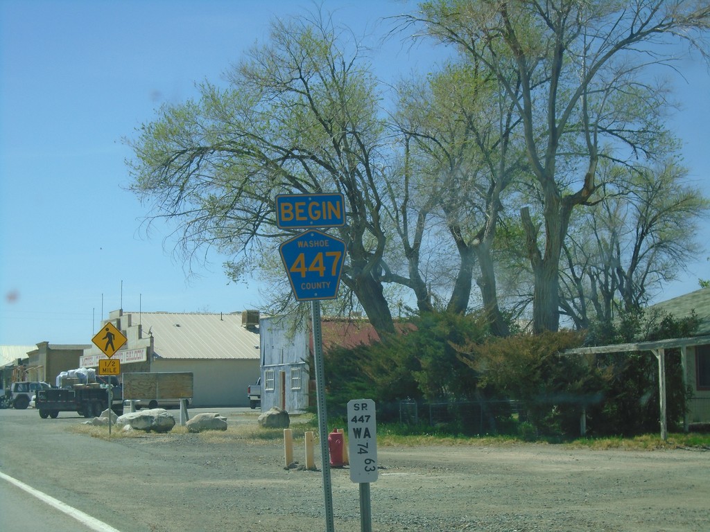
Begin Washoe County 447 - Gerlach
Begin Washoe County 447 in Gerlach. NV-447 northbound ends here.
Taken 04-27-2019

 Gerlach
Washoe County
Nevada
United States
Gerlach
Washoe County
Nevada
United States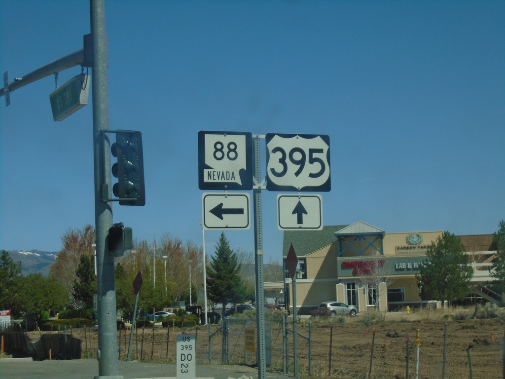
US-395 North at NV-88 - Minden
US-395 North at NV-88 in Minden. Turn left for NV-88 west.
Taken 04-27-2019

 Minden
Douglas County
Nevada
United States
Minden
Douglas County
Nevada
United States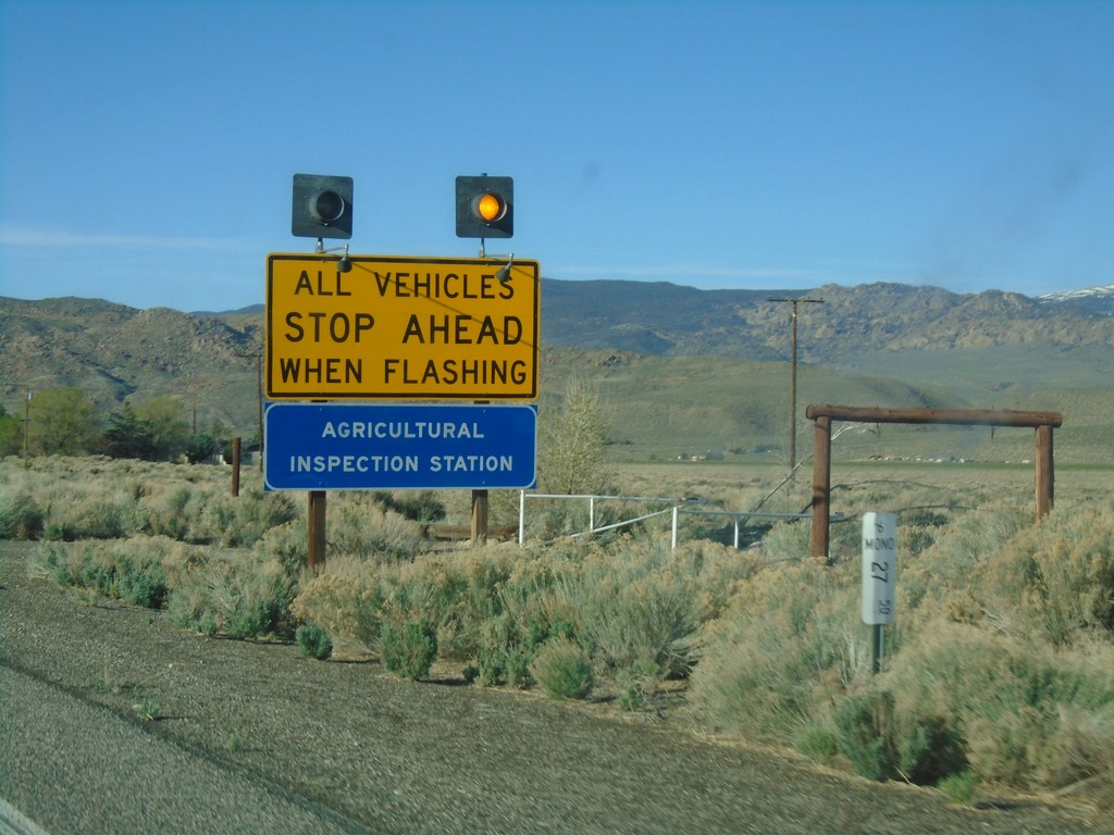
US-6 West - California State Agricultural Inspection
US-6 west approaching the California State Agricultural Inspection Station at Benton. All traffic must stop for inspection.
Taken 04-27-2019
 Benton
Mono County
California
United States
Benton
Mono County
California
United States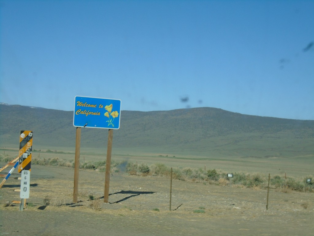
US-6 West - Welcome to California
Welcome to California on US-6 west. Taken at the Nevada-California state line. The cattle guard marks the actual state line.
Taken 04-27-2019
Benton
Mono County
California
United States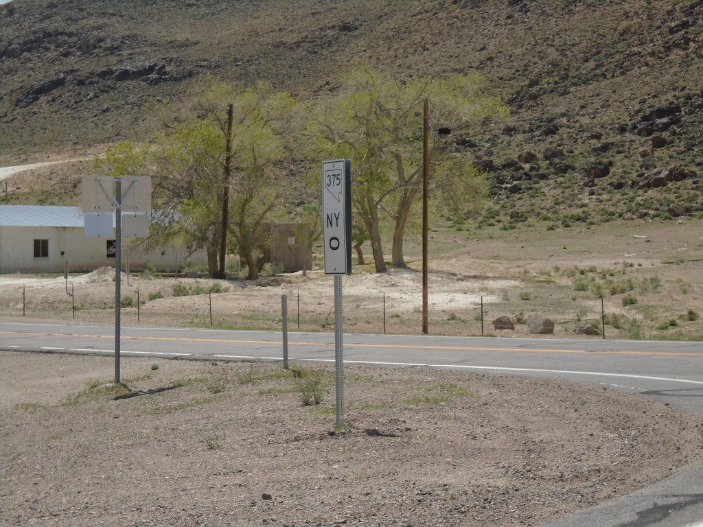
NV-375 - Milepost 0
Milepost 0 (Nye County) on NV-375
Taken 04-26-2019
 Warm Springs
Nye County
Nevada
United States
Warm Springs
Nye County
Nevada
United States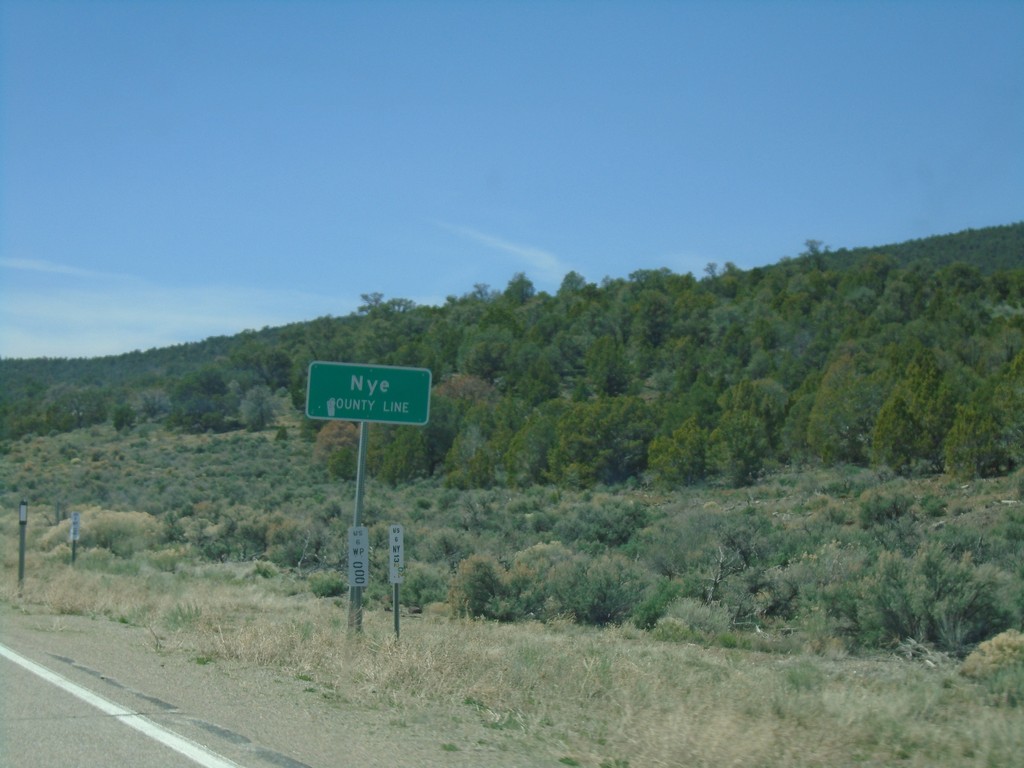
US-6 West - Nye County
Entering Nye County on US-6 West. Nye County is the largest county by area in Nevada and the third largest by area in the United States.
Taken 04-26-2019
Nye County
Nevada
United States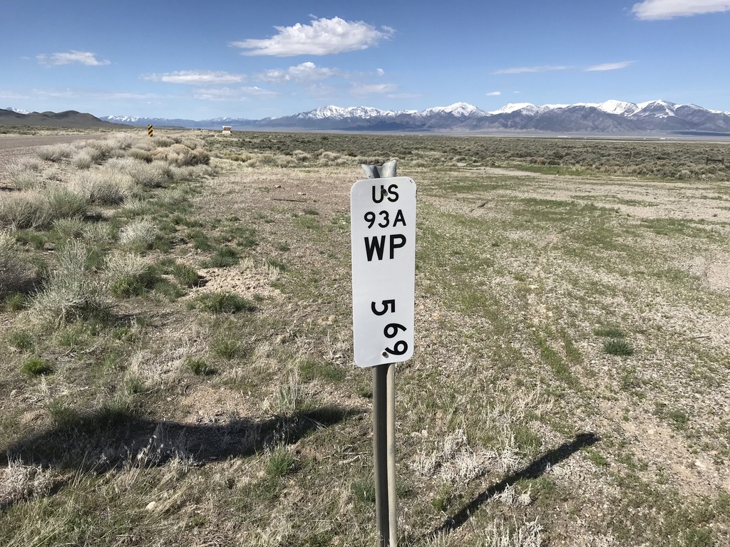
Alt. US-93 South - Postmile
Postmile marker on Alt. US-93 south at the Elko - White Pine County Line. White Pine County 5.69 - US93A.
Taken 04-26-2019
 West Wendover
White Pine County
Nevada
United States
West Wendover
White Pine County
Nevada
United States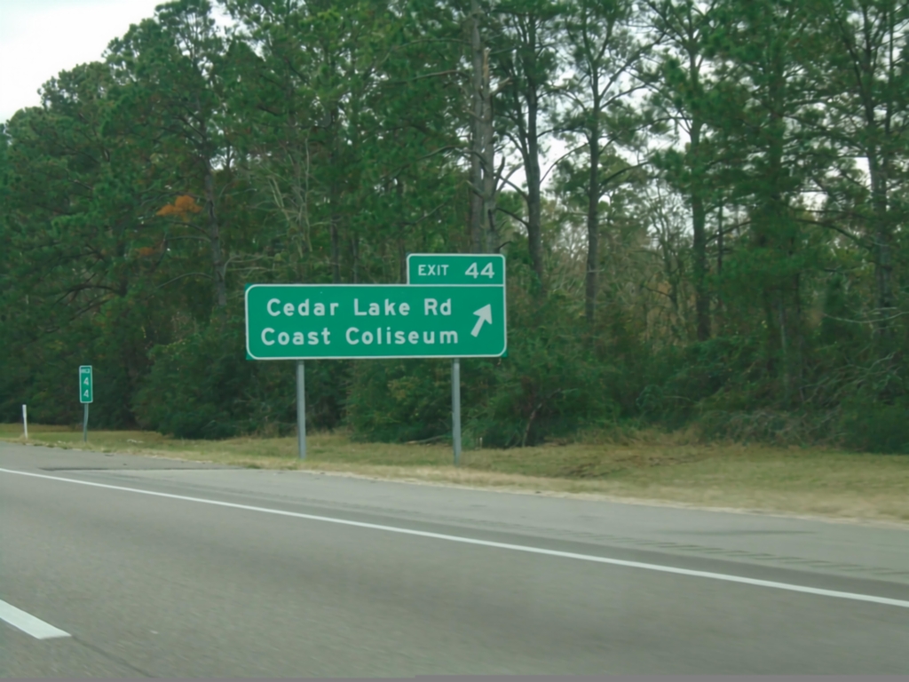
I-10 East - Exit 44
I-10 east at Exit 44 - Cedar Lake Road/Coast Coliseum.
Taken 12-23-2018
 Biloxi
Harrison County
Mississippi
United States
Biloxi
Harrison County
Mississippi
United States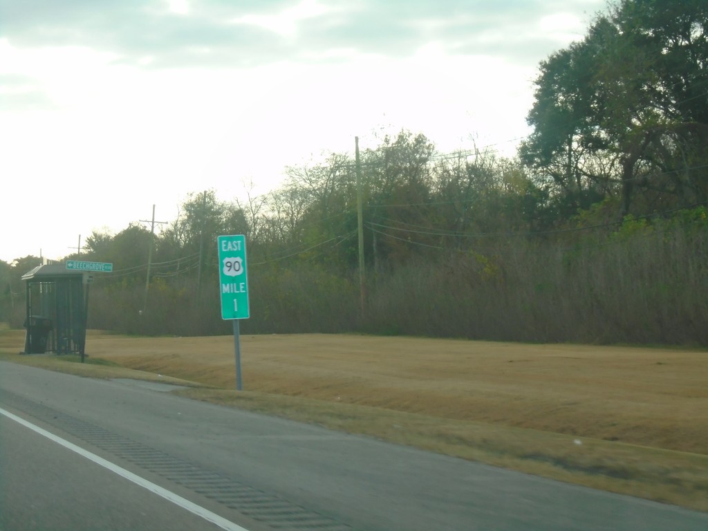
Bus. US-90 East - Milemarker
Milemarker 1 on Bus. US-90 East in Jefferson Parish.
Taken 12-23-2018
 Bridge City
Jefferson Parish
Louisiana
United States
Bridge City
Jefferson Parish
Louisiana
United States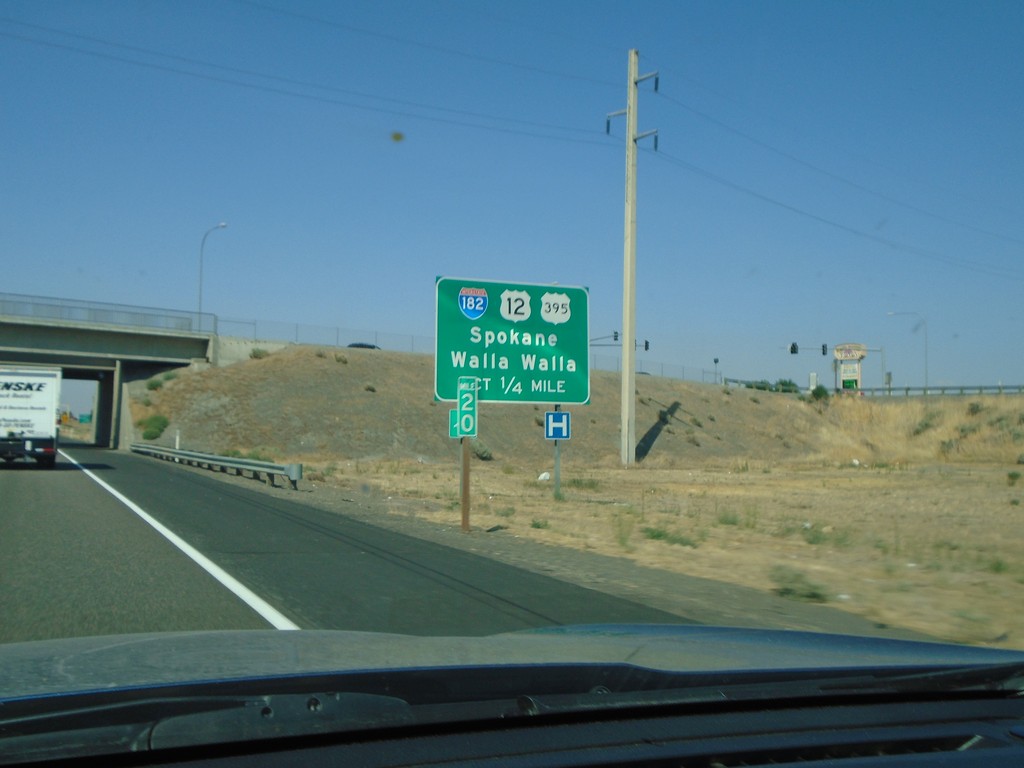
US-395 North Approaching I-182/US-12
US-395 North approaching I-182 (West)/US-12 (West) to Spokane and Walla Walla. US-395 north joins US-12 and I-182 west briefly through Pasco.
Taken 08-04-2018

 Pasco
Franklin County
Washington
United States
Pasco
Franklin County
Washington
United States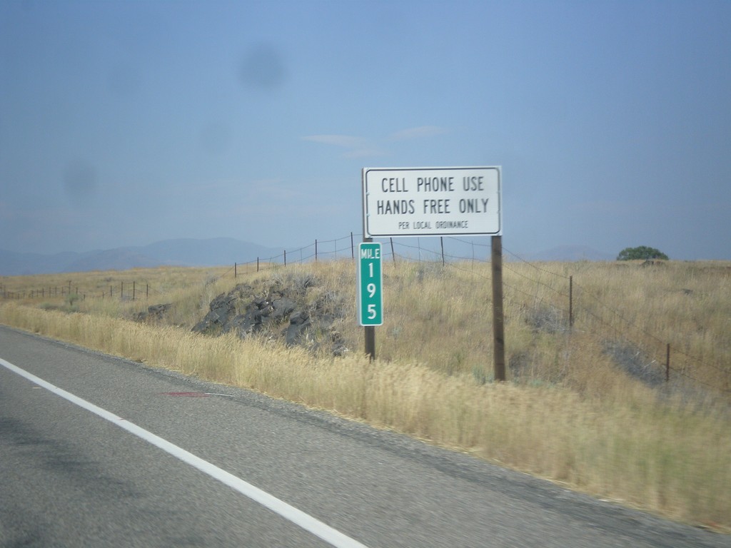
US-26 East/US-93 North - Cell Phone Use - Hands Free Only
Cell Phone Use - Hands Free Only Per Local (Blaine County) ordinance on US-26 East/US-93 North. The state of Idaho as a whole does allow hand held cell phone use.
Taken 07-21-2018

 Carey
Blaine County
Idaho
United States
Carey
Blaine County
Idaho
United States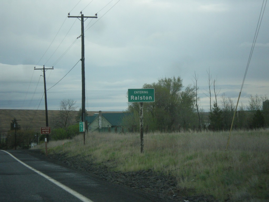
WA-261 North - Ralston
Entering Ralston on WA-261 north.
Taken 04-30-2018
 Ritzville
Adams County
Washington
United States
Ritzville
Adams County
Washington
United States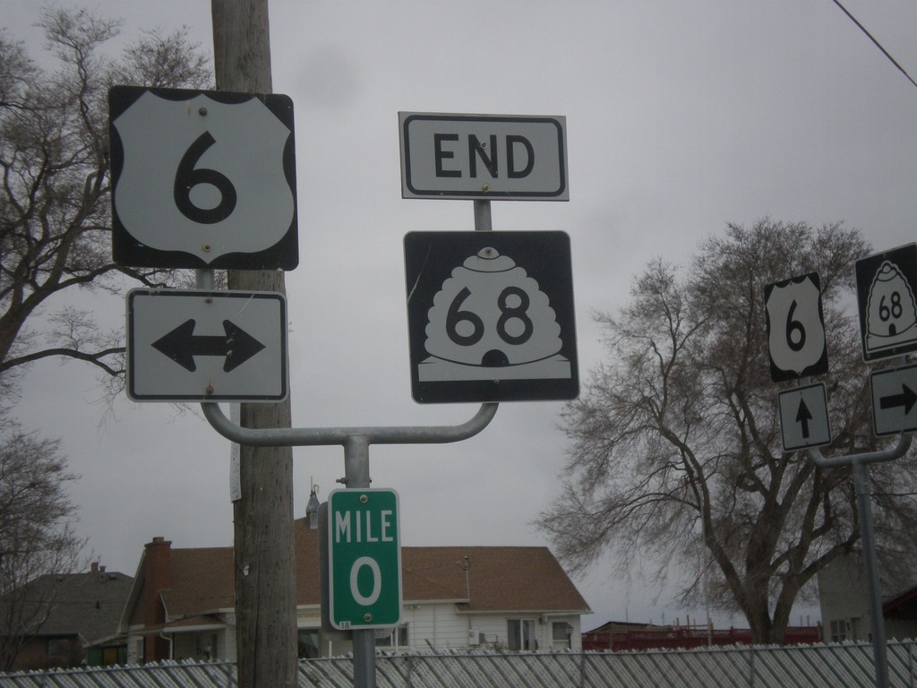
End UT-68 South at US-6
End UT-68 South at US-6 in Elberta.
Taken 02-13-2018
 Goshen
Utah County
Utah
United States
Goshen
Utah County
Utah
United States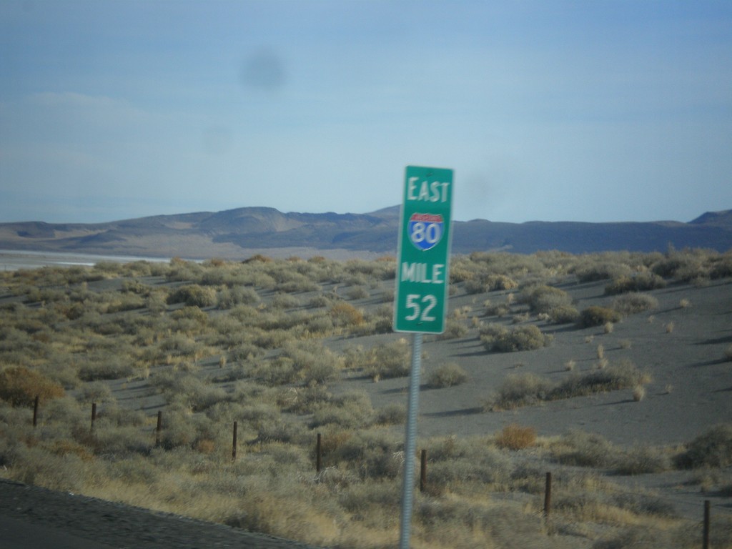
I-80 East - Milemarker 52
Mile 52 on I-80 east. This type of mile marker appears throughout Lyon and portions of Pershing County along I-80 and are recent in 2017.
Taken 11-26-2017
 Fernley
Lyon County
Nevada
United States
Fernley
Lyon County
Nevada
United States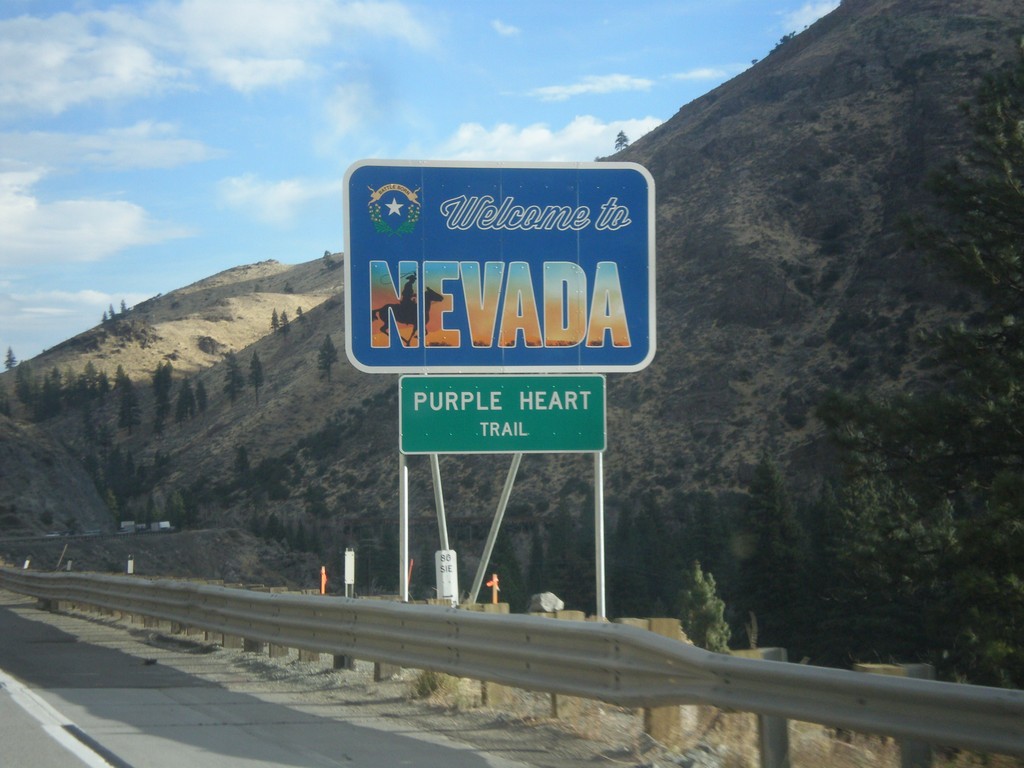
I-80 East - Welcome To Nevada
Welcome To Nevada on I-80 east at the California-Nevada state line. I-80 through Nevada is called the Purple Heart Trail. This sign is a new style of welcome sign.
Taken 11-26-2017
Reno
Washoe County
Nevada
United States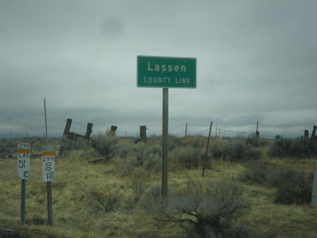
CA-299 West - Lassen County Line
Lassen County Line on CA-299 west.
Taken 11-20-2017
 Adin
Modoc County
California
United States
Adin
Modoc County
California
United States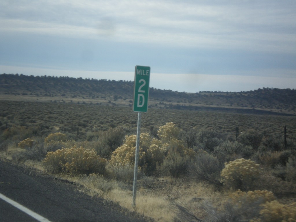
US-395 South - Milepost 2D
Milepost 2D on US-395 south. These types of mileposts have been appearing in Oregon in recent years. The letters represent the segment of the internal highway that this particular stretch is part of. In this case the D is the 4th named highway along US-395 south from the Washington line. (A=Umatilla-Stanfield, B=Pendleton-John Day, C=John Day Burns, D=Lakeview-Burns, E=Fremont).
Taken 11-19-2017
Riley
Harney County
Oregon
United States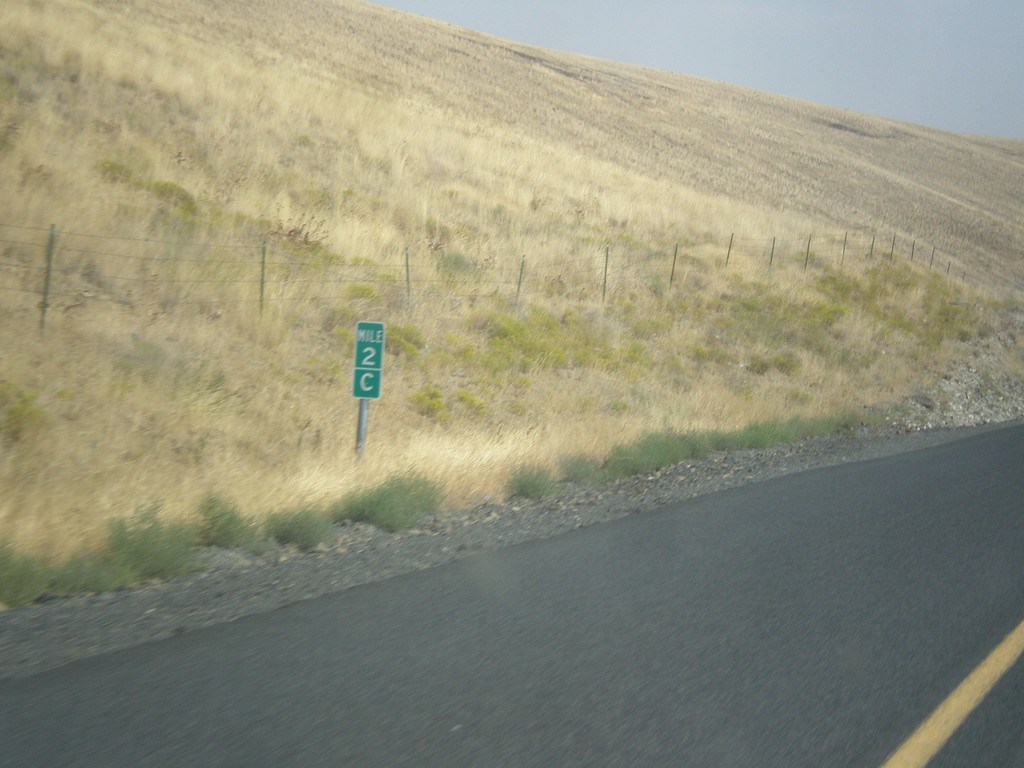
OR-207 North - Milepost
Milepost on OR-207 north - Mile 2C. Milepost 90 (B) on US-395 south. The C is because the state of Oregon maintains different internal highways along the state highway system. Some of the signed highways (like OR-207) span multiple internal highways. In this case this is the third internal highway south from the beginning of OR-207 at US-730 that belongs only to OR-207. The first (Hermiston Highway #333) is marked as an A on mileposts. The second (B) stretch is Lexington-Echo Highway #320. This stretch is the third (C) stretch (Heppner-Spray Highway #321). This type of milepost has been showing up in Oregon in the last 10 years, but not on all highways. I have seen it on US-395 and OR-207.
Taken 09-09-2017
 Heppner
Morrow County
Oregon
United States
Heppner
Morrow County
Oregon
United States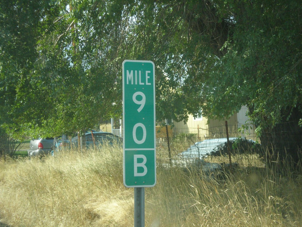
US-395 South - Mile 90 B
Milepost 90 (B) on US-395 south. The B is because the state of Oregon maintains different internal highways along the state highway system. Some of the signed highways (like US-395) span multiple internal highways. In this case this is the second internal highway south from the Washington border that belongs only to US-395. The first (Umatilla-Stanfield #54) is marked as an A on mileposts. This is the second (B) stretch - Pendleton - John Day #28). This type of milepost has been showing up in Oregon in the last 10 years, but not on all highways. I have seen it on US-395 and OR-207.
Taken 09-09-2017
Long Creek
Grant County
Oregon
United States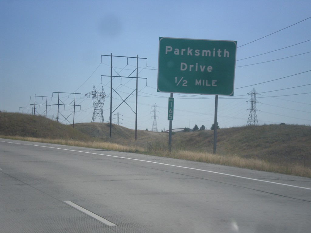
Future US-395 South - Parksmith Drive IC
Future US-395 south approaching the Parksmith Drive interchange.
Taken 07-29-2017
 Mead
Spokane County
Washington
United States
Mead
Spokane County
Washington
United States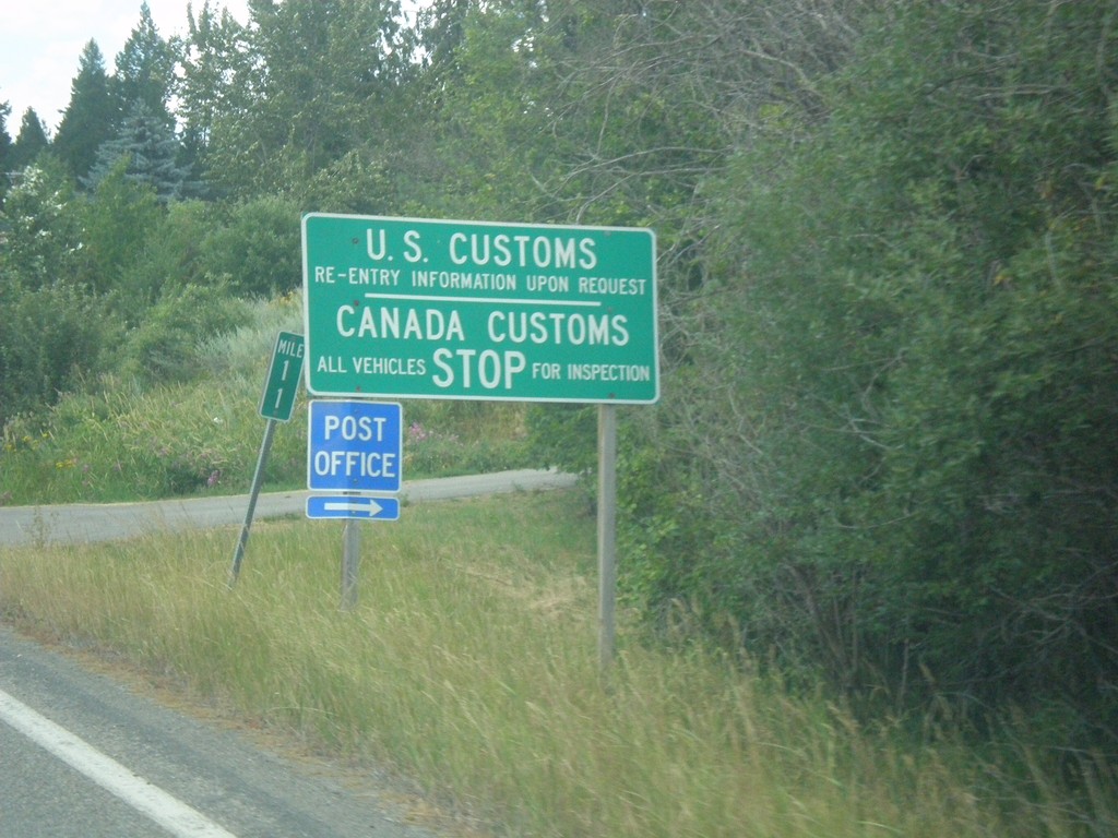
ID-1 North - Border Crossing
ID-1 north approaching US Customs and Canada Customs. Turn right for the Porthill Post Office.
Taken 07-23-2017
 Bonners Ferry
Boundary County
Idaho
United States
Bonners Ferry
Boundary County
Idaho
United States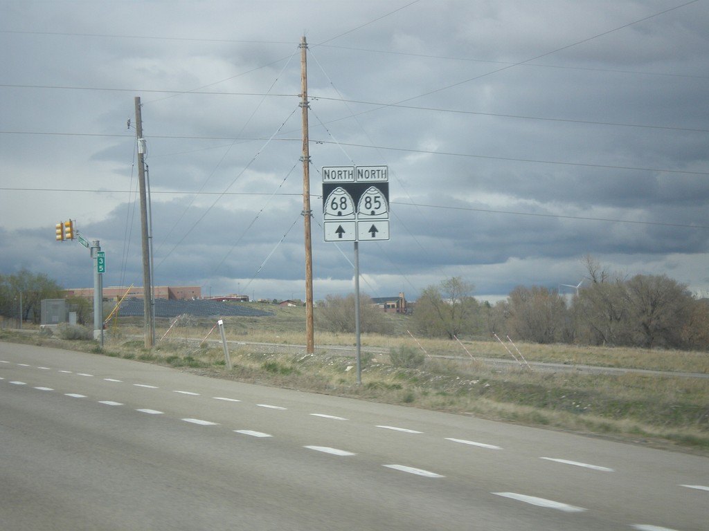
UT-68 North/UT-85 West - Lehi
UT-68 North/UT-85 West in Lehi
Taken 03-31-2017
 Lehi
Utah County
Utah
United States
Lehi
Utah County
Utah
United States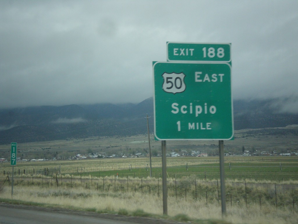
I-15 North - Exit 188
I-15 north at Exit 188 - US-50 East/Scipio. US-50 leaves I-15 north here.
Taken 03-31-2017

 Scipio
Millard County
Utah
United States
Scipio
Millard County
Utah
United States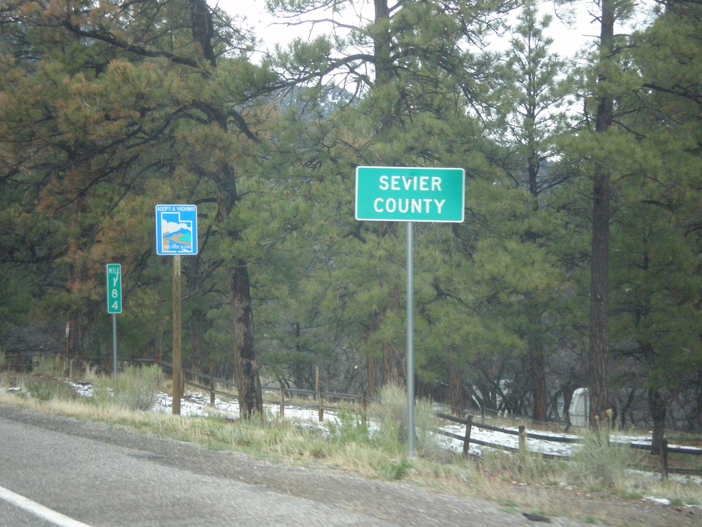
US-89 North - Sevier County
Entering Sevier County on US-89 north.
Taken 03-31-2017
 Sevier
 County
Utah
United States
Sevier
Sevier County
Utah
United States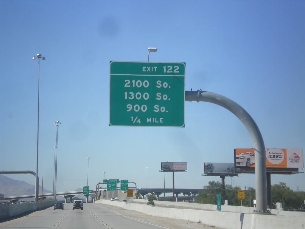
I-80 West - Exit 122
I-80 west approaching Exit 122 - 2100 South/1300 South/900 South.
Taken 10-09-2016
South Salt Lake
Salt Lake County
Utah
United States