Signs Tagged With Milemarker
US-95 South - Mineral County
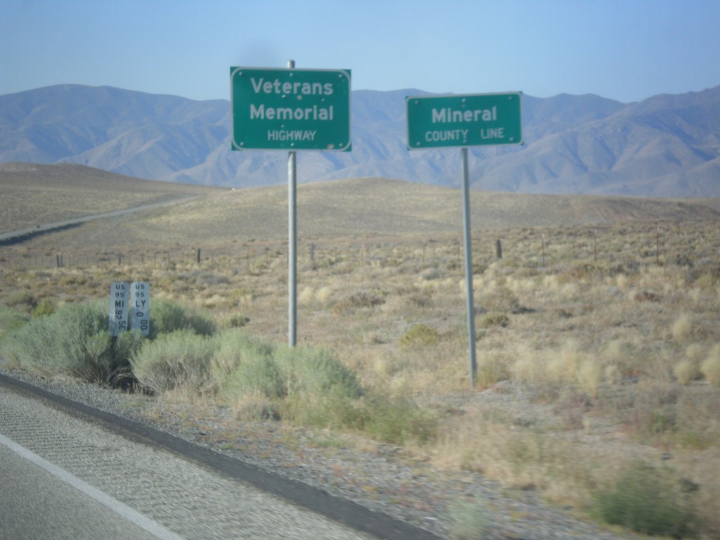
Mineral County Line on US-95 south. US-95 through Nevada is designated the Veterans Memorial Highway.
Taken 08-12-2016
 Schurz
Mineral County
Nevada
United States
Schurz
Mineral County
Nevada
United States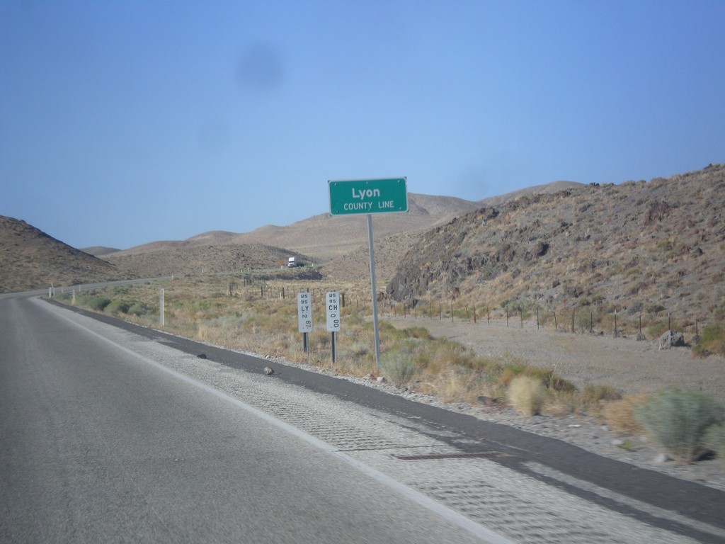
US-95 South - Lyon County
Lyon County Line on US-95 South. US-95 runs through a short 2 mile stretch of Lyon County.
Taken 08-12-2016
Fallon
Churchill County
Nevada
United States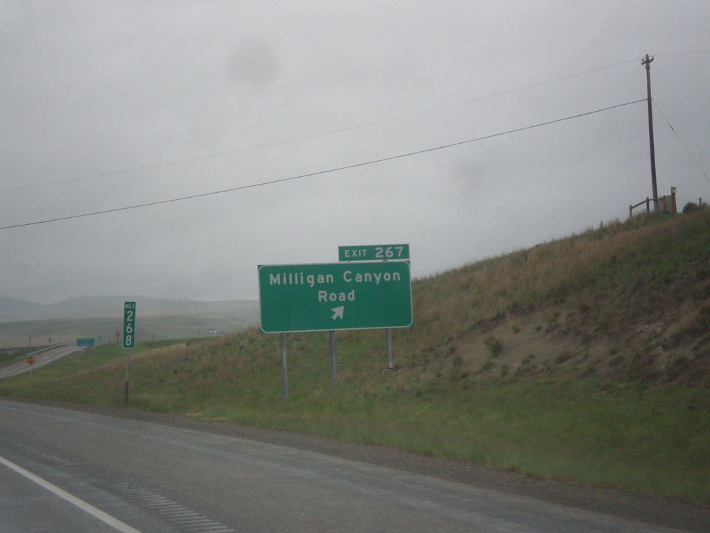
I-90 West - Exit 267
I-90 west at Exit 267 - Milligan Canyon Road.
Taken 05-15-2016
 Cardwell
Jefferson County
Montana
United States
Cardwell
Jefferson County
Montana
United States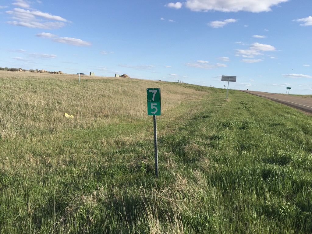
ND-16 South - Milemarker 75
Mile marker 75 on ND-16 south in Beach.
Taken 05-14-2016
 Beach
Golden Valley County
North Dakota
United States
Beach
Golden Valley County
North Dakota
United States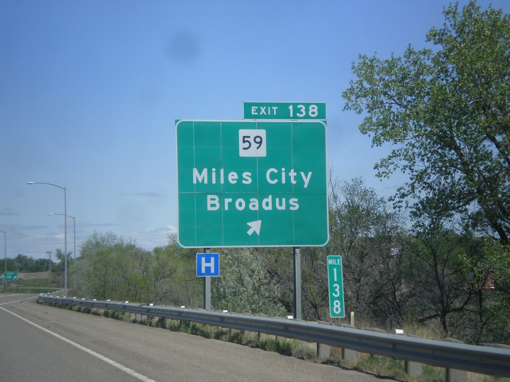
I-94 East - Exit 138
I-94 east at Exit 138 - MT-59/Miles City/Broadus.
Taken 05-14-2016


 Miles City
Custer County
Montana
United States
Miles City
Custer County
Montana
United States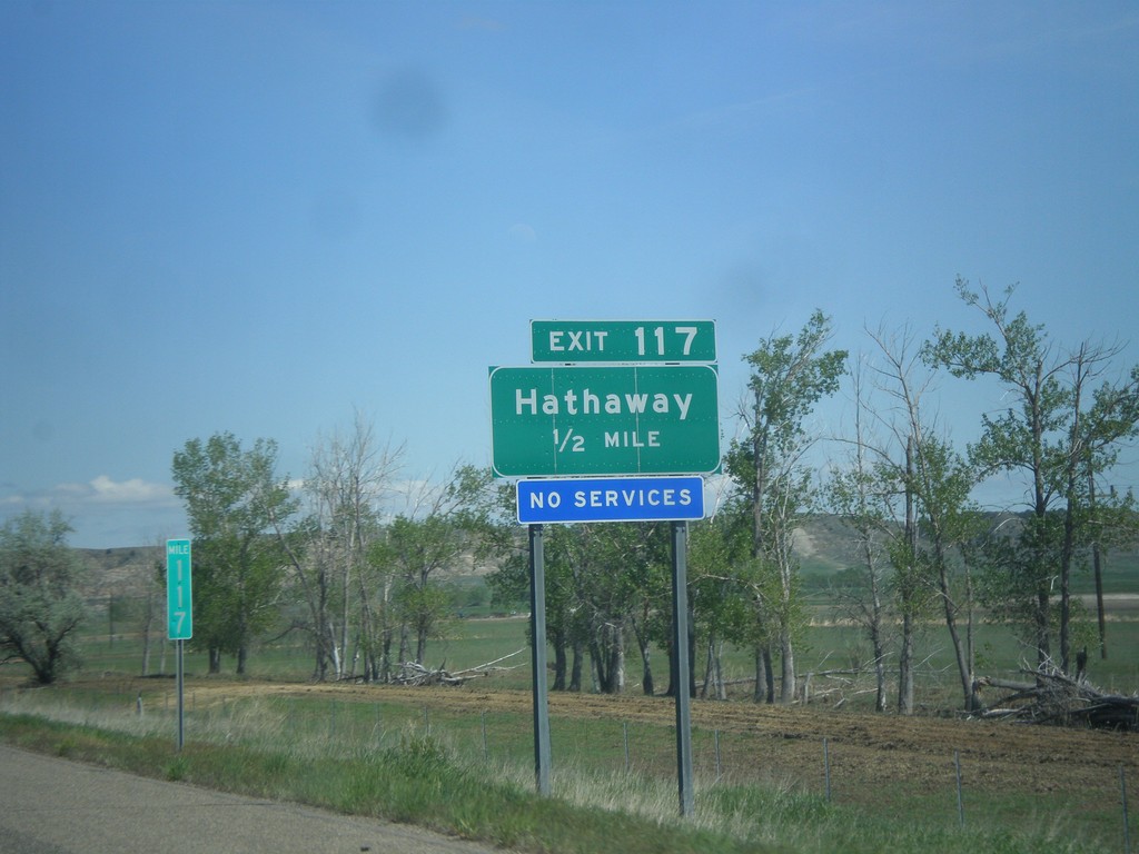
I-94 East - Exit 117
I-94 east approaching Exit 117 - Hathaway
Taken 05-14-2016
Hathaway
Rosebud County
Montana
United States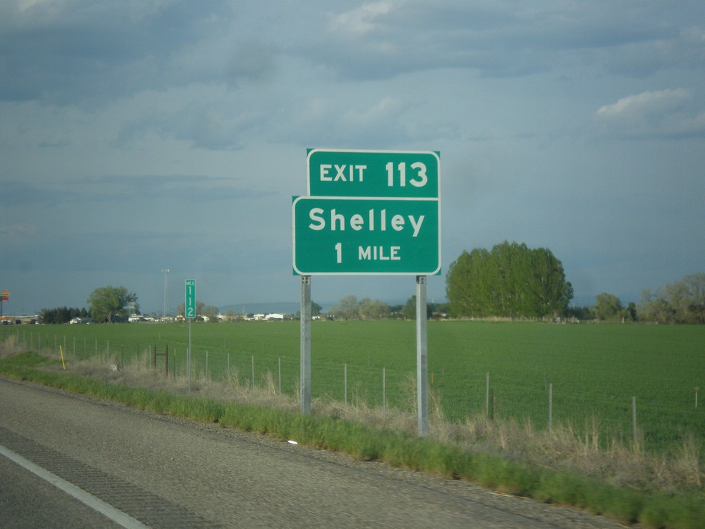
I-15 North - Exit 113
I-15 north approaching Exit 113 - Shelley.
Taken 05-13-2016

 Idaho Falls
Bonneville County
Idaho
United States
Idaho Falls
Bonneville County
Idaho
United States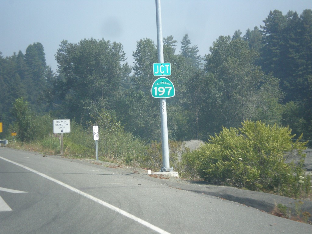
US-101 North Approaching CA-197
US-101 North approaching CA-197 in Del Norte County.
Taken 08-20-2015

 Crescent City
Del Norte County
California
United States
Crescent City
Del Norte County
California
United States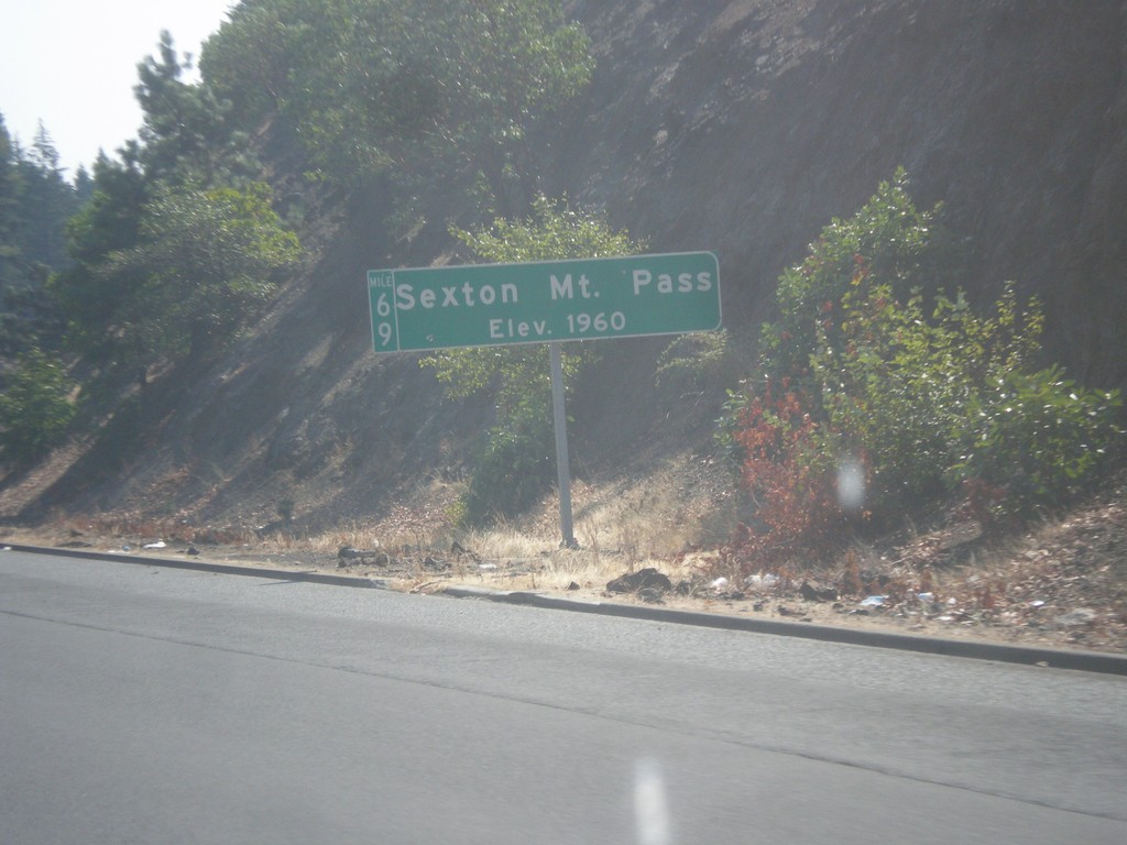
I-5 South - Sexton Mountain Summit
I-5 south at Sexton Mountain Summit - Elevation 1960 Feet. This summit is one a series of passes I-5 crosses between Canyonville and Grants Pass in the Klamath Mountains. The milepost is also attached to the main sign.
Taken 08-17-2015
 Wolf Creek
Josephine County
Oregon
United States
Wolf Creek
Josephine County
Oregon
United States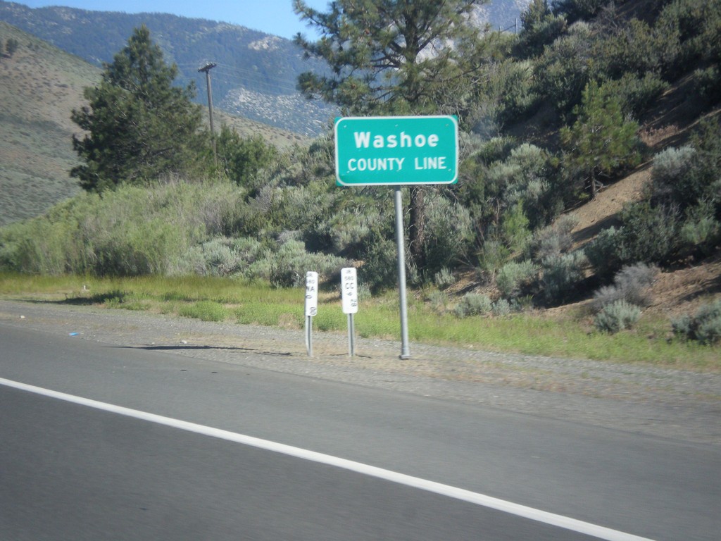
I-580/US-395 North - Washoe County Line
Washoe County Line on I-580/US-395 North.
Taken 06-15-2015

 Carson City
Washoe County
Nevada
United States
Carson City
Washoe County
Nevada
United States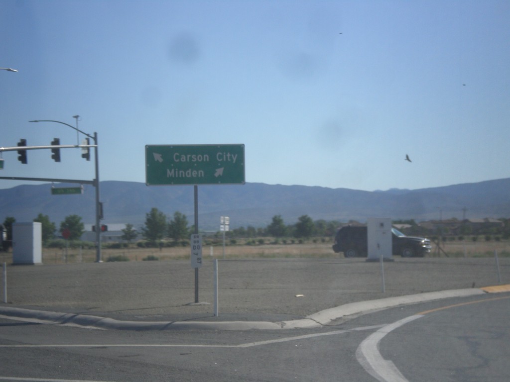
End NV-88 North at US-395
End NV-88 North at US-395 in Minden. Use US-395 north for Carson City; US-395 south for Minden.
Taken 06-15-2015
 Minden
Douglas County
Nevada
United States
Minden
Douglas County
Nevada
United States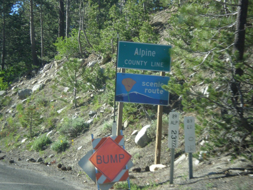
CA-89 South - Alpine County
Alpine County Line on CA-89 south. Alpine County is the smallest county in California by population. CA-89 is posted as a scenic route.
Taken 06-15-2015
 Markleeville
Alpine County
California
United States
Markleeville
Alpine County
California
United States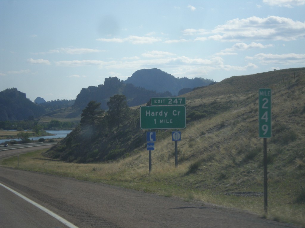
I-15 South - Exit 247
I-15 south approaching Exit 247 - Hardy Creek.
Taken 05-09-2015
Cascade
Cascade County
Montana
United States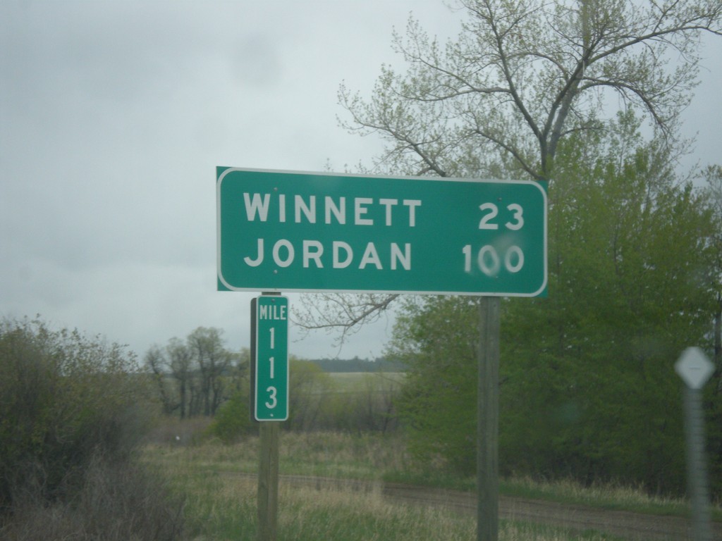
MT-200 East - Distance Marker
Distance marker on MT-200 east. Distance to Winnett and Jordan. Taken at Milepost 113.
Taken 05-08-2015
 Grass Range
Fergus County
Montana
United States
Grass Range
Fergus County
Montana
United States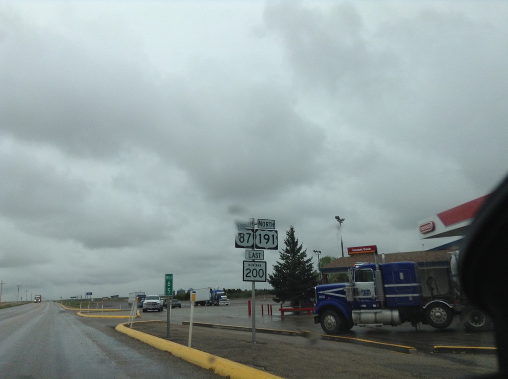
US-87 South/US-191 North/MT-200 East - Fergus County
US-87 South/US-191 North/MT-200 East in Fergus County.
Taken 05-08-2015

 Moore
Fergus County
Montana
United States
Moore
Fergus County
Montana
United States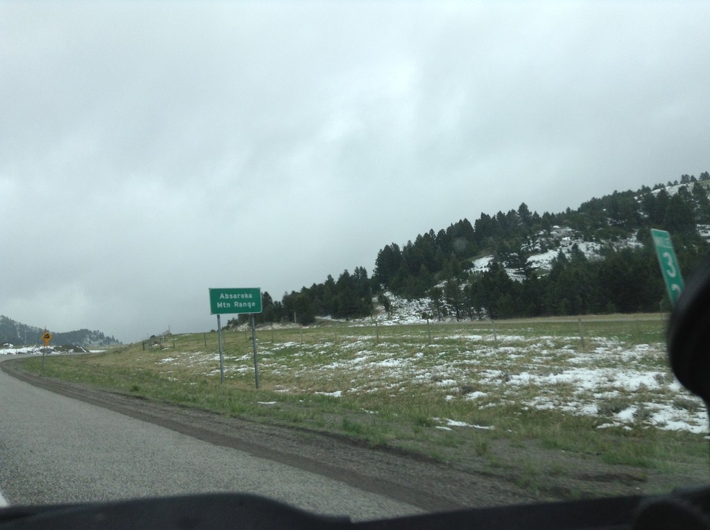
I-90 East - Bozeman Pass
I-90 east at Bozeman Pass. Bozeman Pass is part of the Absaroka Mountain Range. These type of signs are common across Montana, giving name to the many mountain ranges in the state.
Taken 05-08-2015
Muir
Park County
Montana
United States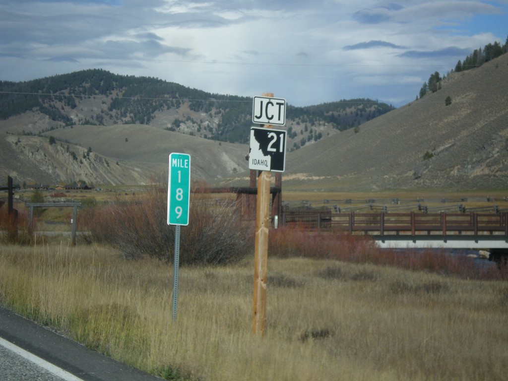
ID-75 North Approaching ID-21
Approaching ID-21 Junction on ID-75 North in Stanley. Milemarker 189.
Taken 10-04-2014

 Stanley
Custer County
Idaho
United States
Stanley
Custer County
Idaho
United States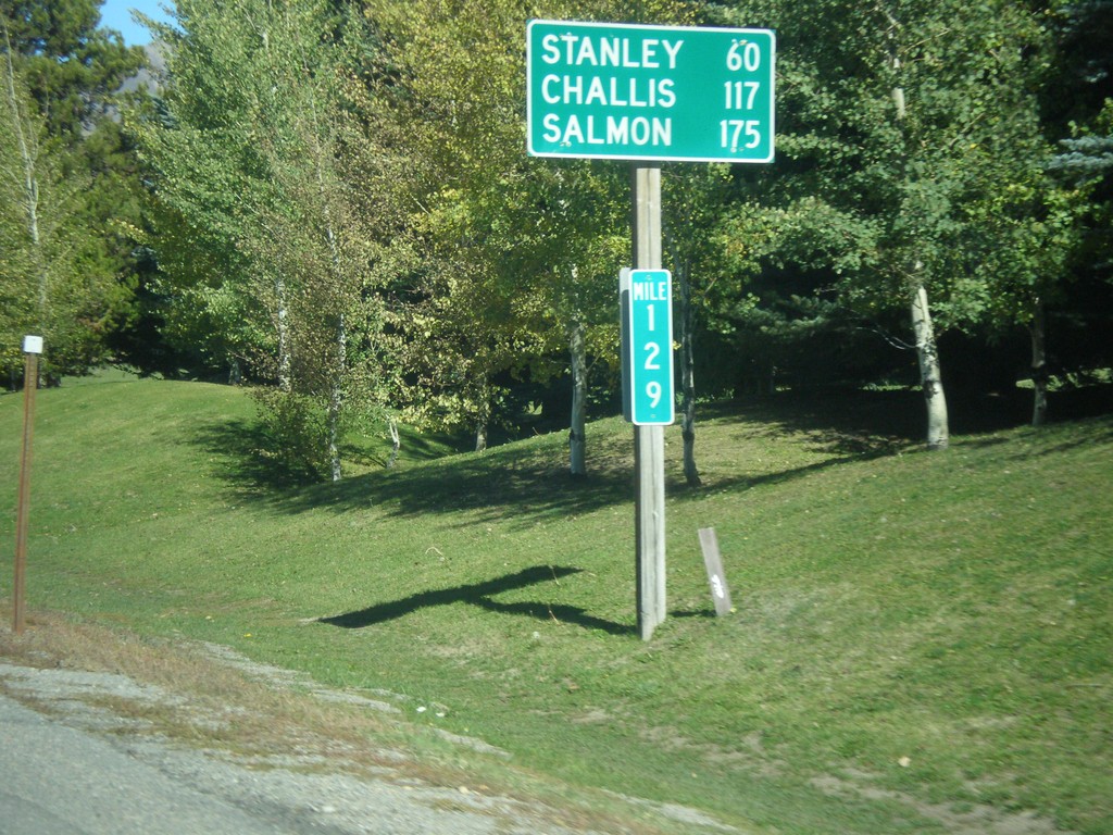
ID-75 North - Distance Marker
Distance marker on ID-75 north. Distance to Stanley, Challis, and Salmon. Milemarker 129. The milemarkers on ID-75 continue reflect the distance from the Idaho-Nevada state line (via US-93) rather than the beginning of ID-75. Originally, ID-75 was signed as US-93.
Taken 10-04-2014
Sun Valley
Blaine County
Idaho
United States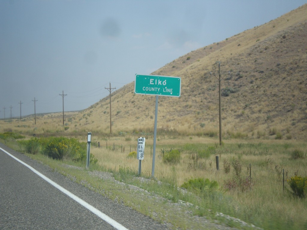
NV-278 North - Elko County Line
Elko County Line on NV-278 north.
Taken 08-31-2014
 Carlin
Elko County
Nevada
United States
Carlin
Elko County
Nevada
United States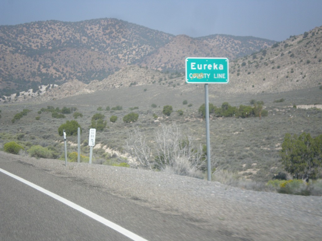
US-50 West - Eureka County Line
Eureka County Line on US-50 west.
Taken 08-31-2014
 Eureka
 County
Nevada
United States
Eureka
Eureka County
Nevada
United States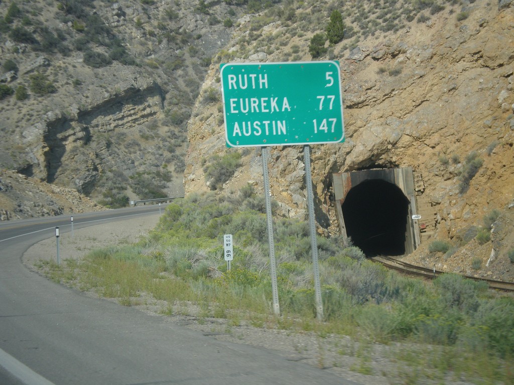
US-50 West - Distance Marker
Distance marker on US-50 west. Distance to Ruth, Eureka, and Austin.
Taken 08-31-2014
Ely
White Pine County
Nevada
United States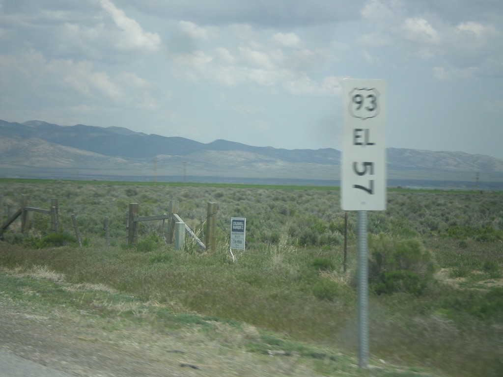
US-93 North - Mile Marker
This is an unusual mile marker on US-93 north in Nevada. Typical mile markers in Nevada are much smaller and do not have a shield outline on them, just a text description of the route. There are two or there on this stretch of road between Wells and Lages Junction.
Taken 05-22-2014
 Wells
Elko County
Nevada
United States
Wells
Elko County
Nevada
United States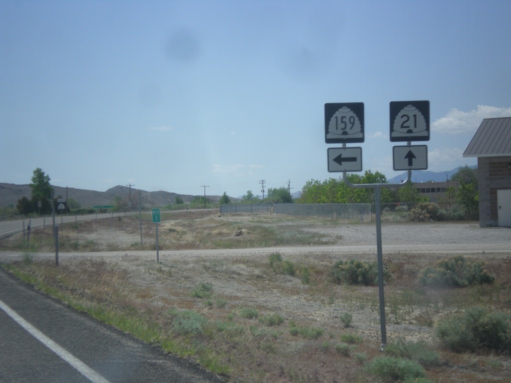
UT-21 East at UT-159
UT-21 east at UT-159 north in Garrison. Garrison is located inside Utah on the Nevada line.
Taken 05-19-2014

 Garrison
Millard County
Utah
United States
Garrison
Millard County
Utah
United States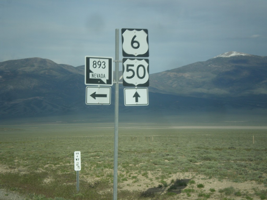
US-6/US-50 East at NV-893
US-6/US-50 East at NV-893 in White Pine County.
Taken 05-16-2014

 Majors Place
White Pine County
Nevada
United States
Majors Place
White Pine County
Nevada
United States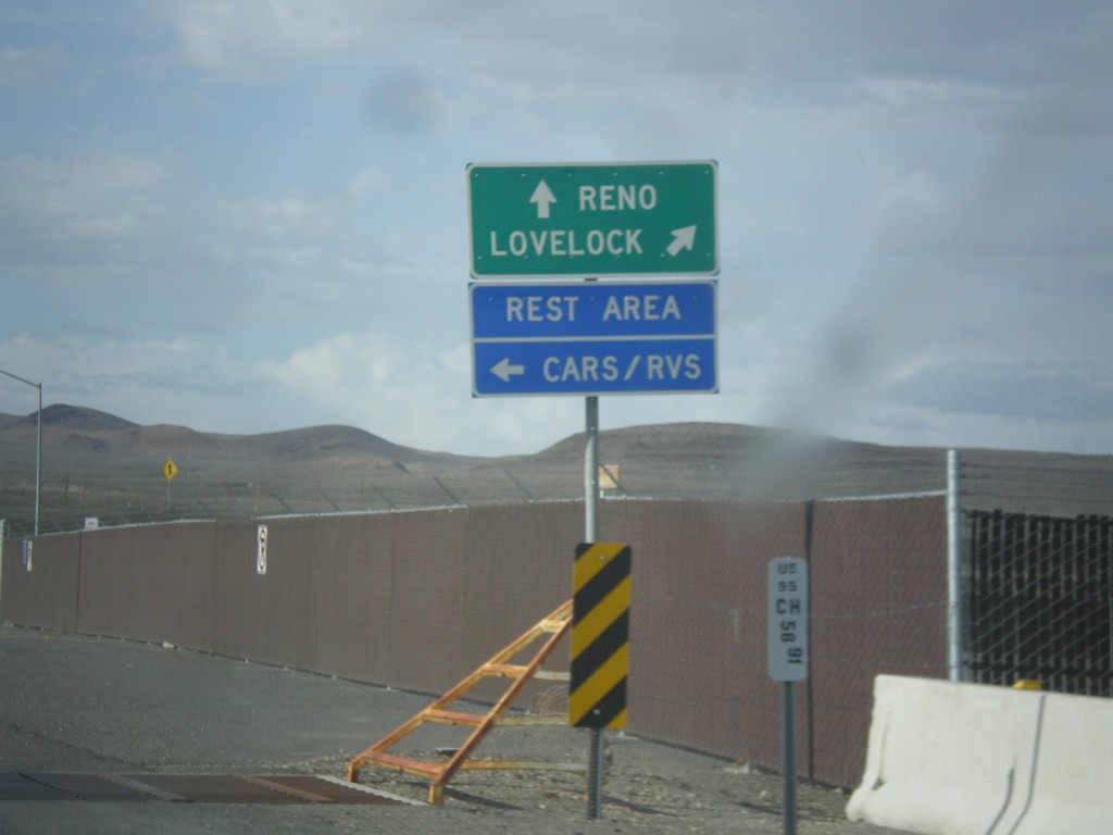
US-95 North Approaching I-80
US-95 north approaching I-80. Use I-80 East/US-95 North to Lovelock; use I-80 West/Alt. US-95 South to Reno. Turn left to enter the Rest Area. Notice the post mile marker at the base of the sign.
Taken 05-05-2014

 Churchill County
Nevada
United States
Churchill County
Nevada
United States