Signs Tagged With Milemarker
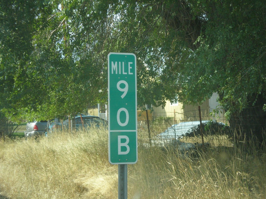
US-395 South - Mile 90 B
Milepost 90 (B) on US-395 south. The B is because the state of Oregon maintains different internal highways along the state highway system. Some of the signed highways (like US-395) span multiple internal highways. In this case this is the second internal highway south from the Washington border that belongs only to US-395. The first (Umatilla-Stanfield #54) is marked as an A on mileposts. This is the second (B) stretch - Pendleton - John Day #28). This type of milepost has been showing up in Oregon in the last 10 years, but not on all highways. I have seen it on US-395 and OR-207.
Taken 09-09-2017
 Long Creek
Grant County
Oregon
United States
Long Creek
Grant County
Oregon
United States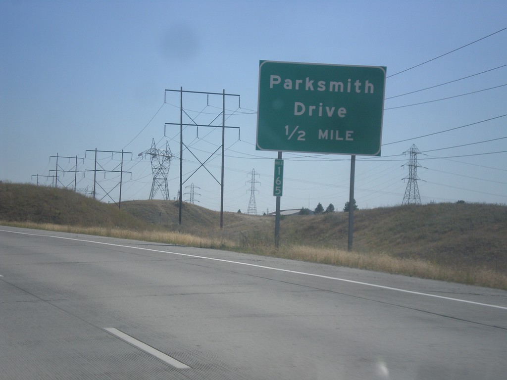
Future US-395 South - Parksmith Drive IC
Future US-395 south approaching the Parksmith Drive interchange.
Taken 07-29-2017
 Mead
Spokane County
Washington
United States
Mead
Spokane County
Washington
United States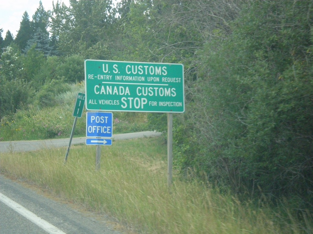
ID-1 North - Border Crossing
ID-1 north approaching US Customs and Canada Customs. Turn right for the Porthill Post Office.
Taken 07-23-2017
 Bonners Ferry
Boundary County
Idaho
United States
Bonners Ferry
Boundary County
Idaho
United States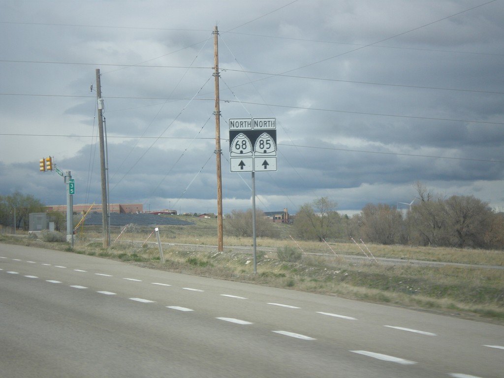
UT-68 North/UT-85 West - Lehi
UT-68 North/UT-85 West in Lehi
Taken 03-31-2017

 Lehi
Utah County
Utah
United States
Lehi
Utah County
Utah
United States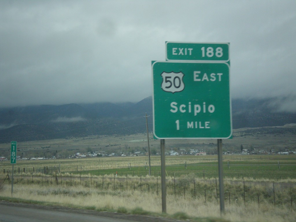
I-15 North - Exit 188
I-15 north at Exit 188 - US-50 East/Scipio. US-50 leaves I-15 north here.
Taken 03-31-2017

 Scipio
Millard County
Utah
United States
Scipio
Millard County
Utah
United States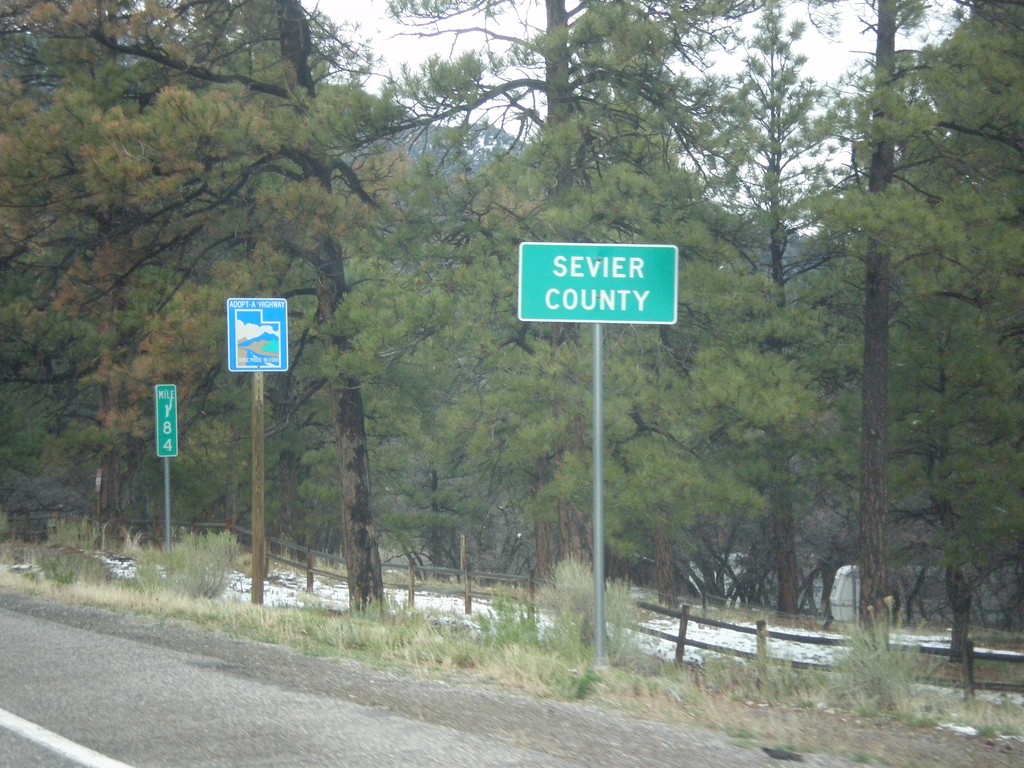
US-89 North - Sevier County
Entering Sevier County on US-89 north.
Taken 03-31-2017
 Sevier
 County
Utah
United States
Sevier
Sevier County
Utah
United States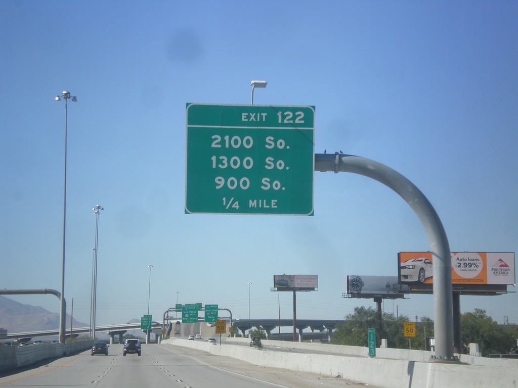
I-80 West - Exit 122
I-80 west approaching Exit 122 - 2100 South/1300 South/900 South.
Taken 10-09-2016
 South Salt Lake
Salt Lake County
Utah
United States
South Salt Lake
Salt Lake County
Utah
United States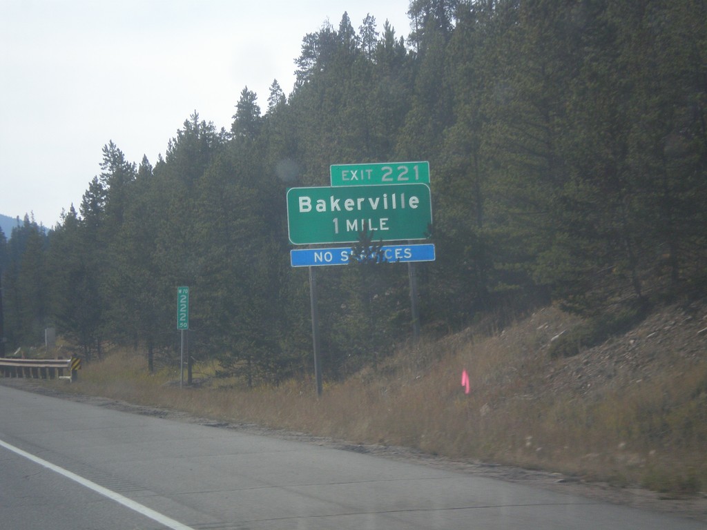
I-70 West - Exit 221
I-70 west approaching Exit 221 - Bakerville.
Taken 10-08-2016

 Silver Plume
Clear Creek County
Colorado
United States
Silver Plume
Clear Creek County
Colorado
United States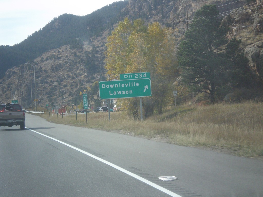
I-70 West - Exit 234
I-70 west at Exit 234 - Downieville/Lawson.
Taken 10-08-2016
 Downieville-Lawson-Dumont
Clear Creek County
Colorado
United States
Downieville-Lawson-Dumont
Clear Creek County
Colorado
United States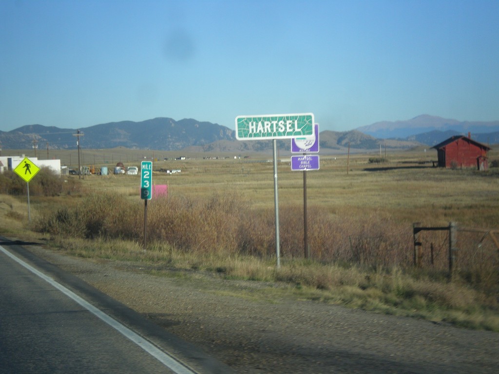
US-24 East/CO-9 South - Hartsel
Entering Hartsel on US-24 East/CO-9 South.
Taken 10-07-2016

 Hartsel
Park County
Colorado
United States
Hartsel
Park County
Colorado
United States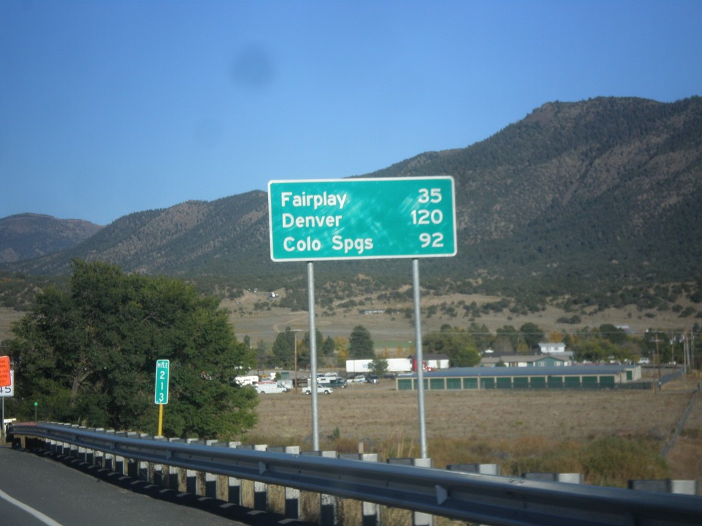
US-24 East/US-285 North - Distance Marker
Distance Marker on US-24 East/US-285 North. Distance to Fairplay and Denver (via US-285), and Colorado Springs (via US-24).
Taken 10-07-2016
 Buena Vista
Chaffee County
Colorado
United States
Buena Vista
Chaffee County
Colorado
United States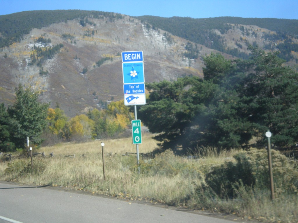
CO-82 East - Top of the Rockies Scenic Byway
Begin Top of the Rockies Scenic Byway on CO-82 East.
Taken 10-07-2016
 Aspen
Pitkin County
Colorado
United States
Aspen
Pitkin County
Colorado
United States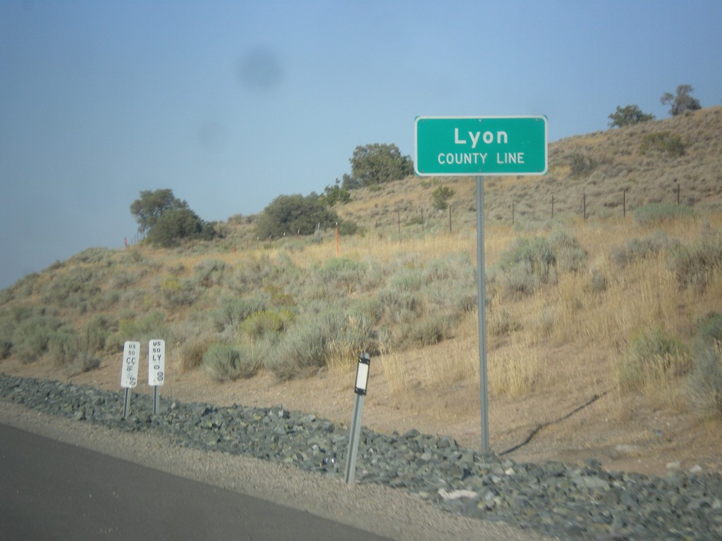
US-50 East - Lyon County
Lyon County Line on US-50 east.
Taken 08-15-2016
Mound House
Lyon County
Nevada
United States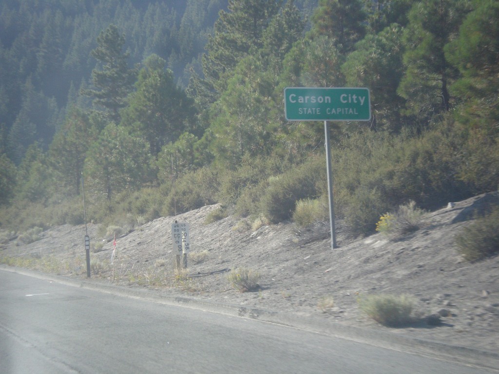
US-50 East - Carson City
US-50 East - Carson City - State Capital. Carson City is an independent city, and the capitol of Nevada. Instead of the text COUNTY LINE that is typical when entering a new county in Nevada, Carson City lists the text STATE CAPITAL.
Taken 08-15-2016
Carson City
Nevada
United States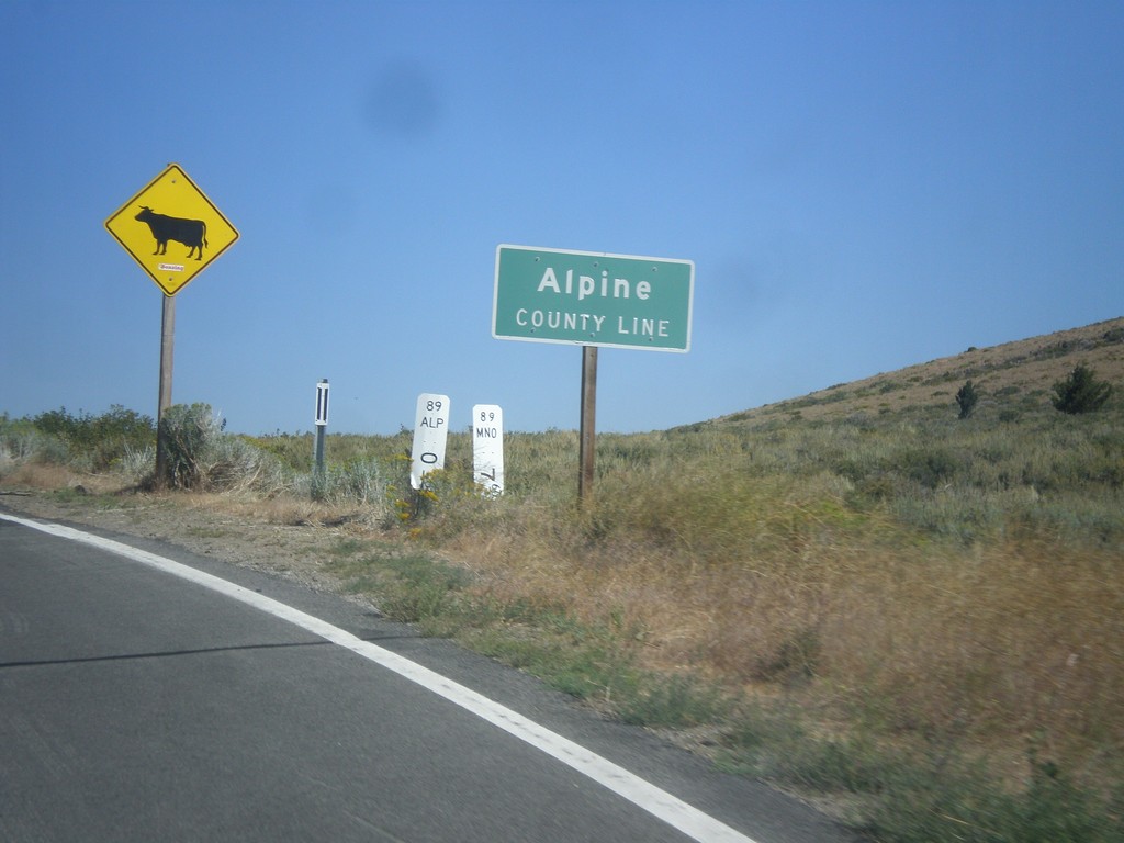
CA-89 North - Alpine County Line
Alpine County Line on CA-89 north. Open range.
Taken 08-12-2016
 Coleville
Mono County
California
United States
Coleville
Mono County
California
United States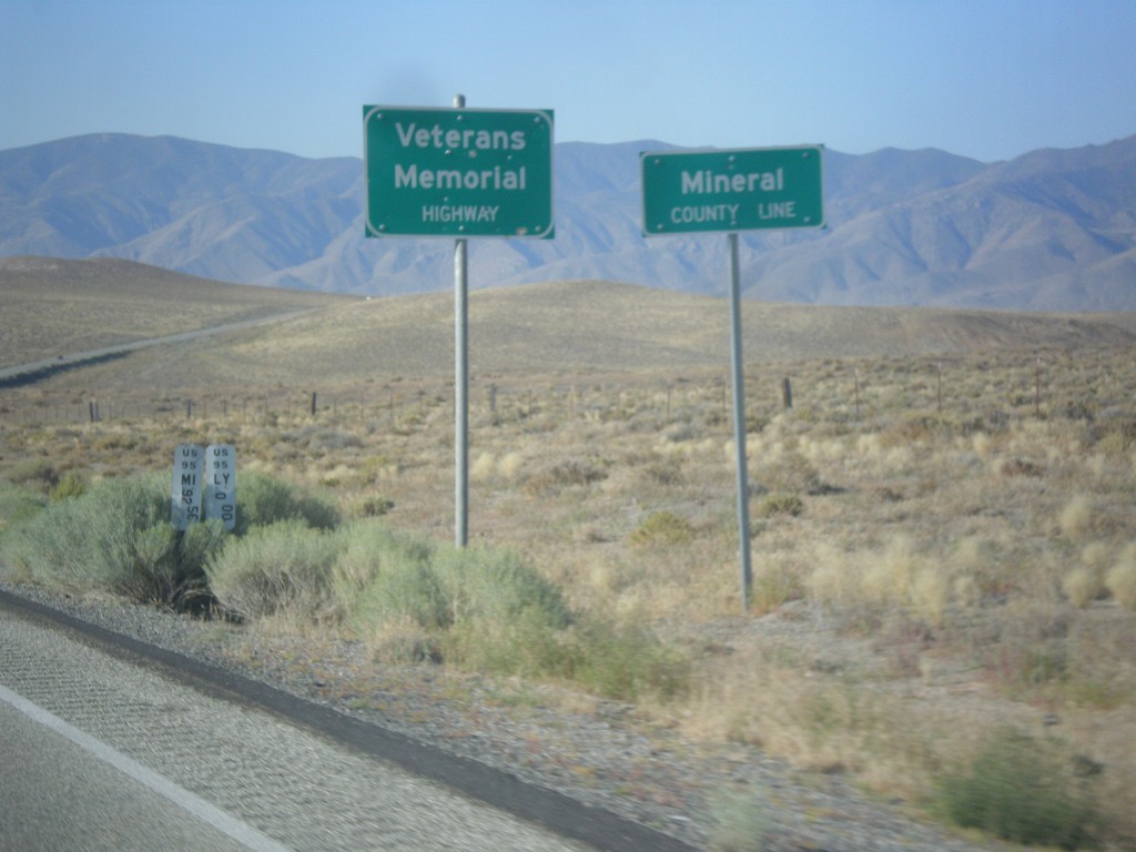
US-95 South - Mineral County
Mineral County Line on US-95 south. US-95 through Nevada is designated the Veterans Memorial Highway.
Taken 08-12-2016
 Schurz
Mineral County
Nevada
United States
Schurz
Mineral County
Nevada
United States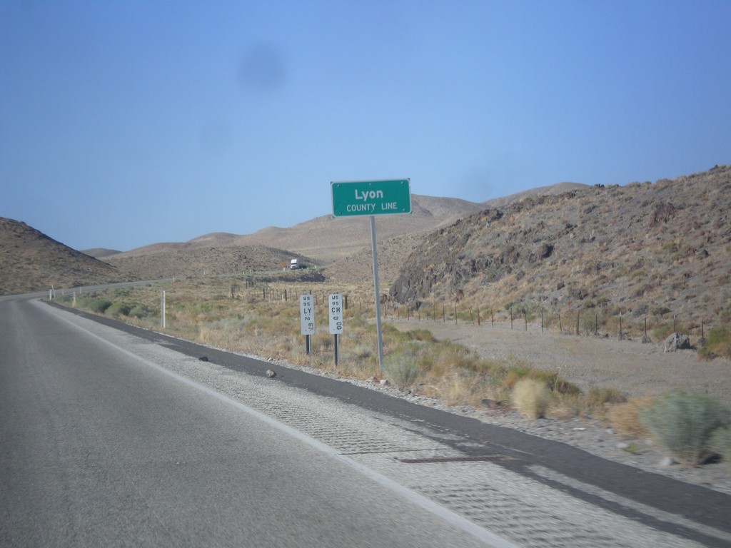
US-95 South - Lyon County
Lyon County Line on US-95 South. US-95 runs through a short 2 mile stretch of Lyon County.
Taken 08-12-2016
Fallon
Churchill County
Nevada
United States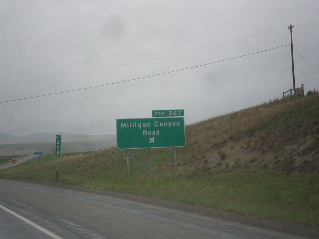
I-90 West - Exit 267
I-90 west at Exit 267 - Milligan Canyon Road.
Taken 05-15-2016
 Cardwell
Jefferson County
Montana
United States
Cardwell
Jefferson County
Montana
United States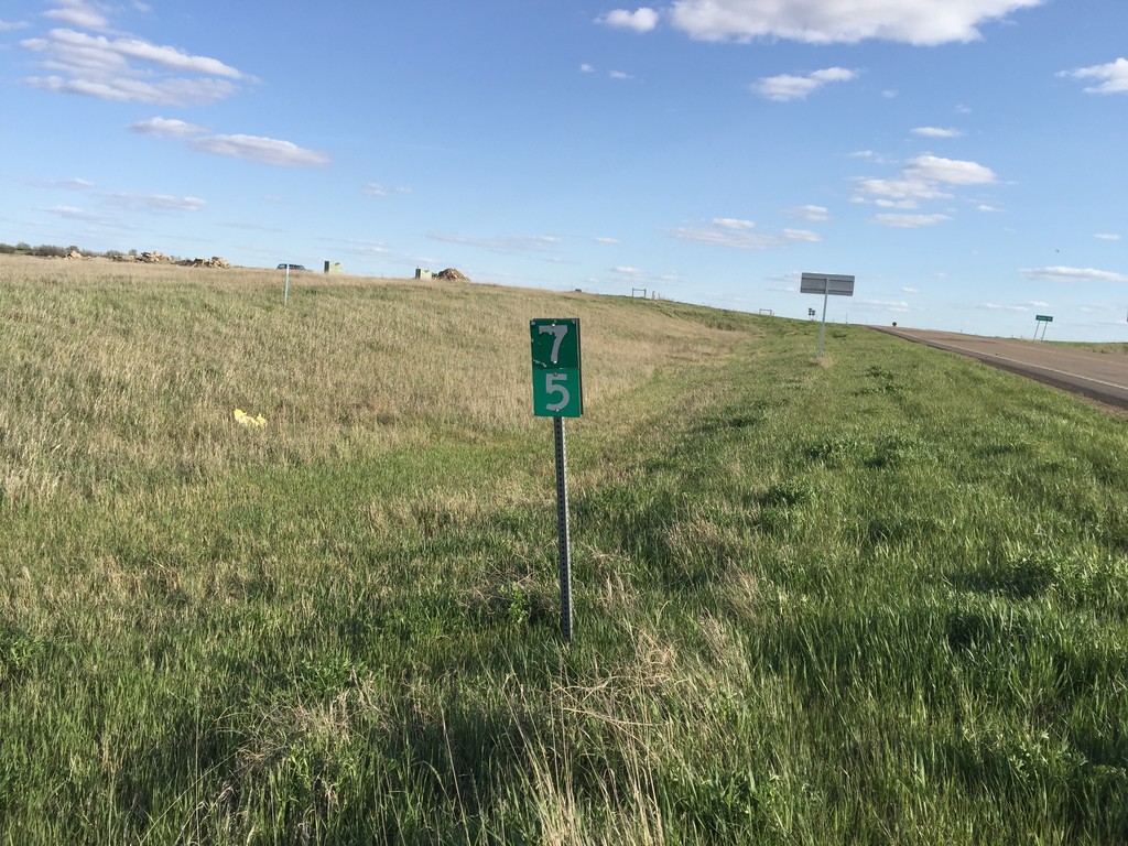
ND-16 South - Milemarker 75
Mile marker 75 on ND-16 south in Beach.
Taken 05-14-2016
 Beach
Golden Valley County
North Dakota
United States
Beach
Golden Valley County
North Dakota
United States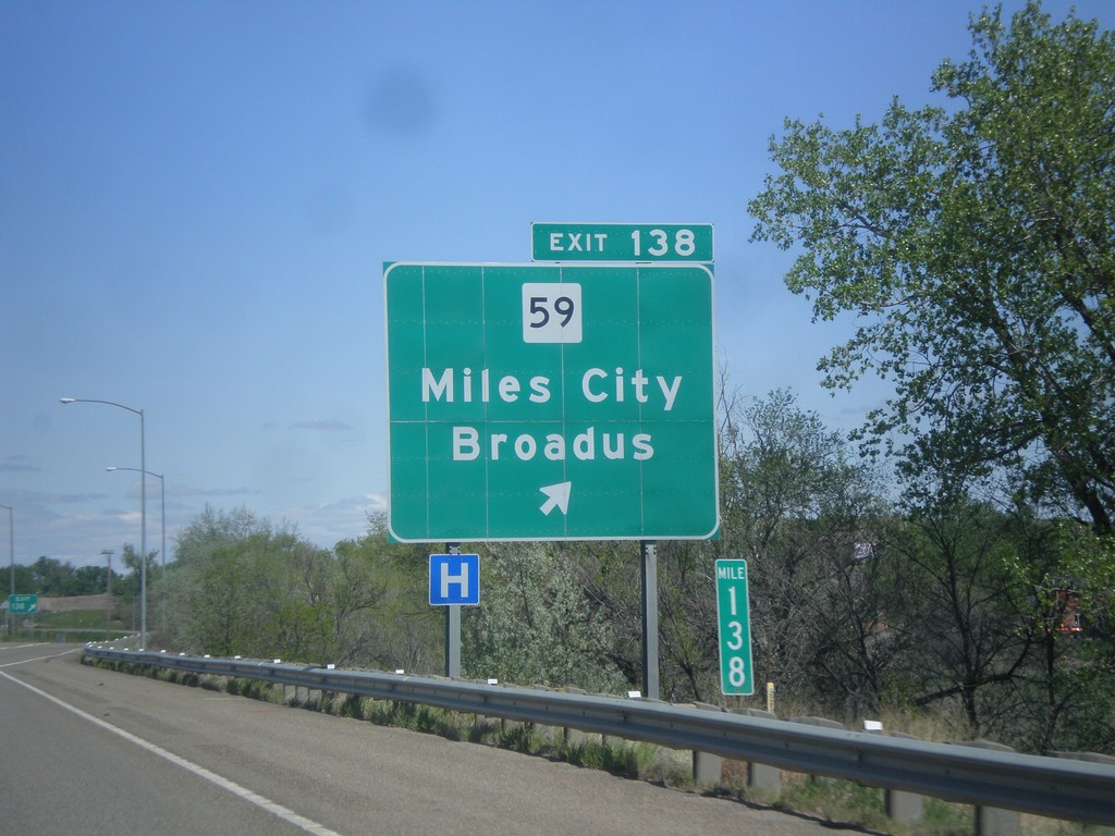
I-94 East - Exit 138
I-94 east at Exit 138 - MT-59/Miles City/Broadus.
Taken 05-14-2016


 Miles City
Custer County
Montana
United States
Miles City
Custer County
Montana
United States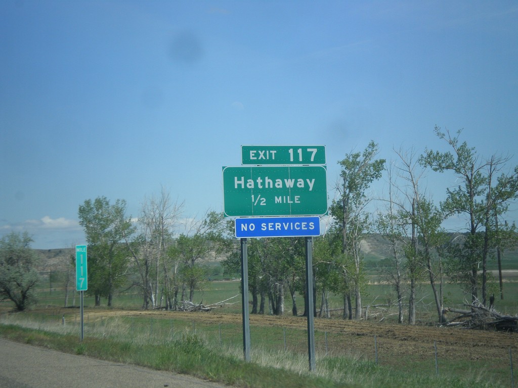
I-94 East - Exit 117
I-94 east approaching Exit 117 - Hathaway
Taken 05-14-2016
Hathaway
Rosebud County
Montana
United States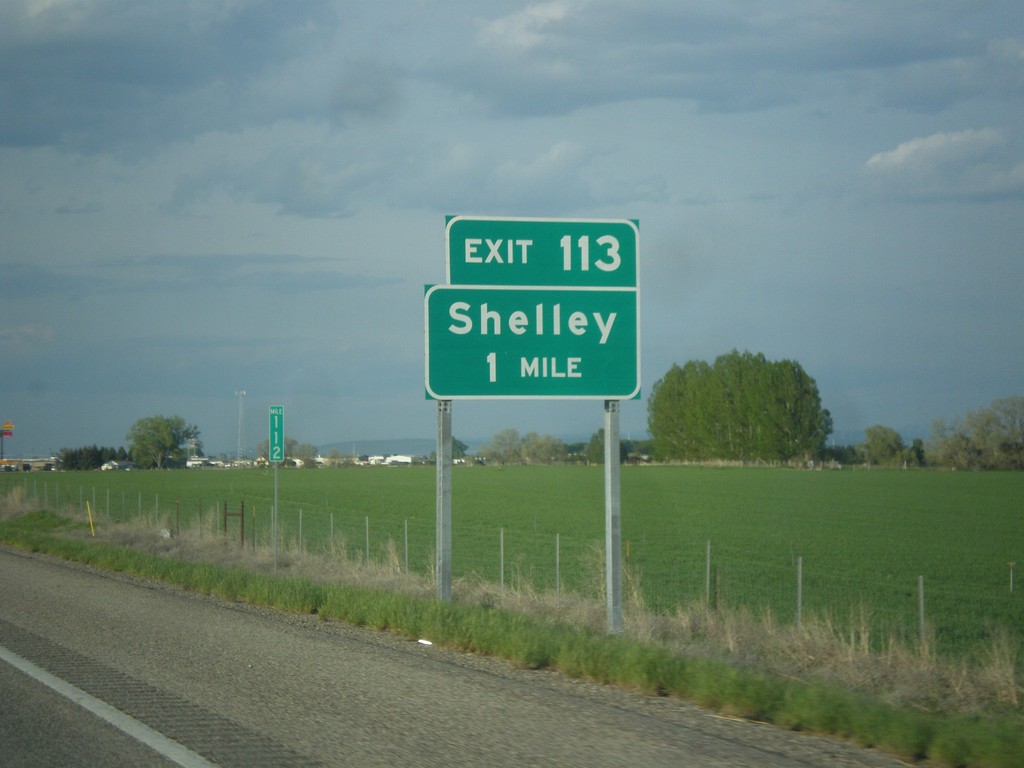
I-15 North - Exit 113
I-15 north approaching Exit 113 - Shelley.
Taken 05-13-2016
 Idaho Falls
Bonneville County
Idaho
United States
Idaho Falls
Bonneville County
Idaho
United States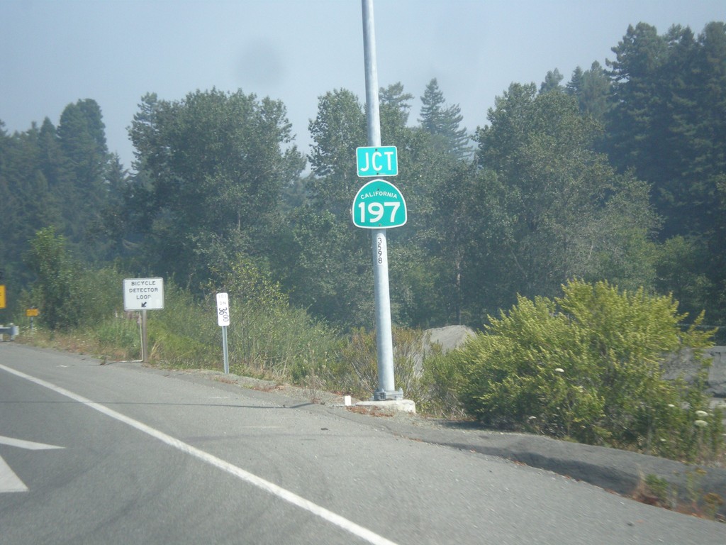
US-101 North Approaching CA-197
US-101 North approaching CA-197 in Del Norte County.
Taken 08-20-2015

 Crescent City
Del Norte County
California
United States
Crescent City
Del Norte County
California
United States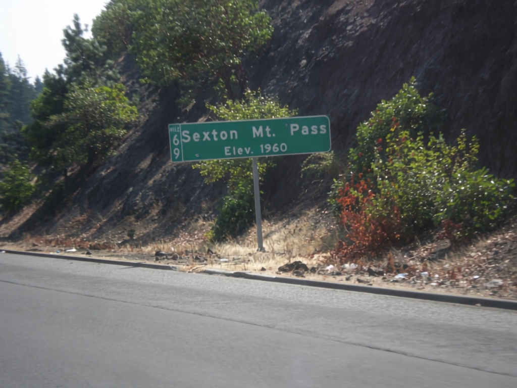
I-5 South - Sexton Mountain Summit
I-5 south at Sexton Mountain Summit - Elevation 1960 Feet. This summit is one a series of passes I-5 crosses between Canyonville and Grants Pass in the Klamath Mountains. The milepost is also attached to the main sign.
Taken 08-17-2015
 Wolf Creek
Josephine County
Oregon
United States
Wolf Creek
Josephine County
Oregon
United States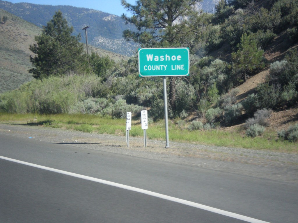
I-580/US-395 North - Washoe County Line
Washoe County Line on I-580/US-395 North.
Taken 06-15-2015
 Carson City
Washoe County
Nevada
United States
Carson City
Washoe County
Nevada
United States