Signs Tagged With Milemarker
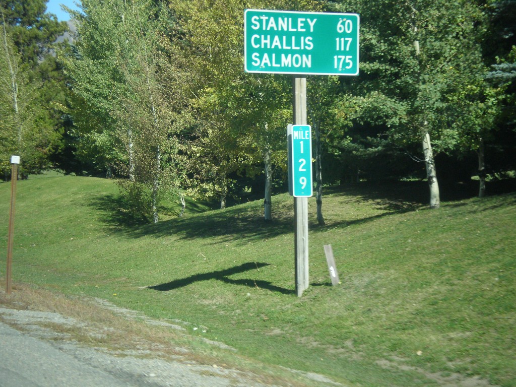
ID-75 North - Distance Marker
Distance marker on ID-75 north. Distance to Stanley, Challis, and Salmon. Milemarker 129. The milemarkers on ID-75 continue reflect the distance from the Idaho-Nevada state line (via US-93) rather than the beginning of ID-75. Originally, ID-75 was signed as US-93.
Taken 10-04-2014
 Sun Valley
Blaine County
Idaho
United States
Sun Valley
Blaine County
Idaho
United States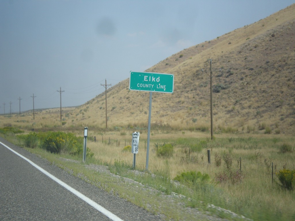
NV-278 North - Elko County Line
Elko County Line on NV-278 north.
Taken 08-31-2014
 Carlin
Elko County
Nevada
United States
Carlin
Elko County
Nevada
United States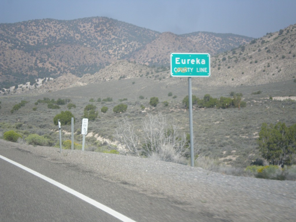
US-50 West - Eureka County Line
Eureka County Line on US-50 west.
Taken 08-31-2014
 Eureka
 County
Nevada
United States
Eureka
Eureka County
Nevada
United States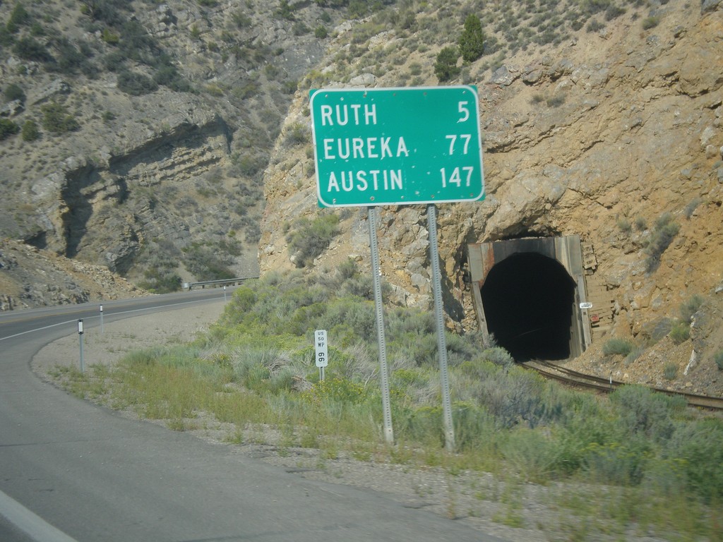
US-50 West - Distance Marker
Distance marker on US-50 west. Distance to Ruth, Eureka, and Austin.
Taken 08-31-2014
Ely
White Pine County
Nevada
United States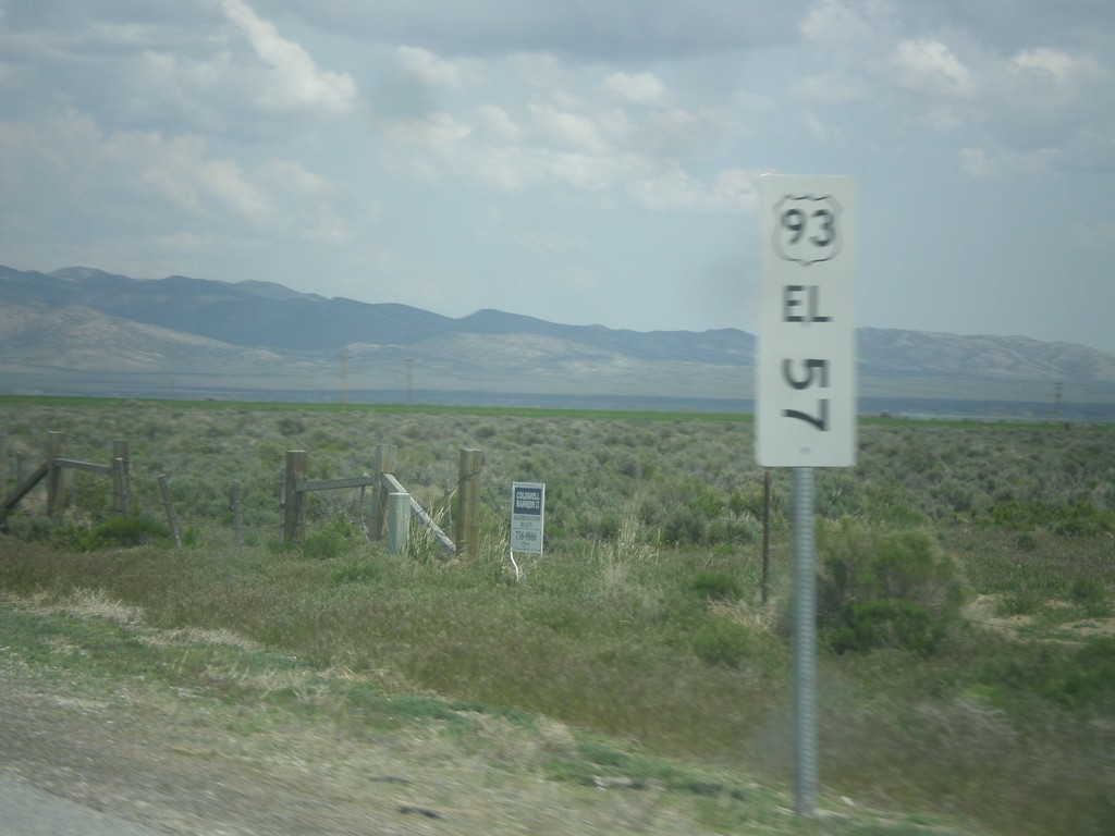
US-93 North - Mile Marker
This is an unusual mile marker on US-93 north in Nevada. Typical mile markers in Nevada are much smaller and do not have a shield outline on them, just a text description of the route. There are two or there on this stretch of road between Wells and Lages Junction.
Taken 05-22-2014
 Wells
Elko County
Nevada
United States
Wells
Elko County
Nevada
United States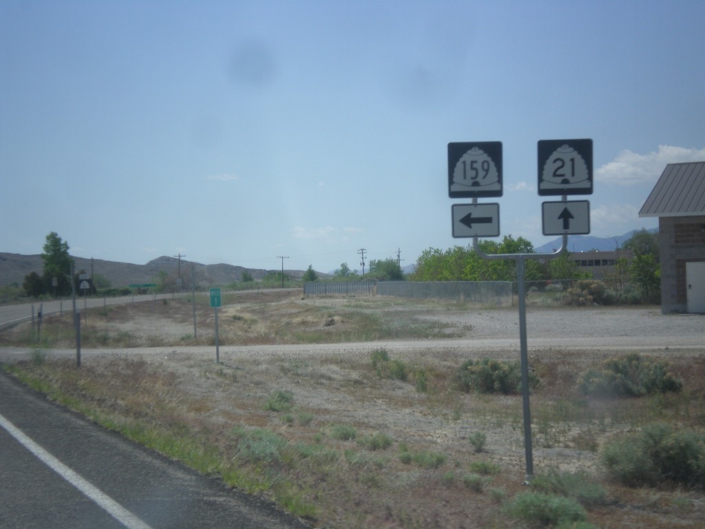
UT-21 East at UT-159
UT-21 east at UT-159 north in Garrison. Garrison is located inside Utah on the Nevada line.
Taken 05-19-2014

 Garrison
Millard County
Utah
United States
Garrison
Millard County
Utah
United States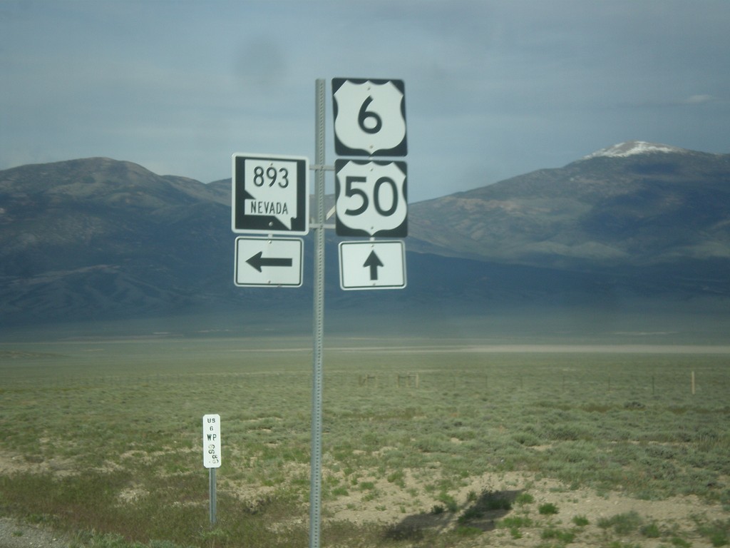
US-6/US-50 East at NV-893
US-6/US-50 East at NV-893 in White Pine County.
Taken 05-16-2014

 Majors Place
White Pine County
Nevada
United States
Majors Place
White Pine County
Nevada
United States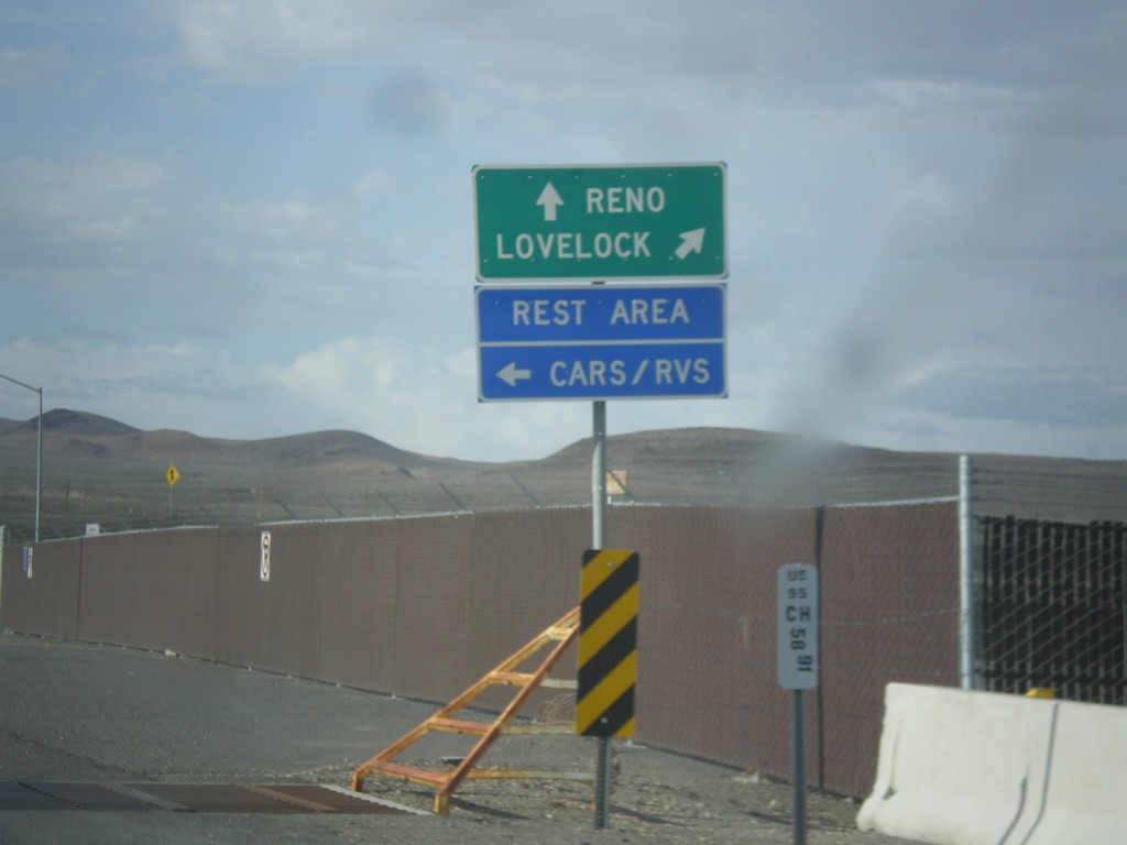
US-95 North Approaching I-80
US-95 north approaching I-80. Use I-80 East/US-95 North to Lovelock; use I-80 West/Alt. US-95 South to Reno. Turn left to enter the Rest Area. Notice the post mile marker at the base of the sign.
Taken 05-05-2014


 Churchill County
Nevada
United States
Churchill County
Nevada
United States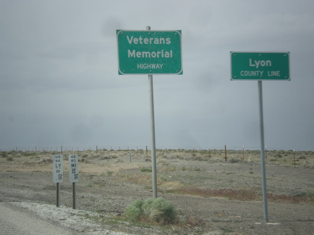
US-95 North - Lyon County Line
Lyon County Line on US-95 north. US-95 is signed as the Veterans Memorial Highway throughout Nevada.
Taken 05-05-2014
Schurz
Lyon County
Nevada
United States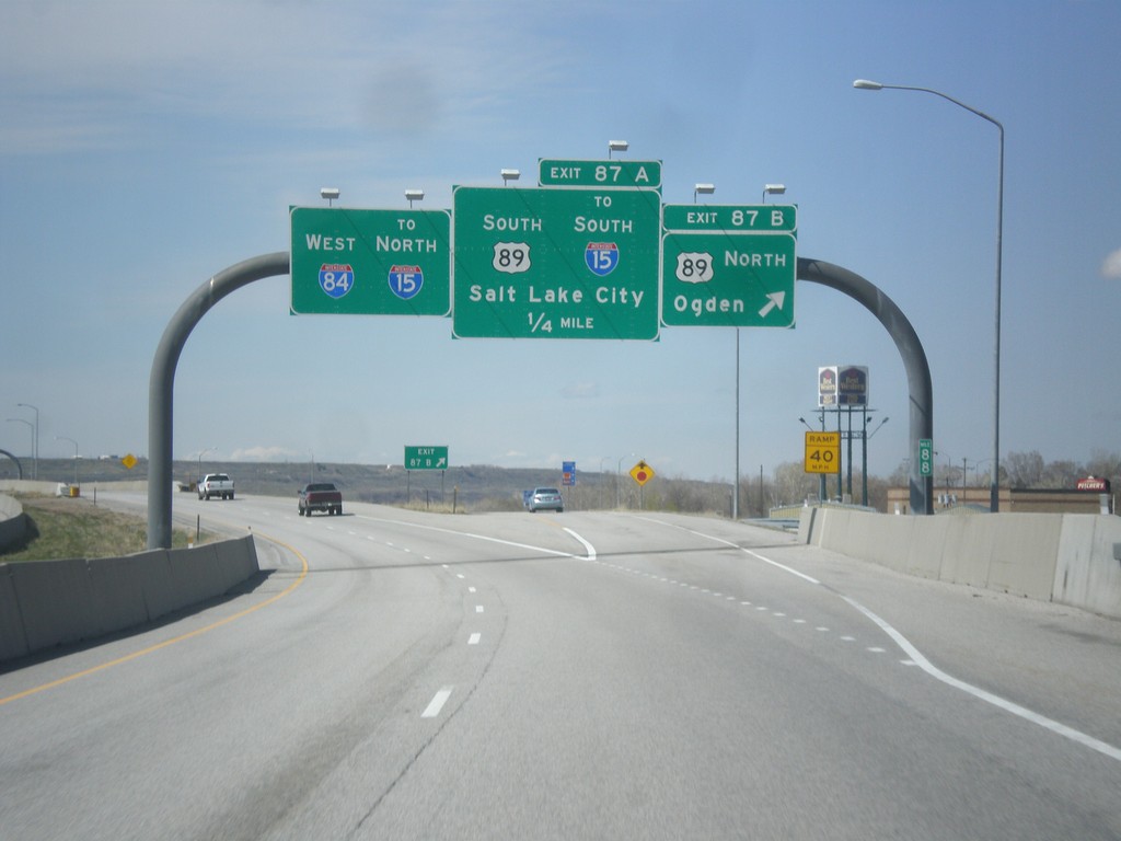
I-84 West - Exits 87A and 87B
I-84 west at Exit 87B - US-89 North/Ogden. Approaching US-89 South/To I-15 South/Salt Lake City. Continue west on I-84 for I-15 north.
Taken 03-31-2014


 Uintah
Weber County
Utah
United States
Uintah
Weber County
Utah
United States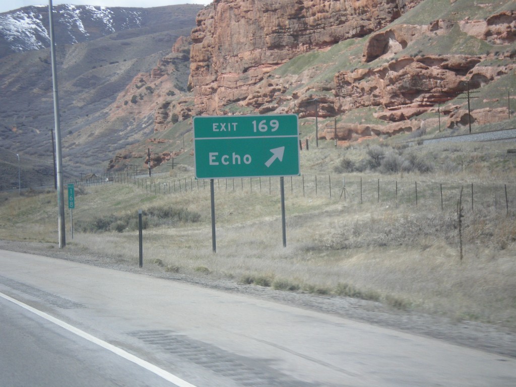
I-80 West - Exit 169
I-80 west at Exit 169 - Echo.
Taken 03-31-2014
Echo
Summit County
Utah
United States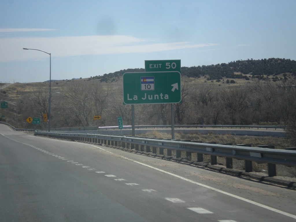
I-25 South - Exit 50
I-25 south at Exit 50 - CO-10/La Junta. US-160 joins I-25 south here to Trinidad.
Taken 03-29-2014


 Walsenburg
Huerfano County
Colorado
United States
Walsenburg
Huerfano County
Colorado
United States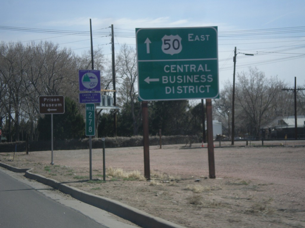
US-50 East - Cañon City Central Business District
US-50 East at 1st St. to (Cañon City) Central Business District.
Taken 03-29-2014
Cañon City
Fremont County
Colorado
United States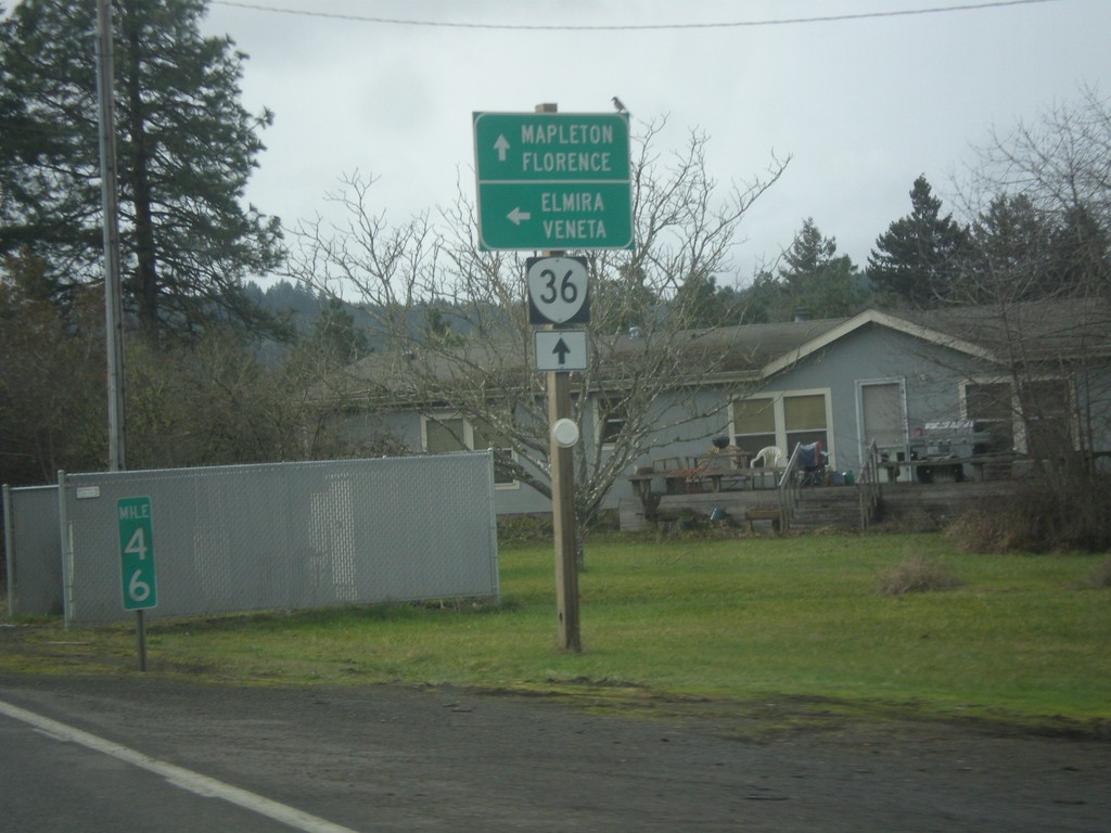
OR-36 West at Territorial Highway
OR-36 west at Territorial Highway south to Veneta and Elmira. Continue west on OR-36 for Mapleton and Florence.
Taken 02-13-2014
 Cheshire
Lane County
Oregon
United States
Cheshire
Lane County
Oregon
United States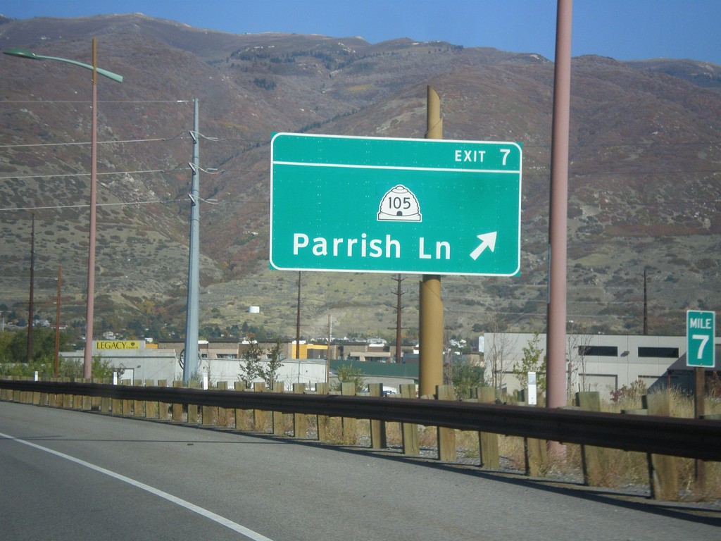
Legacy Parkway (UT-67) North - Exit 7
Legacy Parkway (UT-67) north at Exit 7 - UT-105/Parrish Lane.
Taken 10-18-2013

 Centerville
Davis County
Utah
United States
Centerville
Davis County
Utah
United States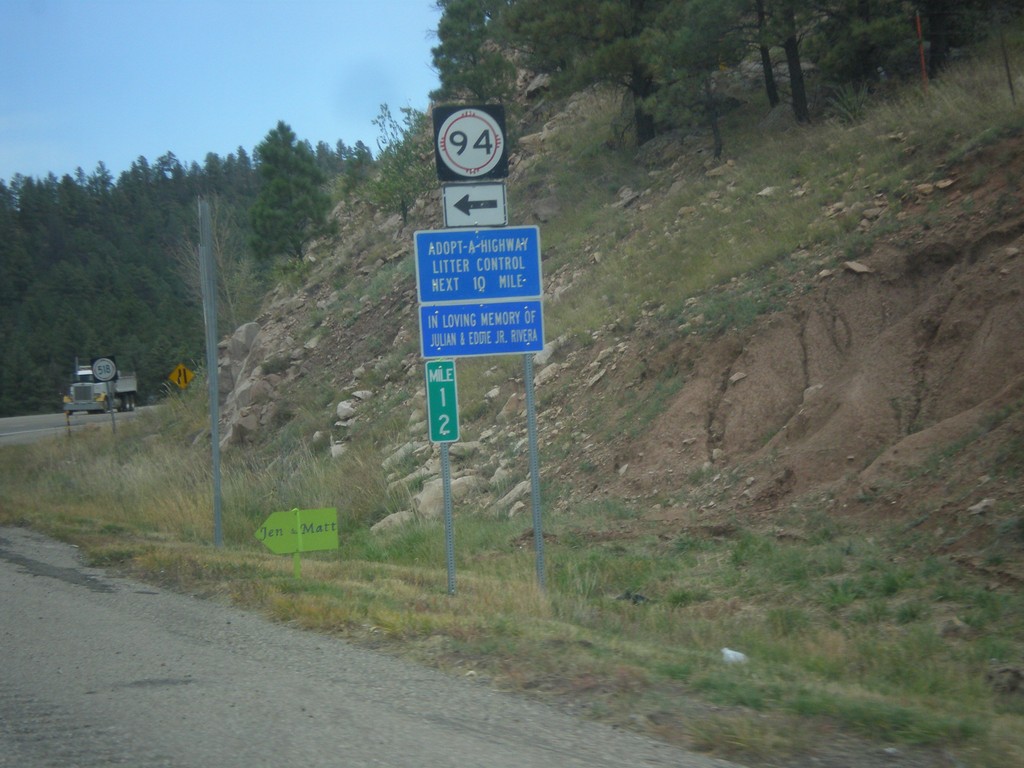
NM-518 North At NM-94
NM-518 north at NM-94 in San Miguel County.
Taken 10-10-2013

 Sapello
San Miguel County
New Mexico
United States
Sapello
San Miguel County
New Mexico
United States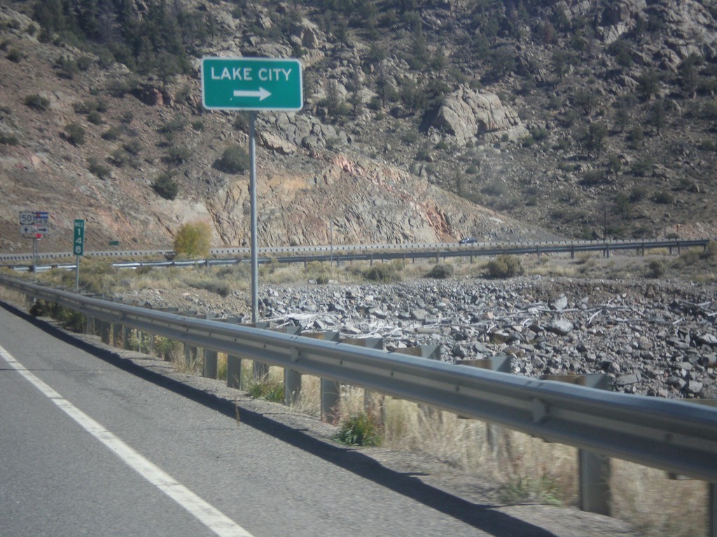
US-50 East at CO-149
US-50 East at CO-149 south to Lake City.
Taken 10-08-2013
 Gunnison
 County
Colorado
United States
Gunnison
Gunnison County
Colorado
United States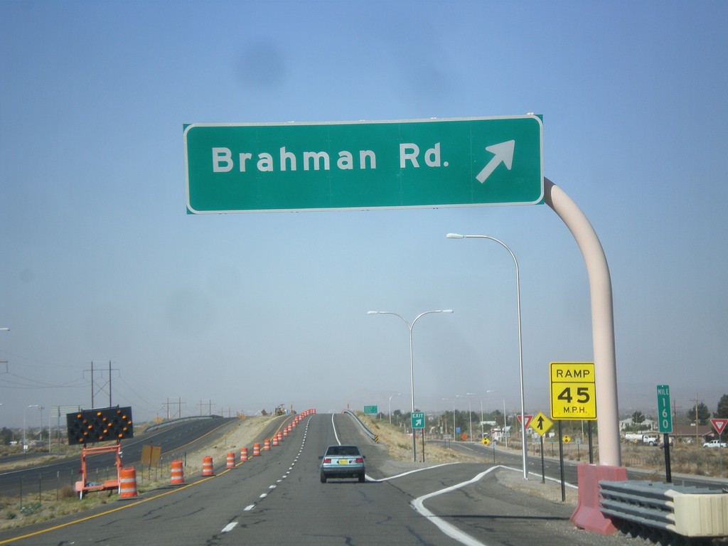
US-70 West - Brahman IC
US-70 west Brahman Road interchange.
Taken 04-15-2013
 Organ
Doña Ana County
New Mexico
United States
Organ
Doña Ana County
New Mexico
United States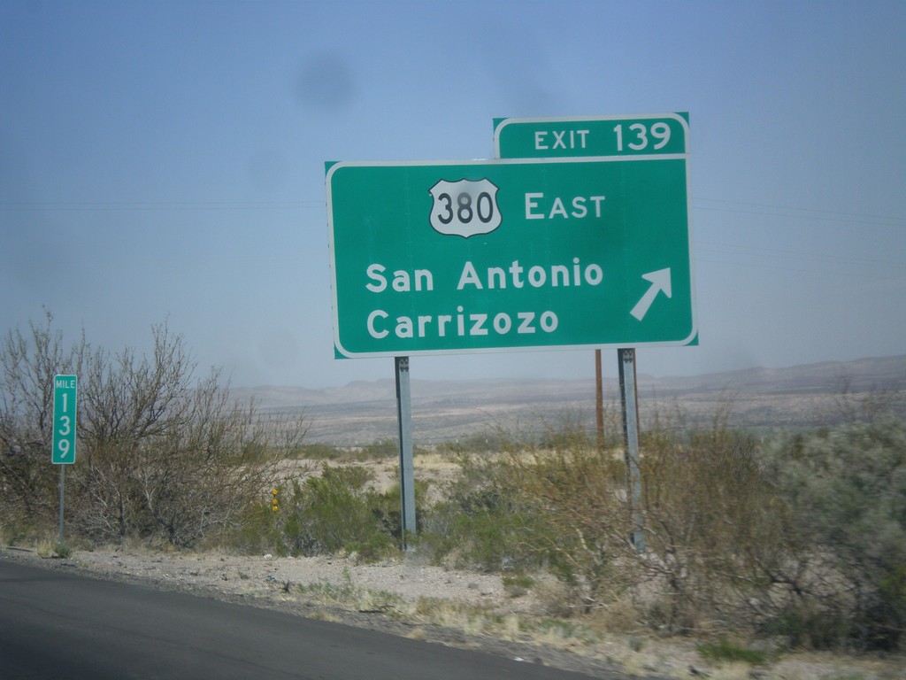
I-25 North - Exit 139
I-25 north at Exit 139 - US-380 East/San Antonio/Carrizozo. This is the western terminus of US-380.
Taken 04-15-2013
 San Antonio
Socorro County
New Mexico
United States
San Antonio
Socorro County
New Mexico
United States
I-25 North - Exit 139
I-25 north approaching Exit 139 - US-380 East/San Antonio/Carrizozo.
Taken 04-15-2013
San Antonio
Socorro County
New Mexico
United States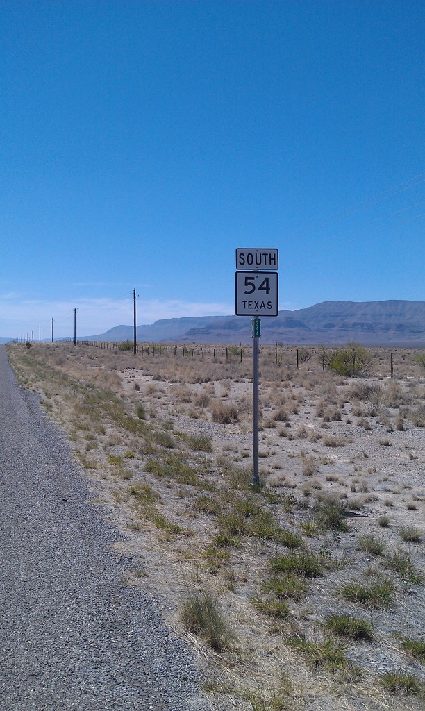
TX-54 South
TX-54 south in Culberson County.
Taken 04-15-2013
 Van Horn
Culberson County
Texas
United States
Van Horn
Culberson County
Texas
United States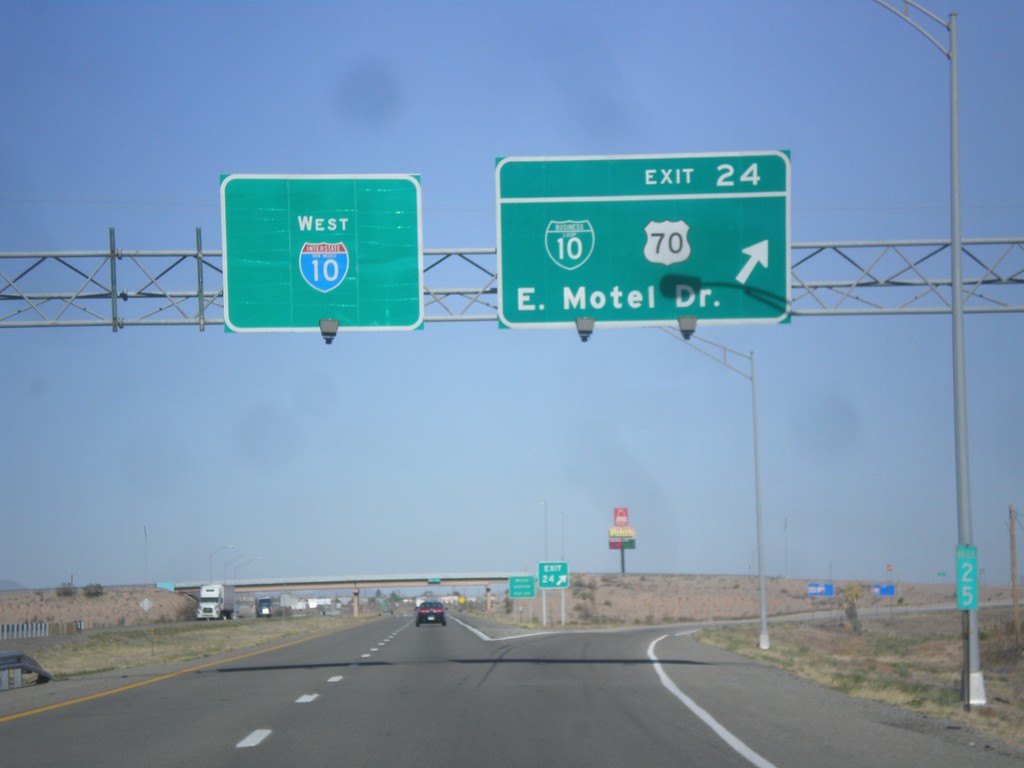
I-10 West - Exit 24
I-10 west at Exit 24 - BL-10/US-70/East Motel Drive.
Taken 04-14-2013

 Lordsburg
Hidalgo County
New Mexico
United States
Lordsburg
Hidalgo County
New Mexico
United States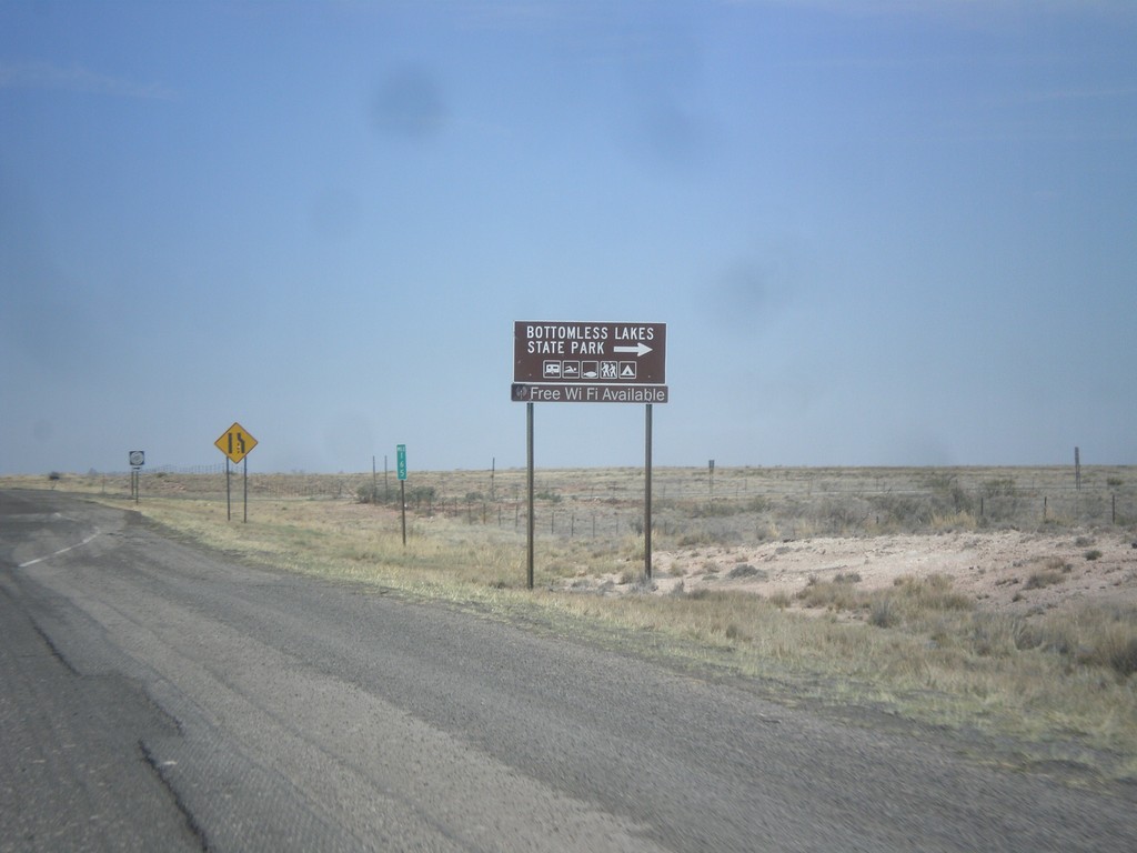
US-380 East at NM-409
US-380 east at NM-409 south to Bottomless Lakes State Park.
Taken 04-14-2013
 Roswell
Chaves County
New Mexico
United States
Roswell
Chaves County
New Mexico
United States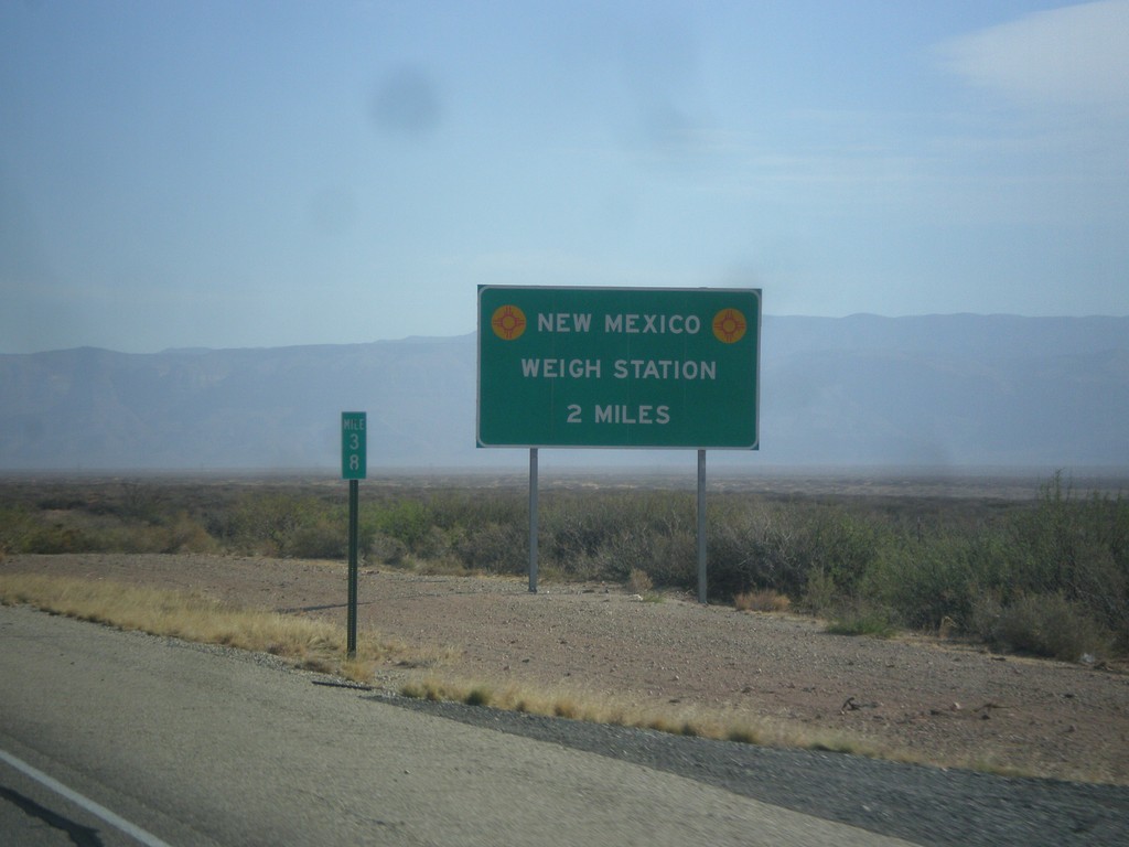
US-54 North - New Mexico Weigh Station
Approaching New Mexico Weigh Station and Border Patrol Checkpoint.
Taken 04-14-2013
 Orogrande
Otero County
New Mexico
United States
Orogrande
Otero County
New Mexico
United States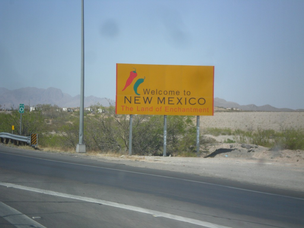
I-10 West - Welcome To New Mexico
Welcome to New Mexico - Land of Enchantment on I-10 west. Taken at the Texas - New Mexico State Line.
Taken 04-14-2013
Anthony
Doña Ana County
New Mexico
United States