Signs Tagged With Milemarker
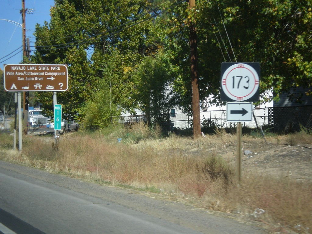
US-550 North at NM-173
US-550 north at NM-173 west to Navajo Lake State Park.
Taken 10-15-2012

 Aztec
San Juan County
New Mexico
United States
Aztec
San Juan County
New Mexico
United States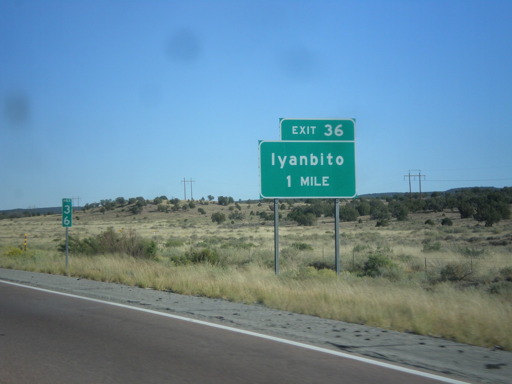
I-40 East Approaching Exit 36
I-40 east approaching Exit 36 - Iyanbito.
Taken 10-10-2012
 Fort Wingate
McKinley County
New Mexico
United States
Fort Wingate
McKinley County
New Mexico
United States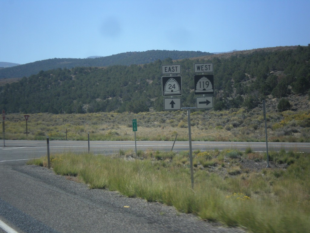
UT-24 East at UT-119
UT-24 east at UT-119 west.
Taken 10-07-2012

 Richfield
Sevier County
Utah
United States
Richfield
Sevier County
Utah
United States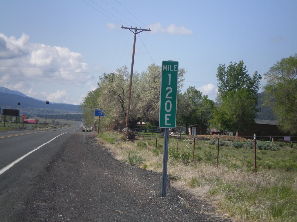
Milemarker at OR-31/US-395 Junction
Milemarker 120E at OR-31/US-395 junction. These type of milemarkers with the letter suffix have started to appear around Oregon. The letter indicates the segment of highway that the mileage is for. In Oregon, mile markers are posted according to internal highway, not posted route number (except for intersate highways). In this case the milemarker is for Fremont Highway. A posted highway can be composed of have multiple segments of internal highways. The milemarker in this photo is for the 5th (E is the 5th letter) segment of internal highway along posted route US-395. See here for more discussion: State Highways In Oregon
Taken 05-28-2012

 Lakeview
Lake County
Oregon
United States
Lakeview
Lake County
Oregon
United States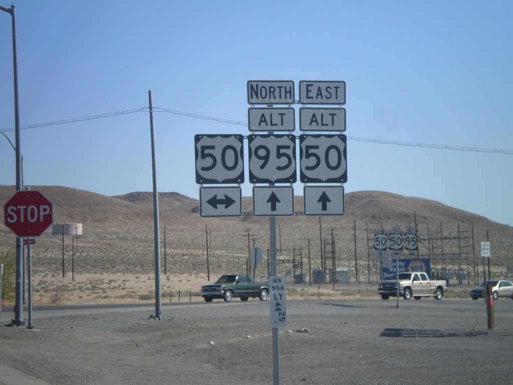
Alt. US-95 North at US-50/Alt. US-50
Alt. US-95 North at US-50/Alt. US-50 in Silver Springs. This is the western end of Alt. US-50. Alt. US-50 follows Alt. US-95 north to Fernley, thence east to outside of Fallon rejoining with US-50.
Taken 05-07-2012


 Silver Springs
Lyon County
Nevada
United States
Silver Springs
Lyon County
Nevada
United States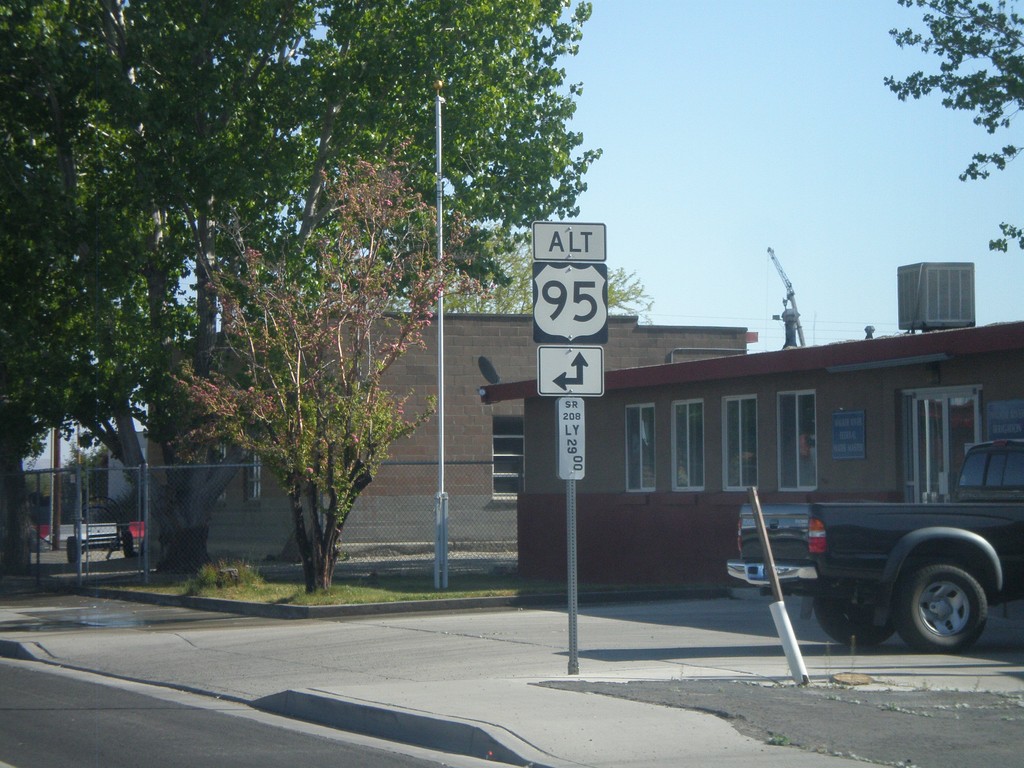
NV-208 North Approaching Alt. US-95
NV-208 north approaching Alt. US-95 north in Yerrington. Below the Alt. US-95 shield is a Nevada post mile marker. Nevada state and US highways do not have traditional mile markers, but instead have these post mile markers. The mileage on these markers reset at each county line. The top line is the route type, in this case SR (State Route). The next line is the two character county abbreviation - LY for Lyon County. The number is the actual mileage, to two decimal places.
Taken 05-07-2012
 Yerington
Lyon County
Nevada
United States
Yerington
Lyon County
Nevada
United States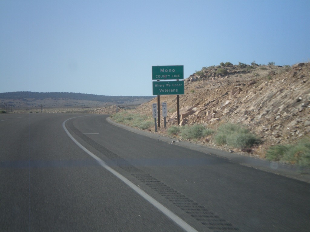
US-395 North - Mono County
Mono County Line on US-395 north.
Taken 05-06-2012
Mesa
Inyo County
California
United States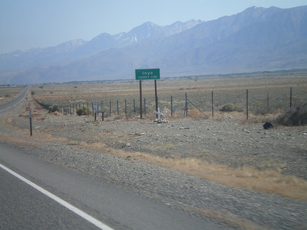
US-6 West - Inyo County Line
Inyo County Line on US-6 west. Taken at the Mono-Inyo county line.
Taken 05-04-2012
 Bishop
Inyo County
California
United States
Bishop
Inyo County
California
United States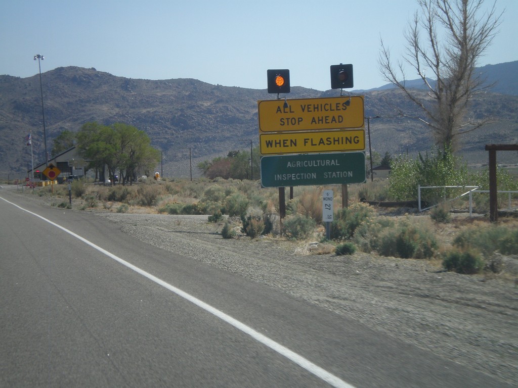
US-6 West - California State Agricultural Inspection
US-6 west approaching the California State Agricultural Inspection Station at Benton. All traffic must stop for inspection. I was waved through on this day.
Taken 05-04-2012
Benton
Mono County
California
United States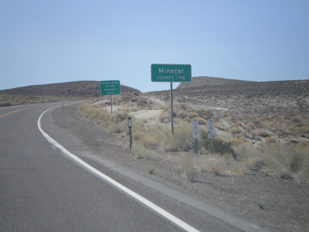
US-6 West - Mineral County Line
US-6 West at Mineral County Line. Taken at the Mineral - Esmeralda County Line.
Taken 05-04-2012
Esmeralda County
Nevada
United States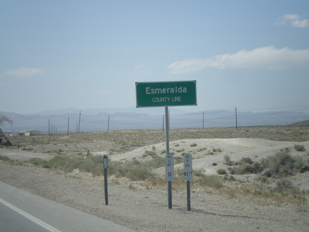
US-6 West/US-95 North - Esmeralda County Line
Esmeralda County Line on US-6 West/US-95 North leaving Tonopah. Taken at the Esmeralda-Nye County Line.
Taken 05-04-2012
 Tonopah
Esmeralda County
Nevada
United States
Tonopah
Esmeralda County
Nevada
United States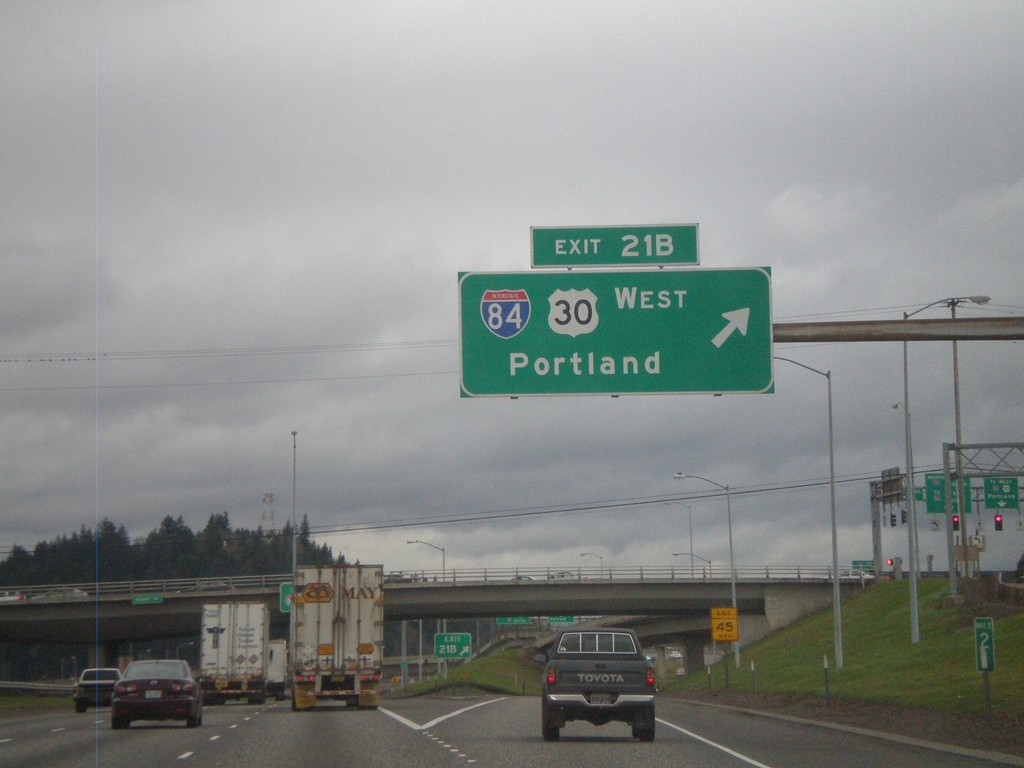
I-205 North - Exit 21B
I-205 north at Exit 21B - I-84/US-30 West/Portland.
Taken 02-21-2012


 Portland
Multnomah County
Oregon
United States
Portland
Multnomah County
Oregon
United States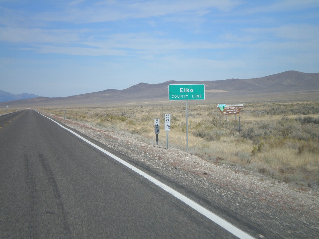
US-93 North - Elko County
Entering Elko County on US-93 north. Elko County is the fourth largest county by area in the lower 48 states.
Taken 10-15-2011
 Ely
Elko County
Nevada
United States
Ely
Elko County
Nevada
United States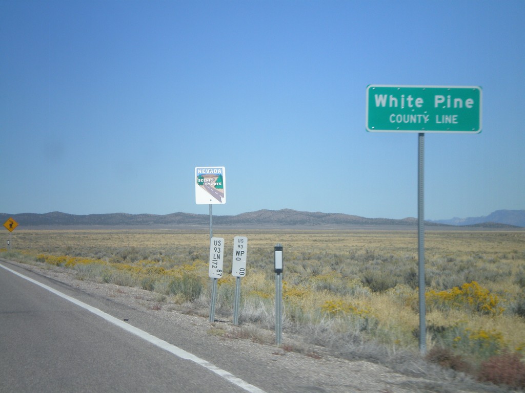
US-93 North - White Pine County Line
White Pine County Line on US-93 north. The sign behind the county line designates this stretch of US-93 as a Nevada Scenic Byway.
Taken 10-14-2011
Pioche
White Pine County
Nevada
United States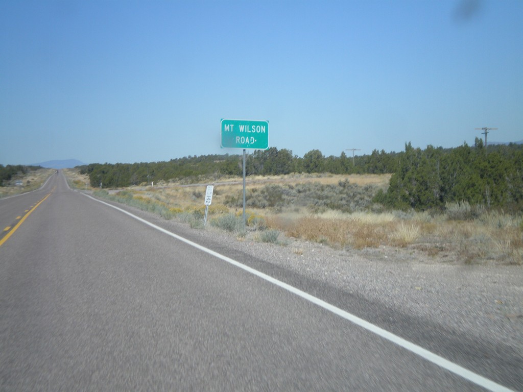
US-93 North - Mt. Wilson Road
US-93 north at Mt. Wilson Road.
Taken 10-14-2011
Pioche
Lincoln County
Nevada
United States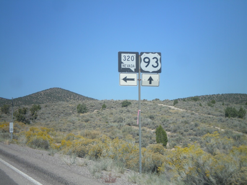
US-93 North at NV-320
US-93 north at NV-320 north.
Taken 10-14-2011
 Pioche
Lincoln County
Nevada
United States
Pioche
Lincoln County
Nevada
United States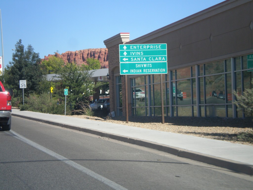
UT-18 North Approaching UT-8
UT-18 North approaching UT-8. Use UT-8 west for Santa Clara and Shivwits Indian Reservation. Continue north on UT-18 for Ivins and Enterprise.
Taken 10-14-2011

 St. George
Washington County
Utah
United States
St. George
Washington County
Utah
United States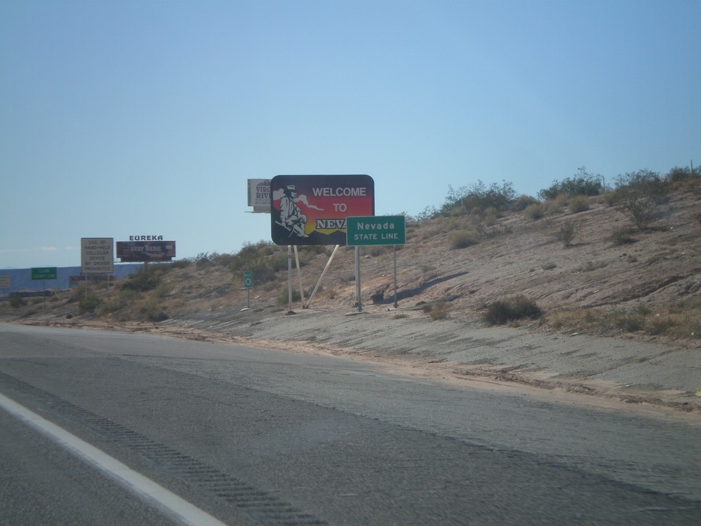
I-15 South - Welcome To Nevada
Welcome To Nevada on I-15 south. Taken at the Nevada-Arizona State Line. The green Nevada State Line sign in the foreground was placed by the Arizona DOT.
Taken 10-09-2011
 Mesquite
Clark County
Nevada
United States
Mesquite
Clark County
Nevada
United States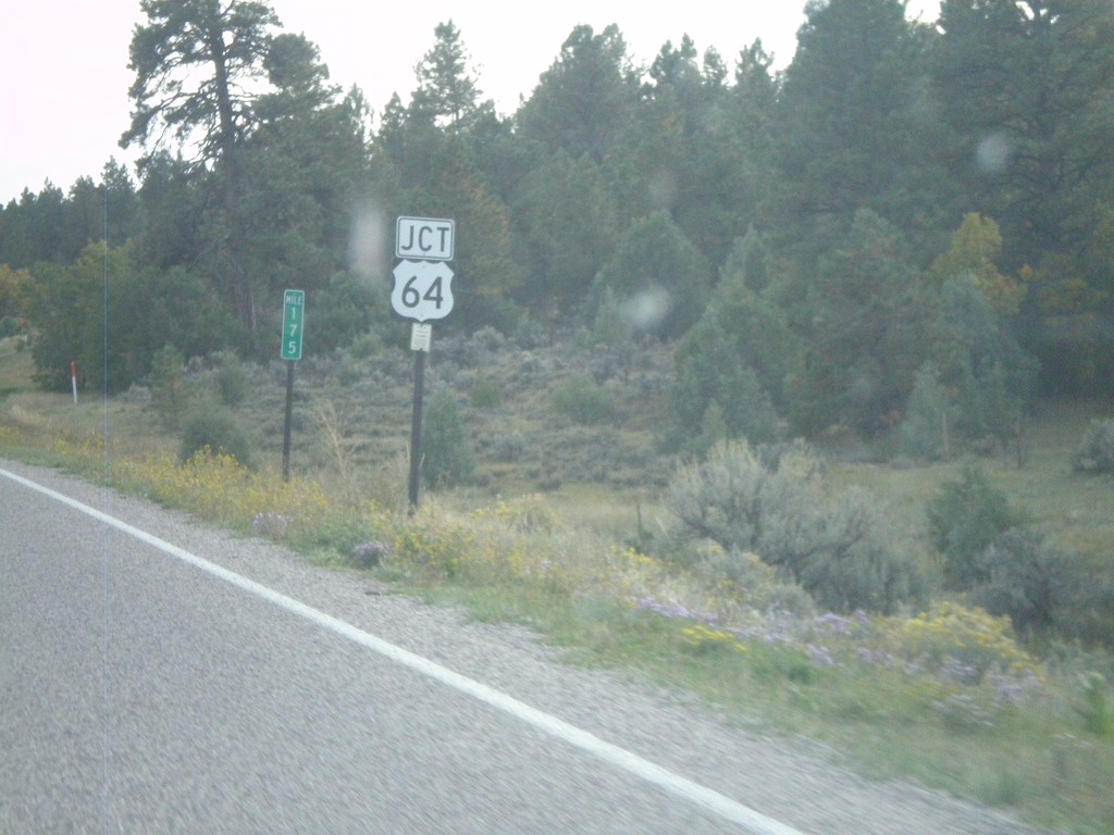
US-84 South/US-64 East At Split
US-84 South/US-64 East at Split. US-64 turns east here towards Taos. Northbound US-64 joins US-84 to west of Chama.
Taken 10-02-2011

 Los Ojos
Rio Arriba County
New Mexico
United States
Los Ojos
Rio Arriba County
New Mexico
United States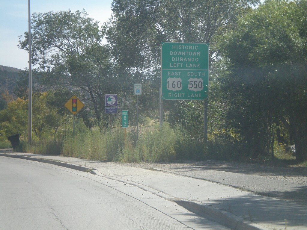
US-160 East Approaching US-550
US-160 East approaching US-550. Turn right for US-160 East/US-550 South; left for Historic Downtown Durango.
Taken 10-02-2011
 Durango
La Plata County
Colorado
United States
Durango
La Plata County
Colorado
United States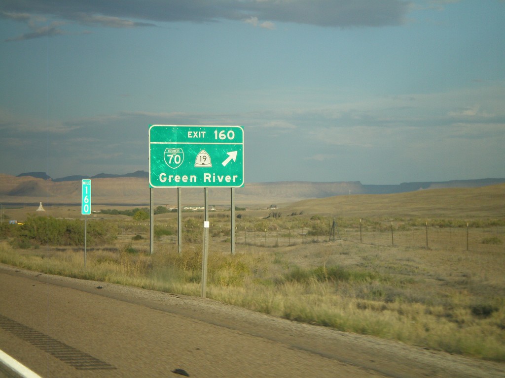
I-70 East - Exit 160
I-70 east at Exit 160 - BL-70/UT-19/Green River.
Taken 10-01-2011


 Green River
Emery County
Utah
United States
Green River
Emery County
Utah
United States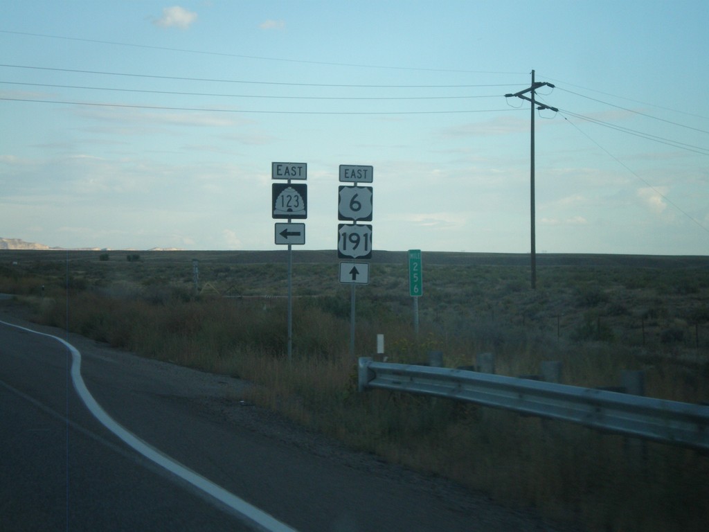
US-6 East/US-191 South at UT-123
US-6 East/US-191 South at UT-123 in Carbon County.
Taken 10-01-2011
 Price
Carbon County
Utah
United States
Price
Carbon County
Utah
United States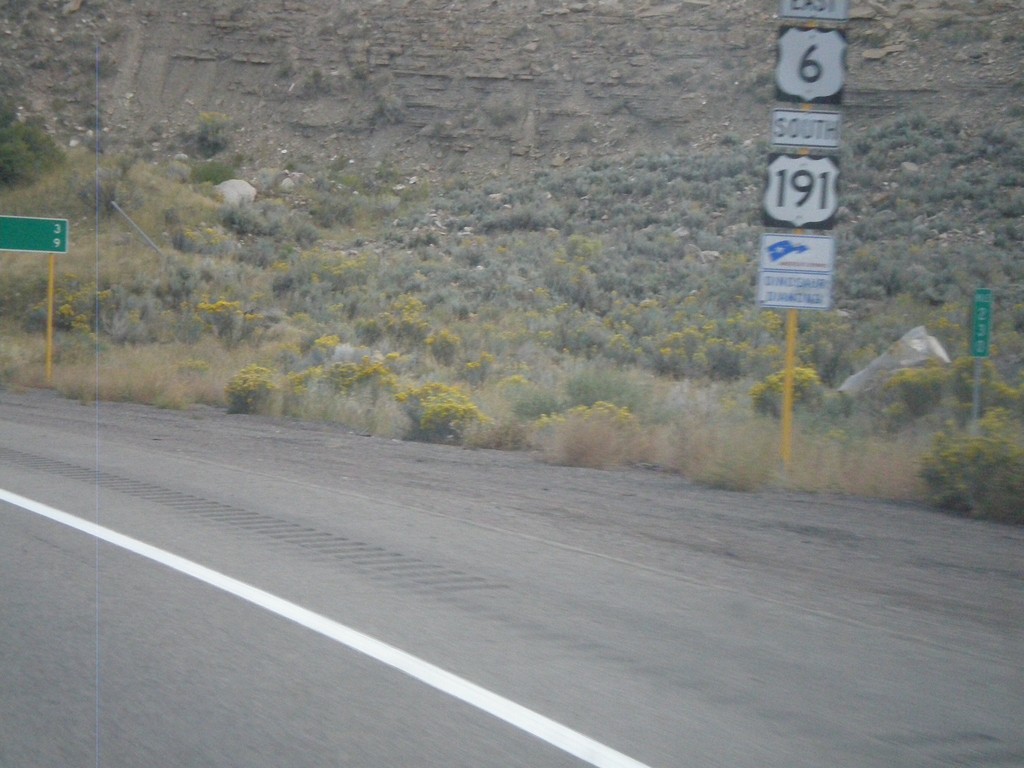
US-6 East/US-191 South near Helper
US-6 East/US-191 South near Helper. The sign beneath the shield designates this stretch of highway as a segment of Dinosaur Diamond Byway - part of America’s Byway System.
Taken 10-01-2011
Helper
Carbon County
Utah
United States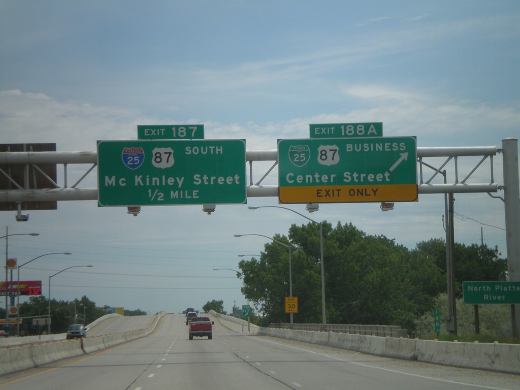
I-25 South - Exits 188A and 187
I-25 south at Exit 188A - BL-25/BL-87/Center St. Approaching Exit 187 - McKinley St. Exit 187 is signed as I-25 and US-87 south, but this is an error. Neither highway exit at McKinley St.
Taken 07-04-2011


 Casper
Natrona County
Wyoming
United States
Casper
Natrona County
Wyoming
United States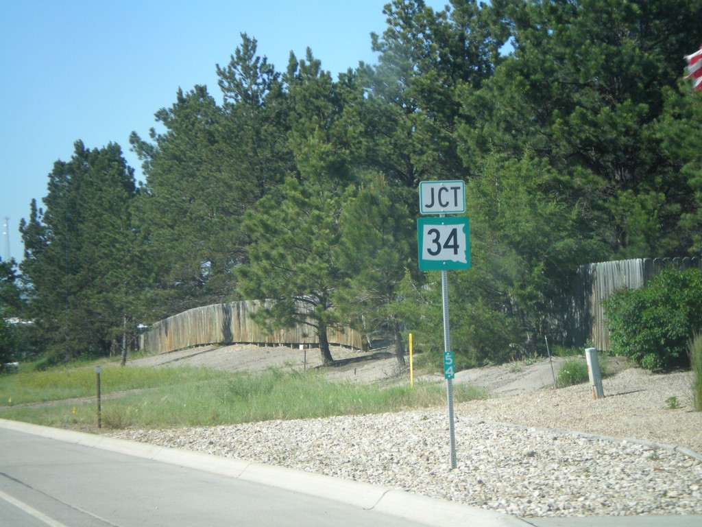
US-85 North Approaching SD-34
US-85 North approaching SD-34. Mile marker 54 is posted to the bottom of the marker.
Taken 07-03-2011

 Belle Fourche
Butte County
South Dakota
United States
Belle Fourche
Butte County
South Dakota
United States