Signs Tagged With Overhead
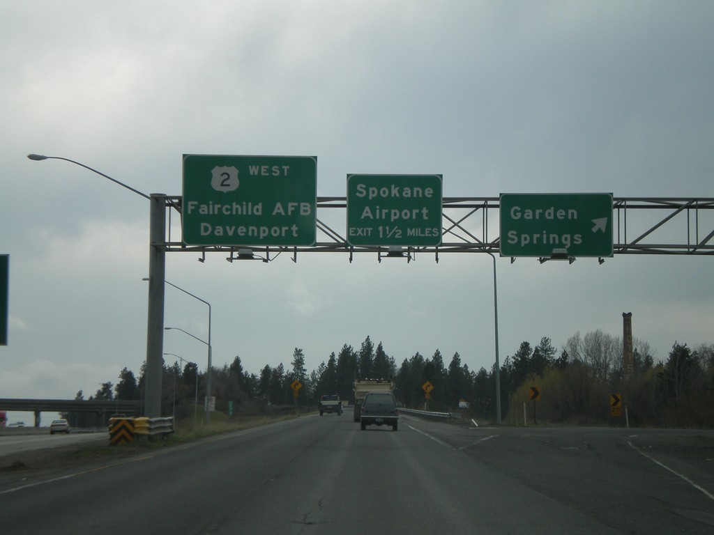
US-2 West - Garden Springs Exit
US-2 west at Garden Springs exit. Approaching Spokane Airport exit. Overhead to Fairchild AFB and Davenport.
Taken 04-14-2008
 Spokane
 County
Washington
United States
Spokane
Spokane County
Washington
United States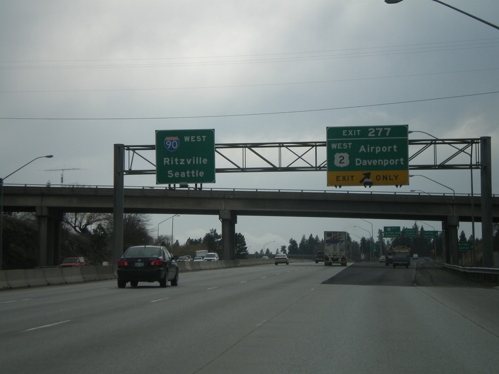
I-90 West - Exit 277
I-90 west at Exit 277 - US-2 West/Airport/Davenport. I-90 overhead to Ritzville and Seattle.
Taken 04-14-2008

 Spokane
 County
Washington
United States
Spokane
Spokane County
Washington
United States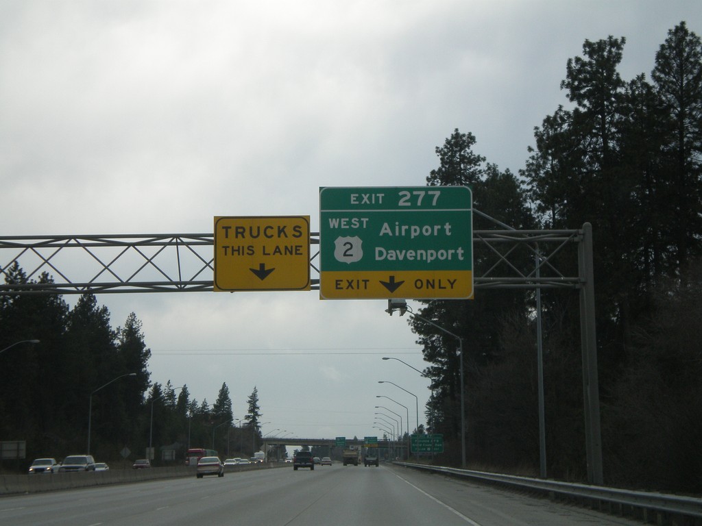
I-90 West - Exit 277
I-90 west approaching Exit 277 - US-2 West/Airport/Fairchild AFB.
Taken 04-14-2008
Spokane
Spokane County
Washington
United States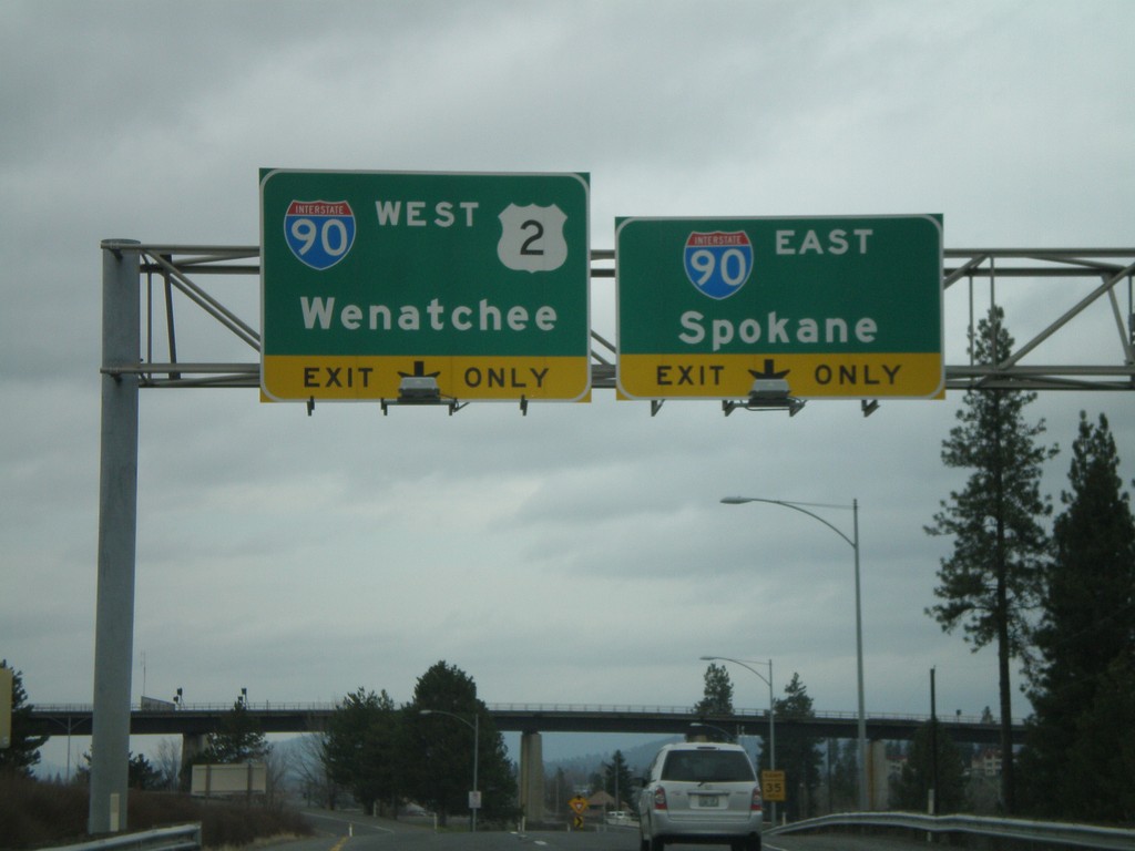
End US-195 North at I-90/US-2/US-395
End US-195 north at I-90/US-2/US-395 (not signed). Use right lane for I-90 East/Spokane. Use left lane for I-90 West/US-2 West/Wenatchee.
Taken 04-14-2008
 Spokane
 County
Washington
United States
Spokane
Spokane County
Washington
United States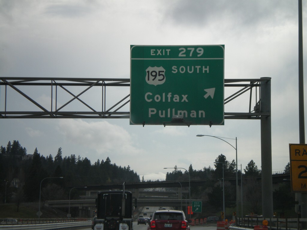
I-90 West - Exit 279
I-90 west at Exit 279 - US-195 South/Colfax/Pullman.
Taken 04-14-2008
Spokane
Spokane County
Washington
United States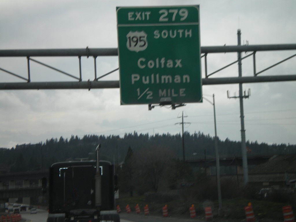
I-90 West - Exit 279
I-90 west approaching Exit 279 - US-195 South/Colfax/Pullman.
Taken 04-14-2008
Spokane
Spokane County
Washington
United States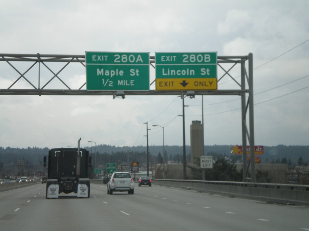
I-90 West - Exits 280B and 280A
I-90 west at Exit 280B - Lincoln St. Approaching Exit 280A - Maple St.
Taken 04-14-2008
Spokane
Spokane County
Washington
United States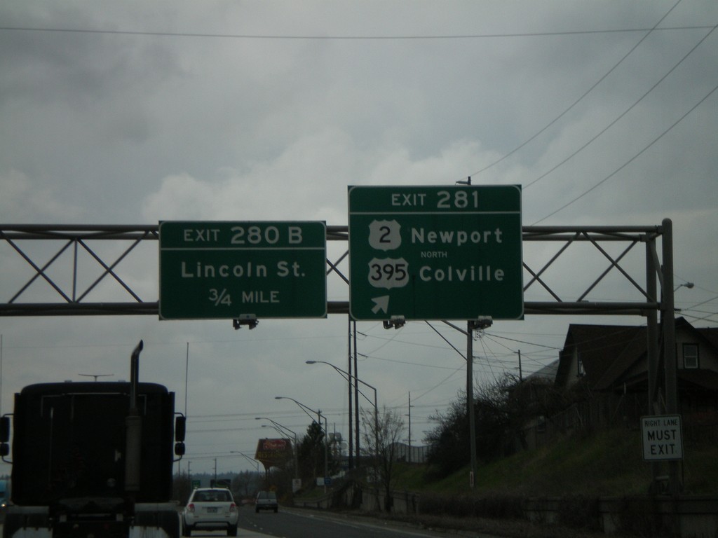
I-90 West - Exit 281
I-90 west at Exit 281 - US-2/Newport/US-395 North/Colville. Approaching Exit 280B - Lincoln St. US-2 joins I-90 here through Spokane. US-395 joins I-90 west to Ritzville.
Taken 04-14-2008
Spokane
Spokane County
Washington
United States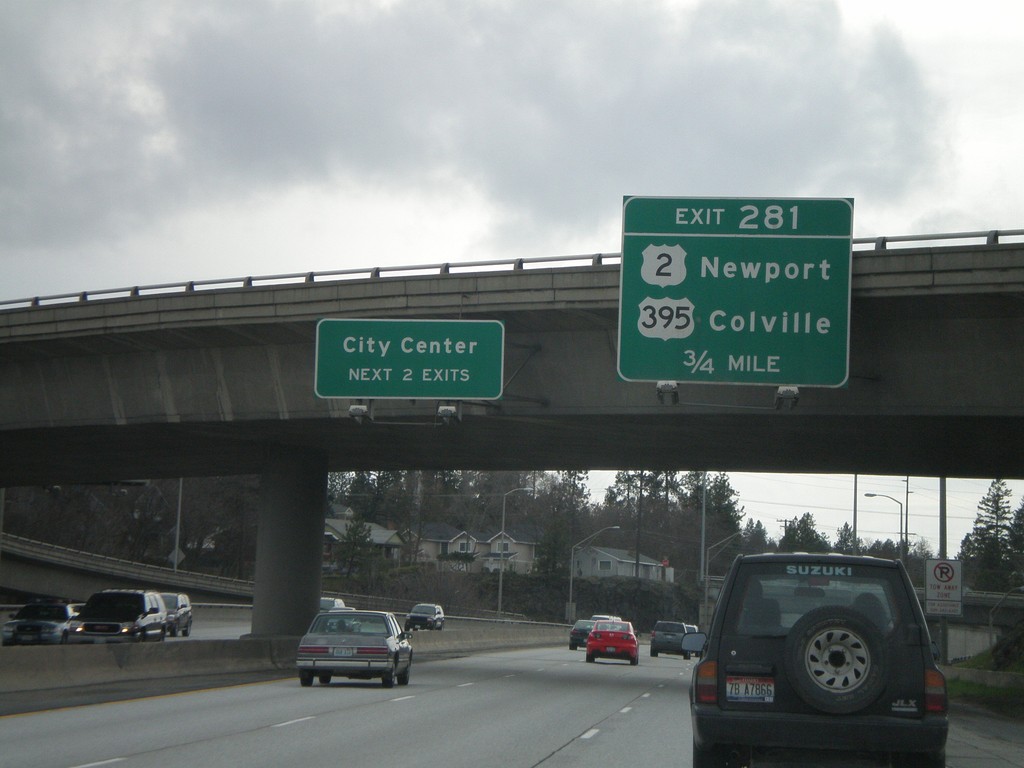
I-90 West - Exit 281
I-90 west approaching Exit 281 - US-2/Newport/US-395/Colville.
Taken 04-14-2008
Spokane
Spokane County
Washington
United States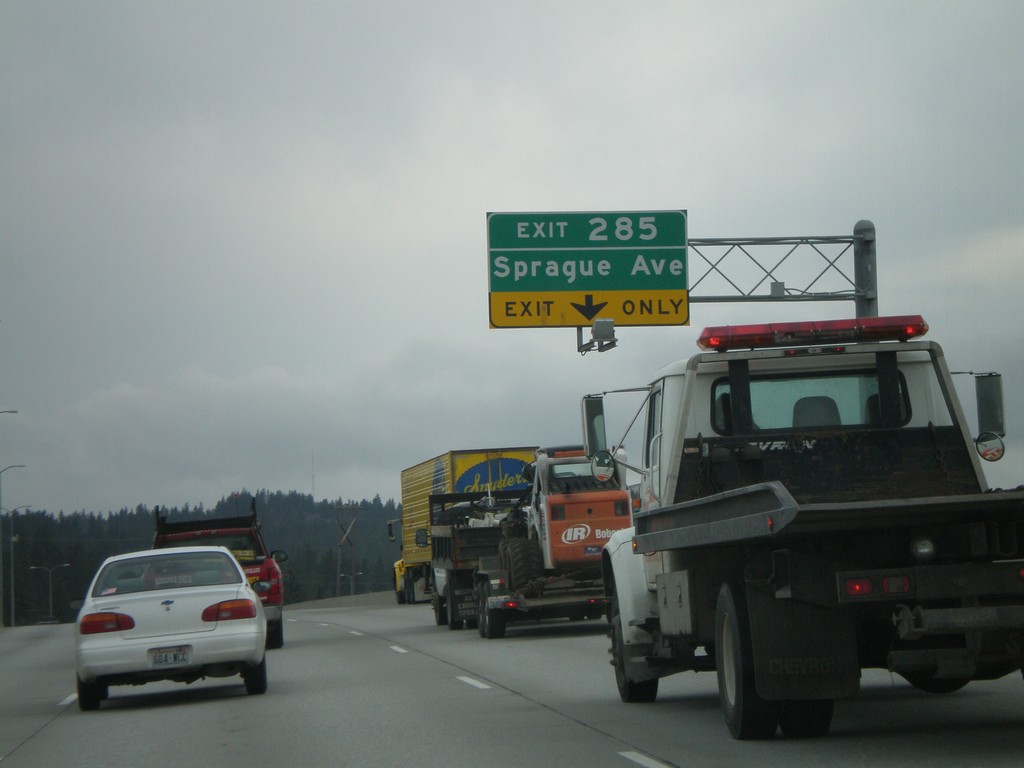
I-90 West - Exit 285
I-90 west approaching Exit 285 - Sprague Ave.
Taken 04-14-2008
Spokane Valley
Spokane County
Washington
United States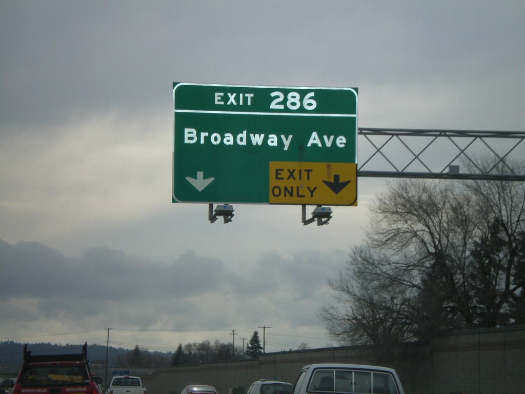
I-90 West - Exit 286
I-90 west approaching Exit 286 - Broadway Ave.
Taken 04-14-2008
Spokane Valley
Spokane County
Washington
United States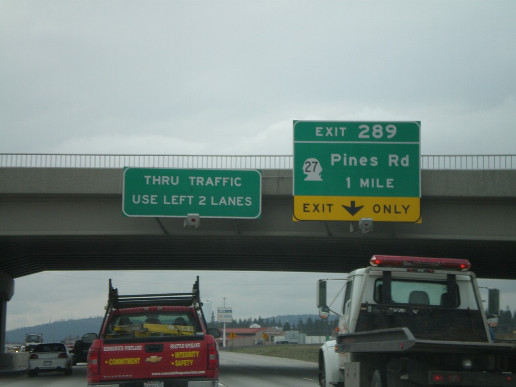
I-90 West - Exit 289
I-90 west approaching Exit 289 - WA-27/Pines Road.
Taken 04-14-2008
 Spokane Valley
Spokane County
Washington
United States
Spokane Valley
Spokane County
Washington
United States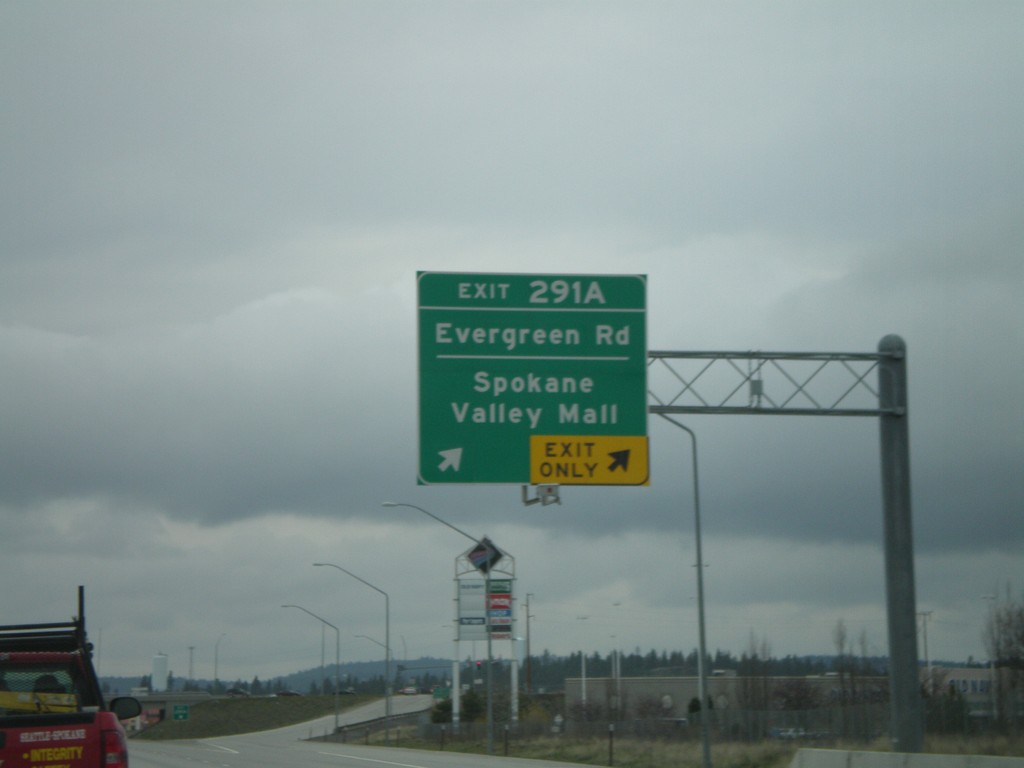
I-90 West - Exit 291A
I-90 west at Exit 291A - Evergreen Road/Spokane Valley Mall.
Taken 04-14-2008
Spokane Valley
Spokane County
Washington
United States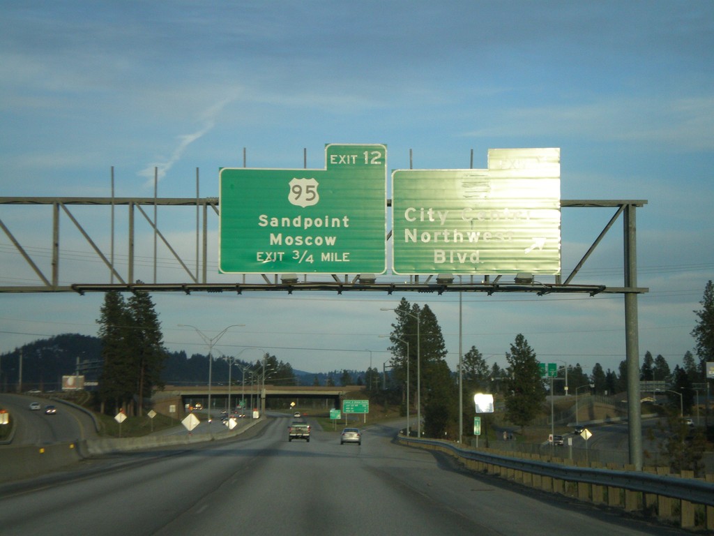
I-90 East - Exits 11 and 12
I-90 east at Exit 11 - City Center/Northwest Blvd. Approaching Exit 12 - US-95/Sandpoint/Moscow.
Taken 04-13-2008
 Coeur d'Alene
Kootenai County
Idaho
United States
Coeur d'Alene
Kootenai County
Idaho
United States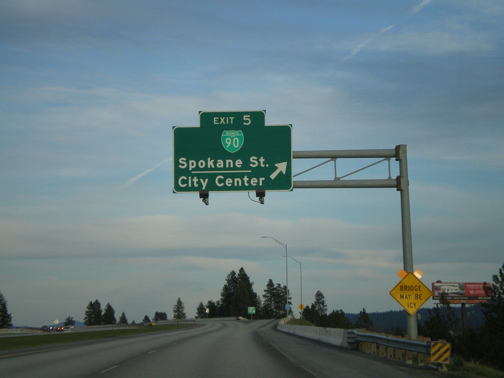
I-90 East - Exit 5
I-90 east at Exit 5 - BL-90/Spokane St./City Center.
Taken 04-13-2008
 Post Falls
Kootenai County
Idaho
United States
Post Falls
Kootenai County
Idaho
United States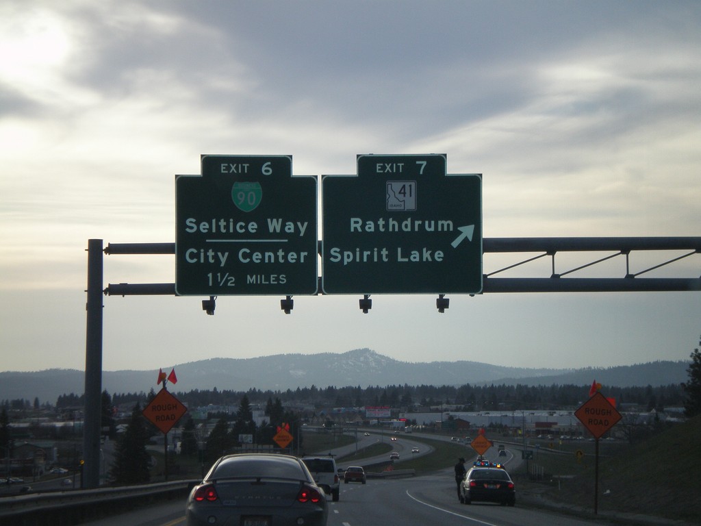
I-90 West - Exits 7 and 6
I-90 west at Exit 7 - ID-41/Rathdrum/Spirit Lake. Approaching Exit 6 - BL-90/Seltice Way/City Center.
Taken 04-13-2008
 Post Falls
Kootenai County
Idaho
United States
Post Falls
Kootenai County
Idaho
United States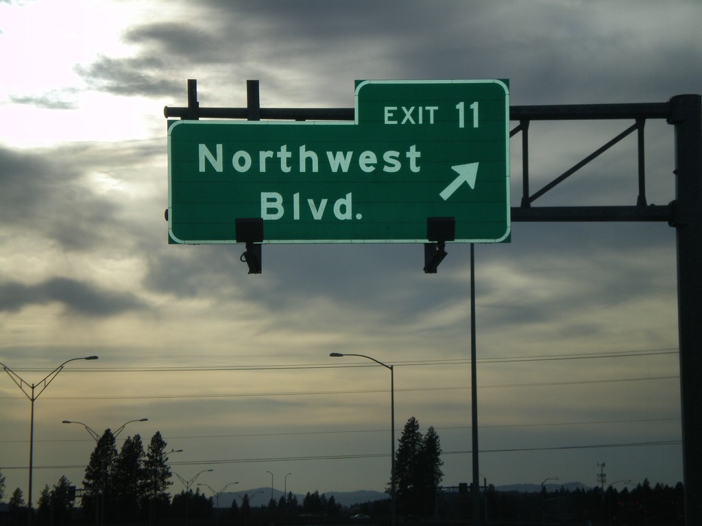
I-90 West - Exit 11
I-90 west at Exit 11 - Northwest Blvd.
Taken 04-13-2008
Coeur d'Alene
Kootenai County
Idaho
United States
I-90 West - Exits 12 and 11
I-90 west at Exit 12 - US-95/Sandpoint/Moscow. Approaching Exit 11 - Northwest Blvd.
Taken 04-13-2008
Coeur d'Alene
Kootenai County
Idaho
United States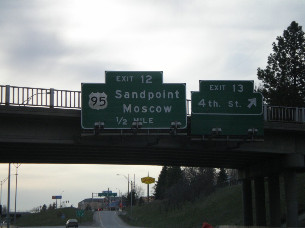
I-90 West - Exits 13 and 12
I-90 west at Exit 13 - 4th St. Approaching Exit 12 - US-95/Sandpoint/Moscow.
Taken 04-13-2008
Coeur d'Alene
Kootenai County
Idaho
United States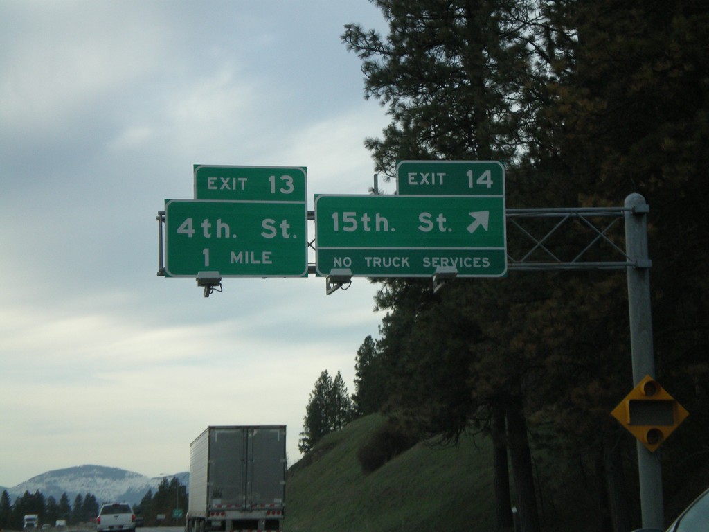
I-90 West - Exits 14 and 13
I-90 west at Exit 14 - 15th St. Approaching Exit 13 - 4th St.
Taken 04-13-2008
Coeur d'Alene
Kootenai County
Idaho
United States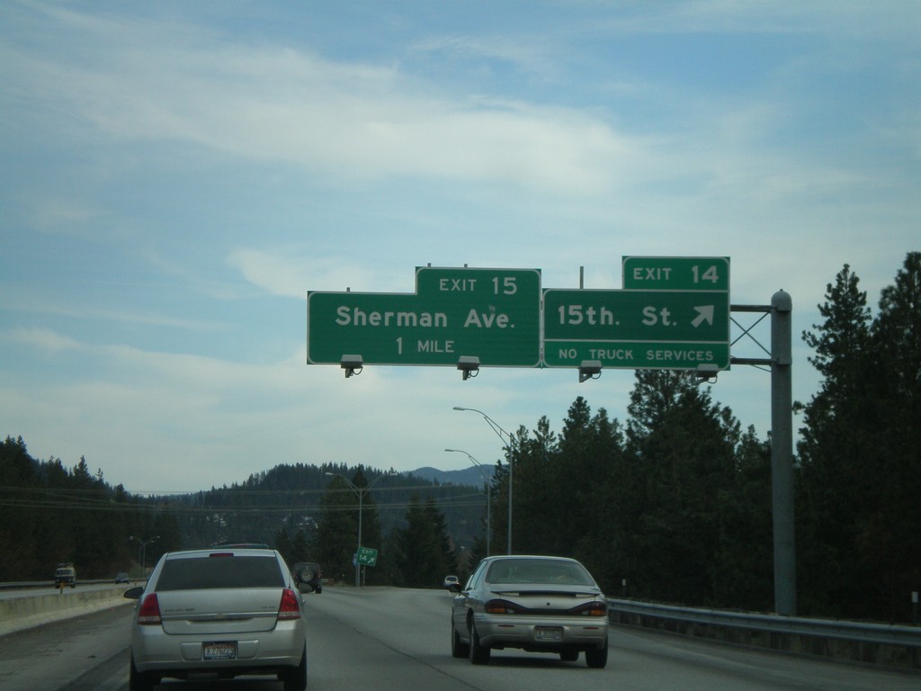
I-90 East - Exit 14 and 15
I-90 east at Exit 14 - 15th St. Approaching Exit 15 - Sherman Ave.
Taken 04-13-2008
Coeur d'Alene
Kootenai County
Idaho
United States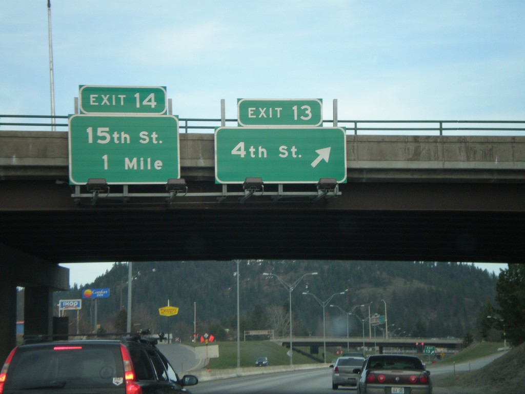
I-90 East - Exits 13 and 14
I-90 east at Exit 13 - 4th St. Approaching Exit 14 - 15th St.
Taken 04-13-2008
Coeur d'Alene
Kootenai County
Idaho
United States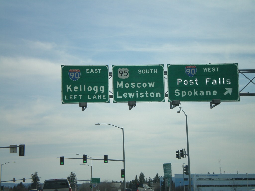
US-95 South at I-90
US-95 south at I-90 west onramp (Exit 12). Use I-90 west for Post Falls and Spokane. Use I-90 east for Kellogg and US-95 south for Moscow and Lewiston.
Taken 04-13-2008
Coeur d'Alene
Kootenai County
Idaho
United States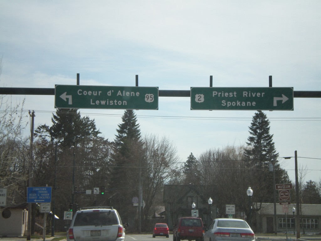
US-2 West/US-95 South at US-2/US-95 Split
US-2 West/US-95 South (5th Ave.) at US-2/US-95 split (Pine St.). Use US-2 West for Priest River and Sandpoint. Use US-95 South for Coeur d’Alene and Lewiston.
Taken 04-13-2008
Sandpoint
Bonner County
Idaho
United States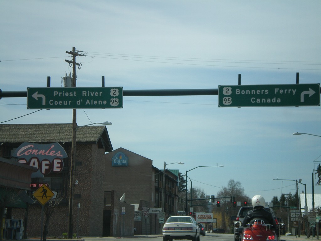
US-2 East/US-95 North Approaching US-2/US-95
US-2 East/US-95 North (Cedar St.) at US-2 West/US-95 South (5th Ave.) to Priest River and Coeur d’Alene. US-2 East/US-95 north to Bonners Ferry and Canada.
Taken 04-13-2008
Sandpoint
Bonner County
Idaho
United States