Signs Tagged With Overhead
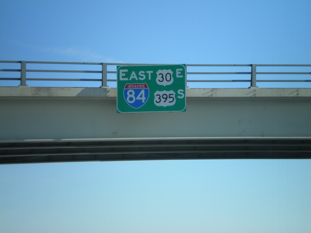
I-84 East/US-30 East/US-395 South Overhead
I-84/US-30 East/US-395 South overhead in Umatilla County.
Taken 01-22-2008


 Pendleton
Umatilla County
Oregon
United States
Pendleton
Umatilla County
Oregon
United States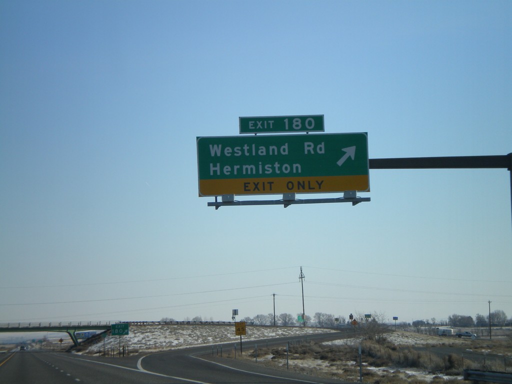
I-84 East - Exit 180
I-84 east at Exit 180 - Westland Road/Hermiston.
Taken 01-22-2008
Hermiston
Umatilla County
Oregon
United States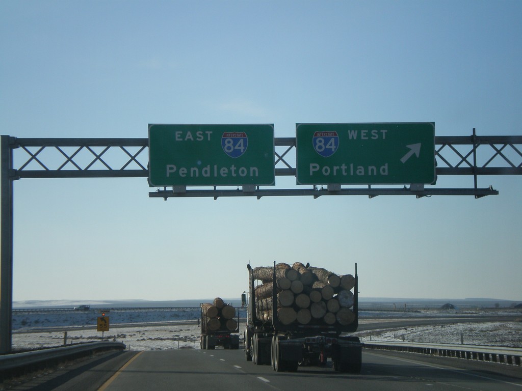
End I-82 East at I-84
End I-82 east at I-84. Use I-84 west to Portland; I-84 east to Pendleton.
Taken 01-22-2008
 Hermiston
Umatilla County
Oregon
United States
Hermiston
Umatilla County
Oregon
United States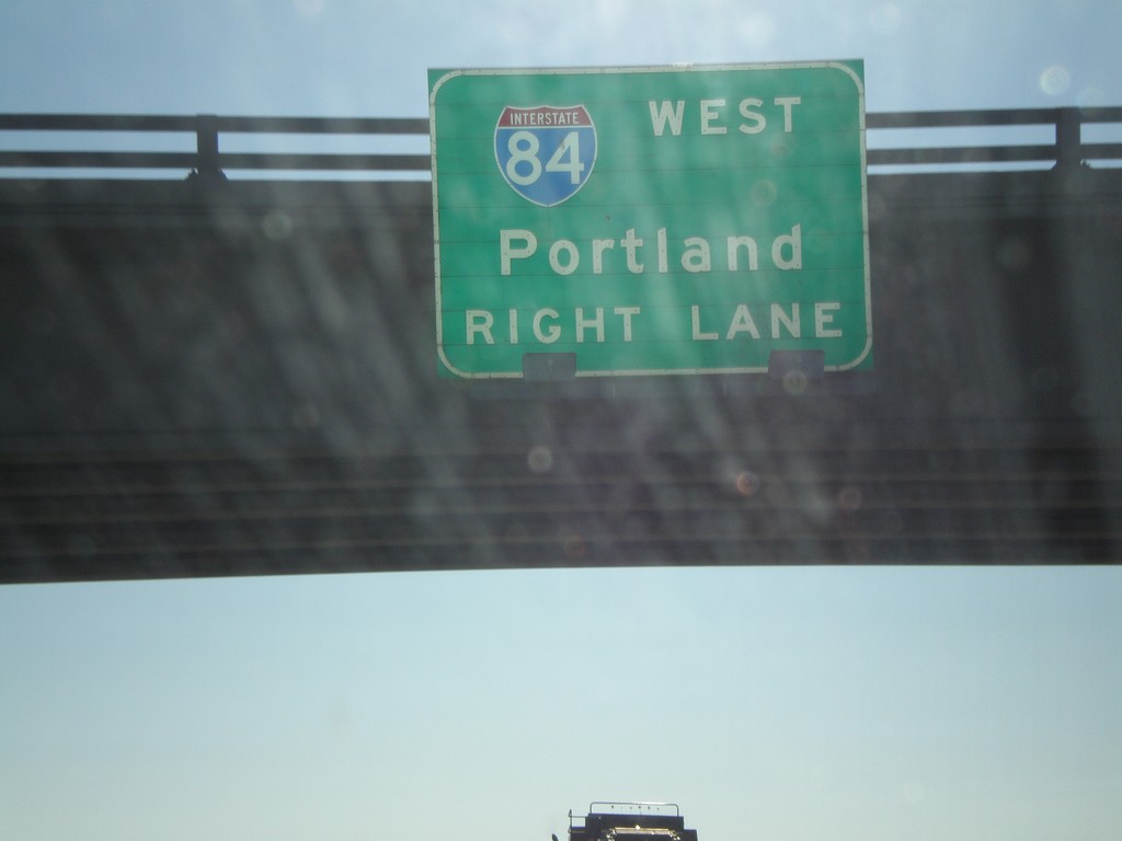
I-82 East Approaching I-84
I-82 east approaching I-84. Use right lane for I-84 west to Portland.
Taken 01-22-2008
Hermiston
Umatilla County
Oregon
United States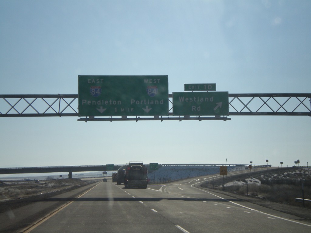
I-82 East - Exit 10 Approaching I-84
I-82 east at Exit 10 - Westland Road. Approaching I-84 to Portland and Pendleton.
Taken 01-22-2008
Hermiston
Umatilla County
Oregon
United States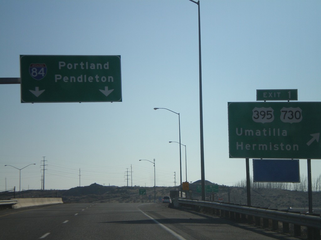
I-82 East - Exit 1
I-82 east at Exit 1 - US-395/US-730/Umatilla/Hermiston. Continue east on I-82 for I-84/Portland/Pendleton.
Taken 01-22-2008
 Umatilla
 County
Oregon
United States
Umatilla
Umatilla County
Oregon
United States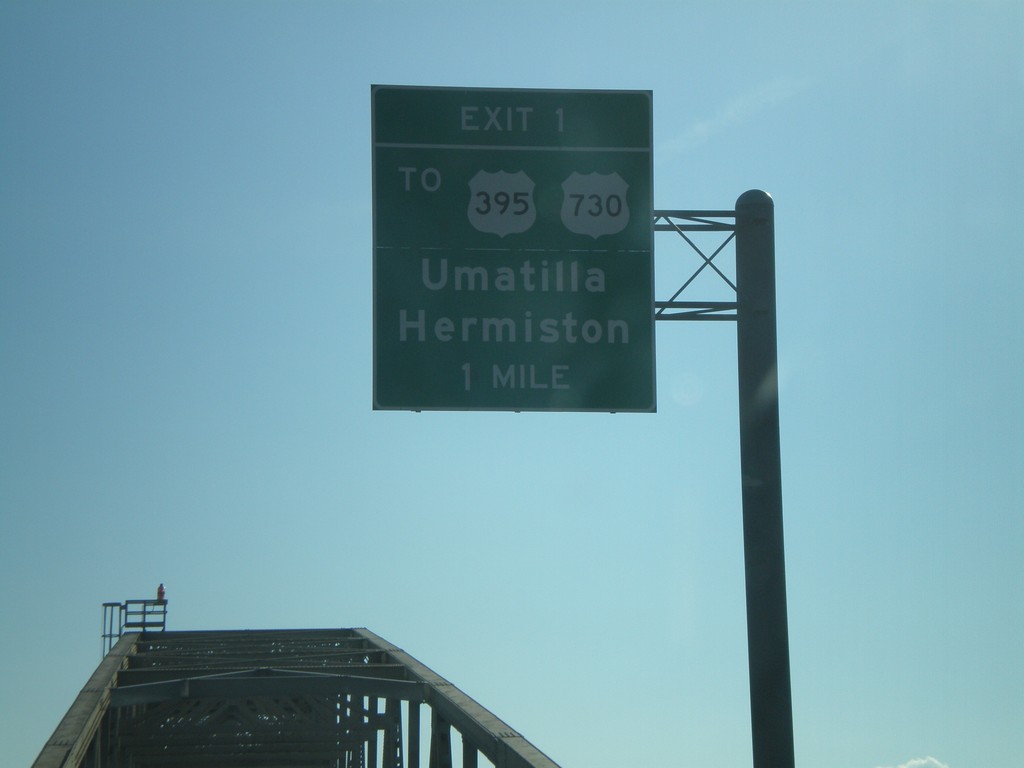
I-82 East - Exit 1 (Oregon)
I-82 east on the Columbia River bridge approaching Oregon Exit 1, To US-395/US-730/Hermiston/Umatilla.
Taken 01-22-2008
Plymouth
Benton County
Washington
United States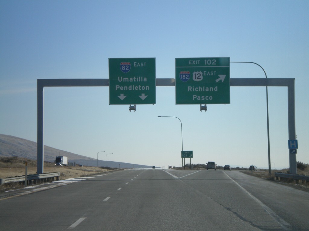
I-82 East - Exit 102
I-82 east at Exit 102 - I-182/US-12 East/Richland/Pasco. Overhead for I-82 East to Umatilla and Pendleton. US-12 joins I-82 from here to Yakima.
Taken 01-22-2008

 West Richland
Benton County
Washington
United States
West Richland
Benton County
Washington
United States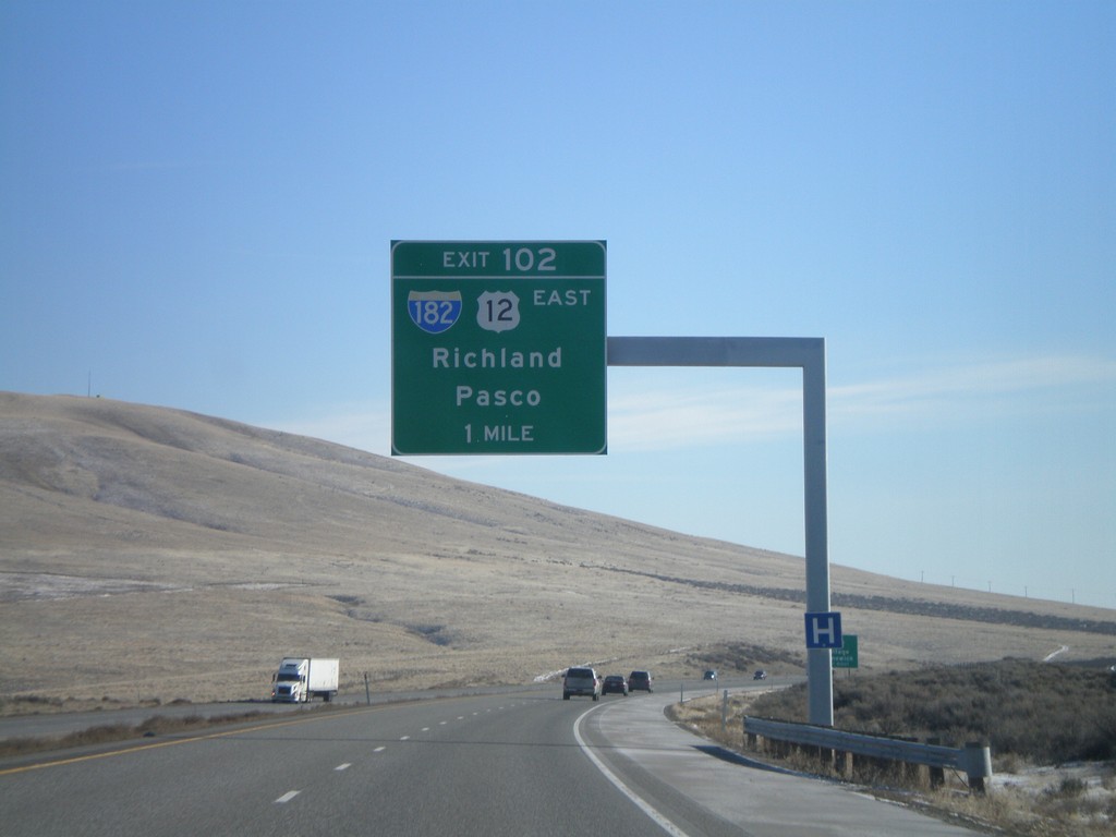
I-82 East - Exit 102
I-82 east approaching Exit 102 - I-182/US-12 East/Richland/Pasco.
Taken 01-22-2008
West Richland
Benton County
Washington
United States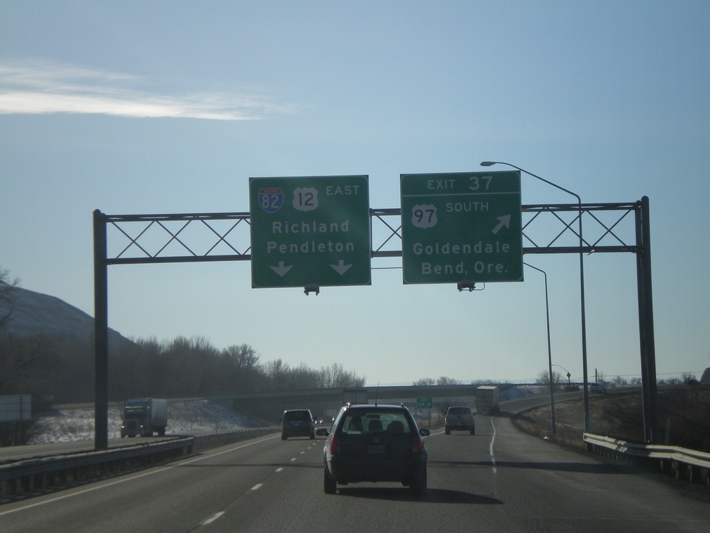
I-82 East - Exit 37
I-82 east at Exit 37 - US-97 South/Goldendale/Bend, Ore. US-97 joins I-82 west to I-90 near Ellensburg. I-82/US-12 overhead to Richland and Pendleton.
Taken 01-22-2008
 Yakima
 County
Washington
United States
Yakima
Yakima County
Washington
United States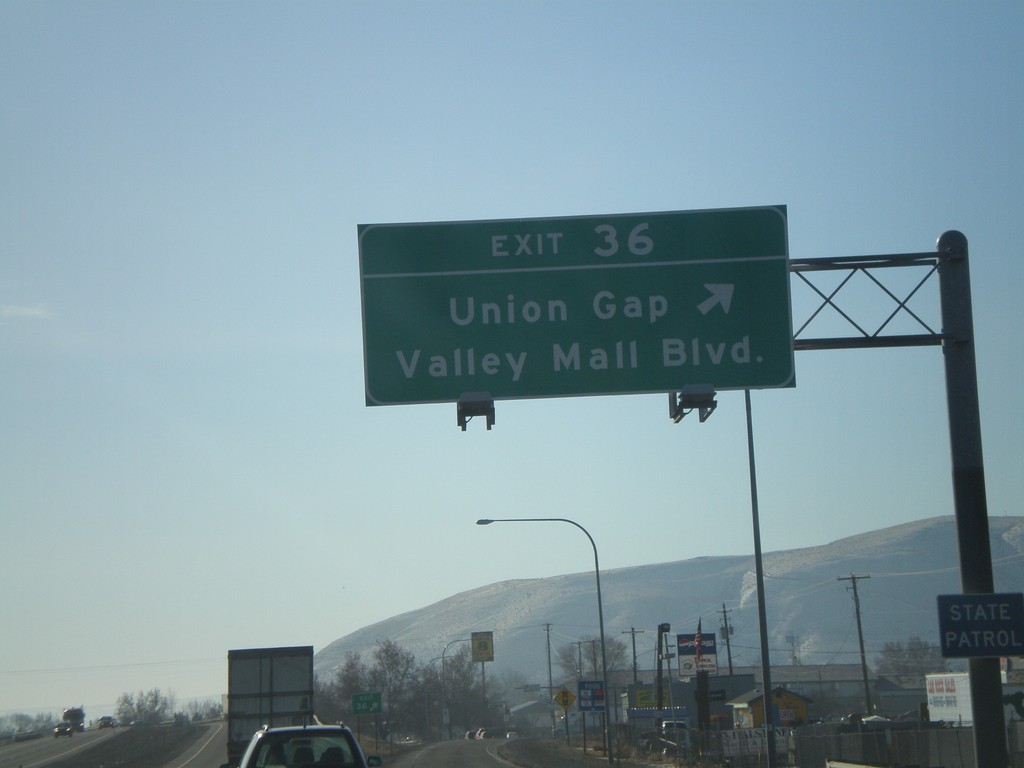
I-82 East - Exit 36
I-82 east at Exit 36 - Union Gap/Valley Mall Blvd.
Taken 01-22-2008
Union Gap
Yakima County
Washington
United States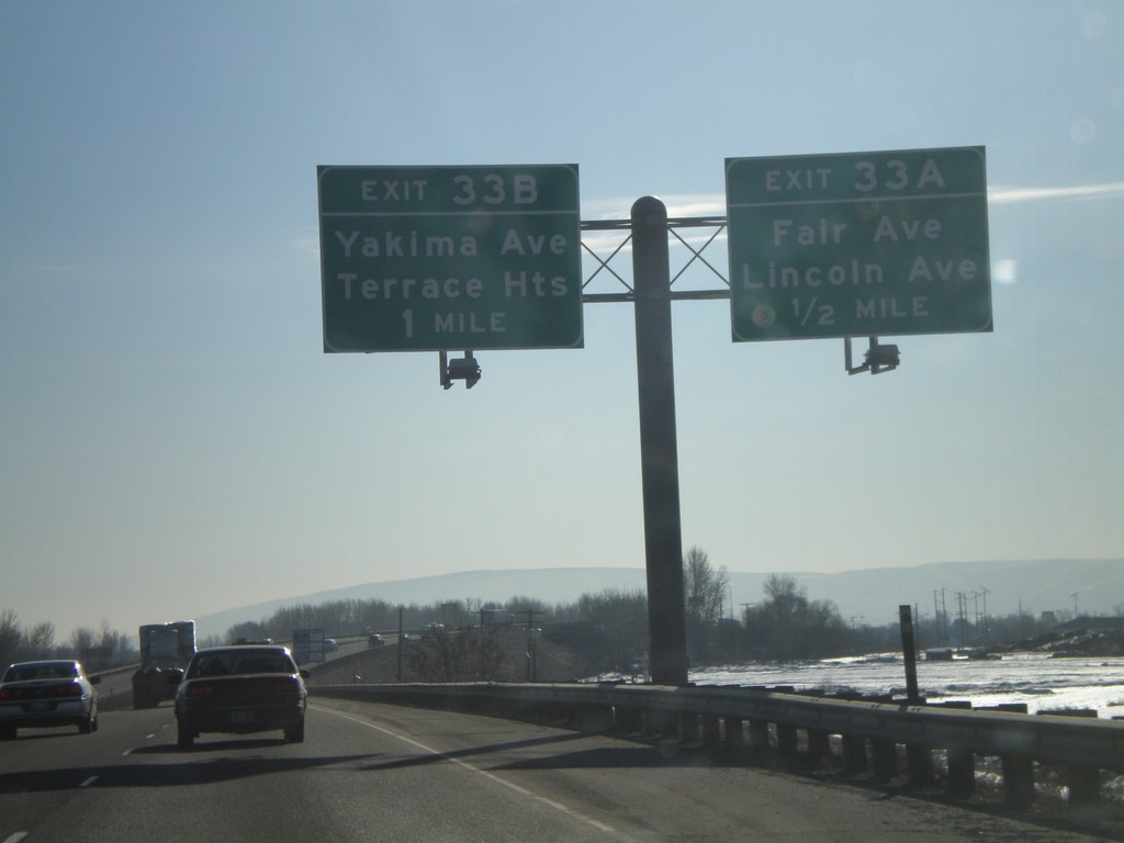
I-82 East - Exits 33A and 33B
I-82 east approaching Exit 33A - Fair Ave./Lincoln Ave. and Exit 33B - Yakima Ave./Terrace Heights.
Taken 01-22-2008
Yakima
Yakima County
Washington
United States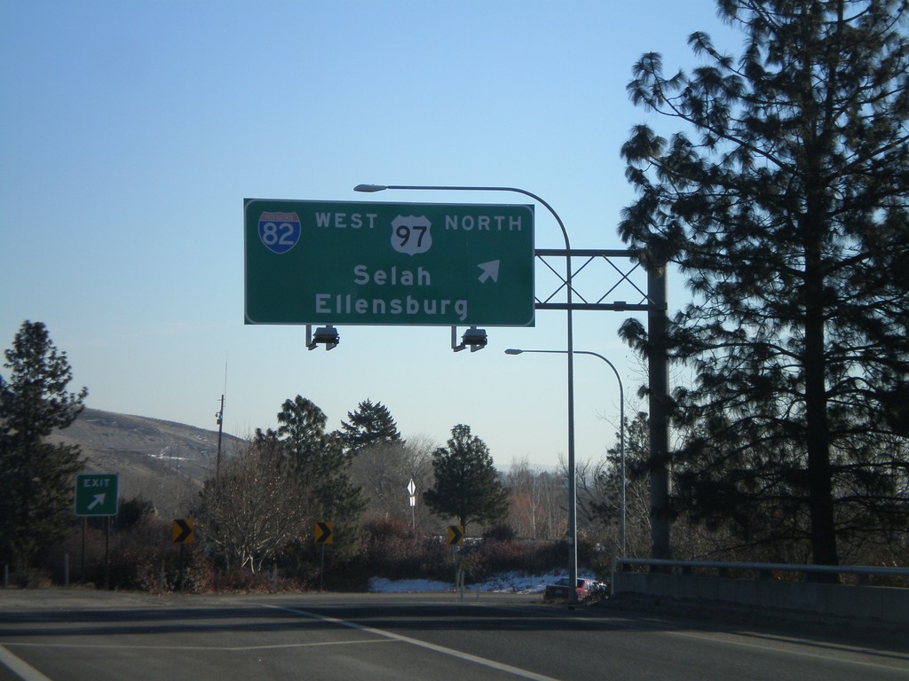
US-12 East at I-82/US-97
US-12 east at I-82 West/US-97 North to Selah and Ellensburg. US-12 east joins I-82 east here to Richland.
Taken 01-22-2008
Yakima
Yakima County
Washington
United States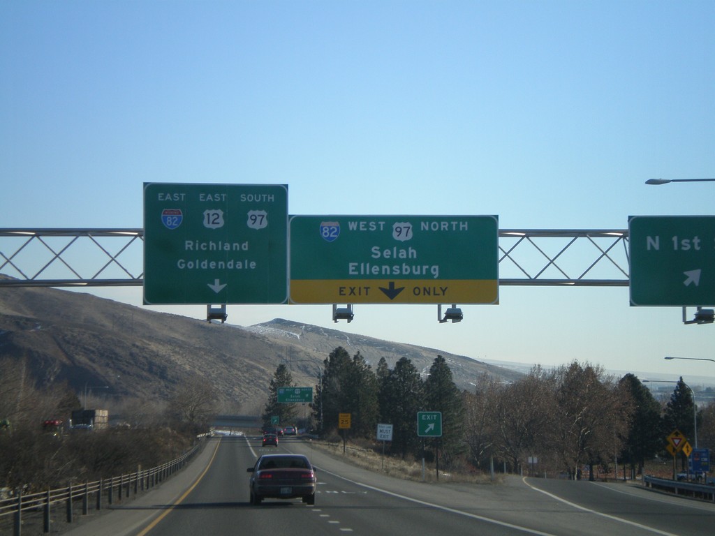
US-12 East at N 1st St - Approaching I-82/US-97
US-12 east at N 1st St exit. Approaching I-82 junction.
Taken 01-22-2008
Yakima
Yakima County
Washington
United States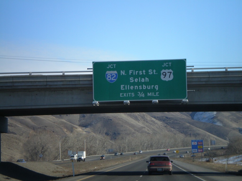
US-12 East Approaching I-82/US-97
Advance signs for I-82/US-97 junction on US-12 east.
Taken 01-22-2008
Yakima
Yakima County
Washington
United States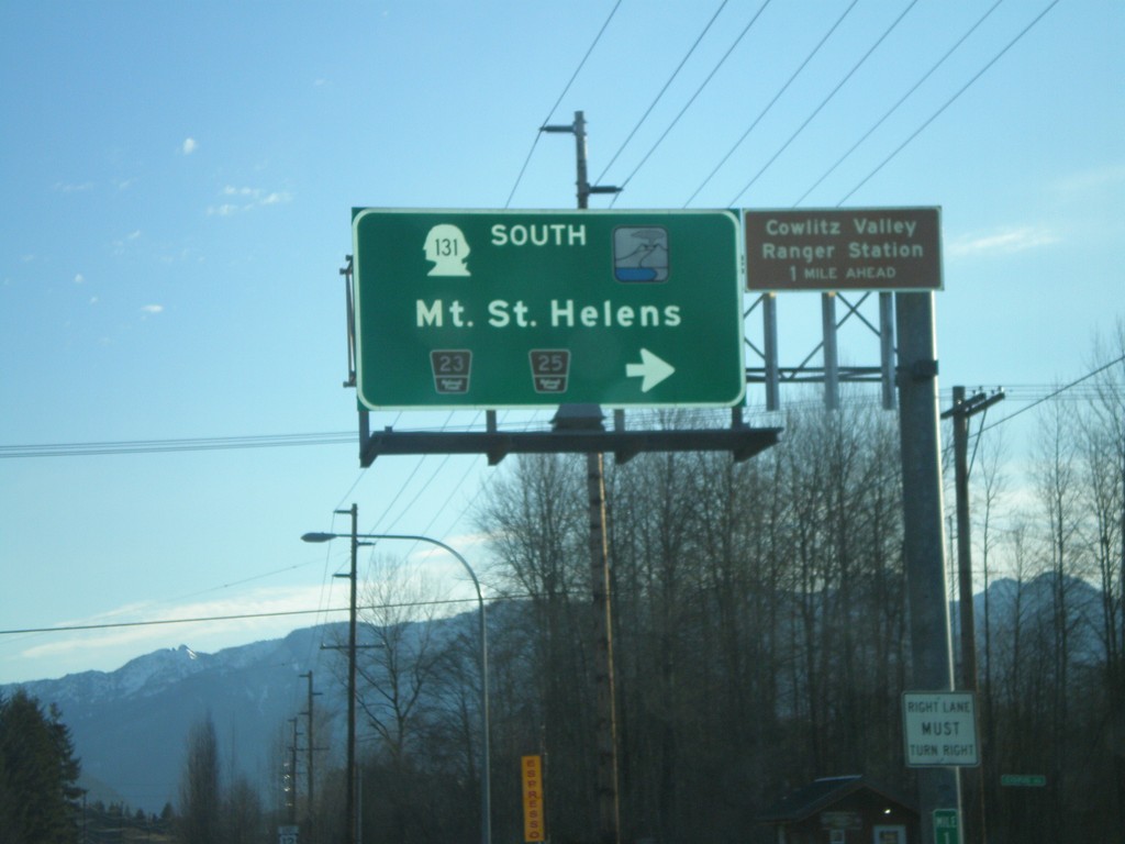
US-12 East at WA-131 South
US-12 east at WA-131 South to Mt. St. Helens.
Taken 01-22-2008
 Randle
Lewis County
Washington
United States
Randle
Lewis County
Washington
United States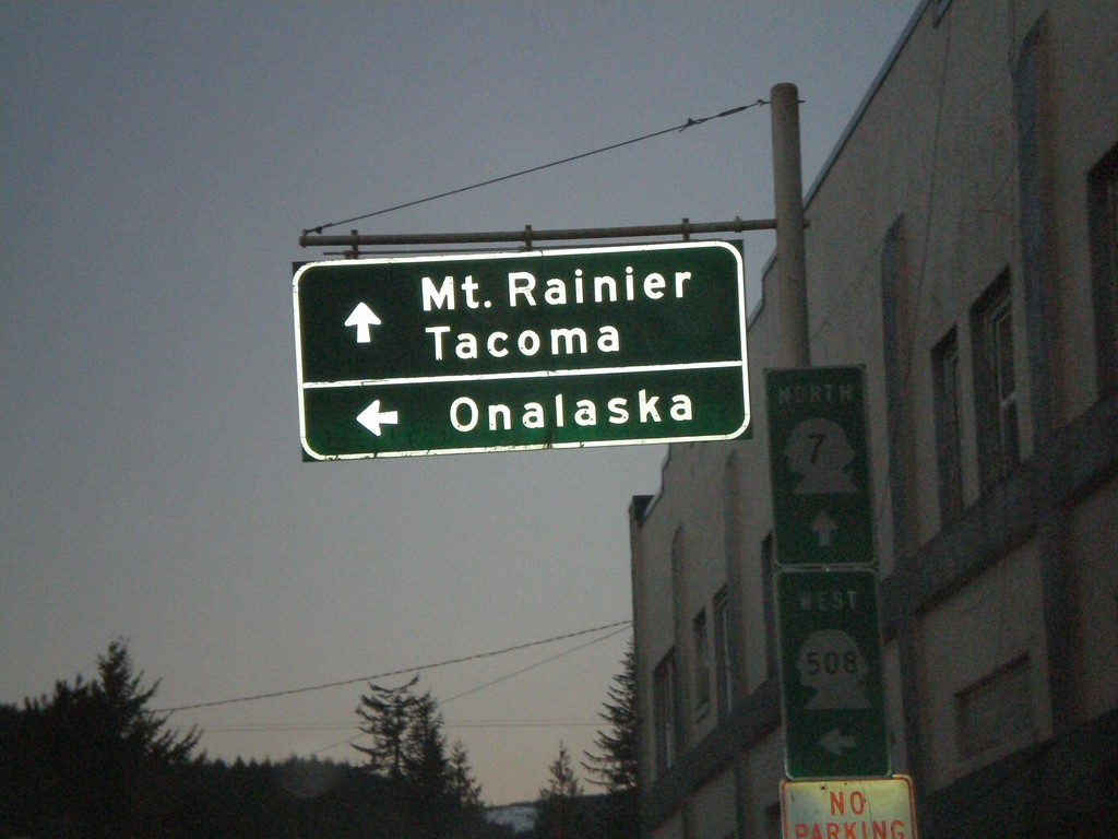
WA-7 North at WA-508 West to Onalaksa
WA-7 north to Mt. Ranier and Tacoma and WA-508 west to Onalaska.
Taken 01-21-2008

 Morton
Lewis County
Washington
United States
Morton
Lewis County
Washington
United States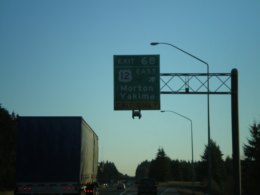
I-5 South - Exit 68
I-5 south at Exit 68 - US-12 East/Morton/Yakima.
Taken 01-21-2008
 Napavine
Lewis County
Washington
United States
Napavine
Lewis County
Washington
United States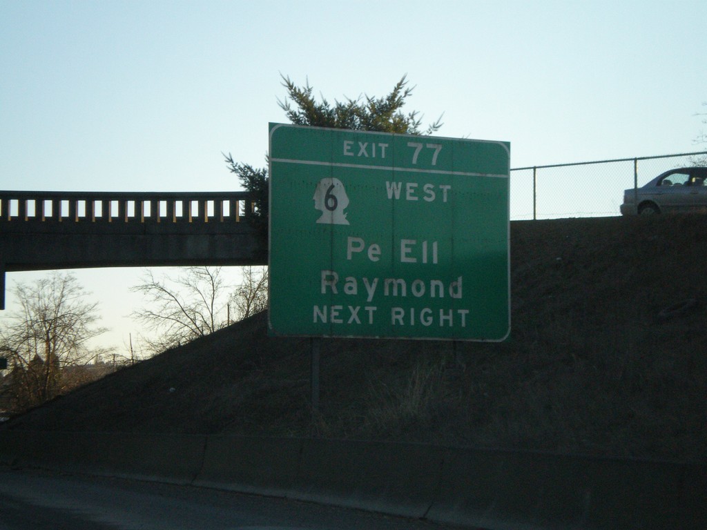
I-5 South - Exit 77
I-5 south approaching Exit 77 - WA-6 West/Pe Ell/Raymond.
Taken 01-21-2008
 Chehalis
Lewis County
Washington
United States
Chehalis
Lewis County
Washington
United States
US-12 East Approaching US-12/WA-8 Split
US-12 East approaching WA-8 (unsigned). US-12 traffic must exit.
Taken 01-21-2008
 Elma
Grays Harbor County
Washington
United States
Elma
Grays Harbor County
Washington
United States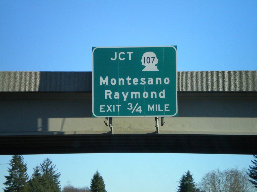
US-12 East Approaching WA-107
US-12 east approaching WA-107 to Raymond and Montesano.
Taken 01-21-2008
 Montesano
Grays Harbor County
Washington
United States
Montesano
Grays Harbor County
Washington
United States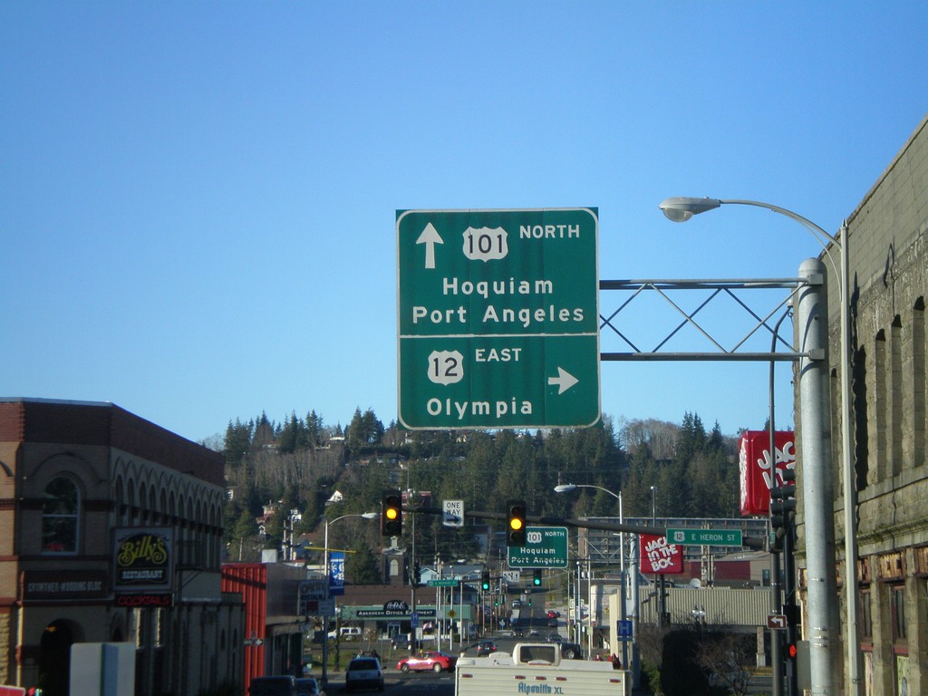
US-101 North at US-12
US-101 north at US-12 East to Olympia. This is the beginning of US-12.
Taken 01-21-2008
 Aberdeen
Grays Harbor County
Washington
United States
Aberdeen
Grays Harbor County
Washington
United States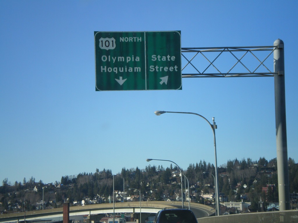
US-101 North at State St.
US-101 north at the State St. offramp. Overhead for US-101 North/Olympia/Hoquiam.
Taken 01-21-2008
Aberdeen
Grays Harbor County
Washington
United States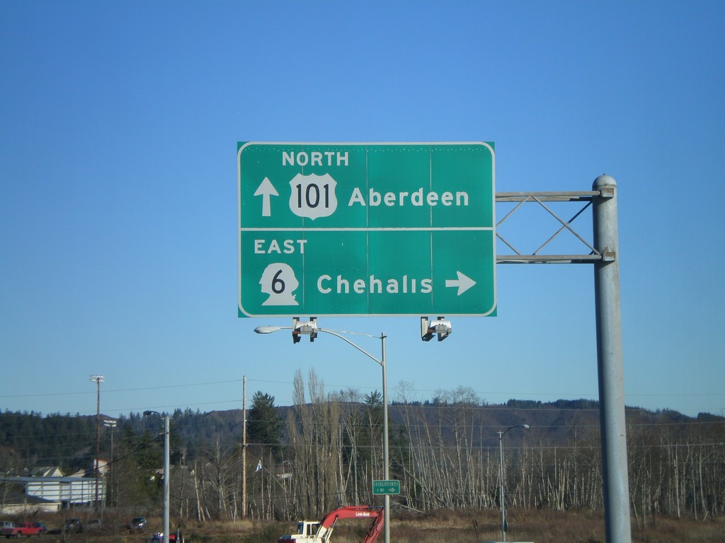
US-101 North at WA-6 East
US-101 north at WA-6 to Chehalis.
Taken 01-21-2008
Raymond
Pacific County
Washington
United States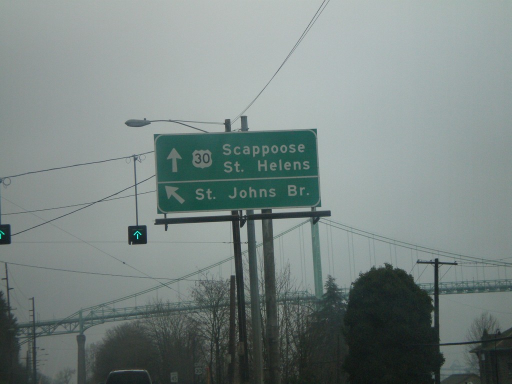
US-30 West - St. Johns Bridge
US-30 west at St. Johns Bridge over the Willamette RIver. Continue west on US-30 for Scappoose and St. Helens.
Taken 01-19-2008
Portland
Multnomah County
Oregon
United States