Signs Tagged With Overhead
I-10 East Exit 94
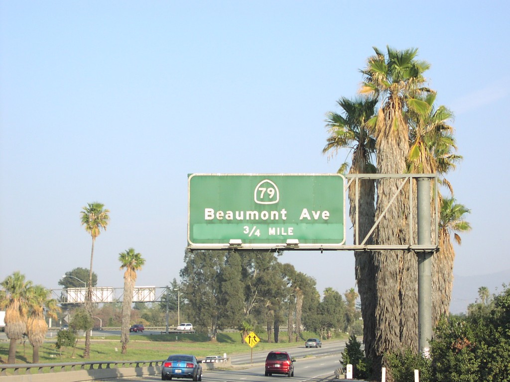
I-10 east approaching Exit 94 - CA-79/Beaumont Ave., 3/4 mile.
Taken 03-01-2007

 Beaumont
Riverside County
California
United States
Beaumont
Riverside County
California
United States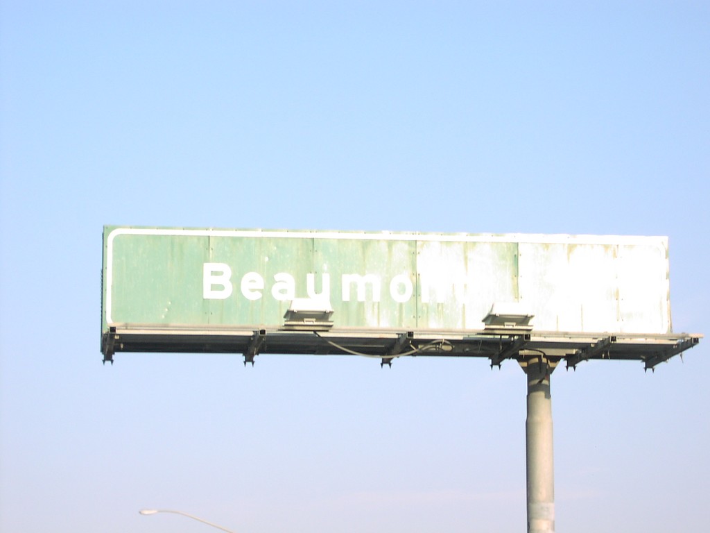
I-10 East Exit 94
I-10 at end of CA-60, at Beaumont exit.
Taken 03-01-2007
 Beaumont
Riverside County
California
United States
Beaumont
Riverside County
California
United States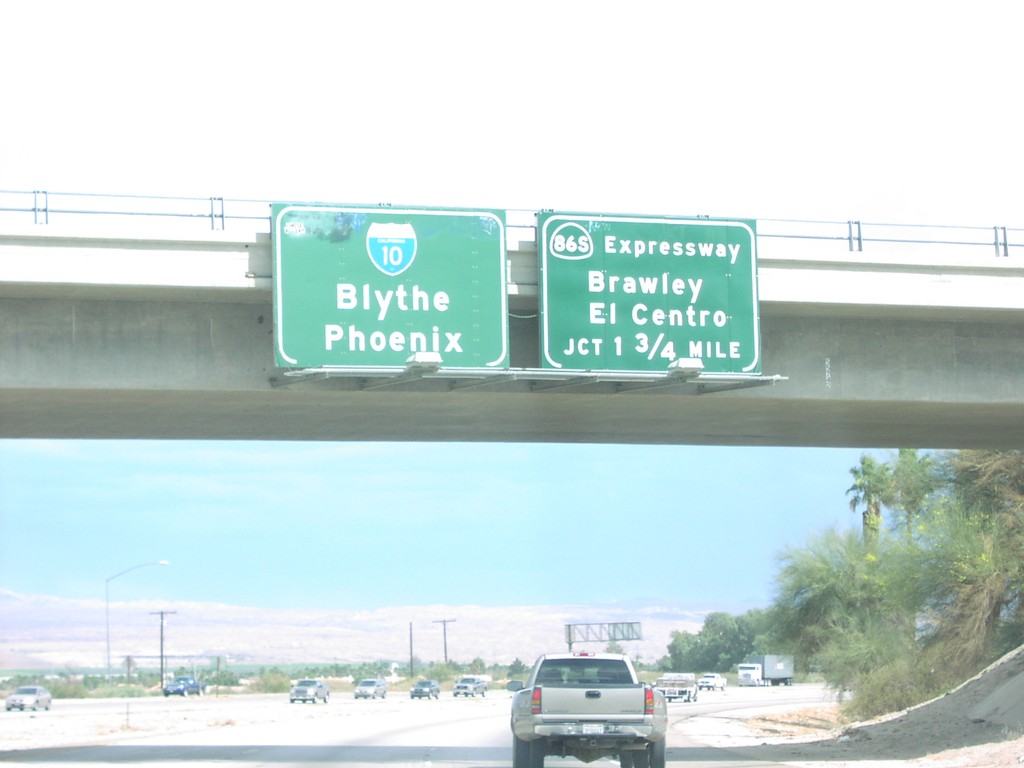
I-10 East Exit 145
I-10 east approaching Exit 145- CA-86S Expressway/Brawley/El Centro, 1 3/4 miles.
Taken 03-01-2007
 Indio
Riverside County
California
United States
Indio
Riverside County
California
United States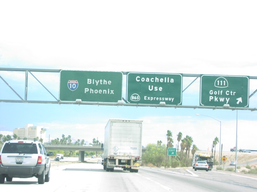
I-10 East Exit 144
I-10 east at Exit 144 - CA-111/Golf Center Parkway. Overhead also directs Coachella traffic use CA-86S Expressway.
Taken 03-01-2007
 Indio
Riverside County
California
United States
Indio
Riverside County
California
United States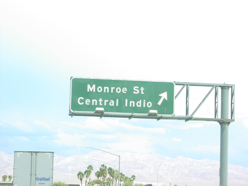
I-10 East Exit 142
I-10 east at Exit 142 - Monroe St./Central Indio.
Taken 03-01-2007
Indio
Riverside County
California
United States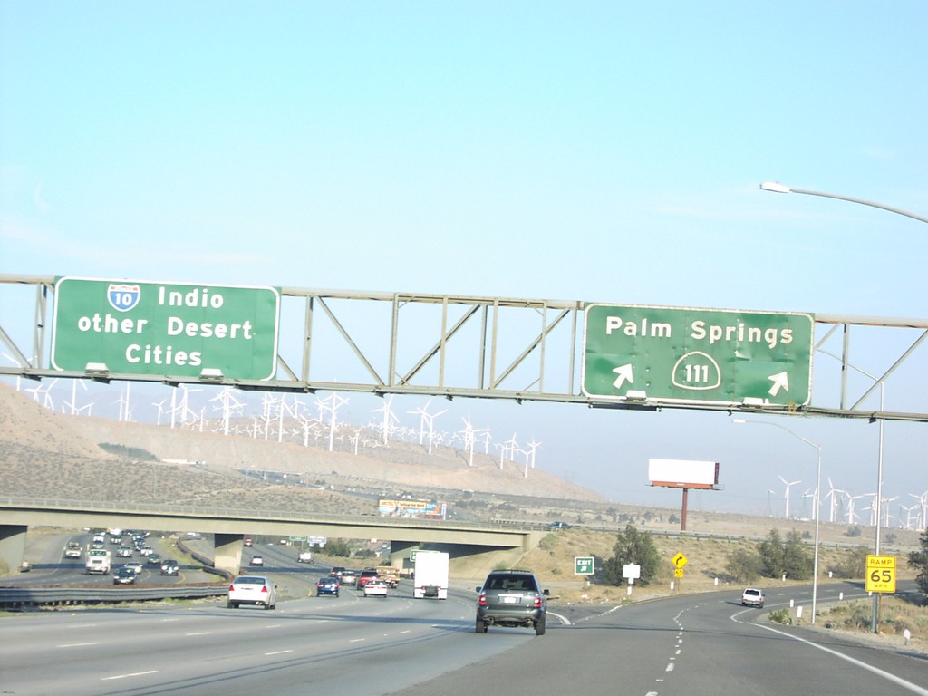
I-10 East Exit 112
I-10 east at Exit 112 - CA-111/Palm Springs. I-10 continues east to Indio and Other Desert Cities. Note the windmills on the hillsides.
Taken 03-01-2007
Palm Springs
Riverside County
California
United States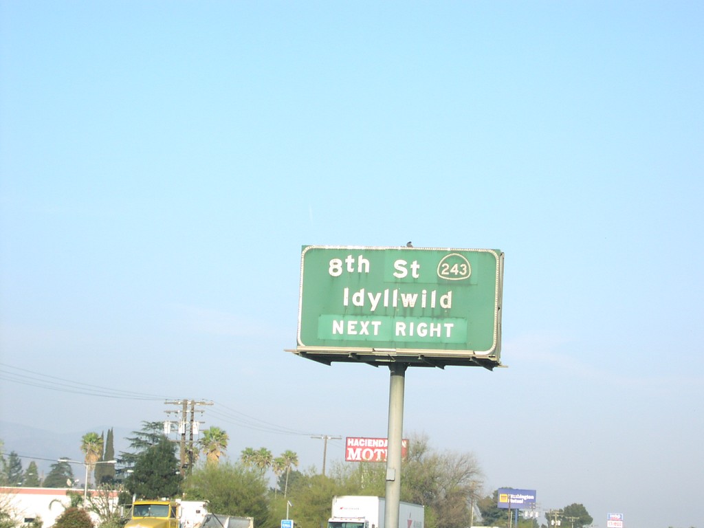
I-10 East Exit 100
I-10 east approaching Exit 100 - CA-243/8th St./Idyllwild, next exit.
Taken 03-01-2007
 Banning
Riverside County
California
United States
Banning
Riverside County
California
United States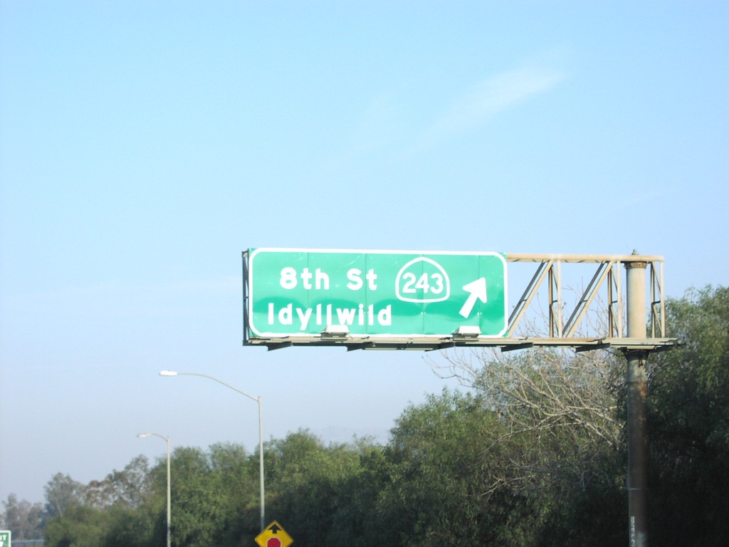
I-10 East Exit 100
I-10 east at Exit 100 - CA-243/8th St./Idyllwild.
Taken 03-01-2007
Banning
Riverside County
California
United States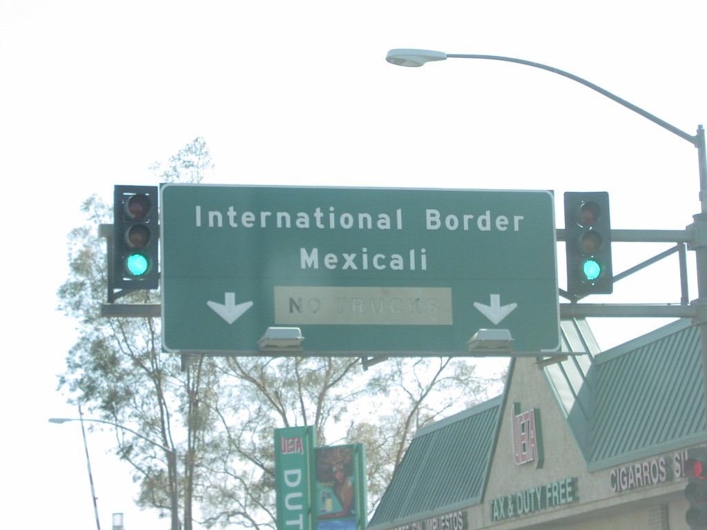
End CA-111 South at International Border
End CA-111 at the International Boundary. Mexicali is just past the border post.
Taken 03-01-2007
Calexico
Imperial County
California
United States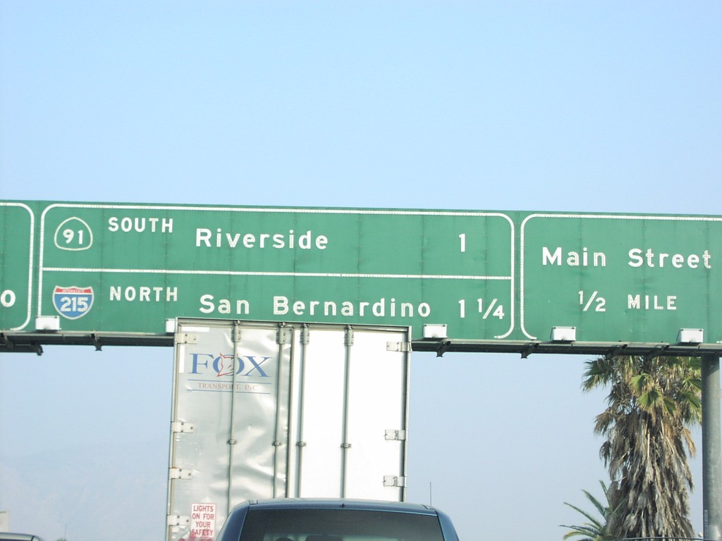
CA-60 East Exits 53AB and 52B
CA-60 east approaching Exit 52B - Main St., Exit 53A - CA-91 South/Riverside, and Exit 53B - I-215 North/San Bernardino.
Taken 03-01-2007

 Riverside
 County
California
United States
Riverside
Riverside County
California
United States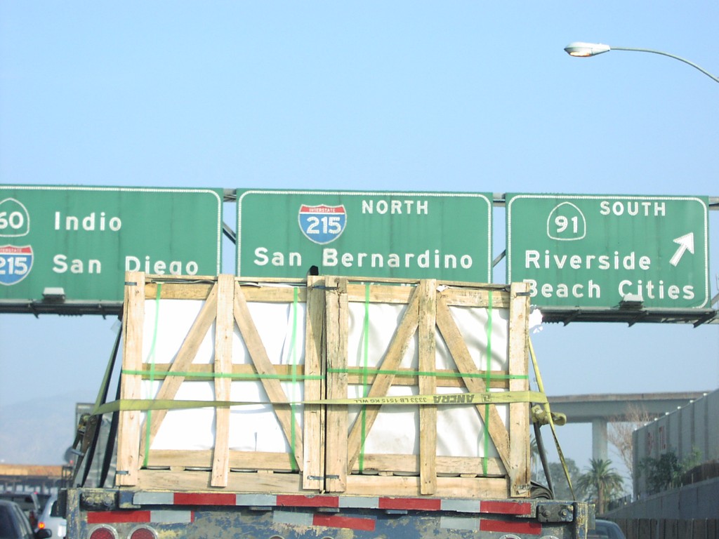
CA-60 East Exits 53AB
CA-60 east at Exit 53A - CA-91 South/Riverside/Beach Cities, and Exit 53B - I-215 North/San Bernardino.
Taken 03-01-2007
Riverside
Riverside County
California
United States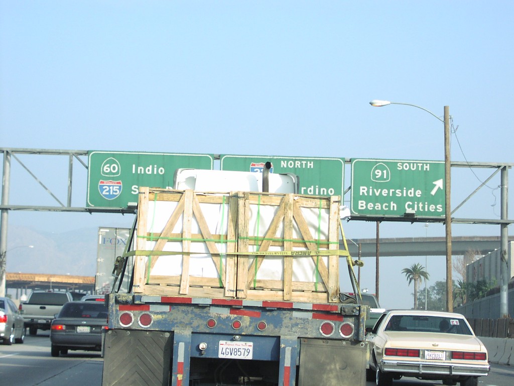
CA-60 East Exits 53AB
CA-60 east at Exit 53A - CA-91 South to Riverside and Beach Cities. New control city on CA-60 is Indio.
Taken 03-01-2007
Riverside
Riverside County
California
United States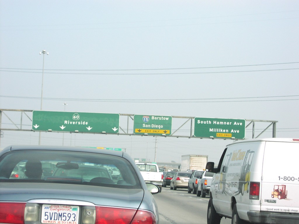
CA-60 East Exits 40 and 41
CA-60 east at Exit 40 - S. Hamner Ave./Milliken Ave. Next exit is Exit 41 - I-15/Barstow/San Diego.
Taken 03-01-2007
 Ontario
San Bernardino County
California
United States
Ontario
San Bernardino County
California
United States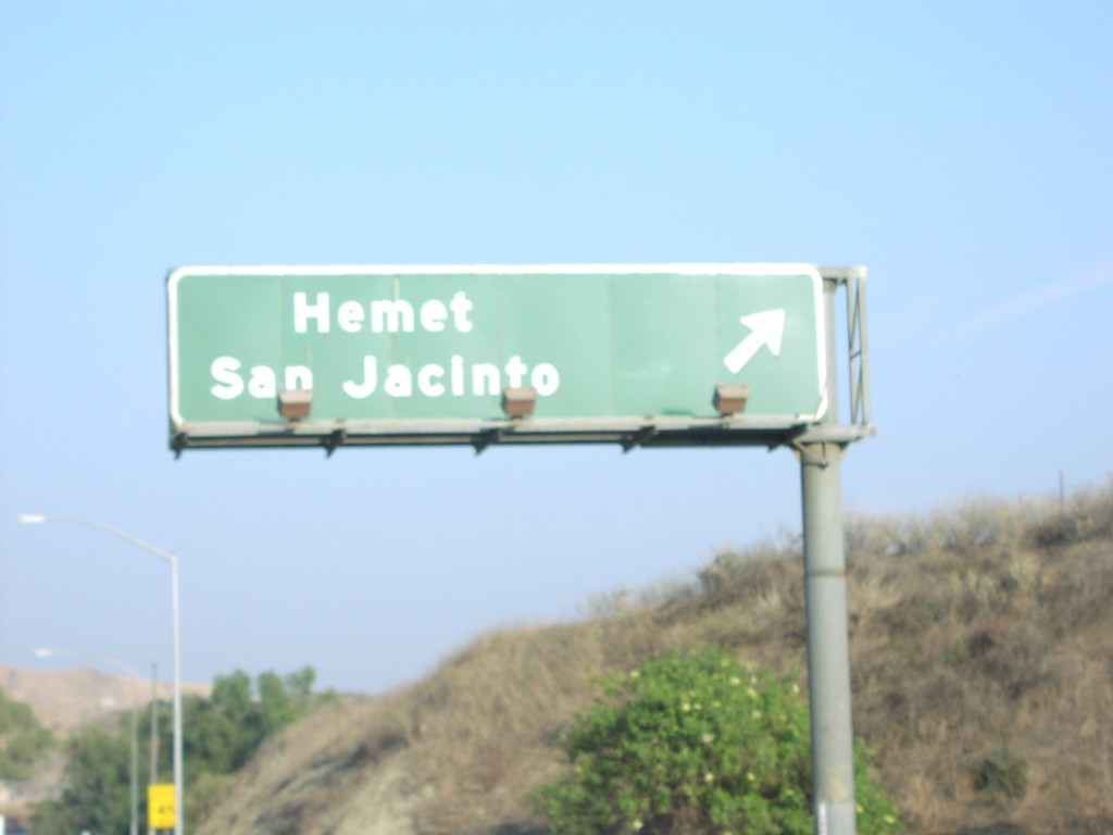
CA-60 East Exit 68
CA-60 east at Exit 68 - Hemet/San Jacinto exit (Gilman Springs Road).
Taken 03-01-2007
Moreno Valley
Riverside County
California
United States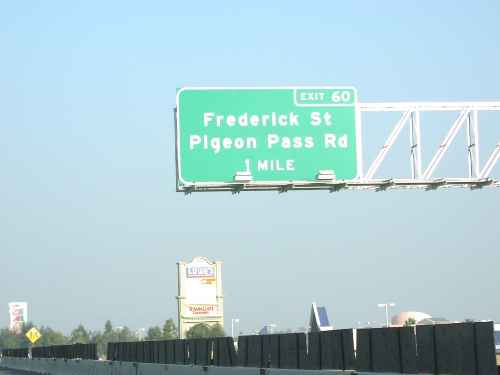
CA-60 East Exit 60
CA-60 east approaching Exit 60 - Frederick St./Pigeon Pass Road, 1 mile.
Taken 03-01-2007
Moreno Valley
Riverside County
California
United States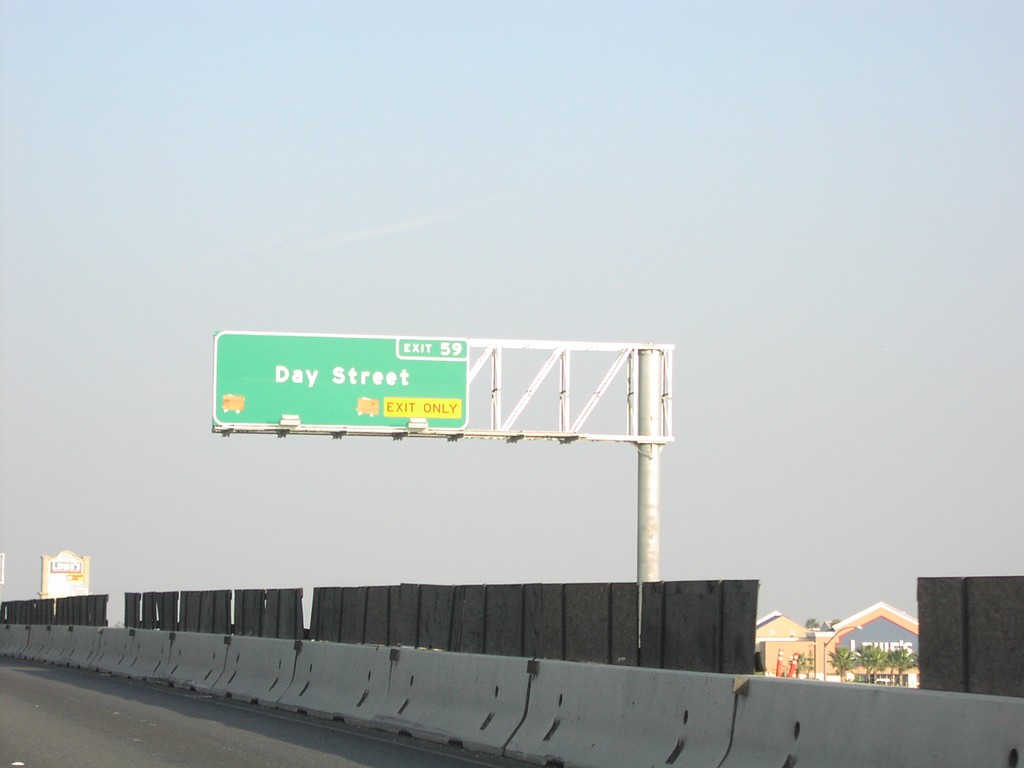
CA-60 East Exit 59
CA-60 east at Exit 59 - Day St.
Taken 03-01-2007
Riverside
Riverside County
California
United States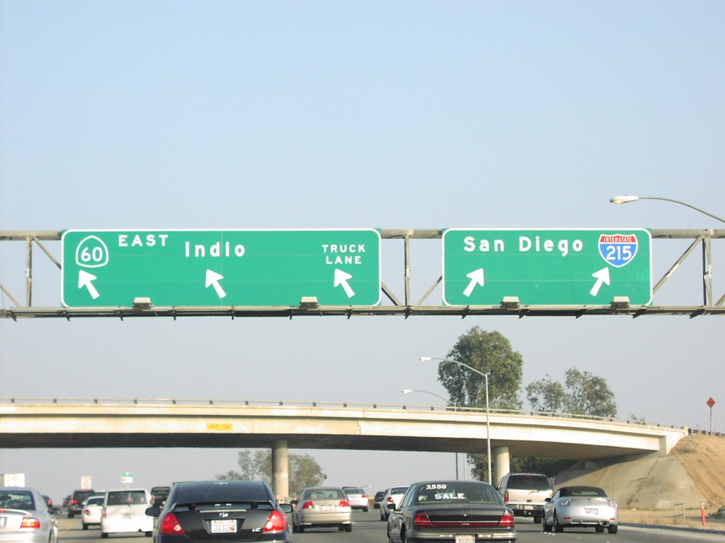
CA-60 East Exit 53B
CA-60 East/I-215 South at Exit 53B - I-215/CA-60 split. I-215 south to San Diego; CA-60 east to Indio.
Taken 03-01-2007
Riverside
Riverside County
California
United States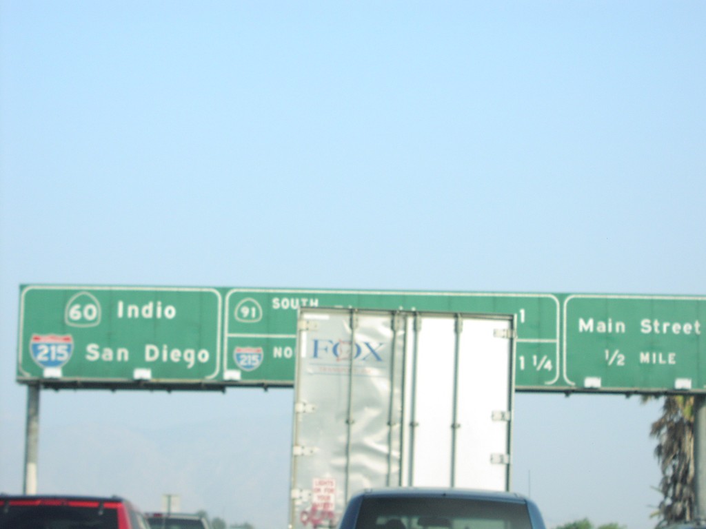
CA-60 East Exit 52B
CA-60 east approaching Exit 52B - Main St. and Exits 53AB CA-91/I-215
Taken 03-01-2007
Riverside
Riverside County
California
United States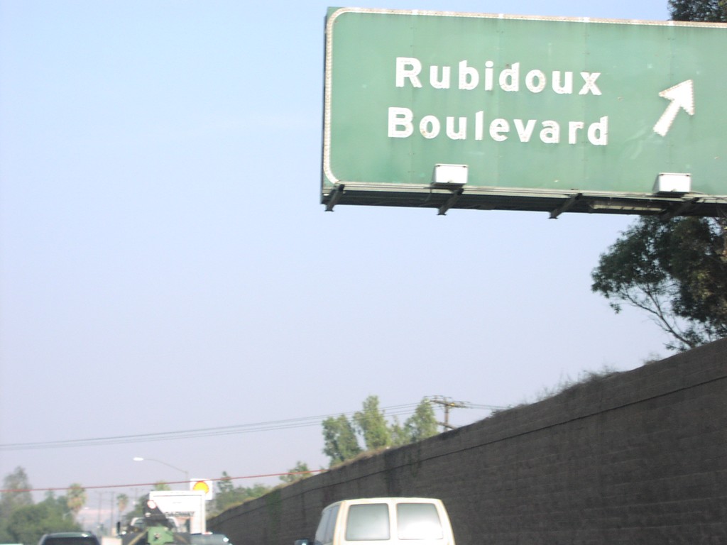
CA-60 East Exit 50
CA-60 east at Exit 50 - Rubidoux Blvd.
Taken 03-01-2007
Riverside
Riverside County
California
United States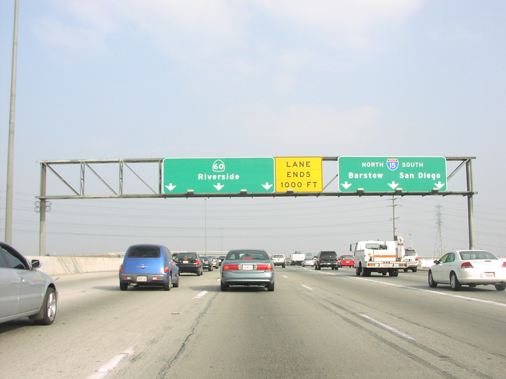
CA-60 East Exit 41
CA-60 east at Exit 41 - I-15/Barstow/San Diego
Taken 03-01-2007
Ontario
San Bernardino County
California
United States
CA-60 East at Exit 52B and Exits 53AB
CA-60 east at Main St. Approaching CA-91/Riverside, and I-215 north to San Bernardino. CA-60 and I-215 are multiplexed east through Riverside.
Taken 03-01-2007
Riverside
Riverside County
California
United States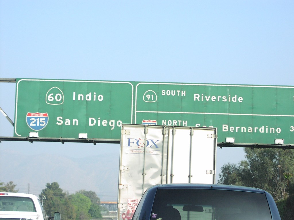
CA-60 East Approaching Exits 53AB
CA-60 east approaching Exit 53A - CA-91/Riverside, and Exit 53B - I-215 North/San Bernardino.
Taken 03-01-2007
Riverside
Riverside County
California
United States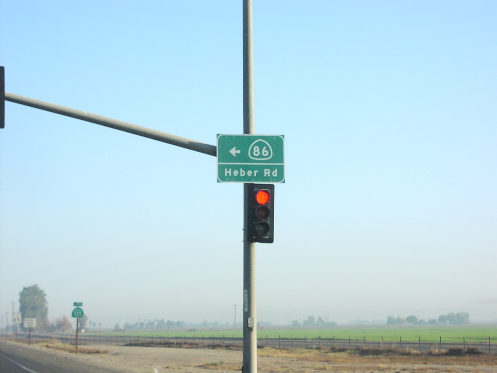
CA-111 North at CA-86
CA-111 north at CA-86 north. CA-86/Heber Road sign on signal.
Taken 03-01-2007
 Heber
Imperial County
California
United States
Heber
Imperial County
California
United States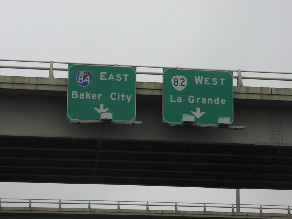
OR-82 West at I-84 East
OR-82 west to La Grande at I-84 east to Baker City.
Taken 02-01-2007

 La Grande
Union County
Oregon
United States
La Grande
Union County
Oregon
United States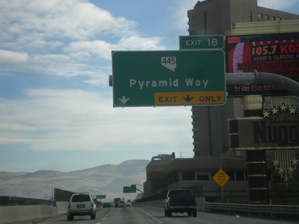
I-80 East - Exit 18
I-80 east approaching Exit 18. Exit 18 - NV-445/Pyramid Way.
Taken 01-24-2007

 Sparks
Washoe County
Nevada
United States
Sparks
Washoe County
Nevada
United States