Signs Tagged With Overhead
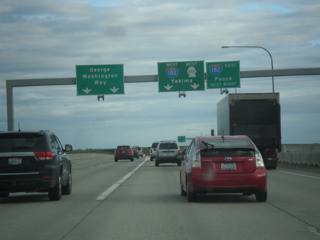
WA-240 West at I-182 and George Washington Way
WA-240 West at I-182 and George Washington Way in Richland. Use right lane for I-182 East to Richland; and I-182 West/WA-240 West to Yakima. Continue straight for George Washington Way.
Taken 04-28-2017


 Richland
Benton County
Washington
United States
Richland
Benton County
Washington
United States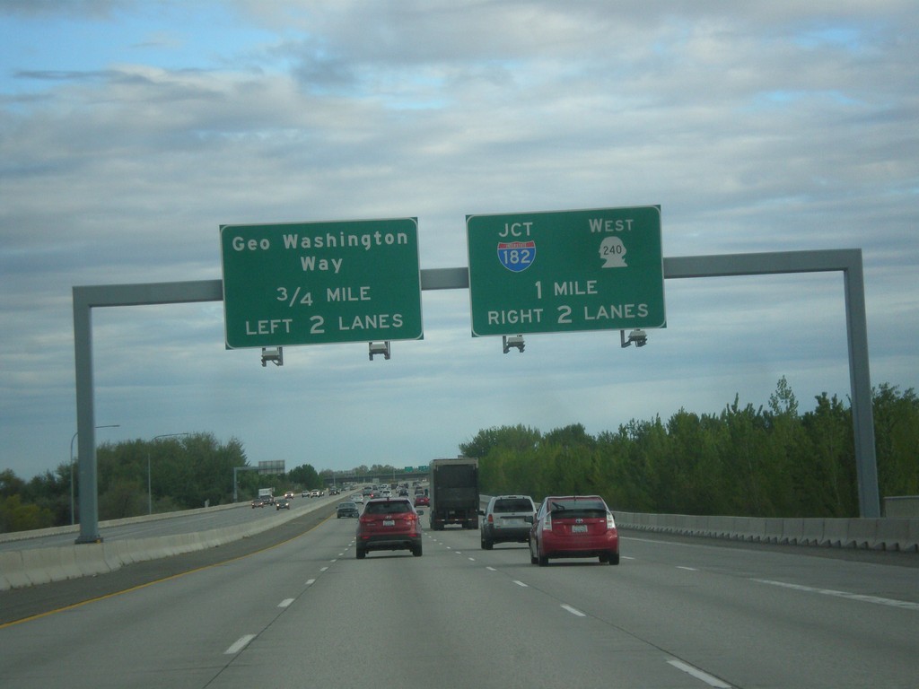
WA-240 West Approaching I-182 and George Washington Way
WA-240 West Approaching I-182 and George Washington Way in Richland. Use right lanes for I-182 and to continue west on WA-240. WA-240 joins I-182 west briefly.
Taken 04-28-2017
Richland
Benton County
Washington
United States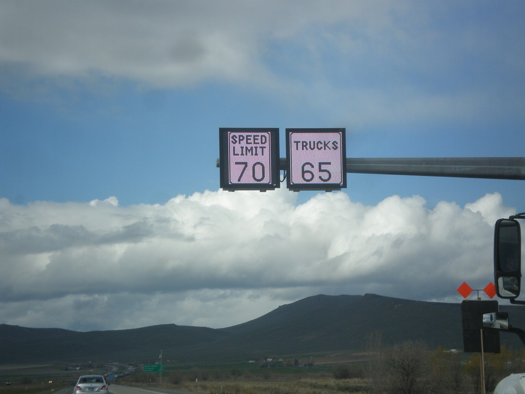
I-84 West - Variable Speed Limits
Variable Speed Limit sign on I-84 West, just outside of Baker City. The stretch of I-84 between Baker City and Ladd Canyon converted to variable speed limits in 2016.
Taken 04-27-2017
 Baker City
Baker County
Oregon
United States
Baker City
Baker County
Oregon
United States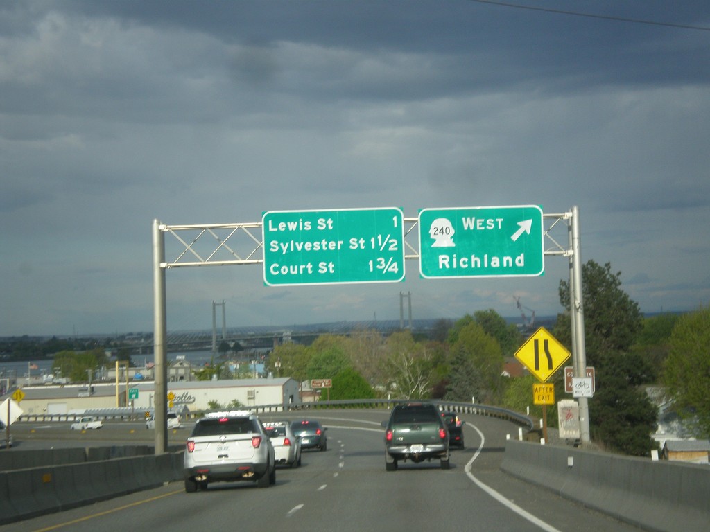
US-395 North at WA-240 West
US-395 North at WA-240 West to Richland. Continue north on US-395 for Pasco. The next three exits are Lewis St., Sylvester St., and Court St. (all in Pasco).
Taken 04-27-2017
 Kennewick
Benton County
Washington
United States
Kennewick
Benton County
Washington
United States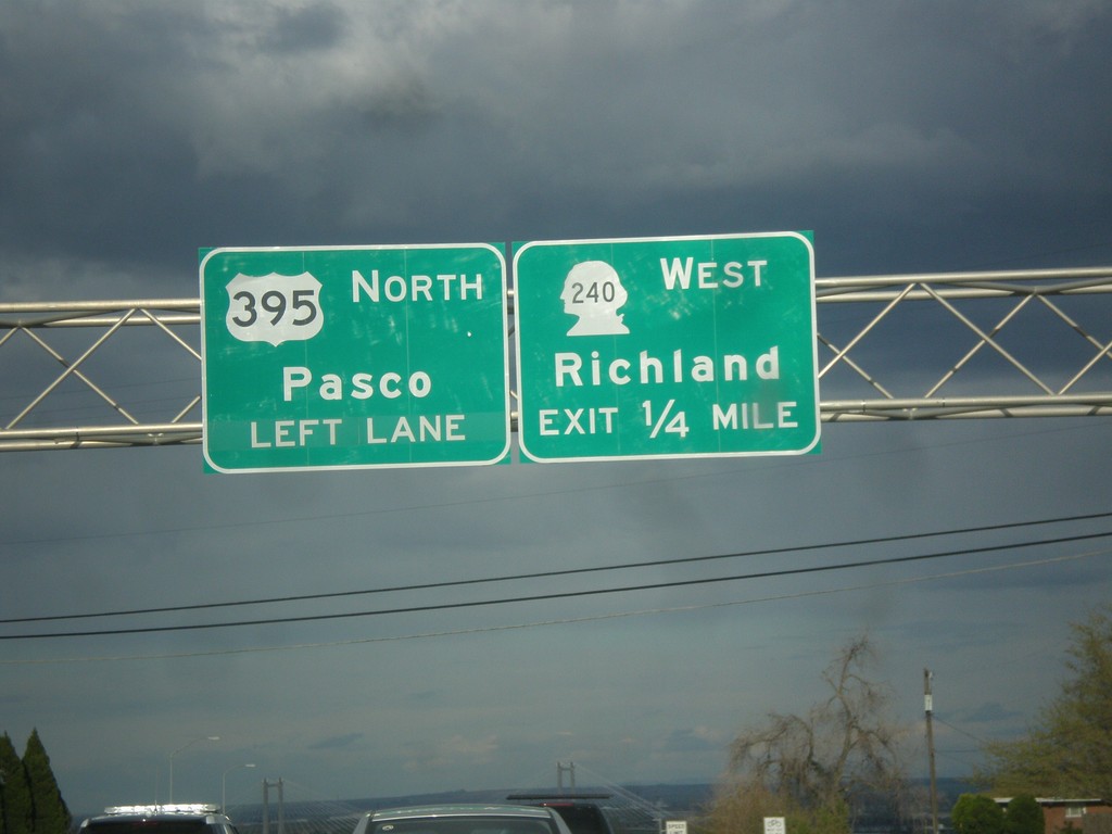
US-395 North Approaching WA-240
US-395 North Approaching WA-240 West to Richland. Continue north on US-395 for Pasco.
Taken 04-27-2017
Kennewick
Benton County
Washington
United States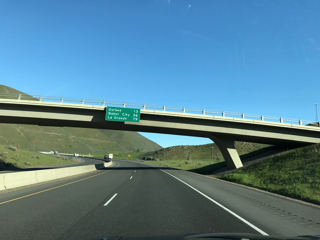
I-84 West - Distance Marker
Distance marker on I-84 west. Distance to Durkee, Baker City, and La Grande.
Taken 04-15-2017
 Huntington
Baker County
Oregon
United States
Huntington
Baker County
Oregon
United States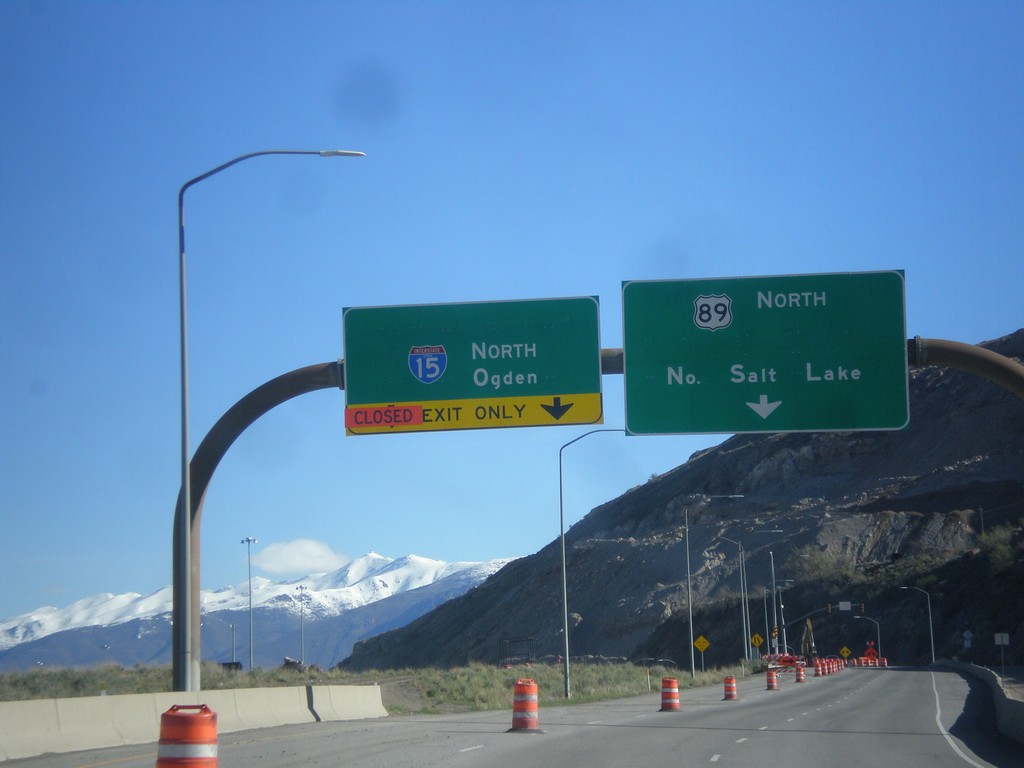
US-89 North at I-15 North Onramp to Ogden
US-89 North at I-15 North Onramp to Ogden. Continue north on US-89 for North Salt Lake. US-89 parallels I-15 north to Brigham City. US-89 briefly joins I-15 between Woods Cross and Farmington.
Taken 04-01-2017

 Salt Lake City
Salt Lake County
Utah
United States
Salt Lake City
Salt Lake County
Utah
United States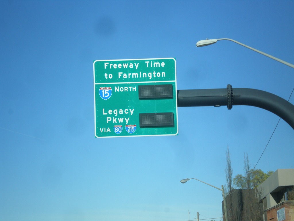
US-89 North (400 South) - I-15 North Travel Times
US-89 North (400 South) in Salt Lake City. Freeway Travel Times to Farmington via Legacy Parkway (via I-80/I-215) or via I-15. This was taken on Saturday morning and there were no times displayed.
Taken 04-01-2017
Salt Lake City
Salt Lake County
Utah
United States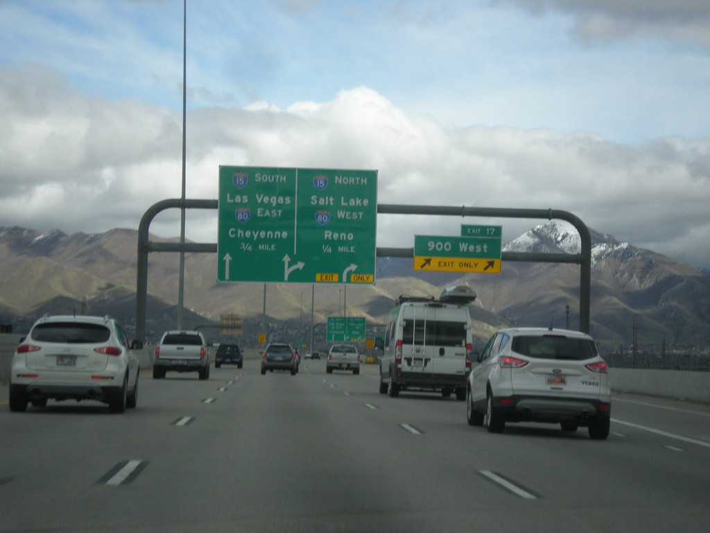
UT-201 East - Exits 17 and I-15/I-80 Jct.
UT-201 east at Exit 17 - 900 West. Approaching I-15 North/Salt Lake/I-80 West/Reno (NV). Also approaching I-15 South/Las Vegas (NV)/I-80 East/Cheyenne (WY).
Taken 03-31-2017

 West Valley City
Salt Lake County
Utah
United States
West Valley City
Salt Lake County
Utah
United States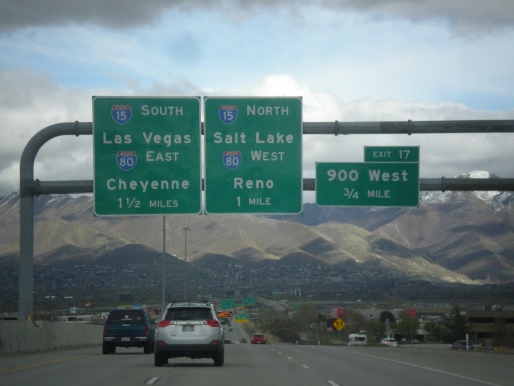
UT-201 East - Exits 17 and I-15/I-80 Jct.
UT-201 East approaching Exit 17 - 900 West. Approaching I-15 South/Las Vegas (NV)/I-80 East/Cheyenne (WY) and I-15 North/Salt Lake/I-80 West/Reno(NV).
Taken 03-31-2017
Salt Lake City
Salt Lake County
Utah
United States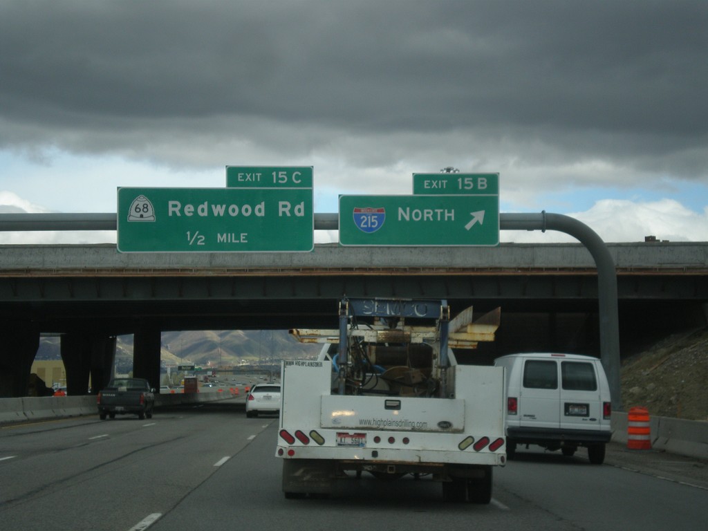
UT-201 East - Exits 15B and 15C
UT-201 east at Exit 15B - I-215 North. Approaching Exit 15C - UT-68/Redwood Road.
Taken 03-31-2017

 West Valley City
Salt Lake County
Utah
United States
West Valley City
Salt Lake County
Utah
United States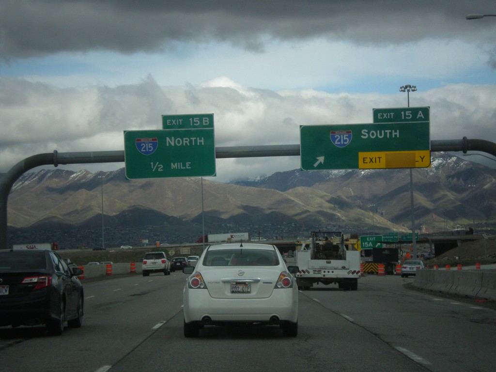
UT-201 East - Exit 15A and 15B
UT-201 east at Exit 15A - I-215 South. Approaching Exit 15B - I-215 North.
Taken 03-31-2017
West Valley City
Salt Lake County
Utah
United States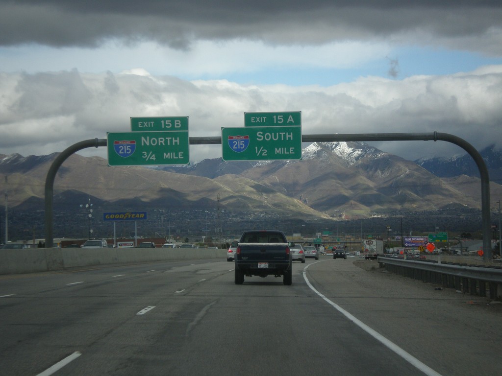
UT-201 East - Exits 15A and 15B
UT-201 east approaching Exit 15A - I-215 South and Exit 15B - I-215 North.
Taken 03-31-2017
West Valley City
Salt Lake County
Utah
United States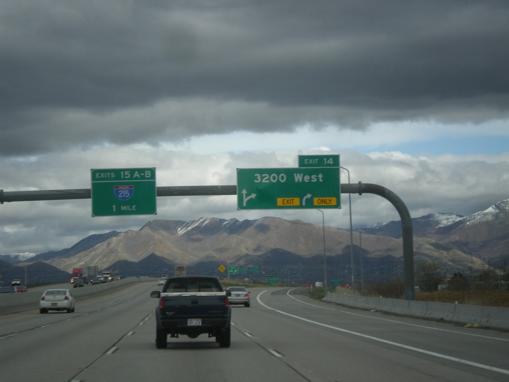
UT-201 East - Exits 14 and 15A-B
UT-201 East at Exit 14 - 3200 West. Approaching Exit 15A-B - 1-215.
Taken 03-31-2017
Salt Lake City
Salt Lake County
Utah
United States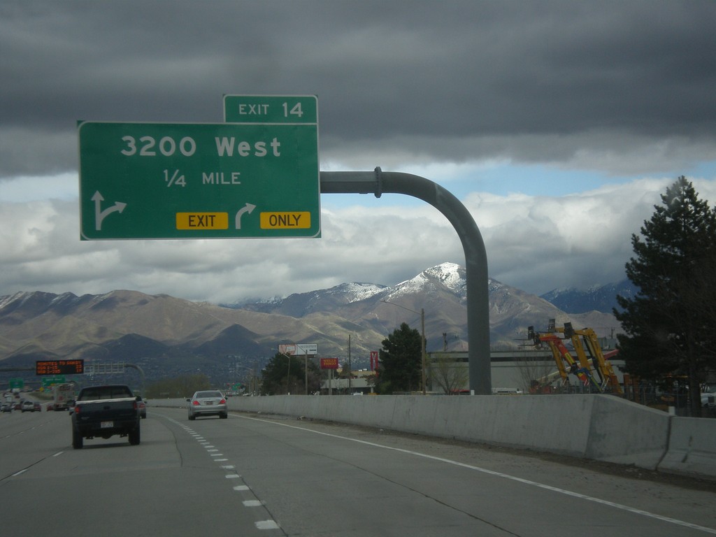
UT-201 East - Exit 14
UT-201 east approaching Exit 14 - 3200 West.
Taken 03-31-2017
West Valley City
Salt Lake County
Utah
United States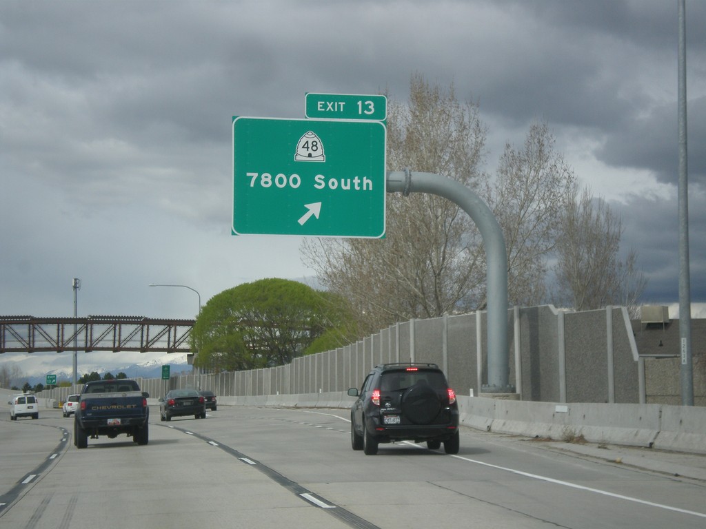
UT-154 North - Exit 13
UT-154 North (Bangerter Highway) at Exit 13 - UT-48/7800 South.
Taken 03-31-2017

 West Jordan
Salt Lake County
Utah
United States
West Jordan
Salt Lake County
Utah
United States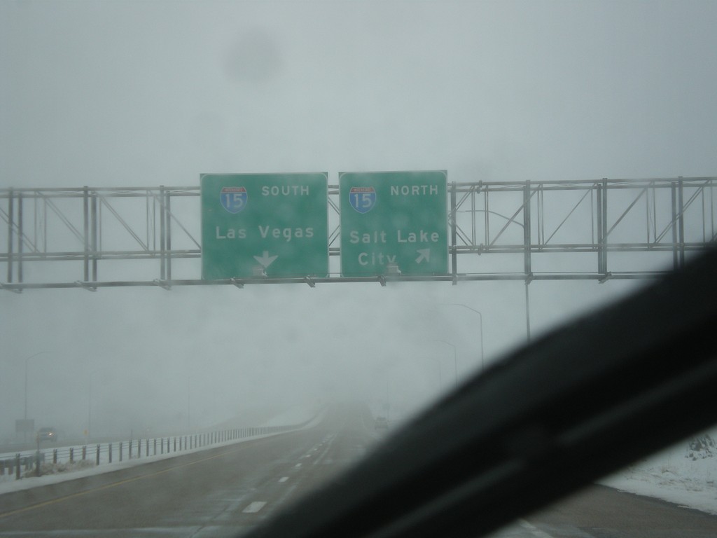
End I-70 West at I-15
End I-70 West at I-15. Use I-15 north for Salt Lake CIty; I-15 South for Las Vegas (Nevada).
Taken 03-31-2017
 Sulphurdale
Beaver County
Utah
United States
Sulphurdale
Beaver County
Utah
United States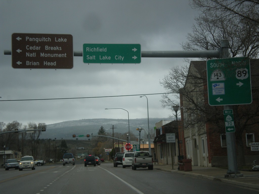
US-89 North at UT-143
US-89 north at UT-143 south. Turn left for UT-143 south to Cedar Breaks National Monument, Brian Head, and Panguitch Lake. Turn right to continue north on US-89 to Richfield and Salt Lake City. UT-143 is part of the Utah’s Patchwork Parkway National Scenic Byway.
Taken 03-31-2017
 Panguitch
Garfield County
Utah
United States
Panguitch
Garfield County
Utah
United States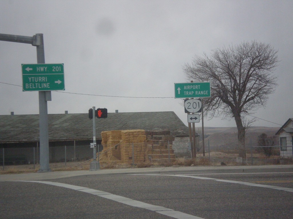
SW 4th Ave. West at OR-201
SW 4th Ave. West at OR-201. Continue straight on SW 4th Ave. for the Ontario Airport and Trap Range.
Taken 11-19-2016
 Ontario
Malheur County
Oregon
United States
Ontario
Malheur County
Oregon
United States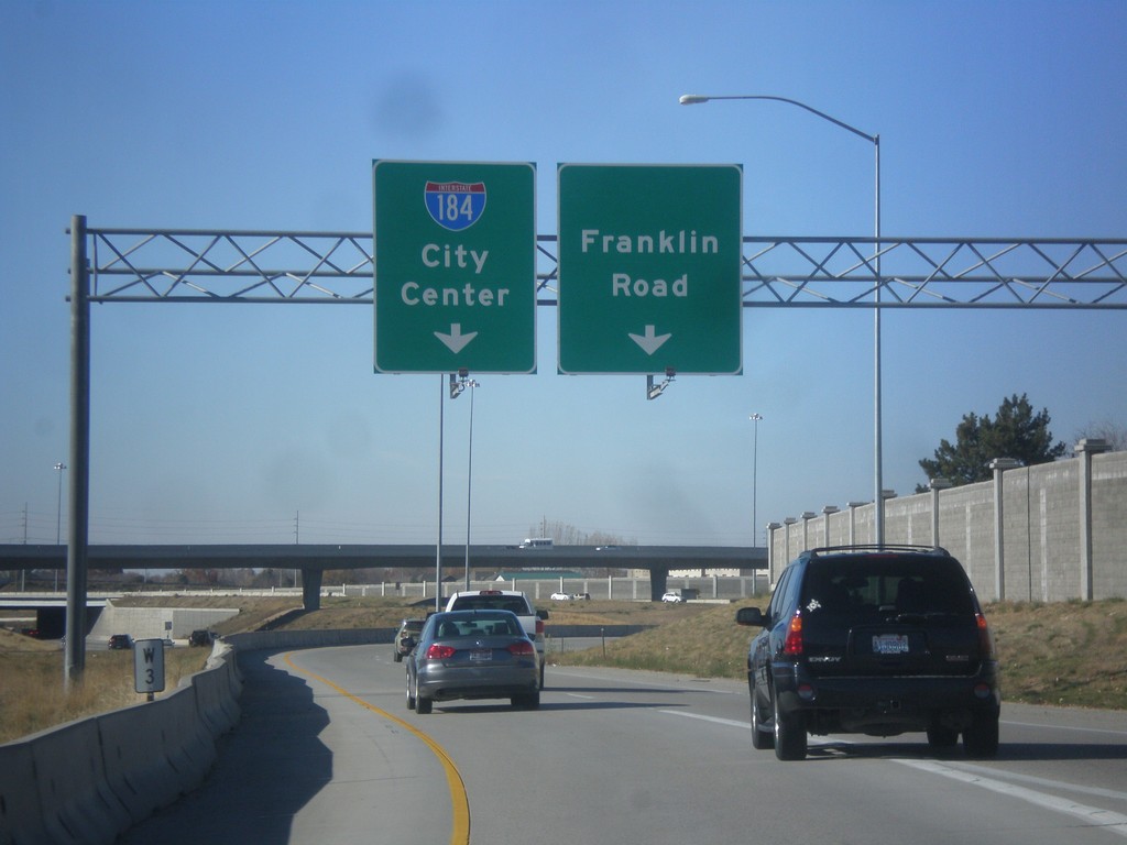
I-184 East / I-84 West Separation
I-184 East / I-84 West Separation. Use right lane for Franklin Road (Exit 1A) and left lane for I-184 East/City Center.
Taken 11-11-2016
 Boise
Ada County
Idaho
United States
Boise
Ada County
Idaho
United States
I-84 West - Nampa/Ontario
Overhead for I-84 West - Nampa/Ontario (Oregon) on I-84 just west of the I-84/I-184 junction.
Taken 11-11-2016
Boise
Ada County
Idaho
United States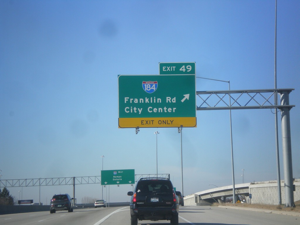
I-84 West - Exit 49
I-84 west at Exit 49 - I-184/Franklin Road/City Center.
Taken 11-11-2016
Boise
Ada County
Idaho
United States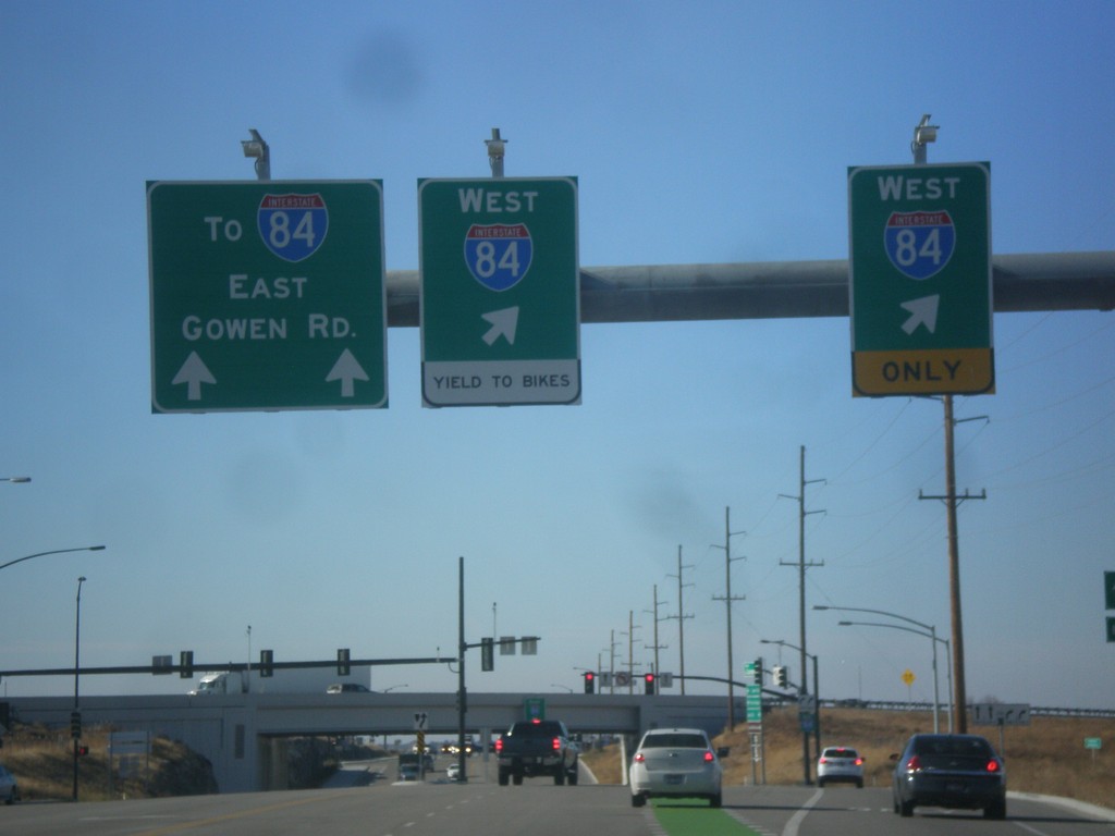
End ID-21 South at I-84 in Boise
End ID-21 South at I-84 in Boise. Use right lanes for I-84 West; left lanes for I-84 East and for Gowen Road.
Taken 11-11-2016


 Boise
Ada County
Idaho
United States
Boise
Ada County
Idaho
United States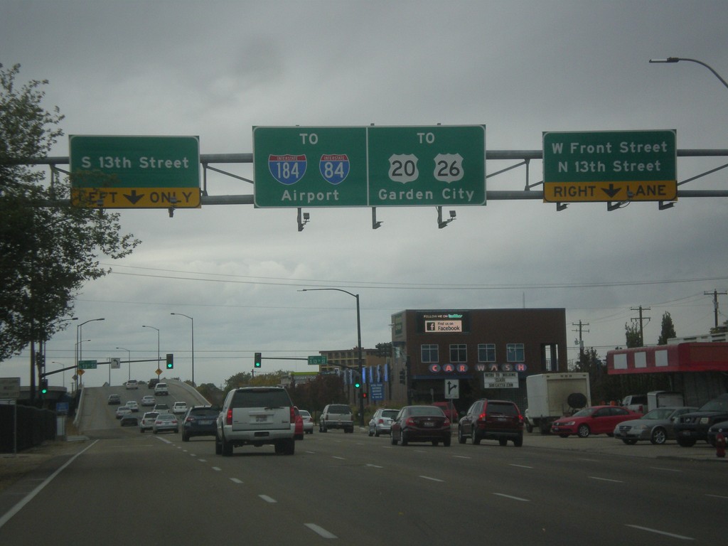
US-20/US-26 West Front St. at 13th St.
US-20/US-26 West (Front St.) at 13th St. After 13th St. US-20/US-26 becomes a freeway, locally known as The Connector. Use the connector for Garden City, I-84, and I-184.
Taken 10-15-2016
Boise
Ada County
Idaho
United States
US-20/US-26 West - Broadway Ave Approaching Front St
US-20/US-26 West (Broadway Ave.) approaching Front St. Use left lanes for Front St. These types of US shields are not at all common in Idaho. Almost all US shields are shown as solid white, not just white outlines. These signs appeared after the new bridge over the Boise River was completed here.
Taken 10-15-2016
Boise
Ada County
Idaho
United States