Signs Tagged With Overhead
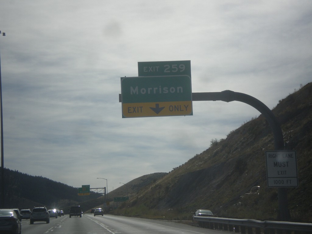
I-70 West - Exit 259
I-70 west approaching Exit 259 - Morrison.
Taken 10-08-2016

 Lakewood
Jefferson County
Colorado
United States
Lakewood
Jefferson County
Colorado
United States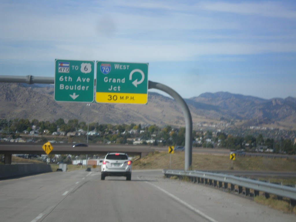
CO-470 West at I-70 West
CO-470 West at I-70 West to Grand Junction. Continue north on CO-470 to US-6/6th Ave./Boulder. CO-470 ends just north of here at US-6 junction.
Taken 10-08-2016

 Golden
Jefferson County
Colorado
United States
Golden
Jefferson County
Colorado
United States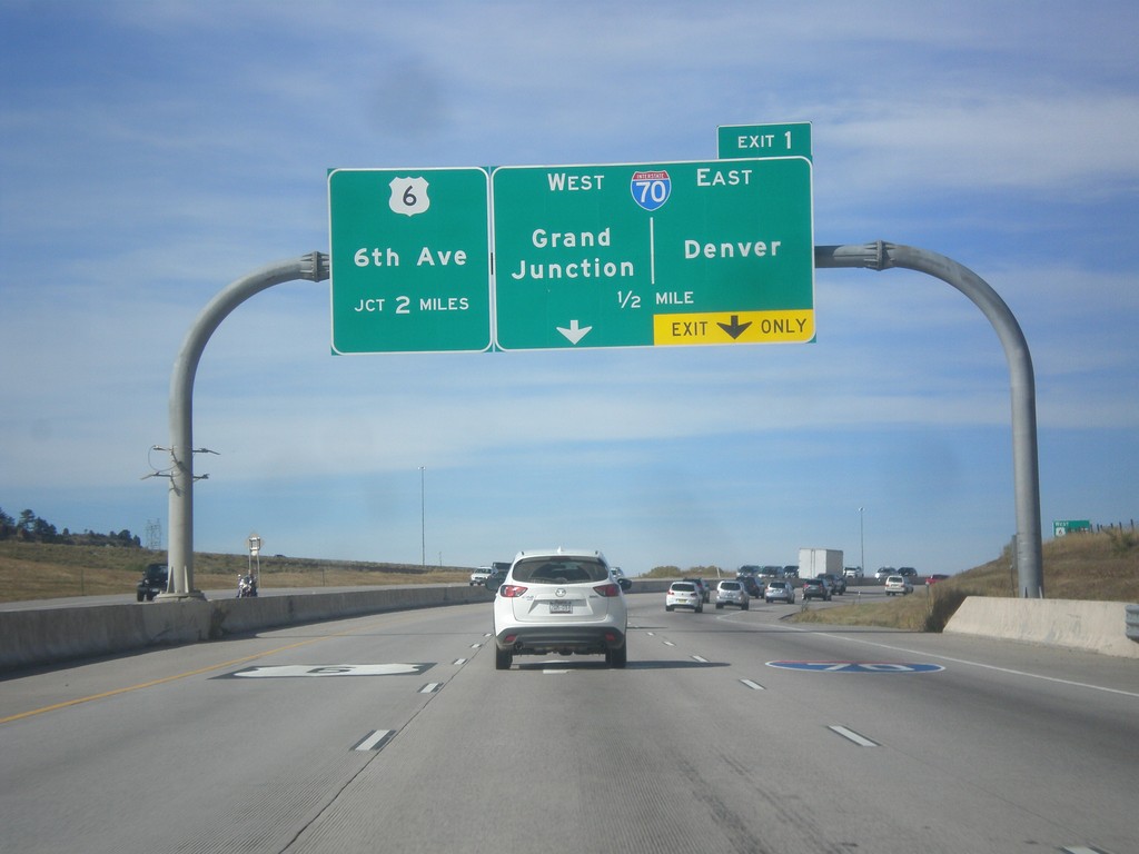
CO-470 West - Exit 1
CO-470 west approaching Exit 1 - I-70/Grand Junction/Denver. CO-470 continues north of the I-70 junction, ending at US-6 (6th Ave.).
Taken 10-08-2016
Lakewood
Jefferson County
Colorado
United States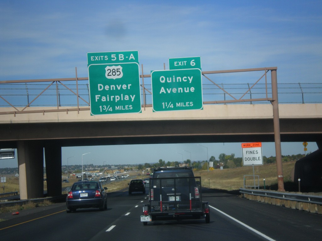
CO-470 West - Exits 6 and 5B-A
CO-470 west approaching Exit 6 - Quincy Ave. Approaching Exit 5B-A - US-285/Denver/Fairplay.
Taken 10-08-2016
 Morrison
Jefferson County
Colorado
United States
Morrison
Jefferson County
Colorado
United States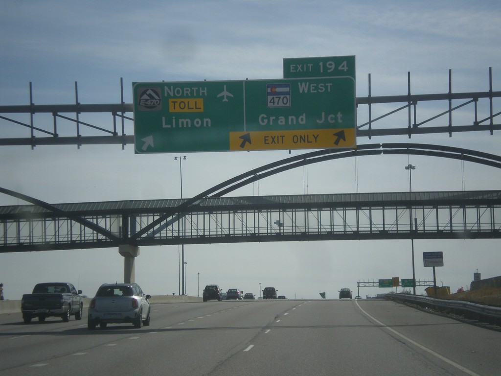
I-25 South - Exit 194
I-25 south at Exit 194 - E-470 North - Toll/Limon and CO-470 West/Grand Junction. E-470/CO-470 is a beltway around the Denver area. This is the southern point on the beltway.
Taken 10-08-2016

 Lone Tree
Douglas County
Colorado
United States
Lone Tree
Douglas County
Colorado
United States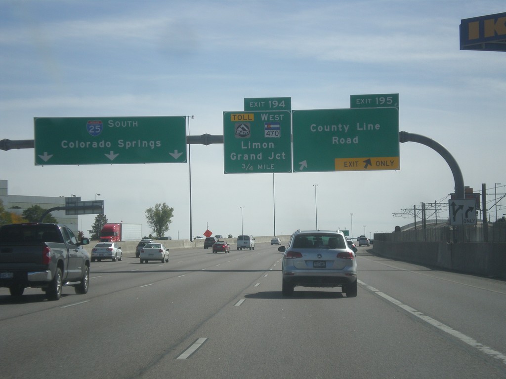
I-25 South - Exits 195 and 194
I-25 south at Exit 195 - County Line Road. Approaching Exit 194 - E-470 Toll/CO-470 West/Limon/Grand Junction.
Taken 10-08-2016
Centennial
Arapahoe County
Colorado
United States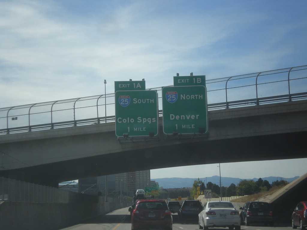
I-225 South Approaching I-25
I-225 South approaching Exit 1A - I-25 South/Colorado Springs, and Exit 1B - I-25 north/Denver. This is the southern end of I-225.
Taken 10-08-2016
 Denver
 County
Colorado
United States
Denver
Denver County
Colorado
United States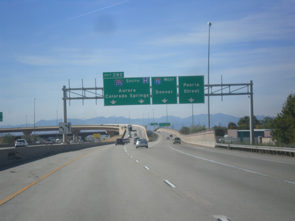
I-70 West/I-225 South Separation - Aurora
I-70 West/I-225 South Separation in Aurora. Merge left for (I-70) Exit 282 - I-225 South/Aurora/Colorado Springs. Merge right for ramp for I-70 west to Denver. Use far right lane for Peoria St.
Taken 10-08-2016
 Denver
Adams County
Colorado
United States
Denver
Adams County
Colorado
United States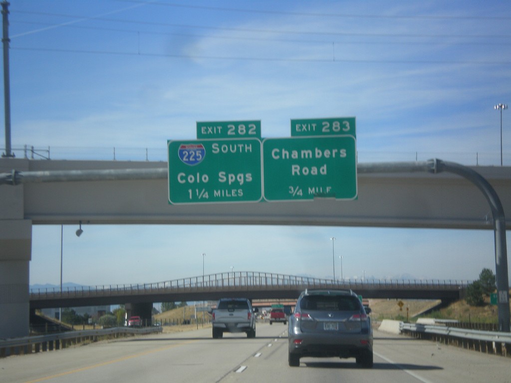
I-70 West - Exits 283 and 282
I-70 west approaching Exit 283 - Chambers Road. Approaching Exit 282 - I-225 South/Colorado Springs.
Taken 10-08-2016
Aurora
Adams County
Colorado
United States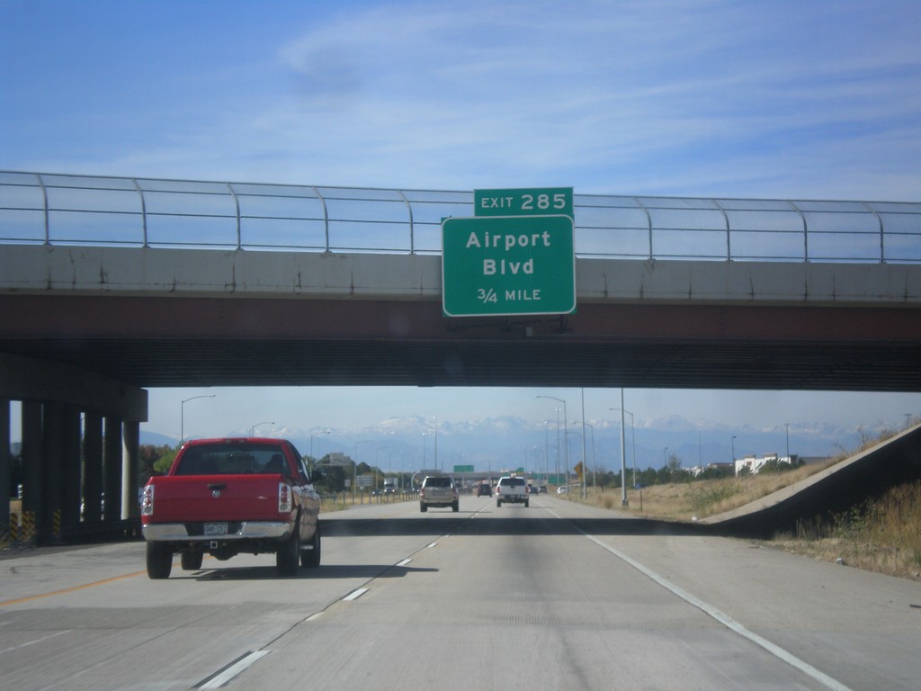
I-70 West - Exit 285
I-70 west approaching Exit 285 - Airport Blvd. Use Exit 285 for access to Denver International Airport.
Taken 10-08-2016
Aurora
Adams County
Colorado
United States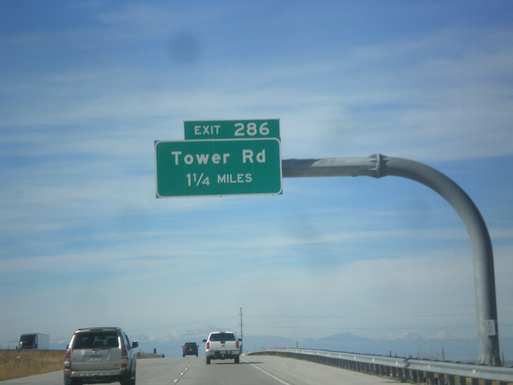
I-70 West - Exit 286
I-70 west approaching Exit 286 - Tower Road.
Taken 10-08-2016
Aurora
Adams County
Colorado
United States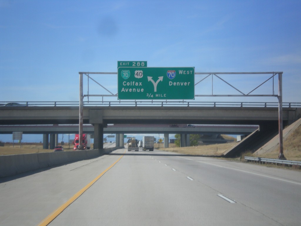
I-70 West - Exit 288
I-70 west approaching Exit 288 - BL-70/US-40/Colfax Ave. Exit 288 is a left exit; merge right to continue west on I-70 to Denver. US-40 leaves I-70 westbound here, and follows Colfax Ave. through Denver. US-40 rejoins I-70 near Golden. This is the eastern end of the Denver business loop.
Taken 10-08-2016

 Adams County
Colorado
United States
Adams County
Colorado
United States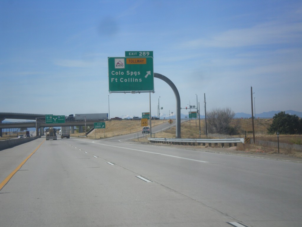
I-70 West - Exit 289
I-70 west at Exit 289 - E-470 Tollway/Colorado Springs/Fort Collins. E-470 is the tolled section of the beltway around Denver.
Taken 10-08-2016
Aurora
Adams County
Colorado
United States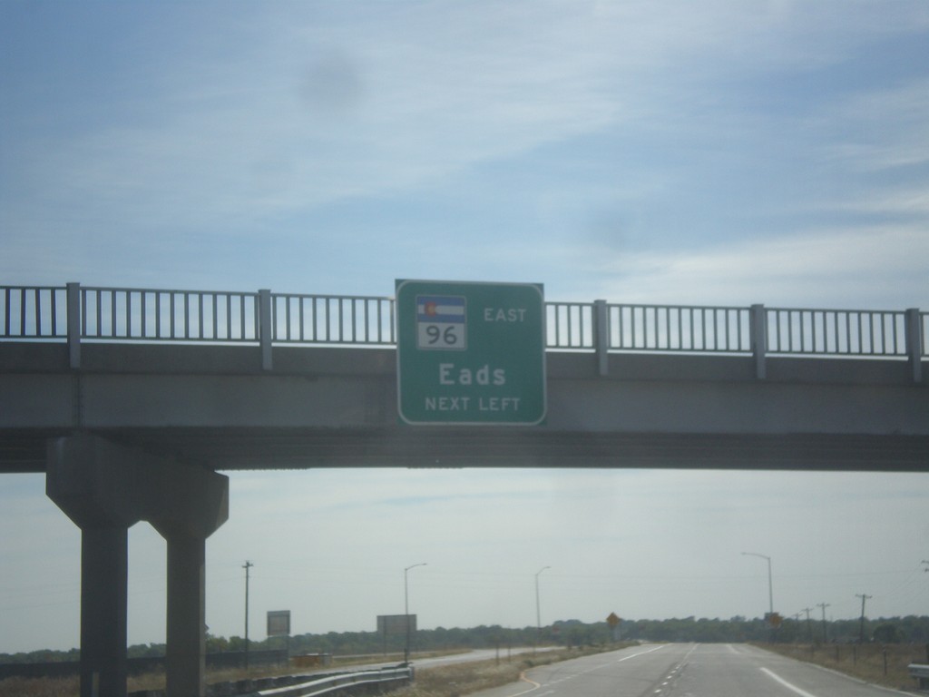
US-50 East/CO-96 East Approaching US-50/CO-96 Split
US-50 East/CO-96 East approaching US-50/CO-96 split. Use left lane for CO-96 East to Eads.
Taken 10-08-2016

 Pueblo
 County
Colorado
United States
Pueblo
Pueblo County
Colorado
United States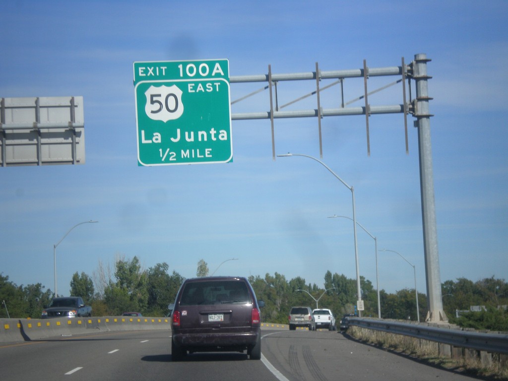
I-25 North - Exit 100A
I-25 north approaching Exit 100A - US-50 East/La Junta. US-50 joins I-25 northbound through Pueblo.
Taken 10-08-2016
Pueblo
Pueblo County
Colorado
United States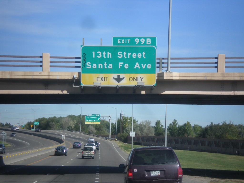
I-25 North - Exit 99B
I-25 north approaching Exit 99B - 13th St./Santa Fe Ave.
Taken 10-08-2016
Pueblo
Pueblo County
Colorado
United States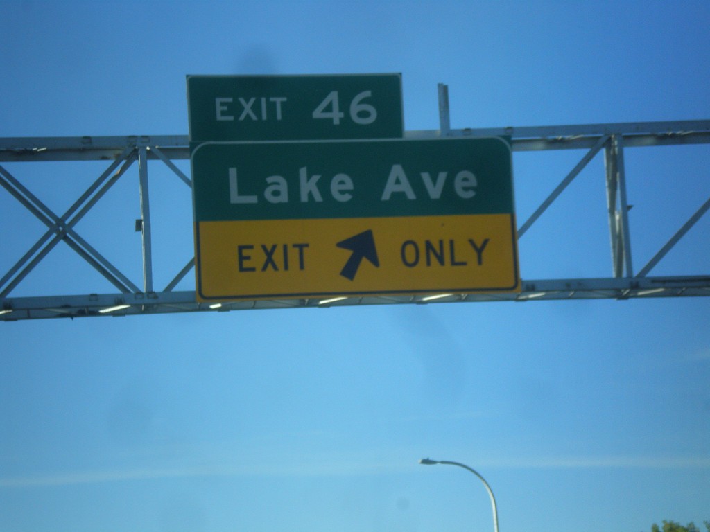
CO-115 South - Exit 46
CO-115 south at Exit 46 - Lake Ave.
Taken 10-08-2016
 Colorado Springs
El Paso County
Colorado
United States
Colorado Springs
El Paso County
Colorado
United States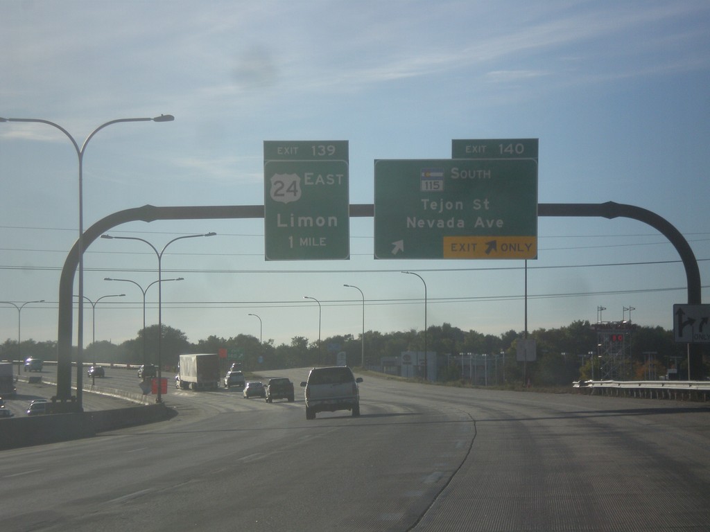
I-25 South/US-24 East - Exits 140 and 139
I-25 South/US-24 East at Exit 140 - CO-115 South/Tejon St./Nevada Ave. Approaching Exit 139 - US-24 East/Limon.
Taken 10-08-2016
 Colorado Springs
El Paso County
Colorado
United States
Colorado Springs
El Paso County
Colorado
United States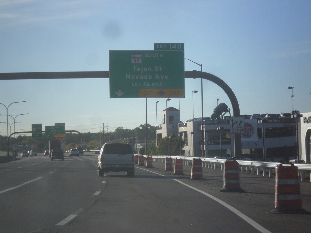
I-25 South - Exit 140
I-25 south approaching Exit 140 - CO-115 South/Tejon St./Nevada Ave.
Taken 10-08-2016
Colorado Springs
El Paso County
Colorado
United States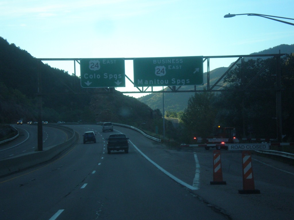
US-24 East - Manitou Springs Business Loop
US-24 East at Bus. US-24 East - Manitou Springs. US-24 continues eastbound to Colorado Springs.
Taken 10-08-2016
 El Paso County
Colorado
United States
El Paso County
Colorado
United States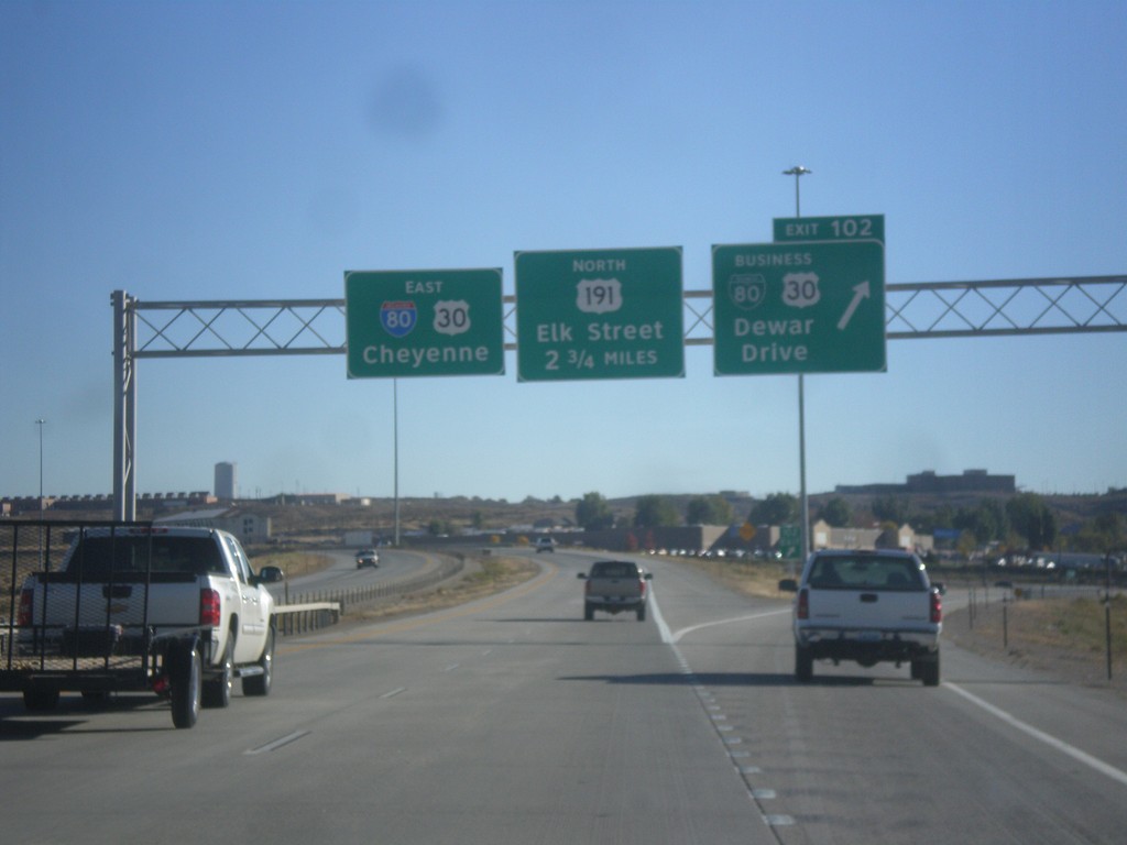
I-80 East - Exits 102 and 104
I-80 East at Exit 102 - BL-80/Bus. US-30/Dewar Drive. Next exit is College Drive which is unsigned on this assembly. The exit after that is Exit 104 - US-191 North/Elk St. I-80/US-30 continues east towards Cheyenne.
Taken 10-07-2016


 Rock Springs
Sweetwater County
Wyoming
United States
Rock Springs
Sweetwater County
Wyoming
United States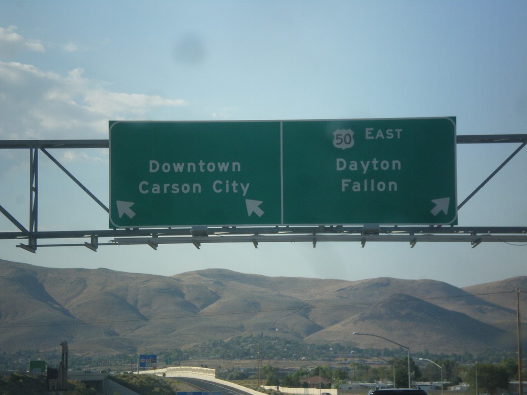
US-395 North/US-50 East on Exit 39 Offramp
US-395 North/US-50 East on Exit 39 Offramp. Use left lane for Carson City Downtown; left lane for US-50 east to Dayton and Fallon.
Taken 08-15-2016

 Carson City
Nevada
United States
Carson City
Nevada
United States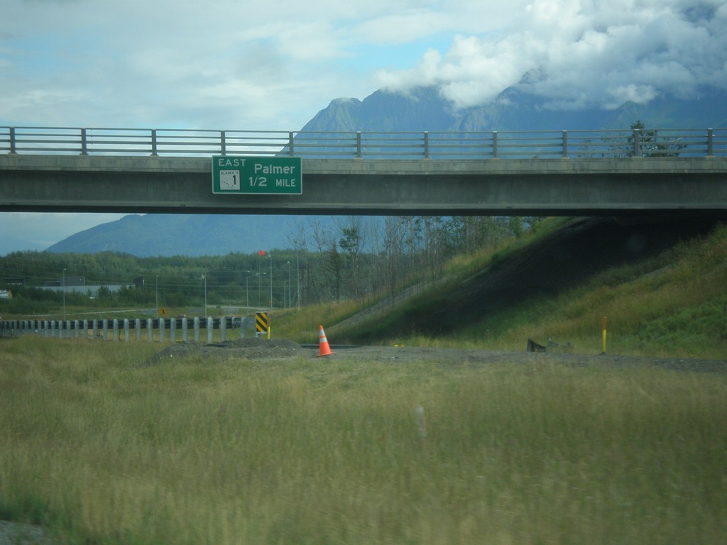
AK-3 South Approaching AK-1 Jct.
AK-3 South (George Parks Highway) approaching AK-1 East/Palmer interchange.
Taken 07-23-2016

 Palmer
Matanuska-Susitna
Alaska
United States
Palmer
Matanuska-Susitna
Alaska
United States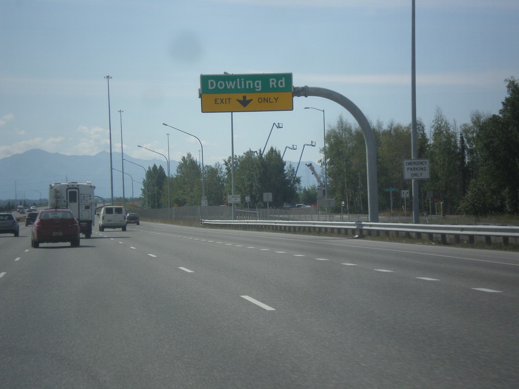
AK-1 South - Dowling Road
AK-1 south approaching Dowling Road interchange.
Taken 07-16-2016
Anchorage
Anchorage Municipality
Alaska
United States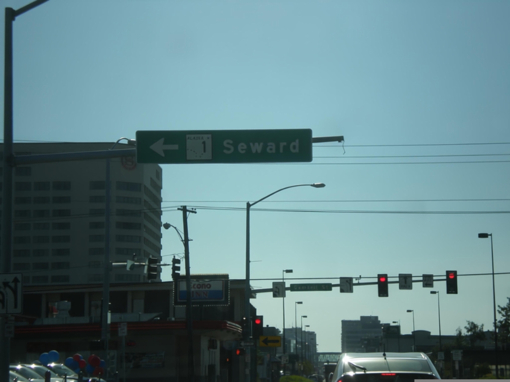
AK-1 South - Glenn Highway at Seward Highway Jct.
AK-1 south (East 5th Ave.) at end of Glenn Highway in Anchorage. Turn left to continue south on AK-1 (Gambell St.) for the Seward Highway to Seward.
Taken 07-15-2016
Anchorage
Anchorage Municipality
Alaska
United States