Signs Tagged With Overhead
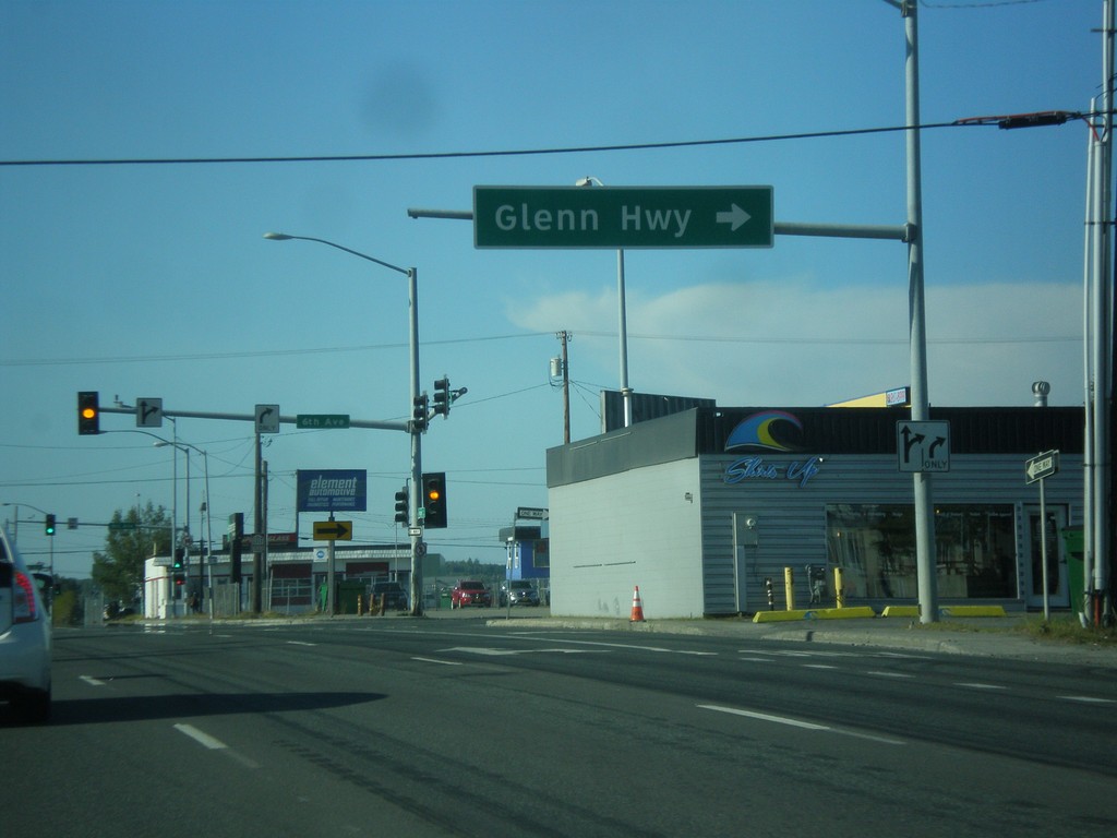
AK-1 North - Seward Highway at Glenn Highway Jct.
AK-1 north (Ingra St.) at East 6th Ave. Turn right to continue north on AK-1 as the Glenn Highway. The Glenn Highway starts at this intersection and runs northeast to Glenallen.
Taken 07-15-2016
 Anchorage
 Municipality
Alaska
United States
Anchorage
Anchorage Municipality
Alaska
United States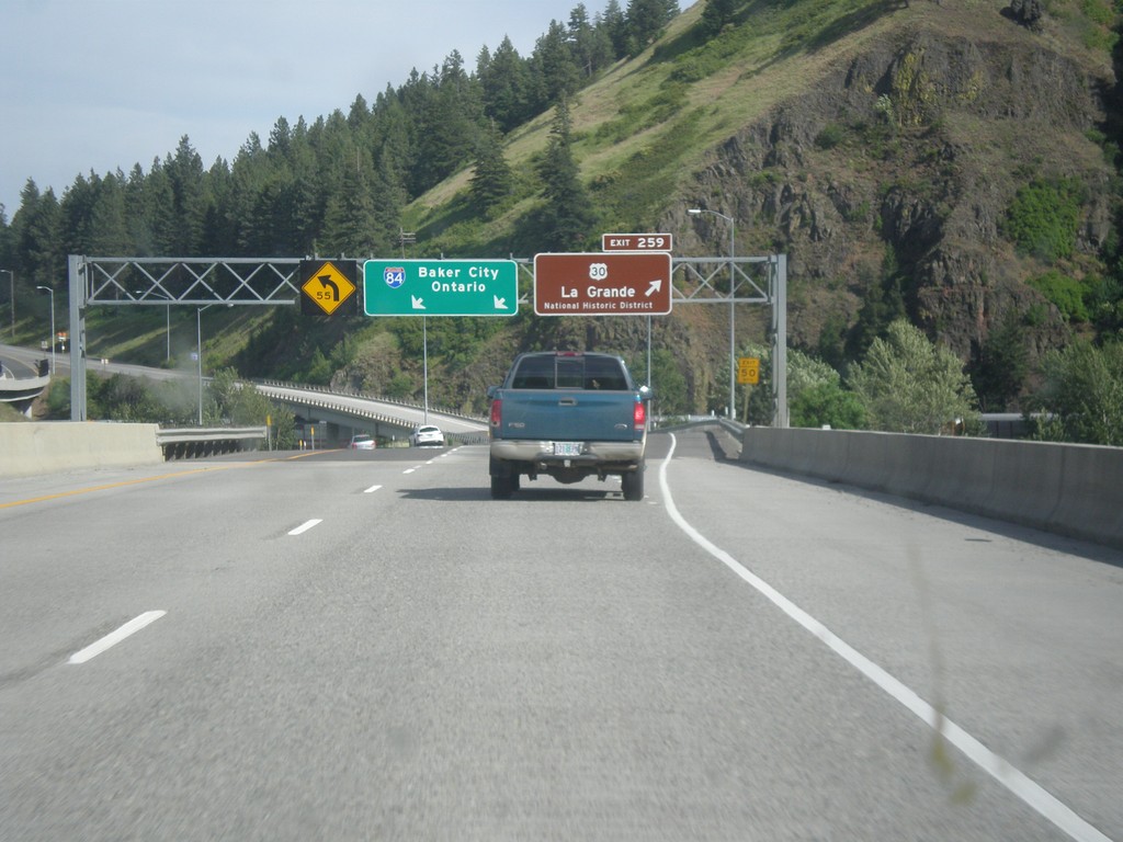
I-84 East - Exit 259
I-84 east at Exit 259 - US-30/La Grande/National Historic District. Overhead for I-84 to Baker City and Ontario. US-30 leaves I-84 eastbound here, and rejoins with I-84 on the other side of LaGrande. LaGrande is the county seat of Union County.
Taken 06-05-2016

 La Grande
Union County
Oregon
United States
La Grande
Union County
Oregon
United States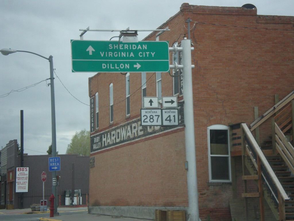
MT-41 South at MT-287
MT-41 South at MT-287 in Twin Bridges. Turn right to continue south on MT-41 to Dillon. Continue straight for MT-287 south to Sheridan and Virginia City.
Taken 05-15-2016

 Twin Bridges
Madison County
Montana
United States
Twin Bridges
Madison County
Montana
United States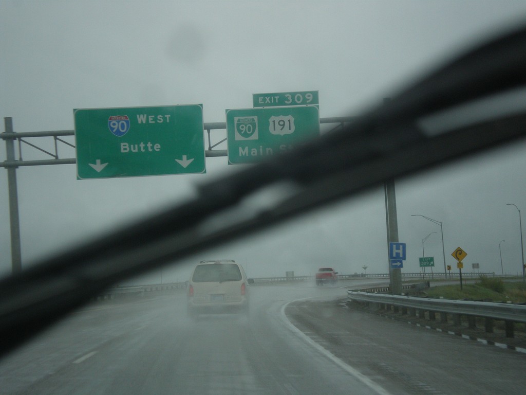
I-90 West - Exit 309
I-90 west at Exit 309 - BL-90/US-191/Main St. US-191 south leaves I-90 westbound here. I-90 continues west to Butte.
Taken 05-15-2016


 Bozeman
Gallatin County
Montana
United States
Bozeman
Gallatin County
Montana
United States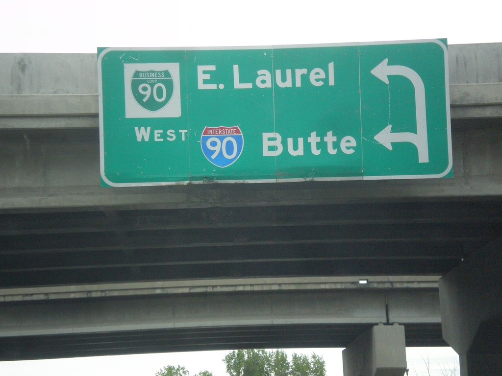
Begin BL-90 West at I-90 West
Begin BL-90 West at I-90 West to Butte (first left). Use second left for BL-90 to East Laurel.
Taken 05-15-2016
 Laurel
Yellowstone County
Montana
United States
Laurel
Yellowstone County
Montana
United States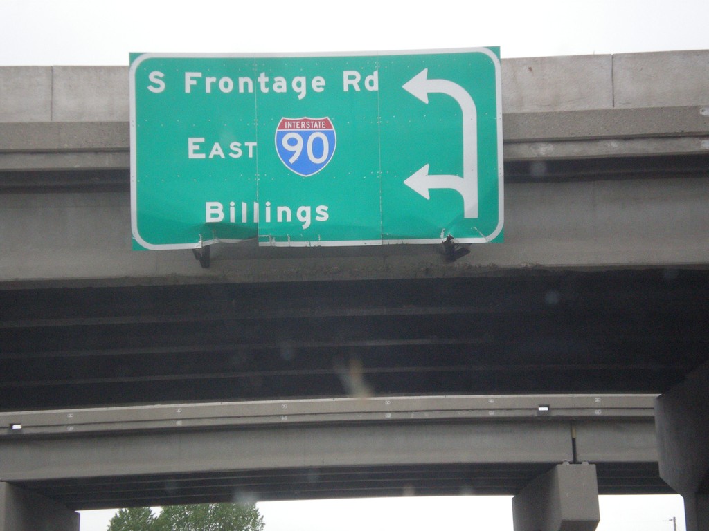
End BL-90 East at South Frontage Road and I-90 East
End BL-90 East at South Frontage Road and I-90 East to Billings.
Taken 05-15-2016
Laurel
Yellowstone County
Montana
United States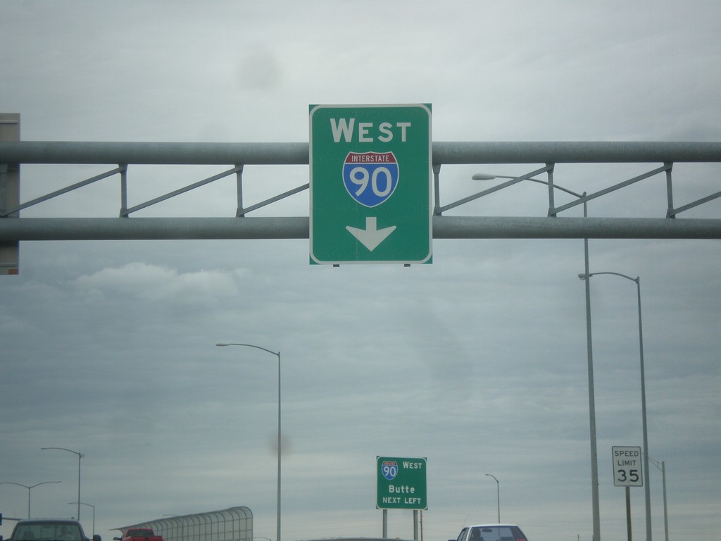
King Ave. West Approaching I-90 West
King Ave. West Approaching I-90 West in Billings.
Taken 05-15-2016
Billings
Yellowstone County
Montana
United States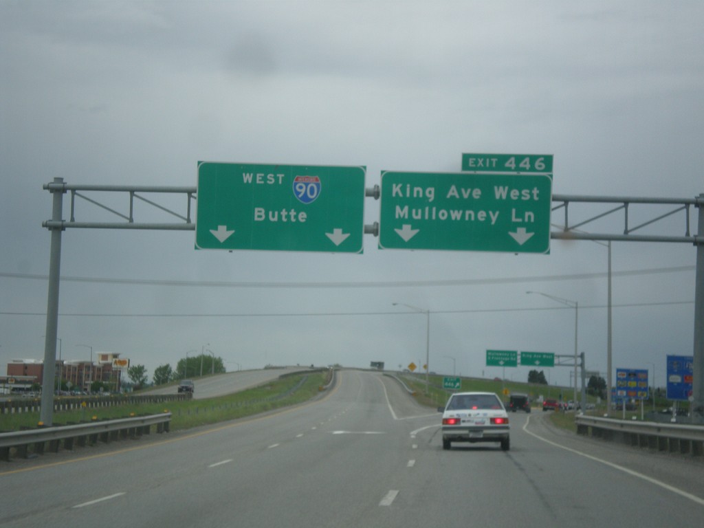
I-90 West - Exit 446
I-90 west at Exit 446 - King Ave. West/Mullowney Lane. I-90 continues west towards Butte.
Taken 05-15-2016
Billings
Yellowstone County
Montana
United States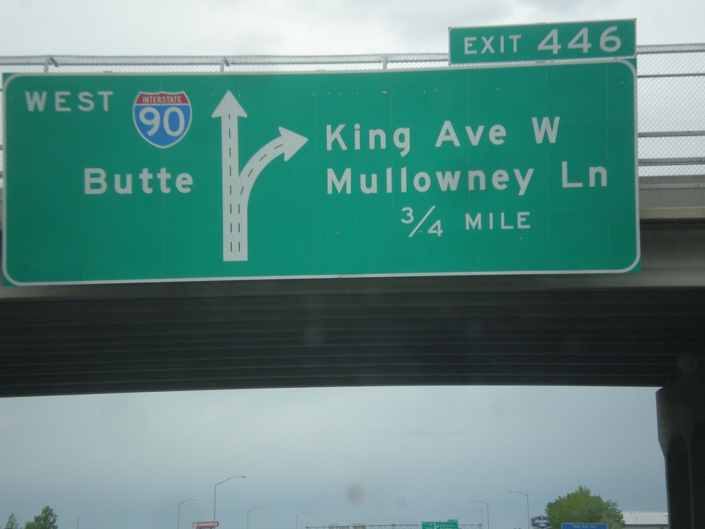
I-90 West - Exit 446
I-90 west approaching Exit 446 - King Ave W./Mullowney Lane. I-90 continues west towards Butte. This is the western end of the Billings business loop.
Taken 05-15-2016
Billings
Yellowstone County
Montana
United States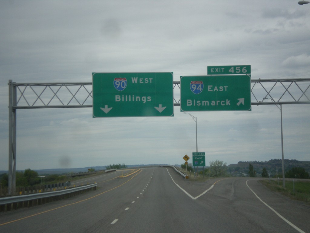
I-90 West at I-94 East - Yellowstone County
I-90 West at Exit 456 - I-94 East/Bismarck (North Dakota). Continue west on I-90 for Billings. This is the western terminus of I-94.
Taken 05-15-2016

 Lockwood
Yellowstone County
Montana
United States
Lockwood
Yellowstone County
Montana
United States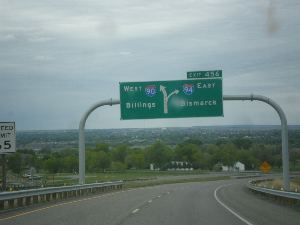
I-90 West - Exit 456
I-90 west approaching Exit 456 - I-94 East/Bismarck (North Dakota).
Taken 05-15-2016
Billings
Yellowstone County
Montana
United States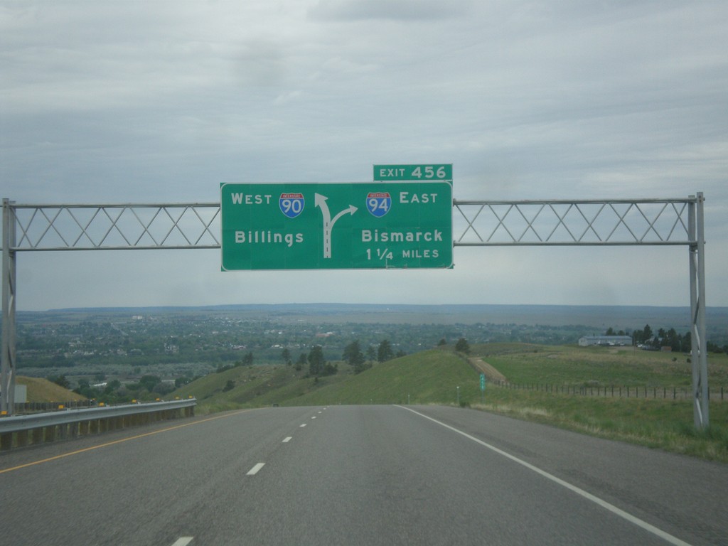
I-90 West - Exit 456
I-90 west approaching Exit 456 - I-94 East/Bismarck (North Dakota). Continue west on I-90 for Billings.
Taken 05-15-2016
Billings
Yellowstone County
Montana
United States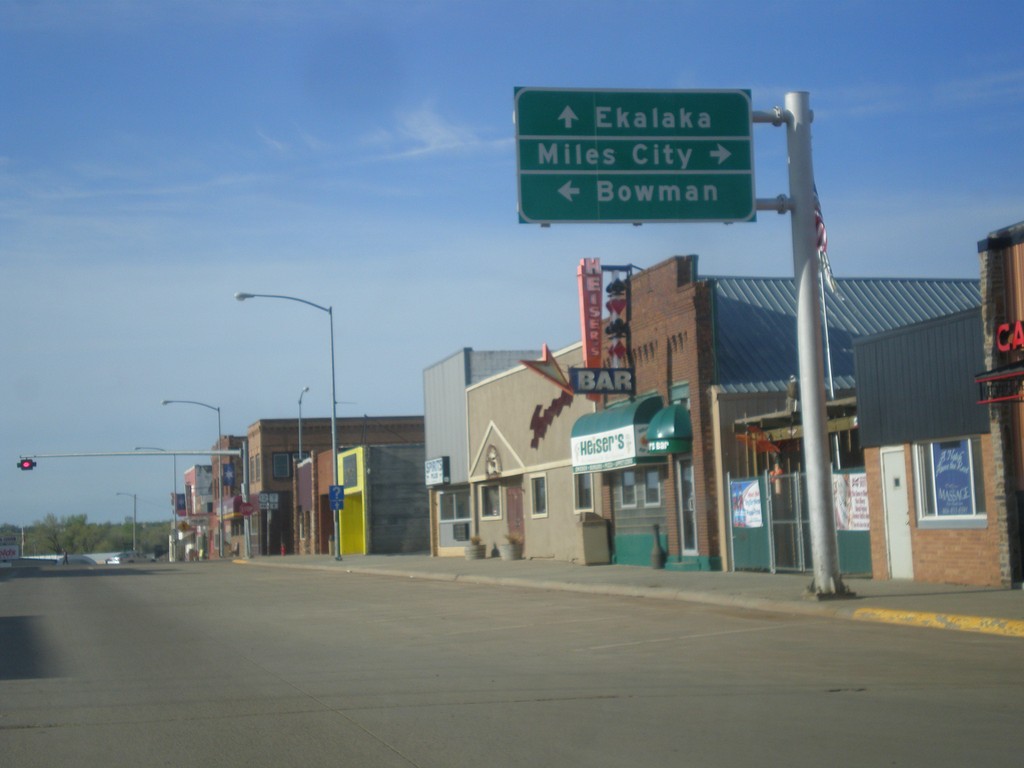
MT-7 South at US-12
MT-7 South at US-12 in Baker. Turn right for US-12 west to Miles City; left for US-12 east to Bowman (North Dakota). Continue south on MT-7 for Ekalaka.
Taken 05-15-2016

 Baker
Fallon County
Montana
United States
Baker
Fallon County
Montana
United States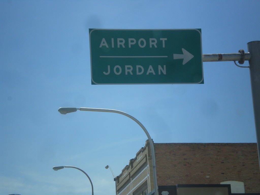
BL-94 West/MT-59 North at MT-59 North Jct.
BL-94 West/MT-59 North (Main St.) at MT-59 North(7th St.) Jct. Use MT-59 north for Airport and Jordan.
Taken 05-14-2016

 Miles City
Custer County
Montana
United States
Miles City
Custer County
Montana
United States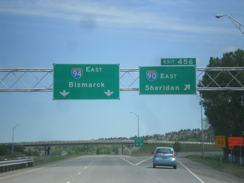
I-90 East - Exit 456 - I-94 Jct.
I-90 east at Exit 456 - I-94 East/Bismarck (North Dakota). Merge right to continue east on I-90 to Sheridan (Wyoming). This is the beginning of I-94. The eastern end of I-94 is the Canadian border at Port Huron, Michigan.
Taken 05-14-2016
Billings
Yellowstone County
Montana
United States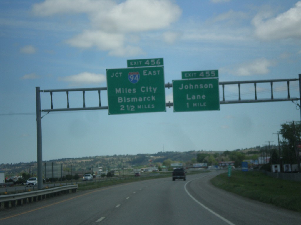
I-90 East - Exits 455 and 456
I-90 east approaching Exit 455 - Johnson Lane, 1 mile. Approaching Exit 456 - I-94 East/Miles City/Bismarck (North Dakota).
Taken 05-14-2016
Billings
Yellowstone County
Montana
United States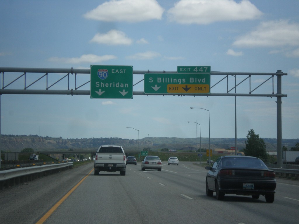
I-90 East - Exit 447
I-90 east at Exit 447 - South Billings Blvd. Continue east on I-90 to Sheridan (Wyoming).
Taken 05-14-2016
Billings
Yellowstone County
Montana
United States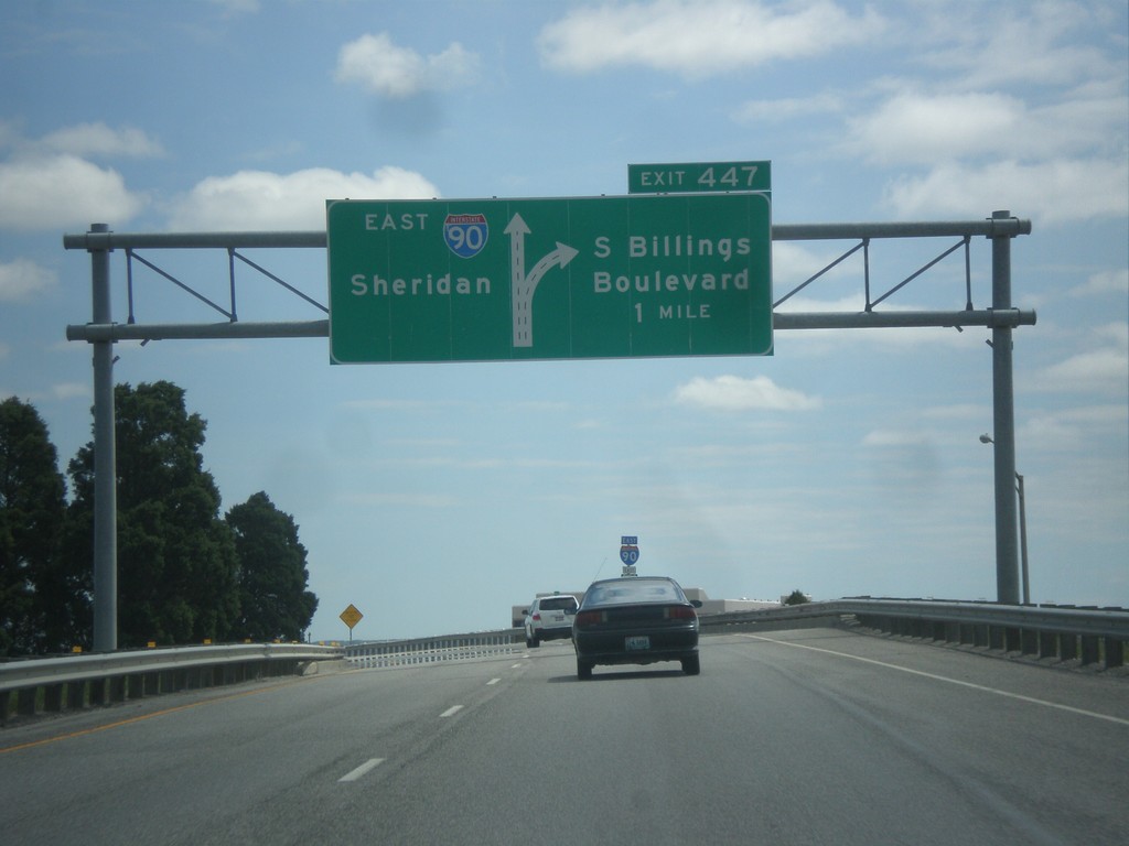
I-90 East - Exit 447
I-90 east approaching Exit 447 - S. Billings Blvd. Continue east on I-90 for Sheridan (Wyoming).
Taken 05-14-2016
Billings
Yellowstone County
Montana
United States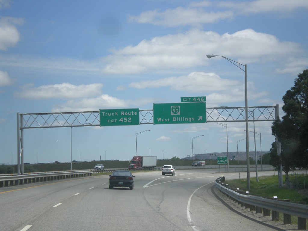
I-90 East Exit 446
I-90 east at Exit 446 - BL-90/West Billings. For the Billings Truck Route, use Exit 452.
Taken 05-14-2016
Billings
Yellowstone County
Montana
United States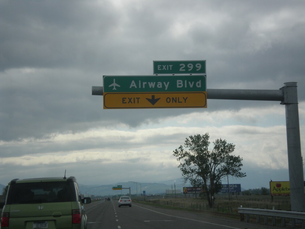
I-90 East - Exit 299
I-90 east approaching Exit 299 - Airway Blvd. in Belgrade. Use Exit 299 for access to Bozeman Yellowstone International Airport. This interchange was opened in 2016.
Taken 05-14-2016
Belgrade
Gallatin County
Montana
United States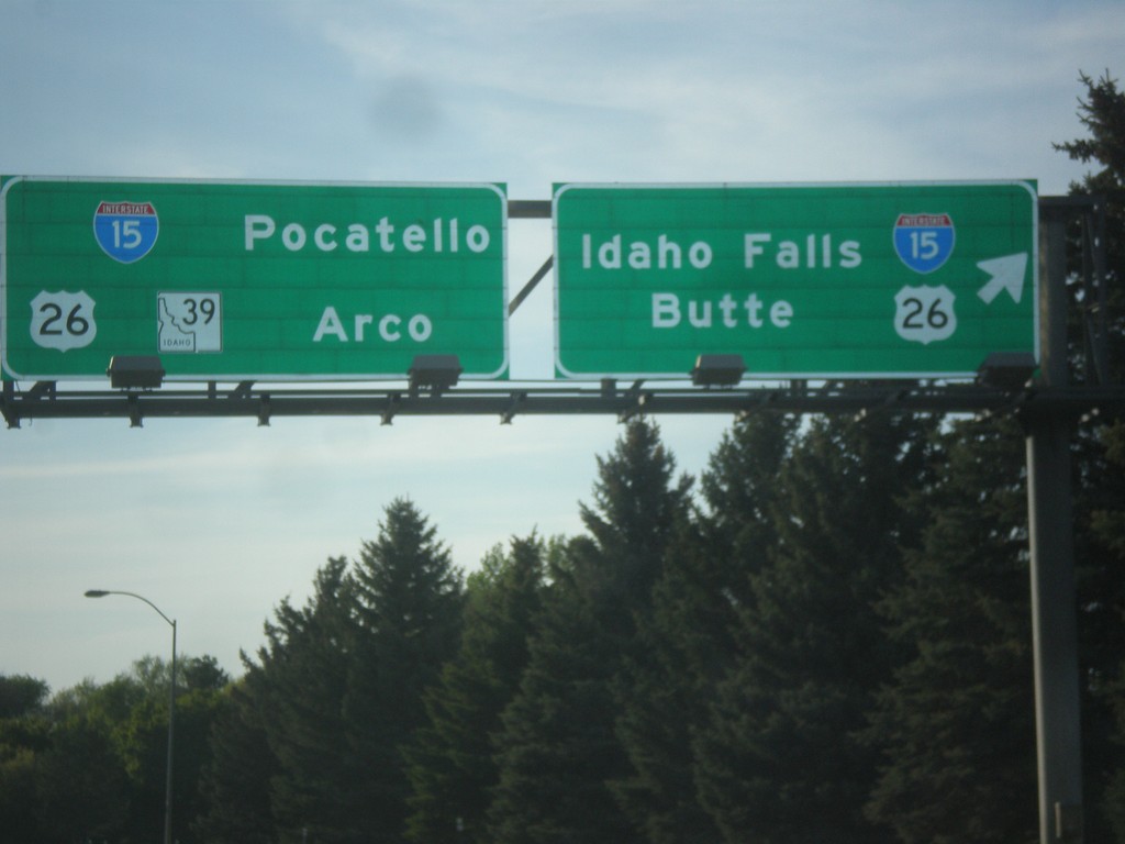
End BL-15 North at I-15/US-26/ID-39 Junction
End BL-15 North at I-15/US-26/ID-39 Junction in Blackfoot. Turn right for I-15 North/US-26 East to Idaho Falls and Butte (Montana). Continue under freeway for I-15 south to Pocatello, and for US-26/ID-39 to Arco. This is the northern end of the Blackfoot business loop.
Taken 05-13-2016


 Blackfoot
Bingham County
Idaho
United States
Blackfoot
Bingham County
Idaho
United States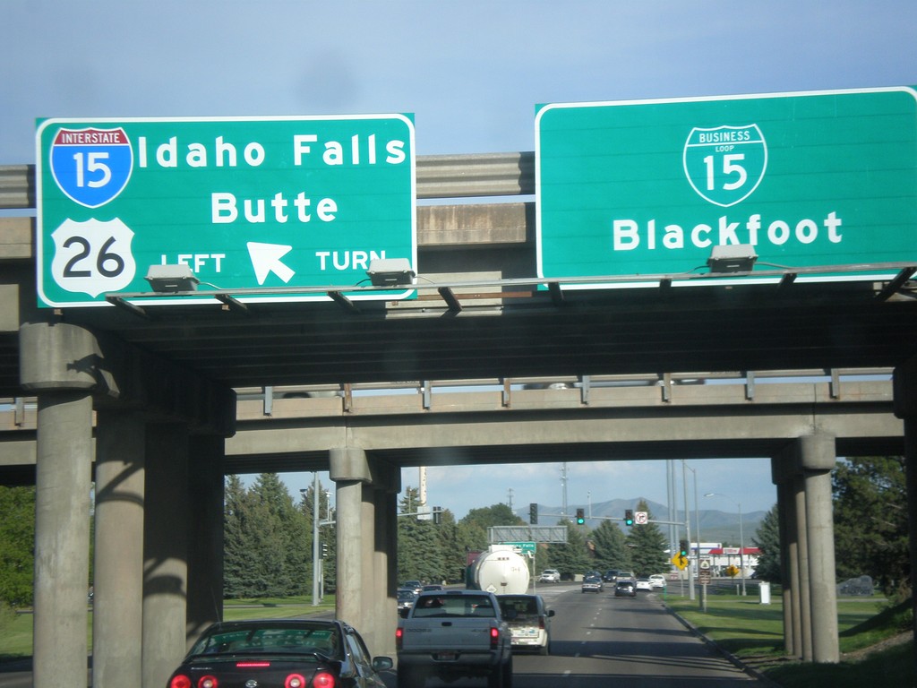
US-26 East at I-15 North and BL-15
US-26 East at I-15 North and BL-15 in Blackfoot. Use I-15 North/US-26 East to Idaho Falls and Butte (Montana). Continue straight for BL-15 to Blackfoot city center.
Taken 05-13-2016
Blackfoot
Bingham County
Idaho
United States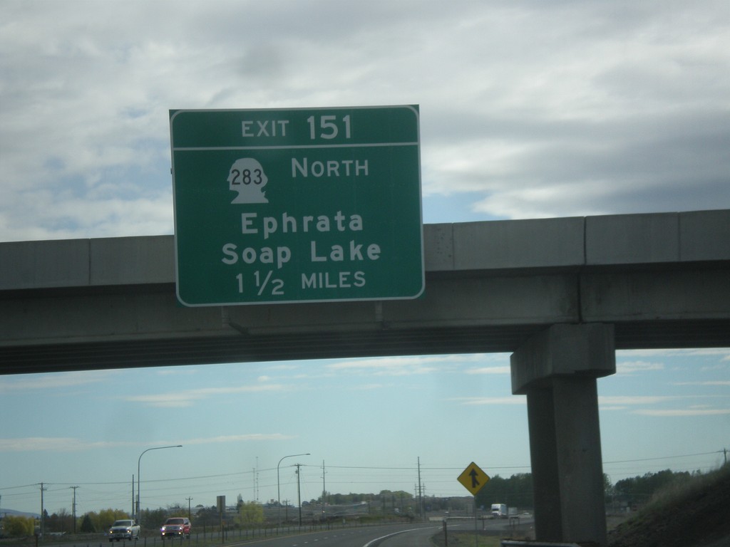
I-90 East - Exit 151
I-90 east approaching Exit 151 - WA-283 North/Ephrata/Soap Lake.
Taken 04-28-2016

 Quincy
Grant County
Washington
United States
Quincy
Grant County
Washington
United States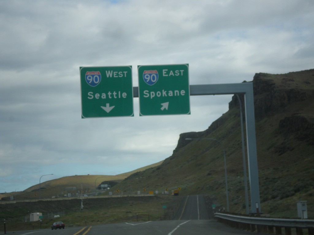
End WA-26 West at I-90
End WA-26 west at I-90. Use I-90 west to Seattle; I-90 east to Spokane.
Taken 04-28-2016
 Vantage
Grant County
Washington
United States
Vantage
Grant County
Washington
United States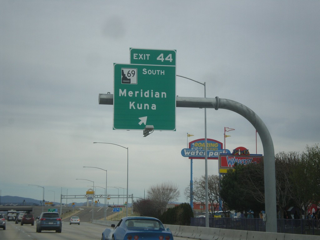
I-84 East - Exit 44
I-84 east at Exit 44 - ID-69 South/Meridian/Kuna. This interchange was rebuilt in 2015 as a SPUI. The ID-69 shield in attached to the exit sign incorrectly has the state of Idaho filled in all black. Normally on these types of state highway shields on freeway junctions, the state is shown white with a black outline and black text.
Taken 03-20-2016

 Meridian
Ada County
Idaho
United States
Meridian
Ada County
Idaho
United States