Signs Tagged With Overhead
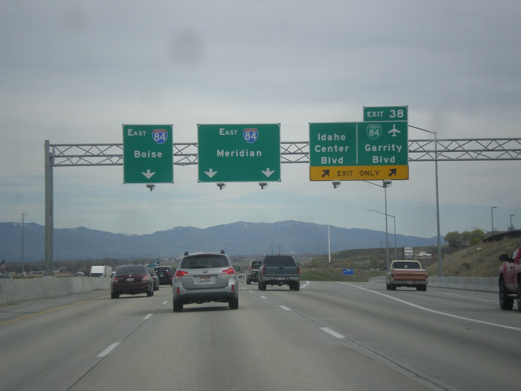
I-84 East - Exit 38
I-84 east at Exit 38 - BL-84/Garrity Blvd/Idaho Center Blvd. Use I-84 east for Meridian and Boise. This is the eastern end of the Nampa/Caldwell business loop.
Taken 03-20-2016


 Nampa
Canyon County
Idaho
United States
Nampa
Canyon County
Idaho
United States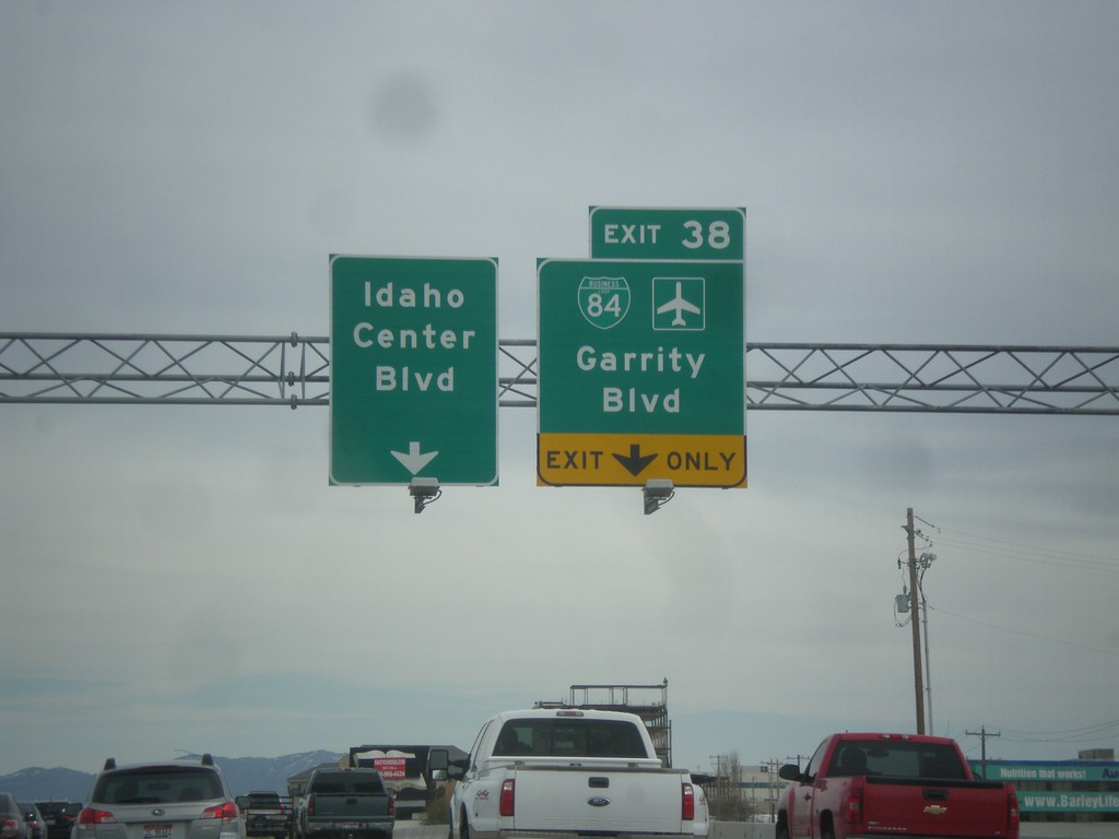
I-84 East - Exit 38
I-84 east approaching Exit 38 - BL-84/Idaho Center Blvd./Garrity Blvd.
Taken 03-20-2016
Nampa
Canyon County
Idaho
United States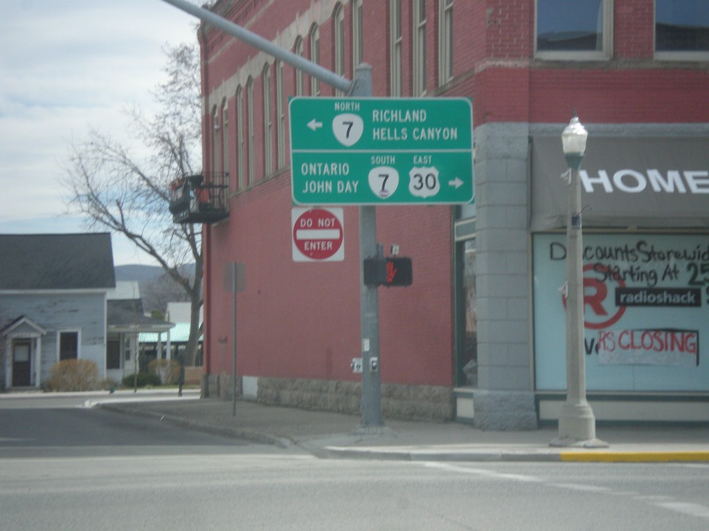
US-30 West at OR-7 - Baker City
US-30 West/OR-7 east in Baker City. Turn right for US-30 East/OR-7 South to Ontario and John Day. Turn left for OR-7 west to Richland and Hells Canyon (via OR-86).
Taken 03-20-2016
 Baker City
Baker County
Oregon
United States
Baker City
Baker County
Oregon
United States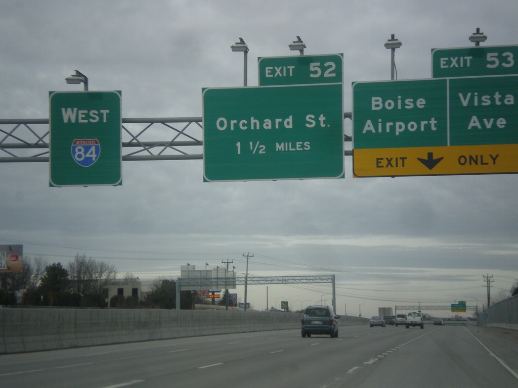
I-84 West - Exits 53 and 52
I-84 west at Exit 53 - Vista Ave./Boise Airport and approaching Exit 52 - Orchard St.
Taken 02-06-2016
Boise
Ada County
Idaho
United States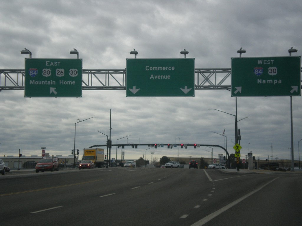
Broadway Ave. South at I-84
Broadway Ave. South (US-20/US-26 East) at I-84. Turn right for I-84/US-30 west to Nampa. Merge left for I-84 East/US-20/US-26/US-30 East to Mountain Home. Broadway Ave. turns into Commerce Ave. south of I-84. This interchange was redesigned as a SPUI in 2015.
Taken 02-06-2016

 Boise
Ada County
Idaho
United States
Boise
Ada County
Idaho
United States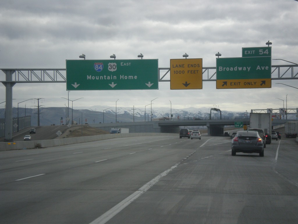
I-84 East - Exit 54
I-84 east at Exit 54 - Broadway Ave. I-84/US-30 continues east to Mountain Home. US-20 and US-26 join I-84 eastbound here.
Taken 02-06-2016
Boise
Ada County
Idaho
United States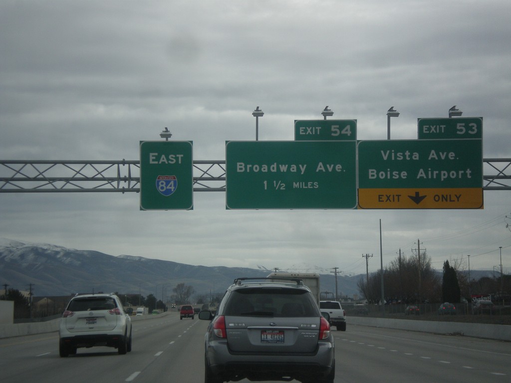
I-84 East - Exit 53 and 54
I-84 east at Exit 53 - Vista Ave./Boise Airport. Approaching Exit 54 - Broadway Ave.
Taken 02-06-2016
Boise
Ada County
Idaho
United States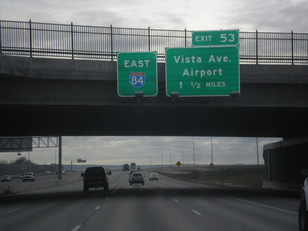
I-84 East Approaching Exit 53
I-84 east overhead, and approaching Exit 53 - Vista Ave./Airport.
Taken 02-06-2016
Boise
Ada County
Idaho
United States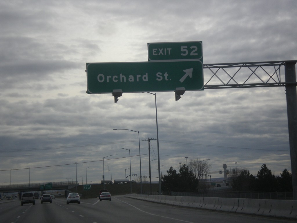
I-84 East - Exit 52
I-84 east at Exit 52 - Orchard St.
Taken 02-06-2016
Boise
Ada County
Idaho
United States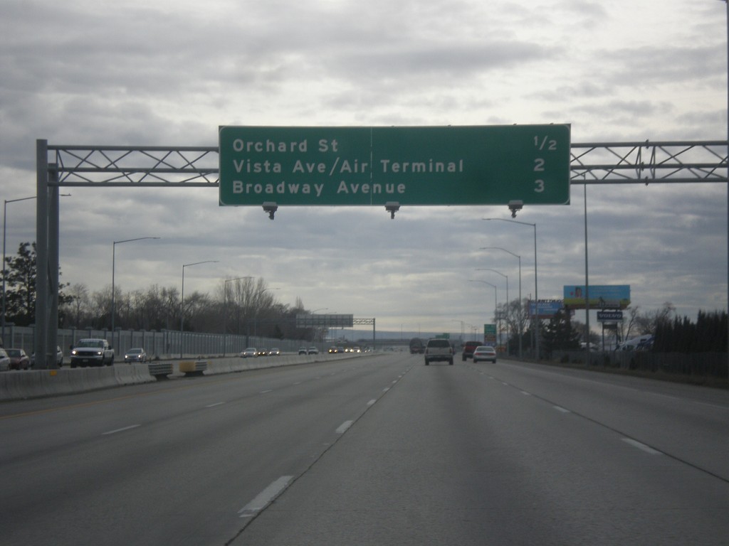
I-84 East - Boise Exits
Next 3 Boise exits on I-84 east - Orchard St., Vista Ave./Air Terminal, and Broadway Ave.
Taken 02-06-2016
Boise
Ada County
Idaho
United States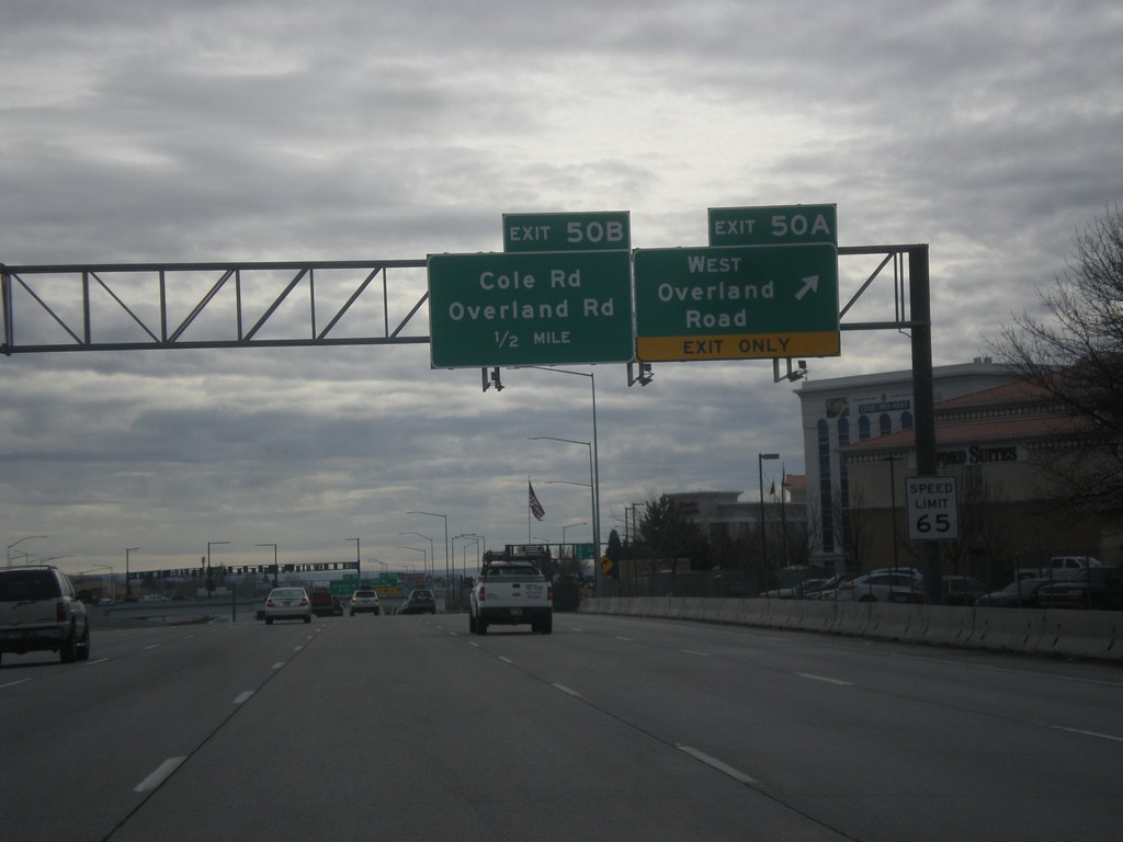
I-84 East Exits 50AB
I-84 east at Exit 50A - West Overland Road. Approaching Exit 50B - Overland Road/Cole Road.
Taken 02-06-2016
Boise
Ada County
Idaho
United States
End I-184 at I-84
I-184 west approaching Exit 0, I-84 west to Nampa and I-84 east to Mountain Home. The very right lanes and very left lanes go west. This interchange is known locally as the Flying Wye.
Taken 02-06-2016
 Boise
Ada County
Idaho
United States
Boise
Ada County
Idaho
United States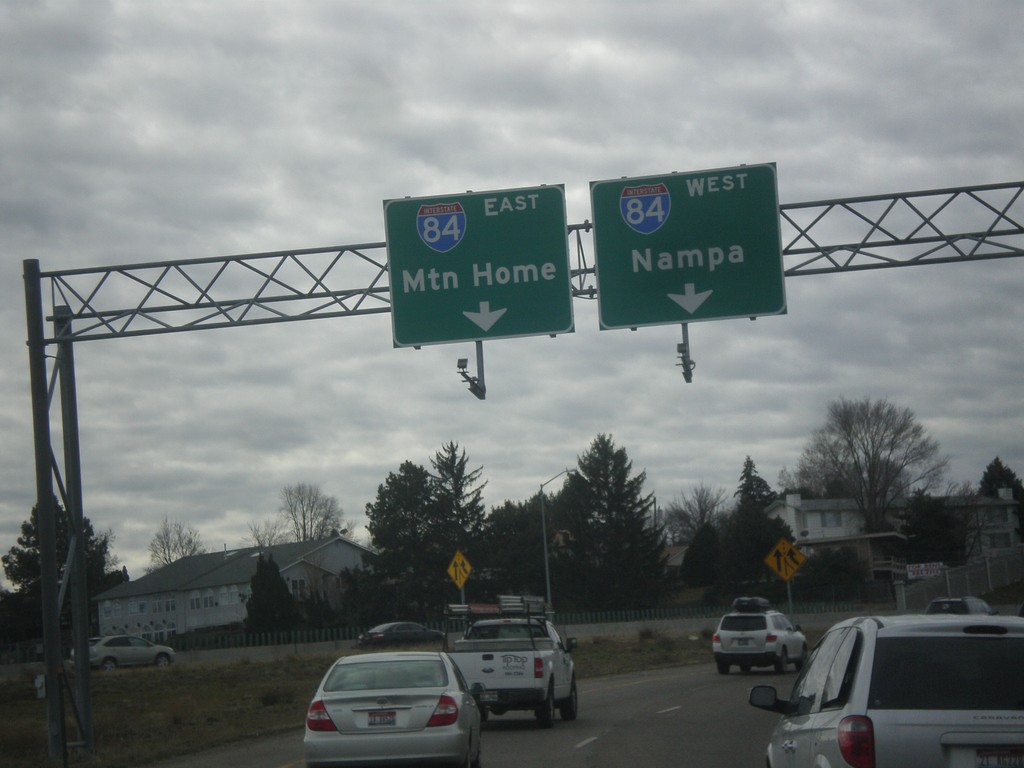
I-184 West - Exit 1A Onramp - Approaching I-84.
I-184 West - Exit 1A Onramp. I-184 immediately ends at the top of this ramp at I-84. Use right lane for I-84 west to Nampa; left lane for I-84 east to Mountain Home.
Taken 02-06-2016
Boise
Ada County
Idaho
United States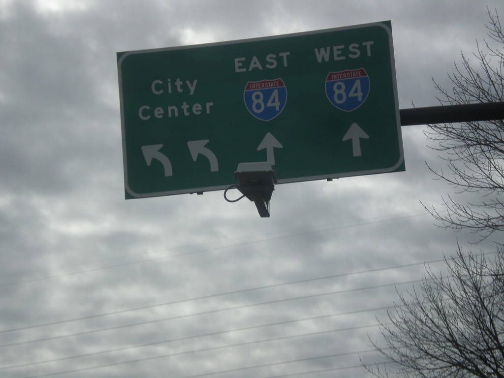
Milwaukee St. South at Franklin Road and I-84
Milwaukee St. south at Franklin Road and I-84 onramps. Turn left on Franklin Road for I-184 East to (Boise) City Center.
Taken 02-06-2016
Boise
Ada County
Idaho
United States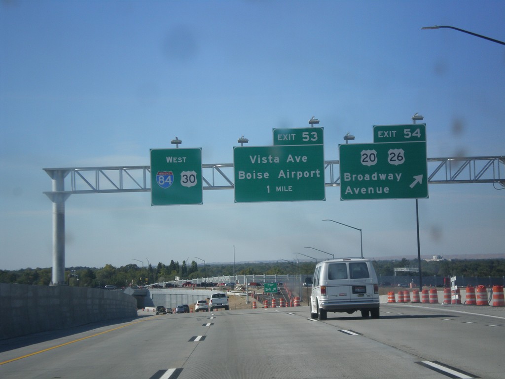
I-84 West - Exits 53 and 54
I-84 west at Exit 54 - US-20/US-26/Broadway Ave. Approaching Exit 53 - Vista Ave./Boise Airport. US-20/US-26 leave I-84 here.
Taken 10-04-2015
Boise
Ada County
Idaho
United States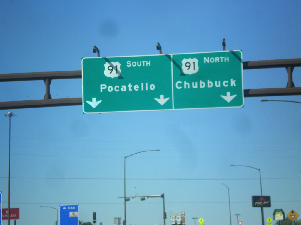
I-86 West - Exit 61 Offramp at US-91
I-86 west at Exit 61 offramp, US-91 jct. Use US-91 north for Chubbuck. Use US-91 south for Pocatello.
Taken 10-04-2015

 Pocatello
Bannock County
Idaho
United States
Pocatello
Bannock County
Idaho
United States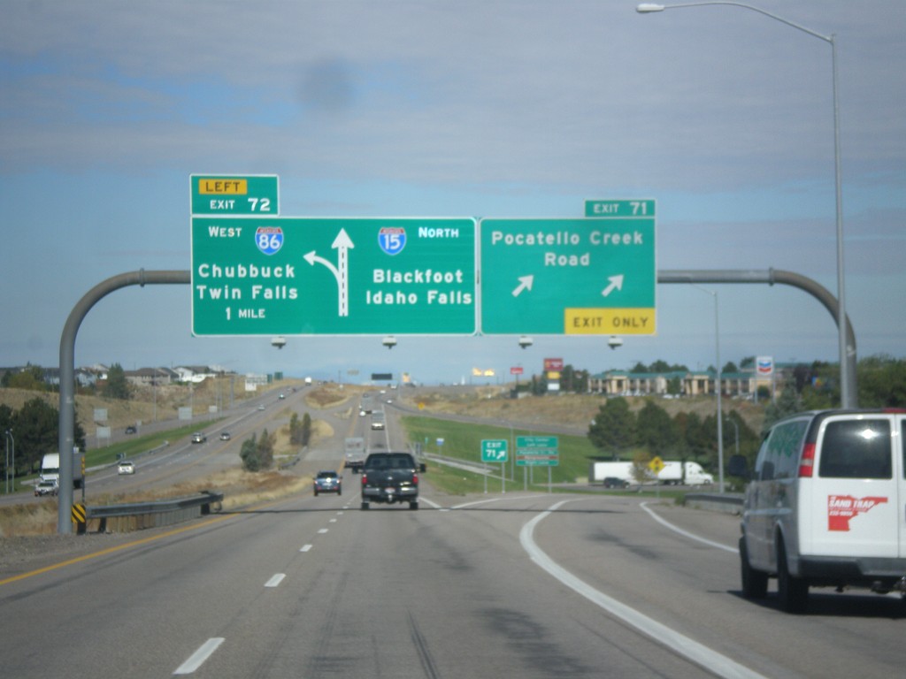
I-15 North - Exits 71 and 72
I-15 north at Exit 71 - Pocatello Creek Road. Approaching Exit 72 - I-86 West/Chubbuck/Twin Falls. Continue north on I-15 for Idaho Falls and Blackfoot.
Taken 10-04-2015

 Pocatello
Bannock County
Idaho
United States
Pocatello
Bannock County
Idaho
United States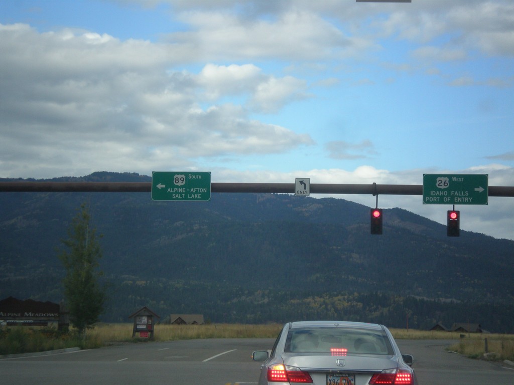
US-26 West/US-89 South - Alpine Junction
US-26 West/US-89 South at Alpine Junction. Turn right for US-26 West to Idaho Falls (ID) and the (Wyoming) Port of Entry. Turn left for US-89 south to Alpine, Afton, and Salt Lake (Utah).
Taken 10-04-2015
 Alpine
Lincoln County
Wyoming
United States
Alpine
Lincoln County
Wyoming
United States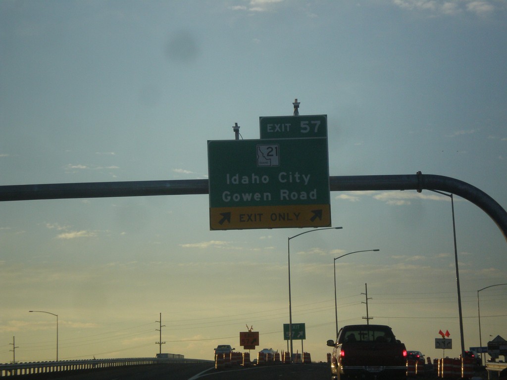
I-84 East - Exit 57
I-84 east at Exit 57 - ID-21/Idaho City/Gowen Road.
Taken 10-03-2015
 Boise
Ada County
Idaho
United States
Boise
Ada County
Idaho
United States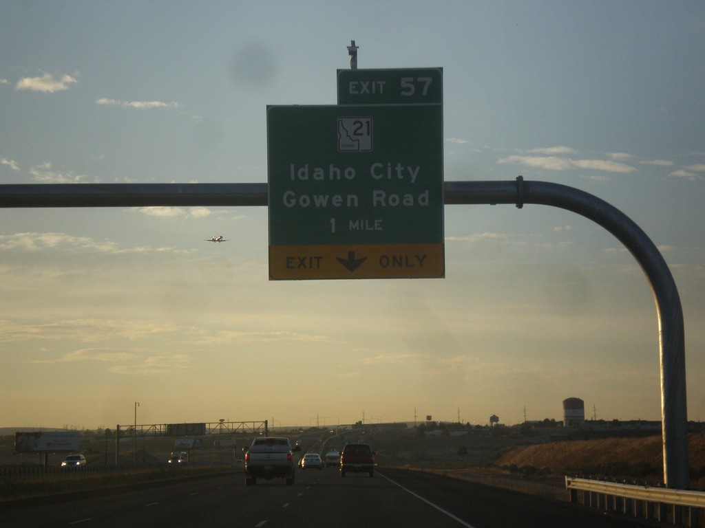
I-84 East - Exit 57
I-84 east approaching Exit 57 - ID-21/Idaho City/Gowen Road.
Taken 10-03-2015
Boise
Ada County
Idaho
United States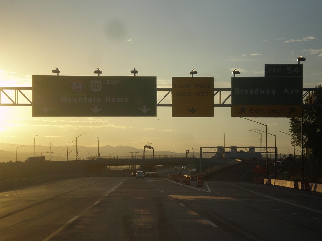
I-84 East - Exit 54
I-84 east at Exit 54 - Broadway Ave. I-84/US-30 continues east to Mountain Home. US-20 and US-26 join I-84 eastbound here.
Taken 10-03-2015
Boise
Ada County
Idaho
United States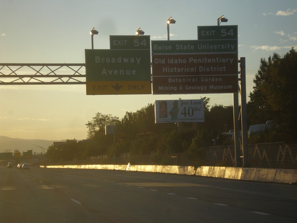
I-84 East - Exit 54
I-84 east approaching Exit 54 - Broadway Ave. Use Exit 54 for Boise State University, Old Idaho Penitentiary Historic District, Botanical Garden, and Mining and Geology Museum.
Taken 10-03-2015
Boise
Ada County
Idaho
United States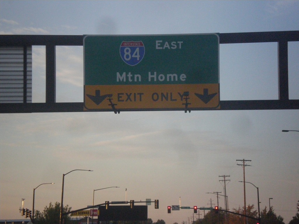
Cole Road South at I-84 East
Cole Road South at I-84 East to Mountain Home.
Taken 10-03-2015
Boise
Ada County
Idaho
United States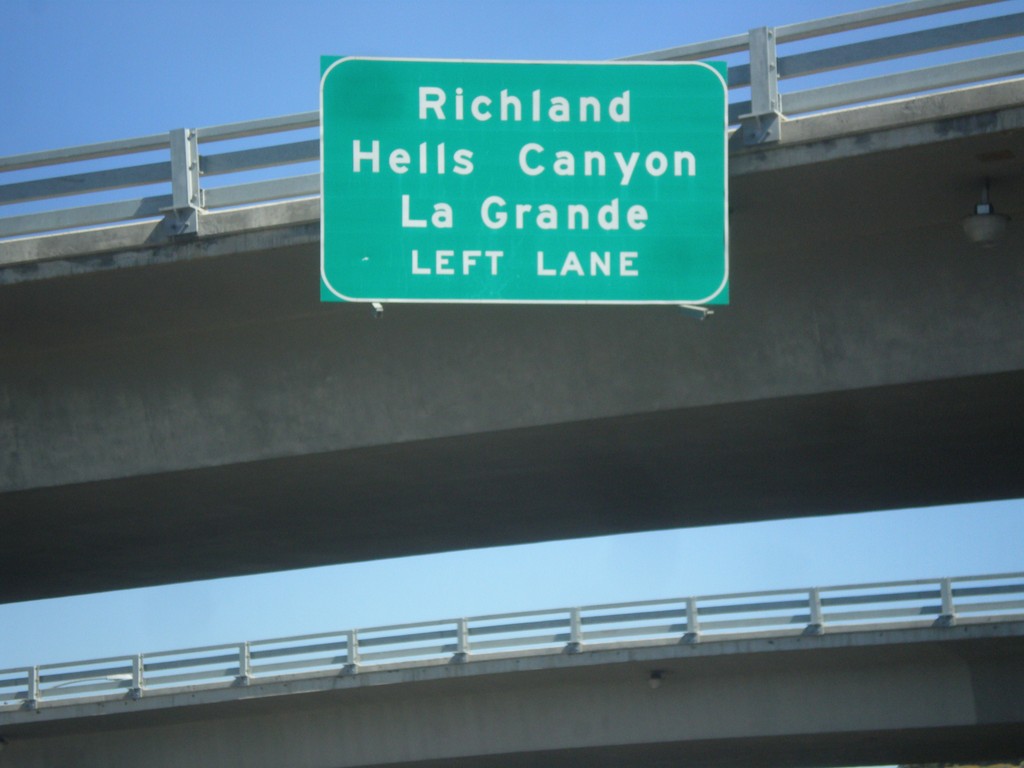
End OR-7 East Approaching I-84 West
End OR-7 East approaching I-84 West to Richland (via OR-86), Hells Canyon (via OR-86) and La Grande.
Taken 09-13-2015
Baker City
Baker County
Oregon
United States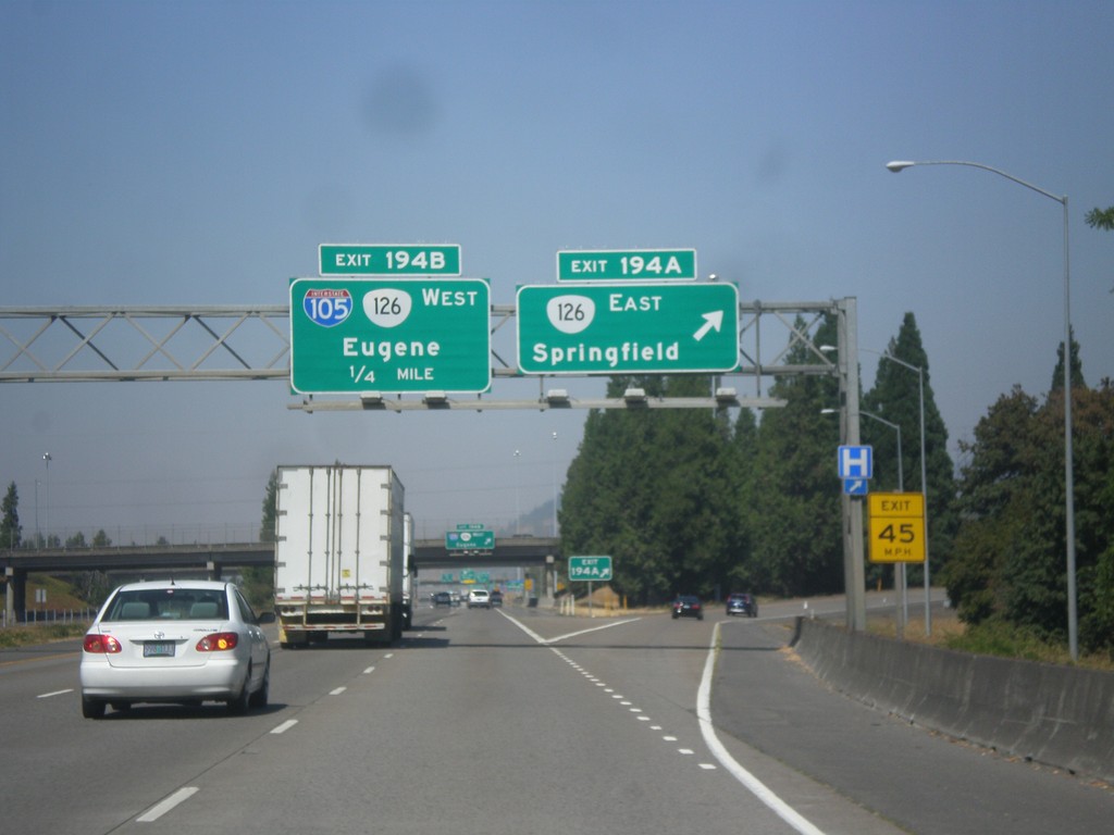
I-5 North - Exits 194 A-B
I-5 north at Exit 194A - OR-126 East/Springfield. Approaching Exit 194B - I-105/OR-126 West/Eugene.
Taken 08-22-2015


 Springfield
Lane County
Oregon
United States
Springfield
Lane County
Oregon
United States