Signs Tagged With Overhead
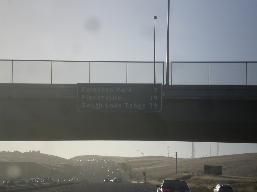
US-50 East - Distance Marker
Distance marker on US-50 east. Distance to Cameron Park, Placerville, and South Lake Tahoe.
Taken 06-15-2015
 Folsom
Sacramento County
California
United States
Folsom
Sacramento County
California
United States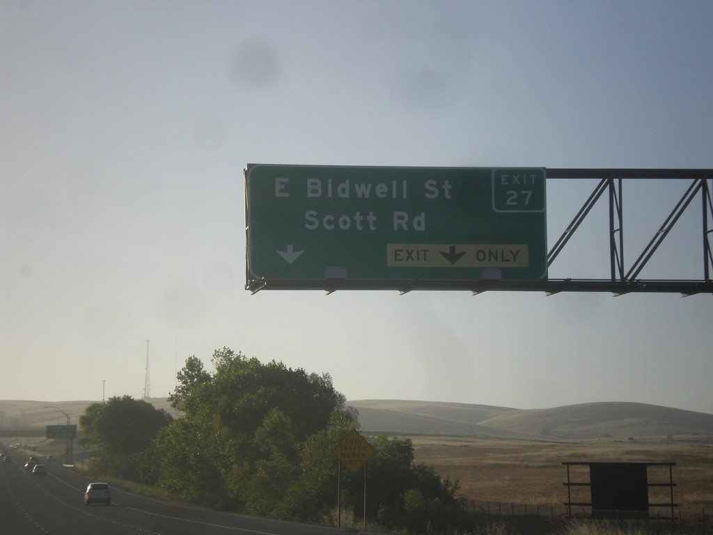
US-50 East - Exit 27
US-50 east at Exit 27 - E. Bidwell St./Scott Rd.
Taken 06-15-2015
Folsom
Sacramento County
California
United States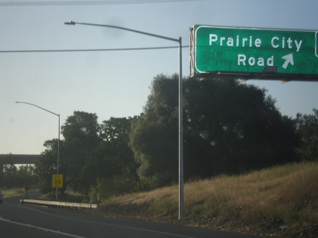
US-50 East - Exit 25
US-50 east at Exit 25 - Prairie City Road.
Taken 06-15-2015
Folsom
Sacramento County
California
United States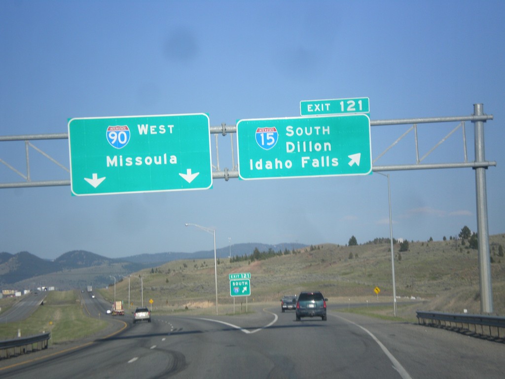
I-15 South/I-90 West - Exit 121
I-15 South/I-90 West at Exit 121 - I-15 South/Dillon/Idaho Falls. Continue west on I-90 for Missoula.
Taken 05-10-2015

 Butte
Silver Bow County
Montana
United States
Butte
Silver Bow County
Montana
United States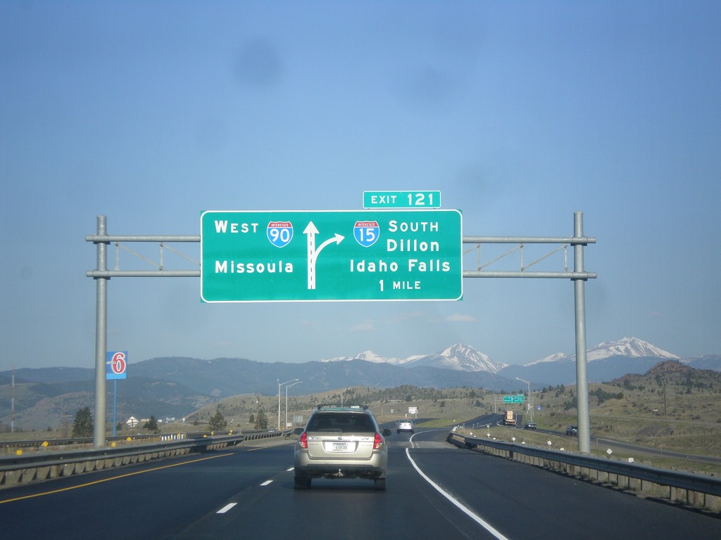
I-15 South/I-90 East - Exit 121
I-15 South/I-90 East approaching Exit 121 - I-15 South/Dillon/Idaho Falls. Continue west on I-90 for Missoula.
Taken 05-10-2015
Butte
Silver Bow County
Montana
United States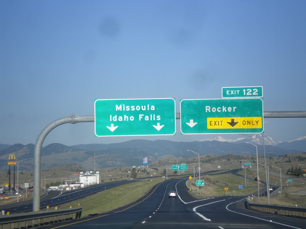
I-15 South/I-90 West - Exit 122
I-15 South/I-90 West at Exit 122 - Rocker. Continue south on I-15 for Idaho Falls; west on I-90 for Missoula.
Taken 05-10-2015
Butte
Silver Bow County
Montana
United States
BL-15 South/BL-90 East/MT-2 South Approaching I-15/I-90
BL-15 South/BL-90 East/MT-2 South approaching I-15 North/I-90 East onramp in Butte.
Taken 05-10-2015


 Butte
Silver Bow County
Montana
United States
Butte
Silver Bow County
Montana
United States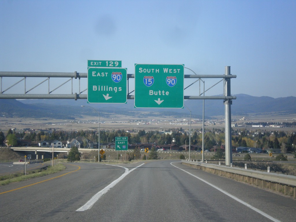
I-15 South at I-90
I-15 south at I-90. Use left Exit 129 for I-90 East to Billings. Use right lane for I-15 South/I-90 West to Butte. I-15 joins I-90 west through Butte.
Taken 05-10-2015
Butte
Silver Bow County
Montana
United States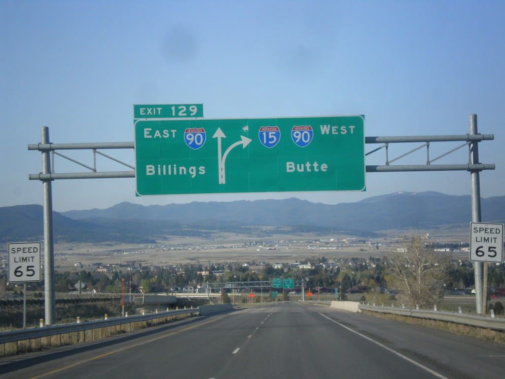
I-15 South - Exit 129
I-15 south approaching Exit 129 - I-90 East/Billings. Continue south on I-15/I-90 West to Butte. I-15 joins I-90 through Butte.
Taken 05-10-2015
Butte
Silver Bow County
Montana
United States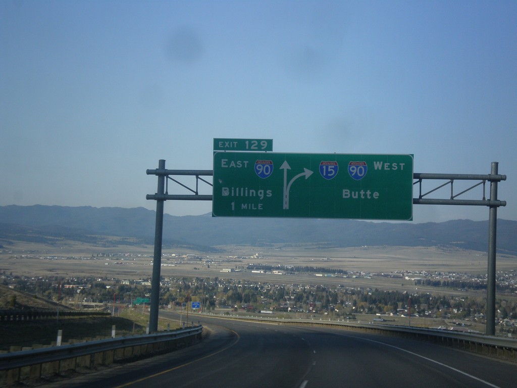
I-15 South - Exit 129
I-15 south approaching Exit 129 - I-90 East/Billings. I-15 South joins I-90 West to Butte.
Taken 05-10-2015
Butte
Silver Bow County
Montana
United States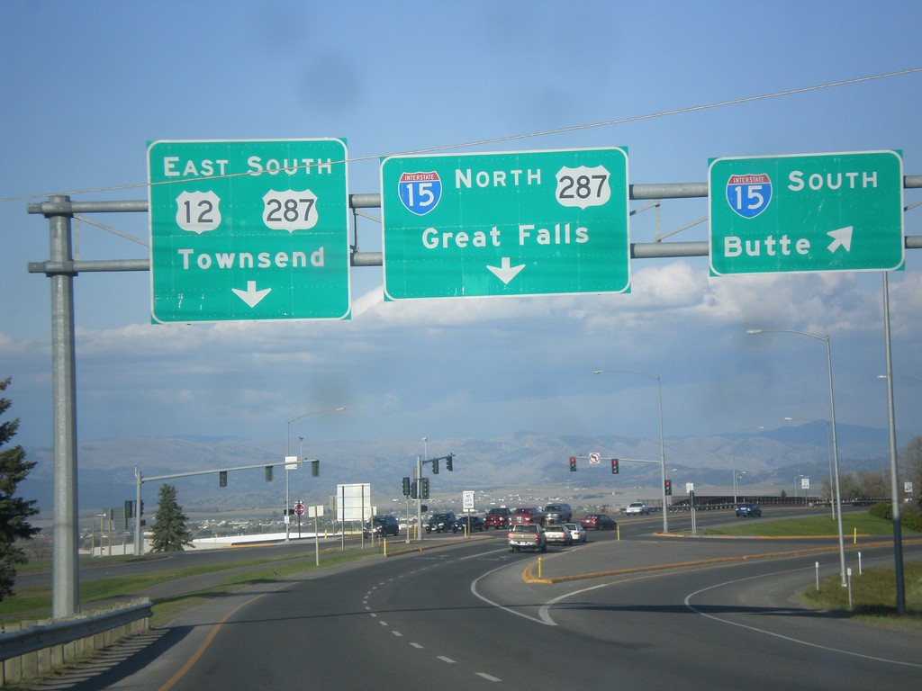
US-12 West/BL-15 South at I-15/US-287
US-12 West/BL-15 South (Prospect Ave.) at I-15. Turn right for I-15 south to Butte; stay right for I-15/US-287 North to Great Falls. Continue straight for US-12 East/US-287 South/Townsend. This is the southern end of the Helena business loop.
Taken 05-09-2015

 Helena
Lewis and Clark County
Montana
United States
Helena
Lewis and Clark County
Montana
United States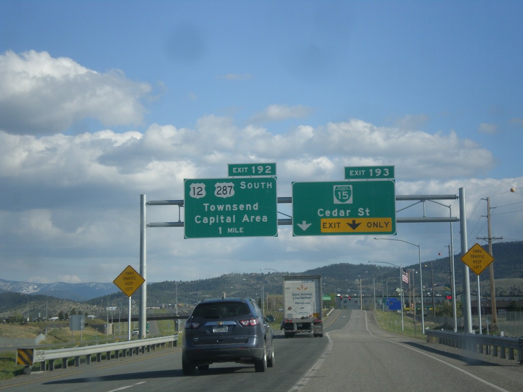
I-15 South - Exits 193 and 192
I-15 south at Exit 193 - BL-15/Cedar St. Approaching Exit 192 - US-12/US-287 South/Townsend/Capital Area.
Taken 05-09-2015
Helena
Lewis and Clark County
Montana
United States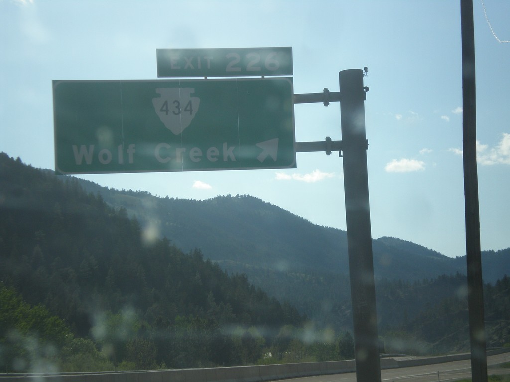
I-15 South - Exit 226
I-15 south at Exit 226 - MTS-434/Wolf Creek.
Taken 05-09-2015
Wolf Creek
Lewis and Clark County
Montana
United States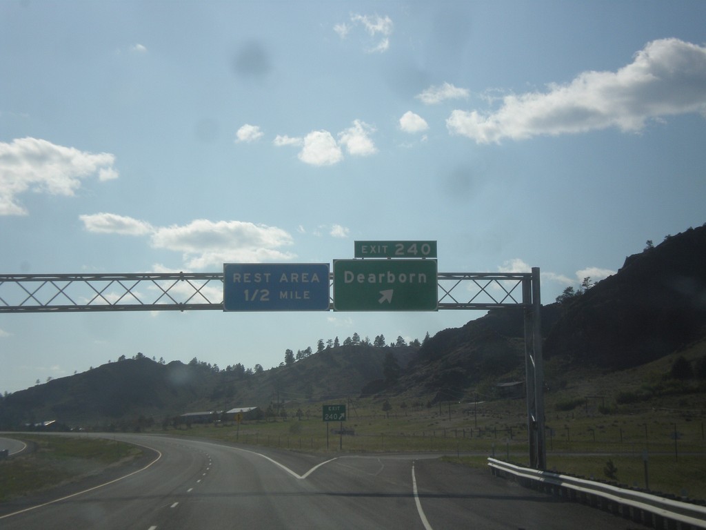
I-15 South - Exit 240
I-15 south at Exit 240 - Dearborn. Approaching Rest Area.
Taken 05-09-2015
Cascade
Cascade County
Montana
United States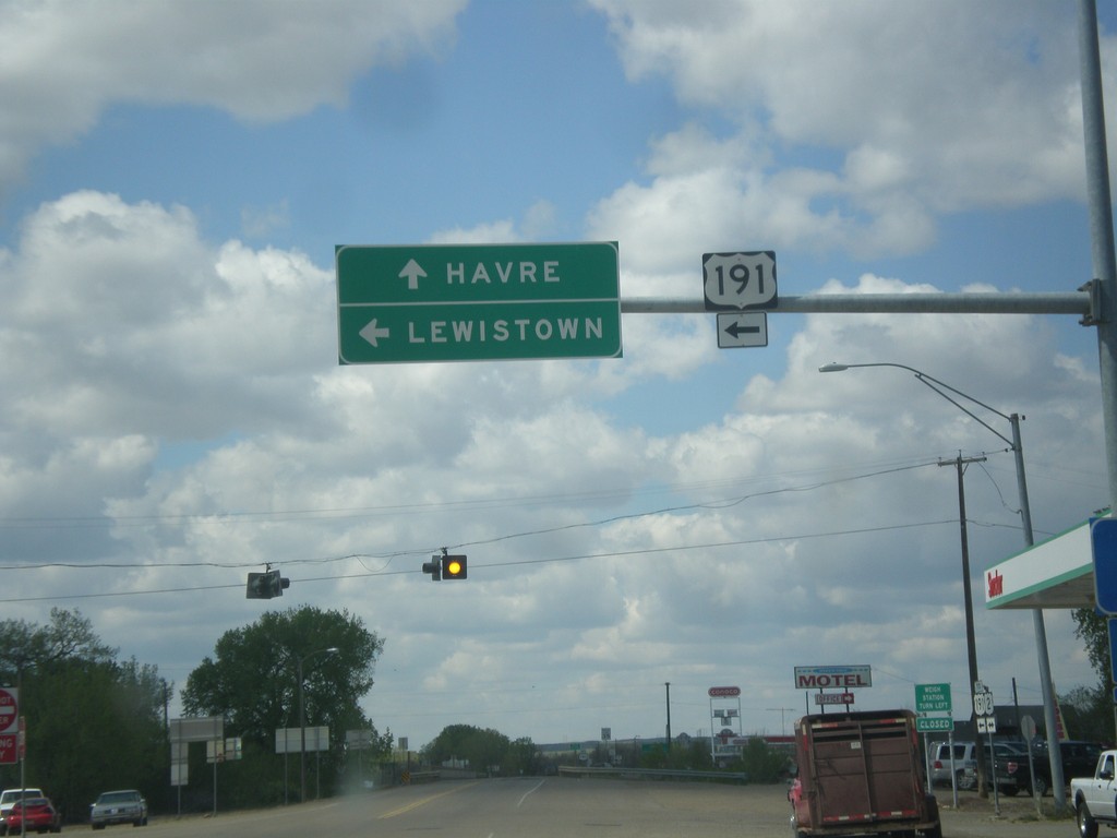
US-2 West at US-191
US-2 west at US-191 south to Lewistown. Continue east on US-2 to Havre. US-191 joins US-2 west through Malta.
Taken 05-09-2015

 Malta
Phillips County
Montana
United States
Malta
Phillips County
Montana
United States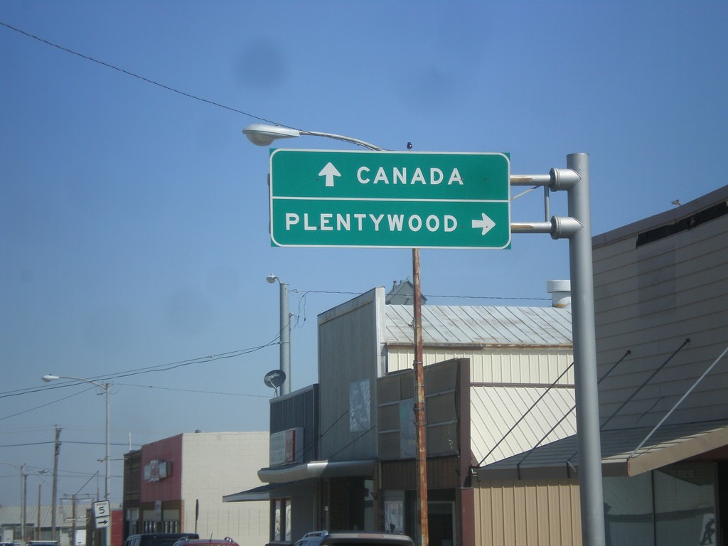
MT-13 North at MT-5
MT-13 north at MT-5. Use MT-5 east for Plentywood. Continue north on MT-13 for Canada.
Taken 05-09-2015

 Scobey
Daniels County
Montana
United States
Scobey
Daniels County
Montana
United States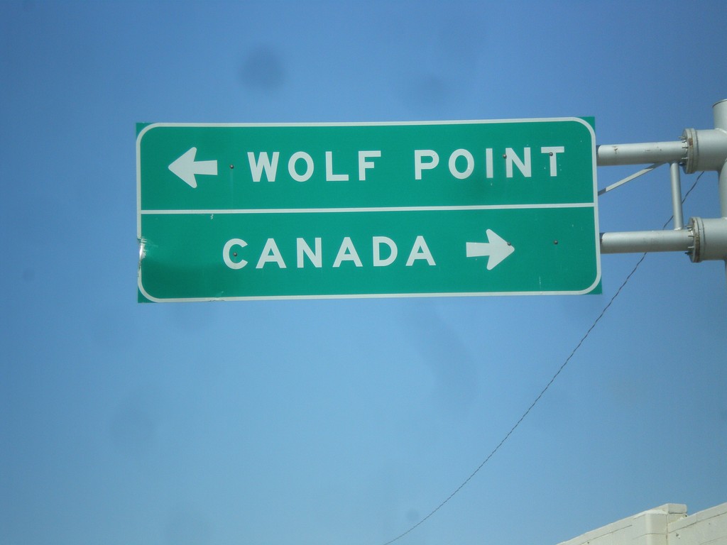
End MT-5 West at MT-13
End MT-5 west at MT-13. Use MT-13 north for Canada; MT-13 south for Wolf Point.
Taken 05-09-2015
Scobey
Daniels County
Montana
United States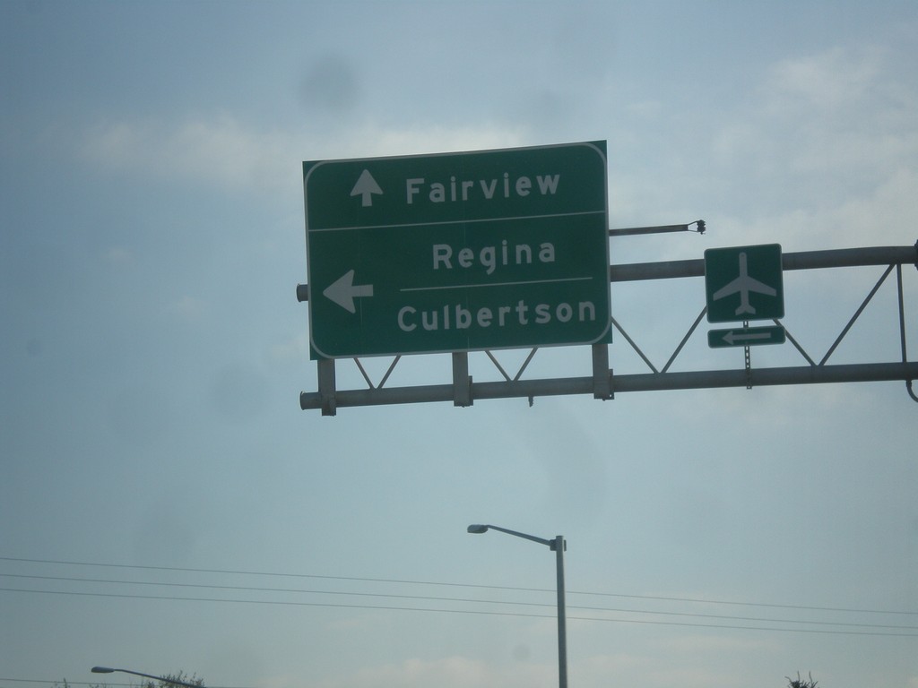
MT-200 East/MT-16 North Split - Sidney
MT-200 East/MT-16 North Split in Sidney. Turn left for MT-16 north to Regina (SK, Canada) and Culbertson. Continue straight for MT-200 East to Fairview.
Taken 05-09-2015

 Sidney
Richland County
Montana
United States
Sidney
Richland County
Montana
United States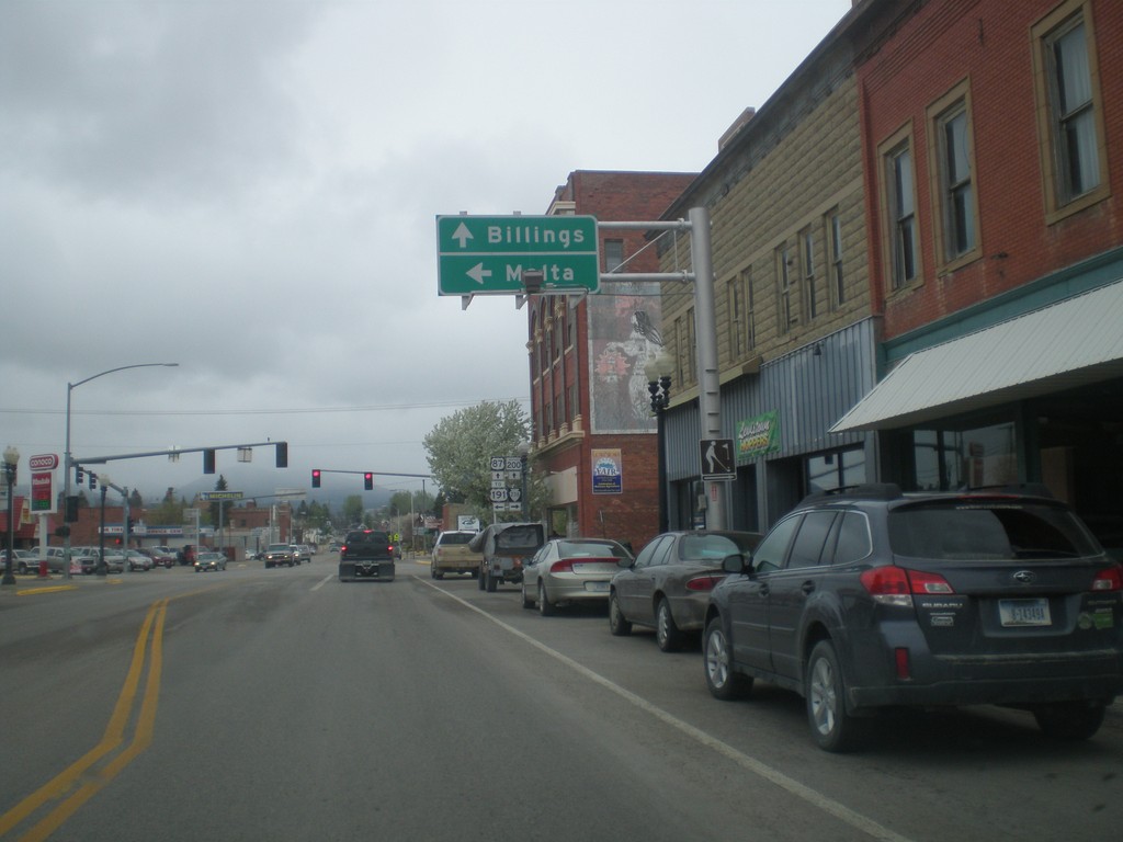
US-87 South/MT-200 East at MTS-238/To US-191
US-87 South/MT-200 East at MTS-238/To US-191. Turn left for US-191 and Malta. Continue straight for US-87 South/MT-200 East to Billings.
Taken 05-08-2015

 Lewistown
Fergus County
Montana
United States
Lewistown
Fergus County
Montana
United States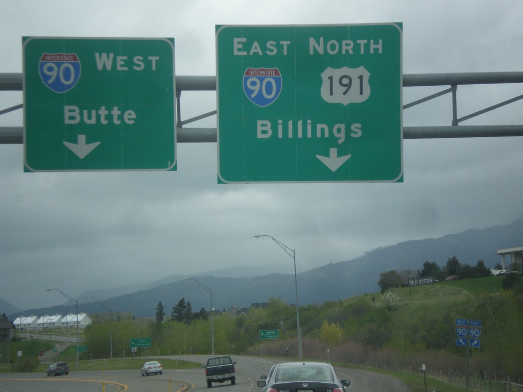
US-191 North/BL-90 East at I-90
US-191 North/BL-90 East at I-90. Merge right for I-90 East/US-191 North to Billings; merge left for I-90 West to Butte.
Taken 05-08-2015
Bozeman
Gallatin County
Montana
United States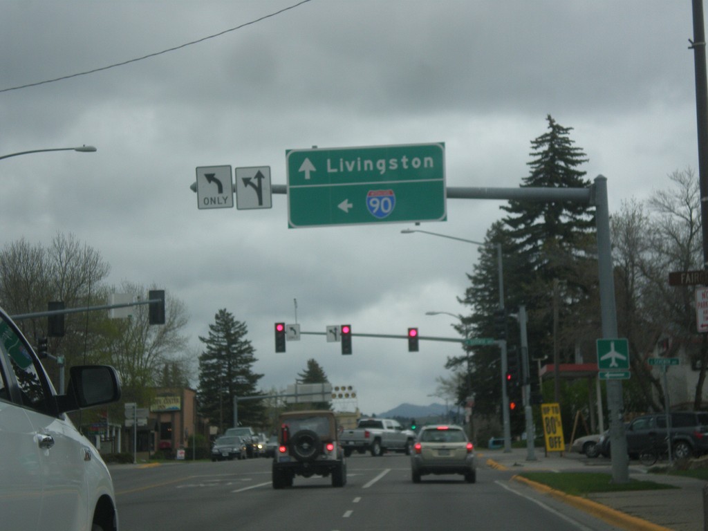
US-191 North at BL-90 - Bozeman
US-191 North (Main St.) at BL-90 (7th St.) in Bozeman. Turn left for BL-90 west to I-90 (West); continue straight for US-191 North/BL-90 East to Livingston (via I-90 east).
Taken 05-08-2015
Bozeman
Gallatin County
Montana
United States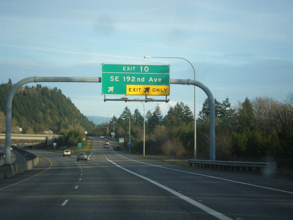
WA-14 East - Exit 10
WA-14 east at Exit 10 - SE 192nd Ave.
Taken 02-16-2015
 Vancouver
Clark County
Washington
United States
Vancouver
Clark County
Washington
United States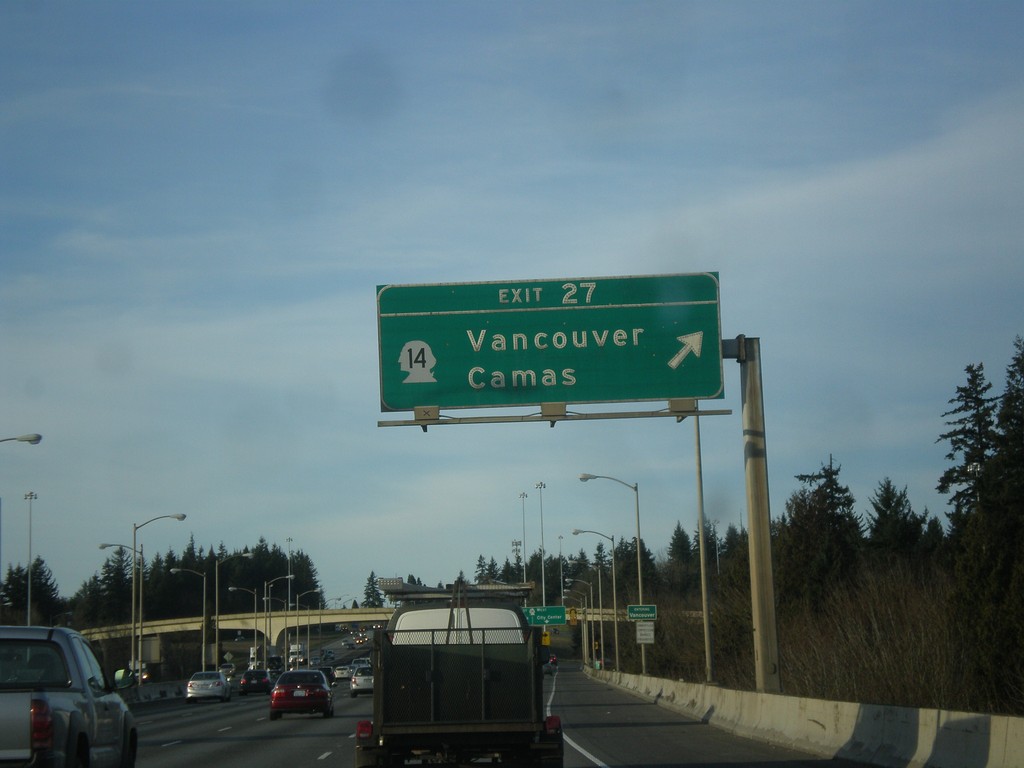
I-205 North - Exit 27
I-205 north at Exit 27 - WA-14/Vancouver/Camas. This is the first exit in Washington along I-205.
Taken 02-16-2015
 Vancouver
Clark County
Washington
United States
Vancouver
Clark County
Washington
United States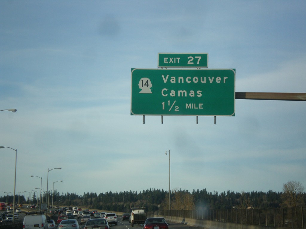
I-205 North - Exit 27
I-205 north approaching Exit 27 - WA-14/Vancouver/Camas. The milemarkers and exit numbers along I-205 do not reset back to zero when crossing into Washington. They continue on the Oregon numbering scheme. Although this is a Washington exit, this sign is still within Oregon.
Taken 02-16-2015
Portland
Multnomah County
Oregon
United States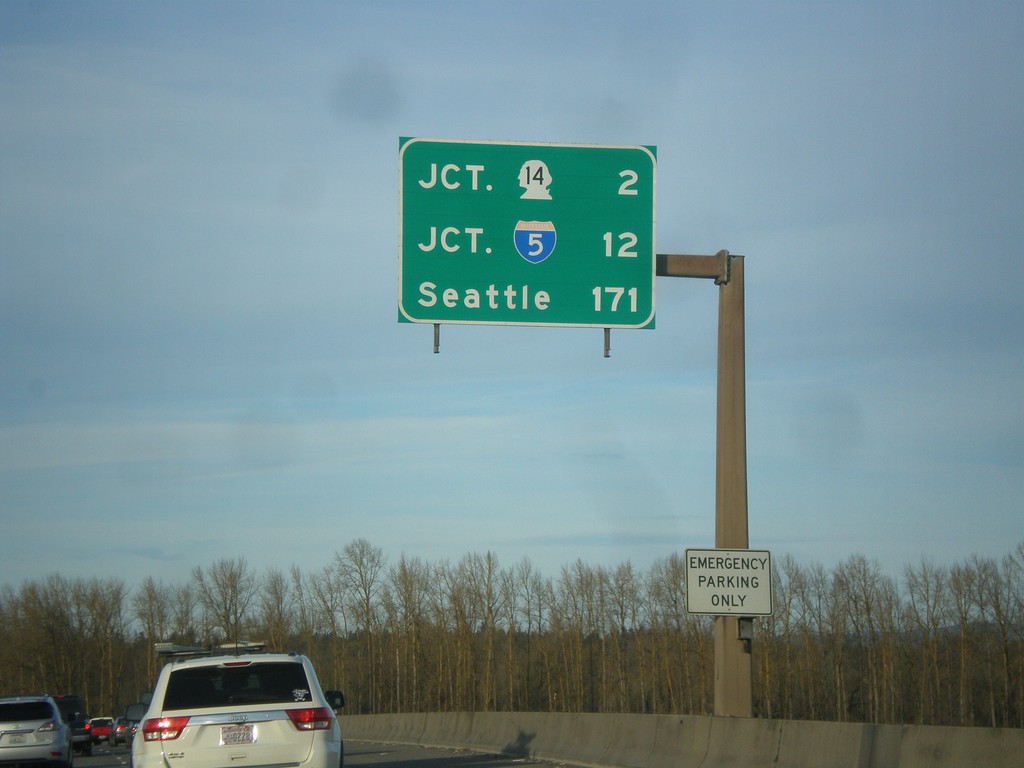
I-205 North - Distance Marker
Last distance marker on I-205 north in Oregon. Distance to WA-14, I-5, and Seattle.
Taken 02-16-2015
Portland
Multnomah County
Oregon
United States