Signs Tagged With Overhead
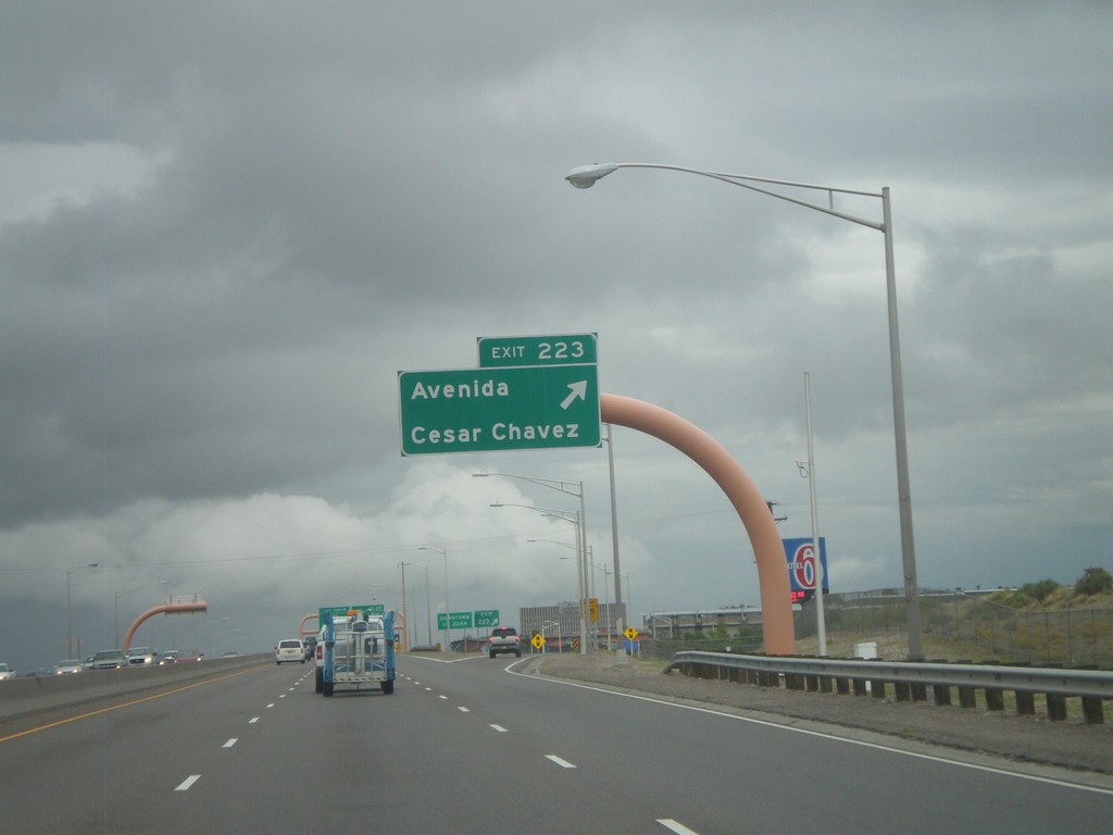
I-25 North - Exit 223
I-25 north at Exit 223 - Avenida Cesar Chavez.
Taken 10-04-2011
 Albuquerque
Bernalillo County
New Mexico
United States
Albuquerque
Bernalillo County
New Mexico
United States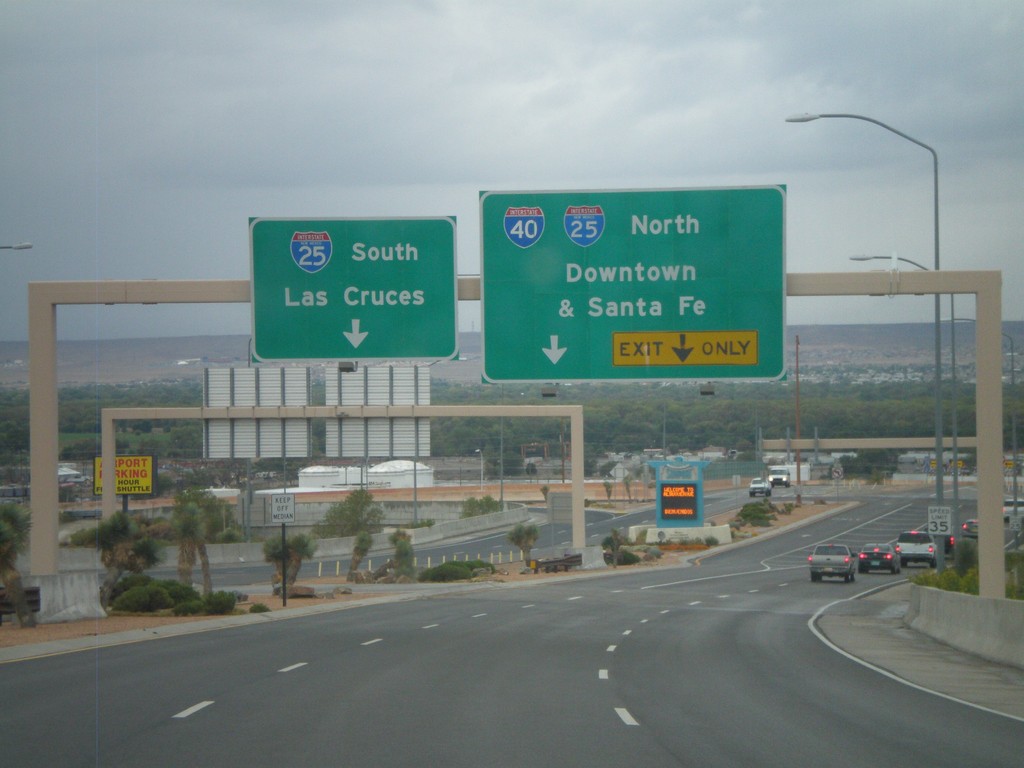
Sunport Blvd. West Approaching I-25
Sunport Blvd. West approaching I-25. Use right lanes for I-25 North/(To)I-40/Downtown (Albuquerque)/Santa Fe. Use left lanes for I-25 South/Las Cruces.
Taken 10-04-2011
 Albuquerque
Bernalillo County
New Mexico
United States
Albuquerque
Bernalillo County
New Mexico
United States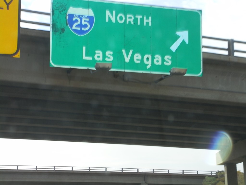
US-84/US-285 South at I-25 North
US-84/US-285 South (St. Francis Drive) at I-25 North to Las Vegas. US-285 South joins I-25 north for 8 miles. US-84 east joins I-25 north to just south of Las Vegas.
Taken 10-04-2011

 Santa Fe
 County
New Mexico
United States
Santa Fe
Santa Fe County
New Mexico
United States
US-84/US-285 South at I-25
US-84/US-285 South (St. Francis Drive) at I-25. Use I-25 south for Albuquerque; use I-25 north for Las Vegas.
Taken 10-04-2011
Santa Fe
Santa Fe County
New Mexico
United States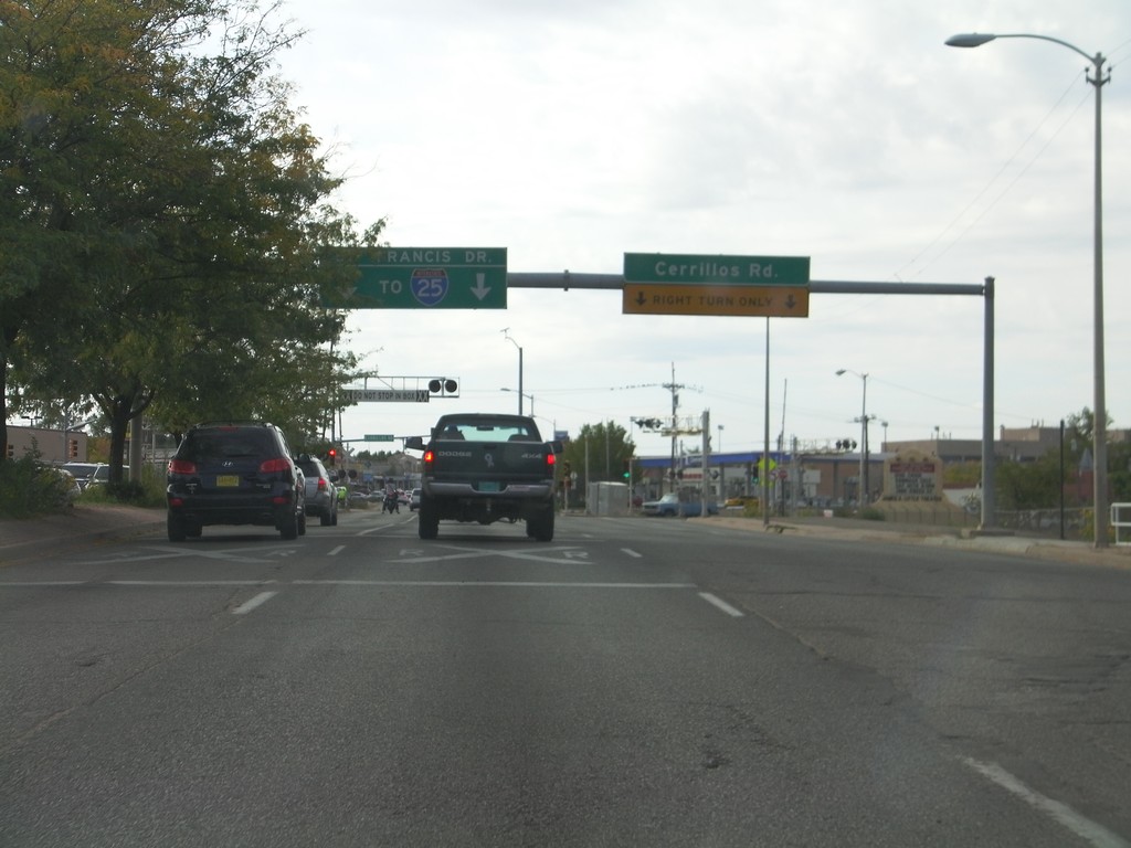
US-84/US-285 South At NM-14
US-84/US-285 South (St. Francis Drive) At NM-14 (Cerrillos Road). Use St. Francis Drive south for I-25.
Taken 10-04-2011
 Santa Fe
 County
New Mexico
United States
Santa Fe
Santa Fe County
New Mexico
United States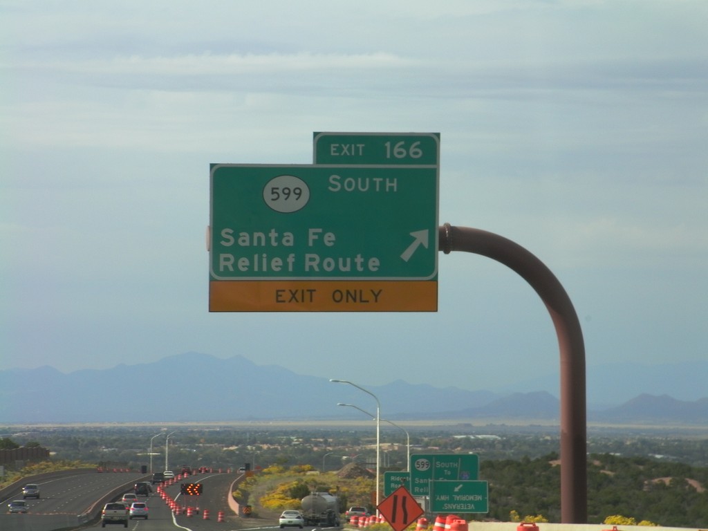
US-84/US-285 South - Exit 166
US-285 South/US-84 East at Exit 166 - NM-599 South/Santa Fe Relief Route. After this interchange, the US-84/US-285 South freeway ends and becomes St. Francis Drive, in Santa Fe.
Taken 10-04-2011
 Santa Fe
 County
New Mexico
United States
Santa Fe
Santa Fe County
New Mexico
United States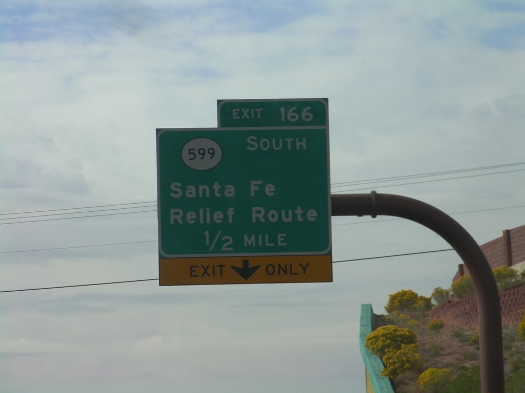
US-84/US-285 South Approaching Exit 166
US-84/US-285 South approaching Exit 166 - NM-599/Santa Fe Relief Route.
Taken 10-04-2011
Santa Fe
Santa Fe County
New Mexico
United States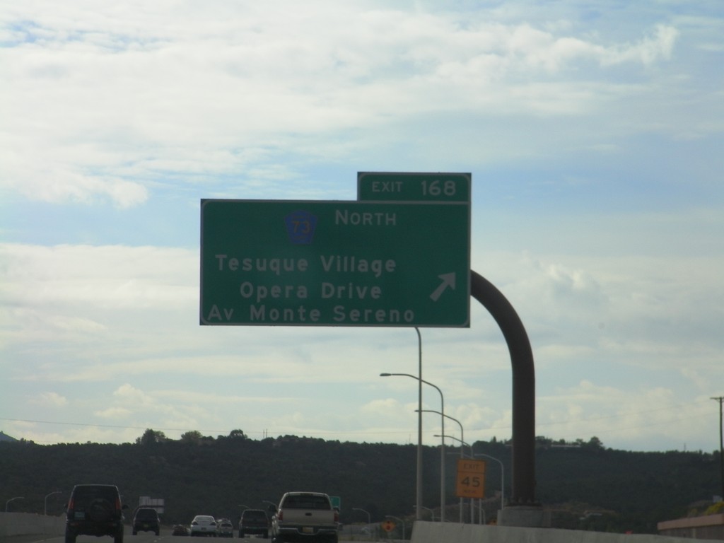
US-84/US-285 South - Exit 168
US-84/US-285 South at Exit 168 - CH-73 North/Tesuque Village/Opera Drive/Av Monte Sereno.
Taken 10-04-2011
 Santa Fe
 County
New Mexico
United States
Santa Fe
Santa Fe County
New Mexico
United States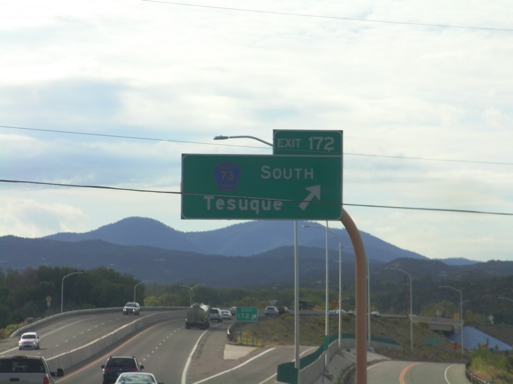
US-84/US-285 South - Exit 172
US-84/US-285 South at Exit 172 - CH-73 South/Tesuque.
Taken 10-04-2011
Santa Fe
Santa Fe County
New Mexico
United States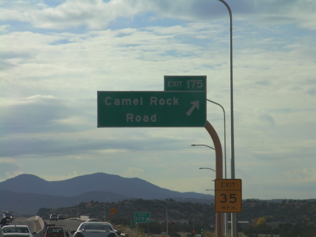
US-84/US-285 South - Exit 175
US-84/US-285 South at Exit 175 - Camel Rock Road.
Taken 10-04-2011
Santa Fe
Santa Fe County
New Mexico
United States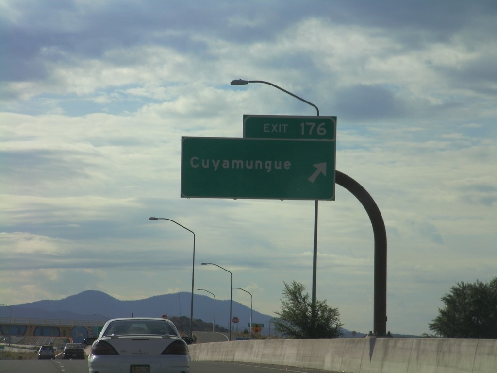
US-84/US-285 South - Exit 176
US-84/US-285 South at Exit 176 - Cuyamungue.
Taken 10-04-2011
Santa Fe
Santa Fe County
New Mexico
United States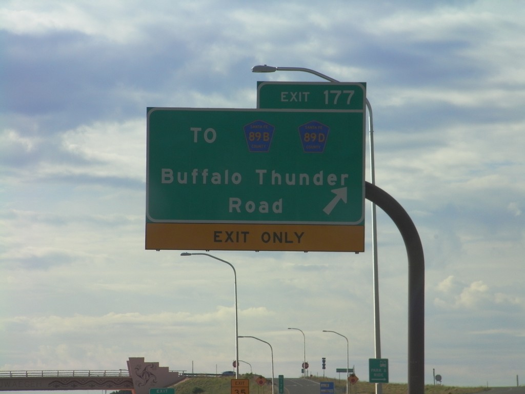
US-84/US-285 South - Exit 177
US-84/US-285 South at Exit 177 - To CH-89B/CH-89D/Buffalo Thunder Road.
Taken 10-04-2011

 Santa Fe
 County
New Mexico
United States
Santa Fe
Santa Fe County
New Mexico
United States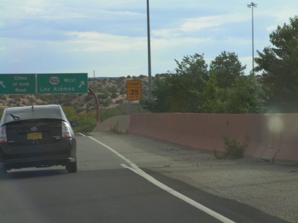
US-84/US-285 South - NM-502
US-84/US-285 South on NM-502 offramp. Merge left for Cities of Gold Road. Merge right for NM-502 West for Los Alamos.
Taken 10-03-2011
 Jaconita
Santa Fe County
New Mexico
United States
Jaconita
Santa Fe County
New Mexico
United States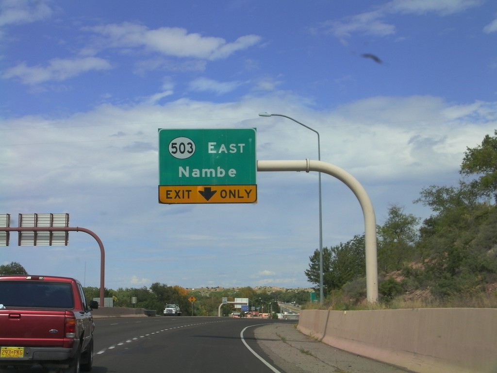
US-84/US-285 North Approaching NM-503
US-84/US-285 North approaching NM-503 East/Nambé.
Taken 10-03-2011
Santa Fe
Santa Fe County
New Mexico
United States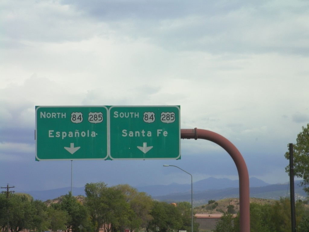
End NM-502 East at US-285/US-84
End NM-502 East at US-285/US-84. UseUS-84/US-285 North for Española; use US-84/US-285 South for Santa Fe. This is the eastern end of the Los Alamos Highway.
Taken 10-03-2011
Jaconita
Santa Fe County
New Mexico
United States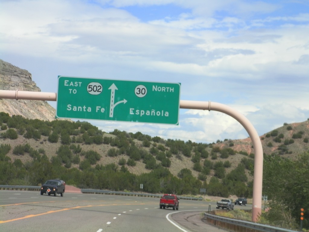
NM-502 East Approaching NM-30
NM-502 East approaching NM-30. Use NM-30 north for Española; continue east on NM-502 for Santa Fe.
Taken 10-03-2011
 Santa Fe
 County
New Mexico
United States
Santa Fe
Santa Fe County
New Mexico
United States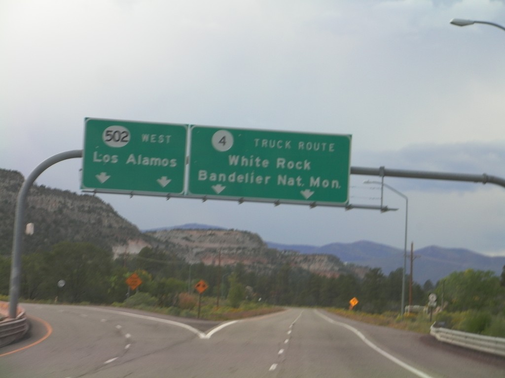
NM-502 West at NM-4
NM-502 West at NM-4. Merge right for NM-4/White Rock/Bandelier National Monument. This is the truck route into Los Alamos. Continue ahead for NM-502 west to Los Alamos.
Taken 10-02-2011
 Los Alamos
Santa Fe County
New Mexico
United States
Los Alamos
Santa Fe County
New Mexico
United States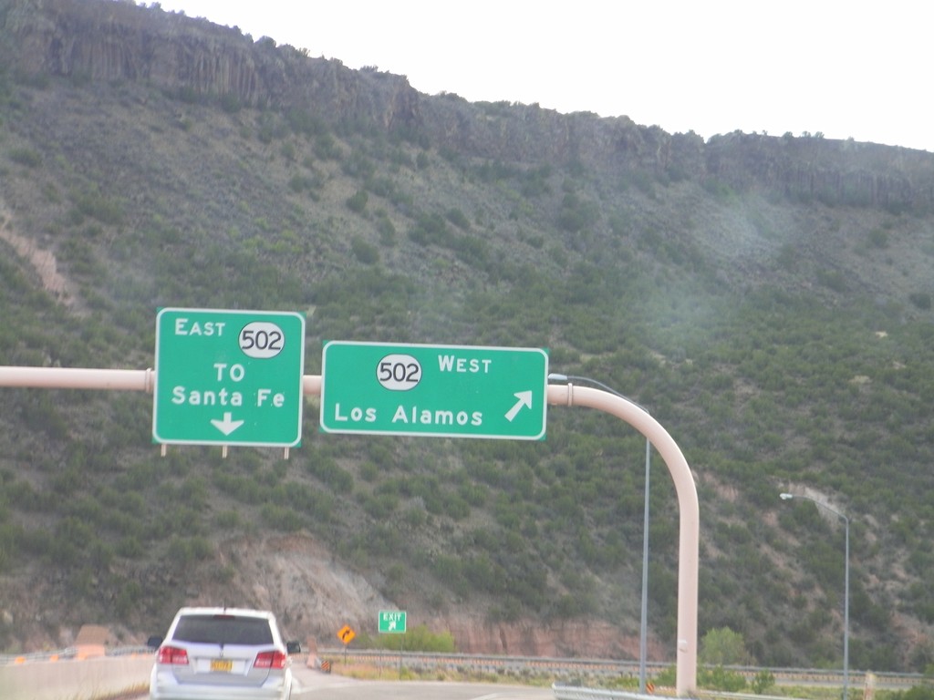
End NM-30 South at NM-520
End NM-30 South at NM-520. Use NM-520 west for Los Alamos; use NM-520 east for Santa Fe.
Taken 10-02-2011
Santa Fe
Santa Fe County
New Mexico
United States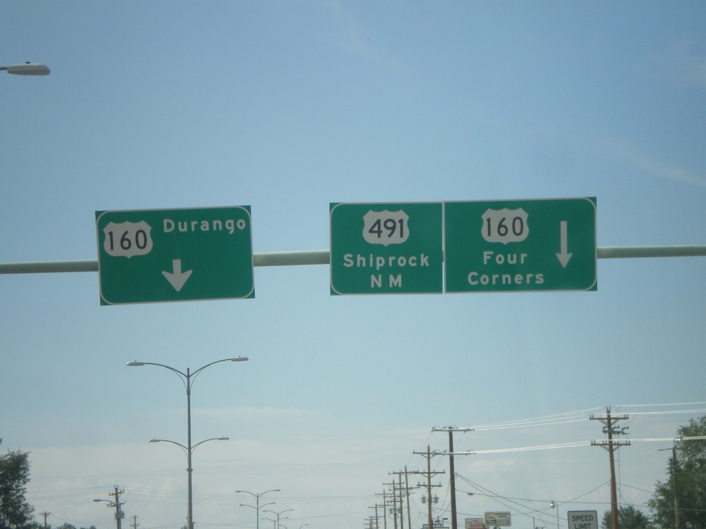
US-491 South at US-160
US-491 south at US-160. Turn left for US-160 east to Durango. Continue ahead for US-160 West/US-491 South. Use US-160 west for Four Corners; use US-491 south for Shiprock, New Mexico. US-160 west joins US-491 southbound to the Four Corners area.
Taken 10-02-2011

 Cortez
Montezuma County
Colorado
United States
Cortez
Montezuma County
Colorado
United States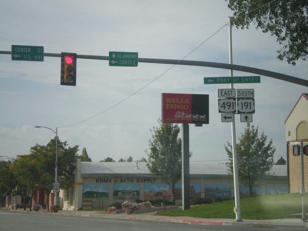
US-191 South at US-491
US-191 South at US-491. Use US-491 east for Cortez (Colorado); continue south on US-191 for Blanding. This is the northern end of US-491. Also US-491 east for the (Utah) Port of Entry.
Taken 10-02-2011
 Monticello
San Juan County
Utah
United States
Monticello
San Juan County
Utah
United States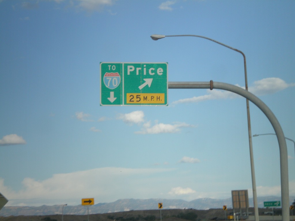
US-6 East/US-191 South at Price Exit
US-6 East/US-191 South at (Exit 243) Price. This is the eastern end of the Price business loop. Continue on US-6 East/US-191 South for I-70 (in Green River).
Taken 10-01-2011

 Price
Carbon County
Utah
United States
Price
Carbon County
Utah
United States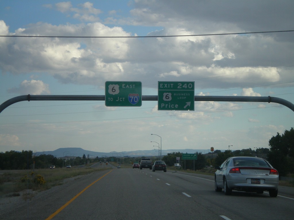
US-6 East/US-191 South - Exit 240
US-6 East/US-191 South at Exit 240 - Business Loop US-6/Price. This is the western end of the Price business loop. US-6 South/US-191 East continues south towards I-70 Junction (in Green River).
Taken 10-01-2011
Price
Carbon County
Utah
United States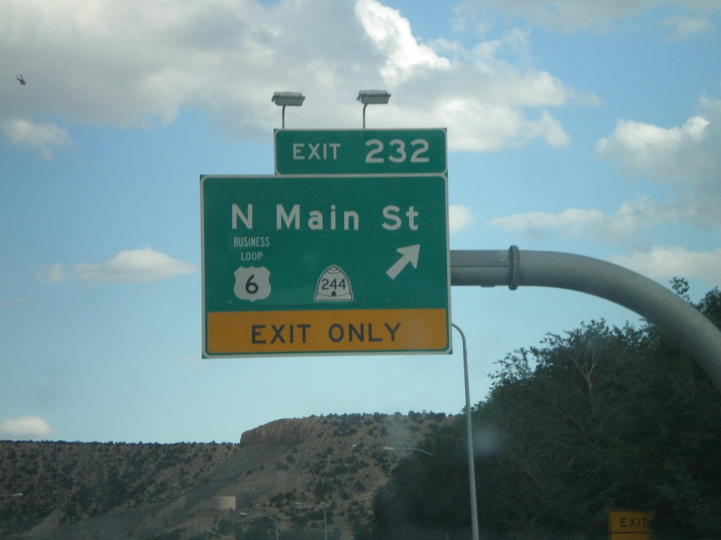
US-6 East/US-191 South - Exit 232
US-6 East/US-191 South at Exit 232 - Business US-6/UT-244/N. Main St. This is the western end of the Helper business loop.
Taken 10-01-2011
 Helper
Carbon County
Utah
United States
Helper
Carbon County
Utah
United States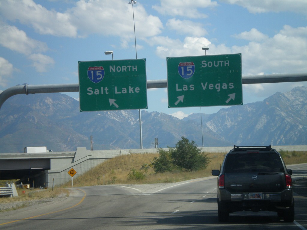
I-215 South at I-15 Split
I-215 south at I-15. Use right lane for I-15 South/Las Vegas; left lane for I-15 North/Salt Lake.
Taken 10-01-2011

 Murray
Salt Lake County
Utah
United States
Murray
Salt Lake County
Utah
United States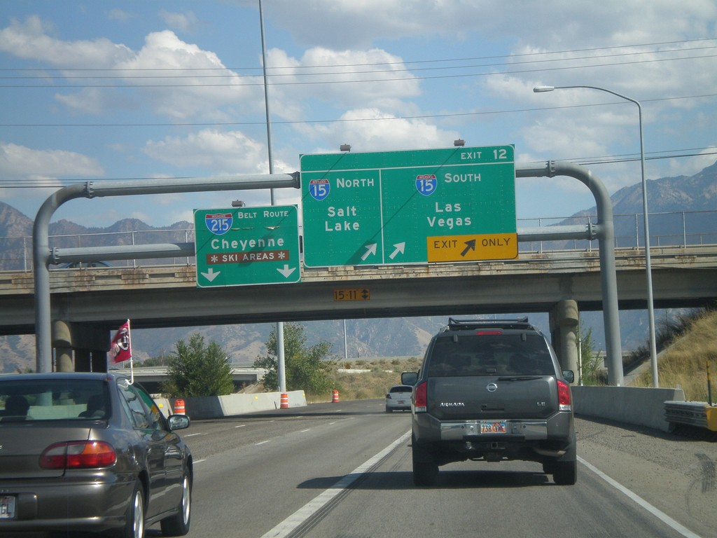
I-215 South - Exit 12
I-215 south at Exit 12 - I-15 North/Salt Lake; I-15 South/Las Vegas. Continue on the I-215 Belt Route for Cheyenne (Wyoming) and Ski Areas.
Taken 10-01-2011
Murray
Salt Lake County
Utah
United States