Signs Tagged With Overhead
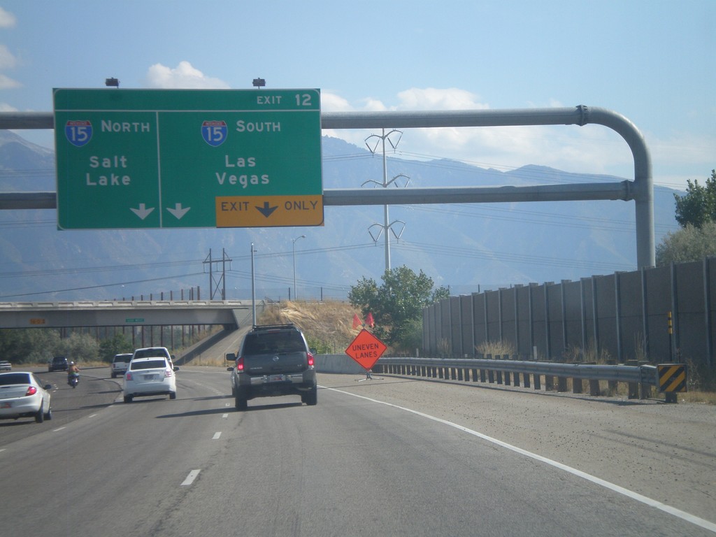
I-215 South - Exit 12
I-215 South approaching Exit 12 - I-15 South/Las Vegas;I-15 North/Salt Lake.
Taken 10-01-2011

 Murray
Salt Lake County
Utah
United States
Murray
Salt Lake County
Utah
United States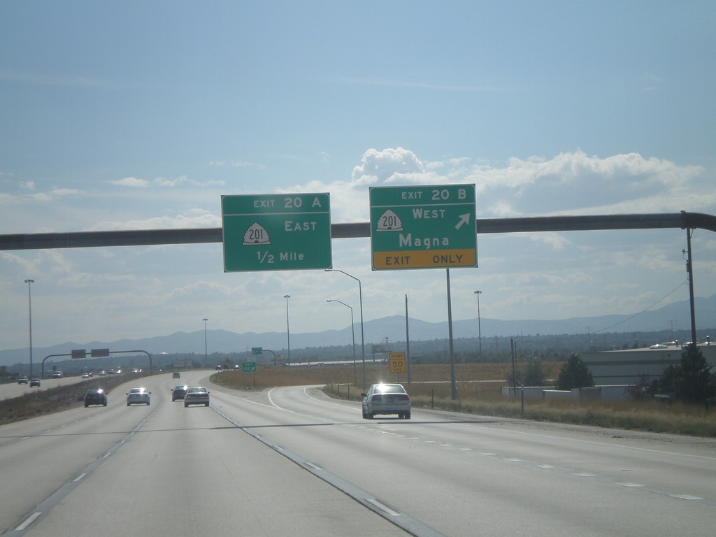
I-215 South - Exits 20B and 20A
I-215 south at Exit 20B - UT-201 West/Magna; approaching Exit 20A - UT-201 East.
Taken 10-01-2011
 Salt Lake City
Salt Lake County
Utah
United States
Salt Lake City
Salt Lake County
Utah
United States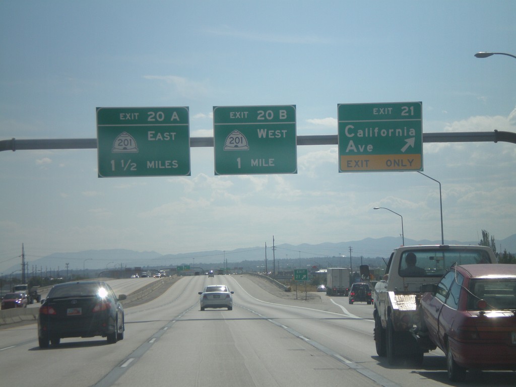
I-215 South - Exits 21, 20B, 20A
I-215 South at Exit 21 - California Ave. Approaching Exit 20B - UT-201 West, and Exit 20A - UT-201 East.
Taken 10-01-2011
Salt Lake City
Salt Lake County
Utah
United States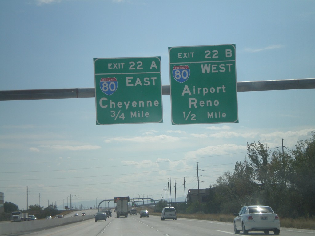
I-215 South - Exits 22B and 22A
I-215 south approaching Exit 22B - I-80 West/Airport/Reno. Approaching Exit 22A - I-80 East/Cheyenne (Wyoming).
Taken 10-01-2011
 Salt Lake City
Salt Lake County
Utah
United States
Salt Lake City
Salt Lake County
Utah
United States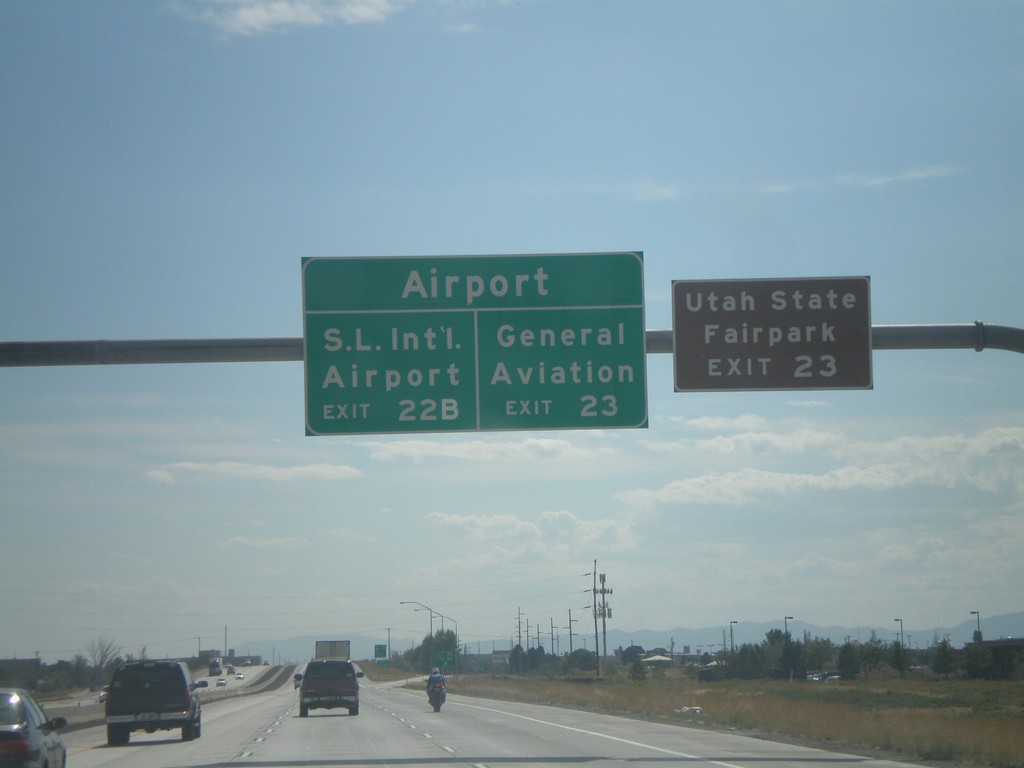
I-215 South - Salt Lake City International Airport Exits
Salt Lake City International Airport exits on I-215 south. For General Aviation, use Exit 23. For Salt Lake City International Airport , use Exit 22B. For the Utah State Fairpark use Exit 23.
Taken 10-01-2011
Salt Lake City
Salt Lake County
Utah
United States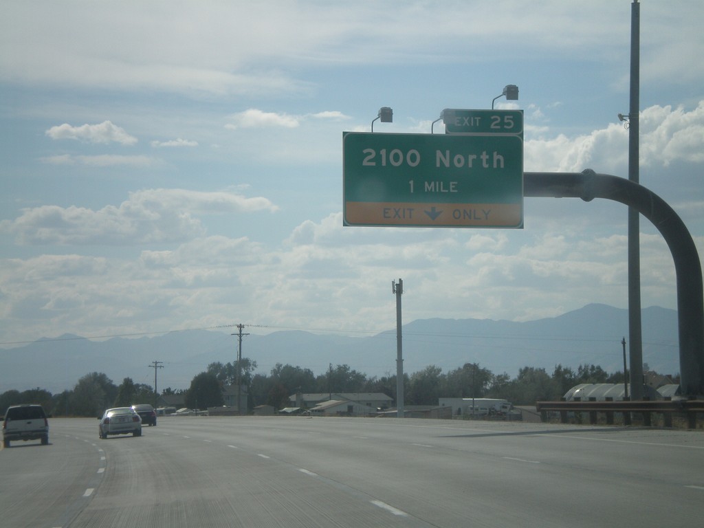
I-215 South - Exit 25
I-215 south at Exit 25 - 2100 North.
Taken 10-01-2011
Salt Lake City
Salt Lake County
Utah
United States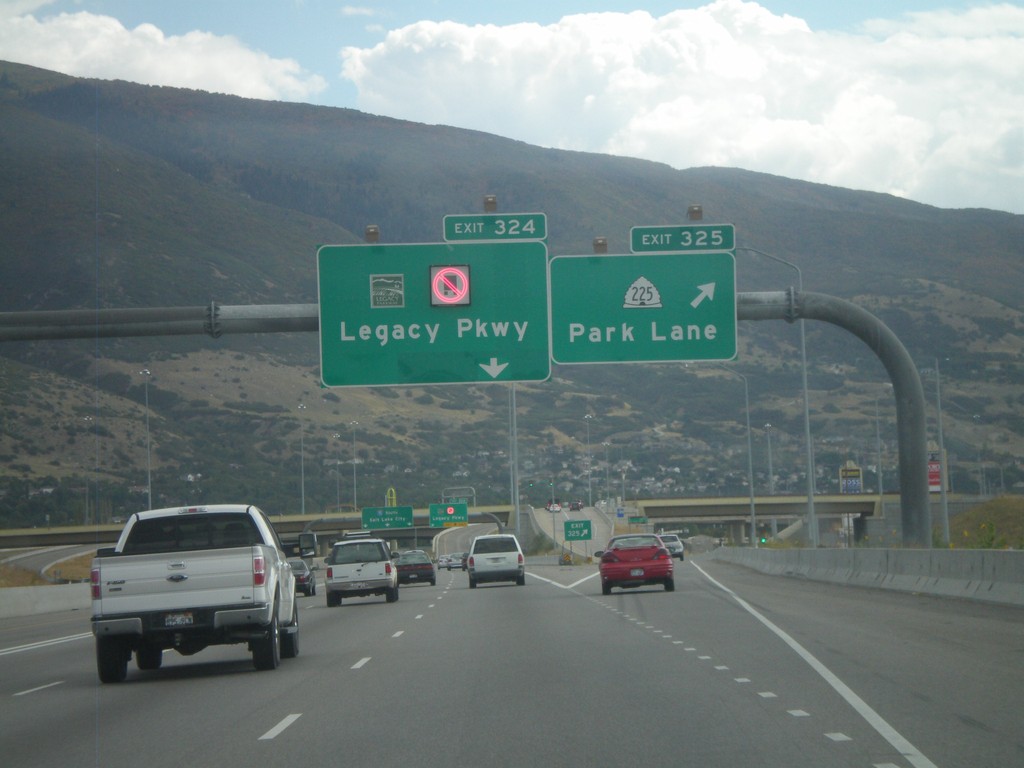
I-15 South - Exits 325 and 324
I-15 south at Exit 325 - UT-225/Park Lane. Approaching Exit 324 - (UT-67)/Legacy Parkway.
Taken 10-01-2011

 Farmington
Davis County
Utah
United States
Farmington
Davis County
Utah
United States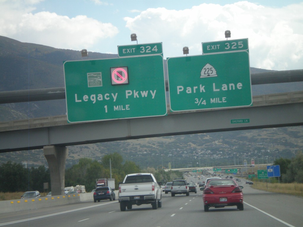
I-15 South - Exits 325 and 324
I-15 south approaching Exit 325 - UT-225/Park Lane. Also approaching Exit 325 - (UT-67)/Legacy Parkway.
Taken 10-01-2011
Farmington
Davis County
Utah
United States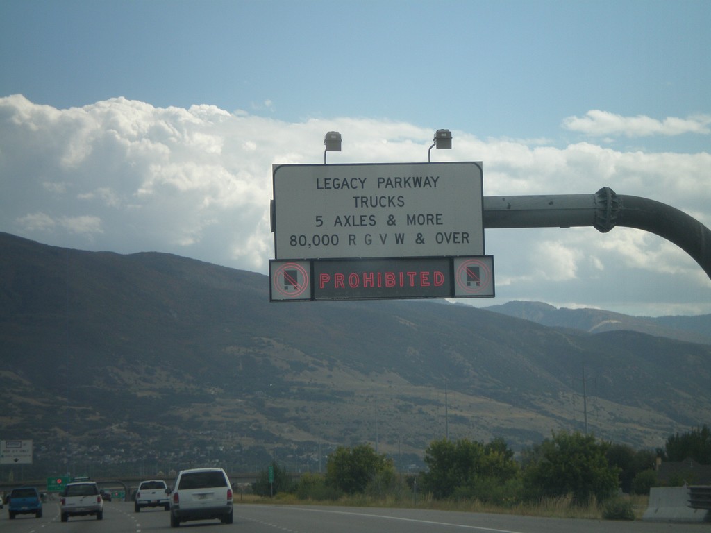
I-15 South Approaching Legacy Parkawy
I-15 south approaching Legacy Parkway. Trucks with more than 5 axles or greater than 80,000 pounds are prohibited for using Legacy Parkway.
Taken 10-01-2011
Kaysville
Davis County
Utah
United States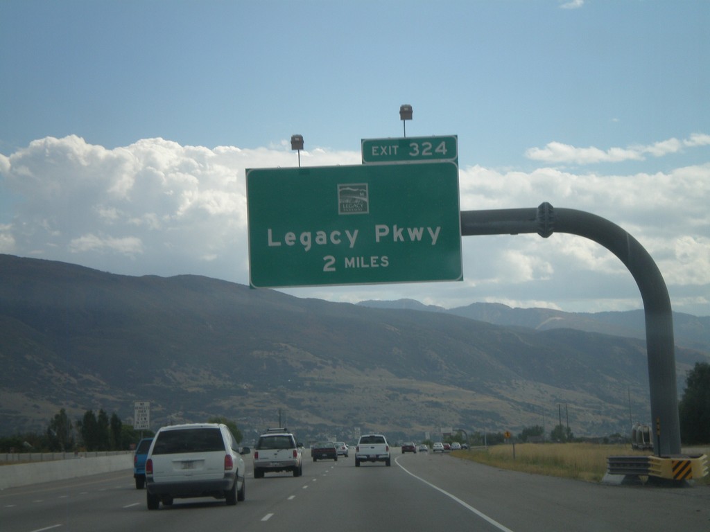
I-15 South - Exit 325
I-15 south approaching Exit 325 - (UT-67)/Legacy Parkway.
Taken 10-01-2011
Kaysville
Davis County
Utah
United States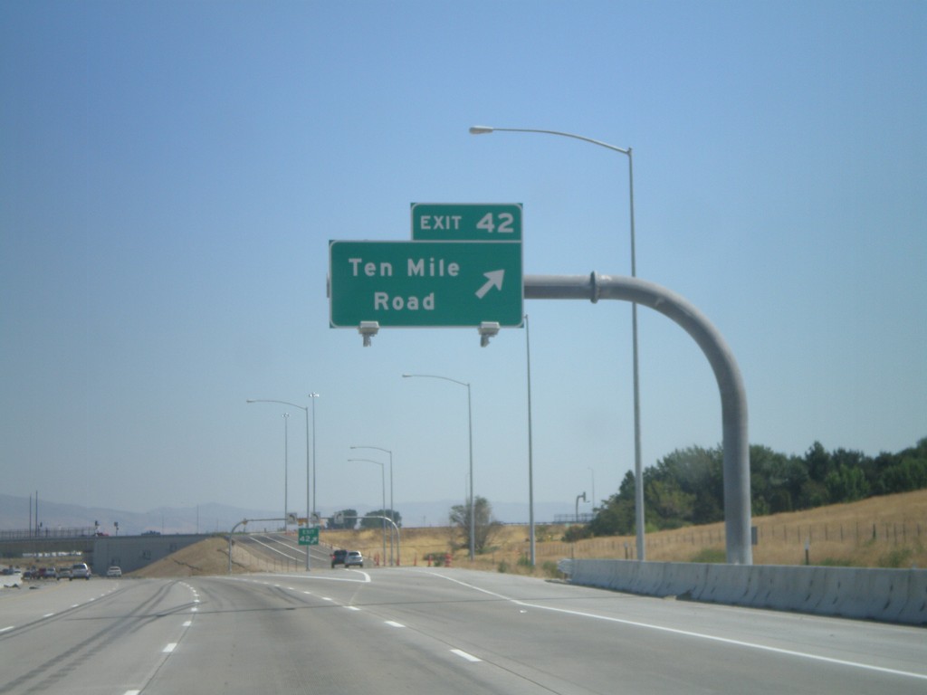
I-84 East - Exit 42
I-84 East at Exit 42 - Ten Mile Road. This is the newest interchange along I-84 in Idaho. It was completed in May of 2011.
Taken 09-04-2011


 Meridian
Ada County
Idaho
United States
Meridian
Ada County
Idaho
United States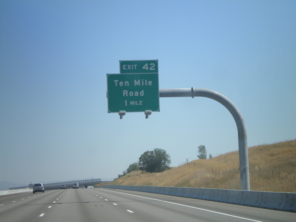
I-84 East Approaching Exit 42
I-84 east approaching Exit 42 - Ten Mile Road.
Taken 09-04-2011
Meridian
Ada County
Idaho
United States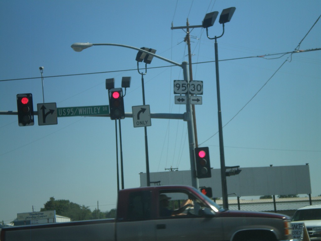
US-30 East At US-95
US-30 East at US-95. Turn right for US-30 East/US-95 South; left for US-95 North. US-30 joins US-95 through Fruitland.
Taken 09-04-2011
 Fruitland
Payette County
Idaho
United States
Fruitland
Payette County
Idaho
United States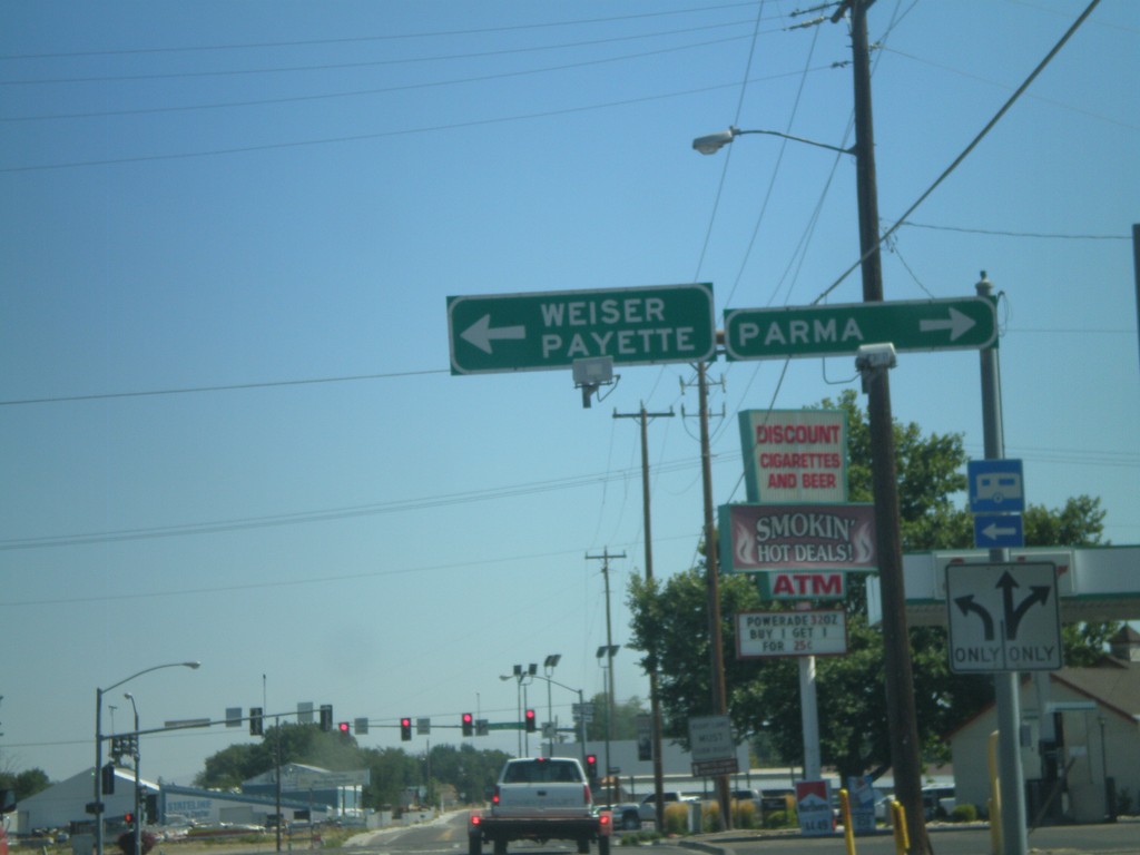
US-30 East Approaching US-95
US-30 East approaching US-95. Turn left for US-95 North to Weiser and Payette. Turn right for US-95 South/US-30 East for Parma. US-30 joins US-95 South through Fruitland.
Taken 09-04-2011
Fruitland
Payette County
Idaho
United States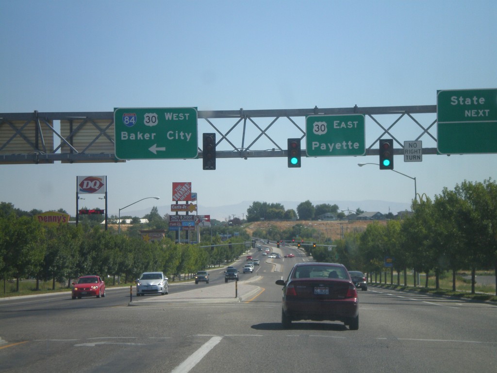
End Bus. US-30 At I-84/US-30
End Business US-30 at I-84 and US-30. Turn left for I-84/US-30 West to Baker City. Continue ahead for US-30 east to Payette (Idaho). The bluff in the background of the picture is in Idaho.
Taken 09-04-2011
 Ontario
Malheur County
Oregon
United States
Ontario
Malheur County
Oregon
United States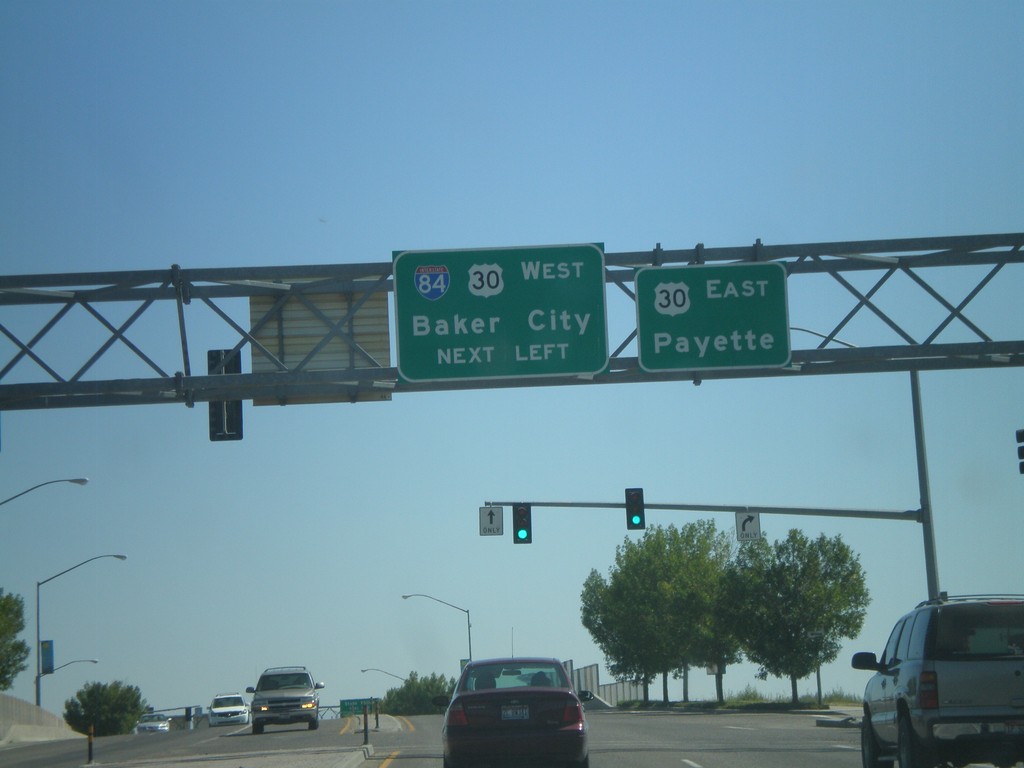
End Business US-30 at I-84 and US-30
End Business US-30 East at I-84 and US-30. Turn left for I-84/US-30 West for Baker City. Continue ahead for US-30 East to Payette (Idaho).
Taken 09-04-2011
Ontario
Malheur County
Oregon
United States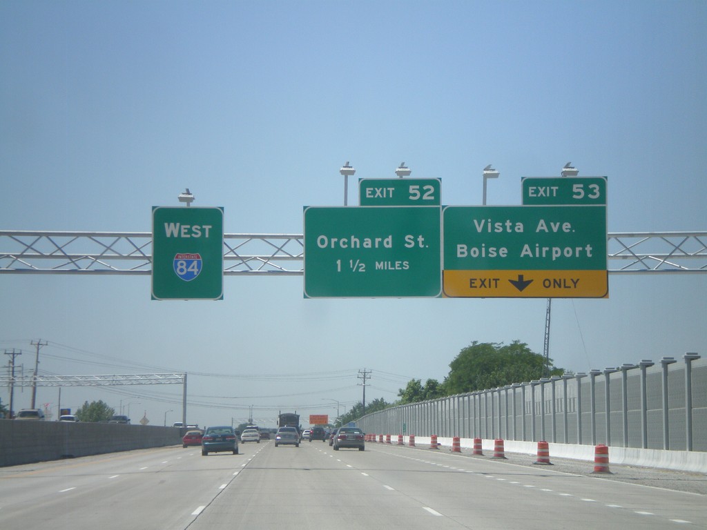
I-84 West - Exits 53 and 52
I-84 west at Exit 53 - Vista Ave./Boise Airport and approaching Exit 52 - Orchard St.
Taken 07-05-2011
Boise
Ada County
Idaho
United States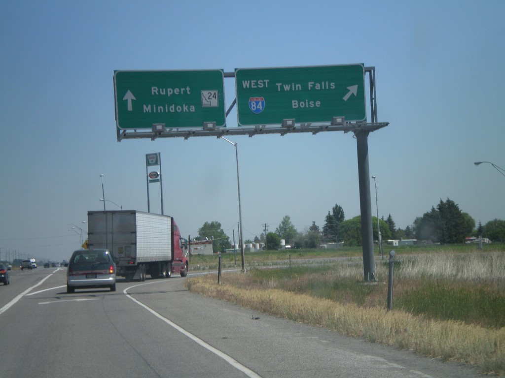
End BL-84 East at ID-24/I-84
End BL-84 (Burley and Heyburn) at I-84 west and ID-24. Use I-84 west for Twin Falls and Boise. Use ID-24 for Rupert and Minidoka.
Taken 07-05-2011

 Heyburn
Minidoka County
Idaho
United States
Heyburn
Minidoka County
Idaho
United States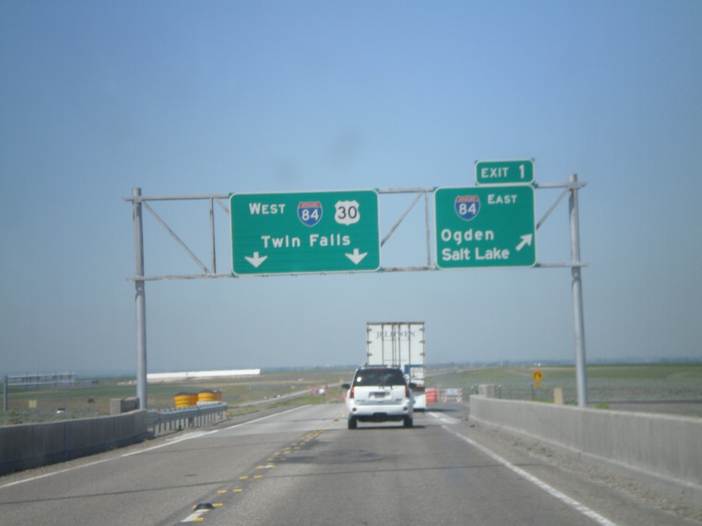
End I-86 West at I-84
End I-86 west at I-84. Merge right onto Exit 1 for I-84 East/Ogden/Salt Lake. Continue ahead for I-84/US-30 West/Twin Falls. This is the western end of I-86.
Taken 07-05-2011
 Cotterel
Cassia County
Idaho
United States
Cotterel
Cassia County
Idaho
United States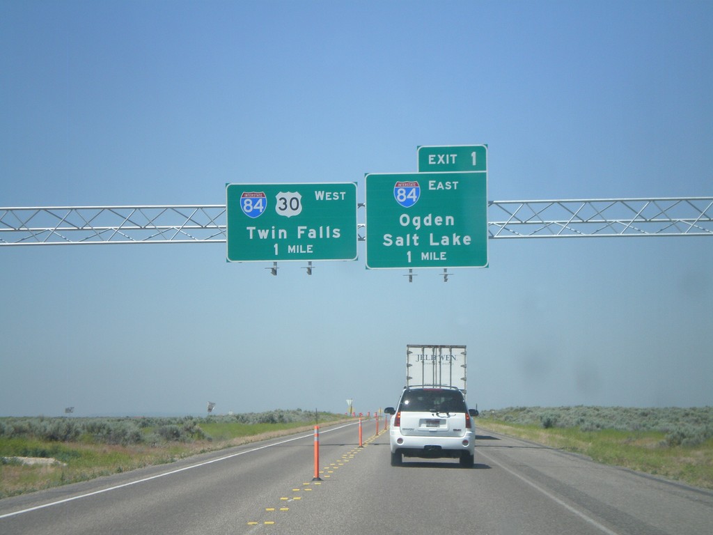
I-86 West at I-84
I-86 west at Exit 1 - I-84 East/Ogden/Salt Lake and I-84 West/US-30 West/Twin Falls. I-86 ends at I-84.
Taken 07-05-2011
Declo
Cassia County
Idaho
United States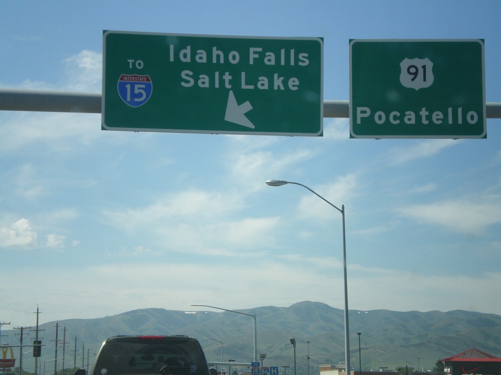
US-91 South at I-86 East (To I-15)
US-91 south at I-86 east (To I-15). Use I-86 east for Idaho Falls and Salt Lake. Continue south on US-91 for Pocatello. I-86 east ends at I-15 just east of here.
Taken 07-05-2011
 Chubbuck
Bannock County
Idaho
United States
Chubbuck
Bannock County
Idaho
United States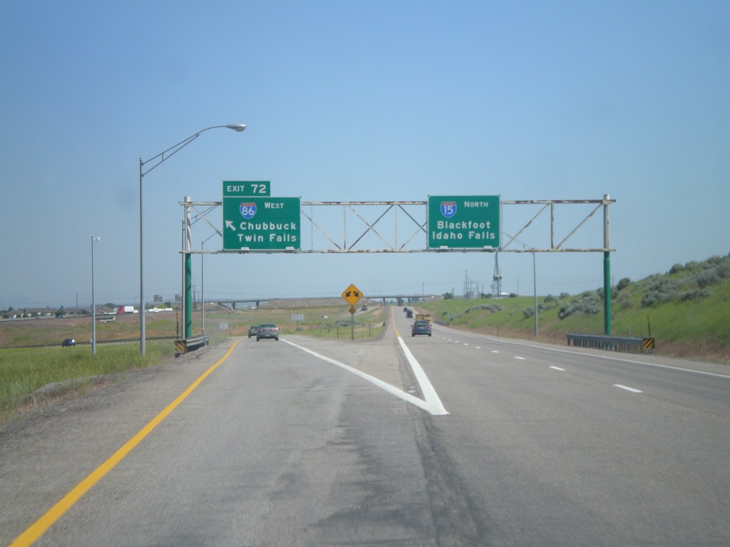
I-15 North at Exit 72
I-15 north at Exit 72 - I-86 West/Twin Falls/Chubbuck. Continue north on I-15 for Blackfoot and Idaho Falls. This is the last exit on I-15 north in the Pocatello area.
Taken 07-05-2011
Pocatello
Bannock County
Idaho
United States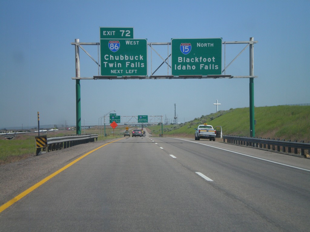
I-15 North - Exit 72
Approaching Exit 72 - I-86 west to Twin Falls and Chubbuck on I-15 north. Continue north on I-15 for Blackfoot and Idaho Falls.
Taken 07-05-2011
Pocatello
Bannock County
Idaho
United States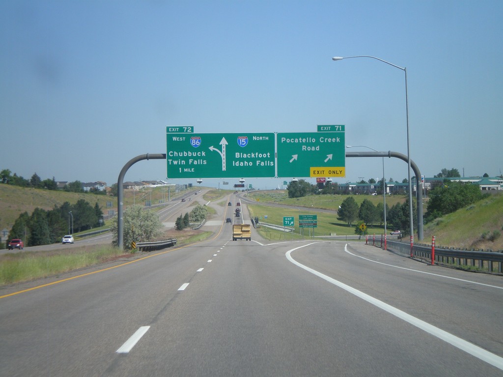
I-15 North - Exits 71 and 72
I-15 north at Exit 71 - Pocatello Creek Road. Approaching Exit 72 - I-86 West/Chubbuck/Twin Falls.
Taken 07-05-2011
 Pocatello
Bannock County
Idaho
United States
Pocatello
Bannock County
Idaho
United States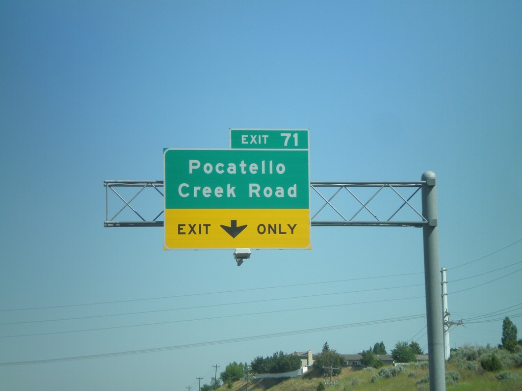
I-15 North Approaching Exit 71
I-15 north approaching Exit 71 - Pocatello Creek Road.
Taken 07-05-2011
Pocatello
Bannock County
Idaho
United States