Signs Tagged With Overhead
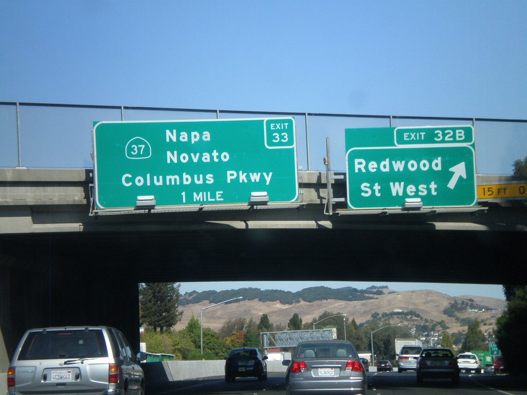
I-80 East - Exit 32B and Exit 33
I-80 east at Exit 32B - Redwood St West. Approaching Exit 33 - CA-37/Napa/Novato/Columbus Parkway.
Taken 10-01-2010

 Vallejo
Solano County
California
United States
Vallejo
Solano County
California
United States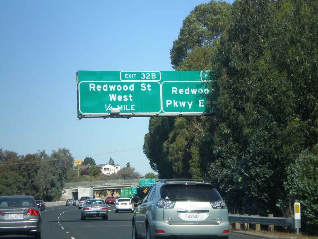
I-80 East - Exits 32A and 32B
I-80 east at Exit 32A - Redwood Parkway East. Approaching Exit 32B - Redwood St West.
Taken 10-01-2010
Vallejo
Solano County
California
United States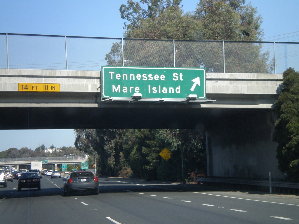
I-80 East - Exit 31B
I-80 east at Exit 31B - Tennessee St/Mare Island.
Taken 10-01-2010
Vallejo
Solano County
California
United States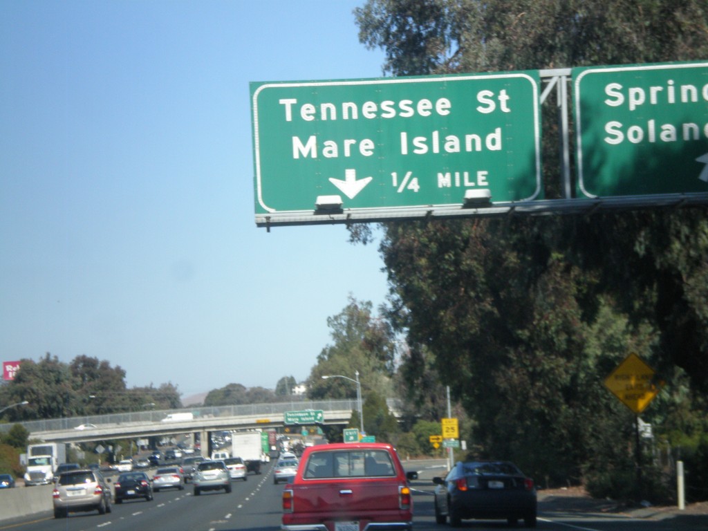
I-80 East - Exits 31A and 31B
I-80 east at Exit 31A - Springs Road/Solano Ave. Approaching Exit 31B - Tennessee St/Mare Island.
Taken 10-01-2010
Vallejo
Solano County
California
United States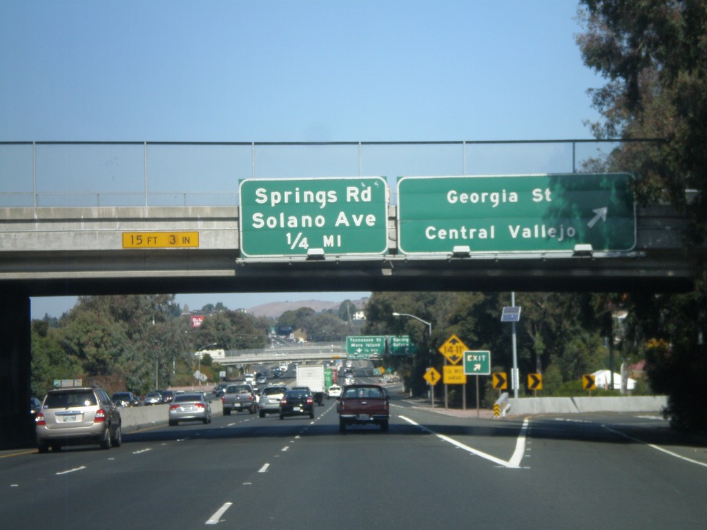
I-80 East - Exits 30C and 31A
I-80 east at Exit 30C - Georgia St/Central Vallejo. Approaching Exit 31A - Springs Road/Solano Ave.
Taken 10-01-2010
Vallejo
Solano County
California
United States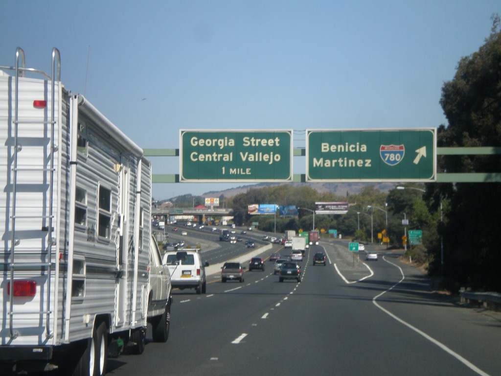
I-80 East - Exits 30A and 30C
I-80 east at Exit 30A - I-780/Benicia/Martinez. Approaching Exit 30C - Georgia St/Central Vallejo.
Taken 10-01-2010
 Vallejo
Solano County
California
United States
Vallejo
Solano County
California
United States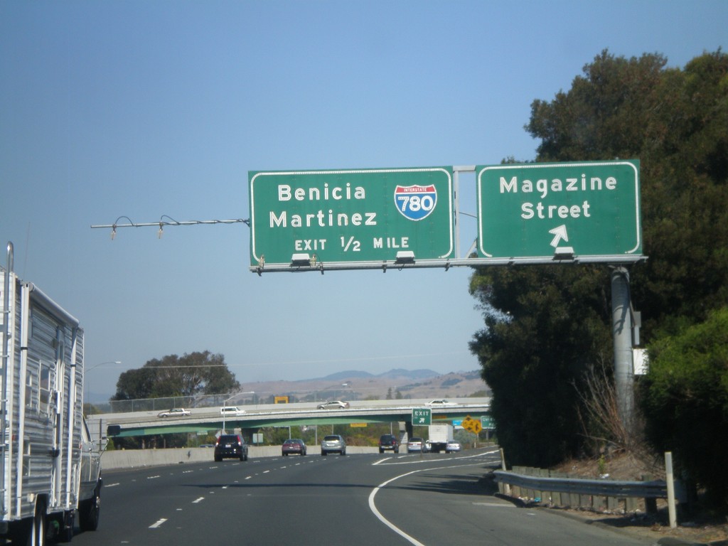
I-80 East - Exits 29C and 30A
I-80 east at Exit 29C - Magazine St. Approaching Exit 30A - I-780/Benicia/Martinez.
Taken 10-01-2010
Vallejo
Solano County
California
United States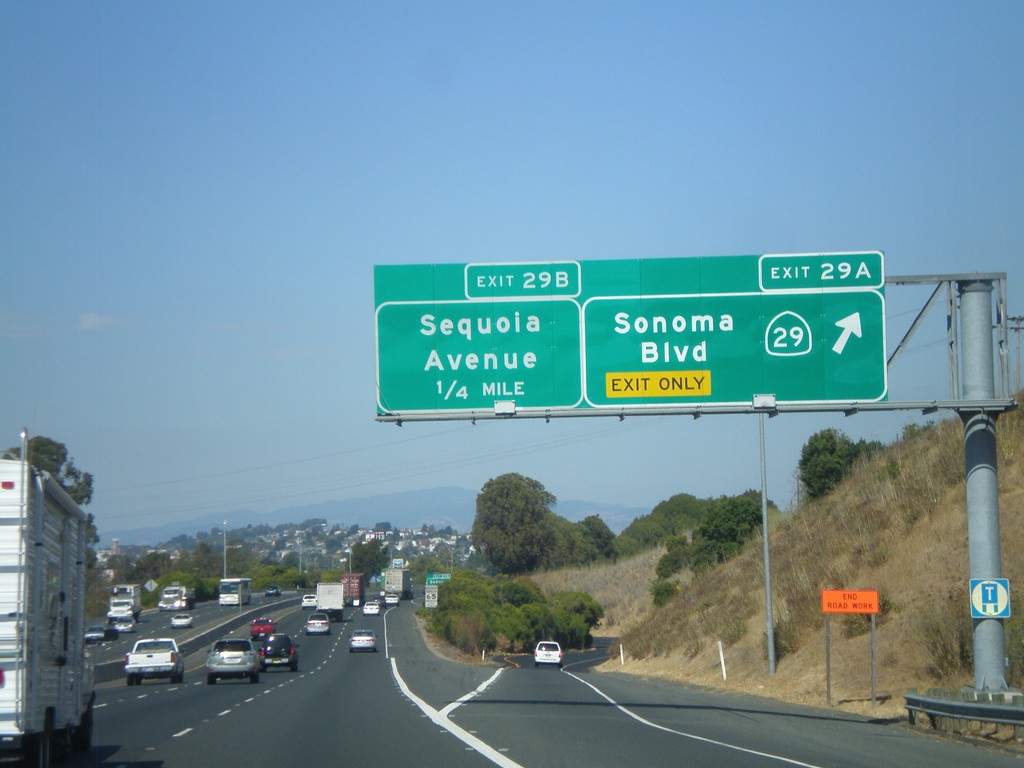
I-80 East - Exits 29A and 29B
I-80 east at Exit 29A - CA-29 North/Sonoma Blvd. Approaching Exit 29B - Sequoia Ave. This is the southern end of CA-29, which is one of the main highways through the Napa Valley.
Taken 10-01-2010
 Vallejo
Solano County
California
United States
Vallejo
Solano County
California
United States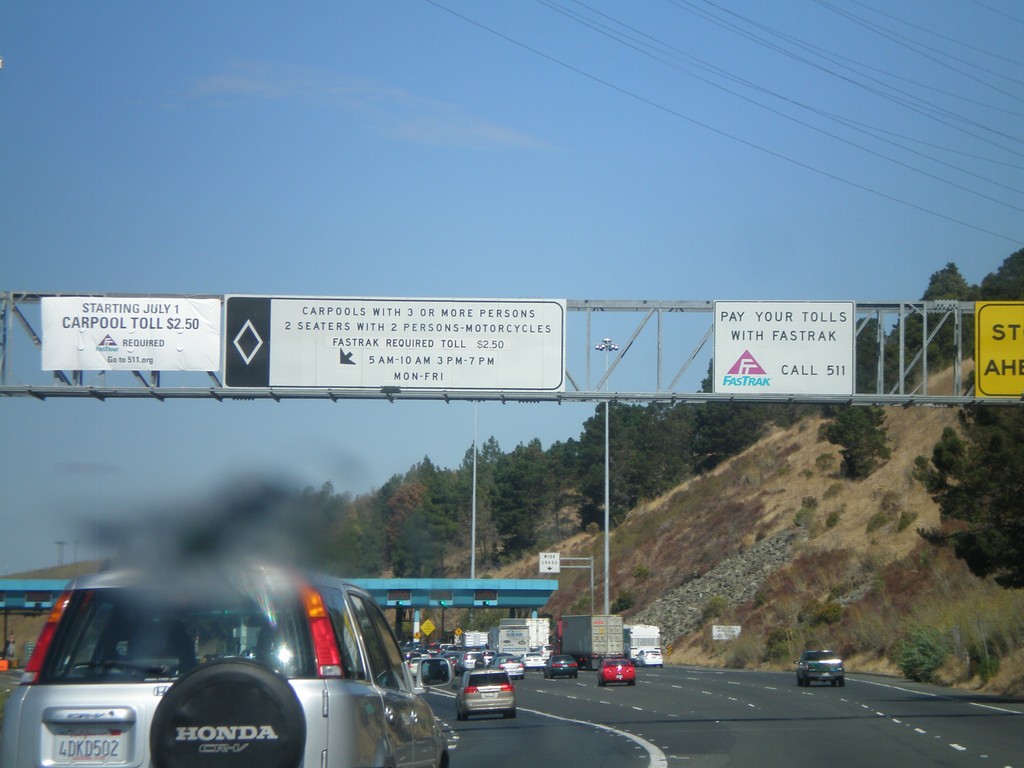
I-80 East - Carquinez Bridge Toll Plaza
Approaching the Carquinez Bridge Toll Plaza on I-80 east. When this photo was taken in Fall 2010, the auto toll was $5.00. The Carquinez Bridge crosses the Carquinez Straits, through which the Sacramento and San Joaquin Delta empty into, before reaching the San Pablo Bay.
Taken 10-01-2010
Vallejo
Solano County
California
United States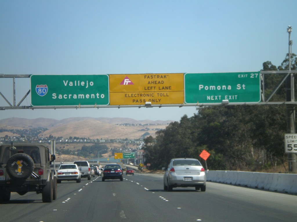
I-80 East - Exit 27
I-80 east approaching Exit 27 - Pomona St. After this exit the highway enters the Carquinez Bridge over the Carquinez Straits, which feeds the Sacramento and San Joaquin Rivers into the San Francisco Bay. Use the left lanes for Fastrak, an electronic tolling system used in California.
Taken 10-01-2010
Crockett
Contra Costa County
California
United States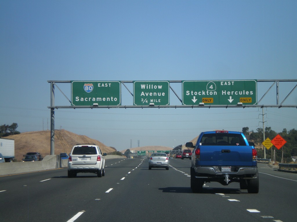
I-80 East - Exits 23 and 24
I-80 east at Exit 23 - CA-4 East/Hercules/Stockton. Approaching Exit 24 - Willow Ave. This is the western end of CA-4, which follows the south side of the Carquinez Straits towards Stockton. CA-4 is a trans-Sierra highway, crossing at Ebbetts Pass. I-80 continues east towards Sacramento.
Taken 10-01-2010
 Hercules
Contra Costa County
California
United States
Hercules
Contra Costa County
California
United States
I-80 East - Exits 22 and 23
I-80 east at Exit 22 - Pinole Valley Road. Approaching Exit 23 - CA-4/Stockton/Hercules.
Taken 10-01-2010
Pinole
Contra Costa County
California
United States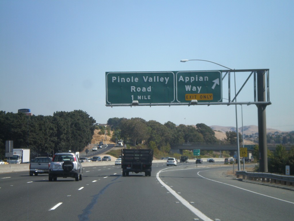
I-80 East - Exits 21 and 22
I-80 east at Exit 21 - Appian Way. Approaching Exit 22 - Pinole Valley Road.
Taken 10-01-2010
Pinole
Contra Costa County
California
United States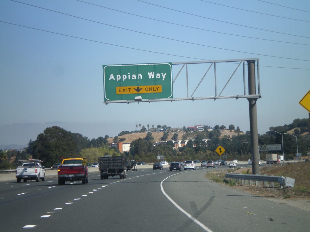
I-80 East - Exit 21
I-80 east approaching Exit 21 - Appian Way.
Taken 10-01-2010
Pinole
Contra Costa County
California
United States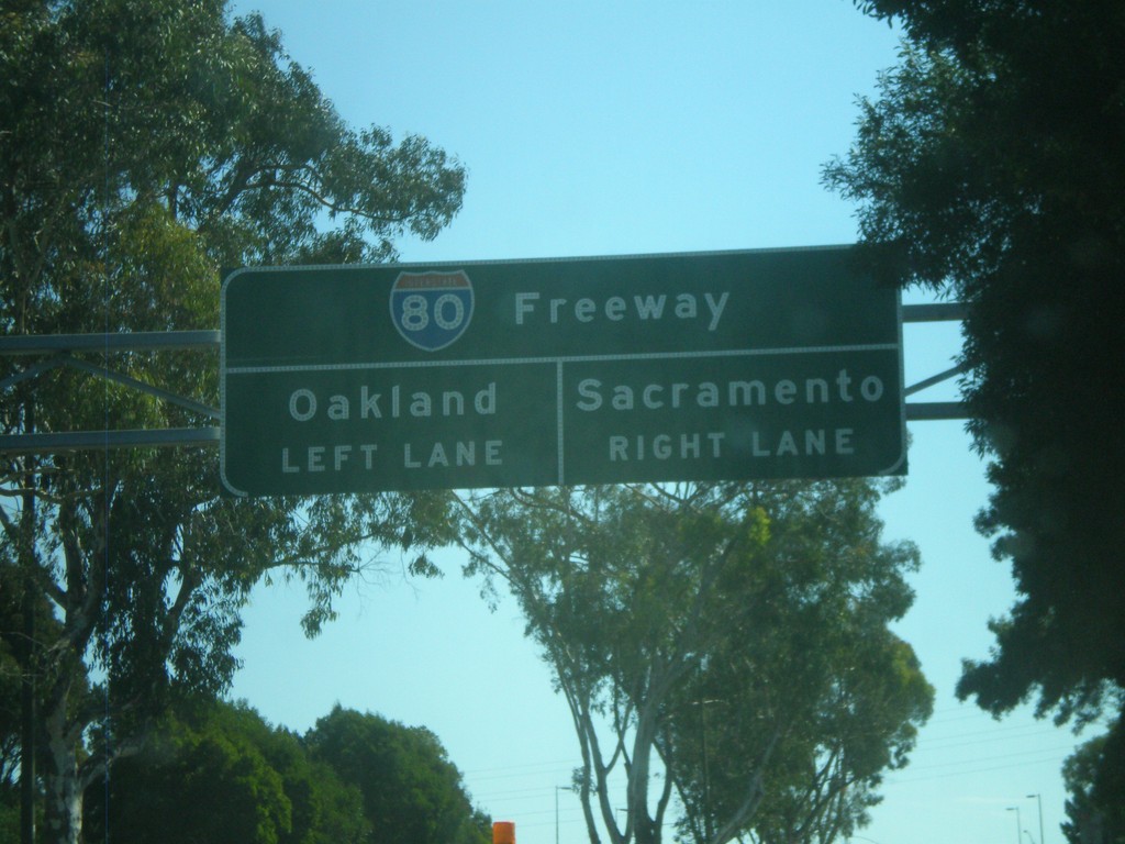
Richmond Parkway East Nearing I-80
Richmond Parkway East approaching I-80. Use right lane for Sacramento. Use left lane for Oakland.
Taken 10-01-2010
Richmond
Contra Costa County
California
United States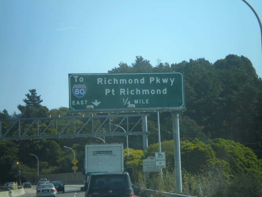
I-580 East - Exit 7
I-580 east approaching Exit 7 - To I-80 East/Richmond Parkway/Point Richmond.
Taken 10-01-2010
 Richmond
Contra Costa County
California
United States
Richmond
Contra Costa County
California
United States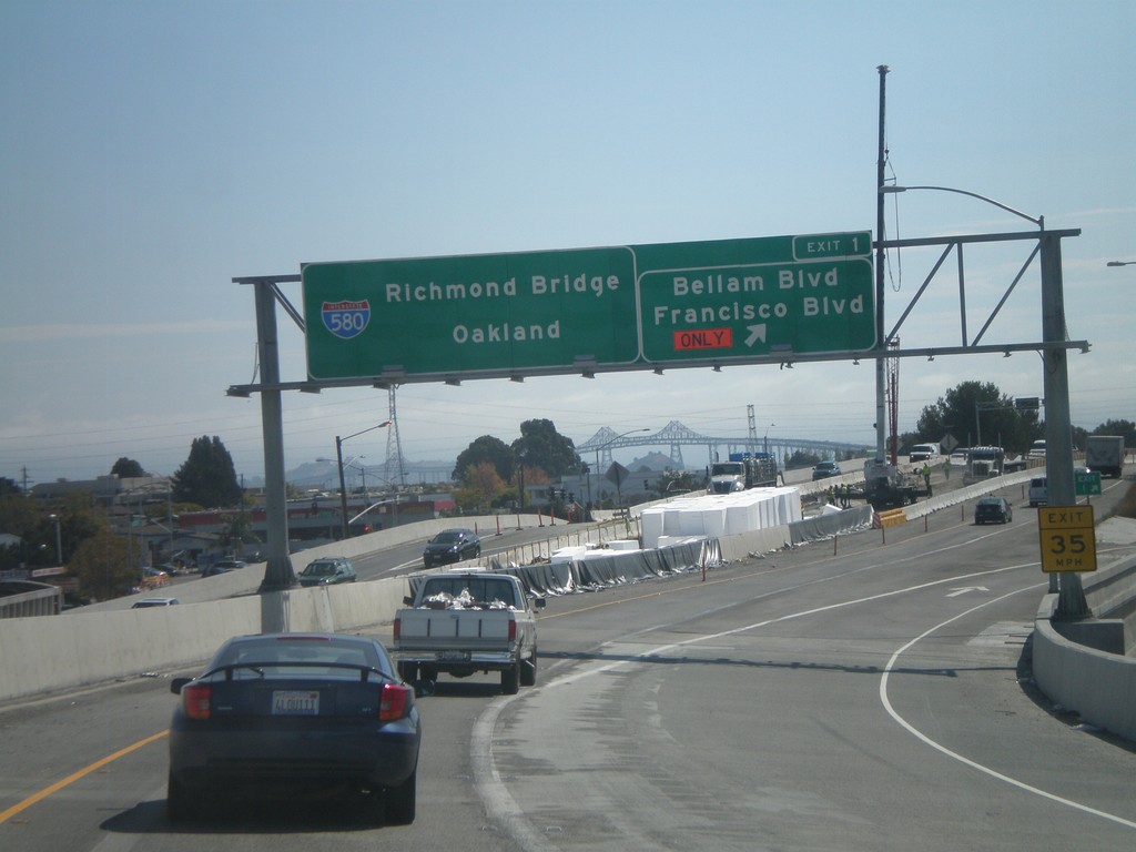
I-580 East - Exit 1
I-580 East at Exit 1 - Bellam Blvd/Francisco Blvd. I-580 continues east towards the Richmond Bridge and Oakland. The Richmond Bridge can be seen in the background.
Taken 10-01-2010
San Rafael
Marin County
California
United States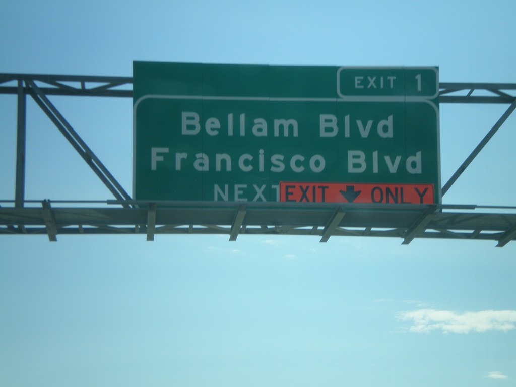
I-580 East - Exit 1
I-580 east approaching Exit 1 - Bellam Blvd./Francisco Blvd. Due to road construction the right lane is an exit only lane for Exit 1.
Taken 10-01-2010
San Rafael
Marin County
California
United States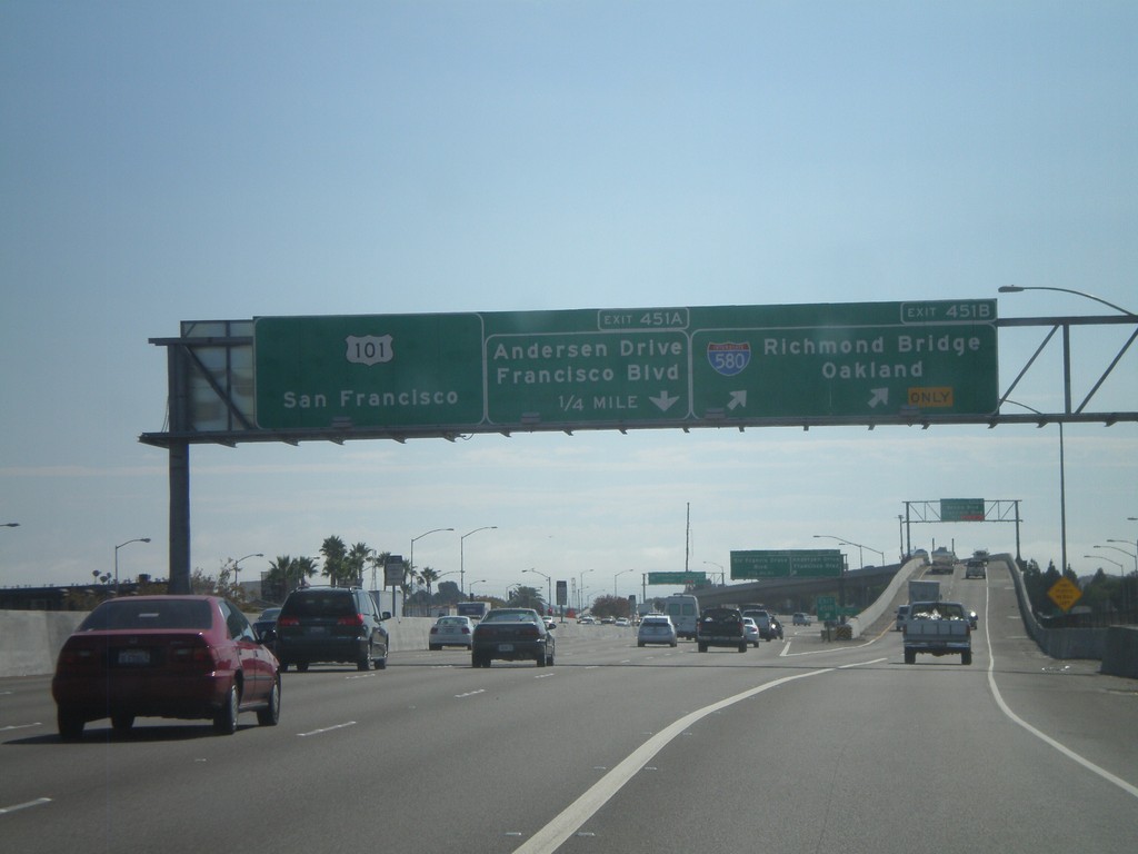
US-101 South - Exits 451B and 451A
US-101 south at Exit 451B - I-580/Richmond Bridge/Oakland. Approaching Exit 451A - Andersen Drive/Francisco Blvd. This is the western end of I-580.
Taken 10-01-2010
 San Rafael
Marin County
California
United States
San Rafael
Marin County
California
United States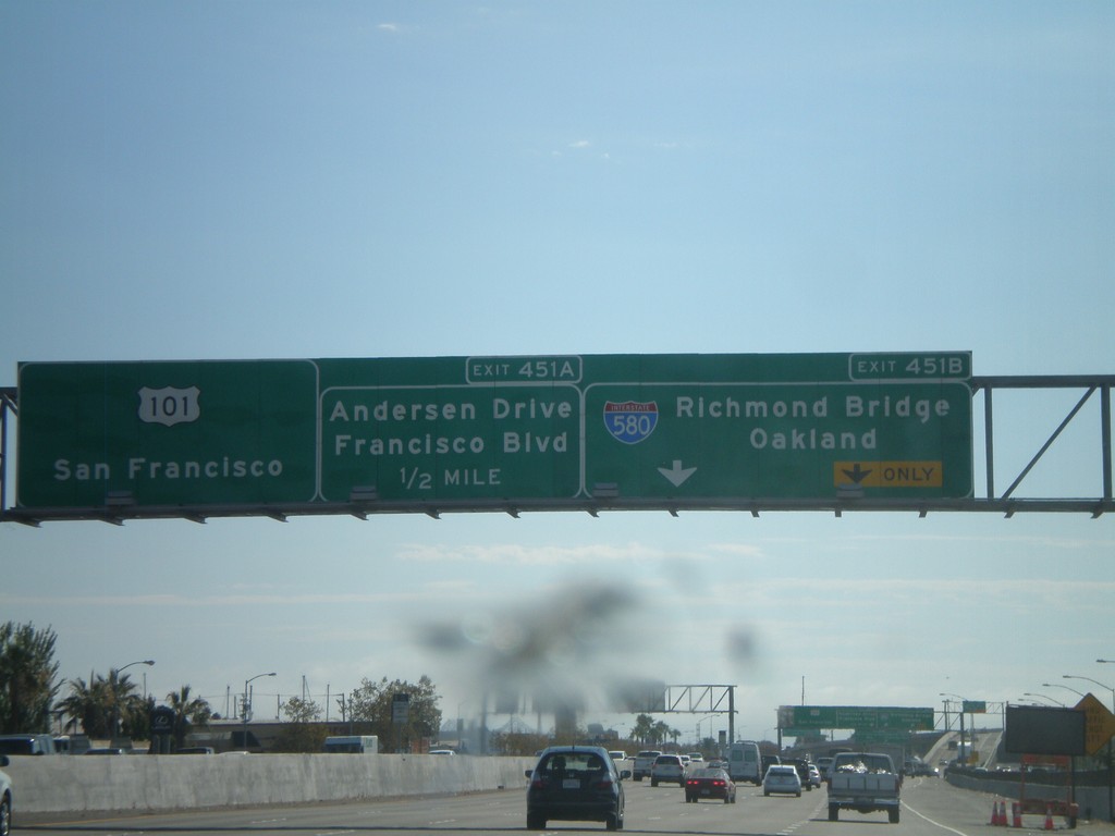
US-101 South - Exits 451B and 451A
US-101 south at Exit 451B - I-580/Richmond Bridge/Oakland. Approaching Exit 451A - Andersen Drive/Francisco Blvd. US-101 continues south towards San Francisco.
Taken 10-01-2010
San Rafael
Marin County
California
United States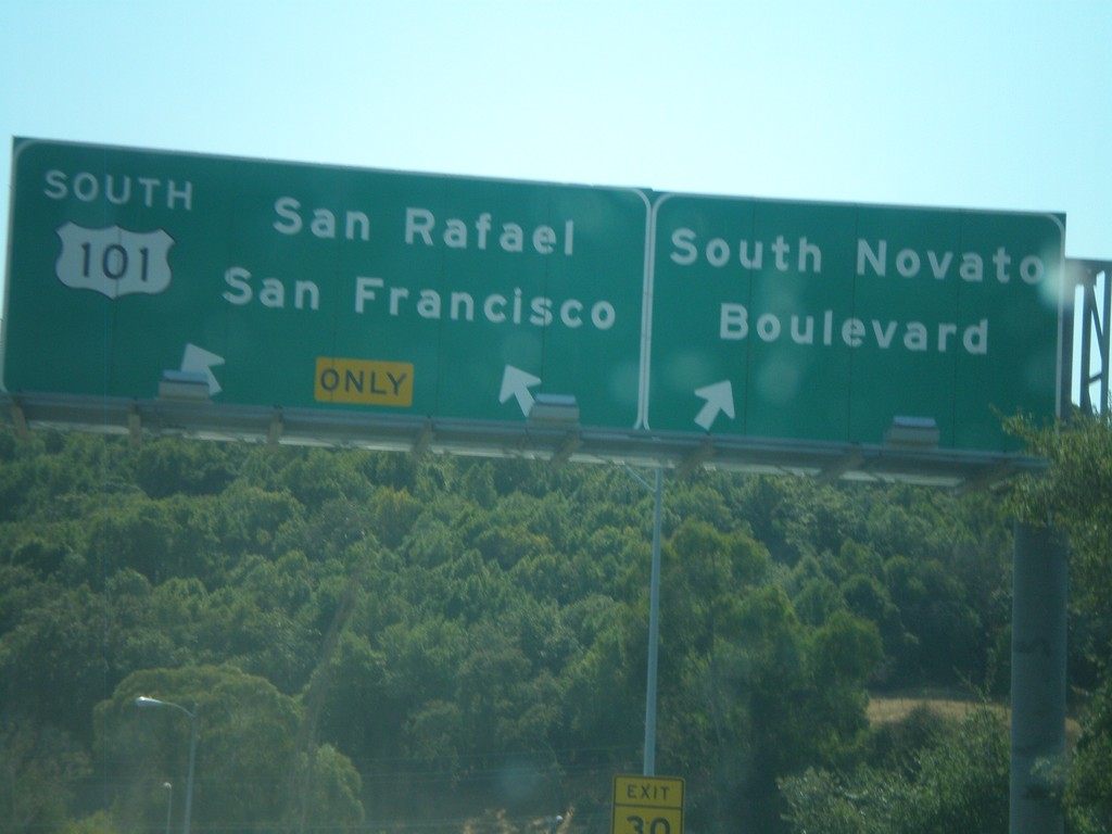
End CA-37 West at US-101
End CA-37 west at US-101. US-101 continues south for San Rafael and San Francisco. Exit right for Novato Blvd.
Taken 09-30-2010
Novato
Marin County
California
United States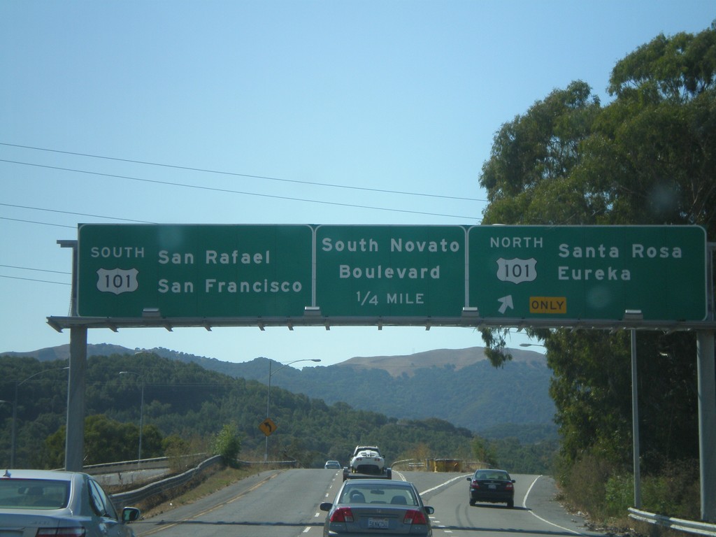
CA-37 West at US-101
CA-37 west at US-101. Use US-101 north for Santa Rosa and Eureka. Use US-101 south for San Rafael and San Francisco. Also approaching the Novato Blvd. exit. US-101 marks the western end of CA-37.
Taken 09-30-2010
Novato
Marin County
California
United States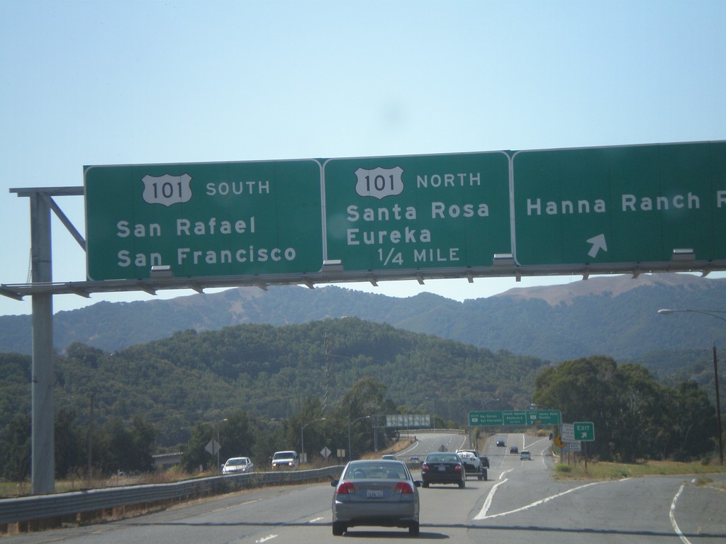
CA-37 West - Hanna Ranch Road Exit
CA-37 west at Hanna Ranch Road exit. Approaching US-101. Use US-101 north for Santa Rosa and Eureka. Use US-101 south for San Rafael and San Francisco.
Taken 09-30-2010
Novato
Marin County
California
United States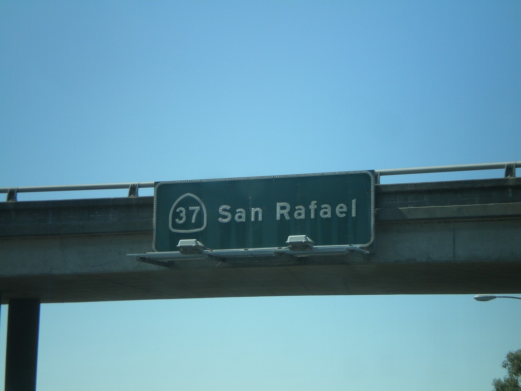
CA-37 - San Rafael
CA-37 - San Rafael overhead on CA-37 west.
Taken 09-30-2010
Vallejo
Solano County
California
United States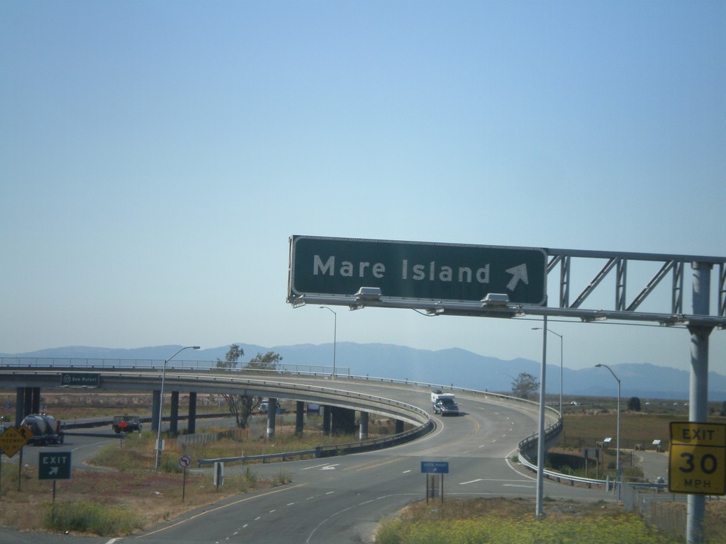
CA-37 West - Exit 17
CA-37 west at Exit 17 - Mare Island.
Taken 09-30-2010
Vallejo
Solano County
California
United States