Signs Tagged With Overhead
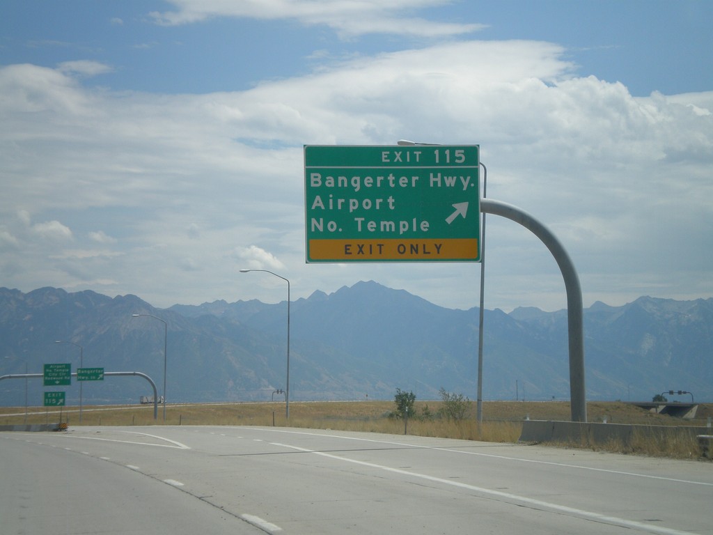
I-80 East - Exit 115
I-80 east at Exit 115 - Bangerter Highway/Airport/North Temple. Use Exit 115 for the Salt Lake City International Airport.
Taken 07-31-2010
 Salt Lake City
Salt Lake County
Utah
United States
Salt Lake City
Salt Lake County
Utah
United States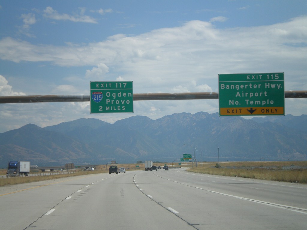
I-80 East - Exits 115 and Exit 117.
I-80 east at Exit 115 - Bangerter Highway/Airport/North Temple. Approaching Exit 117 - I-215/Ogden/Provo.
Taken 07-31-2010
 Salt Lake City
Salt Lake County
Utah
United States
Salt Lake City
Salt Lake County
Utah
United States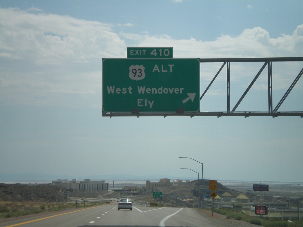
I-80 East - Exit 410
I-80 east at Exit 410 - US-93 Alt./West Wendover/Ely. This is the last exit in Nevada on I-80 east. This exit is the western end of the West Wendover/Wendover business loop. The casinos in West Wendover and the salt flats beyond are visible.
Taken 07-31-2010

 West Wendover
Elko County
Nevada
United States
West Wendover
Elko County
Nevada
United States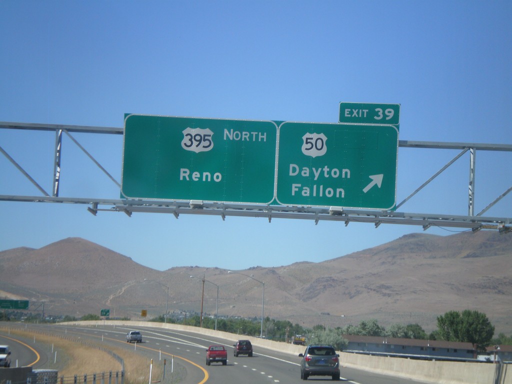
US-395 North - Exit 39
US-395 north at Exit 39 - US-50/Dayton/Fallon. Continue north on US-395 for Reno. The US-50/US-395 split ends here.
Taken 07-12-2010

 Carson City
Nevada
United States
Carson City
Nevada
United States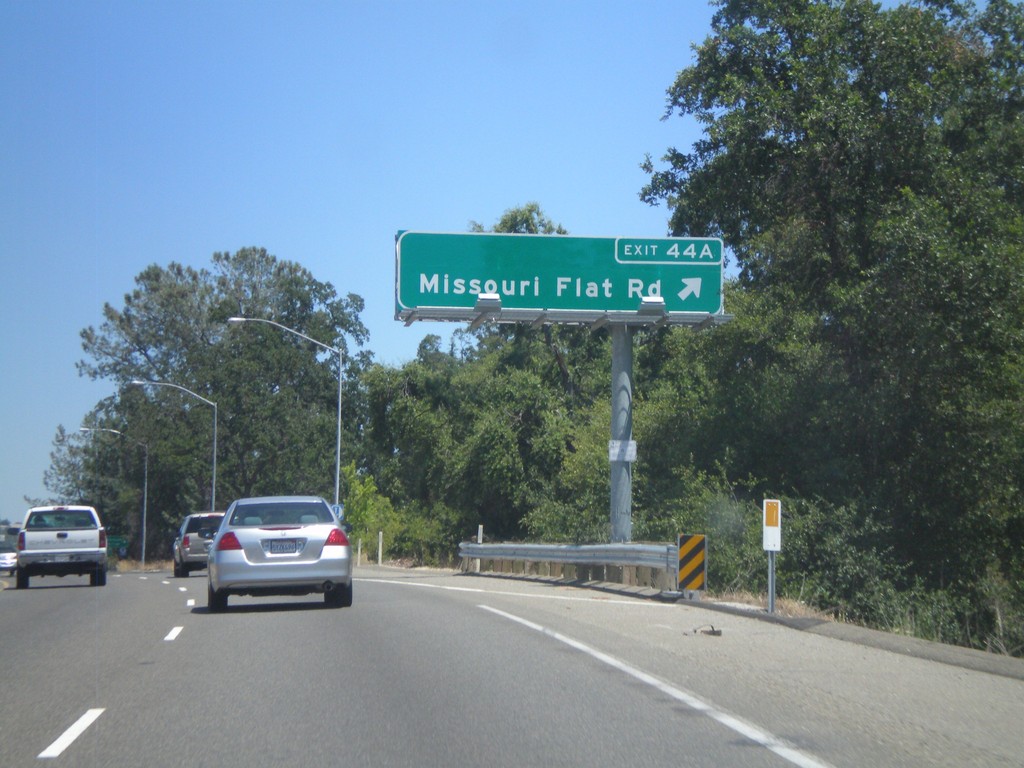
US-50 East - Exit 44A
US-50 east at Exit 44A - Missouri Flat Road.
Taken 07-12-2010
Placerville
El Dorado County
California
United States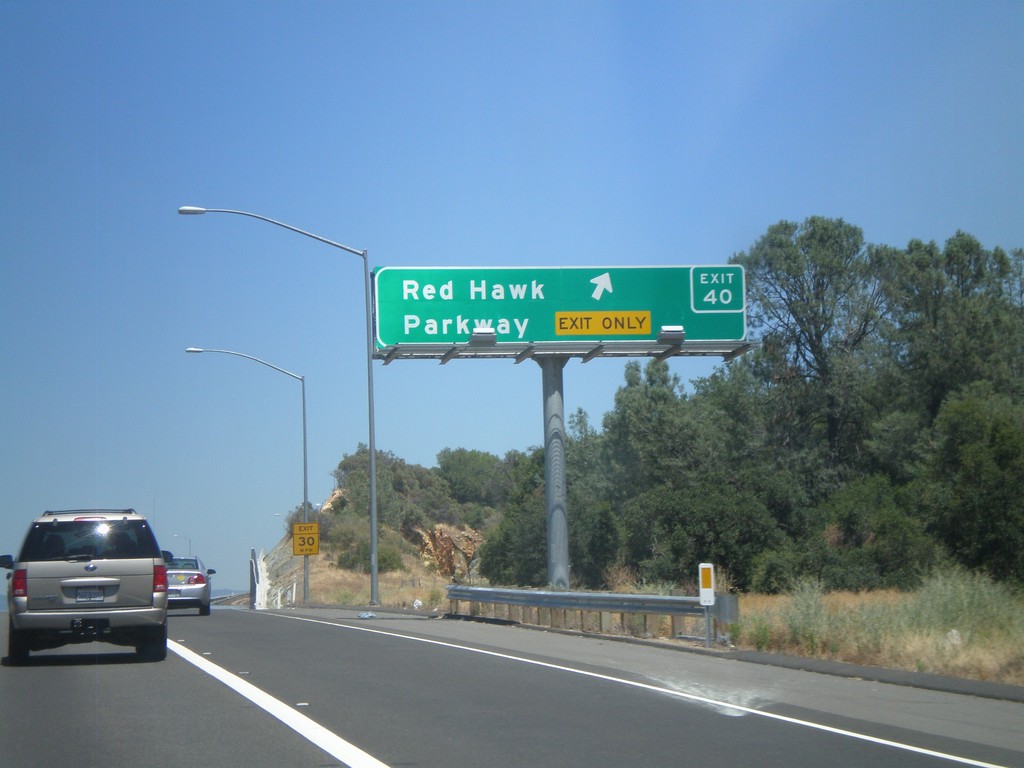
US-50 East - Exit 40
US-50 east at Exit 40 - Red Hawk Parkway.
Taken 07-12-2010
Shingle Springs
El Dorado County
California
United States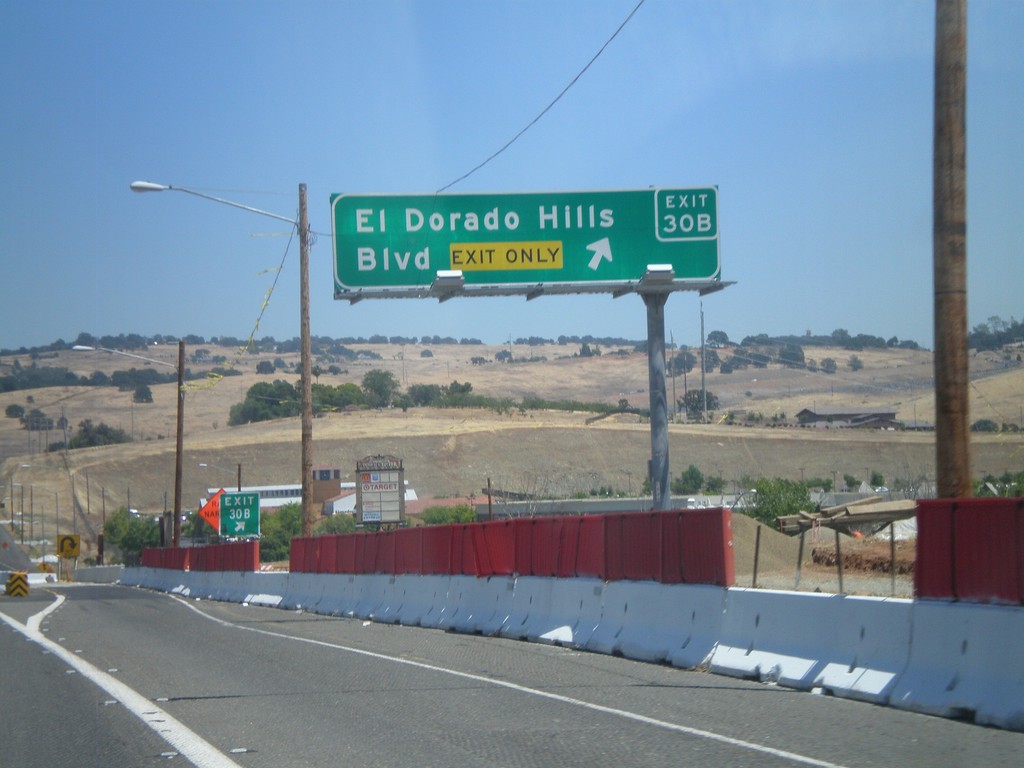
US-50 East - Exit 30B
US-50 east at Exit 30B - El Dorado Hills Blvd.
Taken 07-12-2010
El Dorado Hills
El Dorado County
California
United States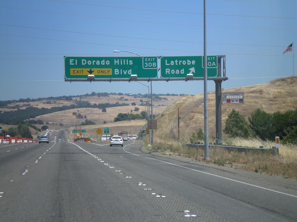
US-50 East - Exits 30A and 30B
US-50 east at Exit 30A - Latrobe Road. Approaching Exit 30B - El Dorado Hills Blvd.
Taken 07-12-2010
El Dorado Hills
El Dorado County
California
United States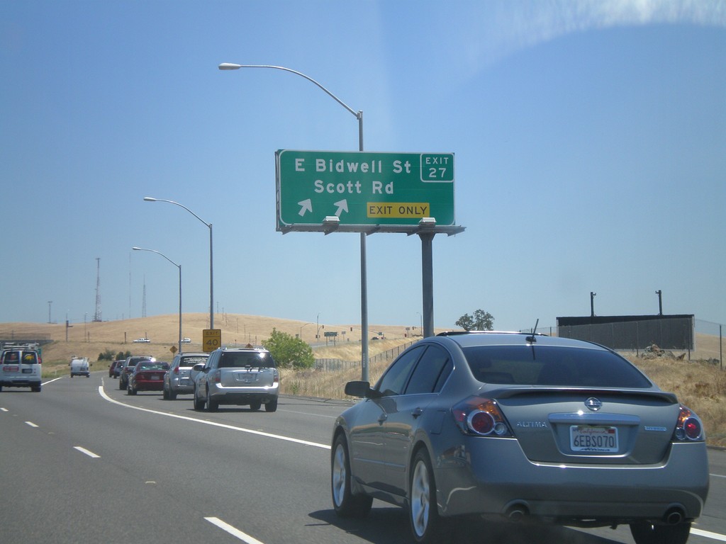
US-50 East - Exit 27
US-50 east at Exit 27 - E. Bidwell St./Scott Rd.
Taken 07-12-2010
Folsom
Sacramento County
California
United States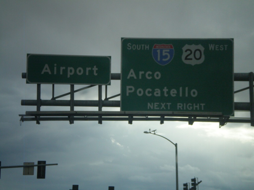
US-20 West at I-15 South
US-20 west at I-15 south to Arco and Pocatello. US-20 west joins I-15 south. Continue straight for the Idaho Falls Airport.
Taken 05-01-2010

 Idaho Falls
Bonneville County
Idaho
United States
Idaho Falls
Bonneville County
Idaho
United States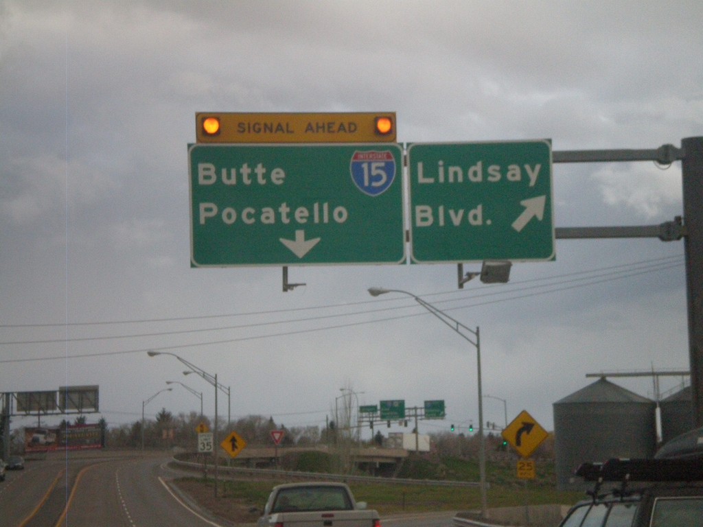
US-20 West - Lindsay Blvd
US-20 west at Lindsay Blvd (Exit 307). Approaching end of freeway at I-15 to Butte and Pocatello.
Taken 05-01-2010
Idaho Falls
Bonneville County
Idaho
United States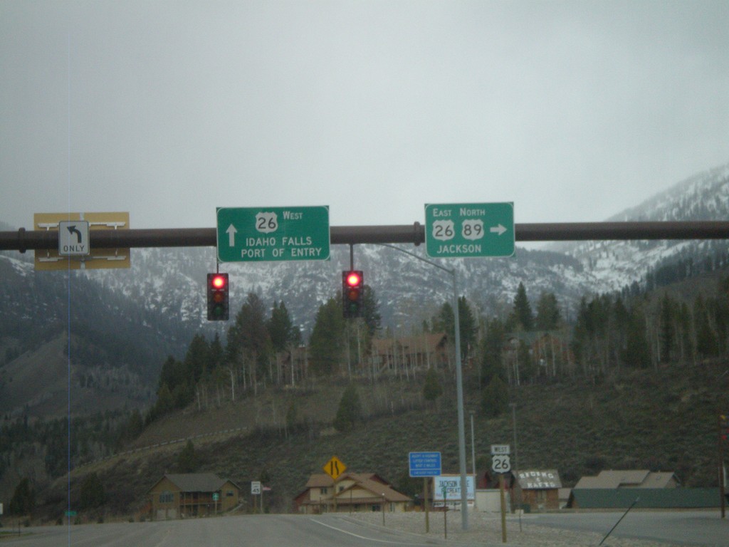
US-89 North at US-26
US-89 north at US-26. US-26 continues west to Idaho Falls and Port of Entry. US-89 North/US-26 East join north towards Jackson.
Taken 05-01-2010

 Alpine
Lincoln County
Wyoming
United States
Alpine
Lincoln County
Wyoming
United States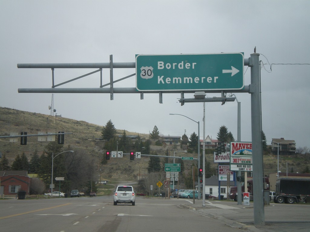
US-89 North at US-30
US-89 north at US-30 in Montpelier. Use US-30 East for Border and Kemmerer. The left half of this sign is missing.
Taken 05-01-2010
 Montpelier
Bear Lake County
Idaho
United States
Montpelier
Bear Lake County
Idaho
United States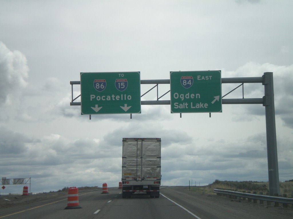
I-84 East - Exit 222
I-84 east at I-86 east to I-15 and Pocatello. Use I-84 east for Ogden and Salt Lake.
Taken 05-01-2010

 Declo
Cassia County
Idaho
United States
Declo
Cassia County
Idaho
United States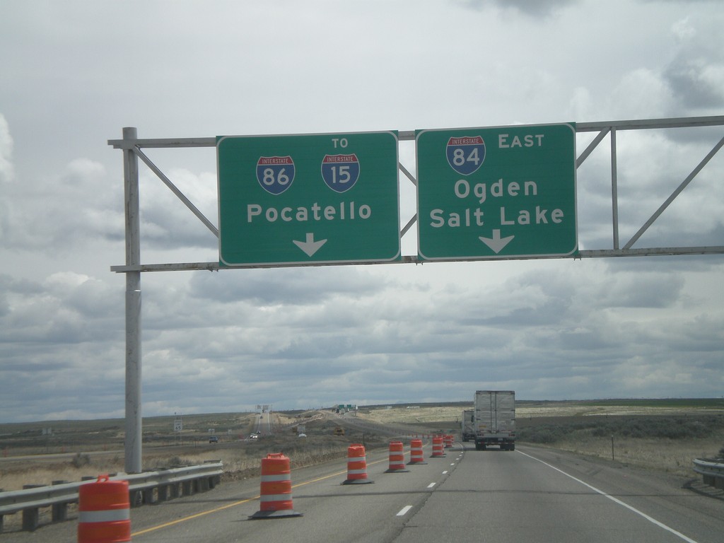
I-84 East Approaching I-86
I-84 east approaching I-86 east to I-15 and Pocatello. Use I-84 west for Ogden and Salt Lake.
Taken 05-01-2010
Declo
Cassia County
Idaho
United States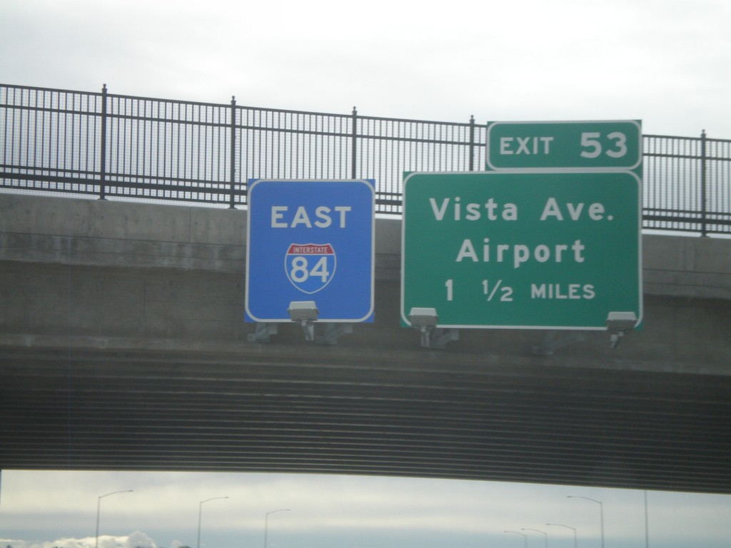
I-84 East - Exit 53
I-84 east overhead, and approaching Exit 53 - Vista Ave./Airport, 1 1/2 miles. The I-84 east sign has a blue background, which is not ordinary. This interchange is currently under construction, and I am guessing the blue will be replaced with green at some point.
Taken 05-01-2010
Boise
Ada County
Idaho
United States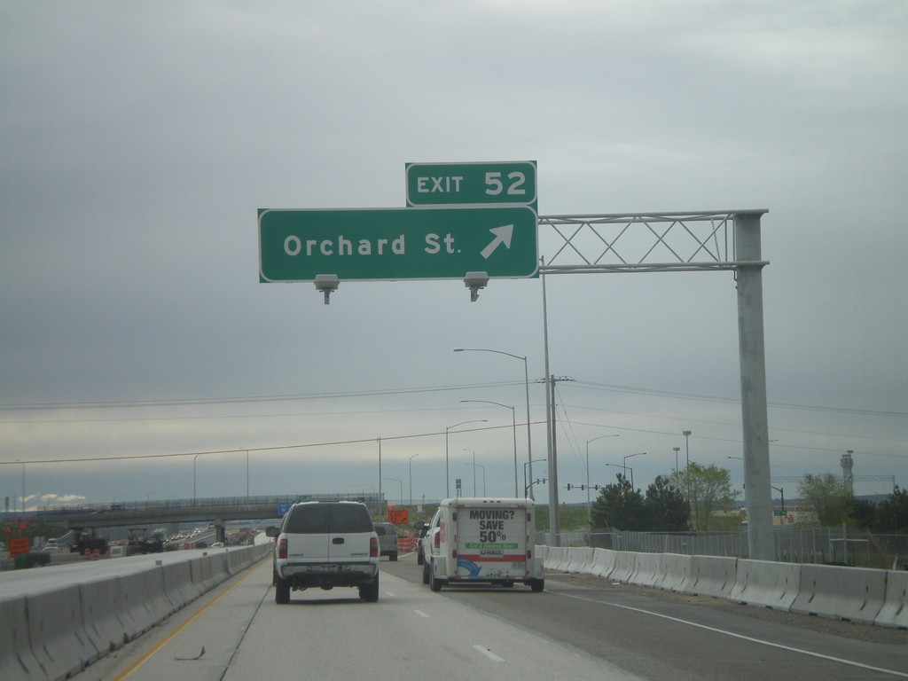
I-84 East - Exit 52
I-84 east at Exit 52 - Orchard St. Orchard St. provides access to Gowen Field - the National Guard Base. This interchange is currently being rebuilt.
Taken 05-01-2010
Boise
Ada County
Idaho
United States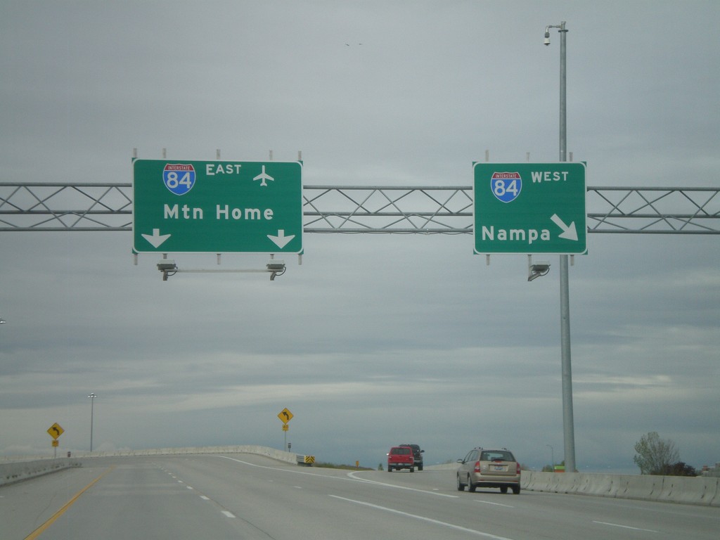
End I-184 at I-84
End I-184 on the ramp to I-84 East to Mountain Home, and I-84 west to Nampa. The control cities on this interchange was recently changed from Twin Falls and Ontario.
Taken 05-01-2010
 Boise
Ada County
Idaho
United States
Boise
Ada County
Idaho
United States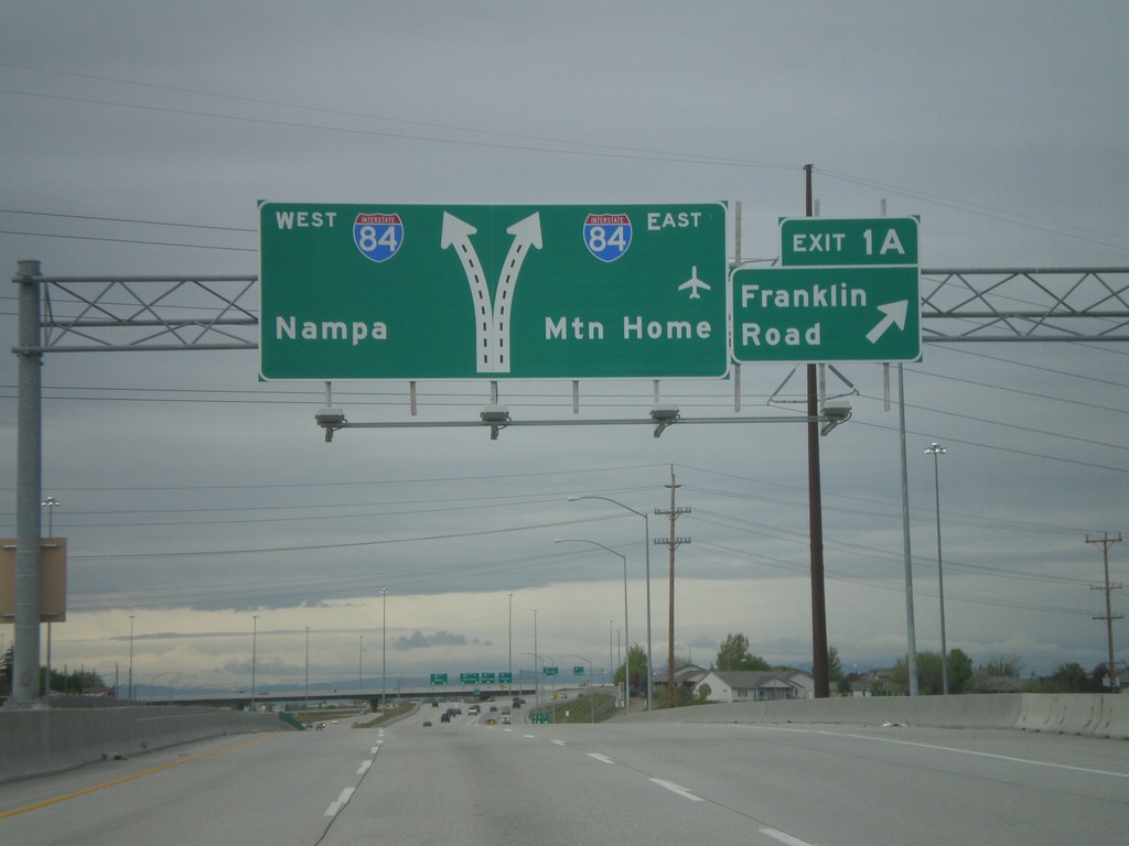
I-184 West - Exit 1A
I-184 west at Exit 1A - Franklin Road. Approaching I-84 to Mountain Home and Nampa.
Taken 05-01-2010
Boise
Ada County
Idaho
United States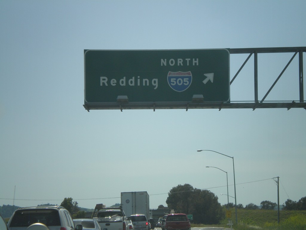
I-80 West - Exit 56
I-80 west at Exit 56 - I-505 North/Redding.
Taken 04-16-2010
 Vacaville
Solano County
California
United States
Vacaville
Solano County
California
United States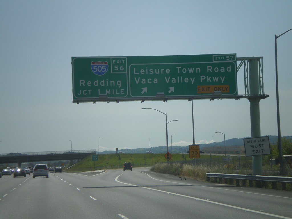
I-80 West - Exit 57 Approaching Exit 56
I-80 west at Exit 57 - Leisure Town Road/Vaca Valley Parkway. Approaching Exit 56 - I-505 North/Redding.
Taken 04-16-2010
Vacaville
Solano County
California
United States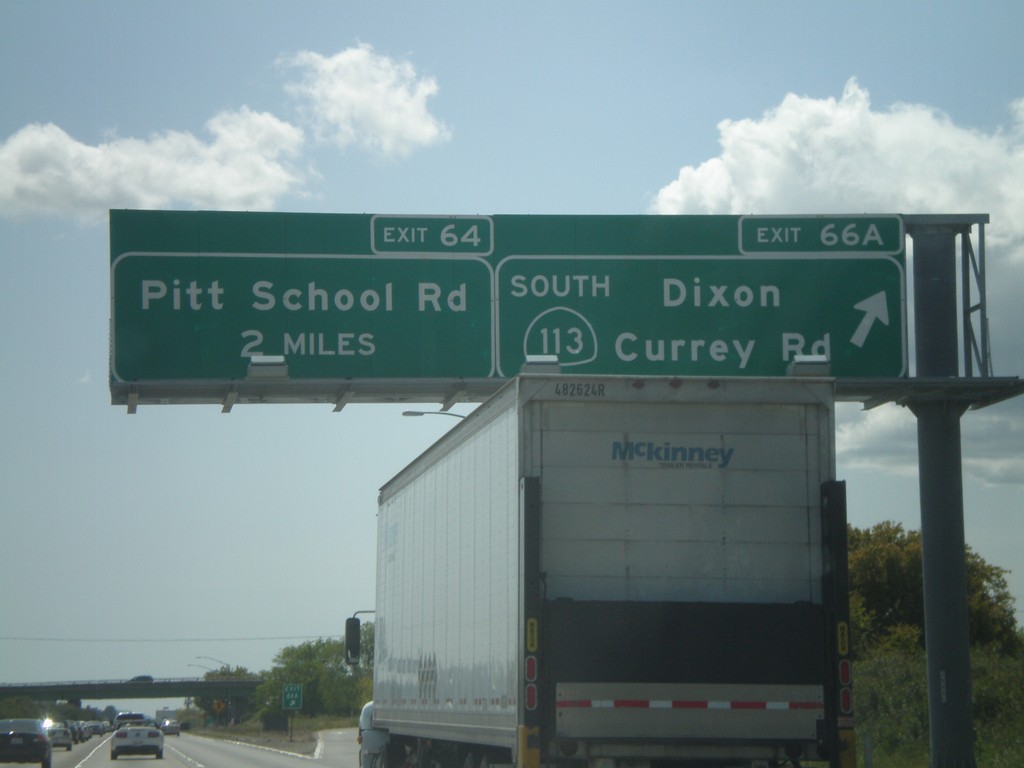
I-80 West/CA-113 South - Exit 66A
I-80 west/CA-113 south at Exit 66A - CA-113 South/Dixon/Currey Road. I-80 and CA-113 split separate here. I-80 west approaches Exit 64 - Pitt School Road.
Taken 04-16-2010
 Dixon
Solano County
California
United States
Dixon
Solano County
California
United States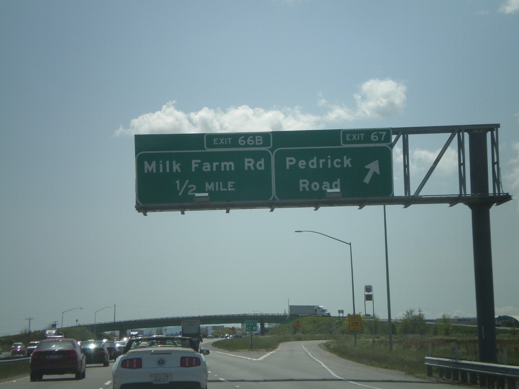
I-80 West/CA-113 South - Exit 67 Approaching Exit 66B
I-80 west/CA-113 south at Exit 67 - Pedrick Road. Approaching Exit 66B - Milk Farm Road.
Taken 04-16-2010
Dixon
Solano County
California
United States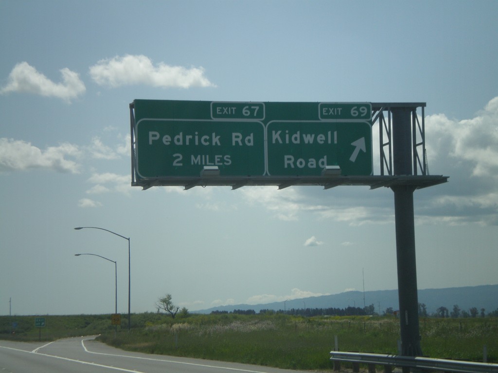
I-80 West/CA-113 South - Exit 69 Approaching Exit 67
I-80 West/CA-113 South at Exit 69 - Kidwell Road. Approaching Exit 67 - Pedrick Road.
Taken 04-16-2010
Dixon
Solano County
California
United States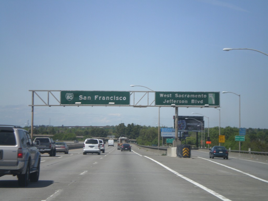
US-50/BL-80 West - Exit 3
US-50/BL-80 west at Exit 3 - West Sacramento/Jefferson Blvd
Taken 04-16-2010
West Sacramento
Yolo County
California
United States