Signs Tagged With Overhead
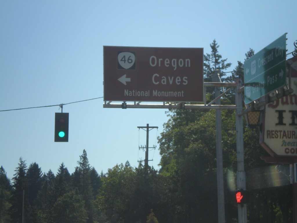
US-199 South at OR-46
US-199 south at OR-46 east to Oregon Cavess National Monument.
Taken 09-23-2009

 Cave Junction
Josephine County
Oregon
United States
Cave Junction
Josephine County
Oregon
United States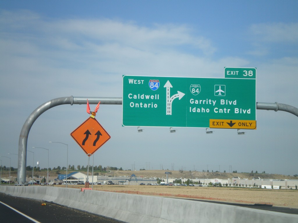
I-84 West - Exit 38
I-84/US-30 west at Exit 38 - BL-84/Garrity Blvd./Idaho Center Blvd. Westbound I-84 traffic continues towards Caldwell and Ontario (OR).
Taken 09-19-2009


 Nampa
Canyon County
Idaho
United States
Nampa
Canyon County
Idaho
United States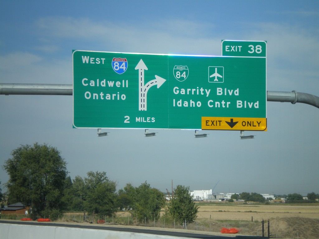
I-84 West Approaching Exit 38
I-84/US-30 west approaching Exit 38 - BL-84/Garrity Blvd./Idaho Center Blvd. Westbound I-84 traffic continues towards Caldwell and Ontario (OR). This is a new sign as part of the I-84 widening between Meridian and Nampa.
Taken 09-19-2009
Nampa
Canyon County
Idaho
United States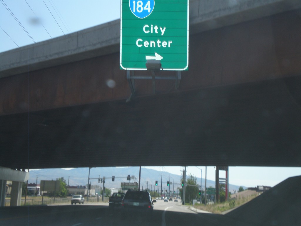
Franklin Road East at I-184 East
Franklin Road East at I-184 East - Exit 1.
Taken 07-04-2009
 Boise
Ada County
Idaho
United States
Boise
Ada County
Idaho
United States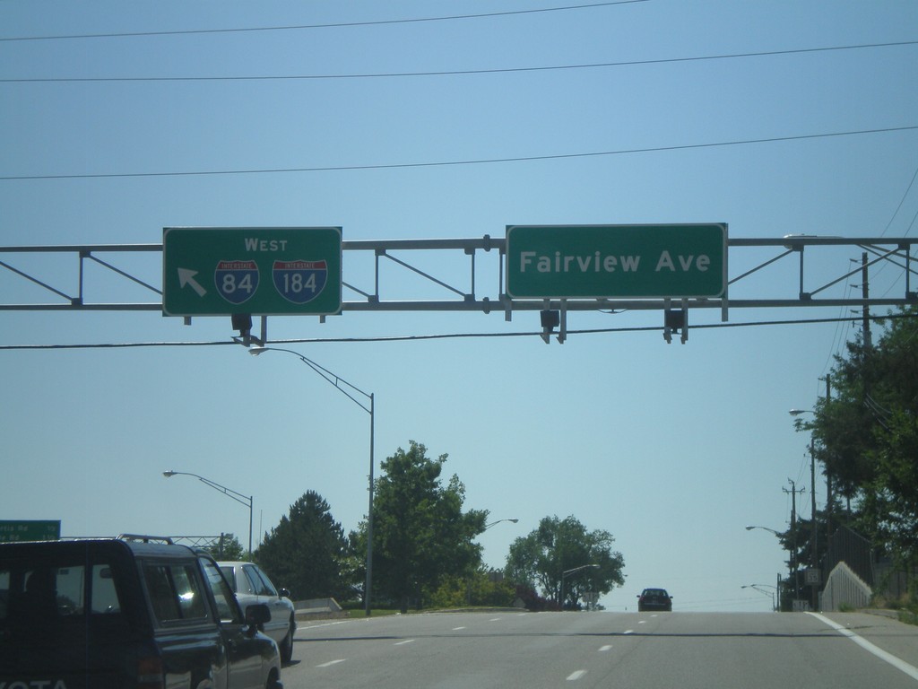
Fairview Ave. West at I-184
Fairview Ave. west at I-184 onramp. I-84 is posted on this sign, but it should read To I-84, since I-84 is still three miles away along I-184.
Taken 06-29-2009
Boise
Ada County
Idaho
United States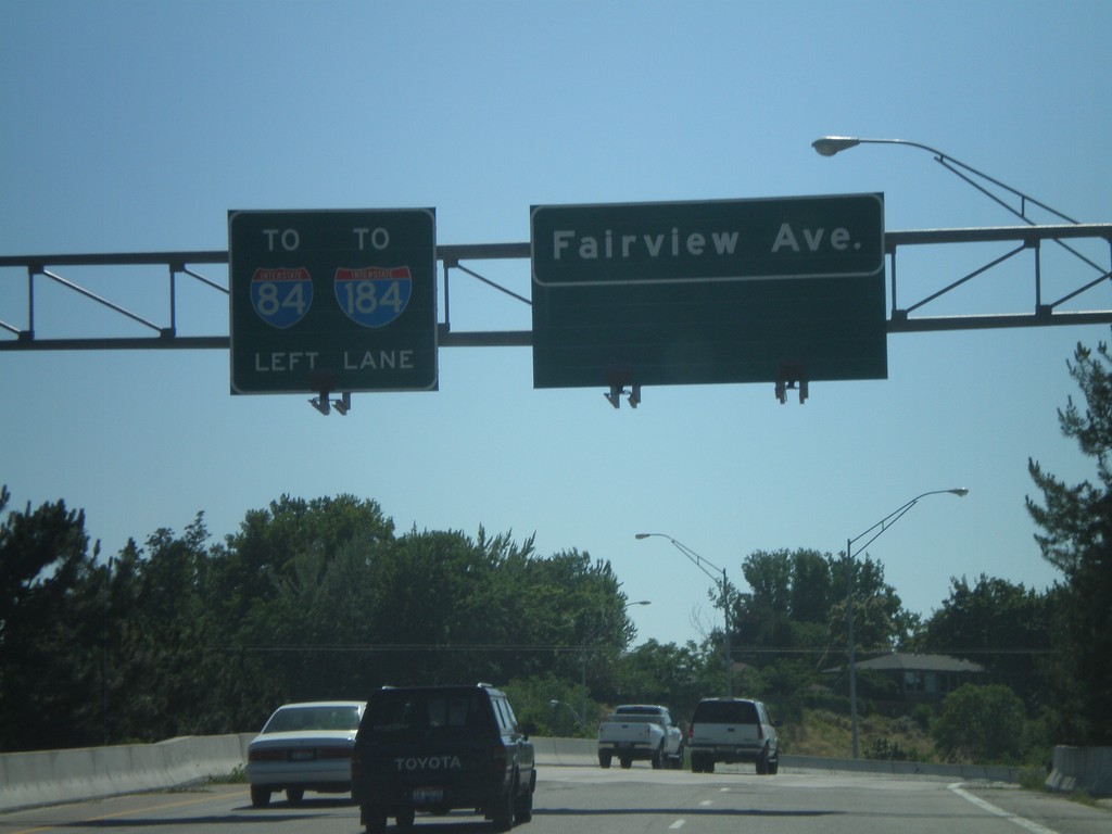
Fairview Ave. west approaching I-184
Fairview Ave. west approaching I-184 onramp.
Taken 06-29-2009
Boise
Ada County
Idaho
United States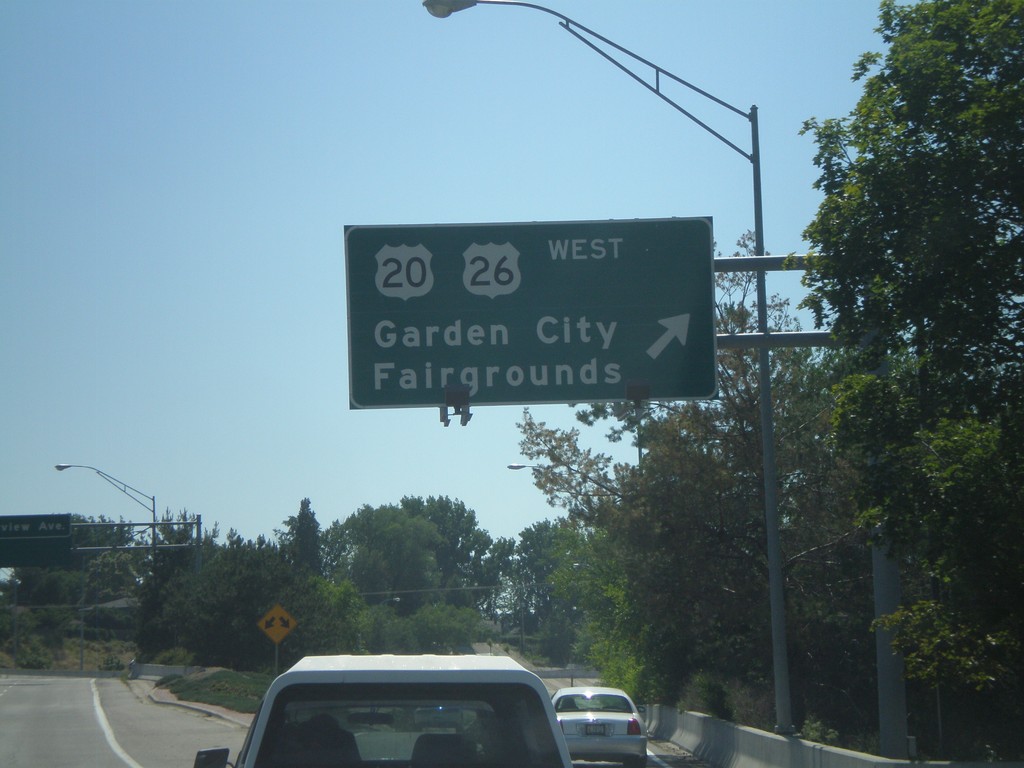
Main St. West at US-20/US-26 West
Main St. west at US-20/US-26 junction to Garden City and Fairgrounds.
Taken 06-29-2009

 Boise
Ada County
Idaho
United States
Boise
Ada County
Idaho
United States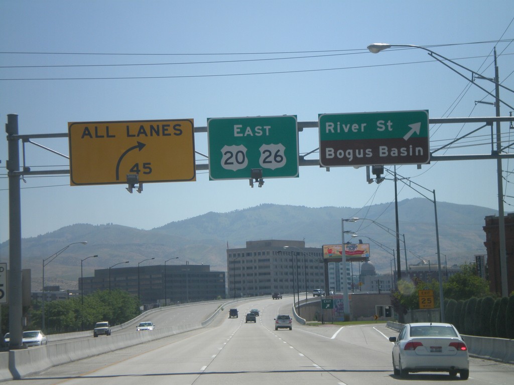
US-20/US-26 East at River St.
US-20/US-26 east at River St./Bogus Basin exit. This is the last exit eastbound on the Boise Connector.
Taken 06-28-2009
Boise
Ada County
Idaho
United States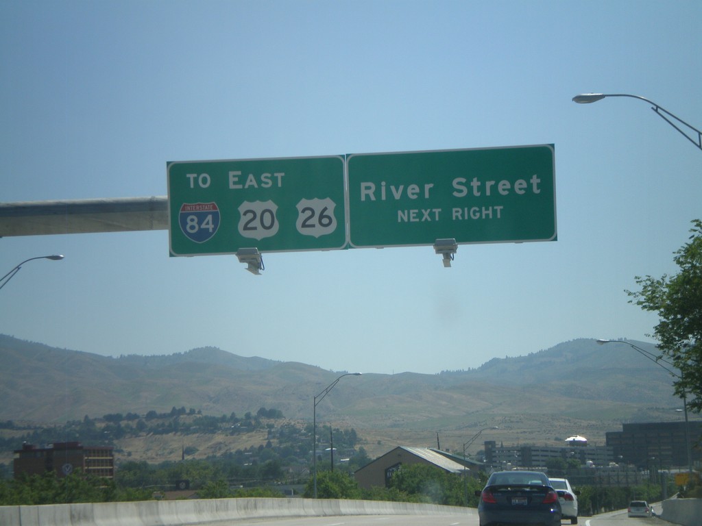
US-20/US-26 East Approaching River St.
US-20/US-26 east approaching River St. exit. US-20/US-26 east through Boise is also marked with To I-84 shields.
Taken 06-28-2009
Boise
Ada County
Idaho
United States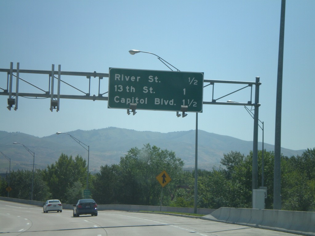
End I-184 East at US-20/US-26
Eastern terminus of I-184 east where US-20/US-26 merge on the freeway. There is no end I-184 marker. Distance marker for River St., 13th St., and Capitol Blvd. Only River St. is a freeway interchange. 13th St. is the end of the freeway.
Taken 06-28-2009
Boise
Ada County
Idaho
United States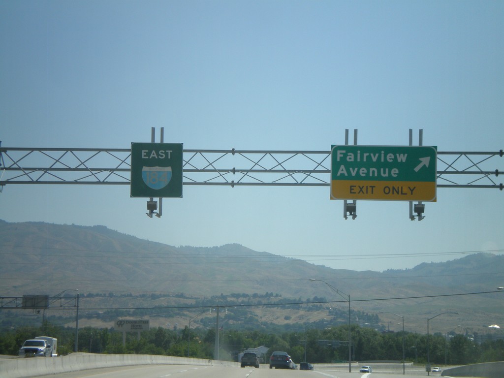
I-184 East - Exit 3
I-184 east Exit 3 - Fairview Ave. I-184 continues east. This is the last I-184 shield eastbound.
Taken 06-28-2009
Boise
Ada County
Idaho
United States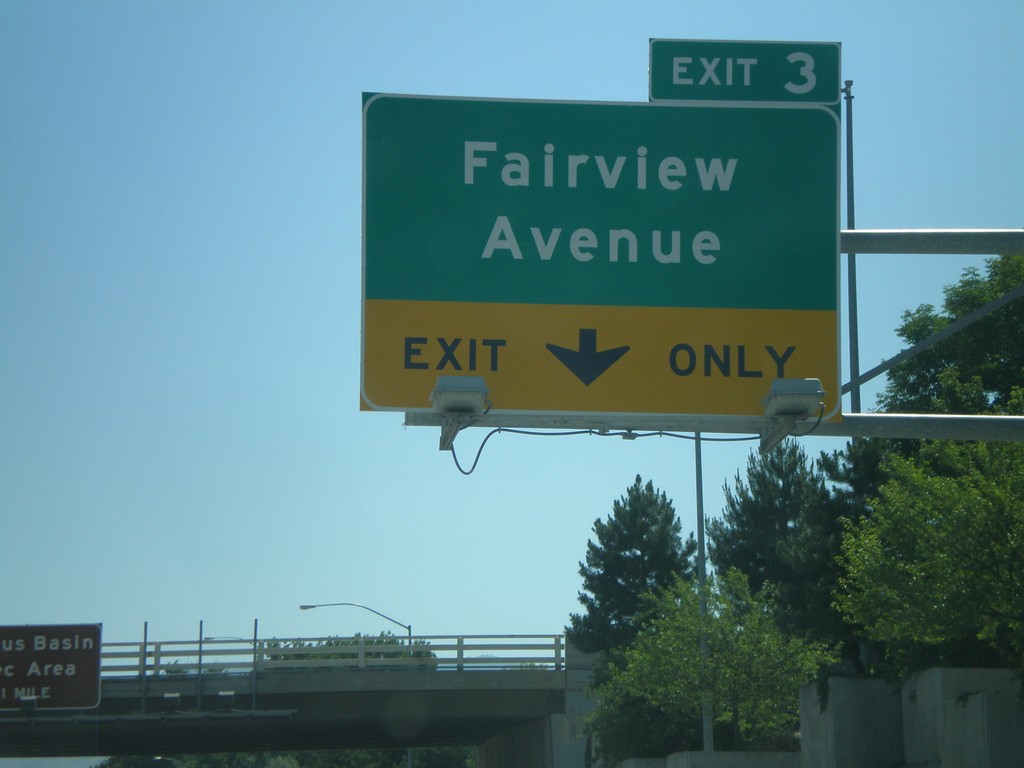
I-184 East Approaching Exit 3
I-184 east approaching Exit 3 - Fairview Ave.
Taken 06-28-2009
Boise
Ada County
Idaho
United States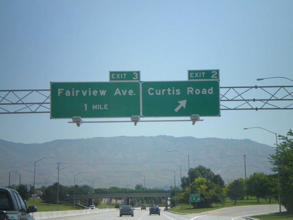
I-184 East - Exit 2. Approaching Exit 3
I-184 east at Exit 2 - Curtis Road. Approaching Exit 3 - Fairview Ave.
Taken 06-28-2009
Boise
Ada County
Idaho
United States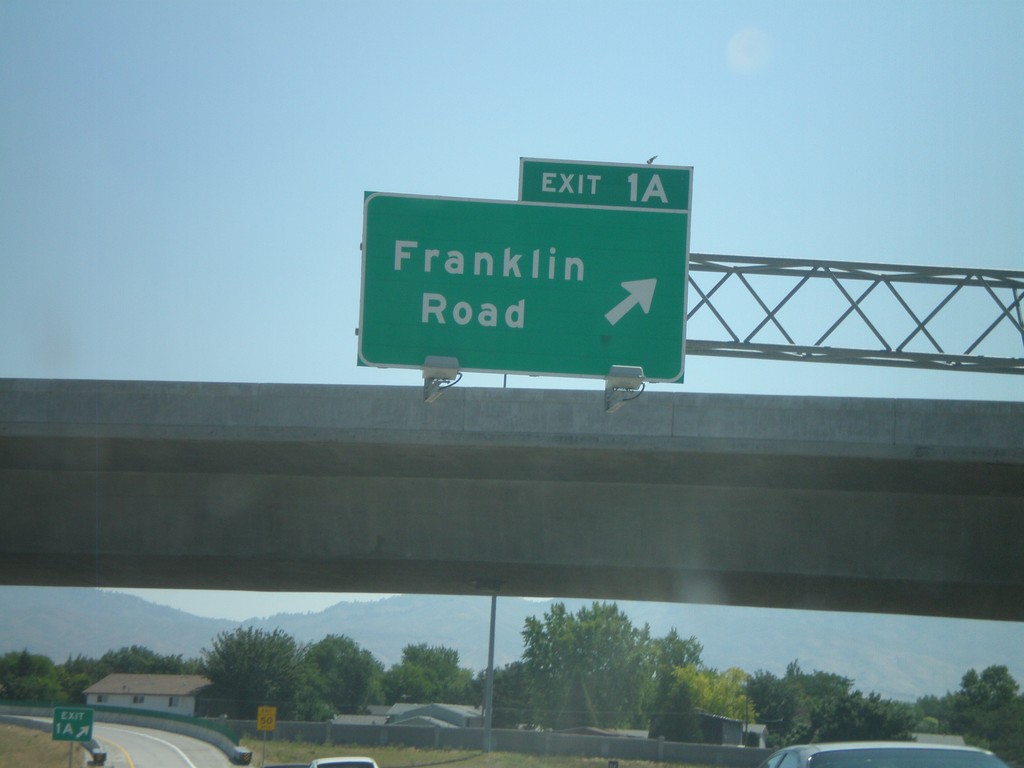
I-184 East - Exit 1A
I-184 east at Exit 1A - Franklin Road
Taken 06-28-2009
Boise
Ada County
Idaho
United States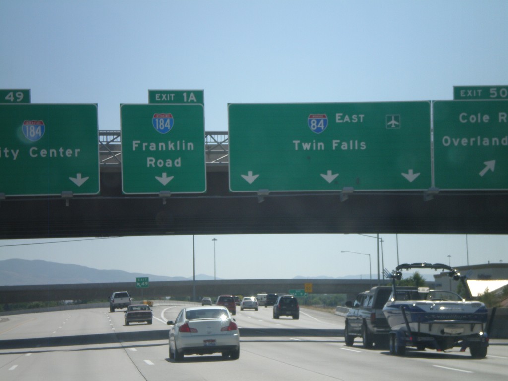
I-84 West Exits 49 and Exits 50AB and I-184 Exit 1A
I-84/US-30 east at Exit 49 and Exit 50A-B. Use left lanes for I-184/City Center. Use middle left lane for I-184 traffic using Exit 1A - Franklin Road exit. Use middle lanes to continue on I-84 east towards Twin Falls. The right lane is for Exits 50A-B - Cole Road/Overland Road.
Taken 06-28-2009
Boise
Ada County
Idaho
United States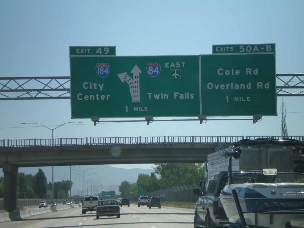
I-84 East Exits 49 and Exits 50AB
I-84 east approaching Exit 49 - I-184/City Center. Also approaching Exits 50A-B Cole Road/Overland Road. I-84 east continues towards Twin Falls and the Boise Air Terminal.
Taken 06-28-2009
Boise
Ada County
Idaho
United States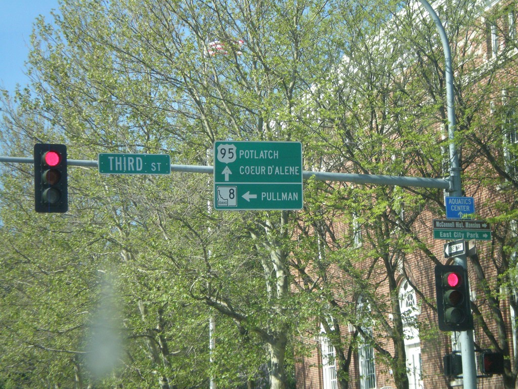
US-95 North at ID-8 West
US-95 north at ID-8 west to Pullman (Washington). US-95 continues north to Potlatch and Coeur d’Alene.
Taken 05-25-2009

 Moscow
Latah County
Idaho
United States
Moscow
Latah County
Idaho
United States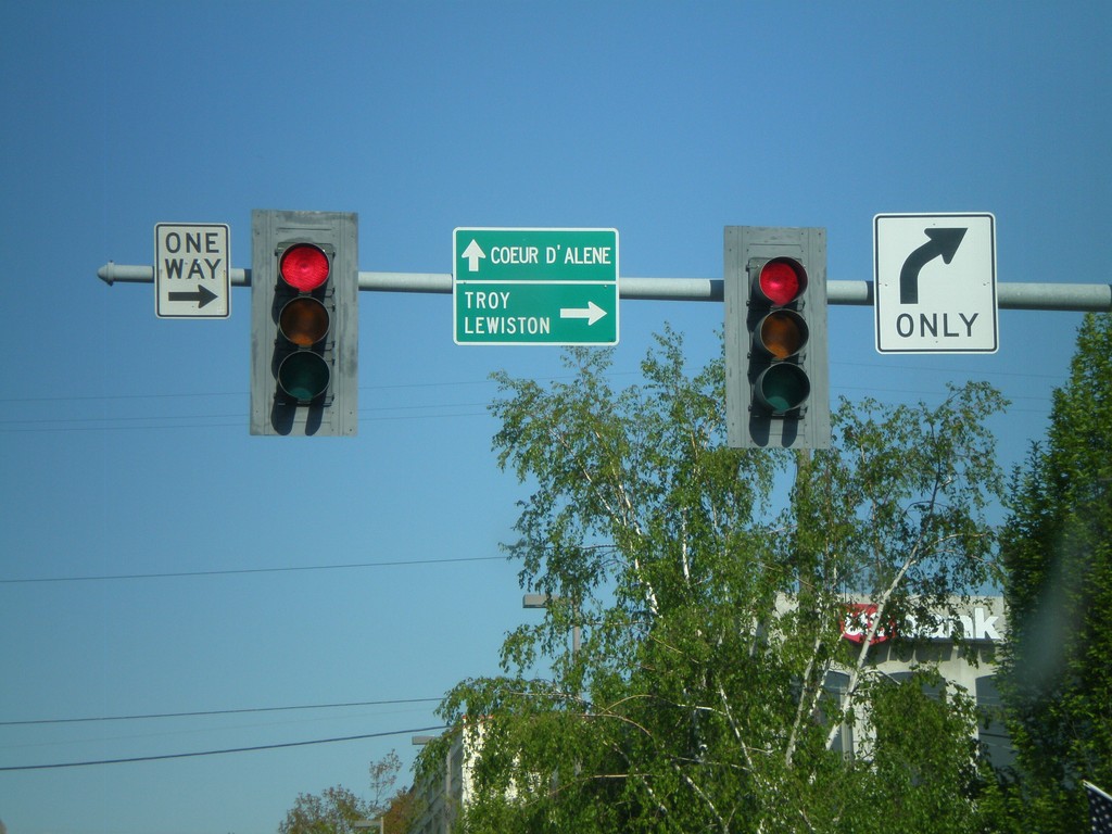
ID-8 East at US-95
ID-8 east at US-95. Follow US-95 South/ID-8 East for Troy and Lewiston. Use US-95 North for Coeur d’Alene.
Taken 05-25-2009
Moscow
Latah County
Idaho
United States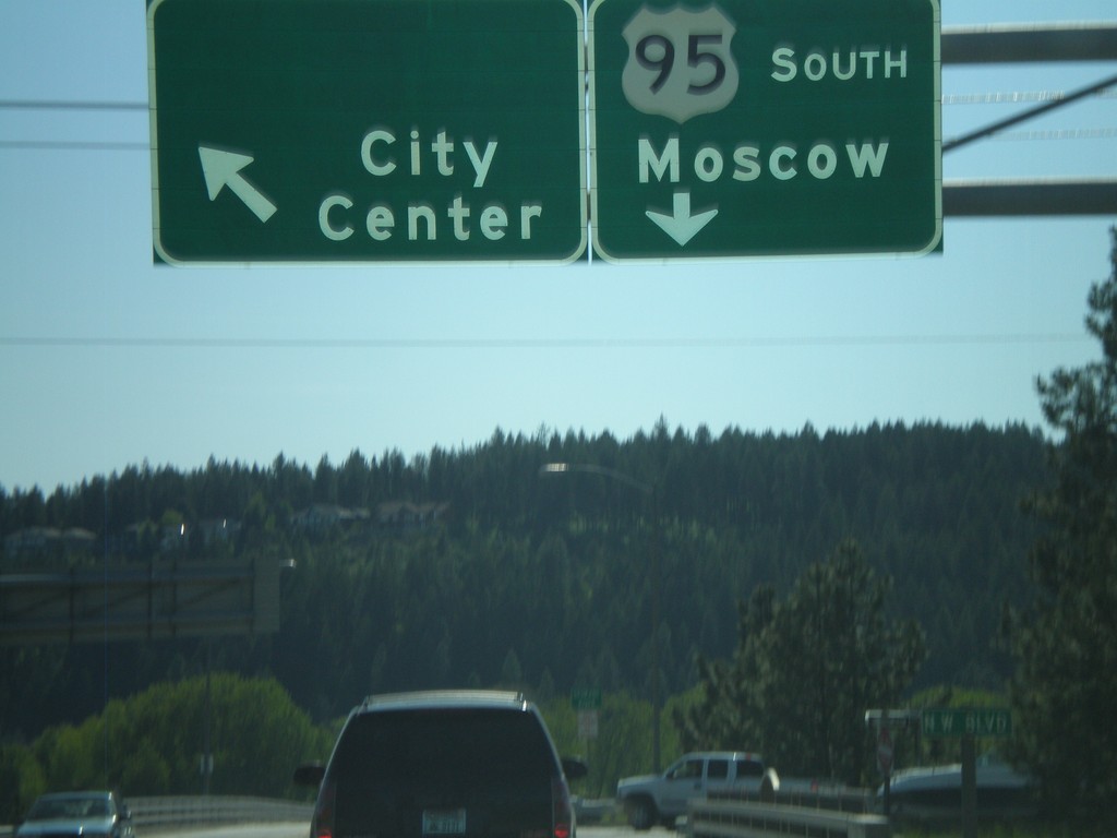
US-95 South at Northwest Blvd.
US-95 south at Northwest Blvd. to City Center. Continue south on US-95 for Moscow. Northwest Blvd. used to be BL-90.
Taken 05-22-2009
Coeur d'Alene
Kootenai County
Idaho
United States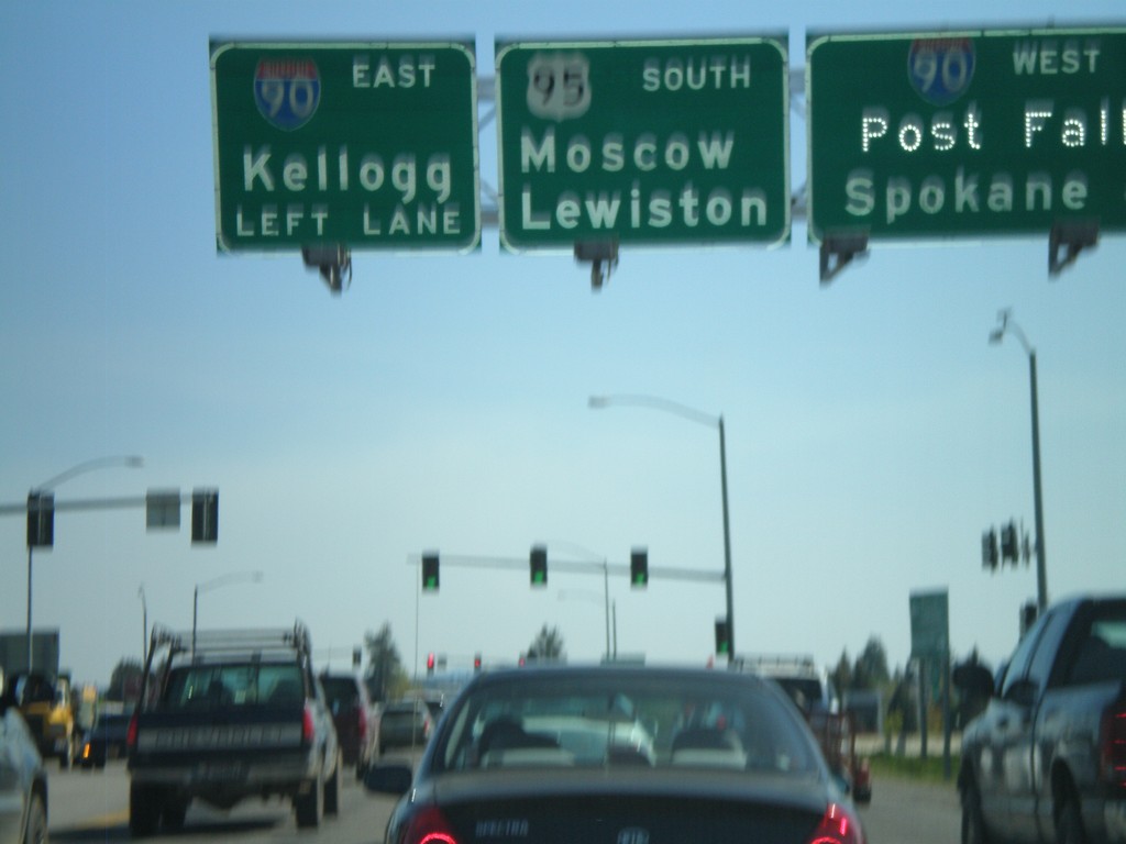
US-95 South at I-90
US-95 south at I-90 west to Post Falls and Spokane. Approaching I-90 east to Kellogg. Continue on US-95 south for Moscow and Lewiston.
Taken 05-22-2009
 Coeur d'Alene
Kootenai County
Idaho
United States
Coeur d'Alene
Kootenai County
Idaho
United States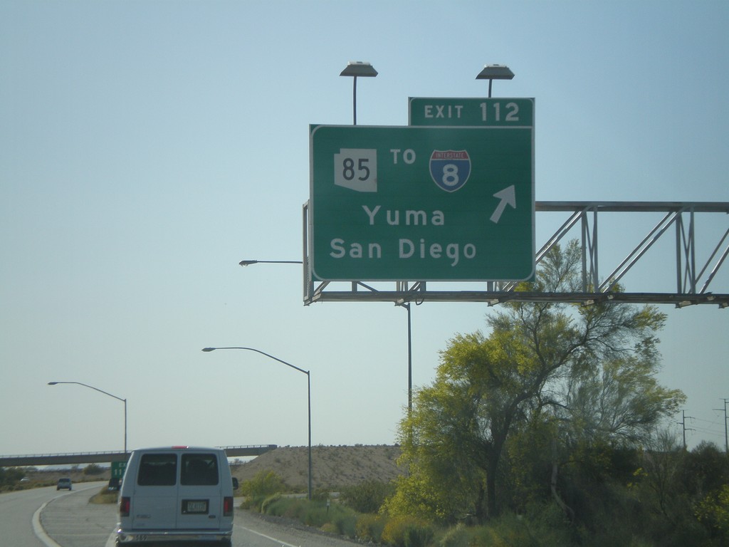
I-10 West - Exit 112
I-10 west at Exit 112 - AZ-85/To I-8/Yuma/San Diego.
Taken 03-23-2009


 Buckeye
Maricopa County
Arizona
United States
Buckeye
Maricopa County
Arizona
United States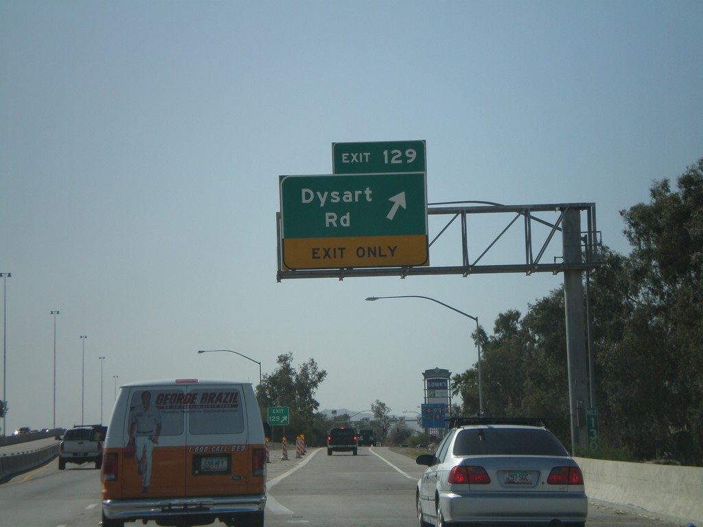
I-10 West - Exit 129
I-10 west at Exit 129 - Dysart Road
Taken 03-23-2009
Avondale
Maricopa County
Arizona
United States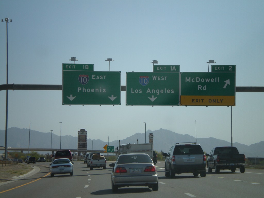
AZ-101 South - Exit 2 and Exit 1AB
AZ-101 Loop South at Exit 2 - McDowell Road. Approaching Exit 1B - I-10 East/Phoenix.
Taken 03-23-2009
 Phoenix
Maricopa County
Arizona
United States
Phoenix
Maricopa County
Arizona
United States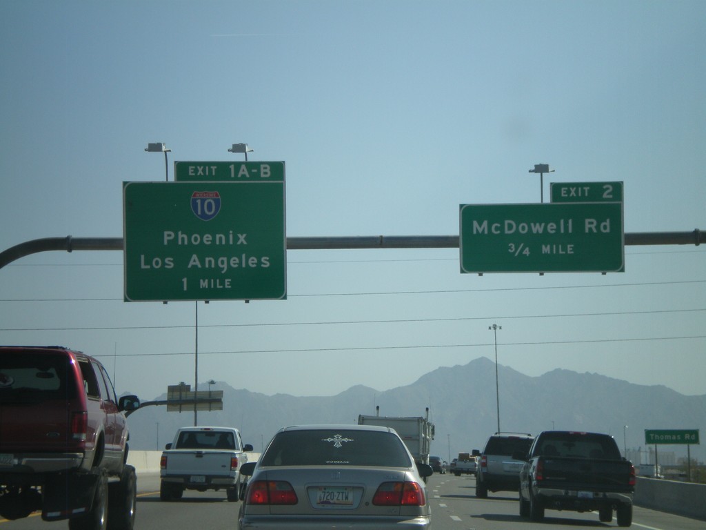
AZ-101 Loop South - Exit 2 and Exit 1AB
AZ-101 Loop South approaching Exit 2 - McDowell Road and Exit 1AB-I-10/Phoenix/Los Angeles.
Taken 03-23-2009
Phoenix
Maricopa County
Arizona
United States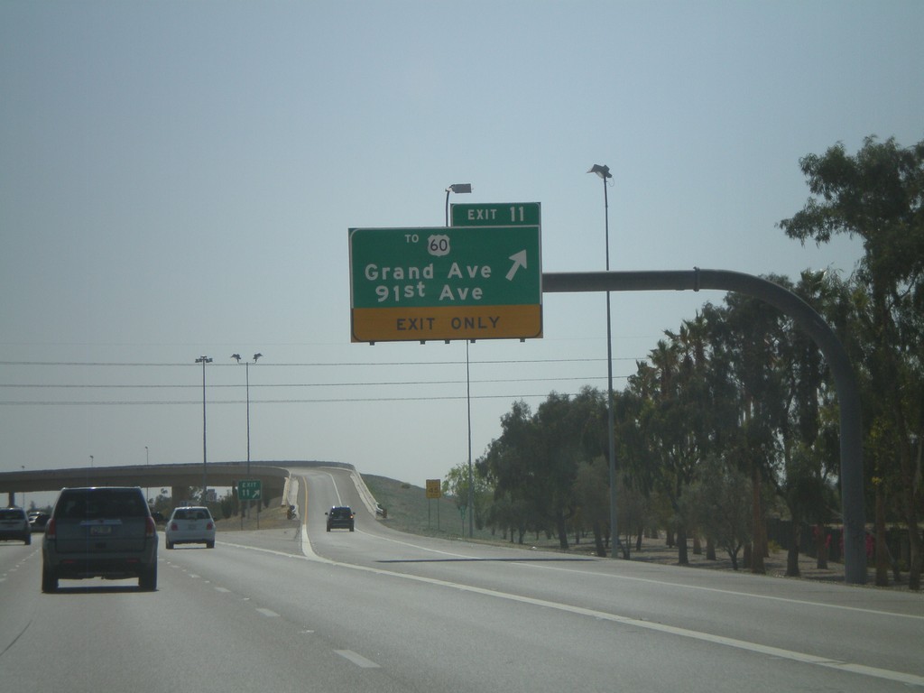
AZ-101 Loop South - Exit 11
AZ-101 Loop South at Exit 11 - To US-60/Grand Ave./91st Ave.
Taken 03-23-2009
 Peoria
Maricopa County
Arizona
United States
Peoria
Maricopa County
Arizona
United States