Signs Tagged With Pass
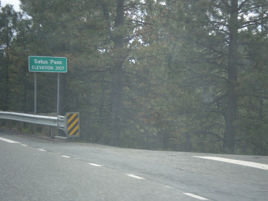
US-97 South - Satus Pass
Satus Pass - Elevation 3107 Feet on US-97 south. Satus Pass is a summit in the Simcoe Mountains.
Taken 04-30-2018
 Goldendale
Klickitat County
Washington
United States
Goldendale
Klickitat County
Washington
United States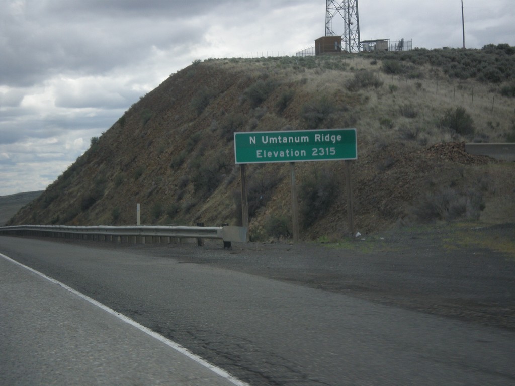
I-82 East - North Umtanum Ridge
I-82 East at North Umtanum Ridge - Elevation 2315 Feet.
Taken 04-30-2018
 Ellensburg
Kittitas County
Washington
United States
Ellensburg
Kittitas County
Washington
United States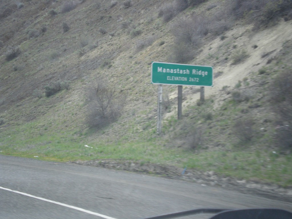
I-82 East - Manastash Ridge
I-82 East at Manastash Ridge - Elevation 2672 Feet.
Taken 04-30-2018
Ellensburg
Kittitas County
Washington
United States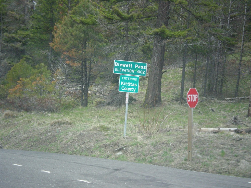
US-97 South - Blewett Pass
US-97 South at Blewett Pass - Elevation 4102 Feet. Entering Kittitas County. Blewett Pass is at the summit of the Wenatchee Mountains.
Taken 04-30-2018
Liberty
Kittitas County
Washington
United States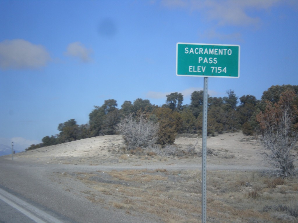
US-6/US-50 West - Sacramento Pass
Sacramento Pass on US-6/US-50 West - Elevation 7154 Feet. Sacramento Pass is a summit in the Snake Range.
Taken 02-13-2018

 Osceola
White Pine County
Nevada
United States
Osceola
White Pine County
Nevada
United States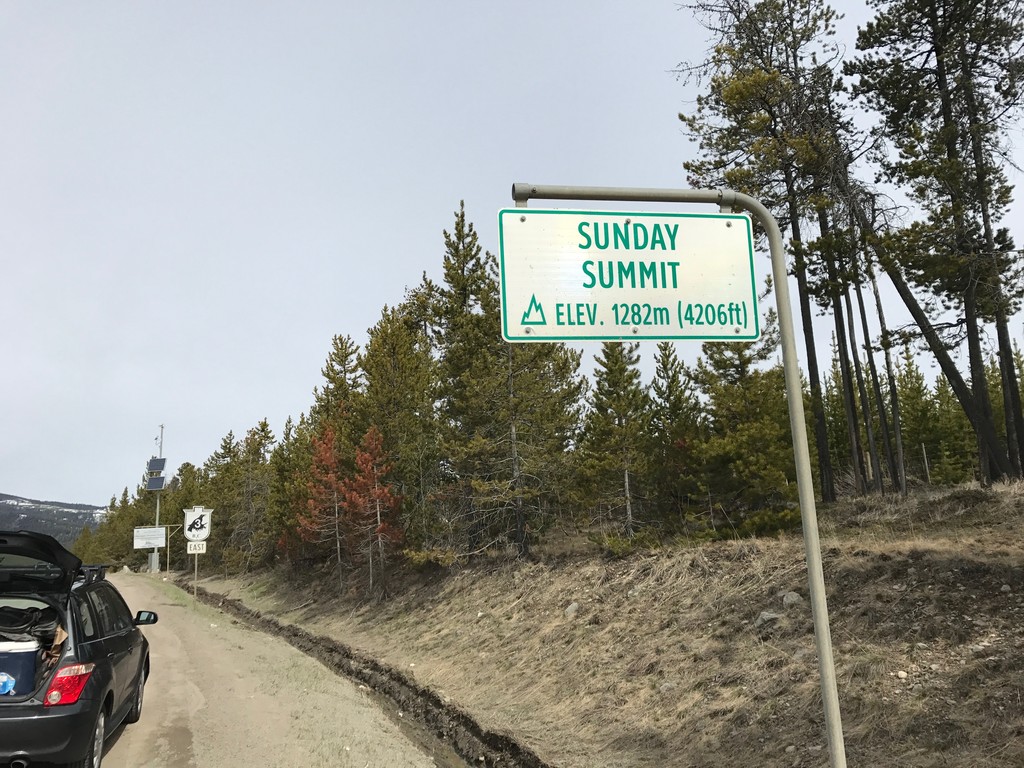
BC-3 East - Sunday Summit
Sunday Summit - Elevation 1282m on BC-3 east. Sunday Summit is a mountain pass in the Cascade Range.
Taken 04-29-2017
 Princeton
Okanagan-Similkameen
British Columbia
Canada
Princeton
Okanagan-Similkameen
British Columbia
Canada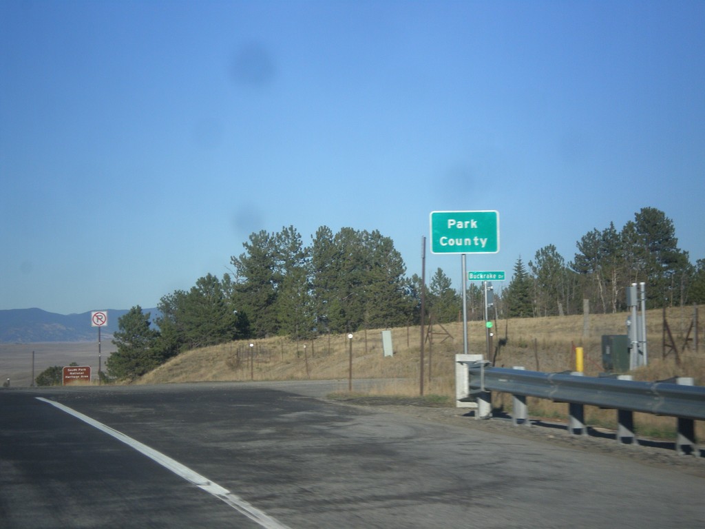
US-24 East/US-285 North - Park County
Entering Park County on US-24 East/US-285 North at Trout Creek Pass - 9,487 Feet.
Taken 10-07-2016

 Hartsel
Park County
Colorado
United States
Hartsel
Park County
Colorado
United States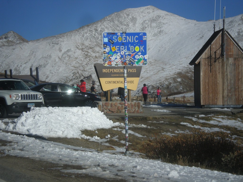
CO-82 East - Independence Pass
Independence Pass on CO-82 east. Independence Pass is 12,095 Feet and on the Continental Divide. Independence Pass is one of the highest mountain passes in Colorado on the state highway system. The only higher pass on the state highway system is US-34 in Rocky Mountain National Park. Independence Pass divides the Arkansas River watershed which flows into the Gulf of Mexico; and the Roaring Fork River which flows into the Colorado River and the Gulf of California.
Taken 10-07-2016
 Pitkin County
Colorado
United States
Pitkin County
Colorado
United States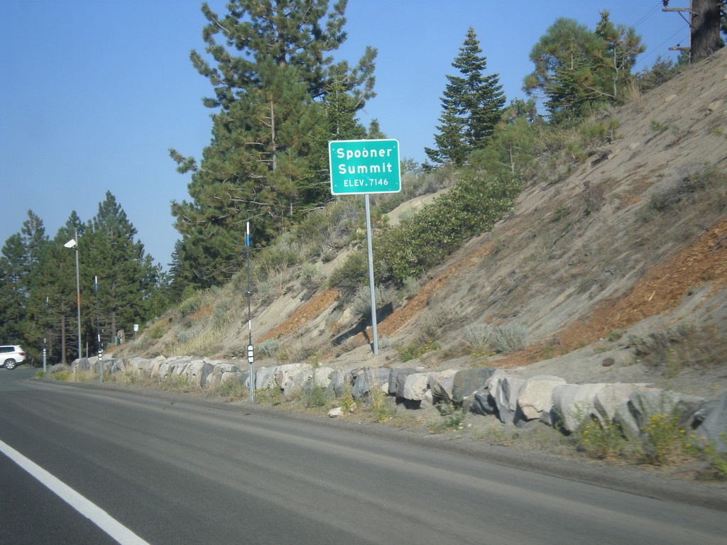
US-50 East - Spooner Summit
Spooner Summit on US-50 east - Elevation 7146 Feet. Spooner Summit is a pass through the Carson Range.
Taken 08-15-2016
Carson City
Douglas County
Nevada
United States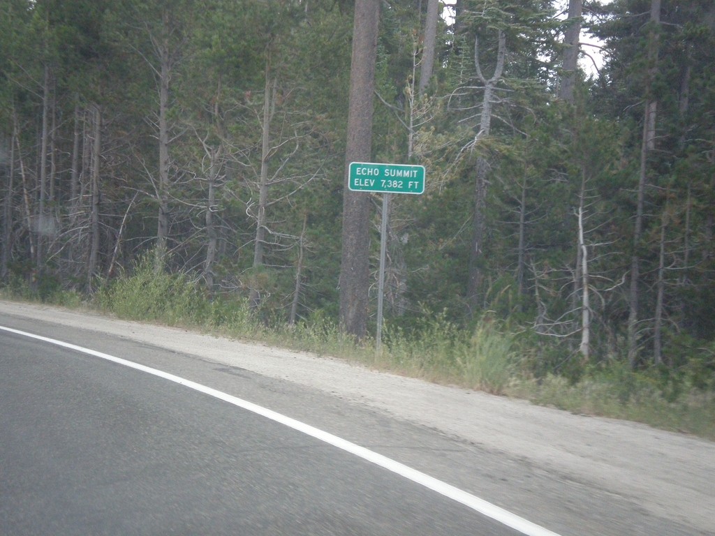
US-50 East - Echo Summit
US-50 each at Echo Summit -Elevation 7382 Feet. This is the summit of the Sierra Nevada on US-50 and the divide between the American River drainage and Lake Tahoe, which drains to the Truckee River.
Taken 08-15-2016
Nebelhorn
El Dorado County
California
United States