Signs Tagged With Red Rock Pass
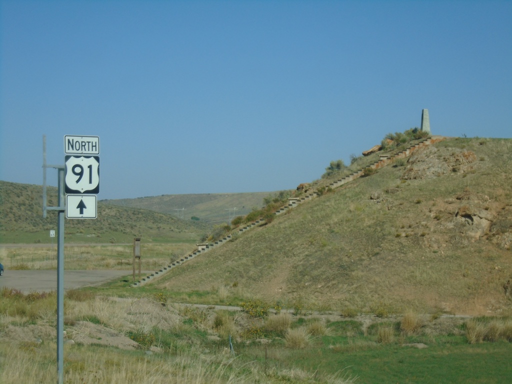
US-91 North at Oxford Highway
US-91 North at Oxford Highway in Bannock County. The intersection is located at Red Rock Pass which was the site of an ancient dam on prehistoric Lake Bonneville. The erosion of this dam created the catastrophic Bonneville Floods which affected much of the Snake River plain of Idaho.
Taken 09-25-2021
 Downey
Bannock County
Idaho
United States
Downey
Bannock County
Idaho
United States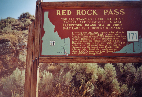
US-91 - Red Rock Pass Historical Marker
Historical Marker on Red Rock Pass, US-91 South. All highways in Idaho have these historical markers. To see all of them check out the Idaho State Historical Marker Guide. Red Rock Pass is where ancient Lake Bonneville - an inland sea, which covered most of the great basin, overflowed into the Snake Plain. Evidence of this great flood is everywhere along the Snake and Columbia Rivers in the Pacific Northwest. This pass marks the divide between the Great Basin and the Snake/Columbia River drainages.
Taken 08-01-2000
Red Rock Junction
Bannock County
Idaho
United States