Signs Tagged With Rest Area
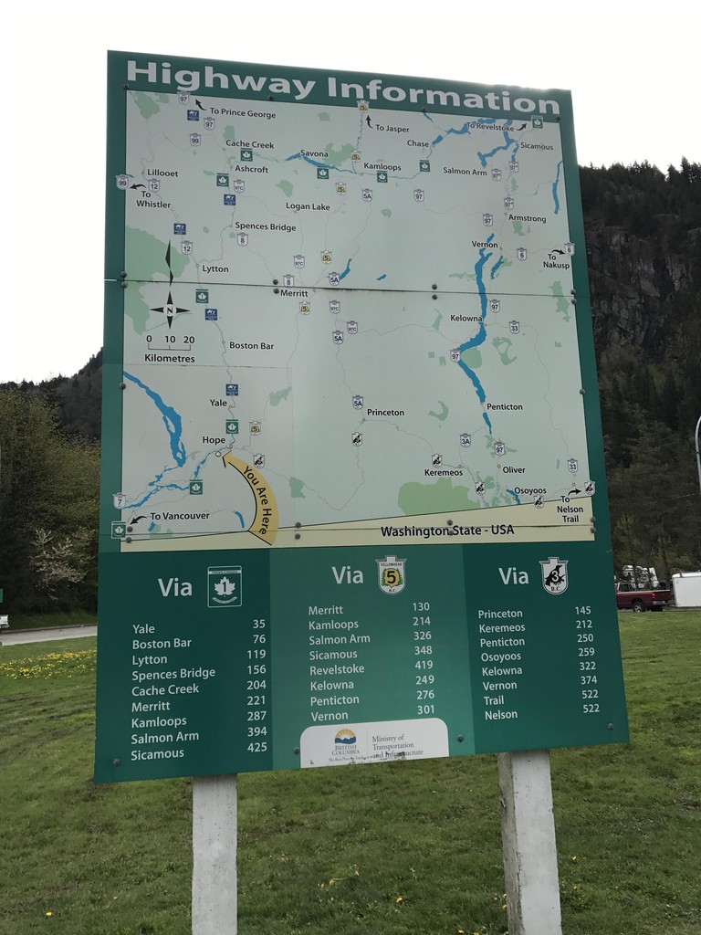
Hunter Creek Rest Area - Highway Information
Route map for the adjacent area of British Columbia, and distances to major destinations. Three routes split off into the interior of British Columbia at Hope just east of here: BC-5 to Coquihalla Pass, TC-1 through the Frasier River Canyon, and BC-3 over Allison Pass.
Taken 04-29-2017


 Hope
Fraser Valley
British Columbia
Canada
Hope
Fraser Valley
British Columbia
Canada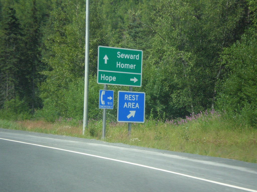
AK-1 South - Hope Jct.
AK-1 South at Hope Jct. Hope is 17 miles north of this junction. Continue south on AK-1 for Seward (via AK-9) and Homer (via AK-1 / Sterling Highway).
Taken 07-16-2016
 Sunrise
Kenai Peninsula Borough
Alaska
United States
Sunrise
Kenai Peninsula Borough
Alaska
United States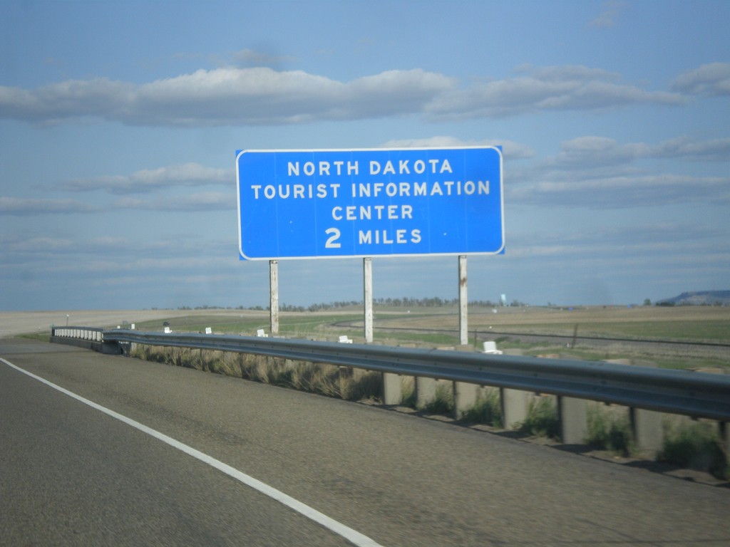
I-94 East - North Dakota Tourist Information Center
I-94 East - North Dakota Tourist Information Center. This sign is located within the state of Montana, about 0.25 miles from the state line.
Taken 05-14-2016
 Yates
Wibaux County
Montana
United States
Yates
Wibaux County
Montana
United States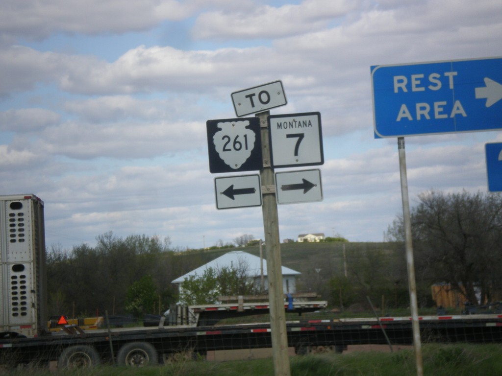
I-94 East - Exit 241 Offramp at MTS-261
I-94 East - Exit 241 offramp at MTS-261. Turn right for MTS-261 south, to MT-7, and the Wibaux Rest Area. Turn left for MTS-261 North. There is no destination city for MTS-261 north, although it parallels the Montana - North Dakota border north to near Sidney.
Taken 05-14-2016

 Wibaux
 County
Montana
United States
Wibaux
Wibaux County
Montana
United States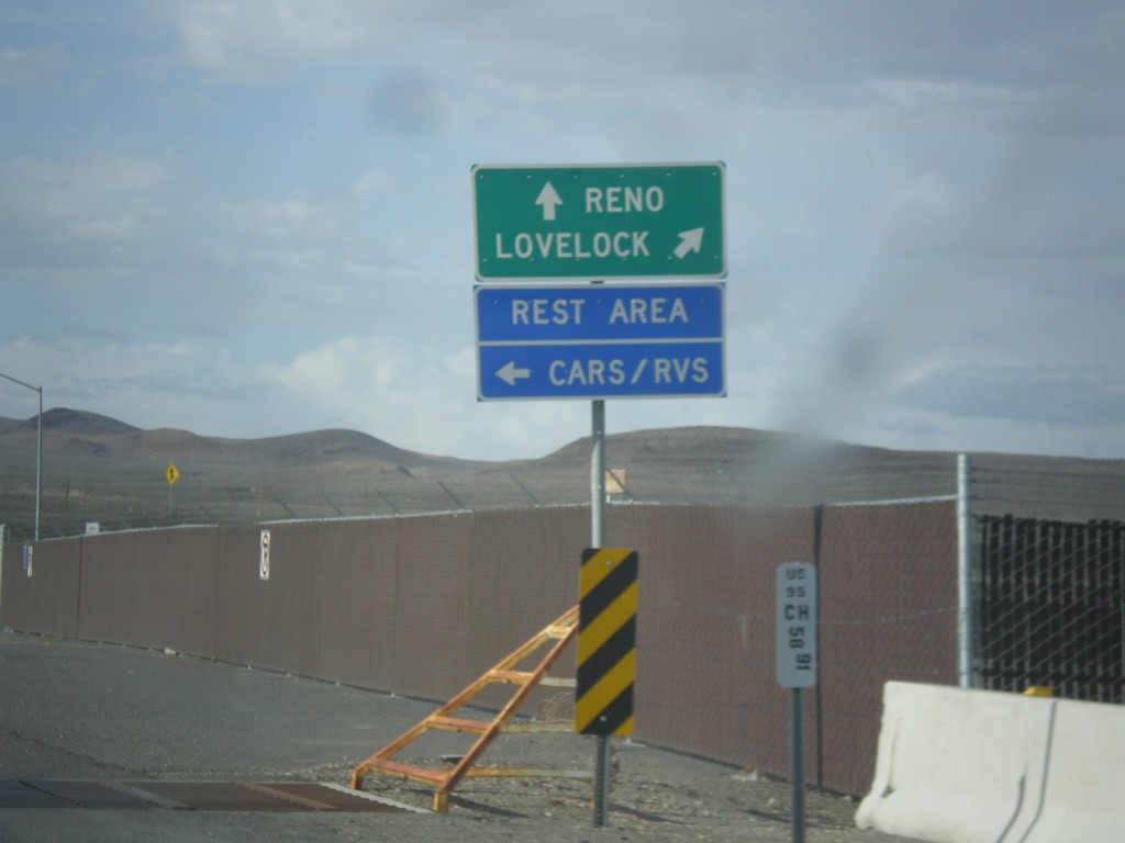
US-95 North Approaching I-80
US-95 north approaching I-80. Use I-80 East/US-95 North to Lovelock; use I-80 West/Alt. US-95 South to Reno. Turn left to enter the Rest Area. Notice the post mile marker at the base of the sign.
Taken 05-05-2014


 Churchill County
Nevada
United States
Churchill County
Nevada
United States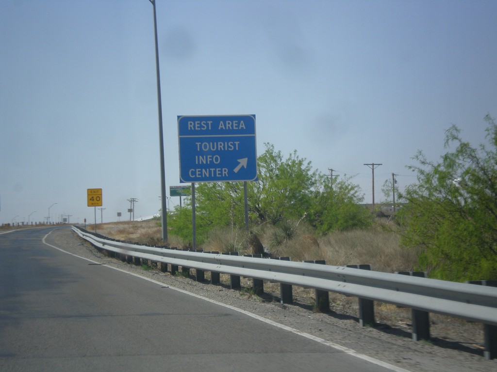
I-10 East - Rest Area and Welcome Center
I-10 east at Rest Area/Tourist Welcome Center just east of the New Mexico/Texas State Line.
Taken 04-15-2013
 Anthony
El Paso County
Texas
United States
Anthony
El Paso County
Texas
United States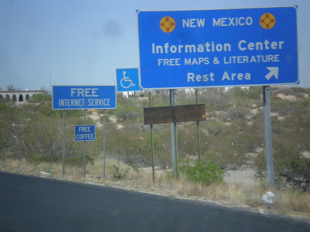
I-10 West - Welcome Center/Rest Area
I-10 west - New Mexico Information Center/Rest Area.
Taken 04-14-2013
Anthony
Doña Ana County
New Mexico
United States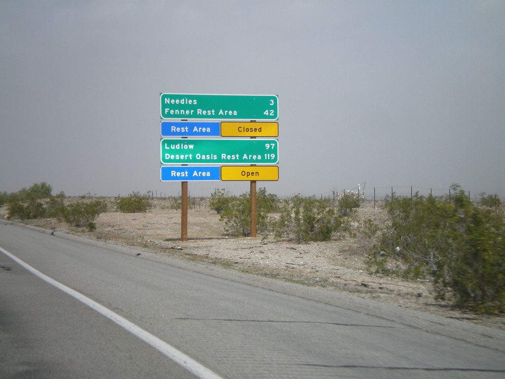
I-40 West - Mojave Desert Services
Services in the Mojave Desert along I-40 west between here and Newberry Springs. Both Needles and Ludlow have services. Also, distance to the next Rest Areas and their status.
Taken 02-25-2011
 Needles
San Bernardino County
California
United States
Needles
San Bernardino County
California
United States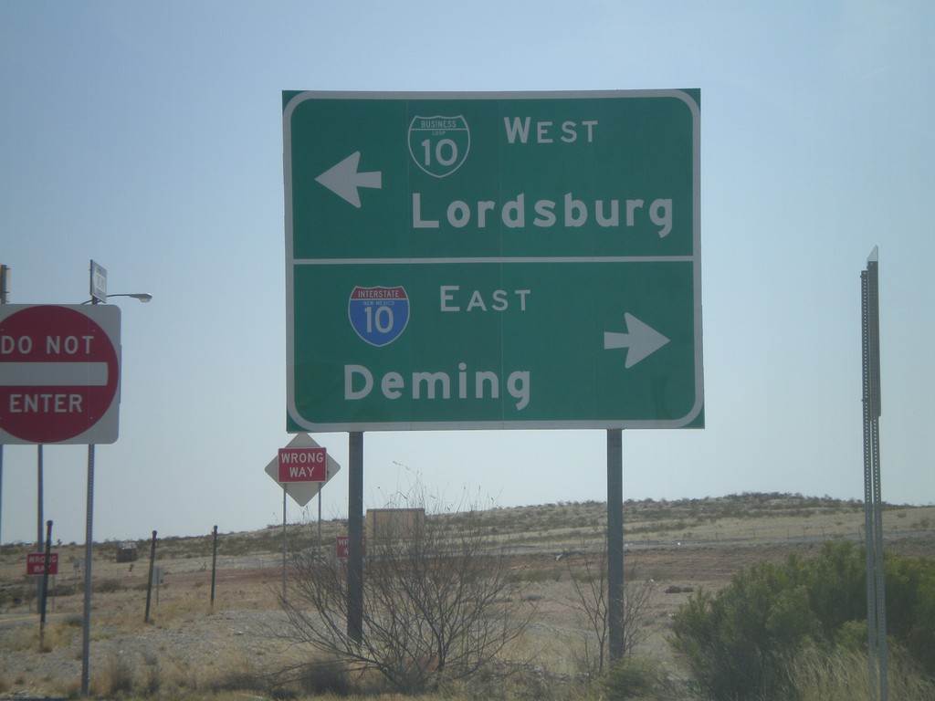
Rest Area Access Road at BL-10
New Mexico Rest Area access road at BL-10. Turn right for I-10 East to Deming. Turn left for BL-10 east into Lordsburg.
Taken 03-21-2010
 Lordsburg
Hidalgo County
New Mexico
United States
Lordsburg
Hidalgo County
New Mexico
United States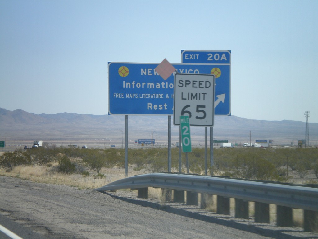
I-10 East - Exit 20A
I-10 west at Exit 20A - New Mexico Information Center/Rest Area. Speed limit drops from 75 MPH to 65 MPH as I-10 enters Lordsburg.
Taken 03-21-2010
Lordsburg
Hidalgo County
New Mexico
United States