Signs Tagged With Scenic Byway
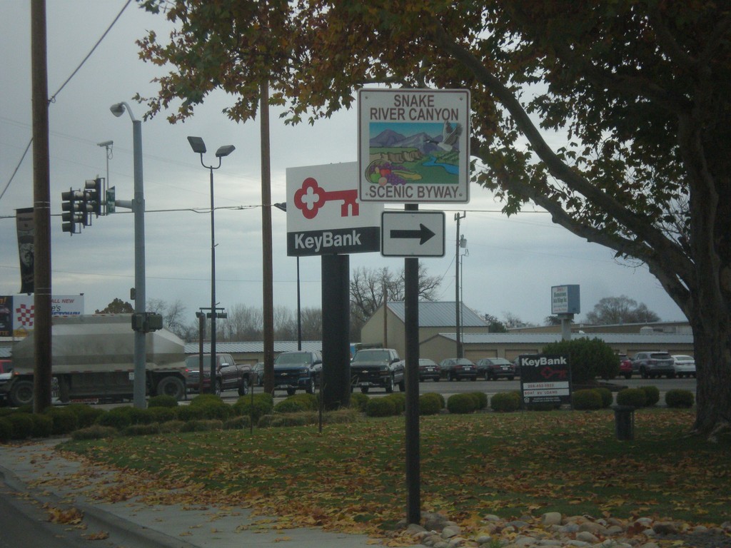
US-30 East Approaching US-95 - Snake River Canyon Scenic Byway
US-30 East approaching US-95. Turn right to continue on the Snake River Canyon Scenic Byway.
Taken 11-19-2016

 Fruitland
Payette County
Idaho
United States
Fruitland
Payette County
Idaho
United States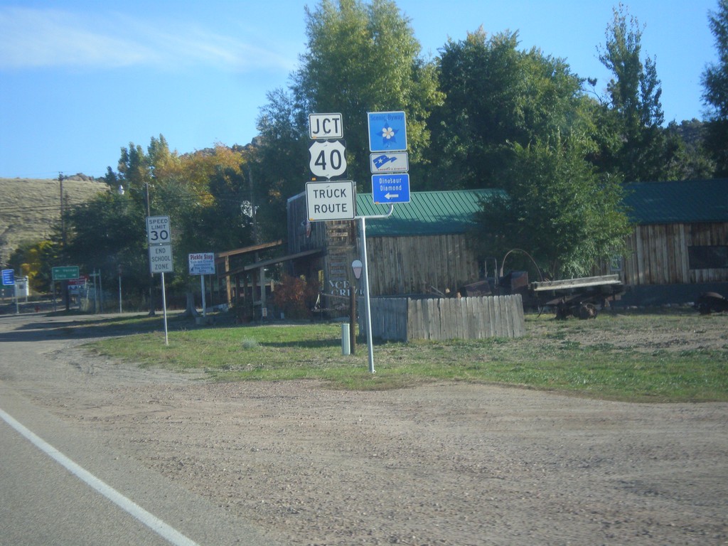
Jct. US-40 on CO-64 North
Jct. US-40 at western end of CO-64 in Dinosaur. Turn left for the Dinosaur Diamond Scenic Byway.
Taken 10-09-2016

 Dinosaur
Moffat County
Colorado
United States
Dinosaur
Moffat County
Colorado
United States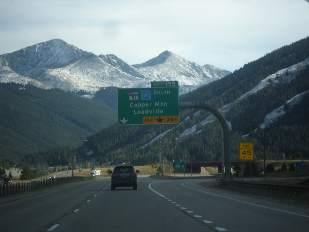
I-70 West - Exit 195
I-70 west at Exit 195 - CO-91 South/Cooper Mountain/Leadville.
Taken 10-08-2016


 Frisco
Summit County
Colorado
United States
Frisco
Summit County
Colorado
United States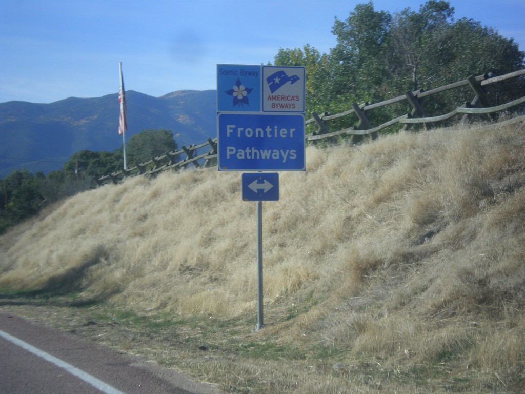
CO-67 South at CO-96 - Frontier Pathways
CO-67 South at CO-96. CO-96 is designated as the Frontier Pathways Scenic Byway.
Taken 10-08-2016

 Silver Cliff
Custer County
Colorado
United States
Silver Cliff
Custer County
Colorado
United States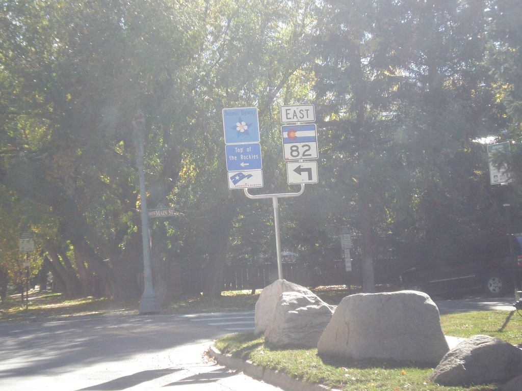
CO-82 East - Aspen
CO-82 east (Original St.) at East Cooper Ave. in Aspen. Turn left on Cooper Ave. to continue east on CO-82 and for the Top of the Rockies Scenic Byway.
Taken 10-07-2016
 Aspen
Pitkin County
Colorado
United States
Aspen
Pitkin County
Colorado
United States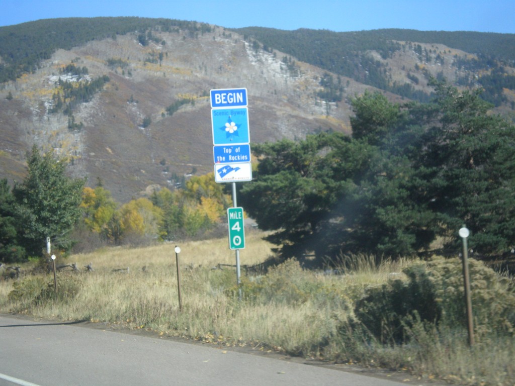
CO-82 East - Top of the Rockies Scenic Byway
Begin Top of the Rockies Scenic Byway on CO-82 East.
Taken 10-07-2016
Aspen
Pitkin County
Colorado
United States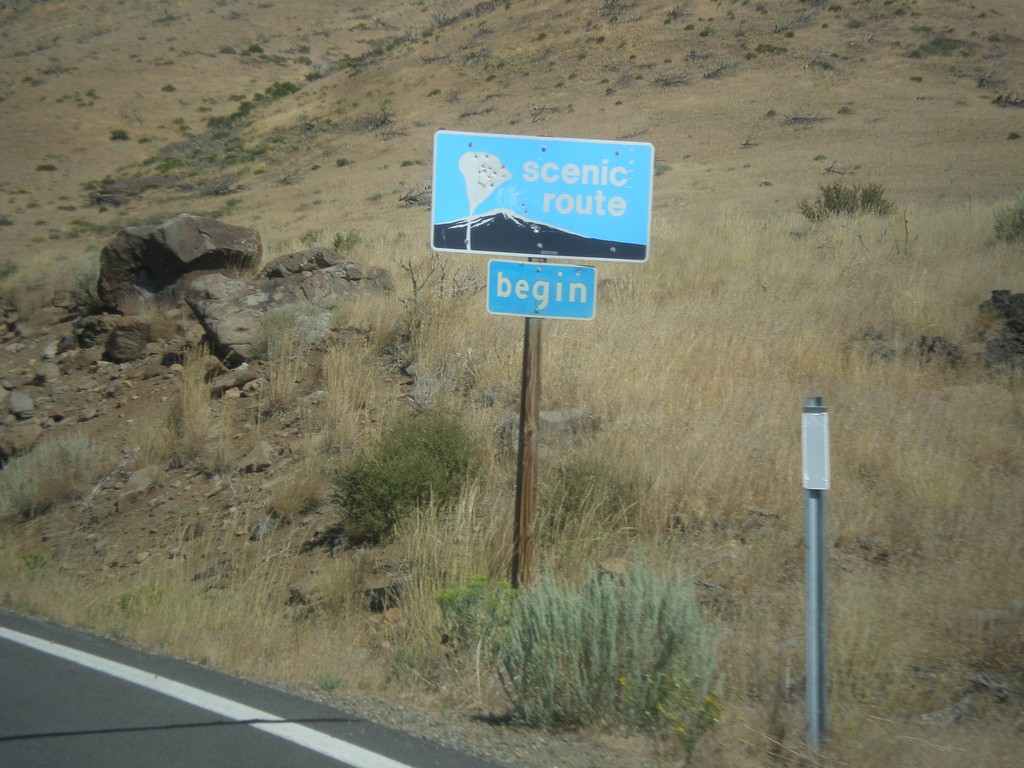
CA-89 North - Begin Scenic Route
Begin Scenic Route on CA-89 north.
Taken 08-12-2016
 Coleville
Mono County
California
United States
Coleville
Mono County
California
United States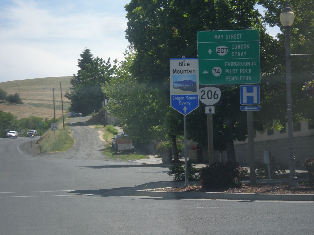
OR-74 East/OR-207 South at OR-206
OR-74 East/OR-207 South at OR-206 in Heppner. Turn left to continue east on OR-74 to Fairgrounds, Pilot Rock, and Pendleton. Continue straight for OR-206/OR-207 South to Condon and Spray. Use OR-206/OR-207 for the Blue Mountain Scenic Byway.
Taken 06-05-2016


 Heppner
Morrow County
Oregon
United States
Heppner
Morrow County
Oregon
United States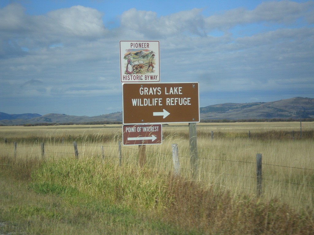
ID-34 South - Grays Lake Road Jct.
ID-34 South at Grays Lake Road Jct. Turn right for Grays Lake National Wildlife Refuge.
Taken 10-04-2015
 Wayan
Caribou County
Idaho
United States
Wayan
Caribou County
Idaho
United States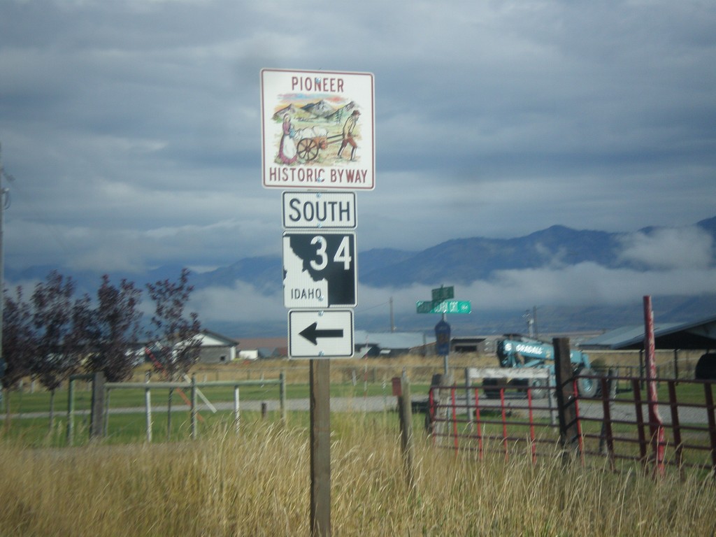
Stateline Road North at ID-34
Stateline Road north at ID-34 south. ID-34 is part of the Pioneer Historic Byway.
Taken 10-04-2015
Freedom
Lincoln County
Wyoming
United States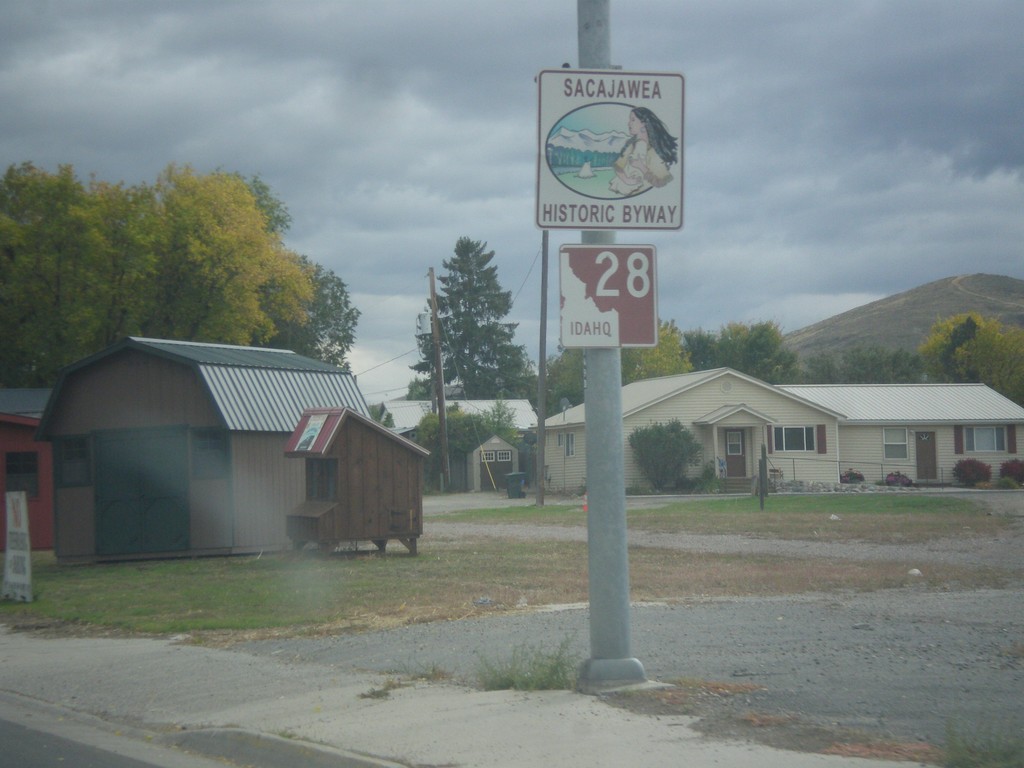
ID-28 South - Sacajawea Historic Byway
Sacajawea Historic Byway on ID-28 South in Salmon.
Taken 10-03-2015
 Salmon
Lemhi County
Idaho
United States
Salmon
Lemhi County
Idaho
United States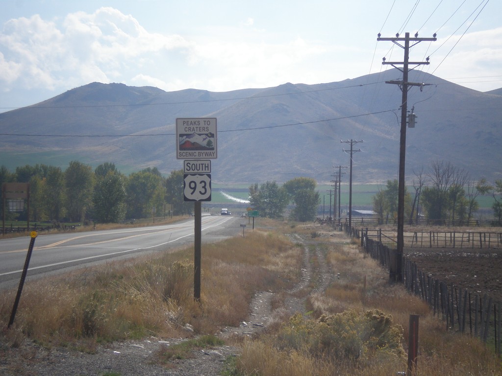
US-93 South - Peaks To Craters Scenic Byway
US-93 South - Peaks To Craters Scenic Byway in Custer County.
Taken 10-03-2015
 Challis
Custer County
Idaho
United States
Challis
Custer County
Idaho
United States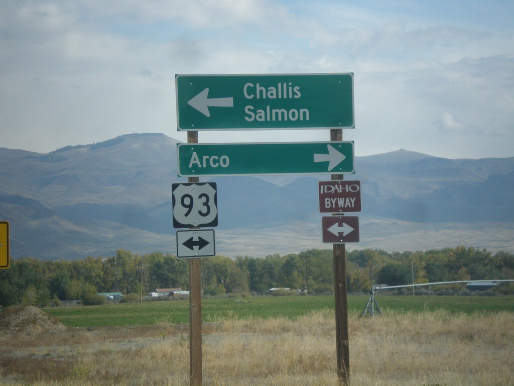
End ID-75 North at US-93
End ID-75 at US-93. Turn left for US-93 north to Challis and Salmon. Turn right for US-93 south to Arco. US-93 north is part of the Salmon River Scenic Byway; US-93 south is part of the Peaks to Craters Scenic Byway.
Taken 10-03-2015
 Challis
Custer County
Idaho
United States
Challis
Custer County
Idaho
United States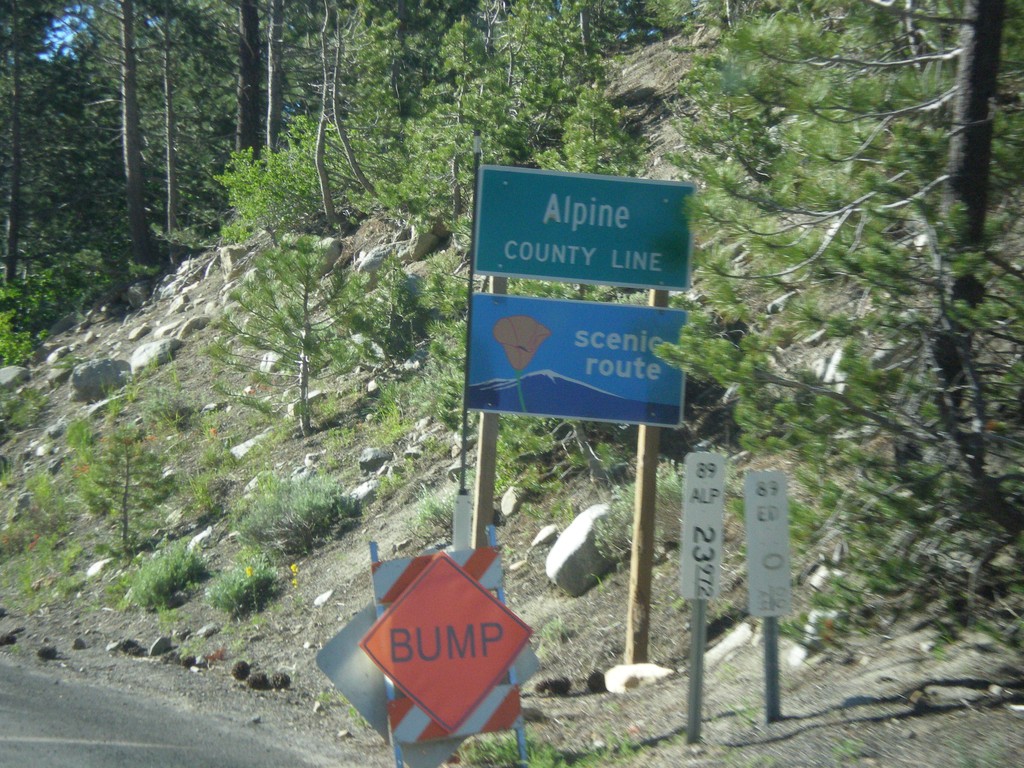
CA-89 South - Alpine County
Alpine County Line on CA-89 south. Alpine County is the smallest county in California by population. CA-89 is posted as a scenic route.
Taken 06-15-2015
Markleeville
Alpine County
California
United States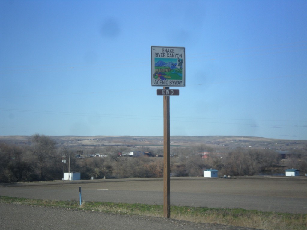
US-20/US-26 West - End Snake River Canyon Scenic Byway
End Snake River Canyon Scenic Byway on US-20/US-26 West, approaching the Oregon state line. This is the only End sign I have seen for a Scenic Byway in Idaho.
Taken 12-14-2014

 Parma
Canyon County
Idaho
United States
Parma
Canyon County
Idaho
United States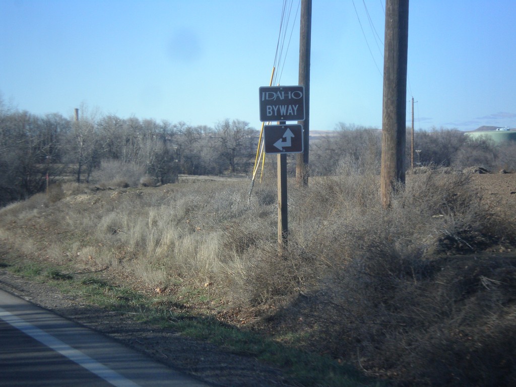
US-20/US-26 West - Apple Valley Road
US-20/US-26 west at Apple Valley Road. The Snake River Canyon Scenic Byway joins US-20/US-26 westbound here.
Taken 12-14-2014
Parma
Canyon County
Idaho
United States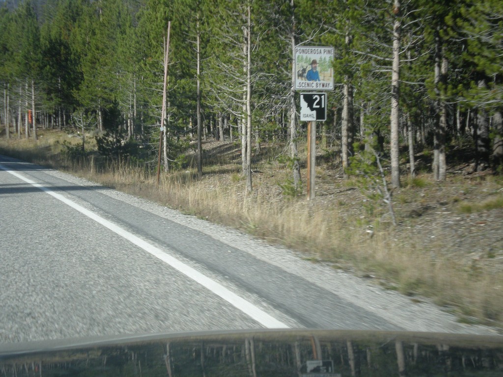
ID-21 North - Ponderosa Pine Scenic Byway
ID-21 North - Ponderosa Pine Scenic Byway. The Ponderosa Pine Scenic Byway runs along ID-21 between Boise and Stanley.
Taken 10-05-2014
 Stanley
Custer County
Idaho
United States
Stanley
Custer County
Idaho
United States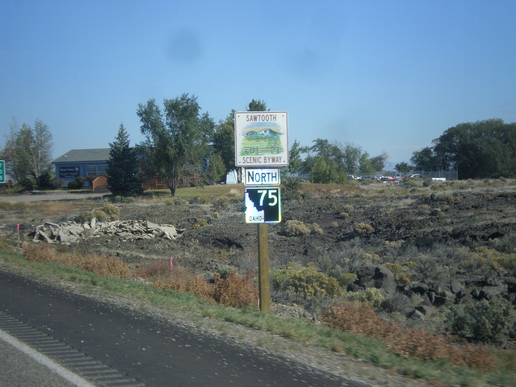
ID-75 North - Sawtooth Scenic Byway
ID-75 North - Sawtooth Scenic Byway. The Sawtooth Scenic Byway runs between Shoshone and Stanley along ID-75.
Taken 10-04-2014
Shoshone
Lincoln County
Idaho
United States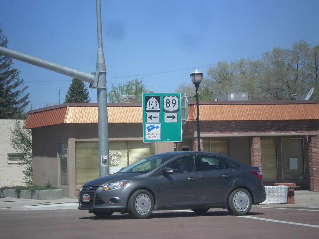
US-89 North at UT-143
US-89 north at UT-143 in Panguitch. Turn left for UT-143 south; right for US-89 north.
Taken 05-21-2014

 Panguitch
Garfield County
Utah
United States
Panguitch
Garfield County
Utah
United States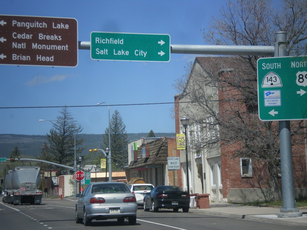
US-89 North at UT-143
US-89 north at UT-143 south. Turn left for UT-143 south to Cedar Breaks National Monument, Brian Head, and Panguitch Lake. Turn right to continue north on US-89 to Richfield and Salt Lake City. UT-143 is part of the Utah’s Patchwork Parkway National Scenic Byway.
Taken 05-21-2014
Panguitch
Garfield County
Utah
United States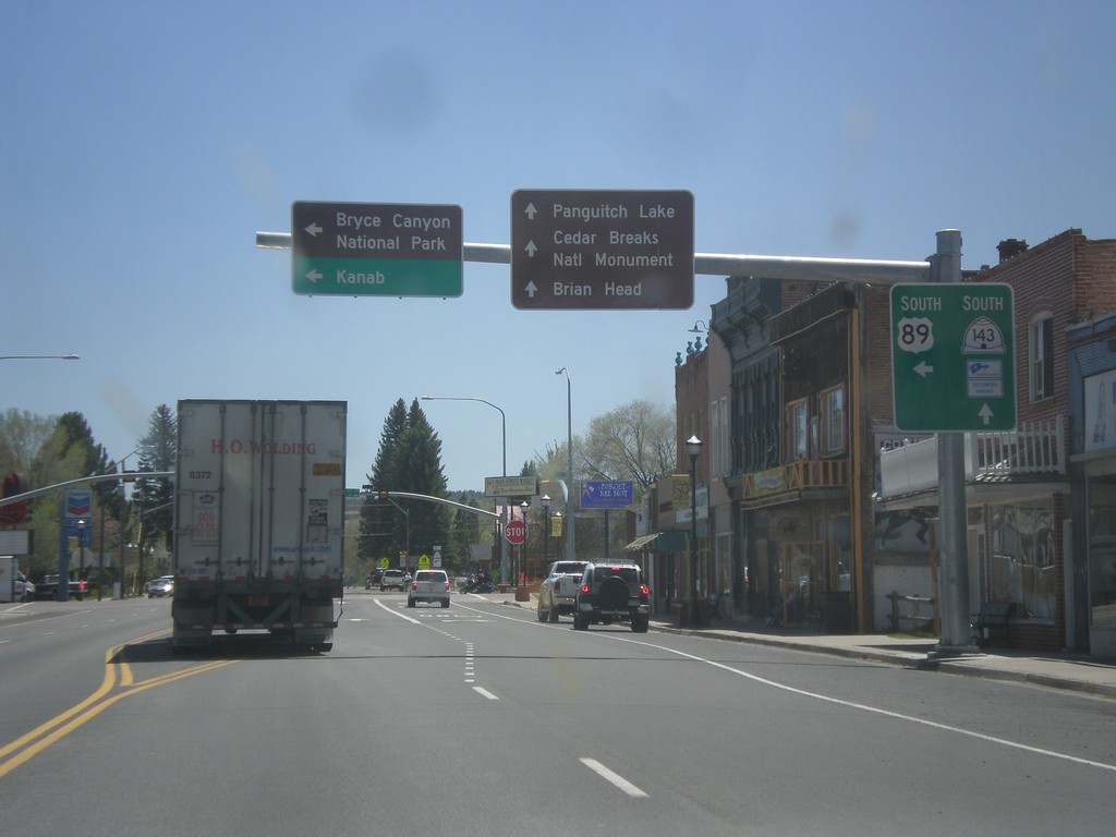
US-89 South at UT-143
US-89 south at UT-143 in Panguitch. Use UT-143 south for Cedar Breaks National Monument, Panguitch Lake, and Brian Head. Turn left to continue south on US-89 towards Bryce Canyon National Park and Kanab. UT-143 is part of Utah’s Patchwork Parkway National Scenic Byway.
Taken 05-19-2014
Panguitch
Garfield County
Utah
United States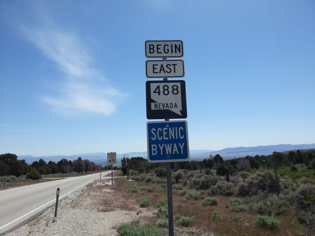
Begin NV-488 East
Begin NV-488 east at the Great Basin National Park Boundary. NV-488 is part of the Nevada Scenic Byway system.
Taken 05-19-2014
 Baker
White Pine County
Nevada
United States
Baker
White Pine County
Nevada
United States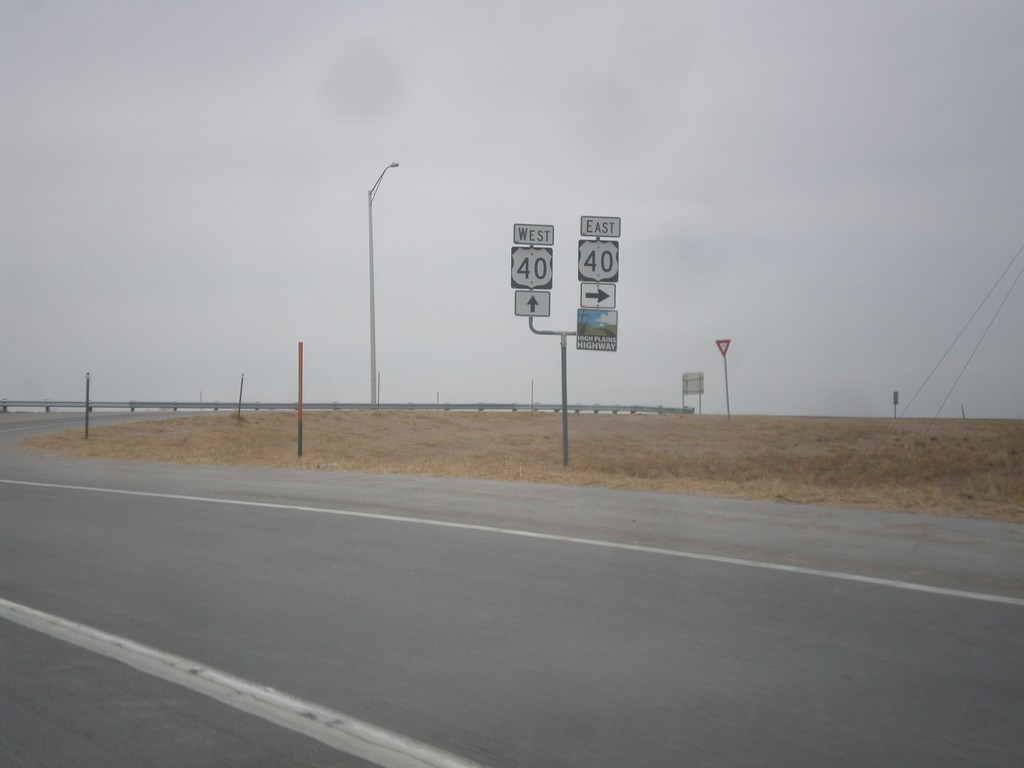
US-287 North at US-40
US-287 north at US-40. US-40 joins US-287 north to Limon. Then both highways merge onto I-70 towards Denver. This is the southern end of the High Plains Highway which connects Kit Carson and Julesburg via US-40 and US-385.
Taken 03-30-2014
 Kit Carson
Cheyenne County
Colorado
United States
Kit Carson
Cheyenne County
Colorado
United States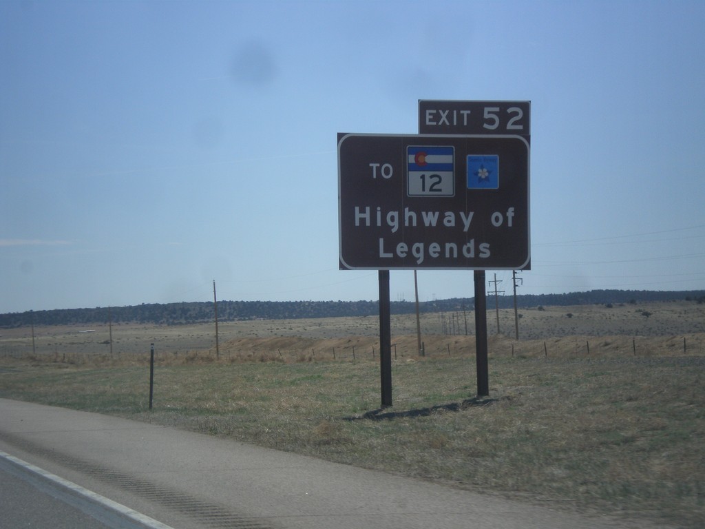
I-25 South Approaching Exit 52
I-25 south approaching Exit 52. Use Exit 52 for CO-12, the Highway of Legends Scenic Byway.
Taken 03-29-2014


 Walsenburg
Huerfano County
Colorado
United States
Walsenburg
Huerfano County
Colorado
United States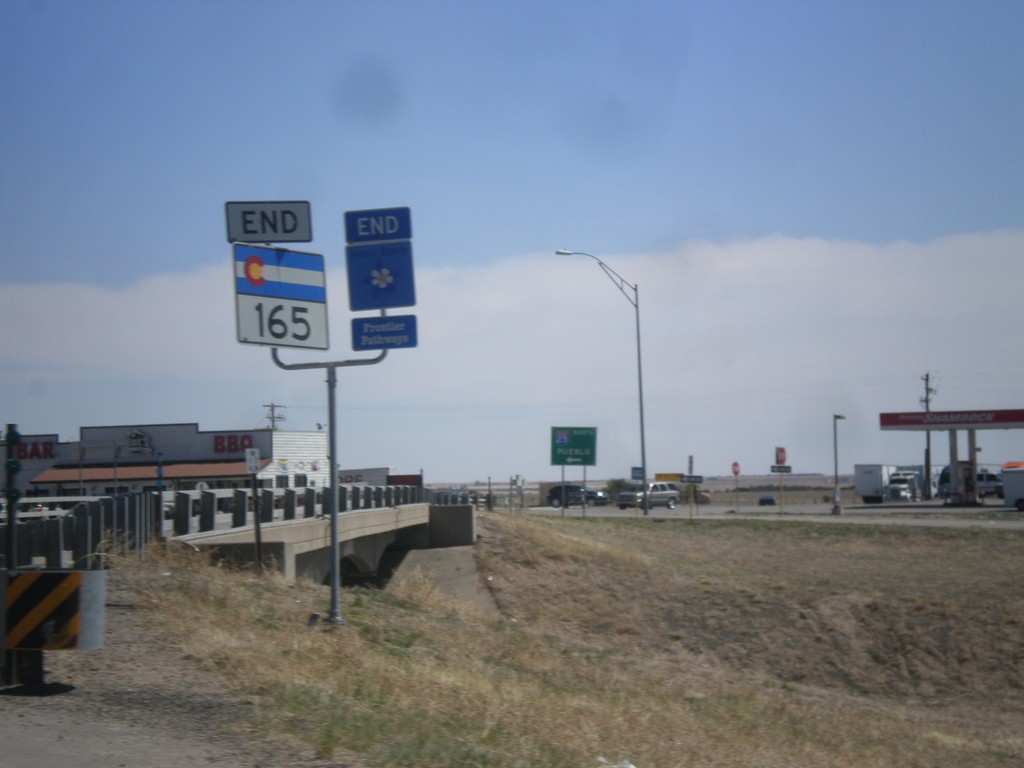
End CO-165 in Colorado City
End CO-165 east at I-25 in Colorado City. This is also the end of the Frontier Pathways Scenic Byway.
Taken 03-29-2014
 Colorado City
Pueblo County
Colorado
United States
Colorado City
Pueblo County
Colorado
United States