Signs Tagged With Shield Different State
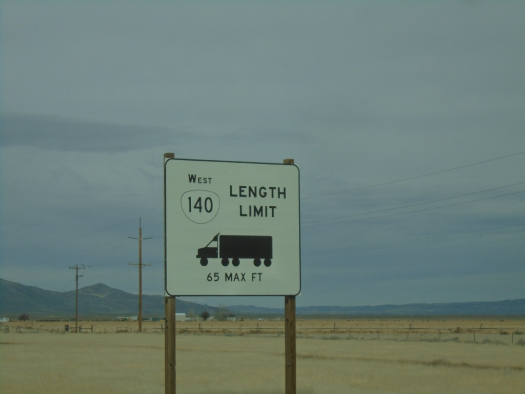
NV-140 North - Oregon Truck Restrictions
Truck restrictions on OR-140. NV-140 becomes OR-140 in Oregon. This sign is posted in Denio Junction, Nevada.
Taken 02-14-2026
 Denio
Humboldt County
Nevada
United States
Denio
Humboldt County
Nevada
United States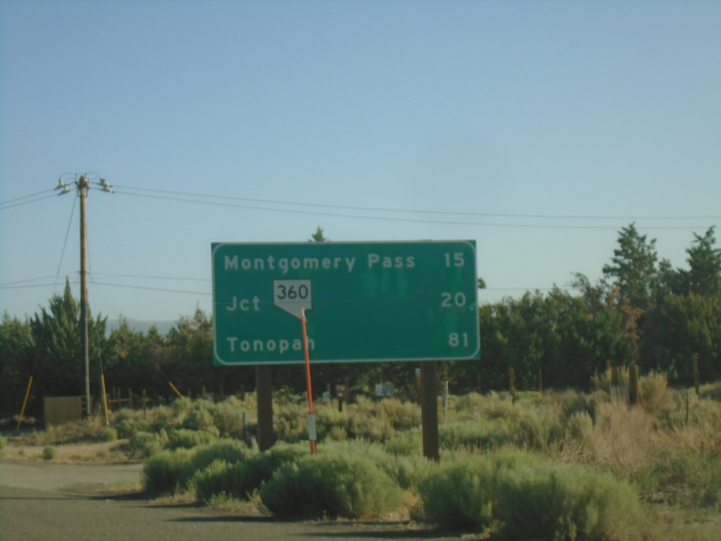
US-6 East - Distance Marker
Distance marker on US-6 east. Distance to Montgomery Pass (NV), Jct NV-360, Tonopah (NV).
Taken 07-22-2025
 Benton
Mono County
California
United States
Benton
Mono County
California
United States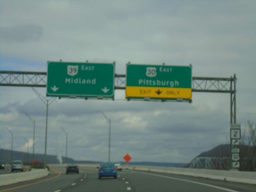
US-30/OH-39 East Split
US-30/OH-39 East at US-30 East to Pittsburgh (PA). Use left lanes to continue east on OH-39 to Midland (PA). Use US-30 East for access to WV-2.
Taken 04-01-2024


 East Liverpool
Columbiana County
Ohio
United States
East Liverpool
Columbiana County
Ohio
United States
US-30/OH-39 East Approaching US-30/OH-39 Split
US-30/OH-39 East approaching US-30 East/Pittsburgh, PA interchange. Continue on US-30 East for WV-2.
Taken 04-01-2024
East Liverpool
Columbiana County
Ohio
United States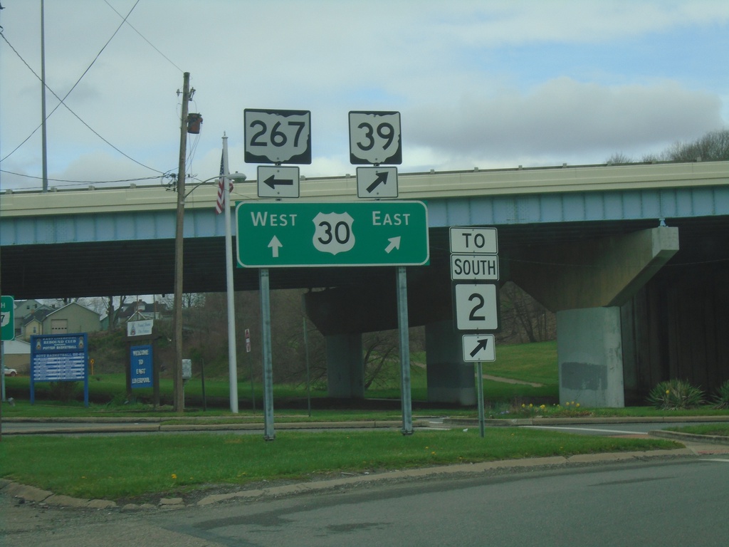
OH-7 North/OH-39 East at US-30/OH-267
OH-7 North/OH-39 East at US-30/OH-267 in East Liverpool. Turn left for OH-267. Continue straight for US-30 West/OH-7 North; merge right for US-30 East/OH-39 East/To WV-2.
Taken 04-01-2024

 East Liverpool
Columbiana County
Ohio
United States
East Liverpool
Columbiana County
Ohio
United States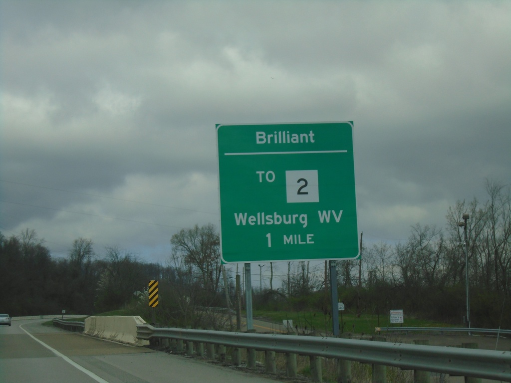
OH-7 North Approaching Brilliant Interchange
OH-7 North Approaching Brilliant/To WV-2 (via Wellsburg Bridge) to Wellsburg, WV.
Taken 04-01-2024
Brilliant
Jefferson County
Ohio
United States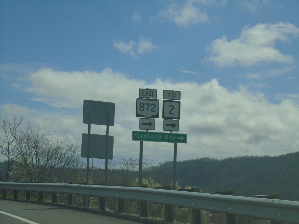
OH-7 North Offramp at OH-872
OH-7 North Offramp at OH-872. Turn right for OH-872 to WV-2 and Moundville, WV.
Taken 04-01-2024
 Dilles Bottom
Belmont County
Ohio
United States
Dilles Bottom
Belmont County
Ohio
United States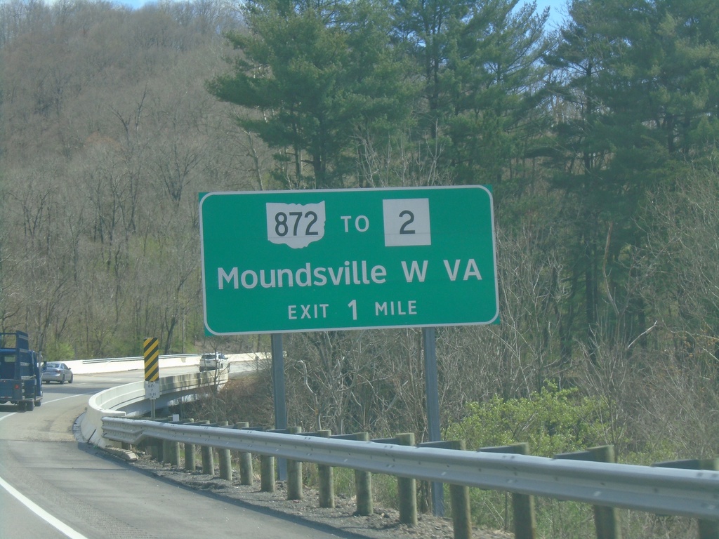
OH-7 North Approaching OH-872/To WV-2
OH-7 North approaching OH-872/To WV-2 to Moundsville, WV.
Taken 04-01-2024
Shadyside
Belmont County
Ohio
United States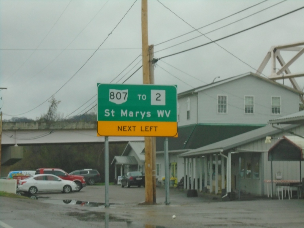
OH-7 North Approaching OH-807/To WV-2
OH-7 North Approaching OH-807/To WV-2/St. Marys, WV in Newport. OH-807 connects Ohio to West Virginia with a bridge over the Ohio River. The bridge can be seen on the upper right side of the picture.
Taken 04-01-2024
 Newport
Washington County
Ohio
United States
Newport
Washington County
Ohio
United States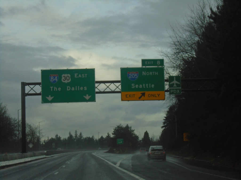
I-84 East - Exit 8
I-84 east at Exit 8 - I-205 North/Seattle (WA). Continue east on I-84/US-30 for The Dalles.
Taken 01-06-2024

 Portland
Multnomah County
Oregon
United States
Portland
Multnomah County
Oregon
United States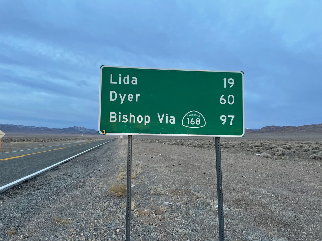
NV-266 West - Distance Marker
Distance marker on NV-266 west. Distance to Lida, Dyer, and Bishop (CA) via CA-168.
Taken 01-15-2022
 Goldfield
Esmeralda County
Nevada
United States
Goldfield
Esmeralda County
Nevada
United States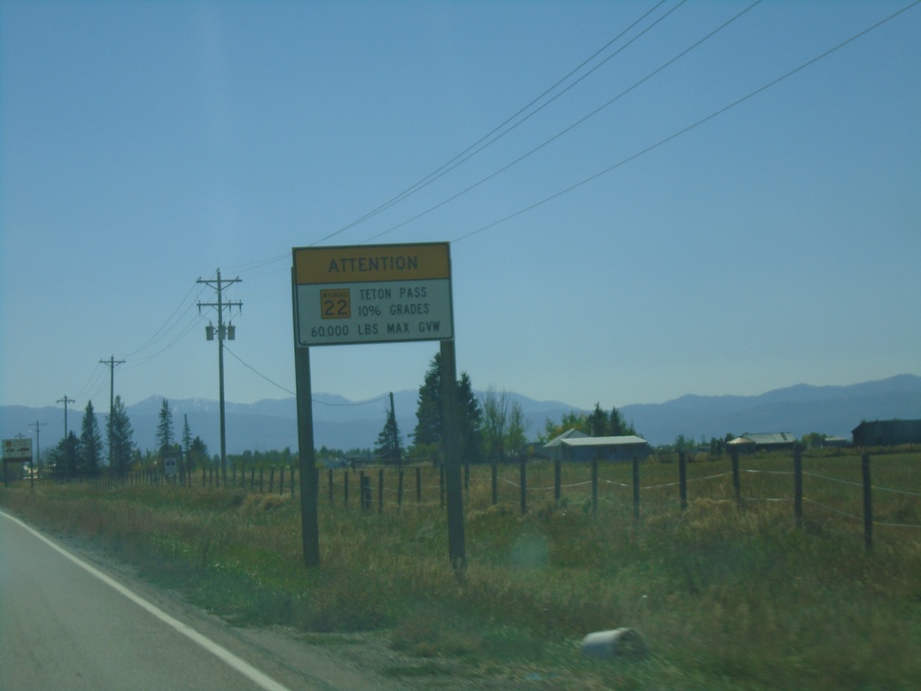
WY-22 East - Teton Pass Restrictions
Sign listing restrictions on Teton Pass in Wyoming. 60,000 lbs GVW over Teton Pass. 10% grades over Teton Pass. Sign displays WY-22 shield within Idaho.
Taken 09-24-2021
 Tetonia
Teton County
Idaho
United States
Tetonia
Teton County
Idaho
United States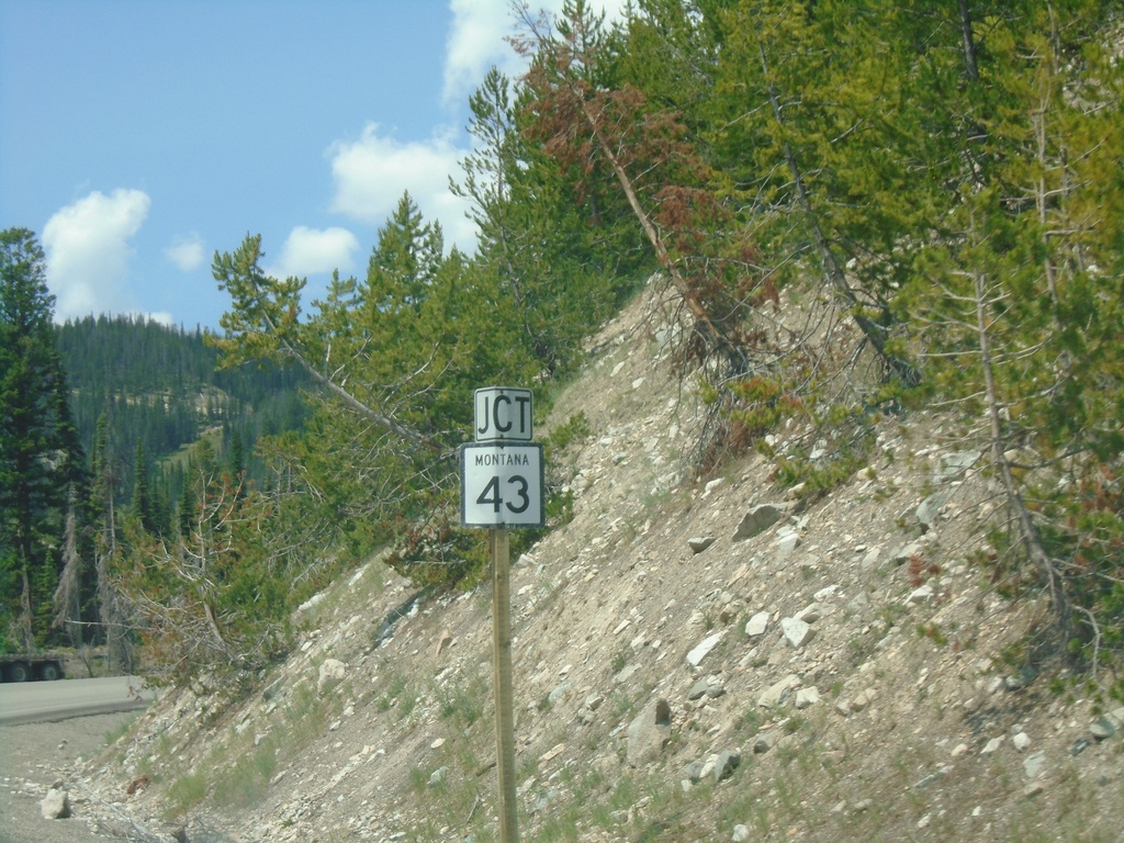
US-93 North Approaching MT-43 Junction
US-93 North approaching MT-43 Junction. The MT-43/US-93 intersection is at the top of Lost Trail Pass on the stateline with Idaho and Montana.
Taken 07-02-2021

 Gibbonsville
Lemhi County
Idaho
United States
Gibbonsville
Lemhi County
Idaho
United States
US-30 East Approaching WY-89
US-30 East approaching WY-89 at Border Junction. WY-89 south joins US-30 east to Sage Junction. While the upcoming junction is in Wyoming, this picture is in Idaho. Milemarker 455 of US-30 in Idaho is in the background.
Taken 08-13-2020
 Montpelier
Bear Lake County
Idaho
United States
Montpelier
Bear Lake County
Idaho
United States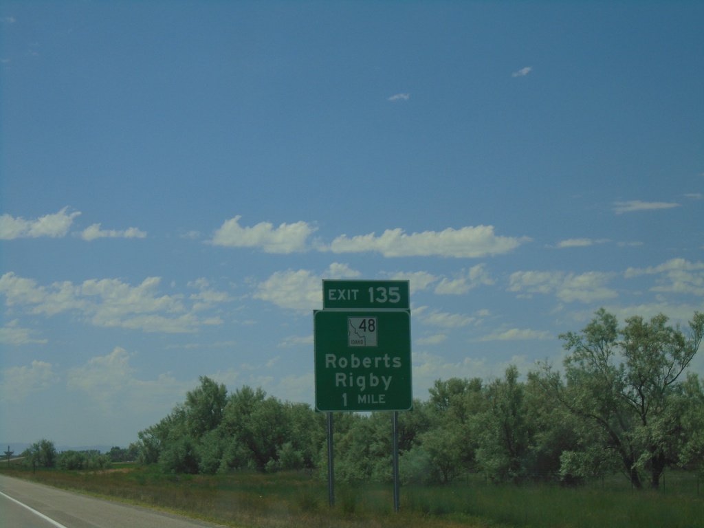
I-15 South - Exit 135
I-15 south approaching Exit 135 - ID-48 South/Roberts/Rigby
Taken 07-17-2020

 Roberts
Jefferson County
Idaho
United States
Roberts
Jefferson County
Idaho
United States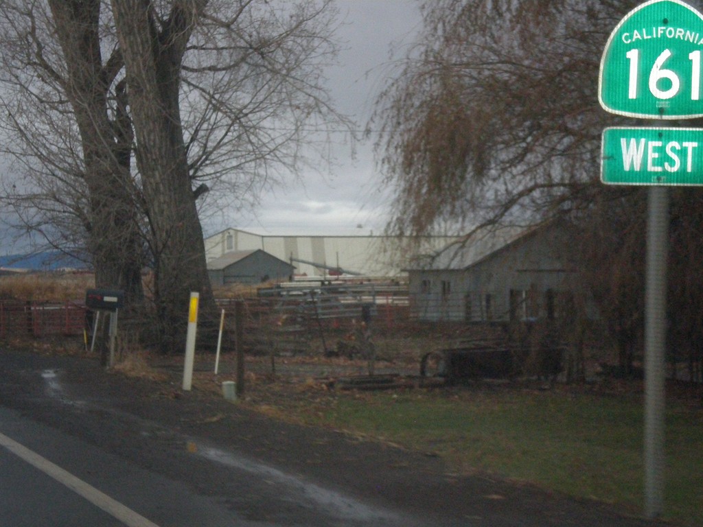
CA-161 West
CA-161 west shield. The Oregon-California line runs along CA-161 so that the north side of the highway is in Oregon.
Taken 11-20-2017
 Merrill
Klamath County
Oregon
United States
Merrill
Klamath County
Oregon
United States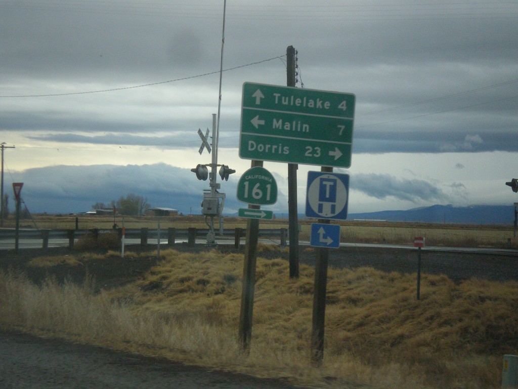
OR-39 South at CA-139 and CA-161
OR-39 south at CA-139 and CA-161. Turn right for CA-161 West to Dorris (California). Turn left on State Line Road to Malin (Oregon). Continue straight on CA-139 south to Tulelake (California). The California-Oregon state line runs along the CA-161 and State Line Road. OR-39 becomes CA-139 at the state line.
Taken 11-20-2017

 Merrill
Klamath County
Oregon
United States
Merrill
Klamath County
Oregon
United States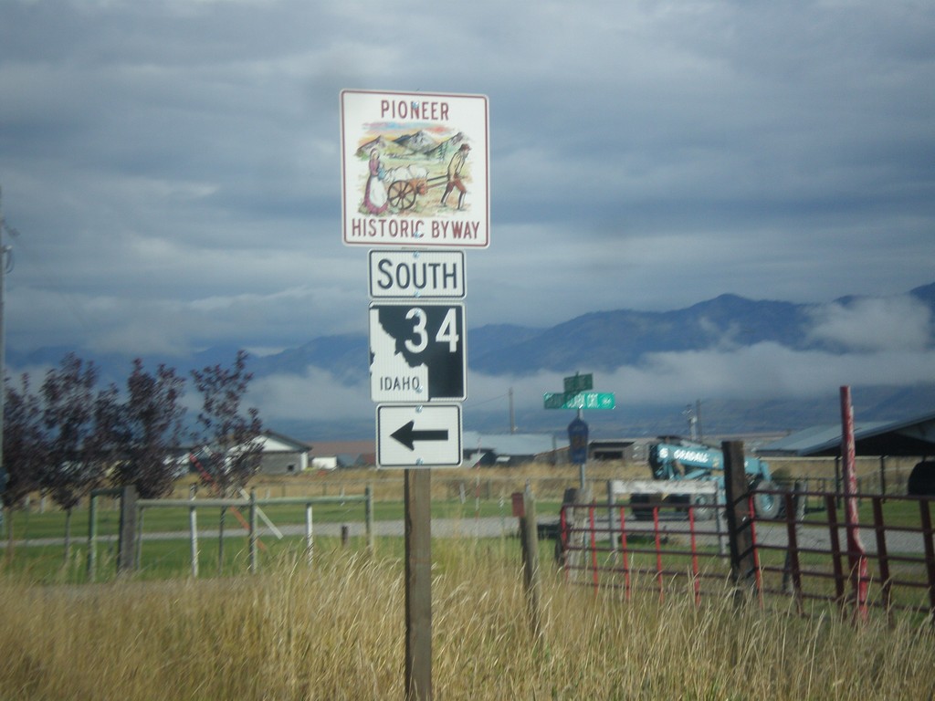
Stateline Road North at ID-34
Stateline Road north at ID-34 south. ID-34 is part of the Pioneer Historic Byway.
Taken 10-04-2015
 Freedom
Lincoln County
Wyoming
United States
Freedom
Lincoln County
Wyoming
United States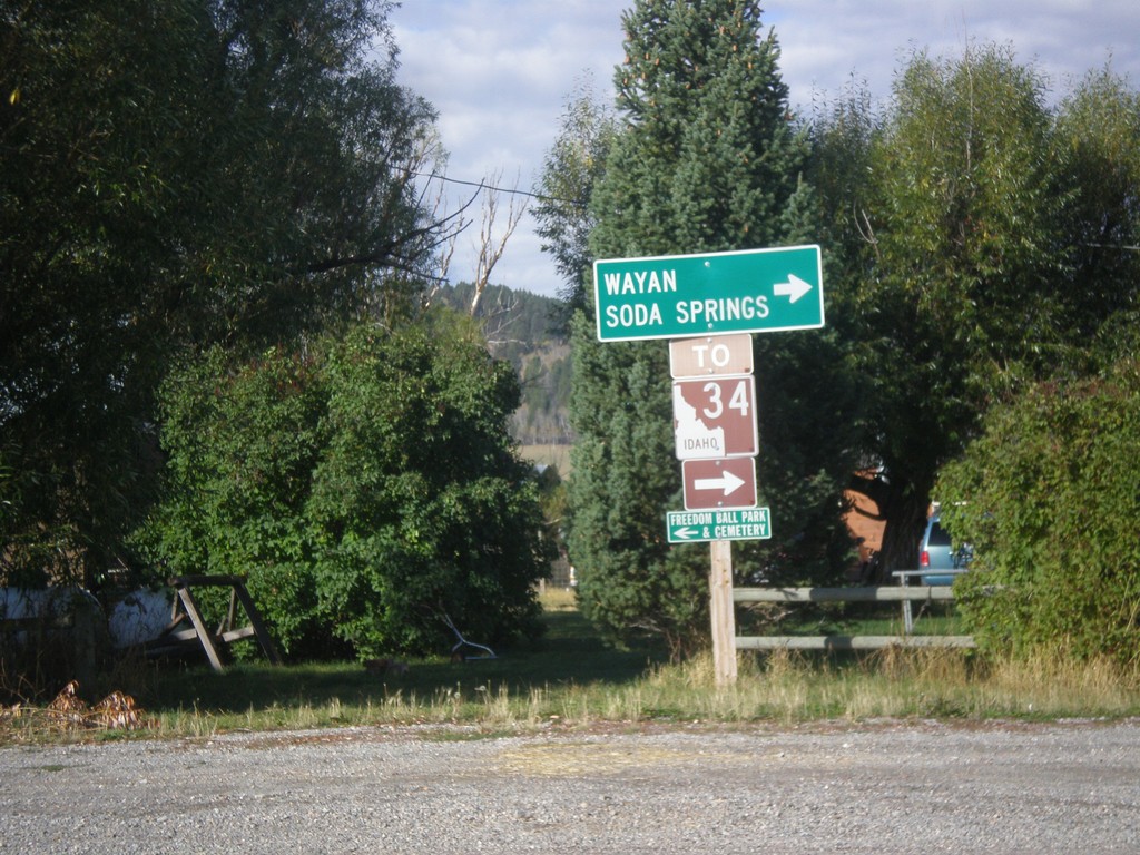
End WY-239 at Stateline Road
Turn right on Stateline Road to access ID-34 to Soda Springs and Wayan (both in Idaho). This sign assembly appears to have been erected by the Idaho Transportation Department. The west side of Stateline Road is in Idaho.
Taken 10-04-2015
 Freedom
Lincoln County
Wyoming
United States
Freedom
Lincoln County
Wyoming
United States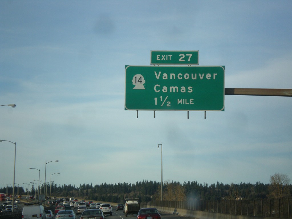
I-205 North - Exit 27
I-205 north approaching Exit 27 - WA-14/Vancouver/Camas. The milemarkers and exit numbers along I-205 do not reset back to zero when crossing into Washington. They continue on the Oregon numbering scheme. Although this is a Washington exit, this sign is still within Oregon.
Taken 02-16-2015
 Portland
Multnomah County
Oregon
United States
Portland
Multnomah County
Oregon
United States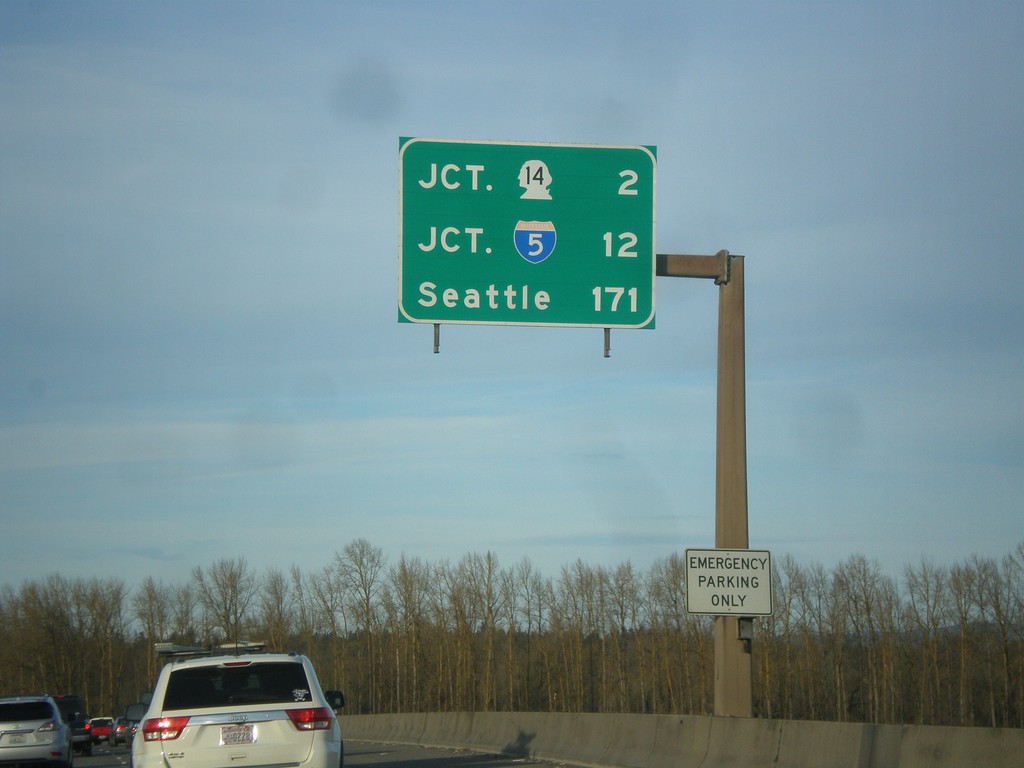
I-205 North - Distance Marker
Last distance marker on I-205 north in Oregon. Distance to WA-14, I-5, and Seattle.
Taken 02-16-2015
Portland
Multnomah County
Oregon
United States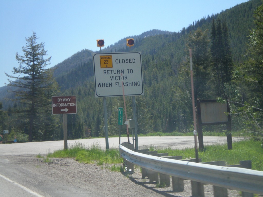
ID-33 East - WY-22 Closure Information
Teton Pass road closure information on ID-33 east approaching the Wyoming state line. When Teton Pass is closed in Wyoming, this is where the road closure starts, just inside of Idaho. All traffic must return to Victor Idaho when the road closure lights are flashing. This is one of the few instances in Idaho of a state highway shield from another state located inside Idaho.
Taken 07-02-2011
 Victor
Teton County
Idaho
United States
Victor
Teton County
Idaho
United States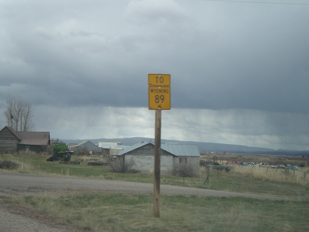
To WY-89 on ID-61 South
To WY-89 on ID-61 south. ID-61 becomes WY-89 at the Idaho-Wyoming State Line.
Taken 05-01-2010
 Geneva
Bear Lake County
Idaho
United States
Geneva
Bear Lake County
Idaho
United States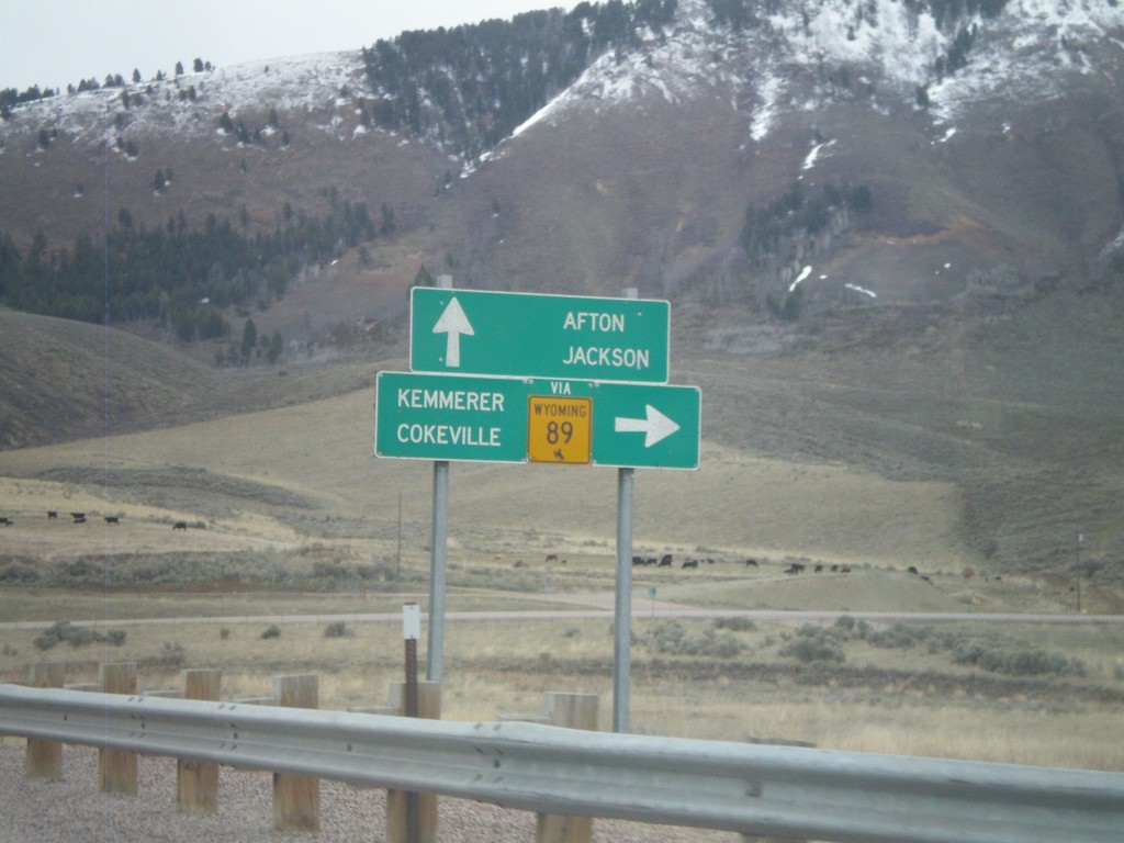
US-89 North Approaching ID-61
US-89 north approaching ID-61 (To WY-89). Use ID-61 south for WY-89, Cokeville, and Kemmerer. Continue north on US-89 for Afton and Jackson. All destinations are in Wyoming. The only instance that I have encountered where state highway shield from another state is posted in Idaho, is at this intersection.
Taken 05-01-2010
 Geneva
Bear Lake County
Idaho
United States
Geneva
Bear Lake County
Idaho
United States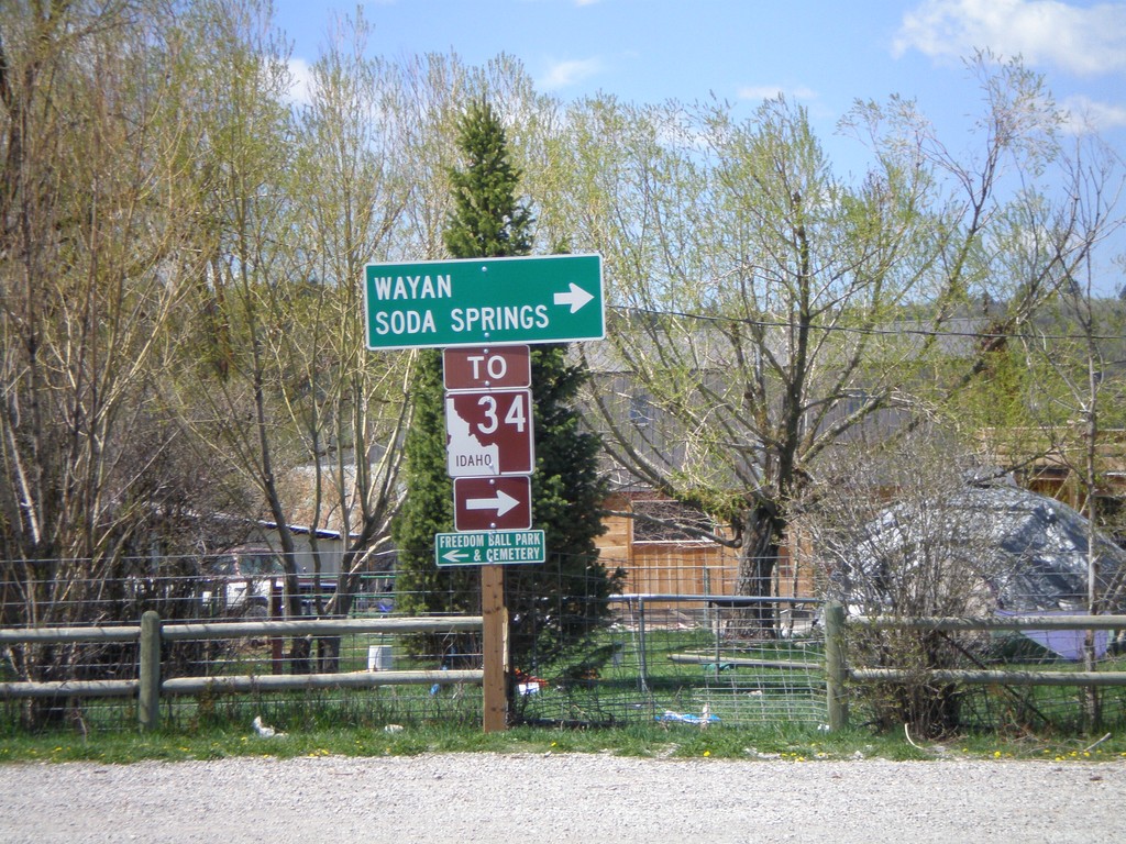
End WY-239 at Stateline Road - To ID-34
End WY-239 at Stateline Road. Turn right on Stateline Road to ID-34, Wayan, and Soda Springs.
Taken 05-19-2008
Freedom
Lincoln County
Wyoming
United States