Signs Tagged With Shield Inside Sign
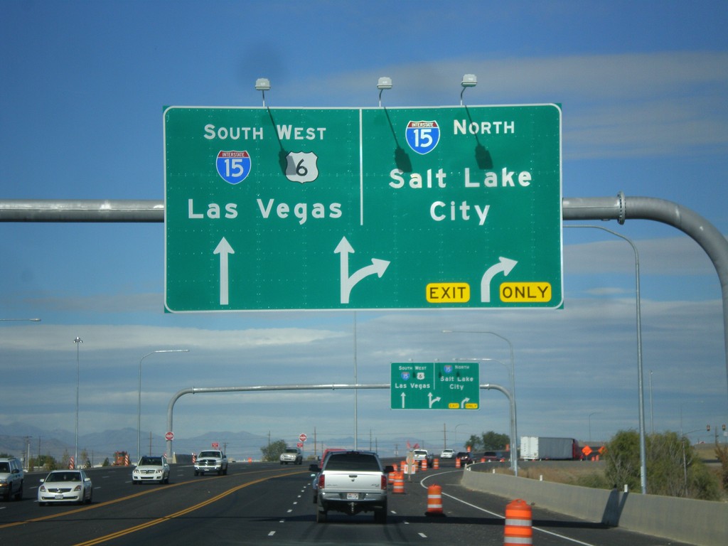
US-6 West at I-15
US-6 west at I-15 in Spanish Fork. Use I-15 north for Salt Lake; use I-15 South/US-6 West for Las Vegas (Nevada). US-6 joins I-15 south to Santiquin.
Taken 10-20-2012

 Spanish Fork
Utah County
Utah
United States
Spanish Fork
Utah County
Utah
United States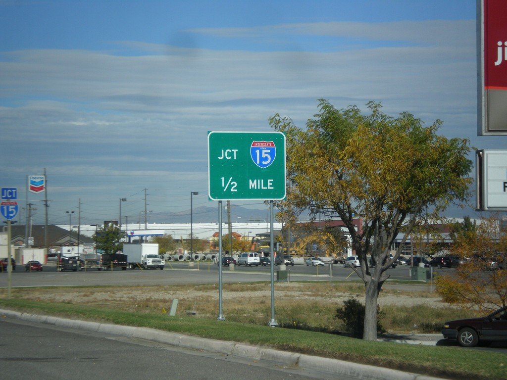
US-6 West Approaching I-15
US-6 west approaching I-15 onramps. Notice the the I-15 shield inside the I-15 Jct. big green sign has the word Utah in it. There are a few of these shields around the Provo area that appear to be newly posted.
Taken 10-20-2012
Spanish Fork
Utah County
Utah
United States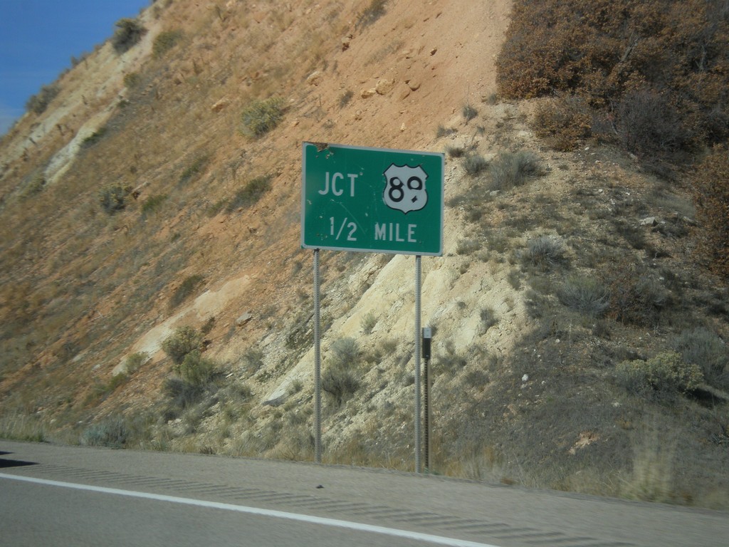
US-6 West Approaching US-89
US-6 west approaching US-89.
Taken 10-20-2012
 Spanish Fork
Utah County
Utah
United States
Spanish Fork
Utah County
Utah
United States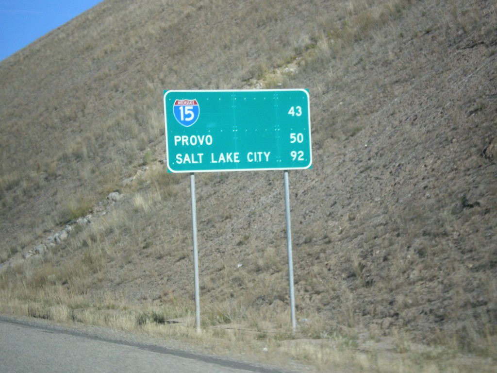
US-6 West - Distance Marker
Distance Marker on US-6 west. Distance to I-15, Provo, and Salt Lake City.
Taken 10-20-2012
Colton
Utah County
Utah
United States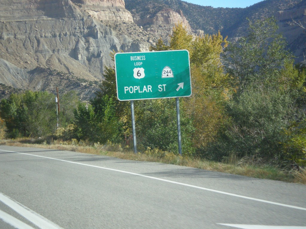
US-6 West/US-191 North at UT-244
US-6 West/US-191 north at UT-244. Exit here for UT-244/Business US-6/Poplar St.
Taken 10-20-2012


 Helper
Carbon County
Utah
United States
Helper
Carbon County
Utah
United States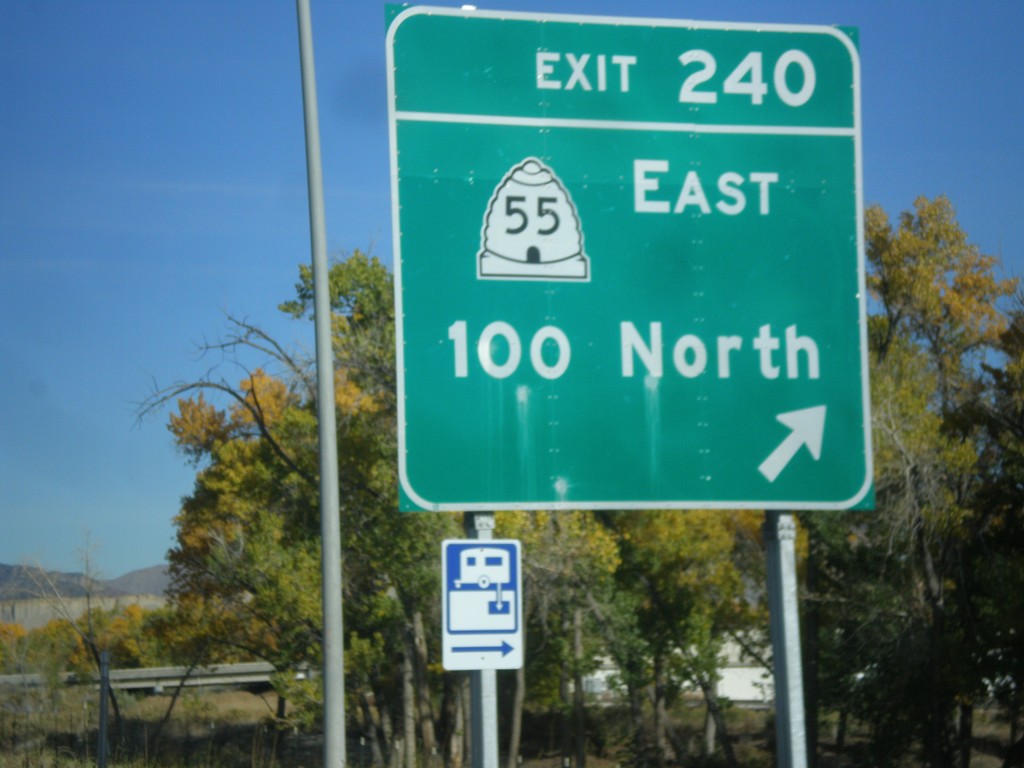
US-6 West/US-191 North at Exit 240
US-6 West/US-191 North at Exit 240 - UT-55 East/100 North.
Taken 10-20-2012
 Price
Carbon County
Utah
United States
Price
Carbon County
Utah
United States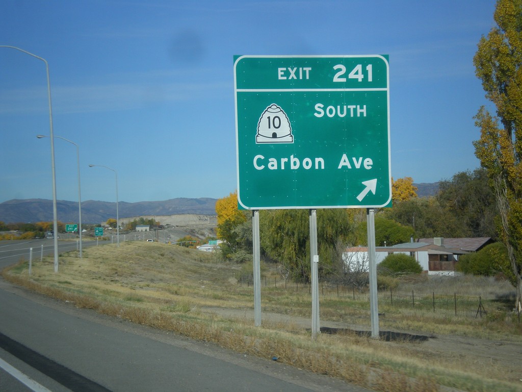
US-6 West/US-191 North - Exit 241
US-6 West/US-191 North at Exit 241 - UT-10 South/Carbon Ave.
Taken 10-20-2012
 Price
Carbon County
Utah
United States
Price
Carbon County
Utah
United States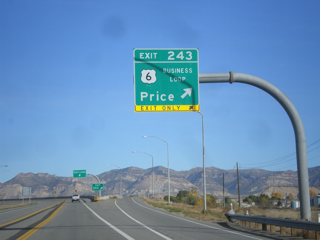
US-6 West/US-191 North - Exit 243
US-6 West/US-191 North at Exit 243 - Business Loop 6/Price.
Taken 10-20-2012
Price
Carbon County
Utah
United States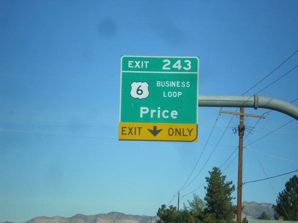
US-6 West/US-191 North Approaching Exit 243
US-6 West/US-191 North approaching Exit 243 - Business Loop US-6/Price. The is the eastern end of the Price business loop.
Taken 10-20-2012
Price
Carbon County
Utah
United States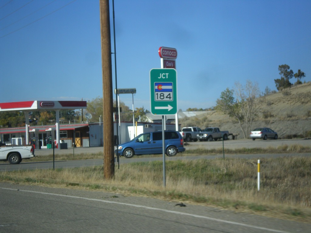
US-491 North at CO-184
US-491 North at CO-184 in Montezuma County.
Taken 10-15-2012

 Cortez
Montezuma County
Colorado
United States
Cortez
Montezuma County
Colorado
United States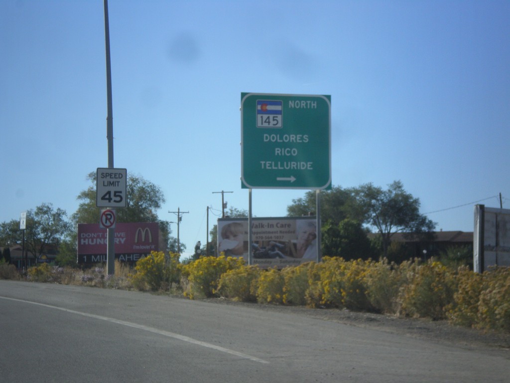
US-160 West at CO-145
US-160 west at CO-145 North to Dolores, Rico, and Telluride.
Taken 10-15-2012

 Cortez
Montezuma County
Colorado
United States
Cortez
Montezuma County
Colorado
United States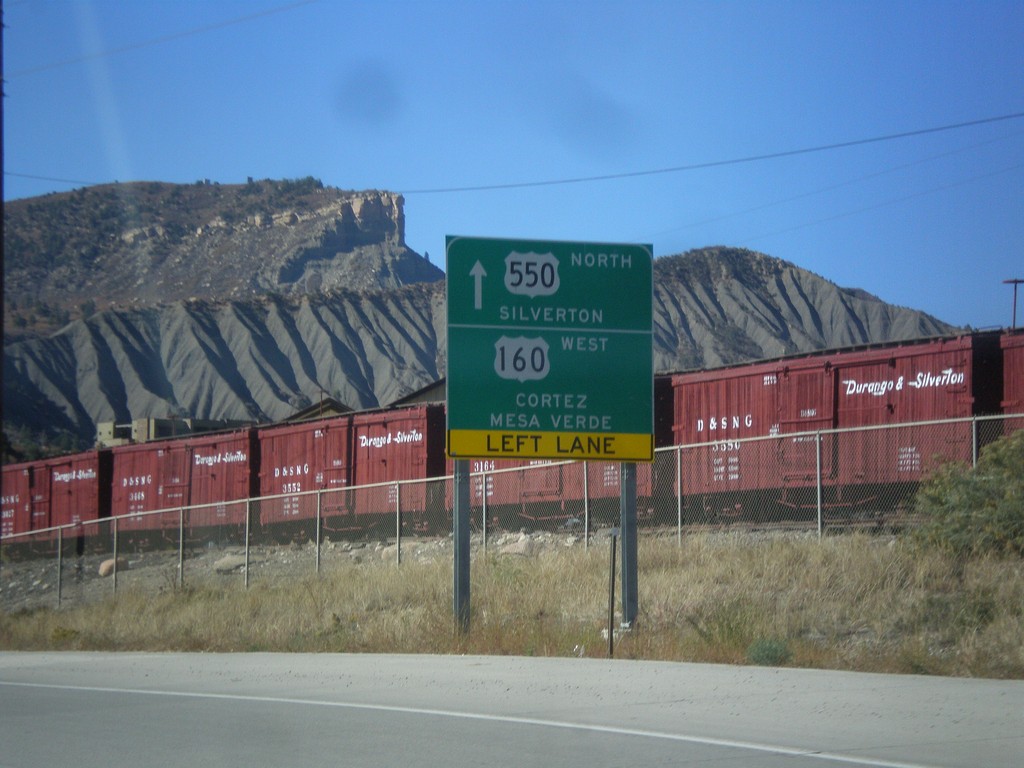
US-550 North/US-160 West at Split
US-550 North/US-160 West at US-550/US-160 split in Durango. Continue straight for US-550 north to Silverton. Turn left for US-160 west to Cortez and Mesa Verde (National Park).
Taken 10-15-2012
 Durango
La Plata County
Colorado
United States
Durango
La Plata County
Colorado
United States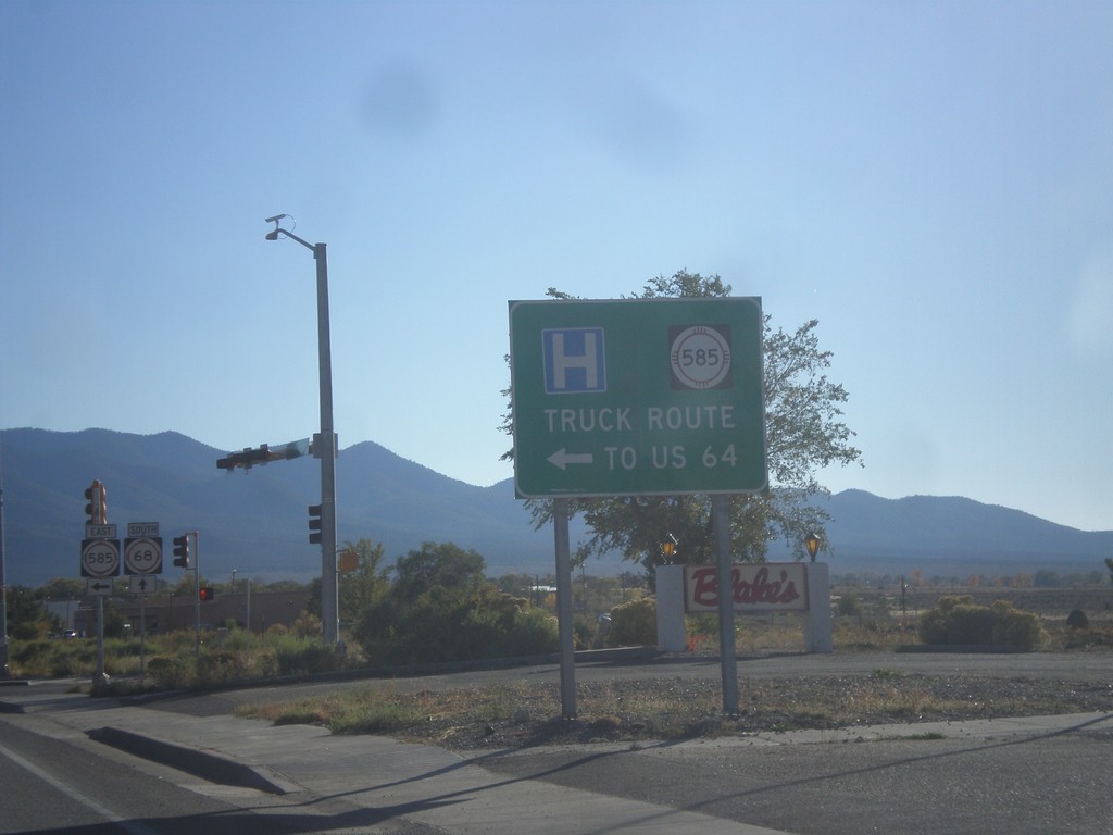
NM-68 South at NM-585 East
NM-68 South at NM-585 East to US-64. NM-585 is the truck route to US-64 east towards Raton.
Taken 10-14-2012


 Taos
Taos County
New Mexico
United States
Taos
Taos County
New Mexico
United States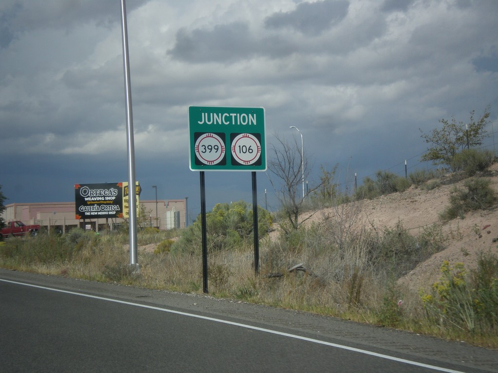
US-84 West/US-285 North Approaching NM-399/NM-106
US-84 West/US-285 North approaching NM-399/NM-106.
Taken 10-12-2012


 Santa Cruz
Santa Fe County
New Mexico
United States
Santa Cruz
Santa Fe County
New Mexico
United States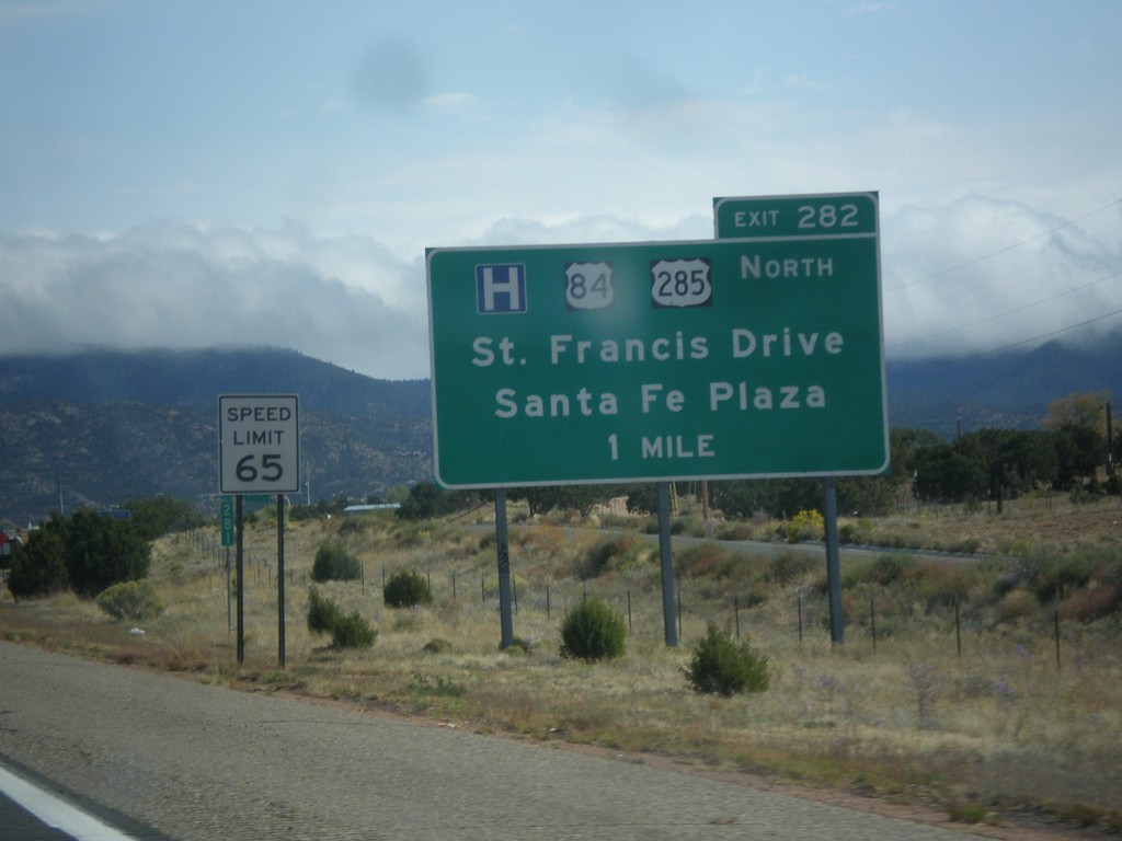
I-25 North Approaching Exit 282
I-25 North approaching Exit 282 - US-84/US-285 North/Santa Fe Plaza/St. Francis Drive.
Taken 10-12-2012
 Santa Fe
 County
New Mexico
United States
Santa Fe
Santa Fe County
New Mexico
United States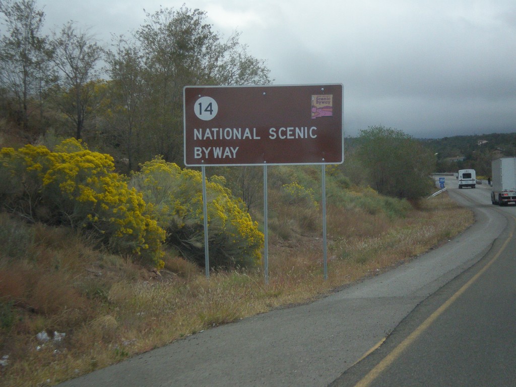
NM-14 North - National Scenic Byway
NM-14 north National Scenic Byway and New Mexico Scenic Byway sign. This is the start of the Turquoise Trail.
Taken 10-12-2012
 Tijeras
Bernalillo County
New Mexico
United States
Tijeras
Bernalillo County
New Mexico
United States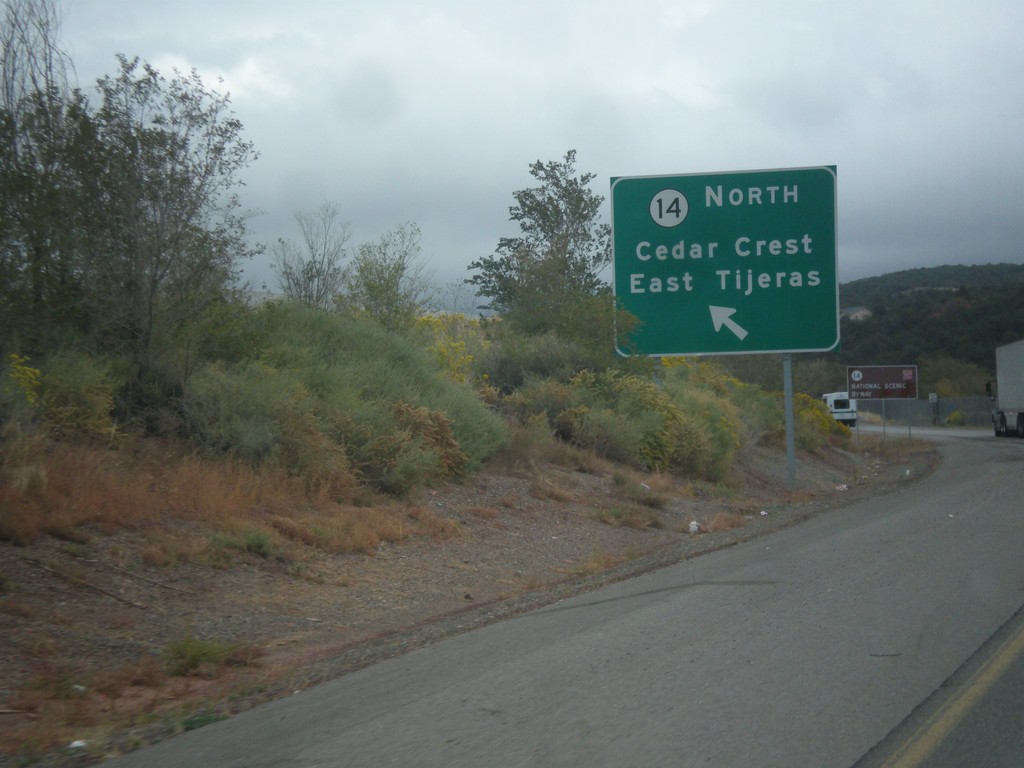
NM-14 at NM-333/NM-337
NM-14/NM-333/NM-337 junction. Use left lane for NM-14 North/Cedar Crest/East Tijeras.
Taken 10-12-2012

 Tijeras
Bernalillo County
New Mexico
United States
Tijeras
Bernalillo County
New Mexico
United States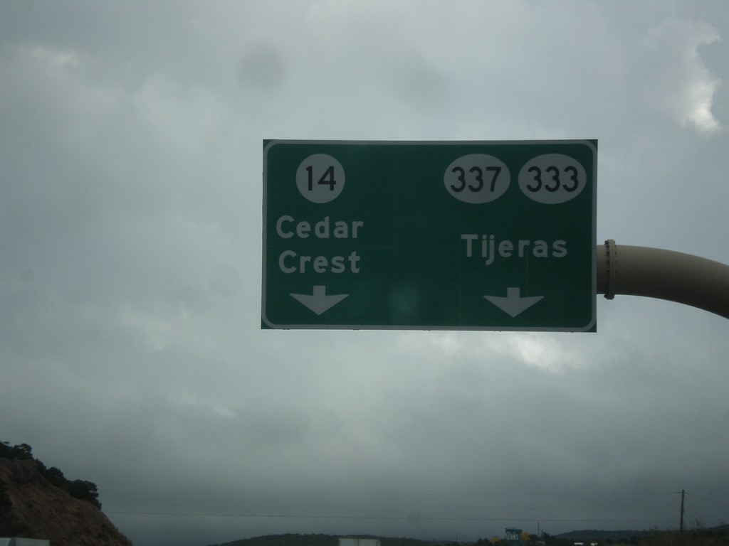
I-40 East Exit 175 Offramp
I-40 East Exit 175 offramp. Use left lane for NM-14 north to Cedar Crest. Use right lane for NM-337/NM-333 to Tijeras.
Taken 10-12-2012
 Tijeras
Bernalillo County
New Mexico
United States
Tijeras
Bernalillo County
New Mexico
United States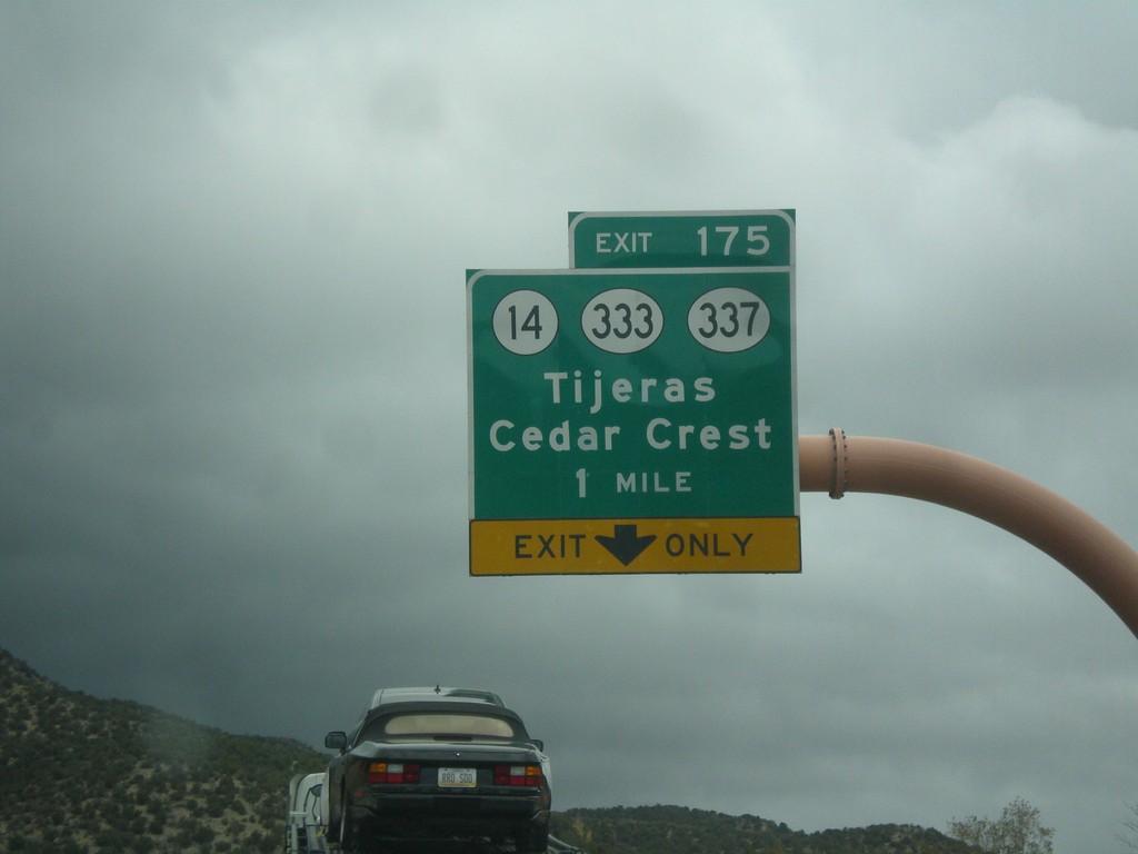
I-40 East - Exit 175
I-40 east at Exit 175 - NM-14/NM-333/NM-337/Tijeras/Cedar Crest. Use NM-14 for the Turquoise Trail National Scenic Byway and the Sandia Crest Ski Area.
Taken 10-12-2012
Cedar Crest
Bernalillo County
New Mexico
United States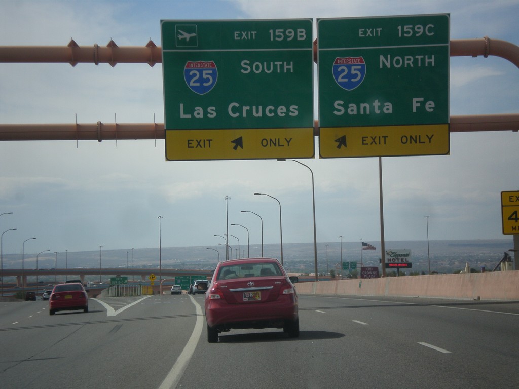
I-40 West - Exits 159B and 159C
I-40 west at Exits 159B and 159C. Use Exit 159B for I-25 South to Las Cruces; Exit 159C for I-25 north to Santa Fe.
Taken 10-11-2012
Albuquerque
Bernalillo County
New Mexico
United States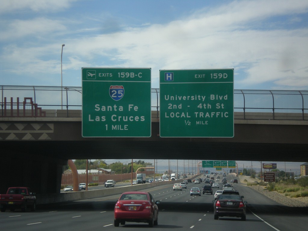
I-40 West Approaching Exits 159B-D
I-40 west approaching Exit 159D - University Blvd./2nd-4th St./LOCAL TRAFFIC; Exit 159BC - I-25/Santa Fe/Las Cruces.
Taken 10-11-2012
Albuquerque
Bernalillo County
New Mexico
United States
Eubank Blvd. South Approaching I-40
Eubank Blvd. South approaching I-40 (Exit 165). Use right lane for I-40 west; left lanes for I-40 east.
Taken 10-11-2012
Albuquerque
Bernalillo County
New Mexico
United States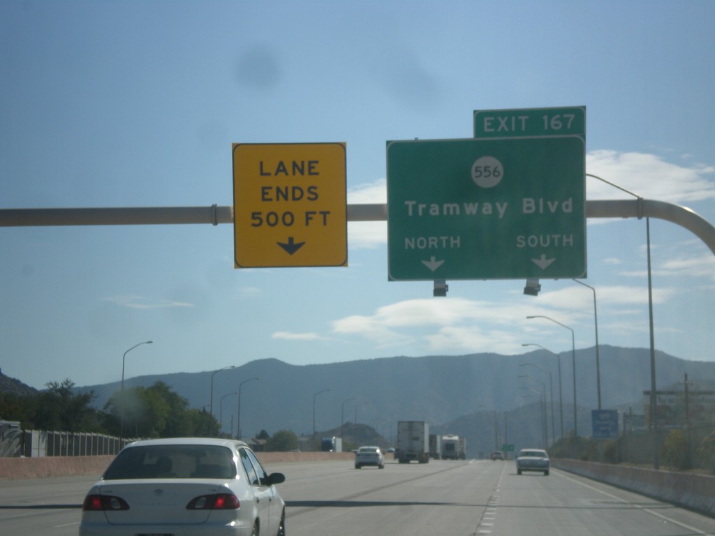
I-40 East - Exit 167
I-40 east at Exit 167 - NM-556/Tramway Blvd.
Taken 10-11-2012
 Albuquerque
Bernalillo County
New Mexico
United States
Albuquerque
Bernalillo County
New Mexico
United States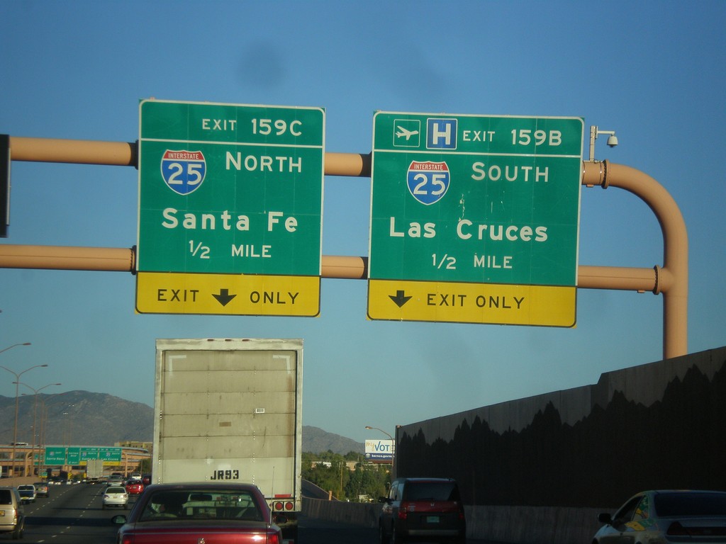
I-40 East Approaching Exits 159C-B
I-40 east approaching Exit 159B - I-25 South/Las Cruces and Exit 159C - I-25 North/Santa Fe.
Taken 10-10-2012
Albuquerque
Bernalillo County
New Mexico
United States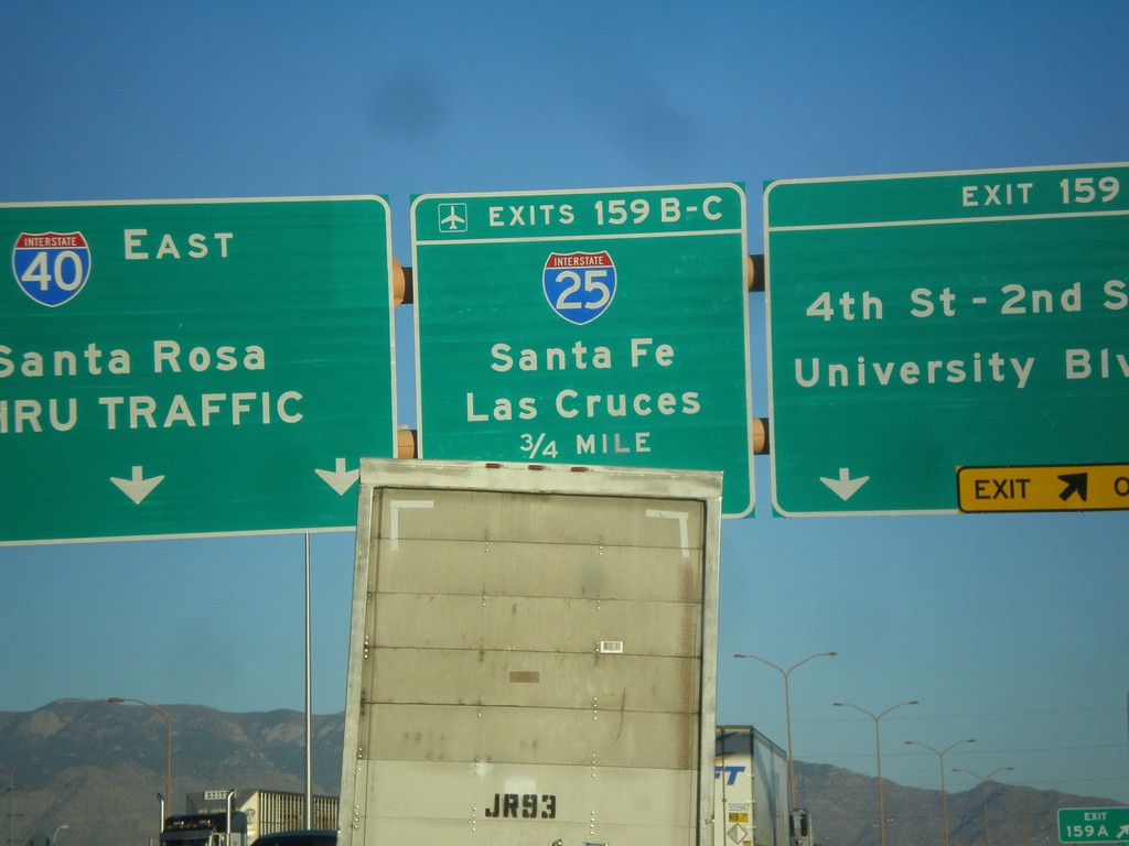
I-40 East - Exits 159 A-C
I-40 east at Exit 159A - 4th-2nd St./University Blvd. Approaching Exit 159BC - I-25/Las Cruces/Santa Fe. Continue east on I-40 east to Santa Rosa.
Taken 10-10-2012
Albuquerque
Bernalillo County
New Mexico
United States