Signs Tagged With Shield Inside Sign
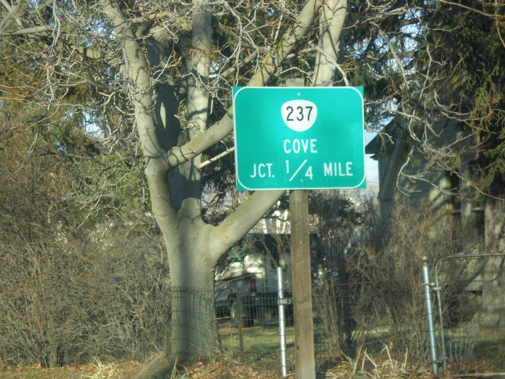
OR-237/OR-203 North Approaching OR-237
OR-237/OR-203 North approaching OR-237 north to Cove.
Taken 12-15-2013

 Union
Union County
Oregon
United States
Union
Union County
Oregon
United States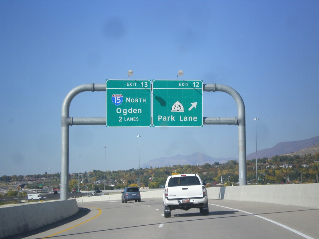
Legacy Parkway - Exits 12 and 13
Legacy Parkway (UT-67) north at Exit 12 - UT-225/Park Lane. Approaching I-15 North/Ogden. Approaching the northern end of Legacy Parkway.
Taken 10-18-2013


 Farmington
Davis County
Utah
United States
Farmington
Davis County
Utah
United States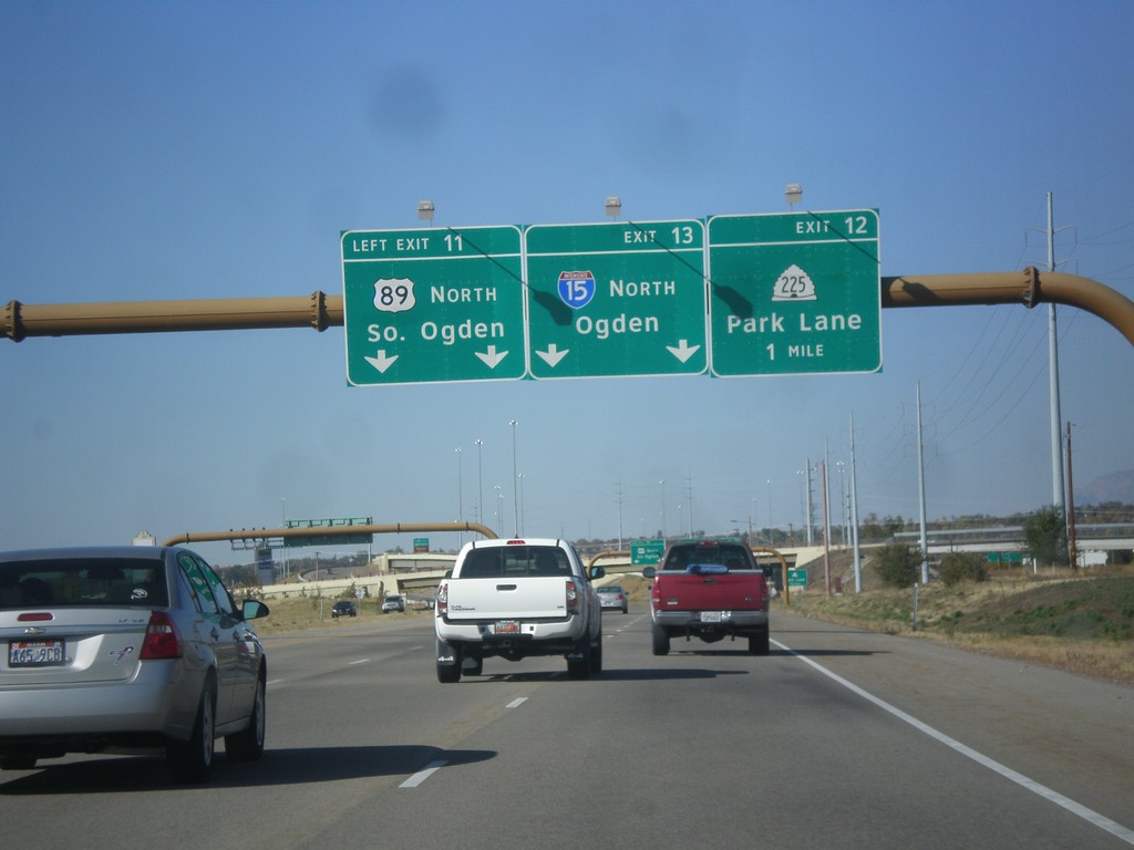
Legacy Parkway (UT-67) North - Exits 11,12,13
Legacy Parkway (UT-67) north at Exit 11- US-89 North/South Ogden. Approaching Exit 12 - UT-225/Park Lane. Also approaching Exit 13 - I-15/Ogden.
Taken 10-18-2013
 Farmington
Davis County
Utah
United States
Farmington
Davis County
Utah
United States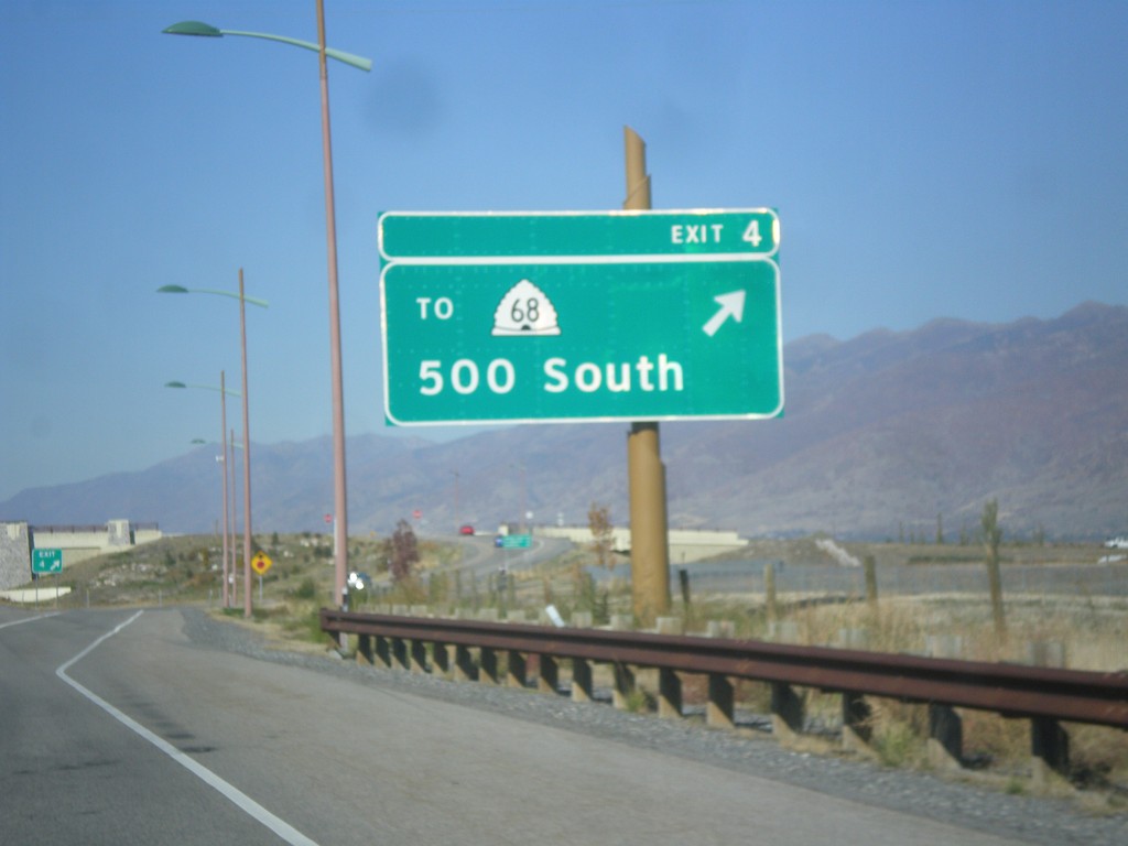
Legacy Parkway (UT-67) North - Exit 4
Legacy Parkway (UT-67) north at Exit 4 - To UT-68/500 South.
Taken 10-18-2013
 Woods Cross
Davis County
Utah
United States
Woods Cross
Davis County
Utah
United States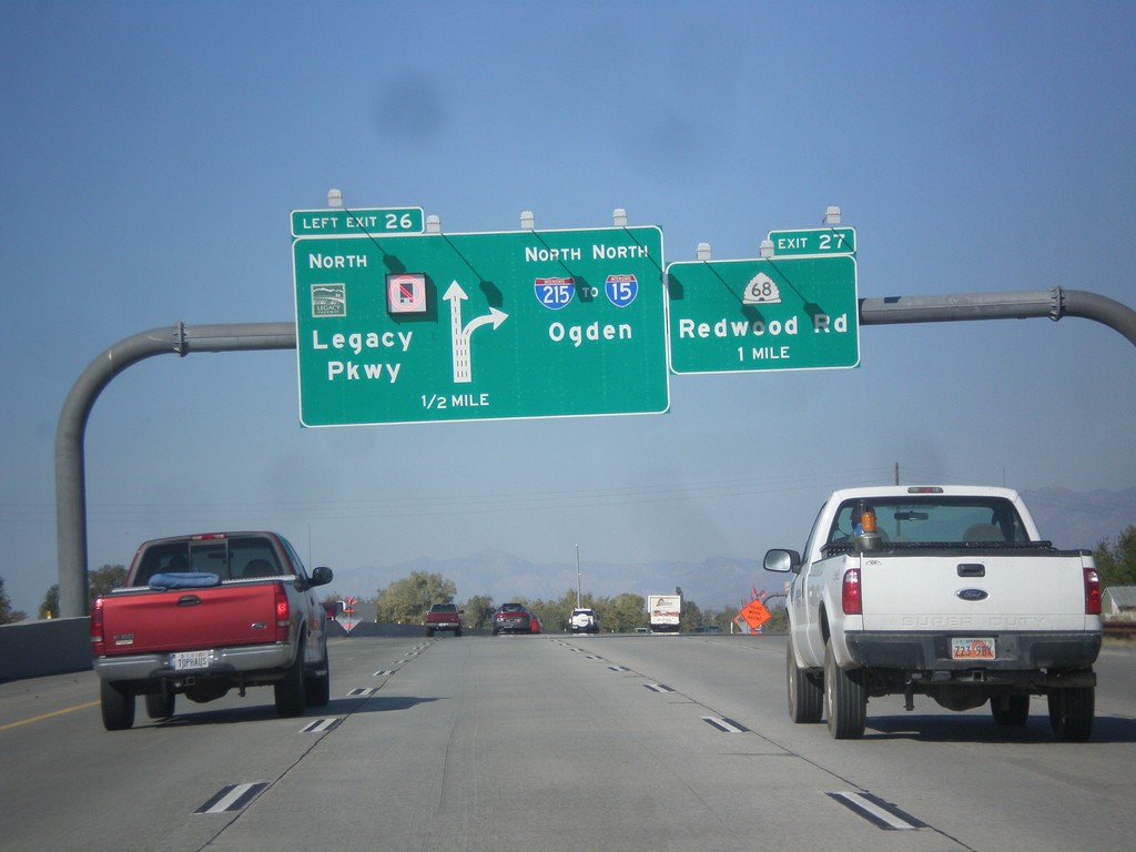
I-215 North - Exits 26 and 27
I-215 north at Exit 26 - UT-67/Legacy Parkway. Approaching Exit 27 - UT-68/Redwood Road. Continue north on I-215 for I-15 and Ogden. Trucks are not allowed to use Legacy Parkway.
Taken 10-18-2013
 Salt Lake City
Salt Lake County
Utah
United States
Salt Lake City
Salt Lake County
Utah
United States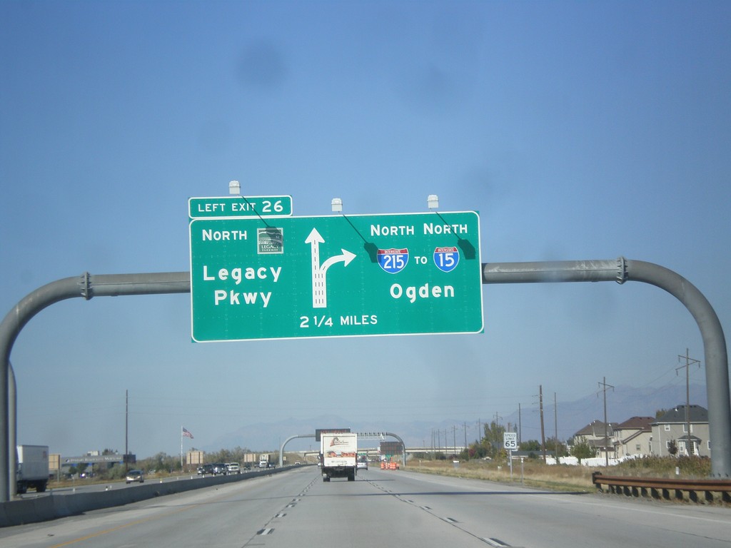
I-215 North - Exit 26
I-215 north approaching Exit 26 - UT-67/Legacy Parkway. Continue north on I-215 for I-15 and Ogden.
Taken 10-18-2013
Salt Lake City
Salt Lake County
Utah
United States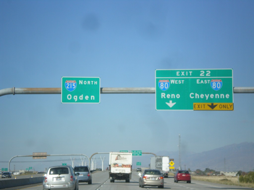
I-215 North Approaching I-80
I-215 north approaching Exit 22 - I-80/Reno (NV)/Cheyenne (WY).
Taken 10-18-2013
 Salt Lake City
Salt Lake County
Utah
United States
Salt Lake City
Salt Lake County
Utah
United States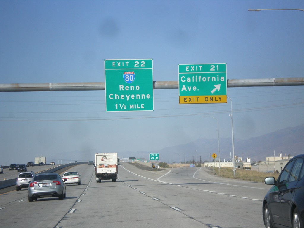
I-215 North - Exits 21 and 22
I-215 north at Exit 21 - California Ave. Approaching Exit 22 - I-80/Reno(NV)/Cheyenne(WY).
Taken 10-18-2013
Salt Lake City
Salt Lake County
Utah
United States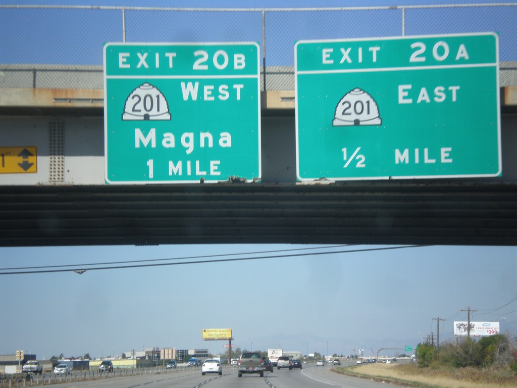
I-215 North - Exits 20A and 20B
I-215 north at Exit 20A - UT-201 East. Approaching Exit 20B - UT-201 West - Magna.
Taken 10-18-2013
 West Valley City
Salt Lake County
Utah
United States
West Valley City
Salt Lake County
Utah
United States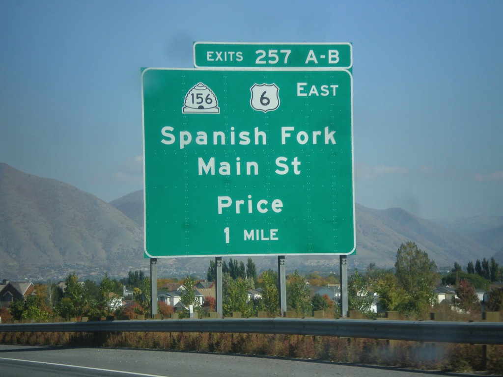
I-15 North - Exits 257A-B
I-15 north approaching Exit 257A-B - US-6 West/UT-156/Spanish Fork/Main St./Price. US-6 leaves I-15 northbound at this interchange.
Taken 10-18-2013

 Spanish Fork
Utah County
Utah
United States
Spanish Fork
Utah County
Utah
United States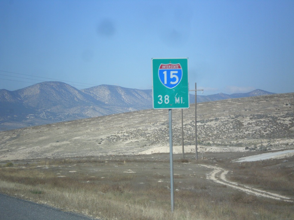
UT-28 North - Distance to I-15
Distance to I-15 on UT-28 north, on the north edge of Gunnison.
Taken 10-18-2013
 Gunnison
Sanpete County
Utah
United States
Gunnison
Sanpete County
Utah
United States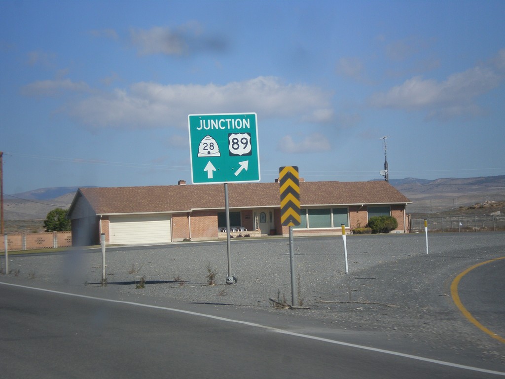
US-89 North at UT-28
US-89 north at UT-28. Merge right to continue north on US-89. Continue straight for UT-28.
Taken 10-18-2013
Gunnison
Sanpete County
Utah
United States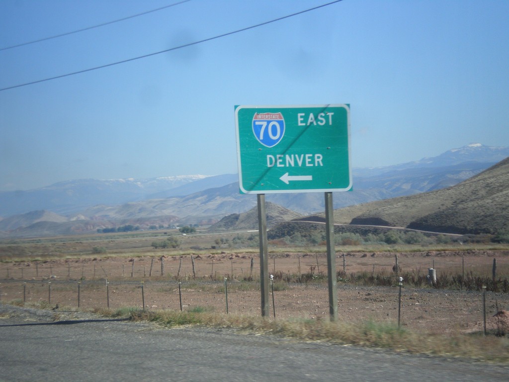
UT-24 West at I-70 (UT-259)
UT-24 west at I-70 east to Denver. There is a signed state highway, UT-259, that connects UT-24 to the I-70 ramps.
Taken 10-18-2013


 Sigurd
Sevier County
Utah
United States
Sigurd
Sevier County
Utah
United States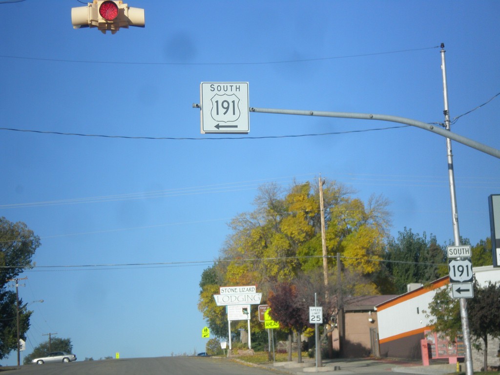
US-191 South - Blanding
US-191 south at the Center St./Main St. intersection in Blanding. US-191 turns south on Main St.
Taken 10-14-2013
 Blanding
San Juan County
Utah
United States
Blanding
San Juan County
Utah
United States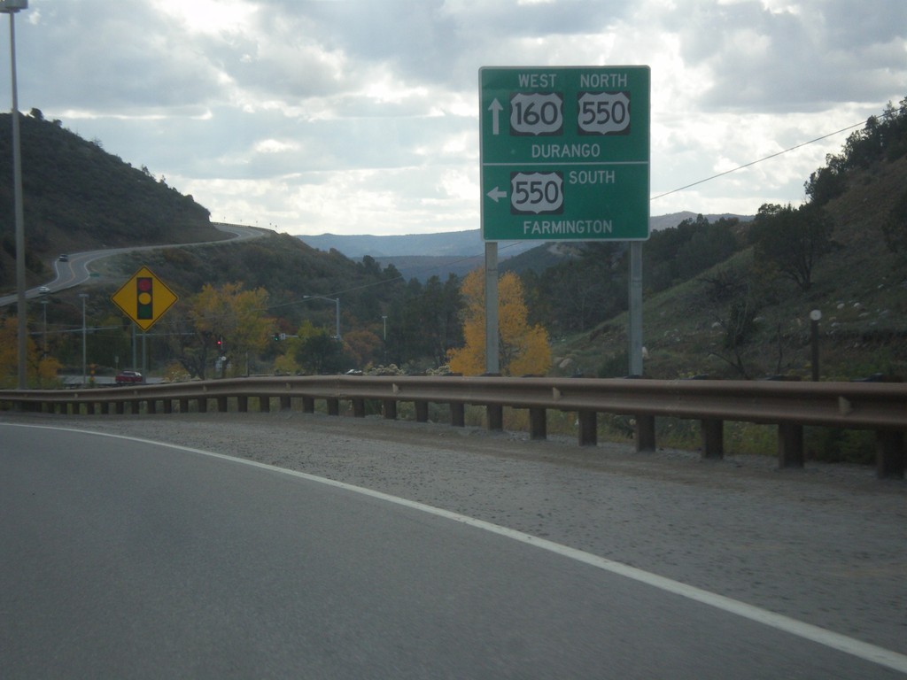
US-160 West at US-550 South
US-160 west at US-550 south. Use US-550 south for Farmington (New Mexico). US-550 north joins US-160 into Durango.
Taken 10-13-2013

 Durango
La Plata County
Colorado
United States
Durango
La Plata County
Colorado
United States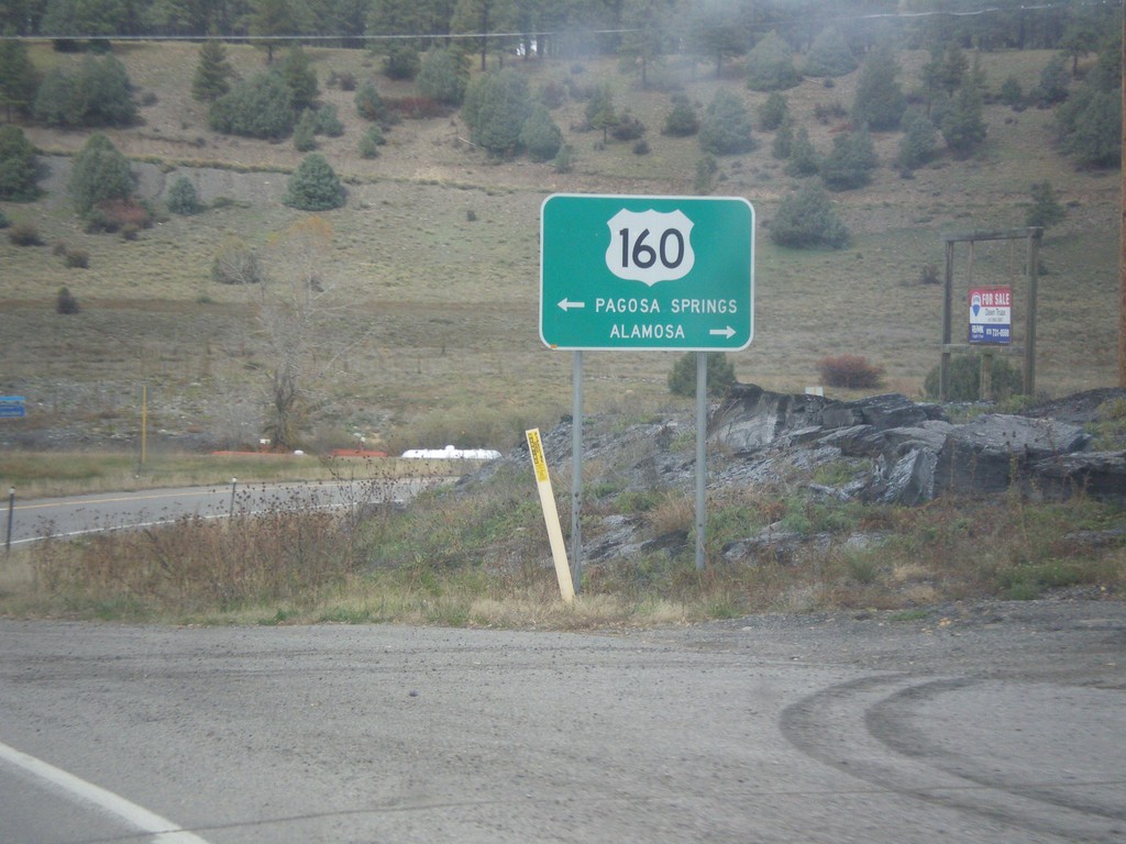
End US-84 at US-160
End US-84 at US-160 in Pagosa Springs. Turn right on US-160 east for Alamosa. Turn left on US-160 west for Pagosa Springs.
Taken 10-13-2013
 Pagosa Springs
Archuleta County
Colorado
United States
Pagosa Springs
Archuleta County
Colorado
United States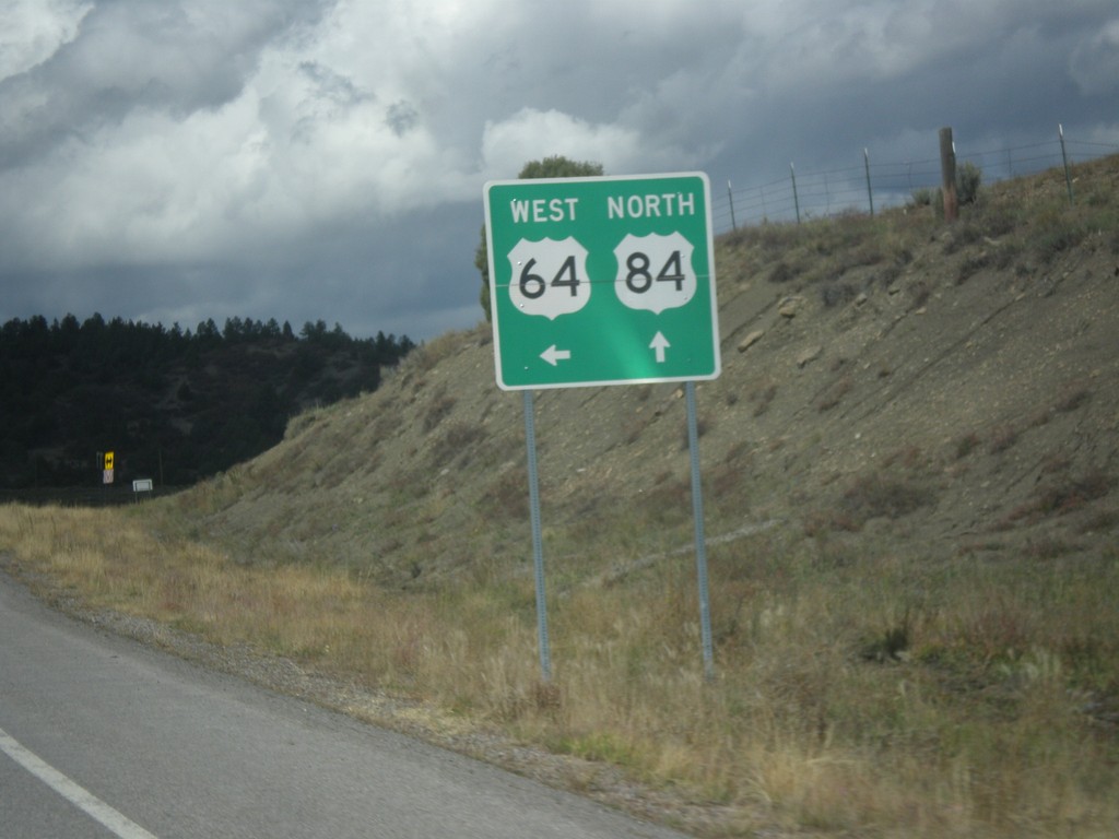
US-64 West/US-84 North at Split
US-64 West/US-84 north at split in Rio Arriba County. US-84 north continues straight; turn left for US-64 west.
Taken 10-13-2013
 Amargo
Rio Arriba County
New Mexico
United States
Amargo
Rio Arriba County
New Mexico
United States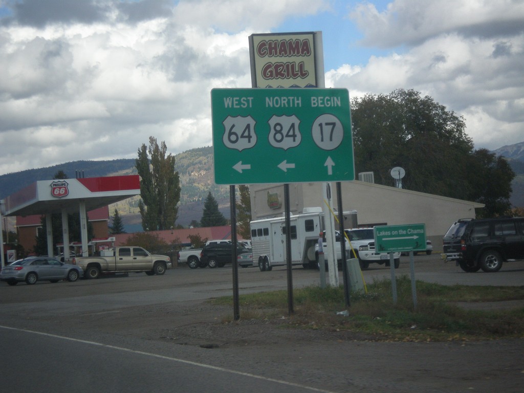
US-64 West/US-84 North at NM-17
US-64 West/US-84 north at NM-17 in Chama. Turn left to continue west on US-64/US-84.
Taken 10-13-2013
 Chama
Rio Arriba County
New Mexico
United States
Chama
Rio Arriba County
New Mexico
United States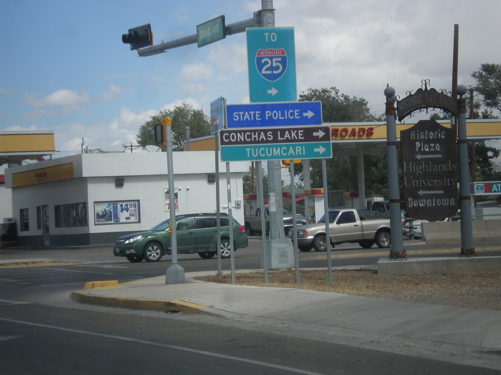
BL-25 North (Grand Ave.) at NM-104
BL-25 North (Grand Ave.) at NM-104 in Las Vegas. Turn right on NM-104 east for I-25, Conchas Lake (State Park), Tucumcari, and State Police.
Taken 10-10-2013

 Las Vegas
San Miguel County
New Mexico
United States
Las Vegas
San Miguel County
New Mexico
United States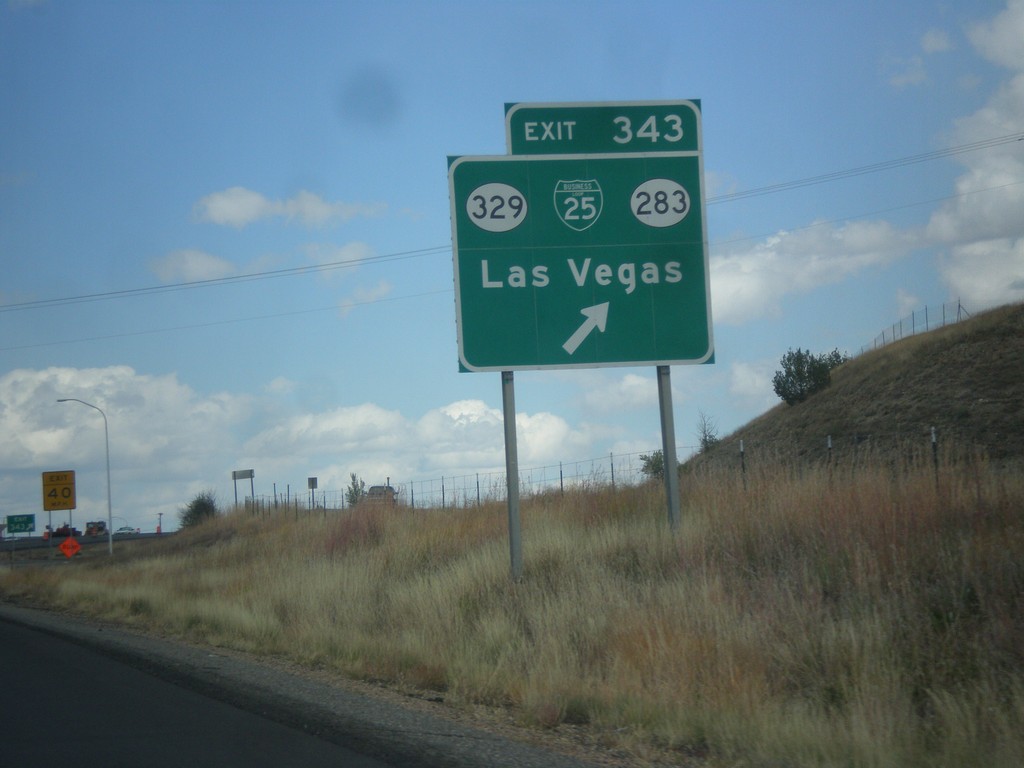
I-25 North - Exit 343
I-25 north at Exit 343 - BL-25/NM-329/NM-283/Las Vegas.
Taken 10-10-2013


 Las Vegas
San Miguel County
New Mexico
United States
Las Vegas
San Miguel County
New Mexico
United States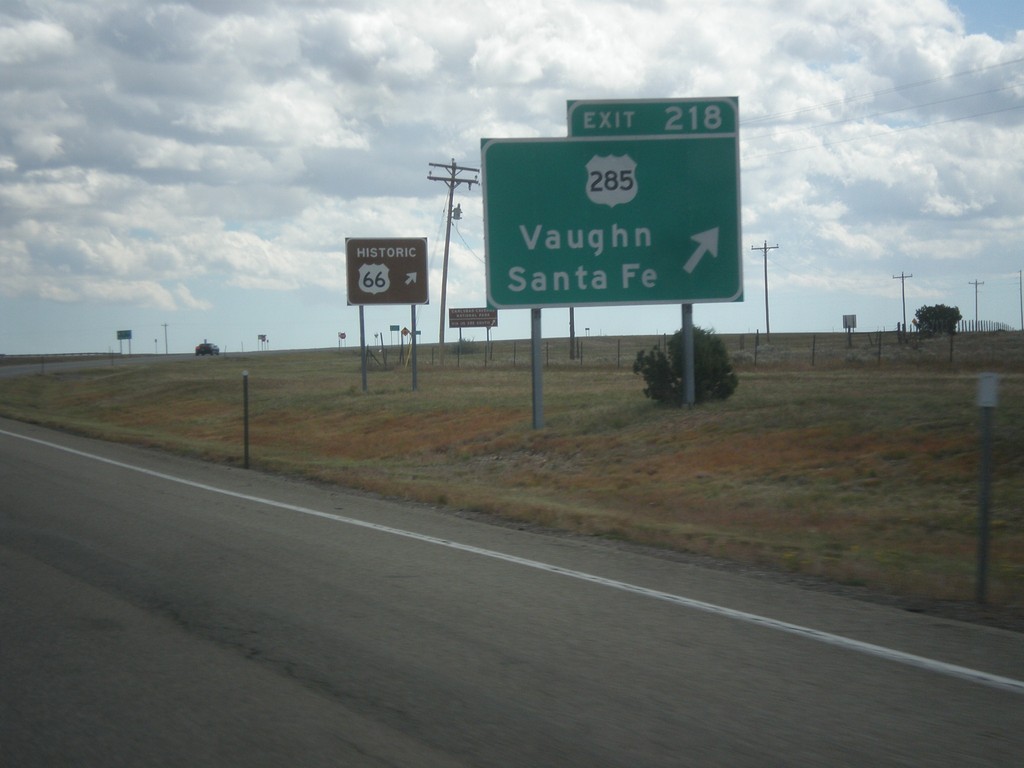
I-40 East - Exit 218
I-40 east at Exit 218 - US-285/Vaughn/Santa Fe.
Taken 10-10-2013

 Clines Corners
Torrance County
New Mexico
United States
Clines Corners
Torrance County
New Mexico
United States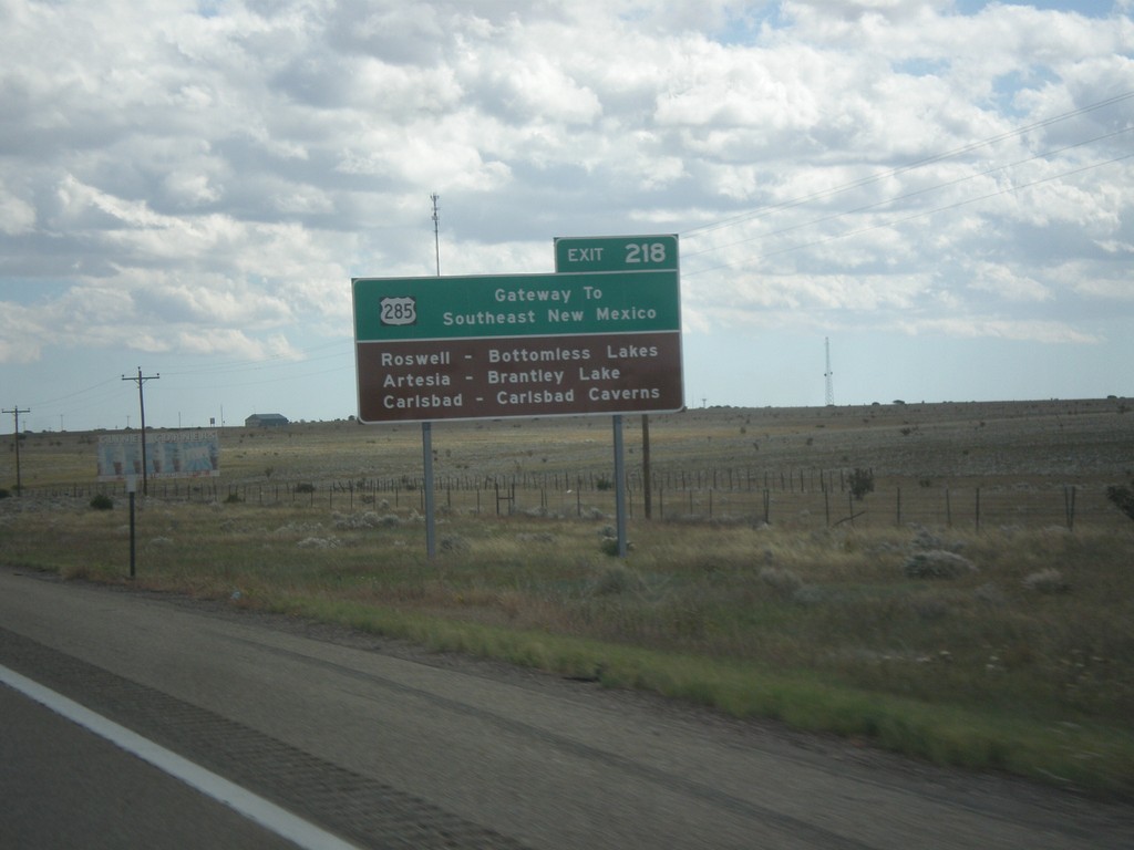
I-40 East - Gateway To Southeast New Mexico
I-40 east approaching Exit 218. US-285 - Gateway to Southeast New Mexico. Use US-285 south for Roswell, Artesia, and Carlsbad.
Taken 10-10-2013
Clines Corners
Torrance County
New Mexico
United States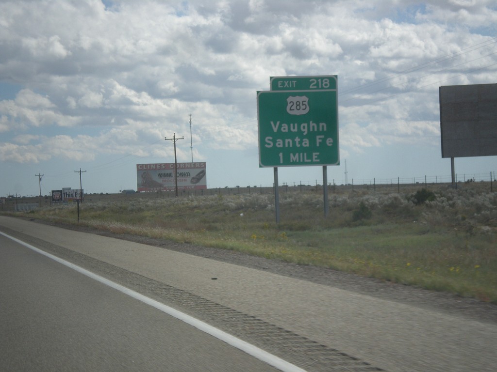
I-40 East Approaching Exit 218
I-40 east approaching Exit 218 - US-285/Santa Fe/Vaughn.
Taken 10-10-2013
Clines Corners
Torrance County
New Mexico
United States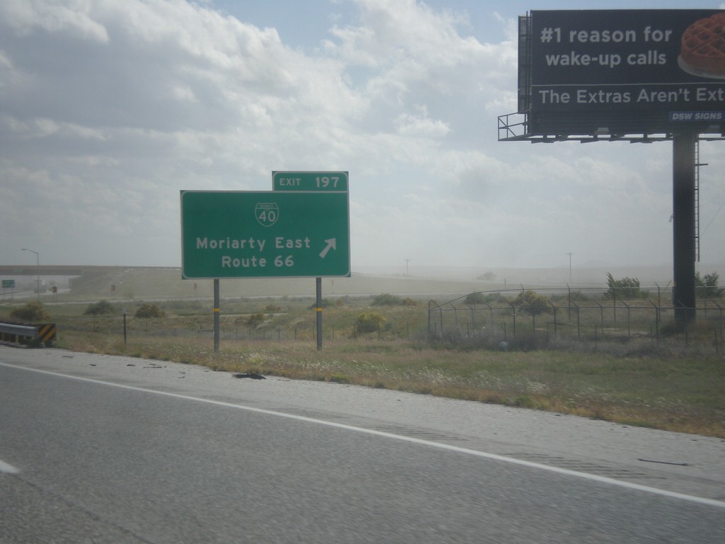
I-40 East - Exit 198
I-40 east at Exit 198 - BL-40/Moriarty East/Route 66. This is the eastern end of the Moriarty business loop.
Taken 10-10-2013
 Moriarty
Torrance County
New Mexico
United States
Moriarty
Torrance County
New Mexico
United States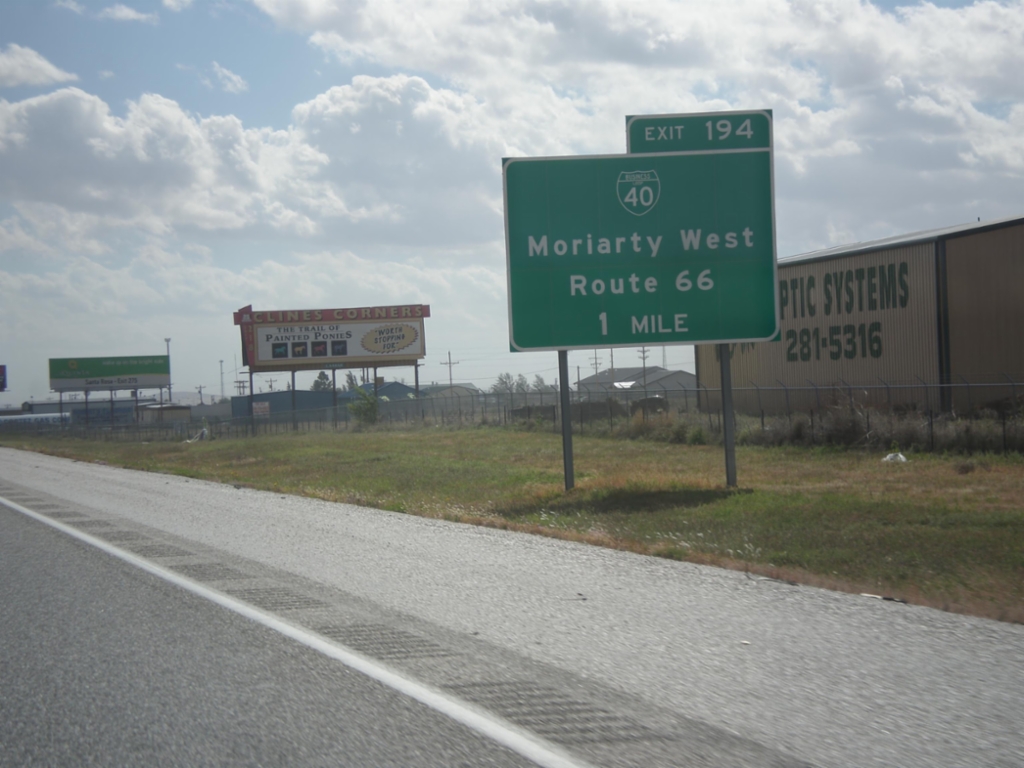
I-40 East Approaching Exit 194
I-40 east approaching Exit 194 - BL-40/Moriarty West/Route 66.
Taken 10-10-2013
Moriarty
Torrance County
New Mexico
United States