Signs Tagged With Shield Inside Sign
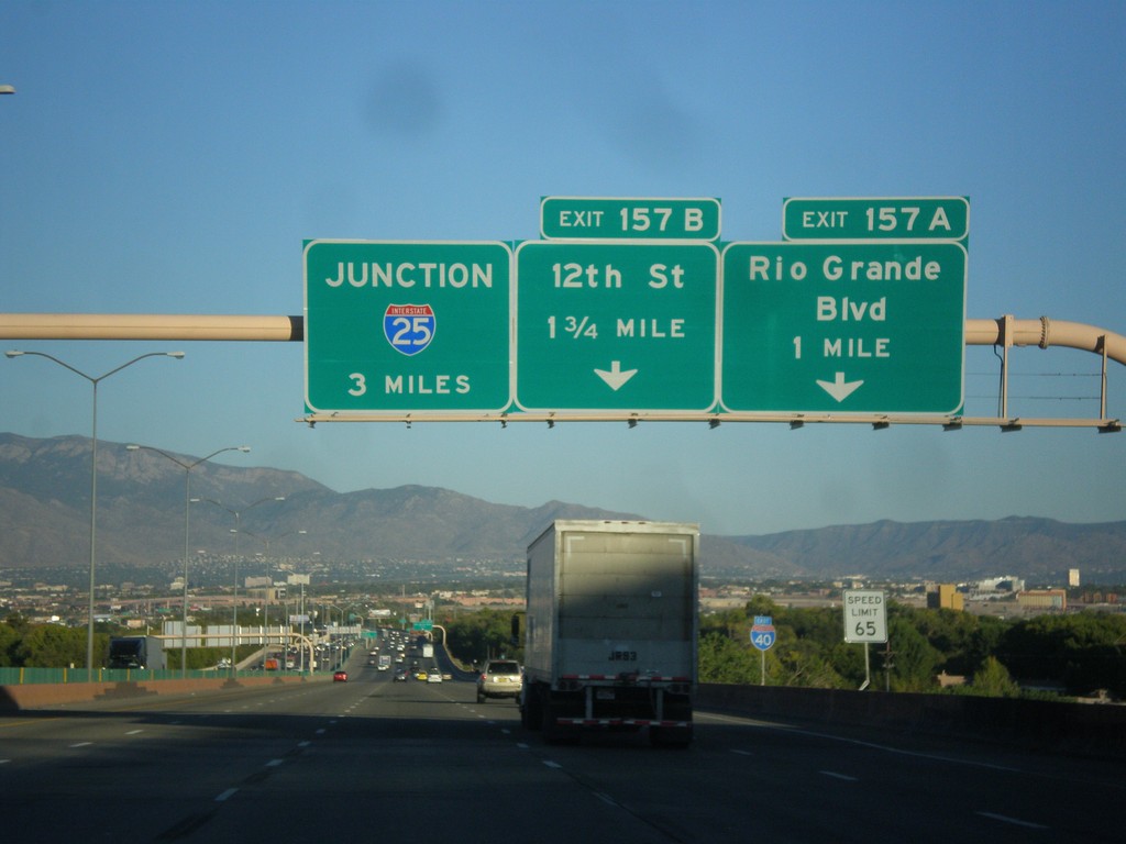
I-40 East Approaching Exits 157A-B
I-40 east approaching Exit 157A - Rio Grande Blvd. and Exit 157B - 12th St. Also approaching I-25 junction in 3 miles.
Taken 10-10-2012

 Albuquerque
Bernalillo County
New Mexico
United States
Albuquerque
Bernalillo County
New Mexico
United States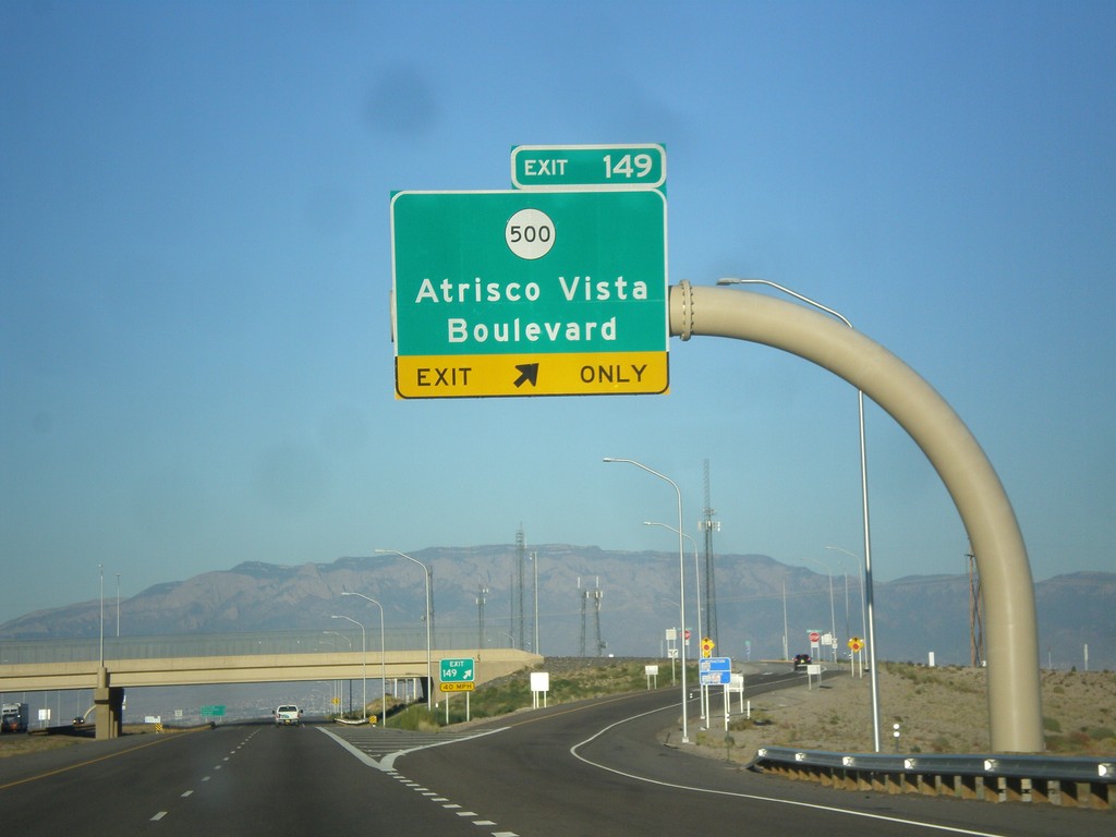
I-40 East - Exit 149
I-40 east at Exit 149 - NM-500/Atrisco Vista Blvd.
Taken 10-10-2012
 Albuquerque
Bernalillo County
New Mexico
United States
Albuquerque
Bernalillo County
New Mexico
United States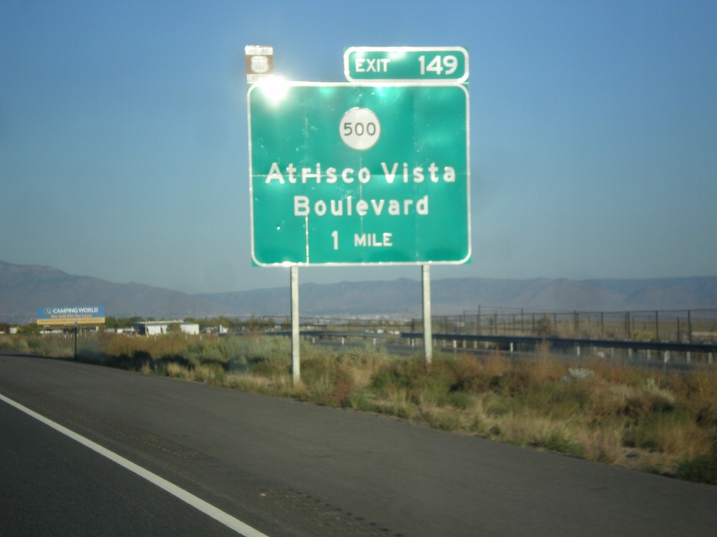
I-40 East Approaching Exit 149
I-40 east approaching Exit 149 - NM-500/Atrisco Vista Blvd. Use Exit 149 to follow the route of historic US-66 into downtown Albuquerque via Central Ave.
Taken 10-10-2012
Albuquerque
Bernalillo County
New Mexico
United States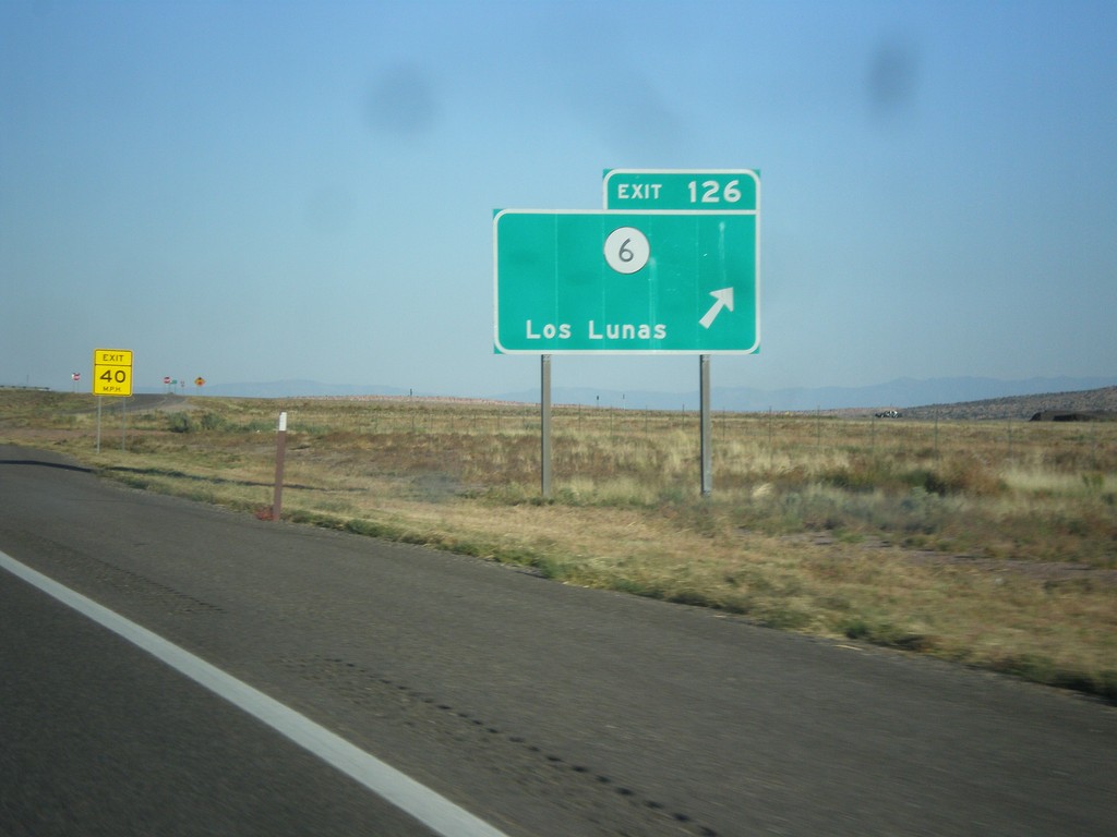
I-40 East - Exit 126
I-40 east at Exit 126 - NM-6/Los Lunas.
Taken 10-10-2012
 Laguna
Cibola County
New Mexico
United States
Laguna
Cibola County
New Mexico
United States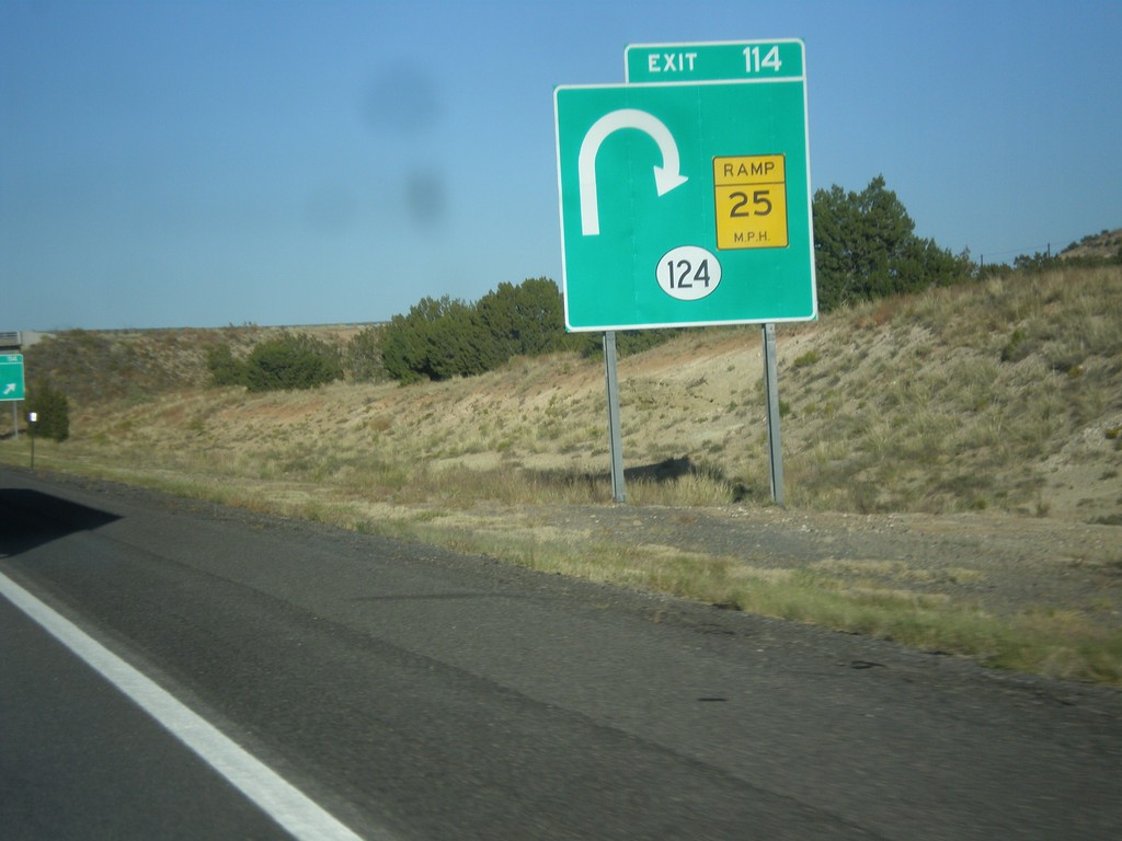
I-40 East Approaching Exit 114
I-40 east approaching Exit 114 - NM-124. The NM-124 interchange is a trumpet style interchange, and involves a loop from eastbound I-40 to NM-124. This is depicted on the sign diagram.
Taken 10-10-2012
 Cibola County
New Mexico
United States
Cibola County
New Mexico
United States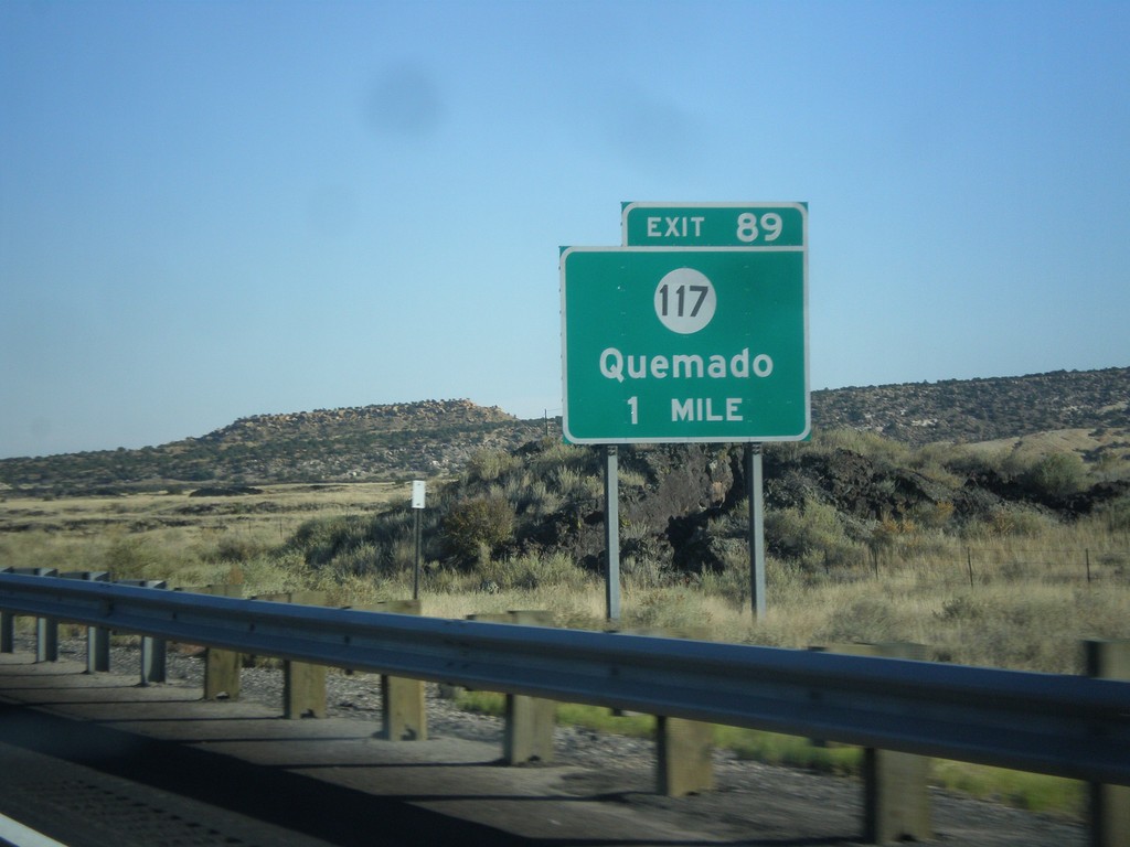
I-40 East Approaching Exit 89
I-40 east approaching Exit 89 - NM-117/Quemado.
Taken 10-10-2012
 Grants
Cibola County
New Mexico
United States
Grants
Cibola County
New Mexico
United States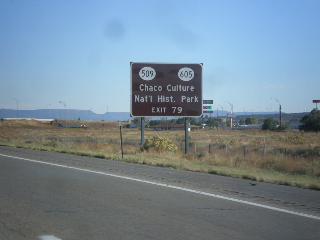
I-40 East Approaching Exit 79
I-40 east approaching Exit 79 - BL-40/NM-112/NM-605/San Mateo. Use Exit 79 for Chaco Culture National Historic Park via NM-605 and NM-509.
Taken 10-10-2012


 Grants
Cibola County
New Mexico
United States
Grants
Cibola County
New Mexico
United States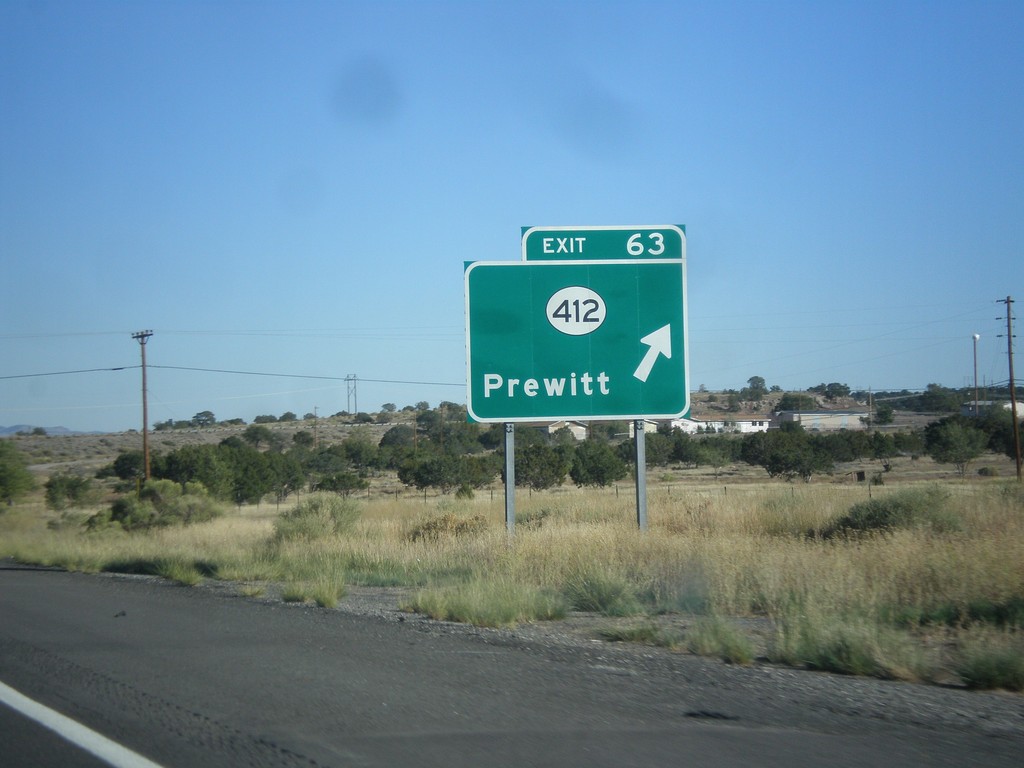
I-40 East - Exit 63
I-40 east at Exit 63 - NM-412/Prewitt.
Taken 10-10-2012
 Prewitt
McKinley County
New Mexico
United States
Prewitt
McKinley County
New Mexico
United States
I-40 East Approaching Exit 47
I-40 east approaching Exit 47 - Continental Divide/Historic US-66 Route.
Taken 10-10-2012
Continental Divide
McKinley County
New Mexico
United States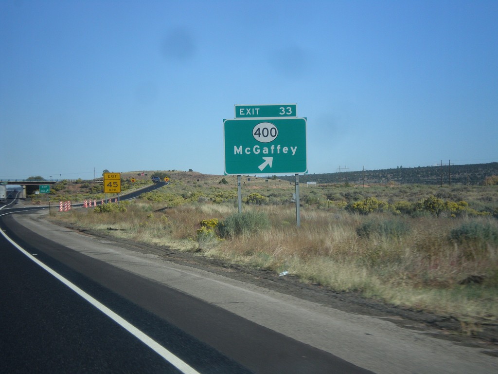
I-40 East - Exit 33
I-40 east at Exit 33 - NM-400/McGaffey.
Taken 10-10-2012
 Fort Wingate
McKinley County
New Mexico
United States
Fort Wingate
McKinley County
New Mexico
United States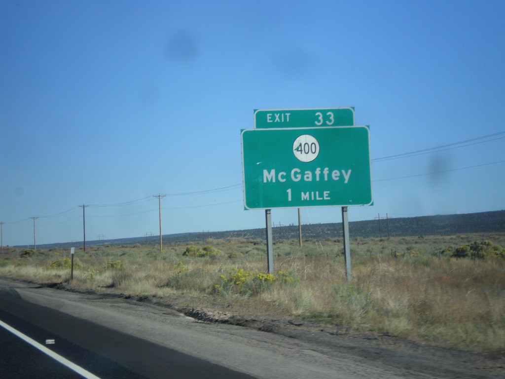
I-40 East Approaching Exit 33
I-40 east approaching Exit 33 - NM-400/McGaffey.
Taken 10-10-2012
Fort Wingate
McKinley County
New Mexico
United States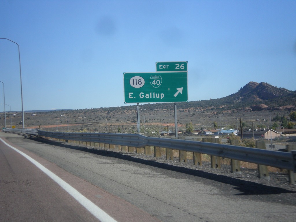
I-40 East - Exit 26
I-40 east at Exit 26 - BL-40/NM-118/East Gallup. This is the eastern end of the Gallup business loop.
Taken 10-10-2012
 Gallup
McKinley County
New Mexico
United States
Gallup
McKinley County
New Mexico
United States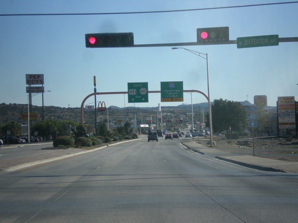
US-491 South Approaching I-40/NM-602
US-491 south approaching I-40 to Albuquerque and Flagstaff (Arizona). US-491 ends at I-40, and turns into NM-602 towards Zuni.
Taken 10-10-2012

 Gallup
McKinley County
New Mexico
United States
Gallup
McKinley County
New Mexico
United States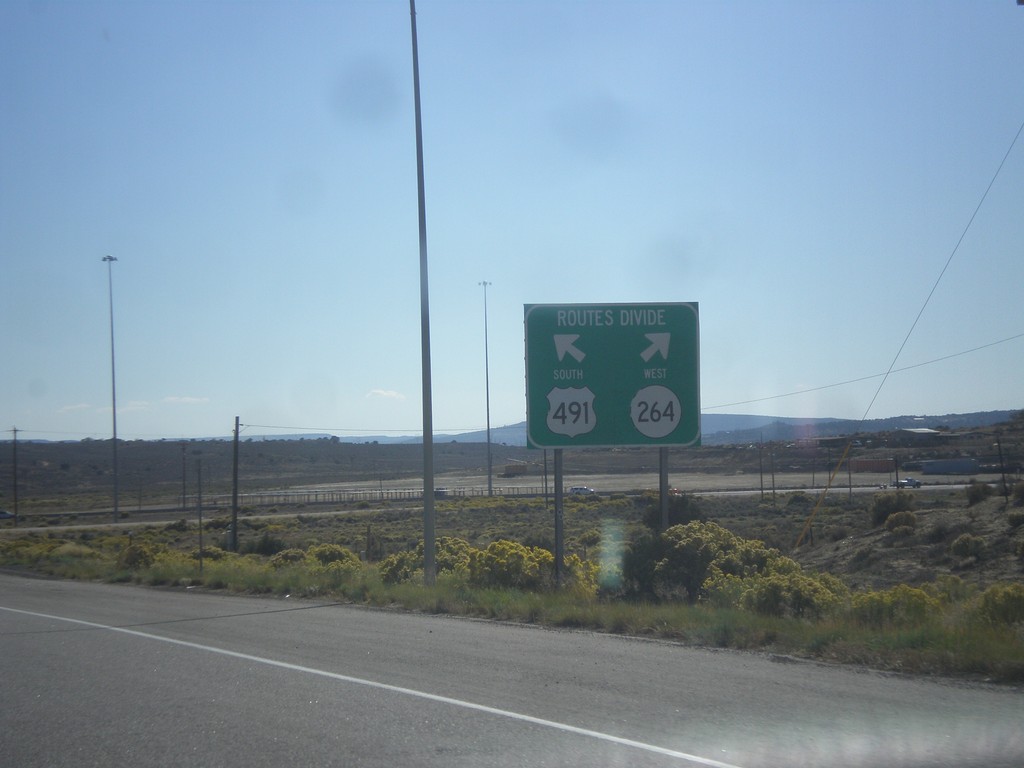
US-491 South at NM-264
US-491 south at NM-264. Use left lane for US-491 south; right lane for NM-264 west.
Taken 10-10-2012
 Yah-ta-hey
McKinley County
New Mexico
United States
Yah-ta-hey
McKinley County
New Mexico
United States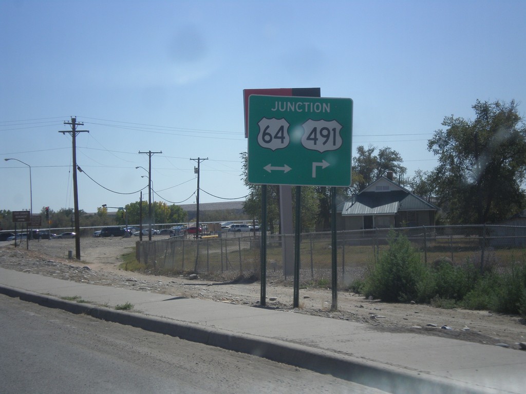
US-491 South Approaching US-64
US-491 south approaching US-64. Turn right for US-64 West/US-491 south; left for US-64 east.
Taken 10-10-2012
 Shiprock
San Juan County
New Mexico
United States
Shiprock
San Juan County
New Mexico
United States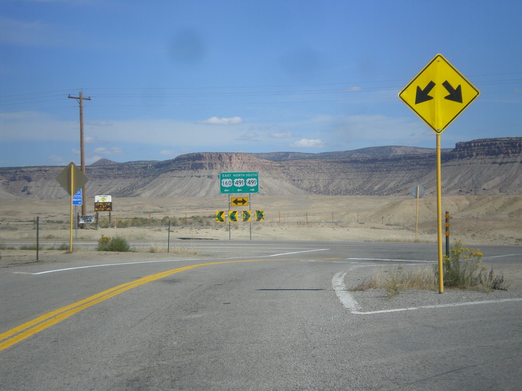
US-160 East at US-491
US-160 east at US-491. Turn left to continue east on US-160. US-160 joins US-491 east to Cortez.
Taken 10-10-2012
 Towaoc
Montezuma County
Colorado
United States
Towaoc
Montezuma County
Colorado
United States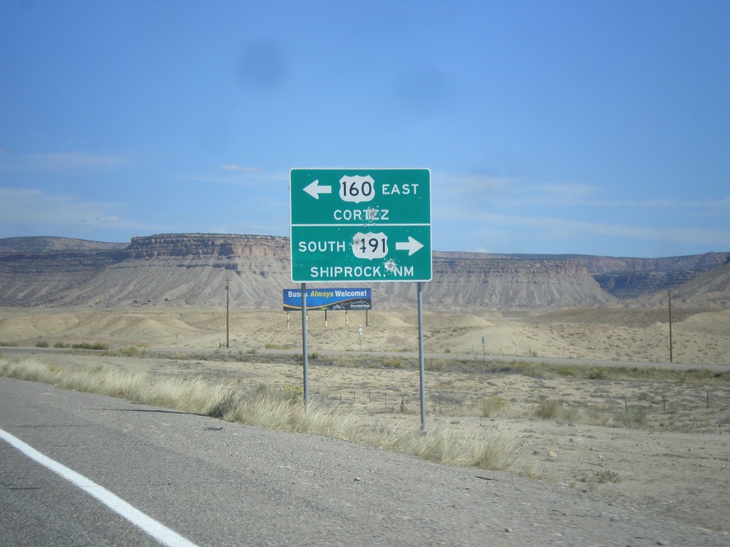
US-160 East at US-491
US-160 east at US-491. Turn right for US-491 south to Shiprock, New Mexico. Turn left for US-491 north and US-160 east to Cortez. US-160 joins US-491 north to Cortez.
Taken 10-10-2012
Towaoc
Montezuma County
Colorado
United States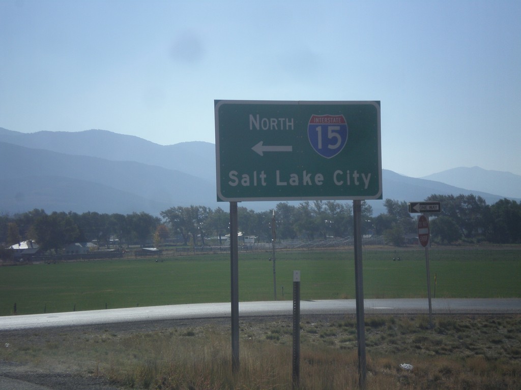
US-50 East at I-15 North
US-50 east at I-15 north to Salt Lake City. US-50 joins I-15 south to Holden.
Taken 10-07-2012

 Scipio
Millard County
Utah
United States
Scipio
Millard County
Utah
United States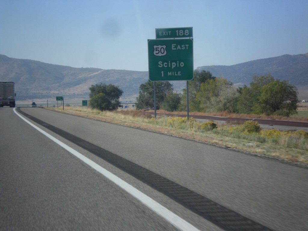
I-15 South Approaching Exit 188
I-15 south approaching Exit 188 - US-50 East/Scipio. US-50 joins I-15 south from Scipio to Holden.
Taken 10-07-2012
Scipio
Millard County
Utah
United States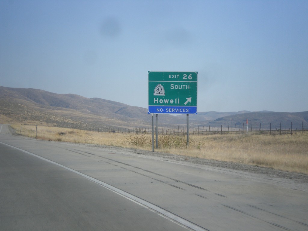
I-84 East - East 26
I-84 east at Exit 26 - UT-83 South/Howell.
Taken 10-06-2012

 Howell
Box Elder County
Utah
United States
Howell
Box Elder County
Utah
United States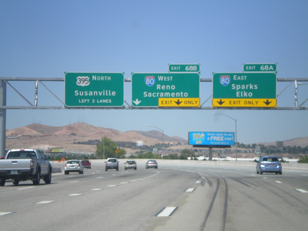
US-395 North - Exits 68A and 68B
US-395 north approaching Exits 68A and 68B. Exit 68A - I-80 East/Sparks/Elko. Exit 68B - I-80 West/Reno/Sacramento (California). US-395 continues north towards Susanville (California). The new signs along the US-395 freeway are using the Clearview font.
Taken 07-28-2012

 Reno
Washoe County
Nevada
United States
Reno
Washoe County
Nevada
United States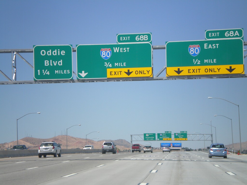
US-395 North Approaching Exits 68AB and 69
US-395 north approaching Exit 68A - I-80 East; Exit 68B - I-80 West, and Exit 69 (exit number not shown) - Oddie Blvd.
Taken 07-28-2012
Reno
Washoe County
Nevada
United States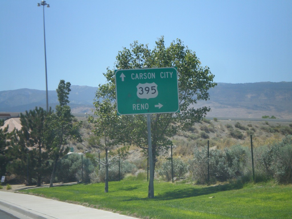
Damonte Ranch Parkway West at US-395
Damonte Ranch Parkway West at US-395. Turn right for US-395 north to Reno. Continue under highway for US-395 south to Carson City.
Taken 07-28-2012
Reno
Washoe County
Nevada
United States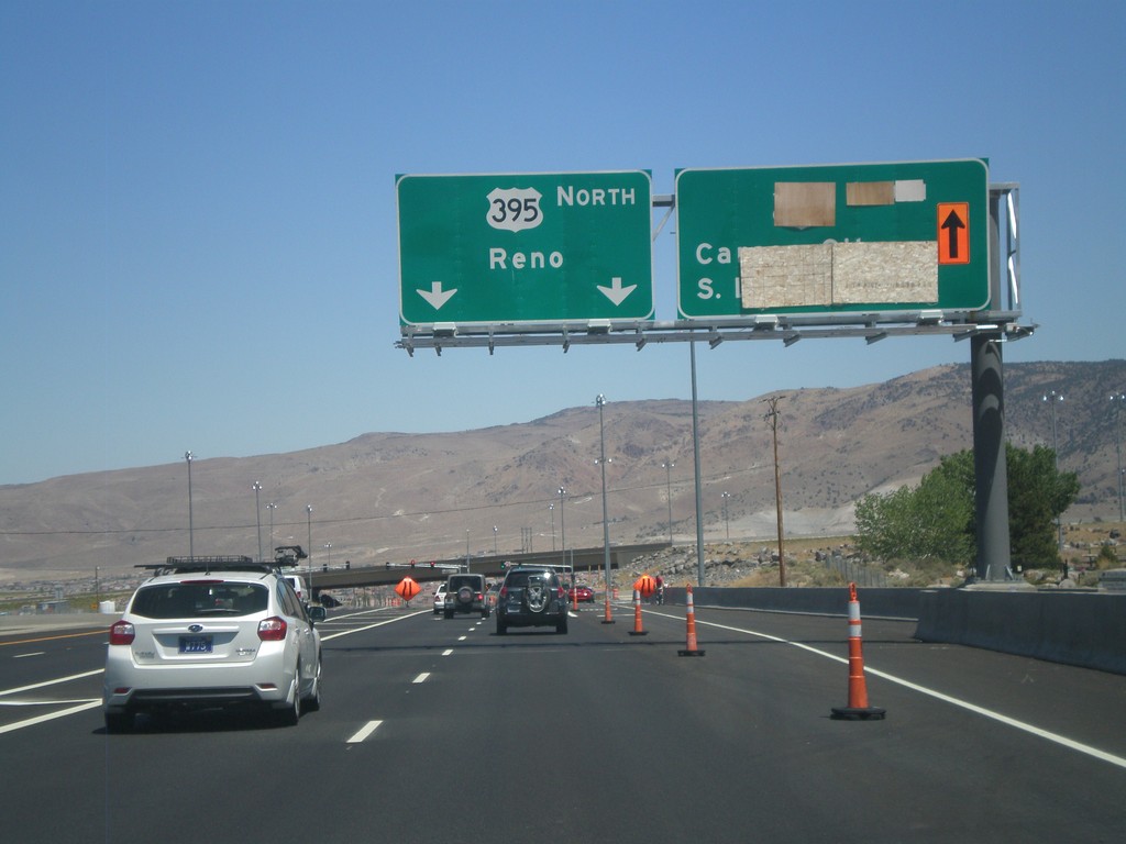
NV-431 East at US-395
NV-431 east at US-395. This is the southern end of the current US-395 freeway. The section between NV-431 and Washoe Lake is expected to be completed in late 2012. For US-395 north to Reno continue straight. In late 2012, the right lanes will be for US-395 south to Carson City and South Lake Tahoe.
Taken 07-28-2012
 Reno
Washoe County
Nevada
United States
Reno
Washoe County
Nevada
United States
NV-28 East Approaching NV-431
NV-28 east approaching NV-431 (Mount Rose Highway).
Taken 07-28-2012
 Incline Village
Washoe County
Nevada
United States
Incline Village
Washoe County
Nevada
United States