Signs Tagged With Shield Inside Sign
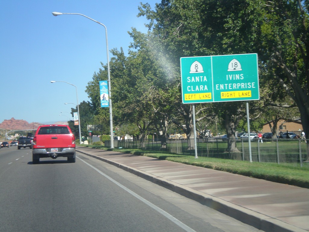
UT-18 North Approaching UT-8
UT-18 north approaching UT-8. Use left lanes for UT-8 to Santa Clara. Use right lanes for UT-18 north to Ivins and Enterprise.
Taken 10-14-2011

 St. George
Washington County
Utah
United States
St. George
Washington County
Utah
United States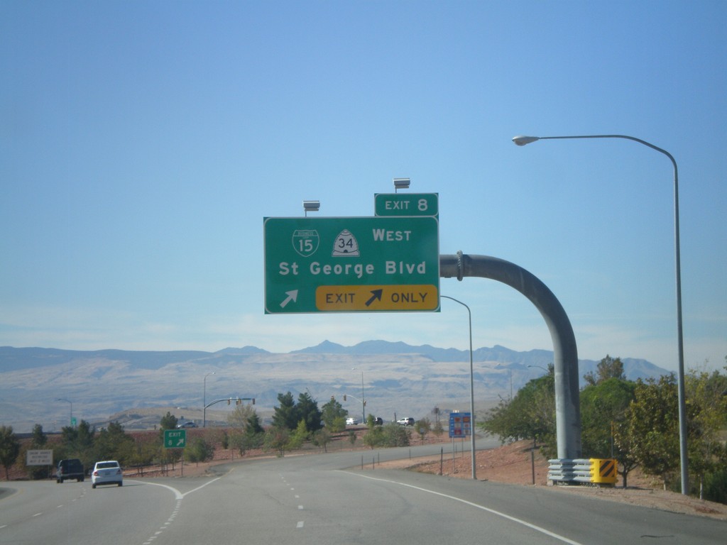
I-15 South - Exit 8
I-15 south at Exit 8 - BL-15/UT-34 West/St. George Blvd.
Taken 10-14-2011


 St. George
Washington County
Utah
United States
St. George
Washington County
Utah
United States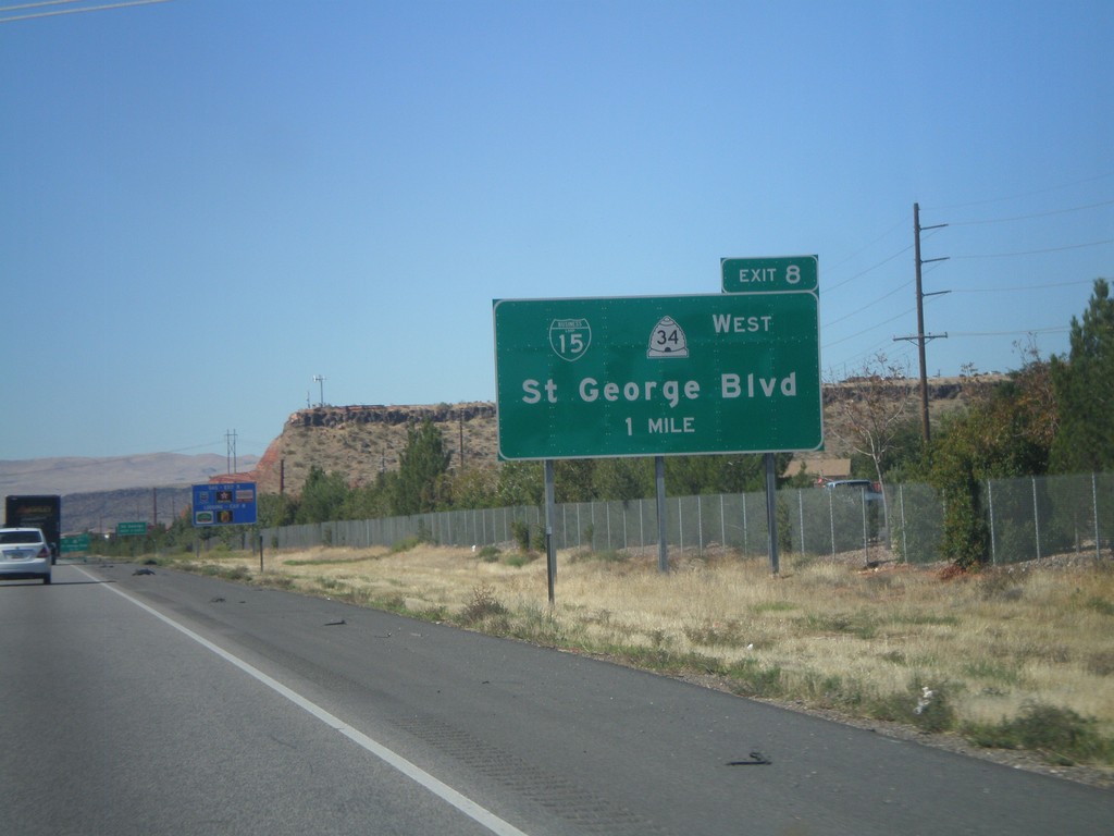
I-15 South - Exit 8
I-15 south approaching Exit 8 - BL-15/UT-34 West/St. George Blvd.
Taken 10-14-2011
St. George
Washington County
Utah
United States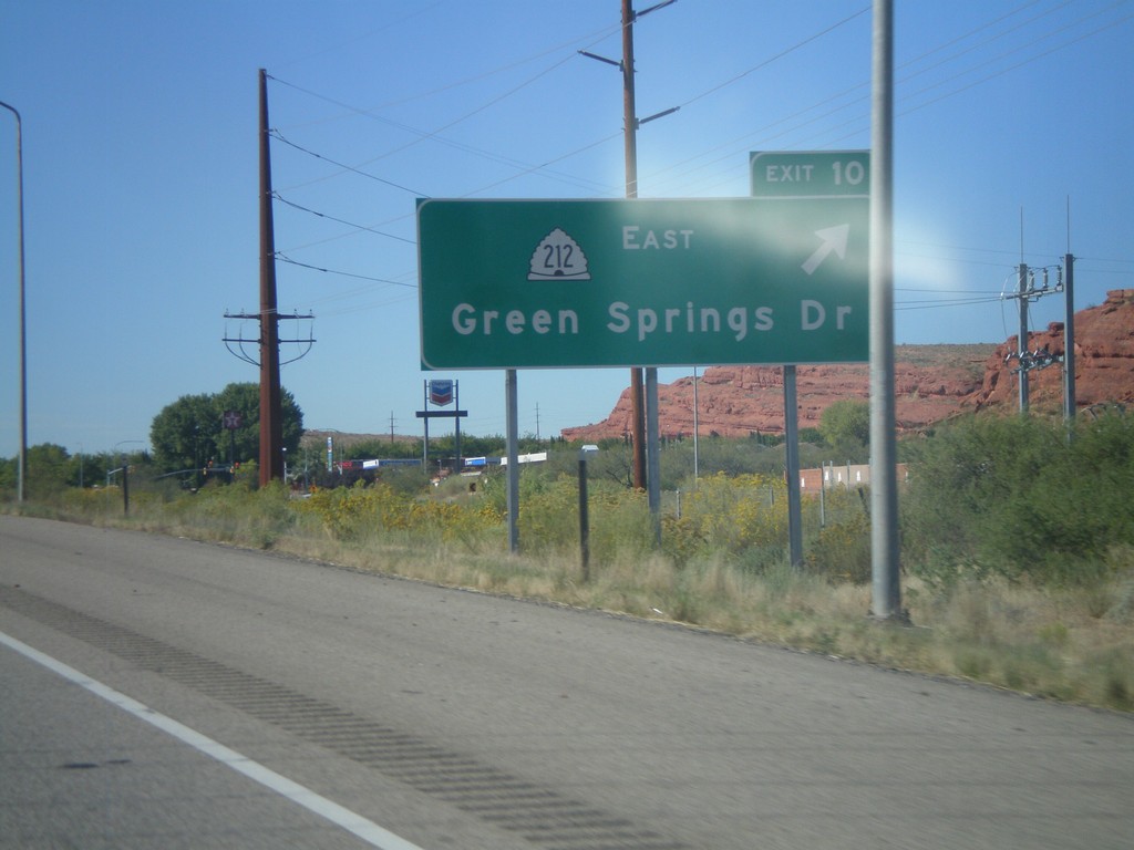
I-15 South - Exit 10
I-15 south at Exit 10 - UT-212 East/Green Springs Drive.
Taken 10-14-2011
 Washington
 County
Utah
United States
Washington
Washington County
Utah
United States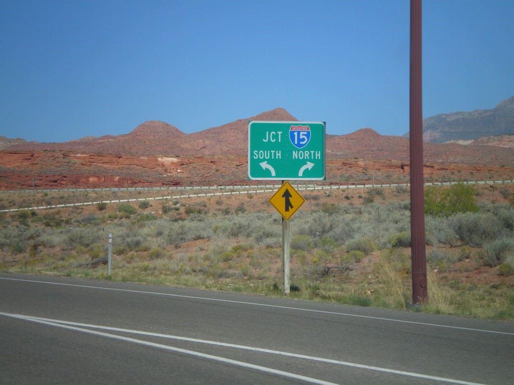
End UT-9 West at I-15
End UT-9 West at I-15. Use left lane for I-15 south; right lane for I-15 north.
Taken 10-14-2011
 Washington
 County
Utah
United States
Washington
Washington County
Utah
United States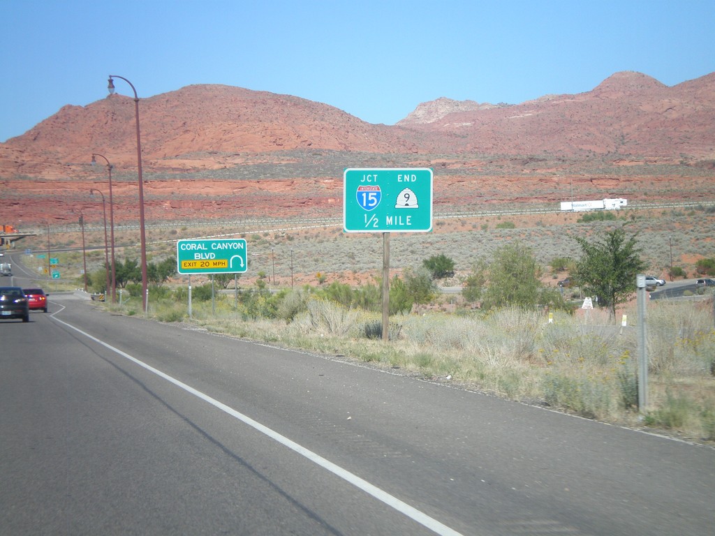
UT-9 West At Coral Canyon Blvd.
UT-9 West At Coral Canyon Blvd interchange. Approaching I-15 and the western end of UT-9.
Taken 10-14-2011
Washington
Washington County
Utah
United States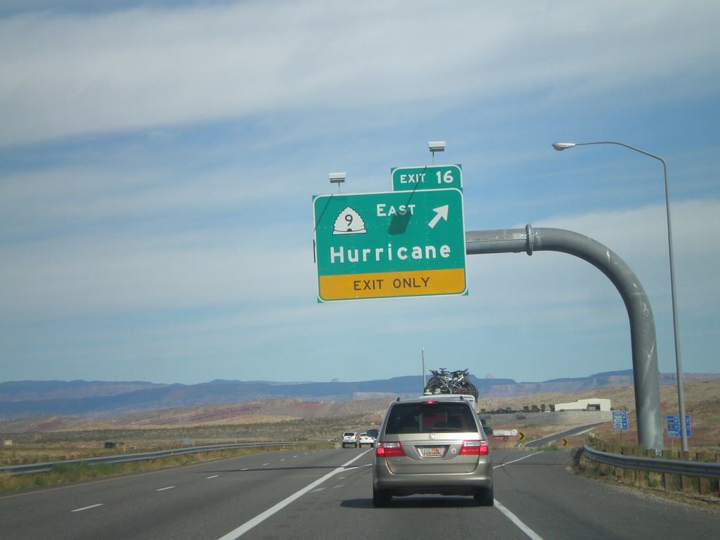
I-15 North - Exit 16
I-15 north at Exit 16 - UT-9 East/Hurricane.
Taken 10-10-2011
Washington
Washington County
Utah
United States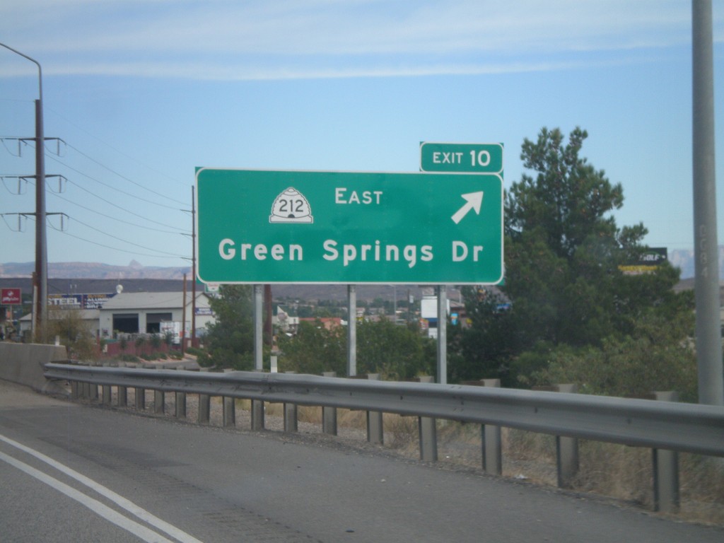
I-15 North - Exit 10
I-15 north at Exit 10 - UT-212 East/Green Springs Drive.
Taken 10-10-2011
St. George
Washington County
Utah
United States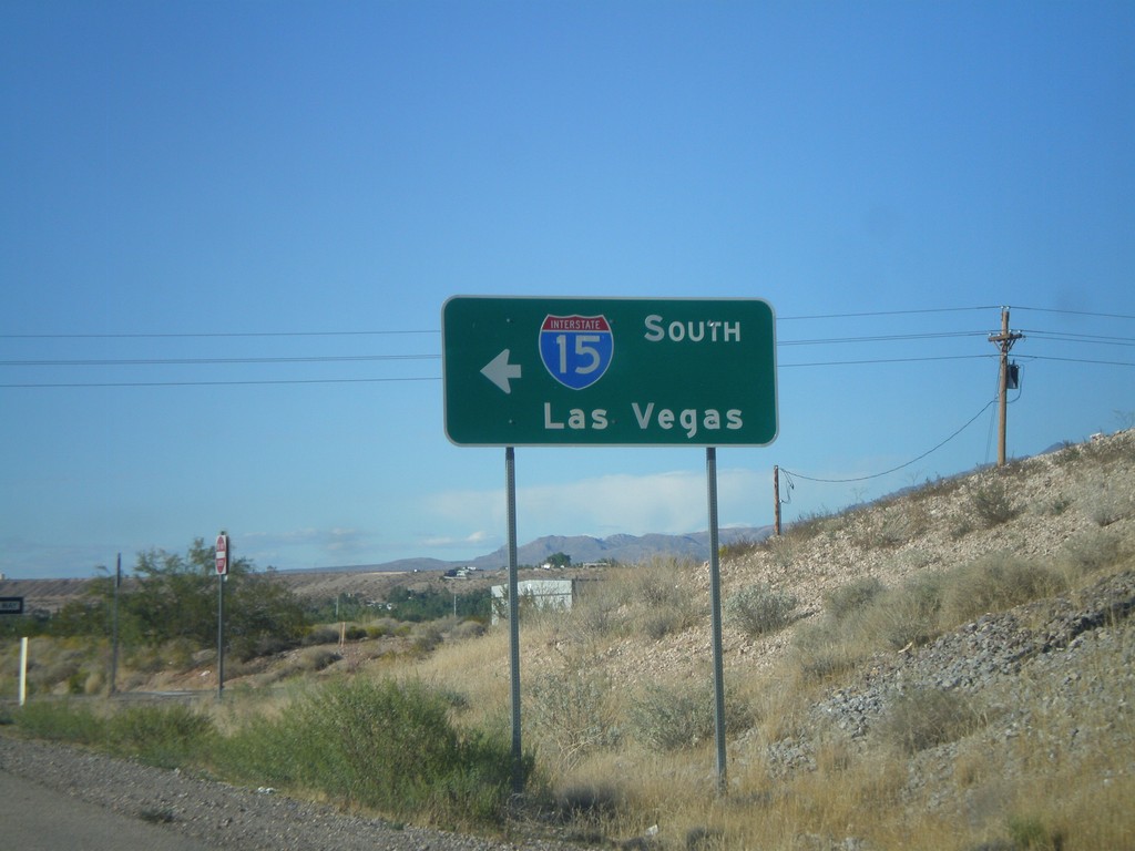
County Road 91 North at I-15 South
County Road 91 North at I-15 South to Las Vegas (Exit 8).
Taken 10-09-2011
Beaver Dam
Mohave County
Arizona
United States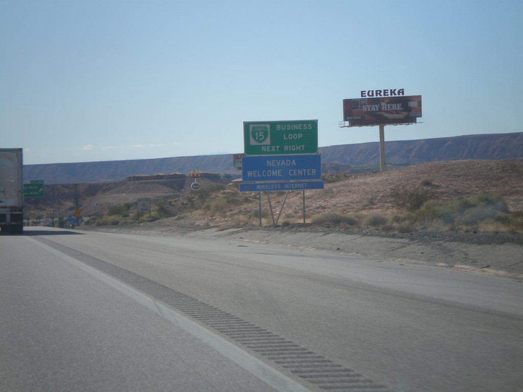
I-15 South - BL-15 Next Right
I-15 south approaching Exit 122. Use Exit 122 for BL-15 and Nevada Welcome Center. This is the north end of the Mesquite Business Loop.
Taken 10-09-2011
Mesquite
Clark County
Nevada
United States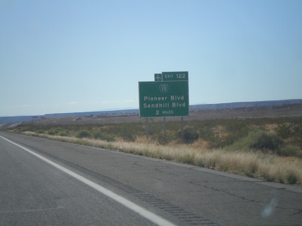
I-15 South Approaching Exit 122
I-15 south approaching Exit 122 (Nevada) - BL-15/Pioneer Blvd/Sandhill Blvd. BL-15 is not signed on the actual interchange within Nevada.
Taken 10-09-2011
Littlefield
Mohave County
Arizona
United States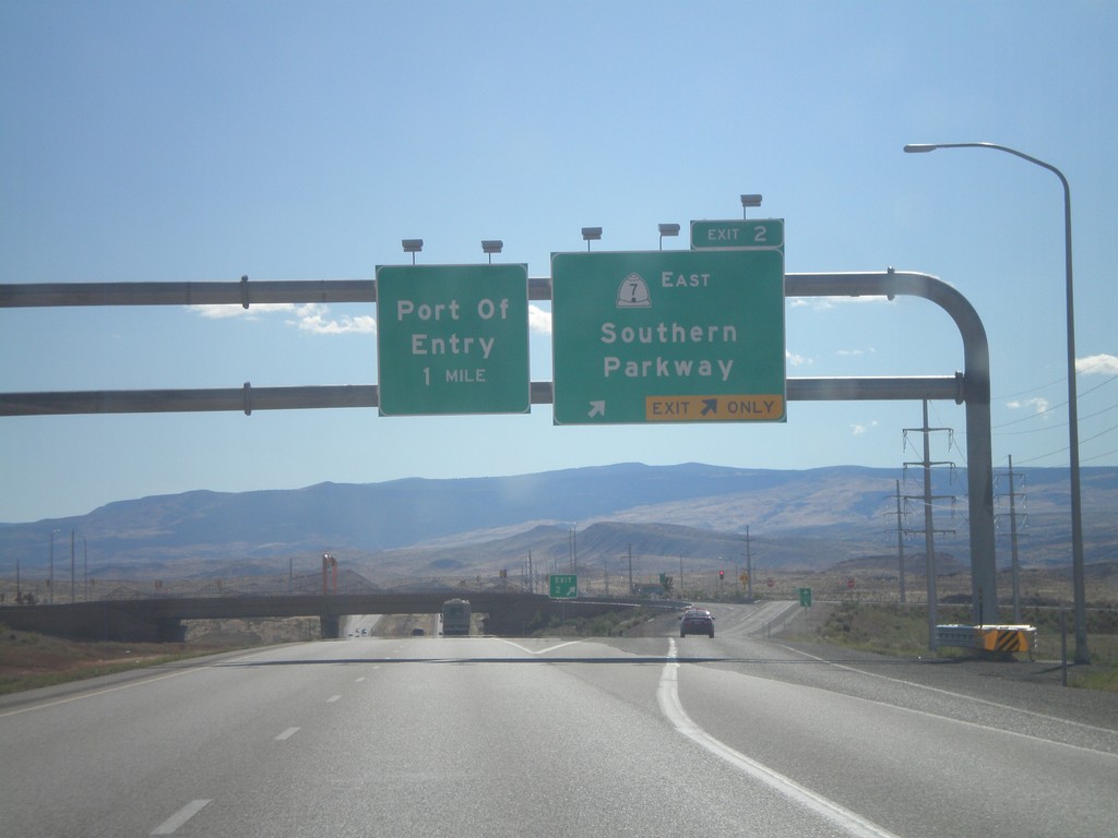
I-15 South - Exit 2
I-15 south at Exit 2 - UT-7 East/Southern Parkway. This is the south eastern end of the new St. George beltway.
Taken 10-09-2011
 St. George
Washington County
Utah
United States
St. George
Washington County
Utah
United States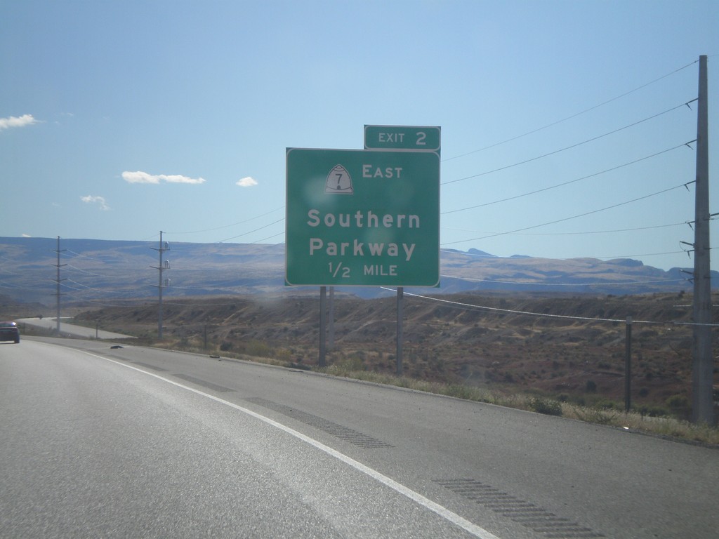
I-15 South Approaching Exit 2
I-15 south approaching Exit 2 - UT-7 East/Southern Parkway. This is the last exit in Utah on I-15 south.
Taken 10-09-2011
St. George
Washington County
Utah
United States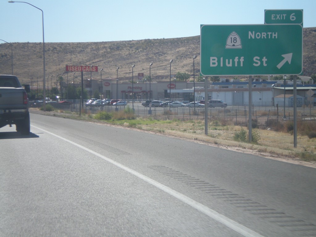
I-15 South - Exit 6
I-15 south at Exit 6 - UT-18/Bluff St. This is the southern end of the St. George business loop.
Taken 10-09-2011
St. George
Washington County
Utah
United States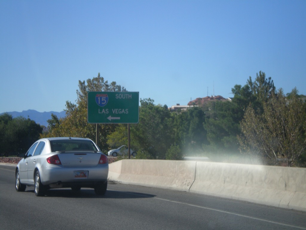
Begin UT-34/BL-15 at I-15 South
Begin UT-34/BL-15 at I-15 South to Las Vegas (Nevada). This is the northern end of the St. George Business Loop.
Taken 10-09-2011
St. George
Washington County
Utah
United States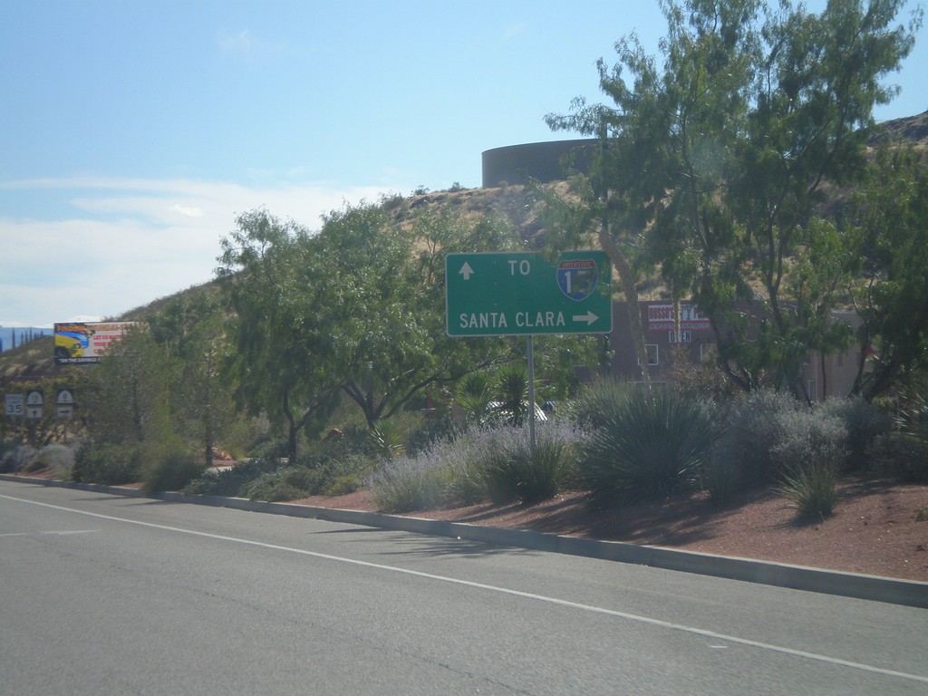
UT-18 South Approaching UT-8
UT-18 South approaching UT-8 west to Santa Clara. Continue south on UT-18 for I-15.
Taken 10-09-2011
St. George
Washington County
Utah
United States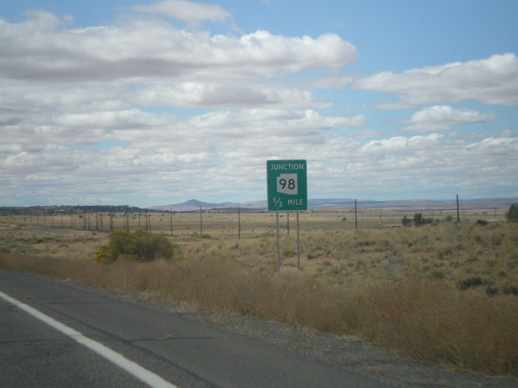
US-160 West Approaching AZ-98
US-160 west approaching AZ-98.
Taken 10-08-2011

 Shonto
Navajo County
Arizona
United States
Shonto
Navajo County
Arizona
United States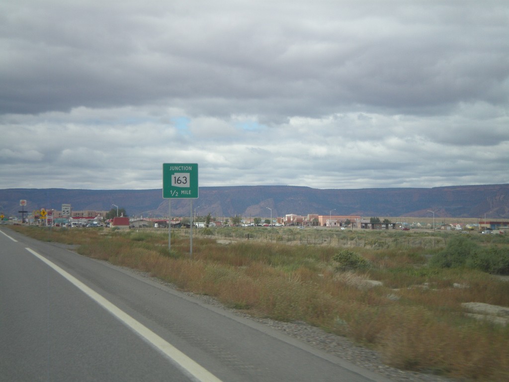
US-160 West Approachign US-163
US-160 west approaching US-163. US-163 is incorrectly marked here as AZ-163.
Taken 10-08-2011
 Kayenta
Navajo County
Arizona
United States
Kayenta
Navajo County
Arizona
United States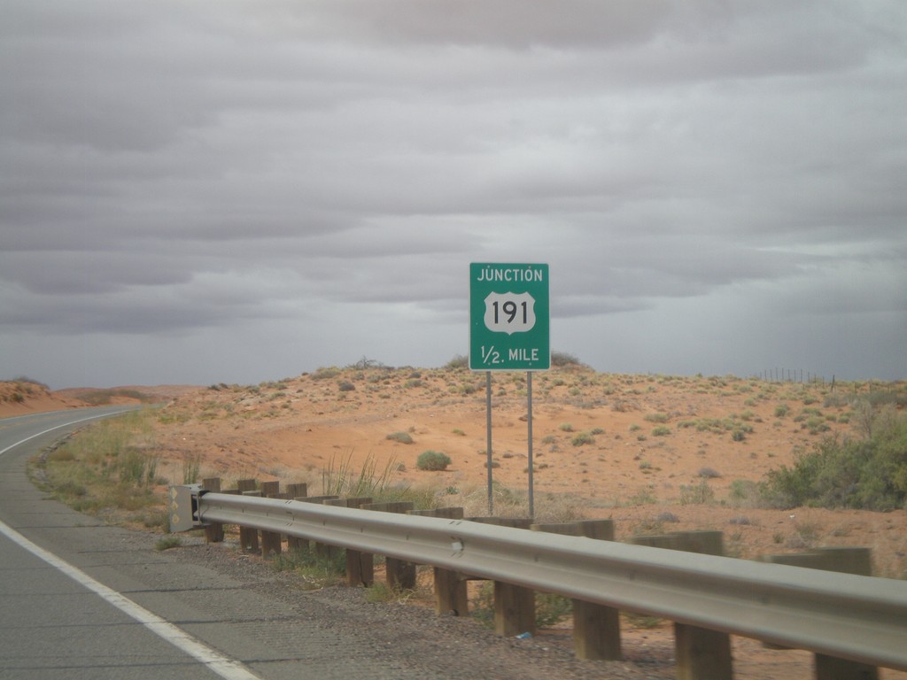
US-160 West/US-191 South Approaching US-191 South
US-160 West/US-191 South approaching US-191 South.
Taken 10-08-2011
 Teec Nos Pos
Apache County
Arizona
United States
Teec Nos Pos
Apache County
Arizona
United States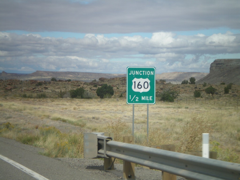
US-64 West Approaching US-160
US-64 West approaching US-160. This is the western end of US-64. The eastern end of US-64 is in Nags Head, North Carolina.
Taken 10-08-2011
 Teec Nos Pos
Apache County
Arizona
United States
Teec Nos Pos
Apache County
Arizona
United States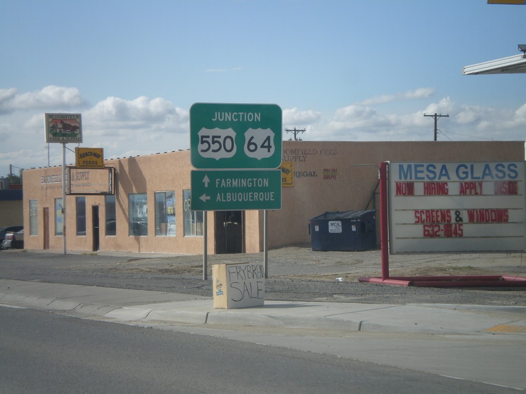
US-64 West/US-550 South at US-550 South
US-64 West/US-550 South at US-550 South. Turn left on US-550 south for Albuquerque. Continue ahead for US-64 west to Farmington.
Taken 10-07-2011
 Bloomfield
San Juan County
New Mexico
United States
Bloomfield
San Juan County
New Mexico
United States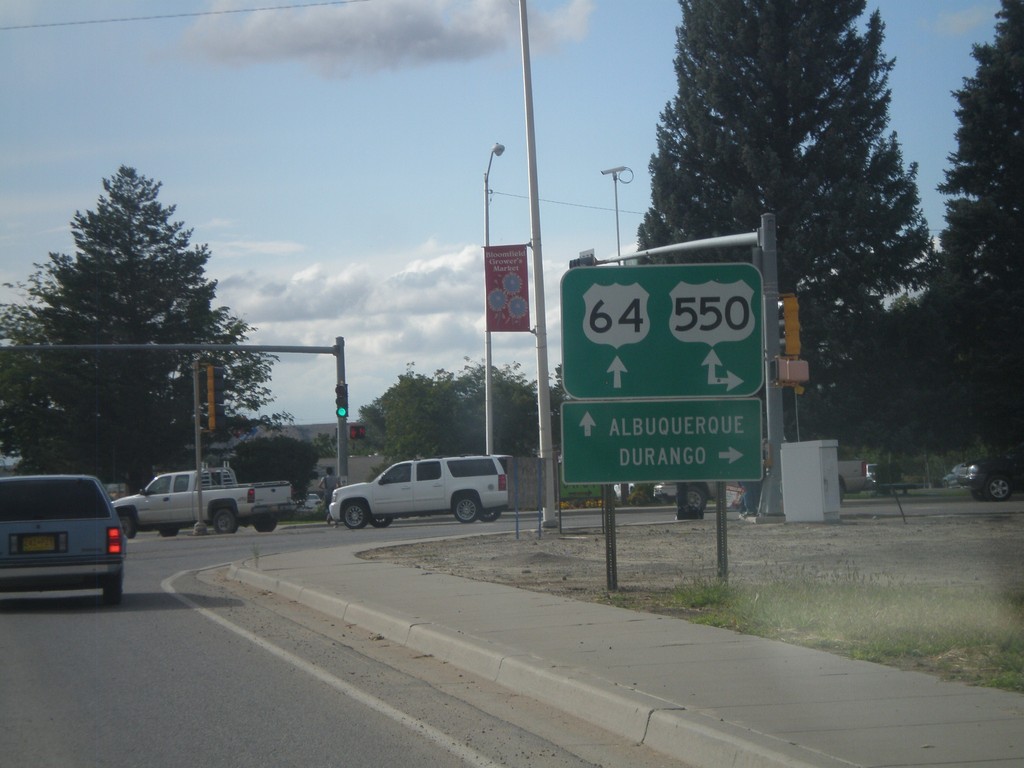
US-64 West at US-550
US-64 west at US-550. US-550 south joins US-64 west through Bloomfield. Turn north on US-550 for Durango (Colorado). Continue ahead on US-64/US-550 for Albuquerque.
Taken 10-07-2011
Bloomfield
San Juan County
New Mexico
United States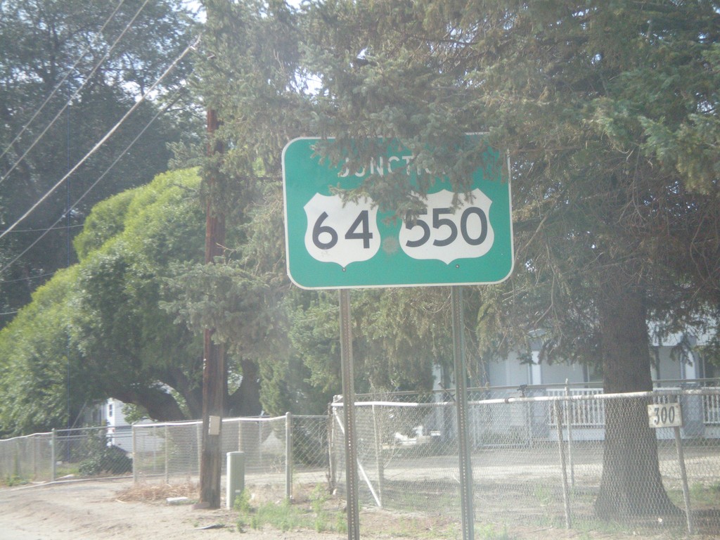
US-64 West Approaching US-550
US-64 west approaching US-550. US-550 joins US-64 through Bloomfield.
Taken 10-07-2011
Bloomfield
San Juan County
New Mexico
United States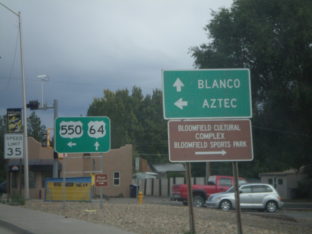
US-64 East/US-550 North at US-550 North
US-64 East/US-550 North at US-550 North. Use US-550 north for Aztec; continue east on US-64 for Blanco.
Taken 10-07-2011
Bloomfield
San Juan County
New Mexico
United States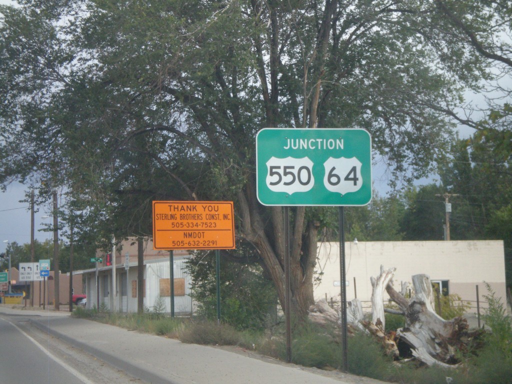
US-64 East/US-550 North Approaching US-550 North
US-64 East/US-550 North approaching US-550 north in Bloomfield.
Taken 10-07-2011
Bloomfield
San Juan County
New Mexico
United States