Signs Tagged With Shield Inside Sign
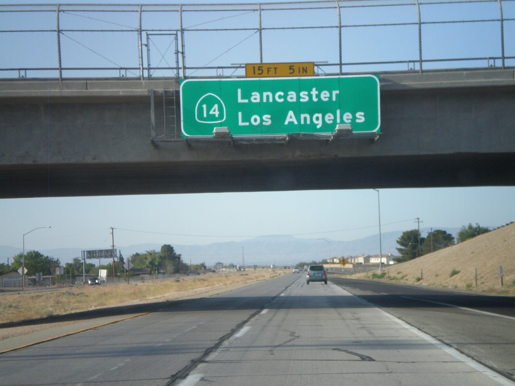
CA-14 South - Lancaster/Los Angeles
CA-14 south to Lancaster and Los Angeles. Posted on the Rosamond Blvd. interchange.
Taken 05-05-2012
 Rosamond
Kern County
California
United States
Rosamond
Kern County
California
United States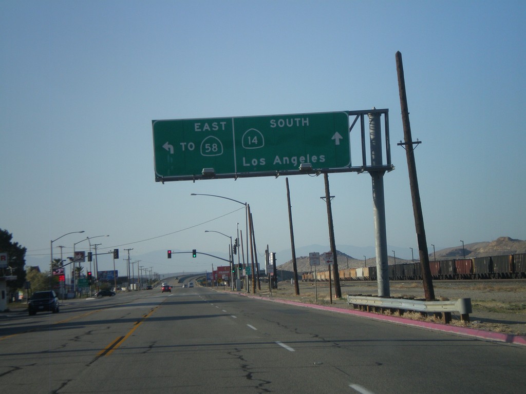
CA-14 South/Bus. CA-58 East at Split
CA-14 South/Bus. CA-58 East at split on south side of Mojave. Turn left for Bus. CA-58 East To CA-58. Continue ahead for CA-14 south to Los Angeles.
Taken 05-05-2012

 Mojave
Kern County
California
United States
Mojave
Kern County
California
United States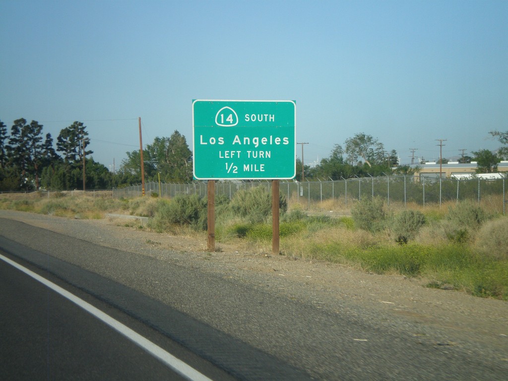
CA-14 South Approaching Bus. CA-58
CA-14 South approaching Bus. CA-58. To continue south on CA-14 towards Los Angeles, turn left at intersection.
Taken 05-05-2012
Mojave
Kern County
California
United States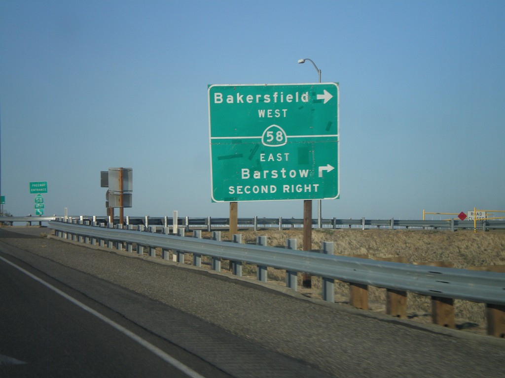
CA-14 South at CA-58
CA-14 south at CA-58. Turn right for CA-58 west to Bakersfield. Continue over overpass and take second right for CA-58 east to Barstow.
Taken 05-05-2012
California City
Kern County
California
United States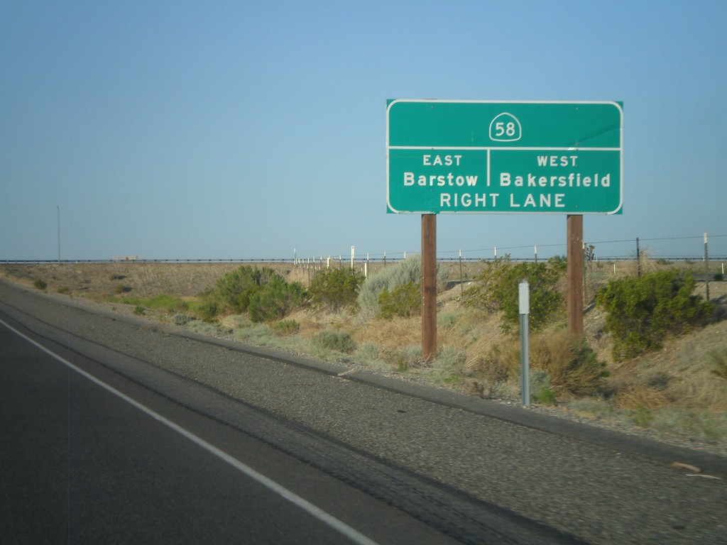
CA-14 South Approaching CA-58
CA-14 South approaching CA-58 to Barstow (east) and Bakersfield (west).
Taken 05-05-2012
Mojave
Kern County
California
United States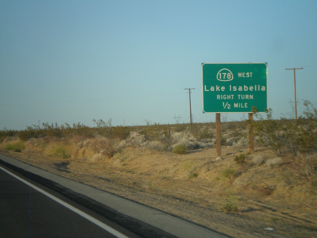
CA-14 South/CA-178 West Approaching CA-178 West
CA-14 South/CA-178 West approaching CA-178 West. Use CA-178 west for Lake Isabella.
Taken 05-05-2012
 Inyokern
Kern County
California
United States
Inyokern
Kern County
California
United States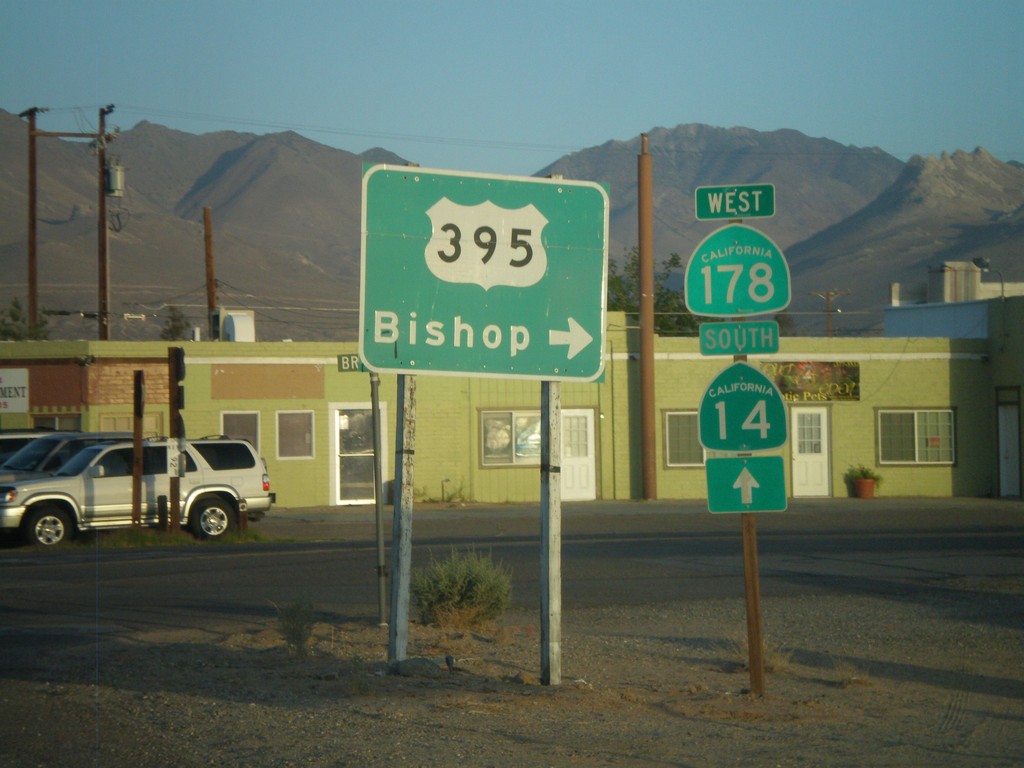
CA-178 West at Brown Road
CA-178 west at Brown Road, to US-395 north towards Bishop. Continue west on CA-178 for CA-14 junction.
Taken 05-05-2012
 Inyokern
Kern County
California
United States
Inyokern
Kern County
California
United States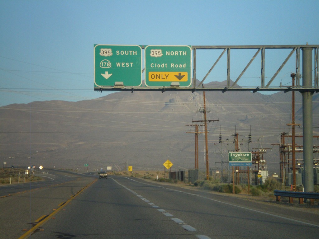
CA-178 West Approaching US-395
CA-178 west approaching US-395. Use right lane for US-395 north and Clodt Road. Continue on overpass for US-395 south and CA-178 west. Entering Inyokern, California.
Taken 05-05-2012
Inyokern
Kern County
California
United States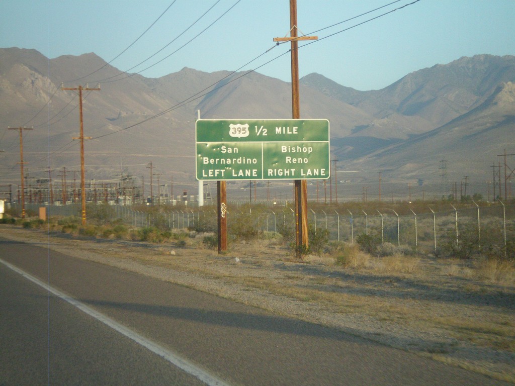
CA-178 West Approaching US-395
CA-178 west approaching US-395. Use US-395 north for Bishop and Reno (Nevada). Use US-395 south for San Bernardino.
Taken 05-05-2012
Ridgecrest
Kern County
California
United States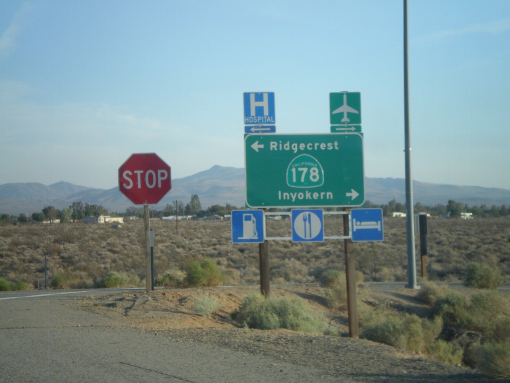
US-395 South Offramp at CA-178
US-395 south offramp at CA-178. Turn right for CA-178 west to Inyokern; left for CA-178 east to Ridgecrest.
Taken 05-04-2012
Inyokern
Kern County
California
United States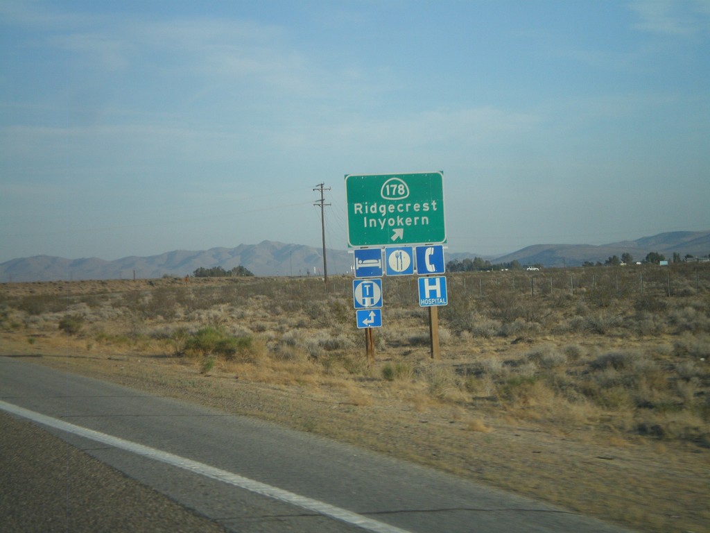
US-395 South at CA-178 Interchange
US-395 South at CA-178 Interchange - CA-178/Inyokern/Ridgecrest.
Taken 05-04-2012
Inyokern
Kern County
California
United States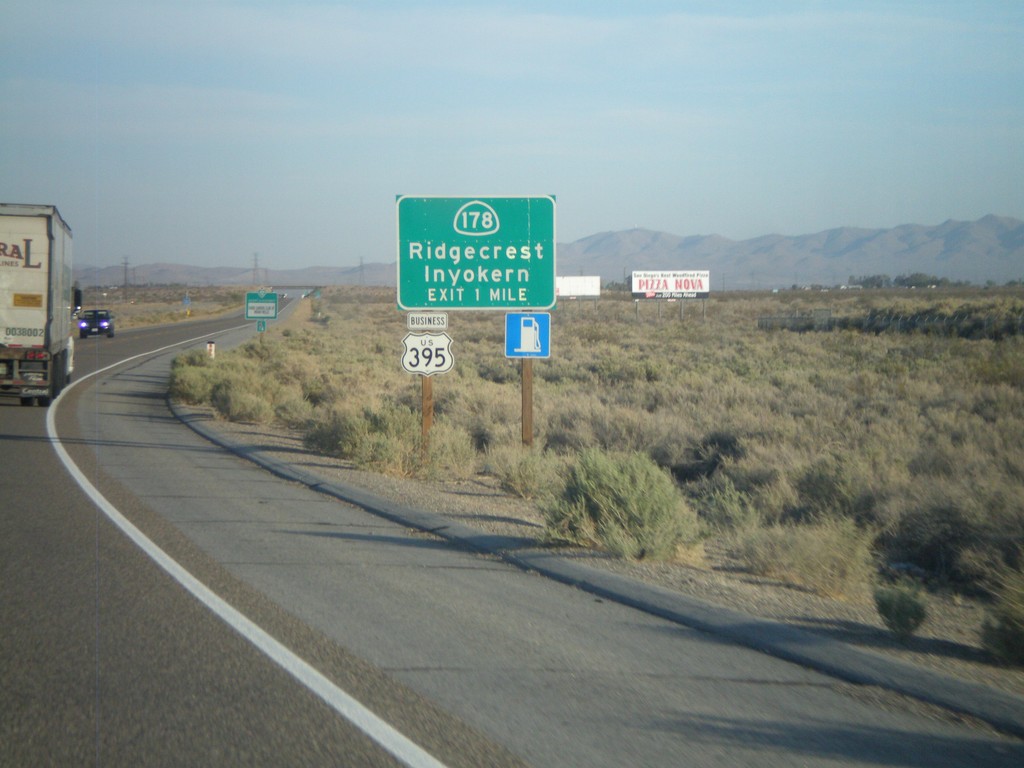
US-395 South Approaching CA-178 Interchange
US-395 South approaching CA-178 Interchange - CA-178/Inyokern/Ridgecrest. Business US-395 leaves US-395 here and follows CA-178 east into Ridgecrest. Business US-395 rejoins US-395 south of Ridgecrest at the China Lake Blvd. intersection.
Taken 05-04-2012
 Inyokern
Kern County
California
United States
Inyokern
Kern County
California
United States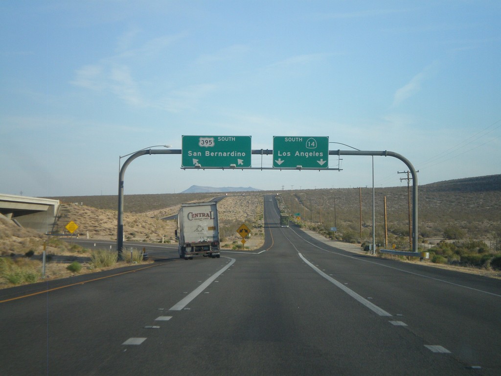
US-395 South at CA-14
US-395 south at CA-14 junction. This is the northern end of CA-14. Use left lanes for US-395 south to San Bernardino. Use right lanes for CA-14 south to Los Angeles.
Taken 05-04-2012
Inyokern
Kern County
California
United States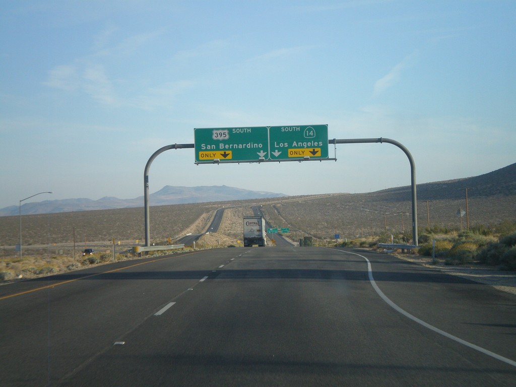
US-395 South Approaching CA-14
US-395 south approaching CA-14. Use left lanes for US-395 south to San Bernardino. Use right lanes for CA-14 south to Los Angeles.
Taken 05-04-2012
Inyokern
Kern County
California
United States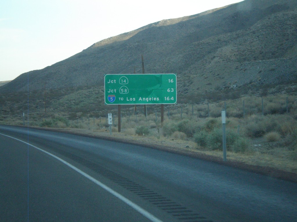
US-395 South - Distance Marker
Distance marker on US-395 south. Distance to CA-14 junction, CA-58 junction, and I-5 (To Los Angeles) junction.
Taken 05-04-2012
 Pearsonville
Inyo County
California
United States
Pearsonville
Inyo County
California
United States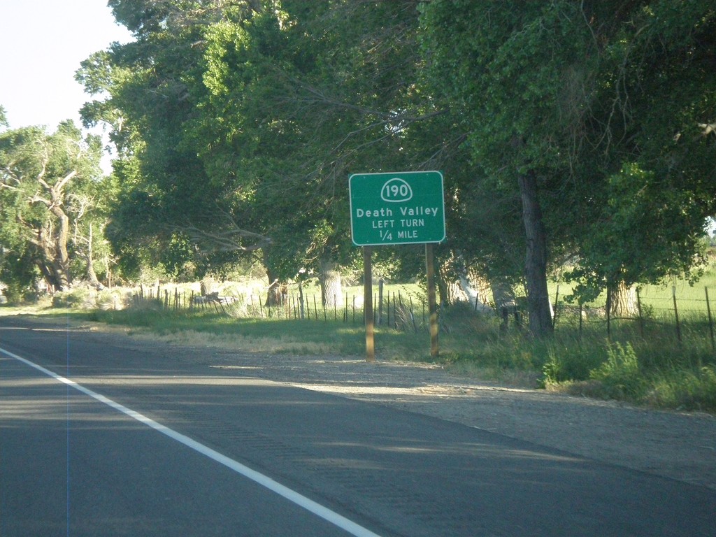
US-395 South Approaching CA-190
US-395 South approaching CA-190 junction to Death Valley.
Taken 05-04-2012
 Olancha
Inyo County
California
United States
Olancha
Inyo County
California
United States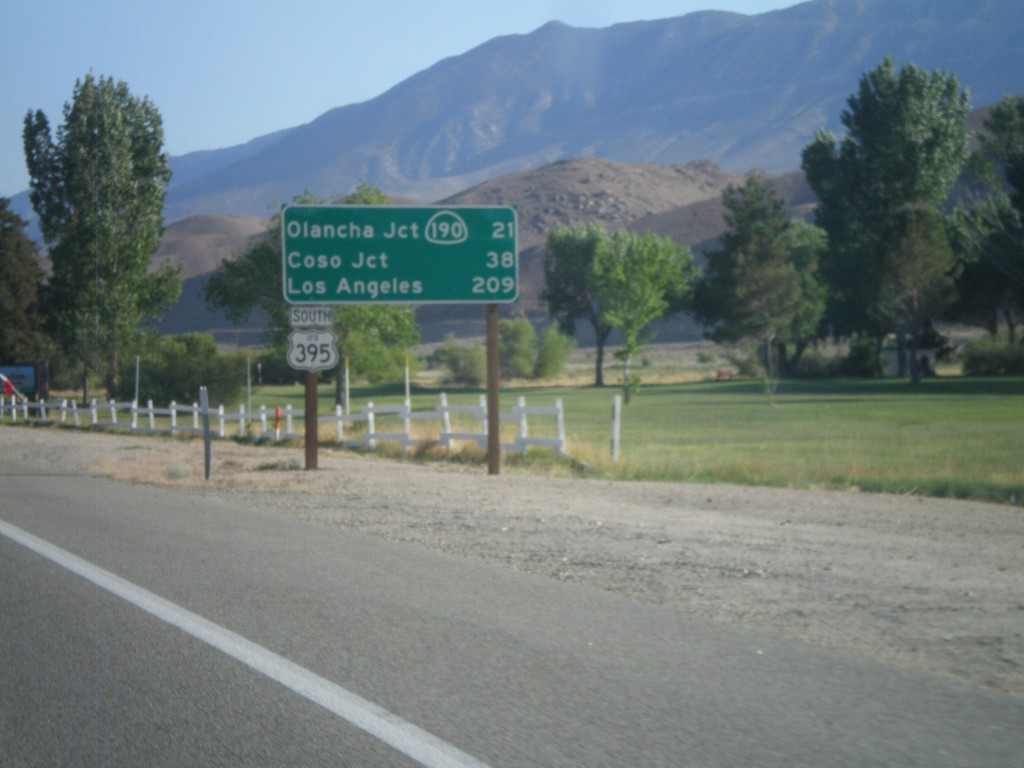
US-395 South - Distance Marker
Distance marker on US-395 south. Distance to CA-190 - Olancha Jct., Coso Jct., and Los Angeles.
Taken 05-04-2012
Lone Pine
Inyo County
California
United States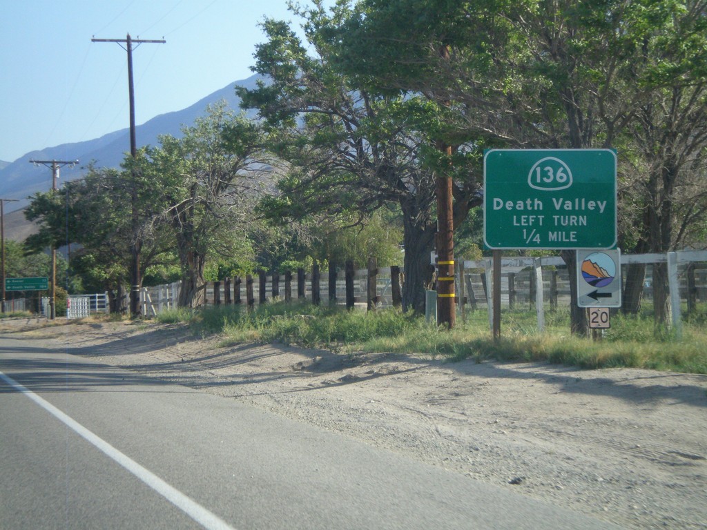
US-395 South Approaching CA-136
US-395 south approaching CA-136 junction. Use CA-136 east to Death Valley.
Taken 05-04-2012
 Lone Pine
Inyo County
California
United States
Lone Pine
Inyo County
California
United States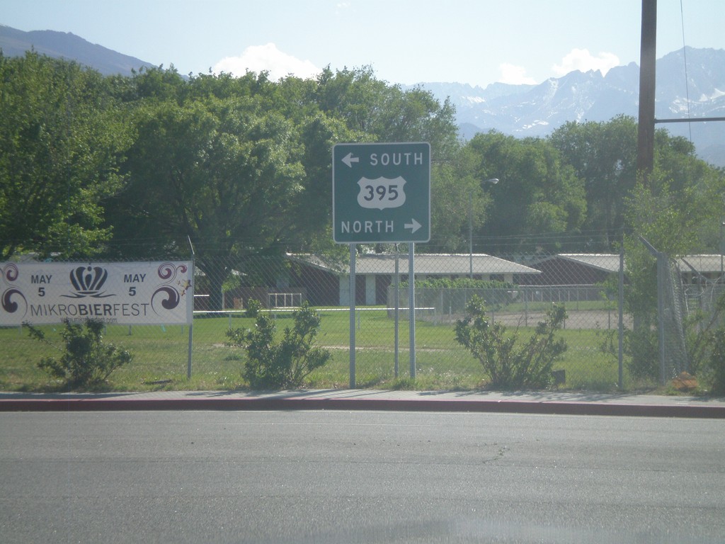
End US-6 West at US-395
End US-6 west at US-395. Use US-395 north for Reno (Nevada); US-395 south for Los Angeles. US-6 begins in Provincetown, Massachusetts.
Taken 05-04-2012
 Bishop
Inyo County
California
United States
Bishop
Inyo County
California
United States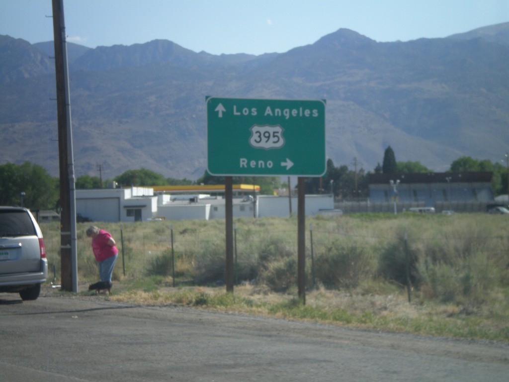
US-6 West Approaching US-395
Approaching western end of US-6 at US-395 junction. Turn right for US-395 north towards Reno (Nevada). Continue ahead for US-395 south towards Los Angeles.
Taken 05-04-2012
Bishop
Inyo County
California
United States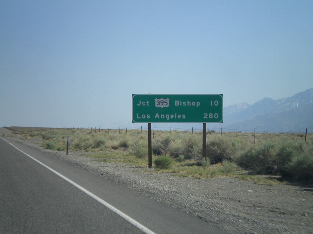
US-6 West - Distance Marker
Distance marker on US-6 west. Distances to Jct. US-395 - Bishop, and Los Angeles.
Taken 05-04-2012
Bishop
Mono County
California
United States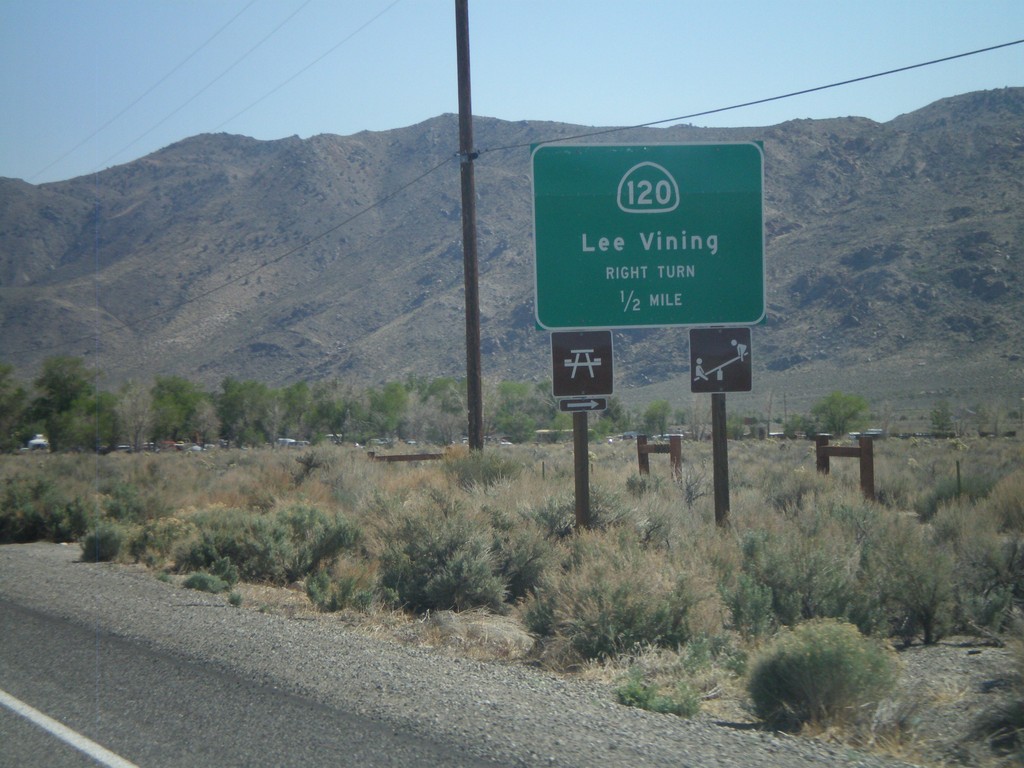
US-6 West Approaching CA-120
US-6 west approaching CA-120 west to Lee Vining.
Taken 05-04-2012
 Benton
Mono County
California
United States
Benton
Mono County
California
United States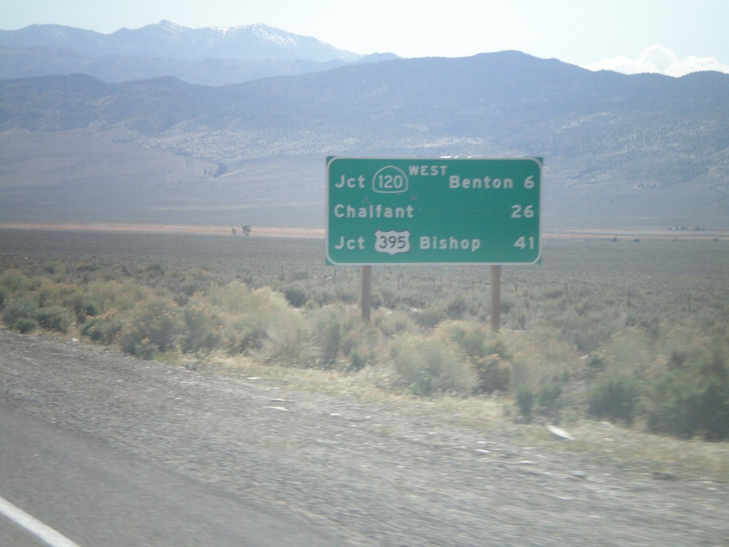
US-6 West - Distance Marker
Distance marker on US-6 west. Distance to Jct. CA-120 West/Benton, Chalfant, and Jct. US-395/Bishop. This is the first distance marker on US-6 inside of California.
Taken 05-04-2012
Benton
Mono County
California
United States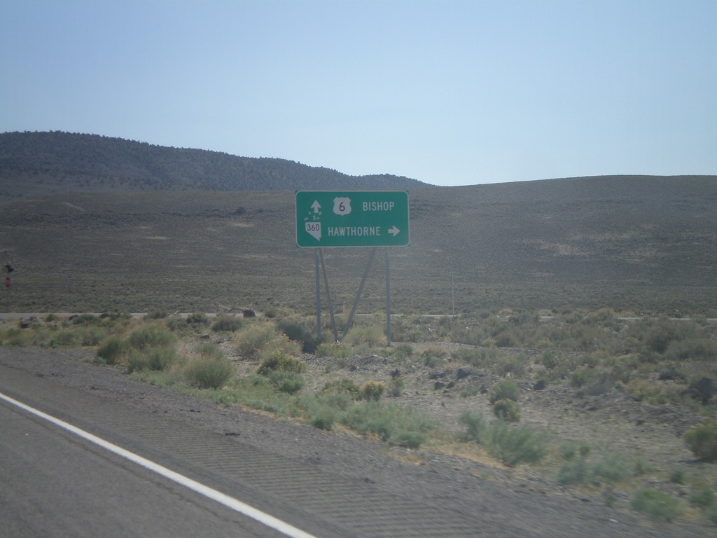
US-6 West at NV-360
US-6 west at NV-360 to Hawthorne. Continue west on US-6 to Bishop (California).
Taken 05-04-2012
 Dyer
Mineral County
Nevada
United States
Dyer
Mineral County
Nevada
United States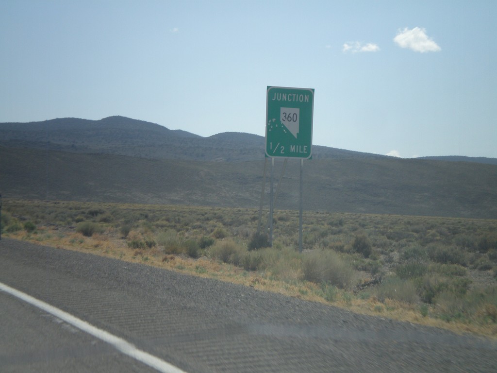
US-6 West Approaching NV-360
US-6 west approaching NV-360.
Taken 05-04-2012
Mineral County
Nevada
United States