Signs Tagged With Shield Inside Sign
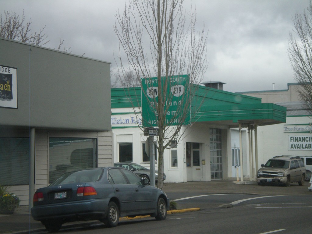
OR-99W North/OR-219 South - Newberg
OR-99W North/OR-219 South in Newberg. Use right lanes to continue north on OR-99W (to Portland) and south on OR-219 (to Salem).
Taken 02-21-2012

 Newberg
Yamhill County
Oregon
United States
Newberg
Yamhill County
Oregon
United States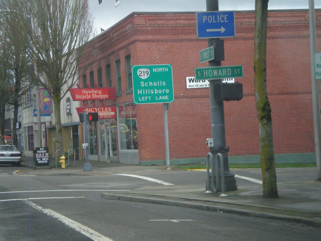
OR-99W North Approaching OR-219
OR-99W North Approaching OR-219 North to Scholls and Hillsboro. OR-219 joins OR-99W through Newberg.
Taken 02-21-2012
Newberg
Yamhill County
Oregon
United States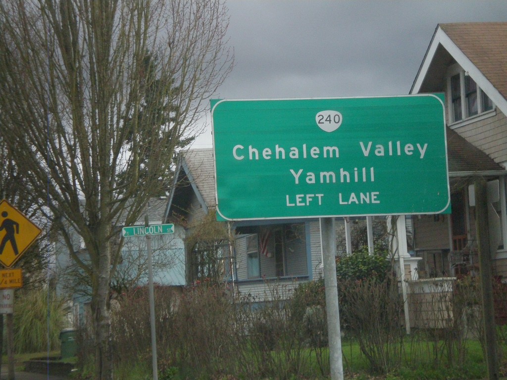
OR-99W North Approaching OR-240
OR-99W north approaching OR-240 north to Chehalem Valley and Yamhill. Use left lanes for OR-240 North.
Taken 02-21-2012
 Newberg
Yamhill County
Oregon
United States
Newberg
Yamhill County
Oregon
United States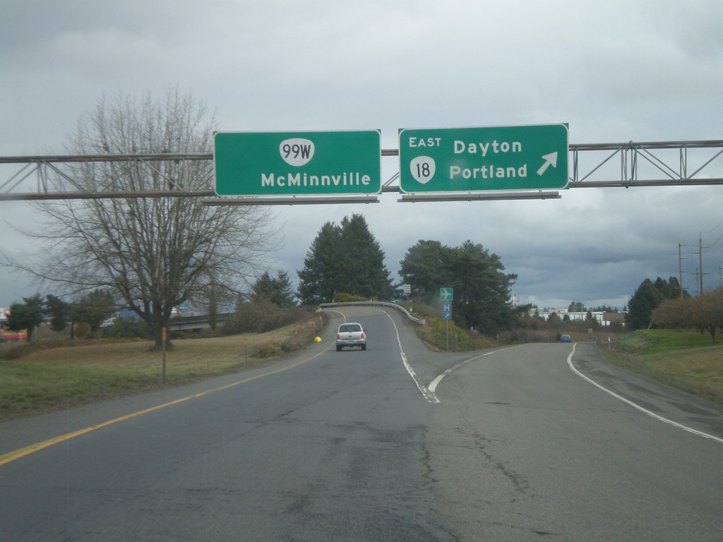
OR-18 East at OR-99W North
OR-18 East at OR-99W North. Merge left for OR-99W/McMinnville. Stay right for OR-18 East/Dayton/Portland. This is the western end of the McMinnville bypass. OR-18 and OR-99W join on the east side of McMinnville.
Taken 02-21-2012
 McMinnville
Yamhill County
Oregon
United States
McMinnville
Yamhill County
Oregon
United States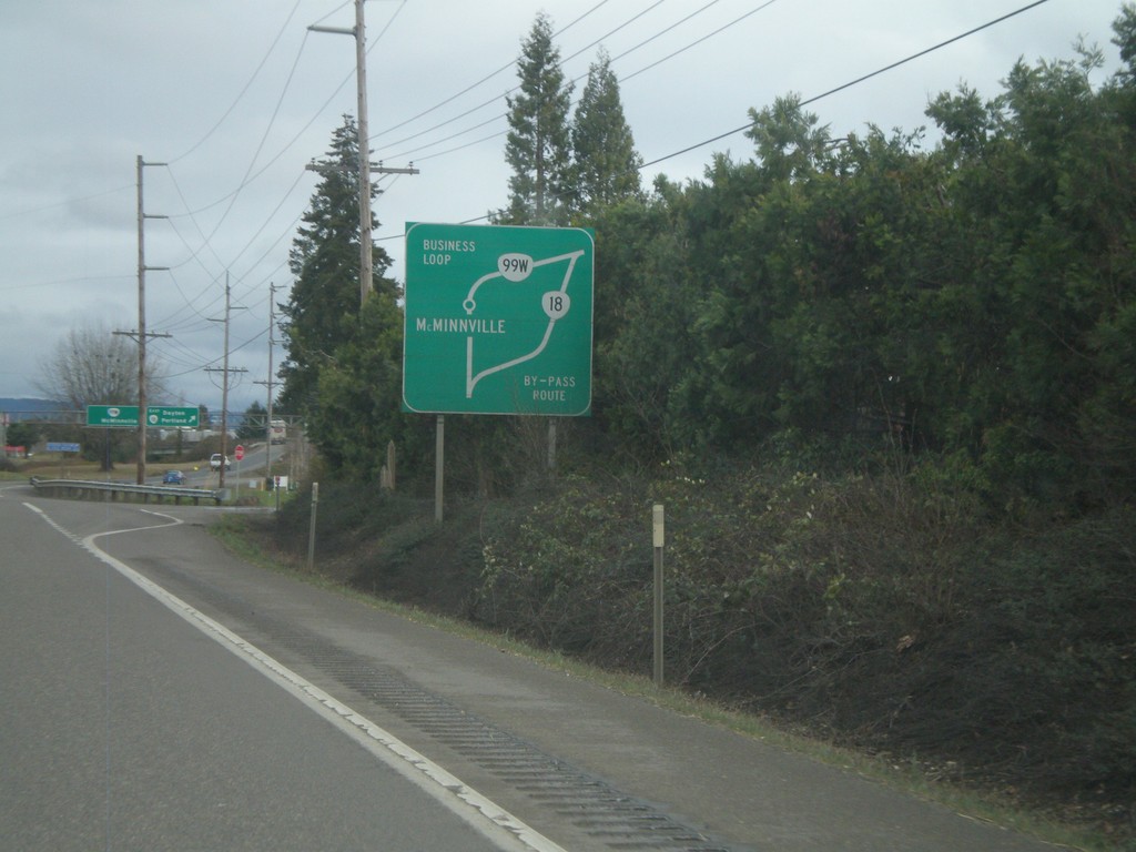
OR-18 East - Route Diagram
OR-18 East route diagram for McMinnville area, approaching OR-99W junction. Use OR-99W as a business loop through McMinnville. Use OR-18 as a bypass around McMinnville.
Taken 02-21-2012
McMinnville
Yamhill County
Oregon
United States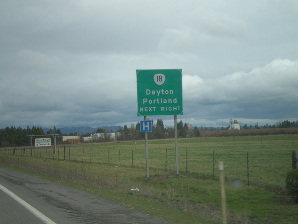
OR-18 East Approaching OR-99W
OR-18 east approaching OR-99W. Merge right for OR-18 East towards Dayton and Portland.
Taken 02-21-2012
McMinnville
Yamhill County
Oregon
United States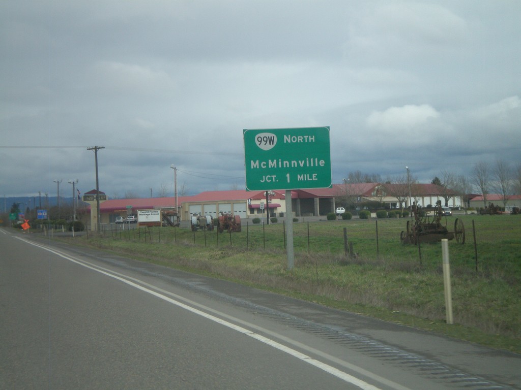
OR-18 East Approaching OR-99W
OR-18 east approaching OR-99W. Use left lane for OR-99W North to McMinnville.
Taken 02-21-2012
McMinnville
Yamhill County
Oregon
United States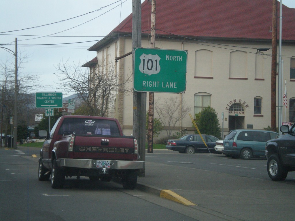
US-101 North - Tillamook
US-101 north in Tillamook. This section of US-101 through Tillamook is a one-way couplet. Stay in right lanes to continue on US-101 north.
Taken 02-19-2012
 Tillamook
 County
Oregon
United States
Tillamook
Tillamook County
Oregon
United States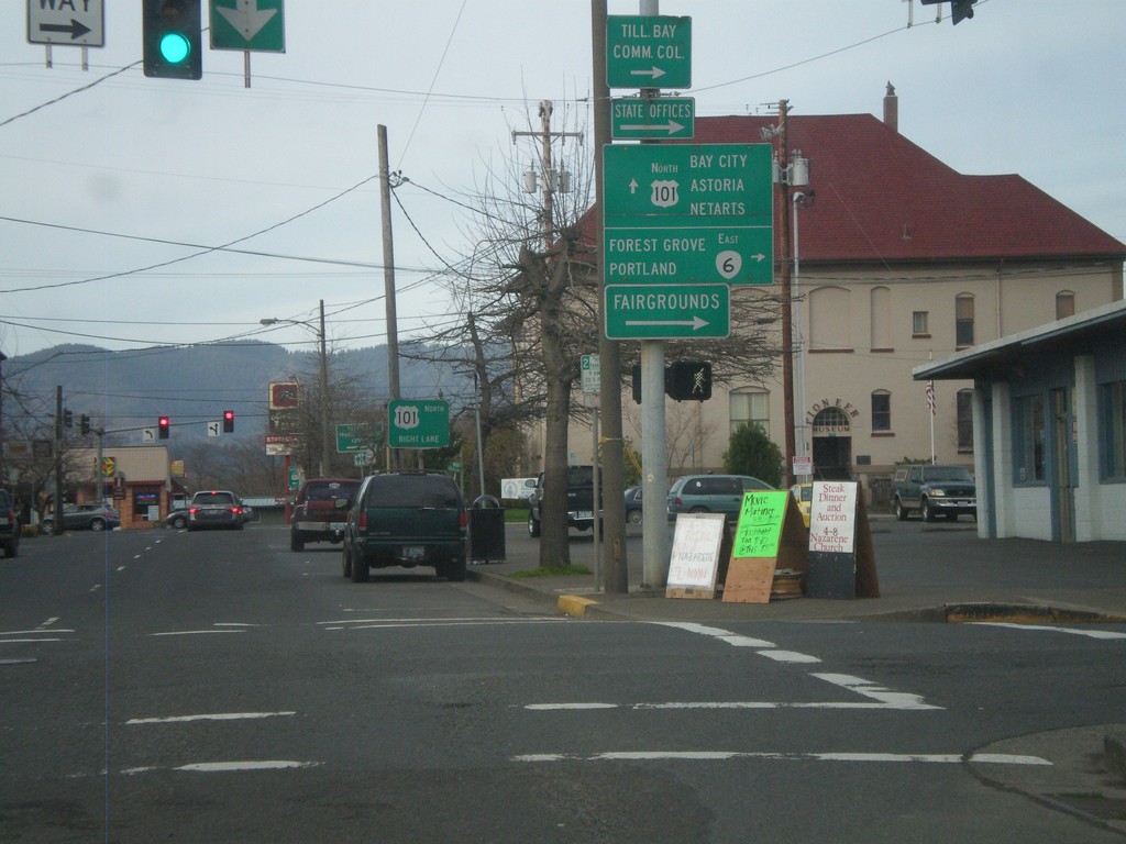
US-101 North at OR-6
US-101 north at OR-6 east. Turn right on OR-6 to Forest Grove and Portland. Continue north on US-101 to Bay City, Astoria, and Netarts. Also use OR-6 west for the Fairgrounds.
Taken 02-19-2012
 Tillamook
 County
Oregon
United States
Tillamook
Tillamook County
Oregon
United States
US-101 North Approaching OR-131
US-101 north approaching OR-131 west to Netarts. Use left lane for OR-131.
Taken 02-19-2012
 Tillamook
 County
Oregon
United States
Tillamook
Tillamook County
Oregon
United States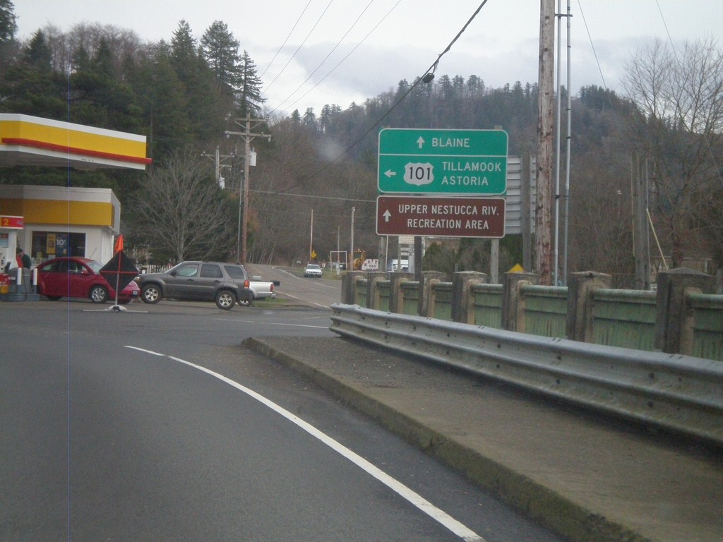
US-101 North at Blaine Road Jct.
US-101 north at Blaine Road jct. Continue ahead for Blaine Road and Upper Nestucca River Recreation Area. Turn left for US-101 north to Tillamook and Astoria.
Taken 02-19-2012
Beaver
Tillamook County
Oregon
United States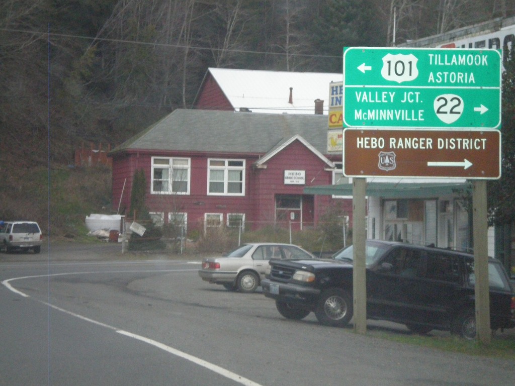
US-101 North Approaching OR-22
US-101 north approaching OR-22. Turn right for OR-22 east to McMinnville and Valley Junction. Turn left for US-101 north to Tillamook and Astoria. Also use OR-22 for the Hebo Ranger District of the Siuslaw National Forest.
Taken 02-19-2012
 Hebo
Tillamook County
Oregon
United States
Hebo
Tillamook County
Oregon
United States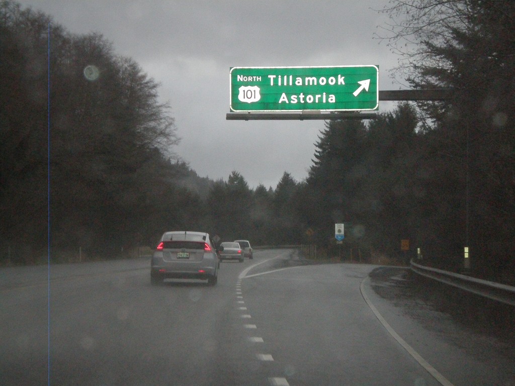
End OR-18 West at US-101
End OR-18 west at US-101. Merge right for US-101 to Tillamook and Astoria.
Taken 02-18-2012
Lincoln City
Lincoln County
Oregon
United States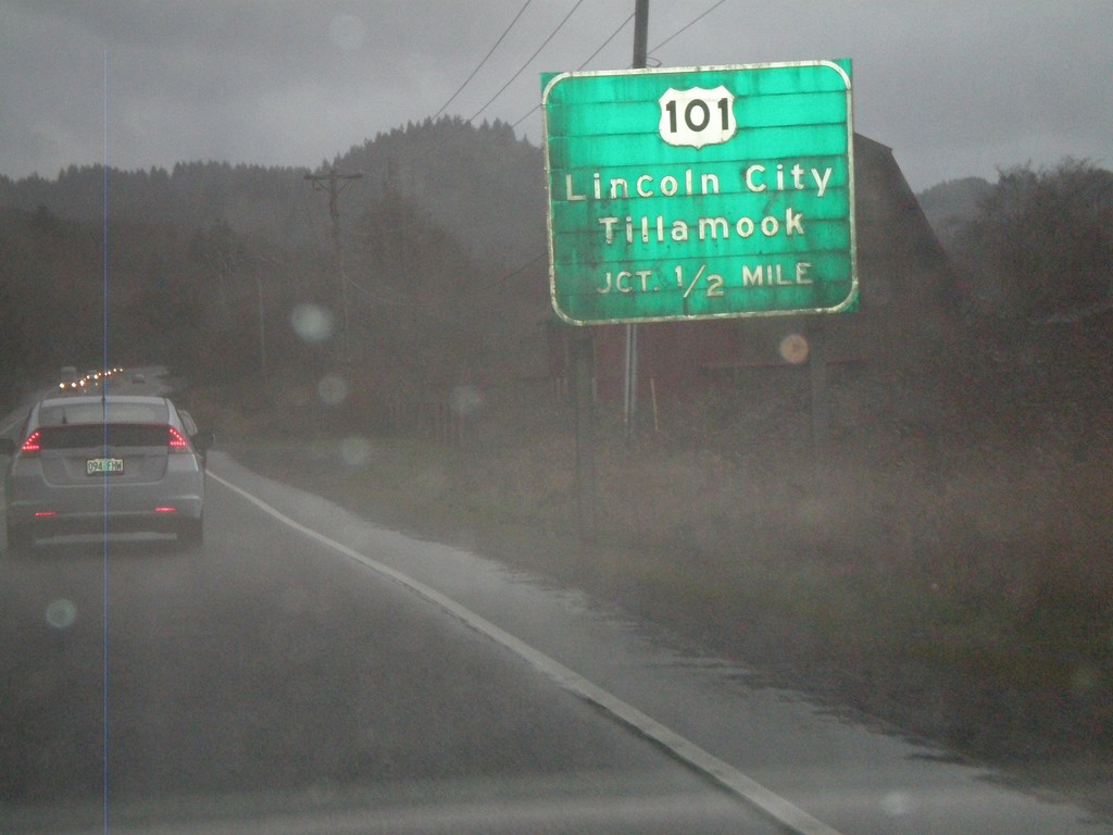
OR-18 West Approaching US-101
OR-18 west approaching US-101. Use US-101 for Lincoln City and Tillamook. This is the western end of OR-18.
Taken 02-18-2012
Otis
Lincoln County
Oregon
United States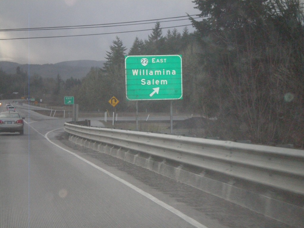
OR-18 West at OR-22
OR-18 west at OR-22 east to Willamina and Salem. OR-22 west joins OR-18 west to Valley Junction.
Taken 02-18-2012
Sheridan
Polk County
Oregon
United States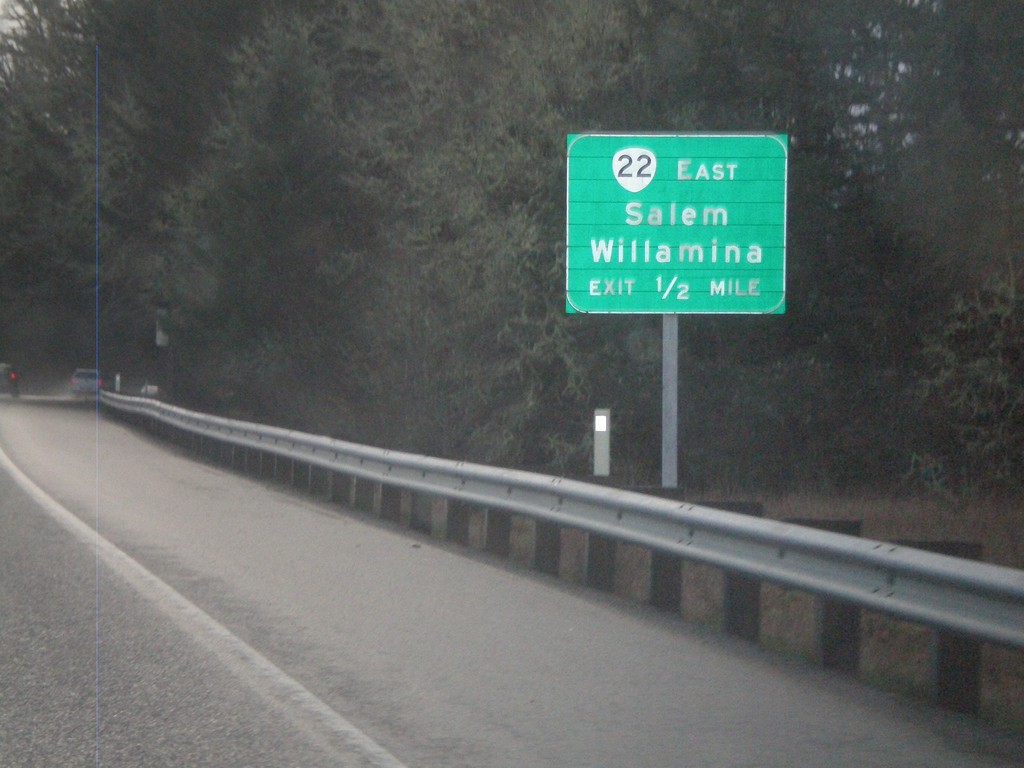
OR-18 West Approaching OR-22
OR-18 west approaching OR-22. Use OR-22 east for Willamina and Salem. OR-22 west joins OR-18 west to Valley Junction.
Taken 02-18-2012
Sheridan
Polk County
Oregon
United States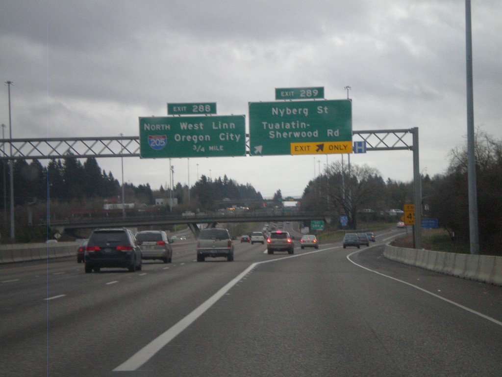
I-5 South - Exits 289 and 286
I-5 south at Exit 289 - Nyberg St./Tualatin-Sherwood Road. Approaching Exit 286 - I-205 North/West Linn/Oregon City.
Taken 02-18-2012

 Tualatin
Washington County
Oregon
United States
Tualatin
Washington County
Oregon
United States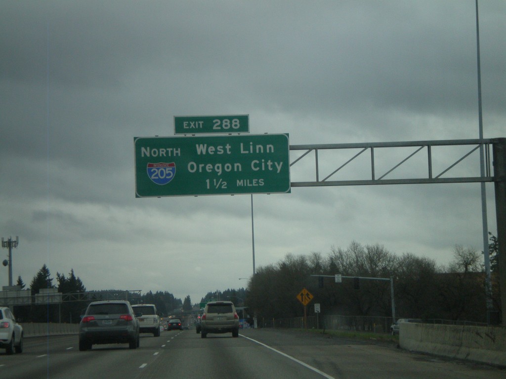
I-5 South Approaching Exit 288
I-5 south approaching Exit 288 - I-205 North/West Linn/Oregon City. I-205 is the beltway around the east side of the Portland metropolitan area. I-205 rejoins I-5 again north of Vancouver, Washington.
Taken 02-18-2012
Portland
Washington County
Oregon
United States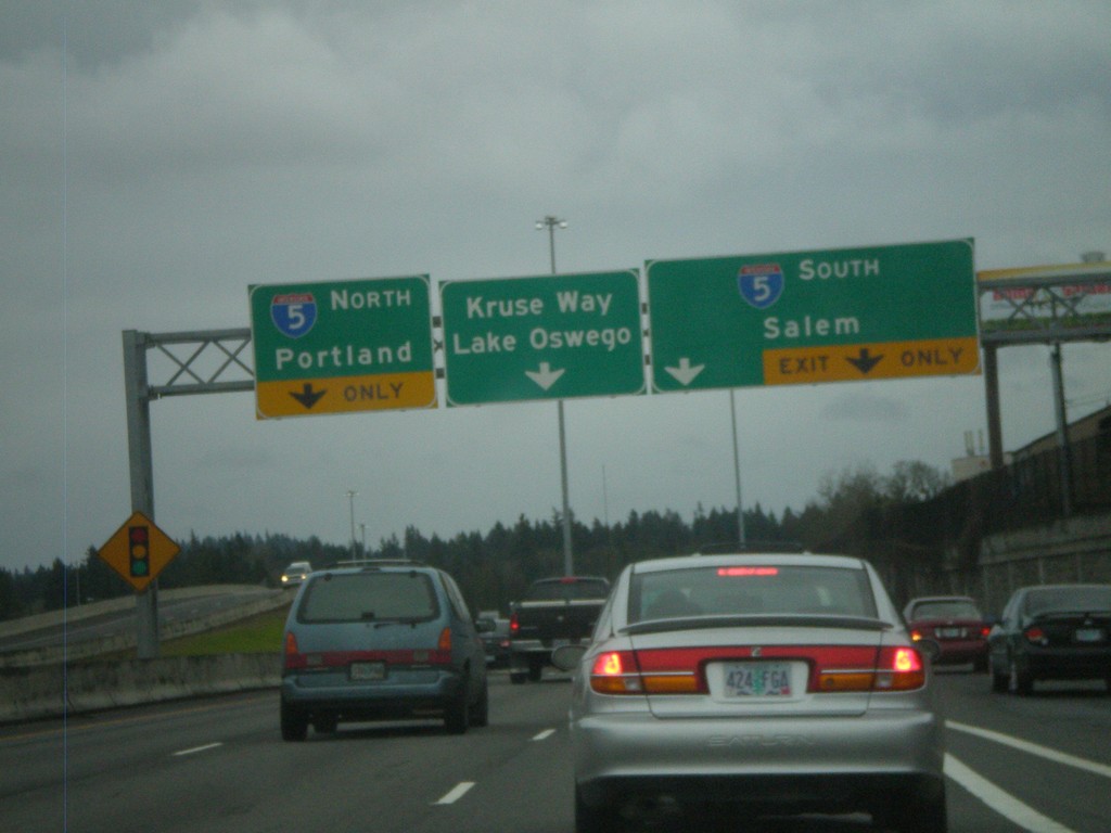
End OR-217 South at I-5
End OR-217 south at I-5. Use right lane for I-5 south to Salem. Use left lane for I-5 north to Portland. Continue ahead for Kruse Way into Lake Oswego. The OR-217 freeway ends here.
Taken 02-18-2012
 Tigard
Washington County
Oregon
United States
Tigard
Washington County
Oregon
United States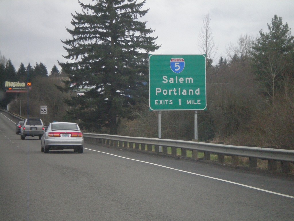
OR-217 South Approaching I-5
OR-217 South approaching I-5 to Salem and Portland.
Taken 02-18-2012
Tigard
Washington County
Oregon
United States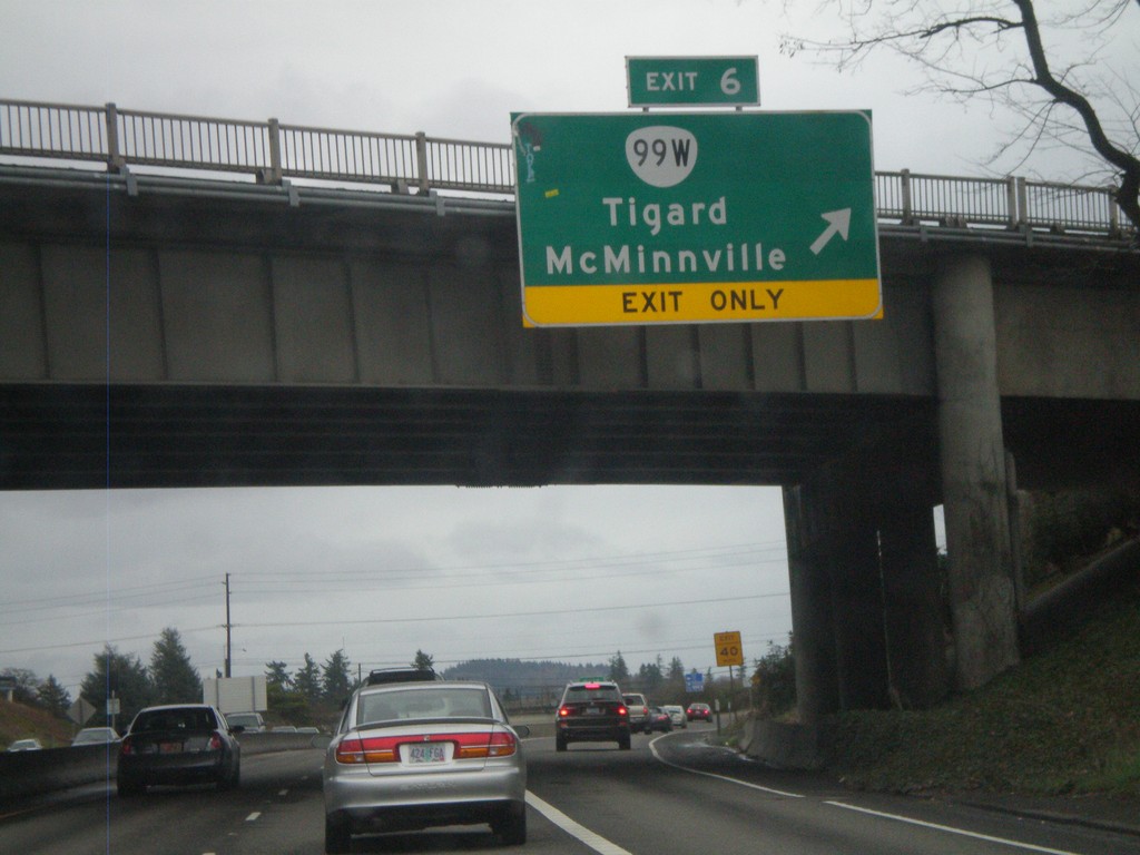
OR-217 South - Exit 6
OR-217 south at Exit 6 - OR-99W/Tigard/McMinnville.
Taken 02-18-2012
Tigard
Washington County
Oregon
United States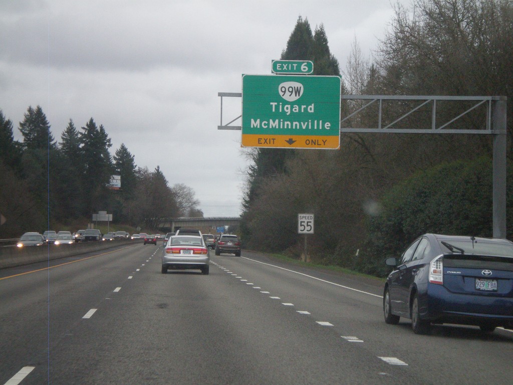
OR-217 South Approaching Exit 6
OR-217 south approaching Exit 6 - OR-99W/McMinnville/Tigard.
Taken 02-18-2012
Portland
Washington County
Oregon
United States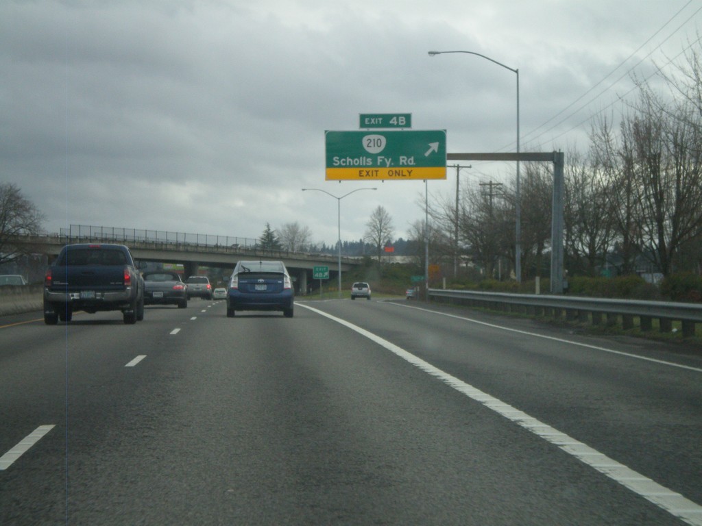
OR-217 South - Exit 4B
OR-217 south at Exit 4B - OR-210/Scholls Ferry Road.
Taken 02-18-2012
 Beaverton
Washington County
Oregon
United States
Beaverton
Washington County
Oregon
United States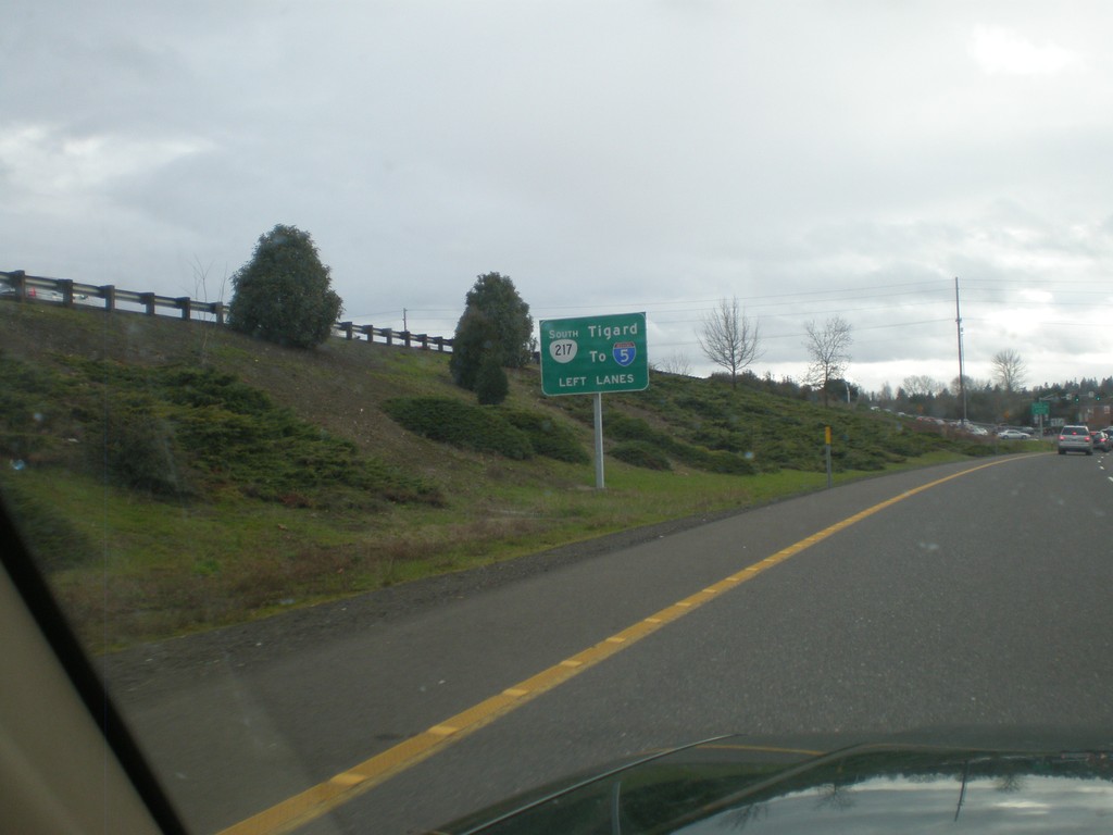
OR-217 Frontage Road in Beaverton Approaching OR-10
OR-217 Frontage Road in Beaverton approaching OR-10. Use left lanes for OR-217 south to I-5 and Tigard.
Taken 02-18-2012
 Beaverton
Washington County
Oregon
United States
Beaverton
Washington County
Oregon
United States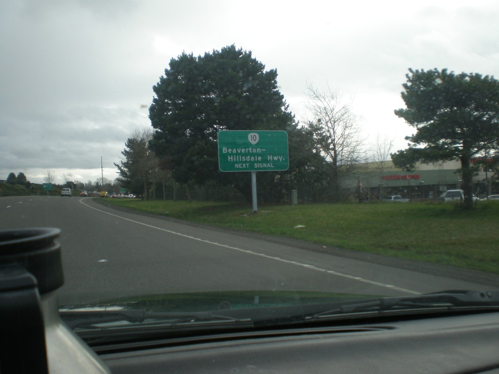
OR-217 South Frontage Road Approaching OR-10
OR-217 South Frontage Road approaching OR-10. Use right lane for OR-10 - Beaverton-Hillsdale Highway. Use left lanes for OR-217 freeway.
Taken 02-18-2012
Beaverton
Washington County
Oregon
United States