Signs Tagged With Shield Inside Sign
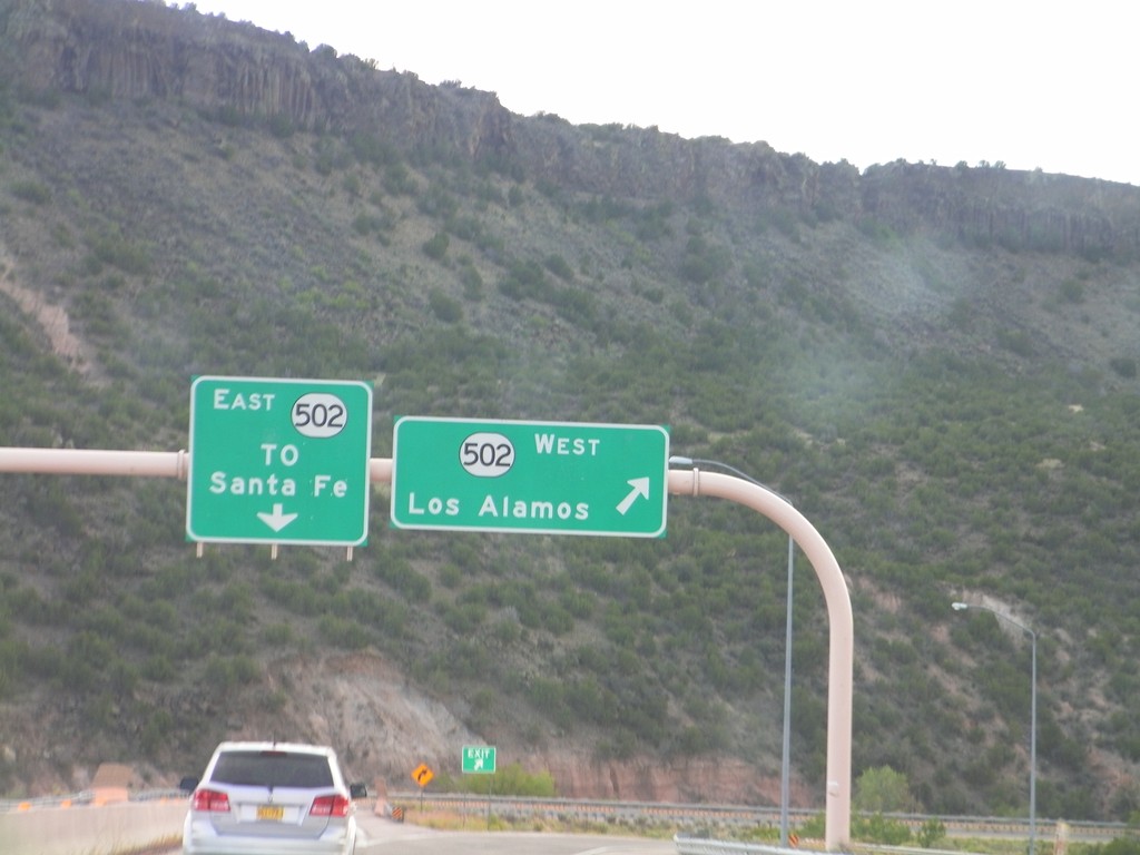
End NM-30 South at NM-520
End NM-30 South at NM-520. Use NM-520 west for Los Alamos; use NM-520 east for Santa Fe.
Taken 10-02-2011

 Santa Fe
 County
New Mexico
United States
Santa Fe
Santa Fe County
New Mexico
United States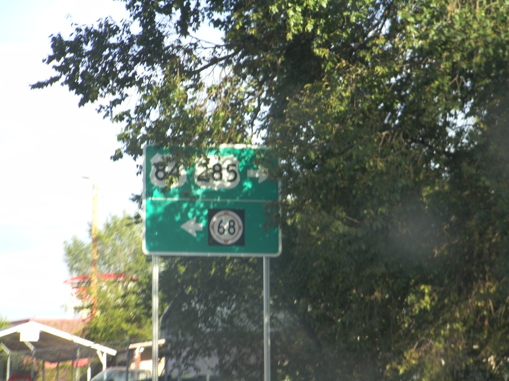
US-84/US-285 South at NM-68
US-84/US-285 South at NM-68. Turn right to continue on US-84/US-285 South. Turn left for NM-68.
Taken 10-02-2011


 Española
Rio Arriba County
New Mexico
United States
Española
Rio Arriba County
New Mexico
United States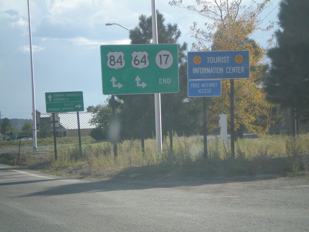
End NM-17 South at US-64/US-84
End NM-17 South at US-64/US-84 in Chama. Turn right for US-64 West/US-84 North to Dulce and Pagosa Springs (Colorado); continue ahead for US-64 East/US-84 South to Tierra Amarilla and Española.
Taken 10-02-2011

 Chama
Rio Arriba County
New Mexico
United States
Chama
Rio Arriba County
New Mexico
United States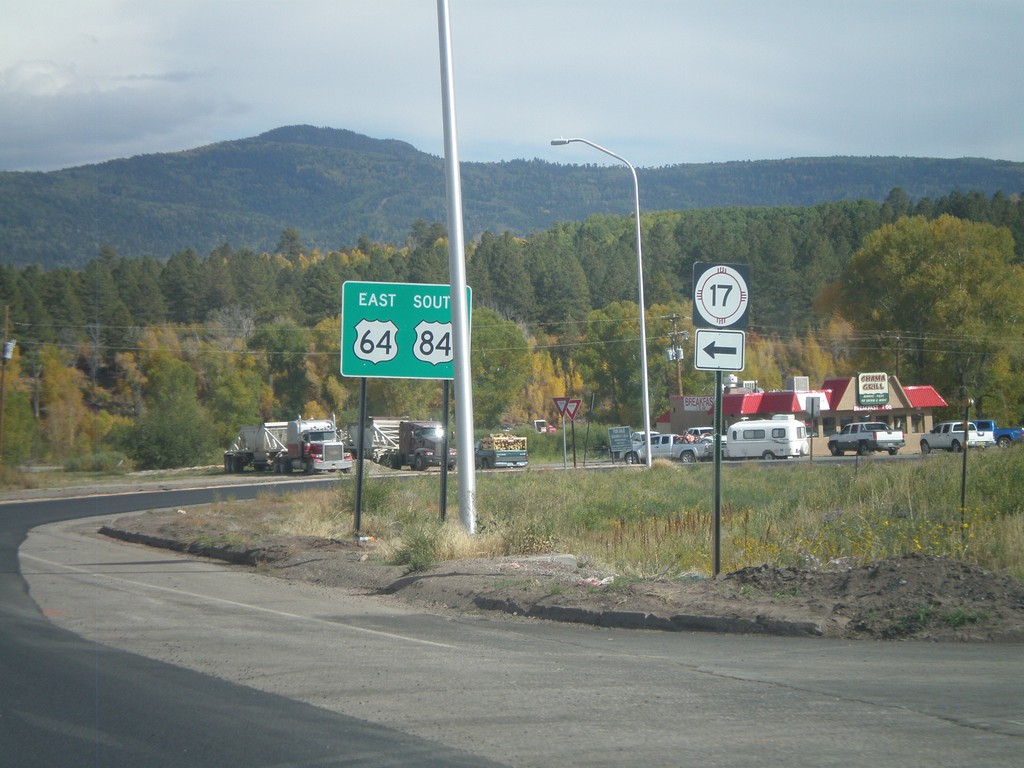
US-84 South/US-64 East at NM-17
US-84 South/US-64 East at NM-17 in Chama. Turn right to continue on US-84 South/US-64 East; turn left for NM-17.
Taken 10-02-2011
Chama
Rio Arriba County
New Mexico
United States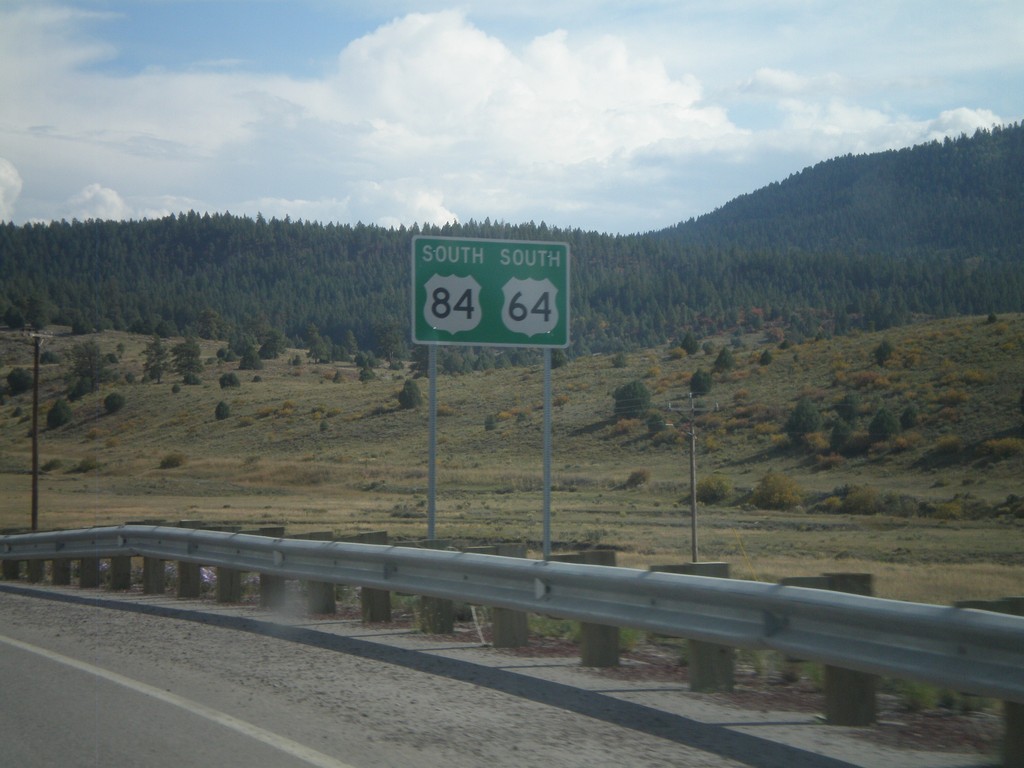
US-64 East/US-84 South
US-64 East/US-84 South in Rio Arriba County.
Taken 10-02-2011
Chama
Rio Arriba County
New Mexico
United States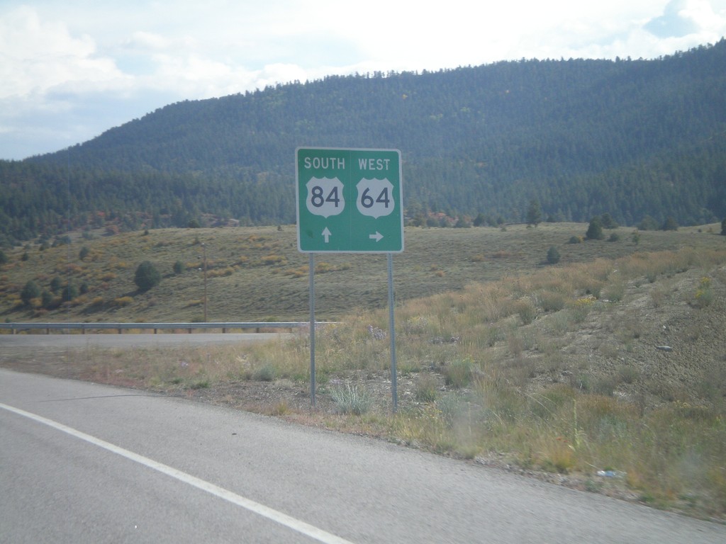
US-84 South at US-64
US-84 south at US-64 junction in Rio Arriba County. Turn left for US-64 west; continue ahead for US-84 South/US-64 east. US-64 joins US-84 through Tierra Amarilla.
Taken 10-02-2011
Chama
Rio Arriba County
New Mexico
United States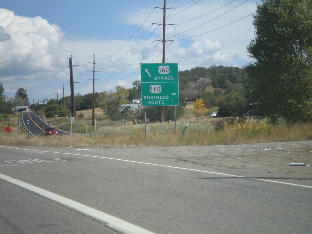
US-160 East at Bayfield Business Loop
US-160 East at Bayfield Business Loop. Turn right for Business US-160 into Bayfield; continue ahead for the Bayfield Bypass.
Taken 10-02-2011

 Bayfield
La Plata County
Colorado
United States
Bayfield
La Plata County
Colorado
United States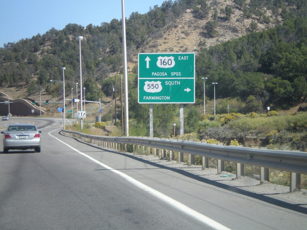
US-160 East/US-550 South at US-550 South
US-160 East/US-550 South at US-550 South. Turn right on US-550 for Farmington (New Mexico). Continue ahead on US-160 for Pagosa Springs.
Taken 10-02-2011
 Durango
La Plata County
Colorado
United States
Durango
La Plata County
Colorado
United States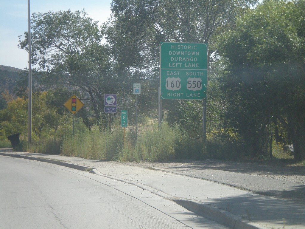
US-160 East Approaching US-550
US-160 East approaching US-550. Turn right for US-160 East/US-550 South; left for Historic Downtown Durango.
Taken 10-02-2011
Durango
La Plata County
Colorado
United States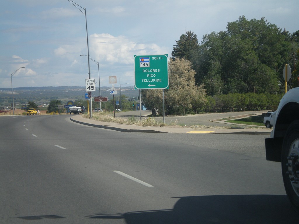
US-160 East at CO-145 North
US-160 east at CO-145 north to Dolores, Rico, and Telluride in Cortez.
Taken 10-02-2011
 Cortez
Montezuma County
Colorado
United States
Cortez
Montezuma County
Colorado
United States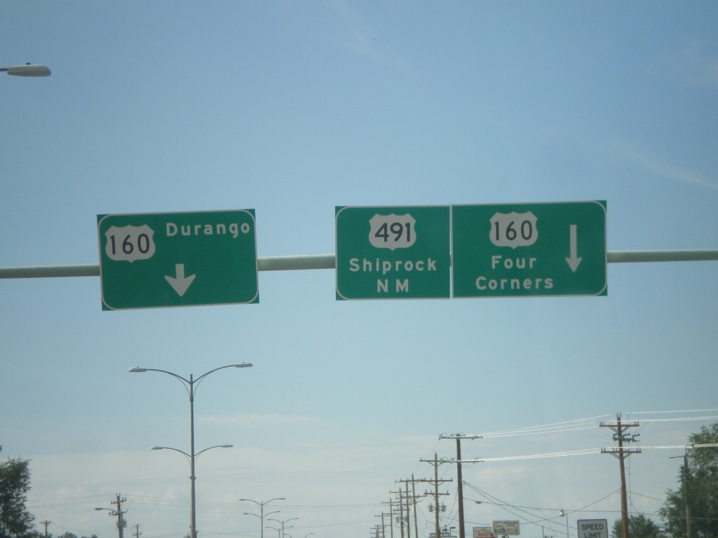
US-491 South at US-160
US-491 south at US-160. Turn left for US-160 east to Durango. Continue ahead for US-160 West/US-491 South. Use US-160 west for Four Corners; use US-491 south for Shiprock, New Mexico. US-160 west joins US-491 southbound to the Four Corners area.
Taken 10-02-2011
 Cortez
Montezuma County
Colorado
United States
Cortez
Montezuma County
Colorado
United States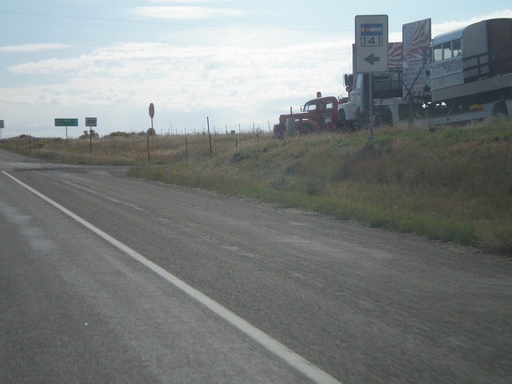
US-491 South at CO-141 North
US-491 South at CO-141 North in Dolores County.
Taken 10-02-2011
 Dove Creek
Dolores County
Colorado
United States
Dove Creek
Dolores County
Colorado
United States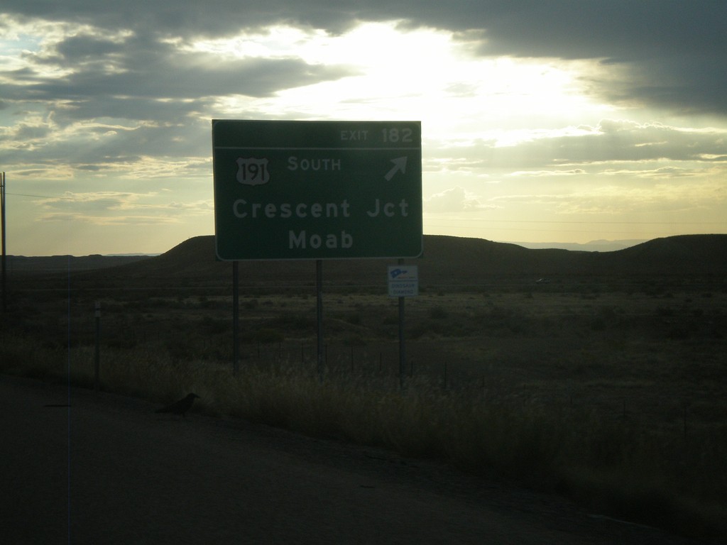
I-70 East - Exit 182
I-70 east at Exit 182 - US-191 South/Crescent Junction/Moab. US-191 south leaves I-70 here.
Taken 10-02-2011


 Crescent Junction
Grand County
Utah
United States
Crescent Junction
Grand County
Utah
United States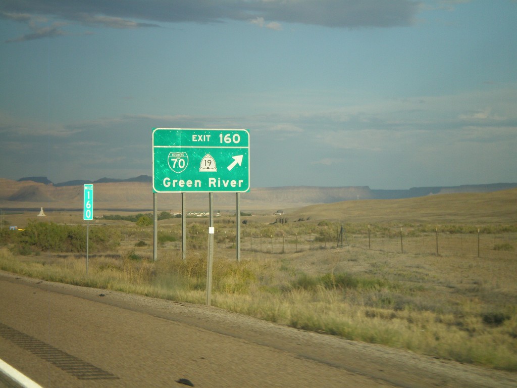
I-70 East - Exit 160
I-70 east at Exit 160 - BL-70/UT-19/Green River.
Taken 10-01-2011

 Green River
Emery County
Utah
United States
Green River
Emery County
Utah
United States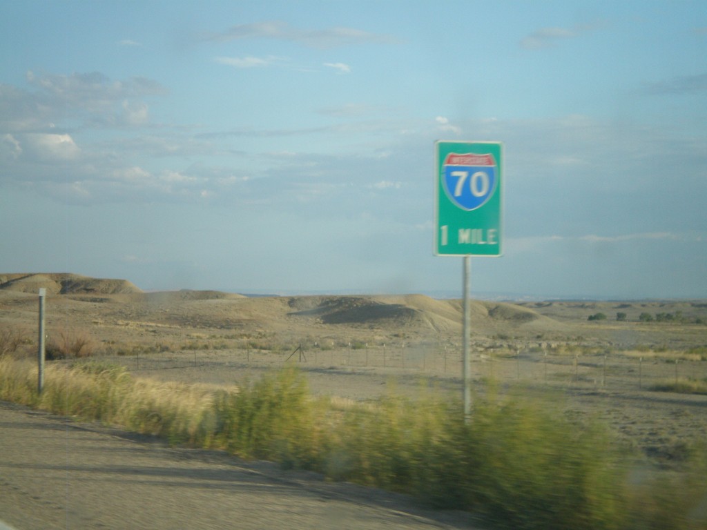
US-6 East/US-191 South Approaching I-70
US-6 East/US-191 South approaching I-70 in Emery County. US-6 East joins I-70 east to Fruita, Colorado; US-191 south joins I-70 east to Crescent Junction.
Taken 10-01-2011
Green River
Emery County
Utah
United States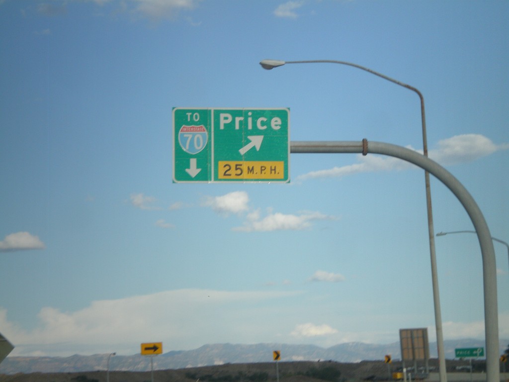
US-6 East/US-191 South at Price Exit
US-6 East/US-191 South at (Exit 243) Price. This is the eastern end of the Price business loop. Continue on US-6 East/US-191 South for I-70 (in Green River).
Taken 10-01-2011
 Price
Carbon County
Utah
United States
Price
Carbon County
Utah
United States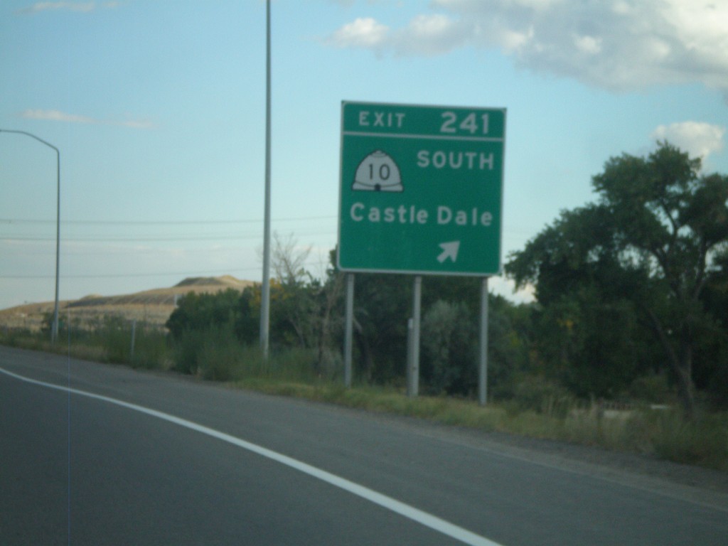
US-6 East/US-191 South - Exit 241
US-6 East/US-191 South at Exit 241 - UT-10 South/Castle Dale.
Taken 10-01-2011
 Price
Carbon County
Utah
United States
Price
Carbon County
Utah
United States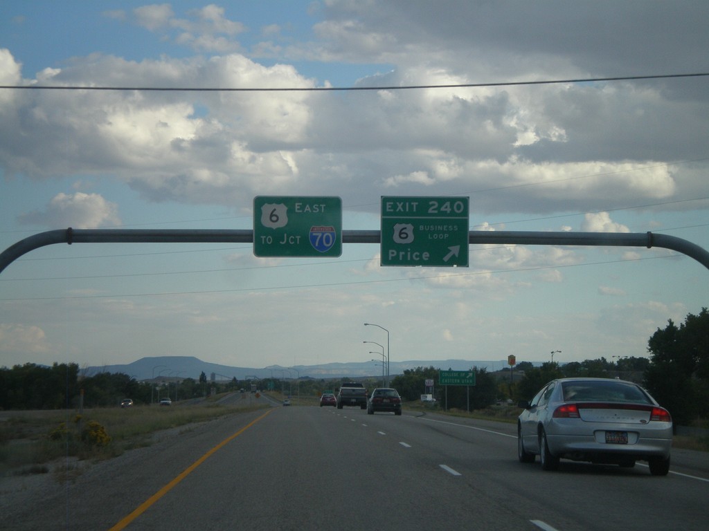
US-6 East/US-191 South - Exit 240
US-6 East/US-191 South at Exit 240 - Business Loop US-6/Price. This is the western end of the Price business loop. US-6 South/US-191 East continues south towards I-70 Junction (in Green River).
Taken 10-01-2011
Price
Carbon County
Utah
United States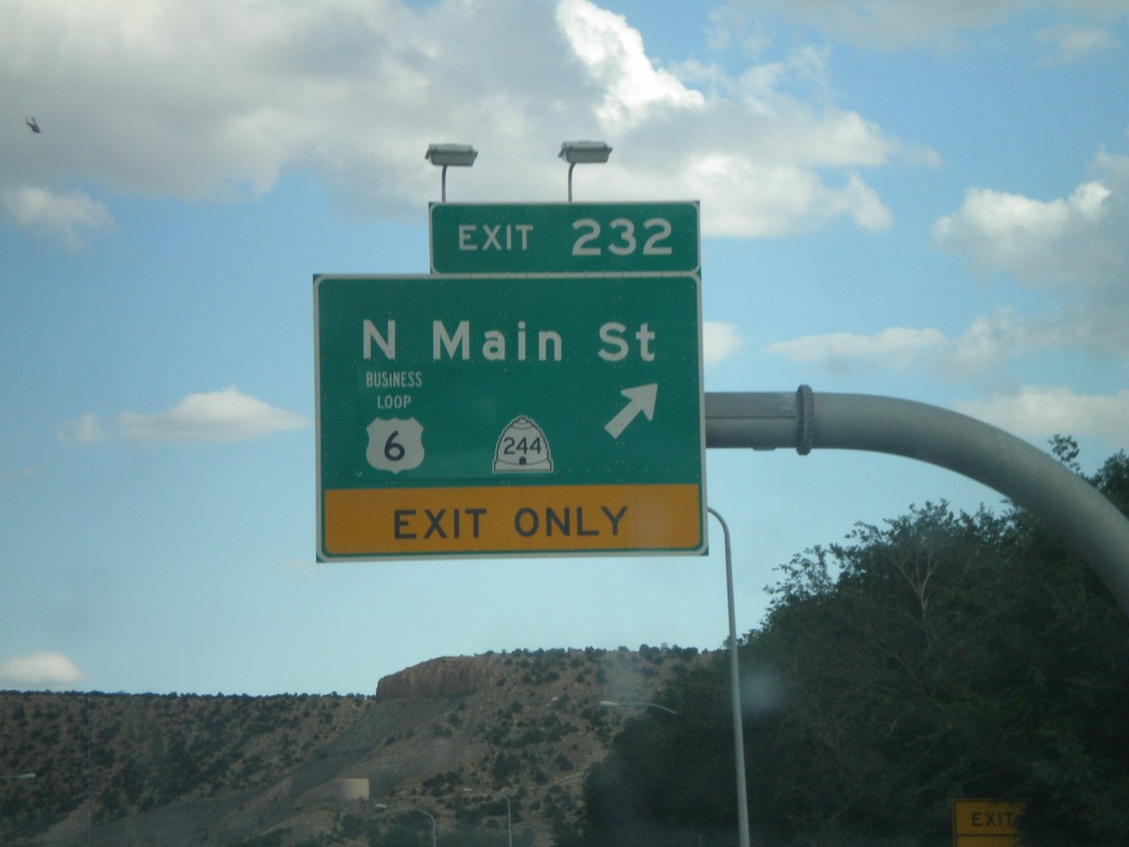
US-6 East/US-191 South - Exit 232
US-6 East/US-191 South at Exit 232 - Business US-6/UT-244/N. Main St. This is the western end of the Helper business loop.
Taken 10-01-2011
 Helper
Carbon County
Utah
United States
Helper
Carbon County
Utah
United States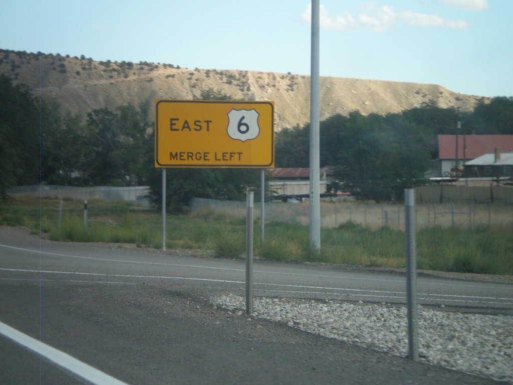
Merge Left For US-6 East
Merge left for US-6 east on US-6 East/US-191 South in Helper. The right lane becomes an exit only lane for Exit 232.
Taken 10-01-2011
Helper
Carbon County
Utah
United States
US-6 East/US-89 South Approaching Split
US-6 East/US-89 South Approaching US-6/US-89 split in Utah County.
Taken 10-01-2011
 Spanish Fork
Utah County
Utah
United States
Spanish Fork
Utah County
Utah
United States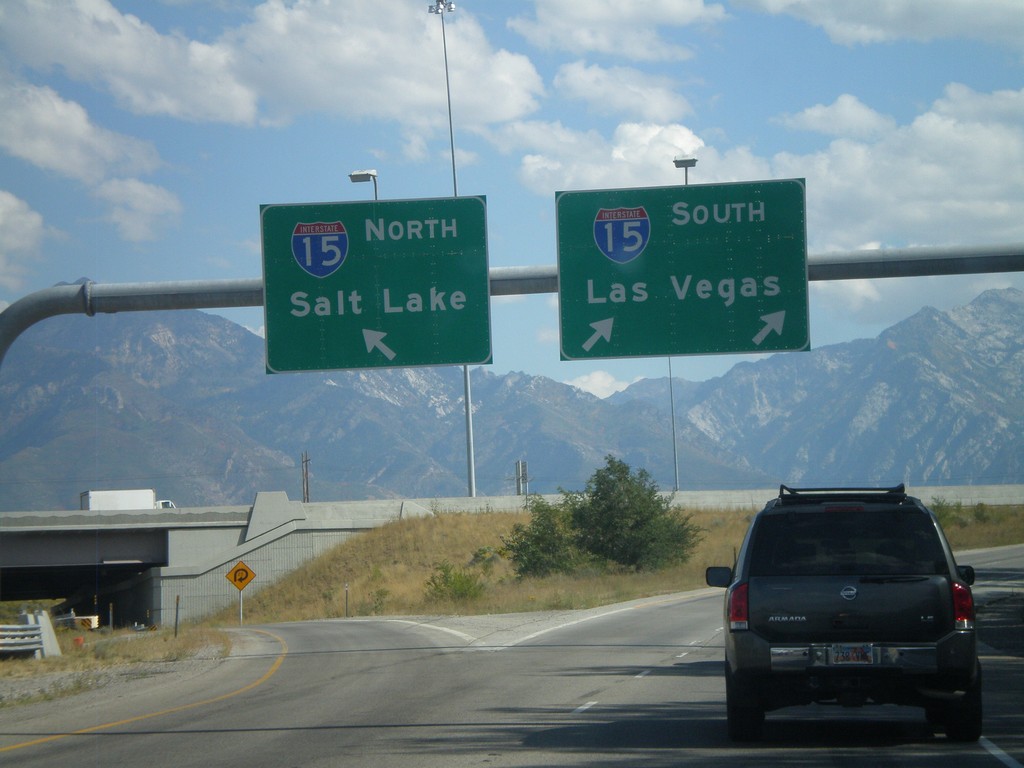
I-215 South at I-15 Split
I-215 south at I-15. Use right lane for I-15 South/Las Vegas; left lane for I-15 North/Salt Lake.
Taken 10-01-2011

 Murray
Salt Lake County
Utah
United States
Murray
Salt Lake County
Utah
United States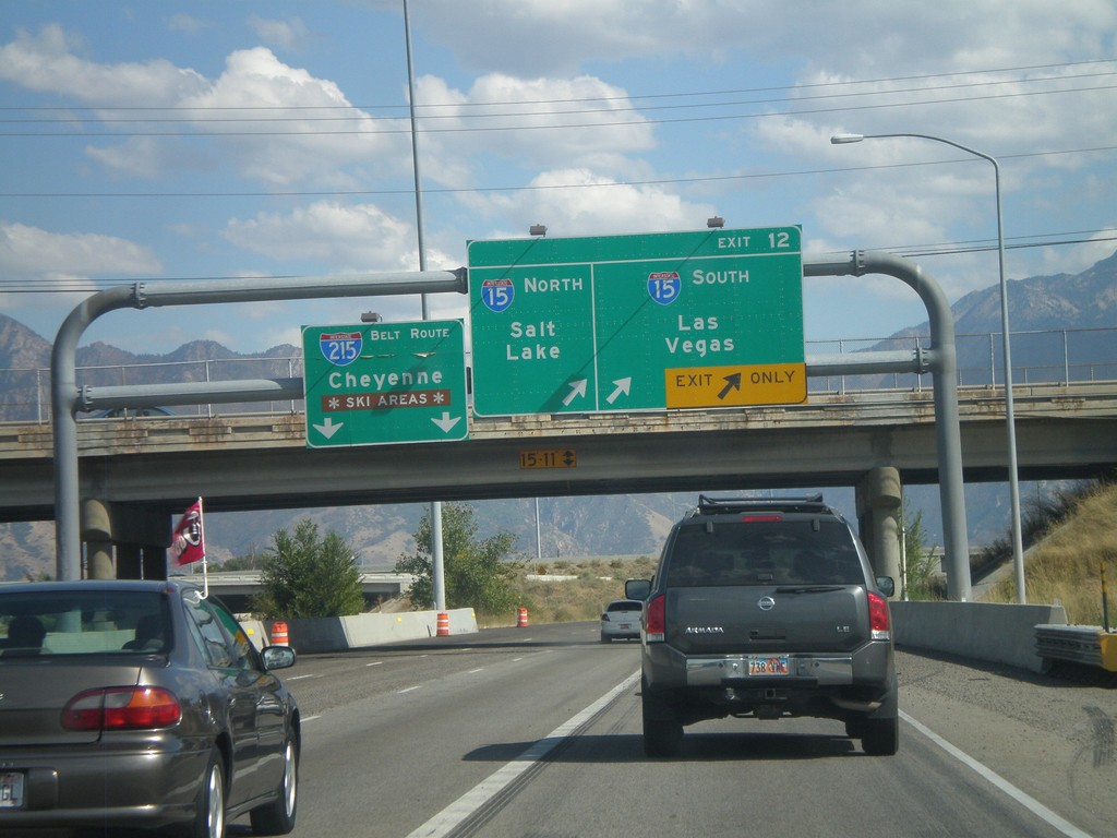
I-215 South - Exit 12
I-215 south at Exit 12 - I-15 North/Salt Lake; I-15 South/Las Vegas. Continue on the I-215 Belt Route for Cheyenne (Wyoming) and Ski Areas.
Taken 10-01-2011
Murray
Salt Lake County
Utah
United States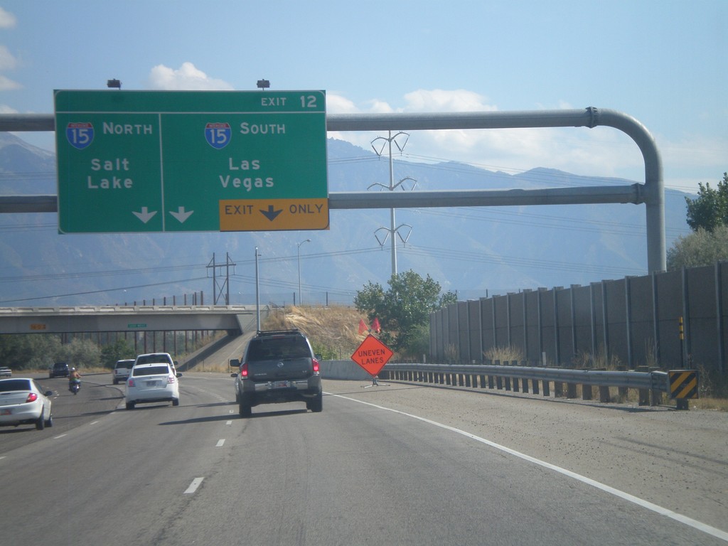
I-215 South - Exit 12
I-215 South approaching Exit 12 - I-15 South/Las Vegas;I-15 North/Salt Lake.
Taken 10-01-2011
Murray
Salt Lake County
Utah
United States
UT-68 South (Redwood Road) at I-215 East
UT-68 South (Redwood Road) at I-215 east onramp in Taylorsville. This is the southern intersection of I-215 with UT-68.
Taken 10-01-2011
 Taylorsville
Salt Lake County
Utah
United States
Taylorsville
Salt Lake County
Utah
United States