Signs Tagged With Shield Inside Sign
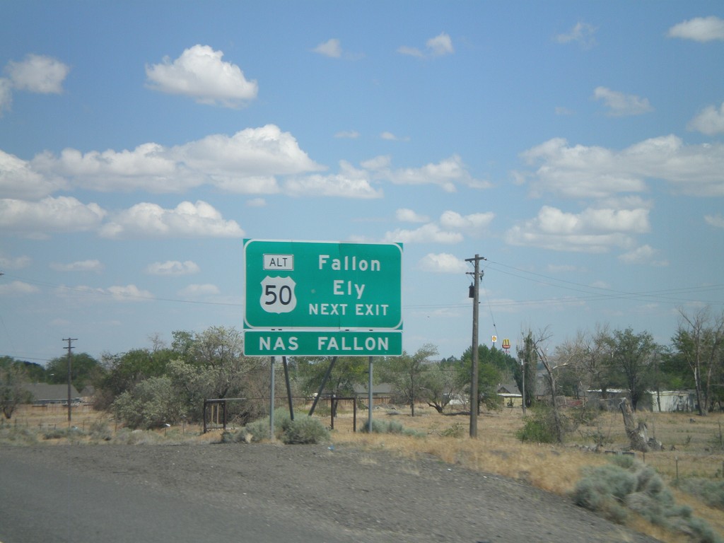
I-80 East Approaching Exit 48
I-80 east approaching Exit 48. Use Exit 48 for Fallon and Ely via Alt. US-50 east.
Taken 06-13-2011


 Fernley
Lyon County
Nevada
United States
Fernley
Lyon County
Nevada
United States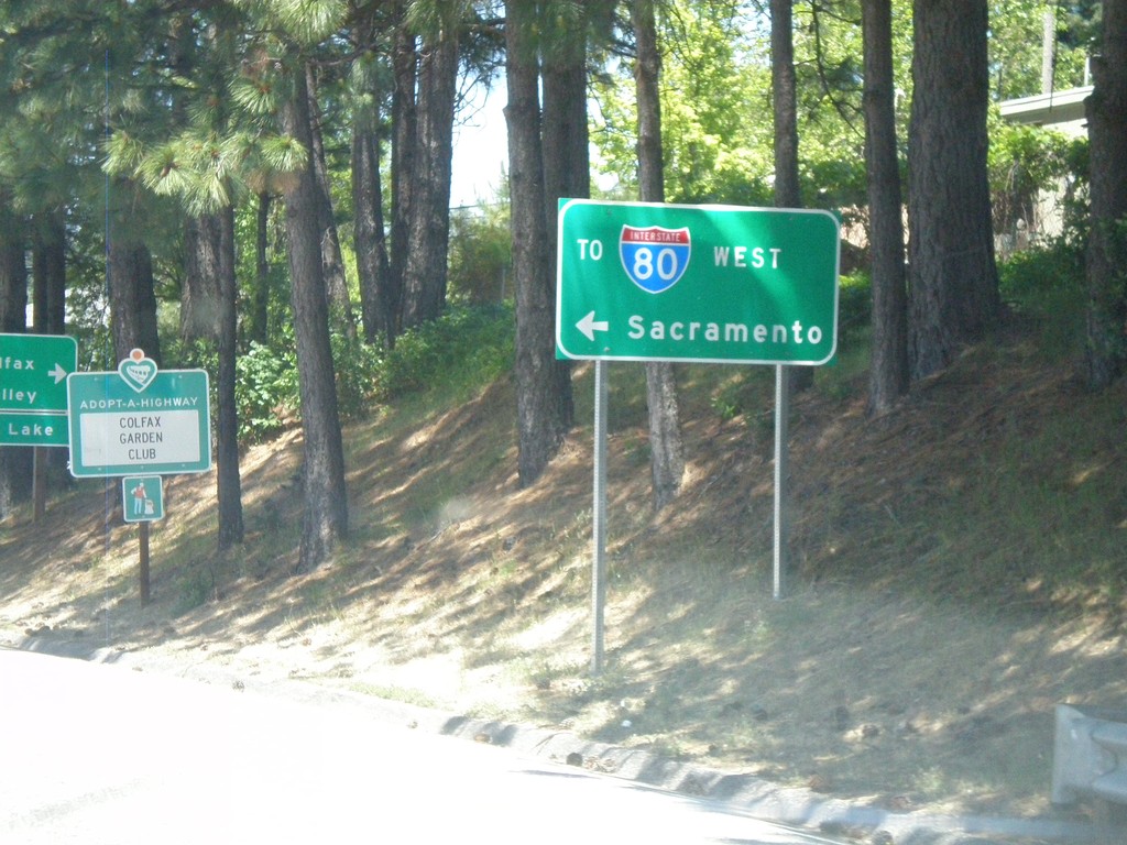
I-80 Overpass (Exit 135) at CA-174 Jct.
Overpass at I-80 Exit 135 at CA-174 jct. Turn right for CA-174; turn left for I-80 West to Sacramento.
Taken 06-13-2011
 Colfax
Placer County
California
United States
Colfax
Placer County
California
United States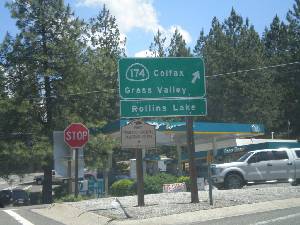
I-80 East at CA-174 (Exit 135)
I-80 east offramp at CA-174. Turn right for CA-174 West to Colfax, Grass Valley, and Rollins Lake. Also turn right for the First Transcontinental Railroad Historical Marker - Colfax.
Taken 06-13-2011
Colfax
Placer County
California
United States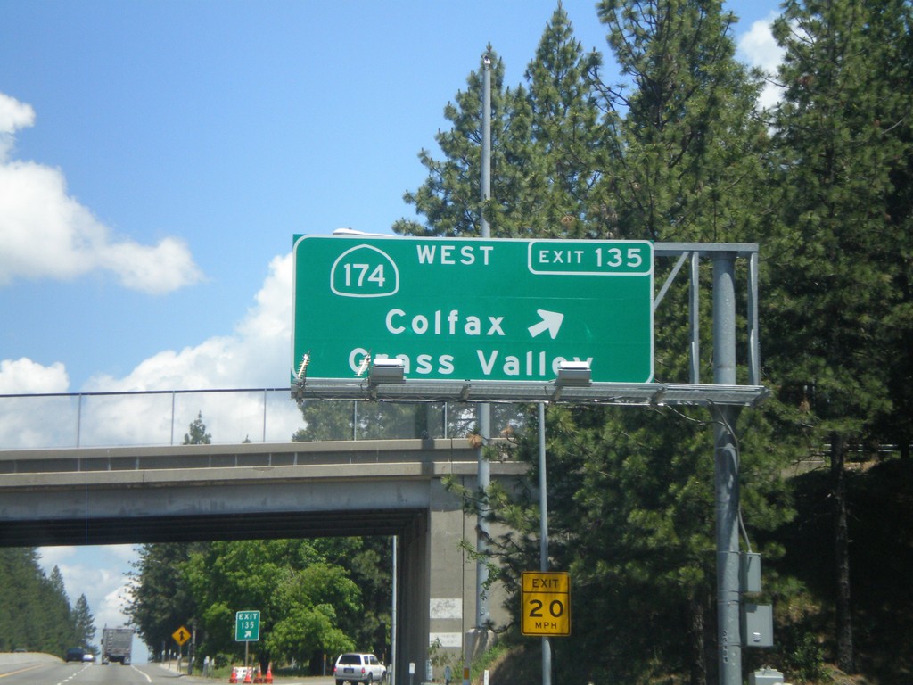
I-80 East - Exit 135
I-80 east at Exit 135 - CA-174 West/Colfax/Grass Valley.
Taken 06-13-2011
Colfax
Placer County
California
United States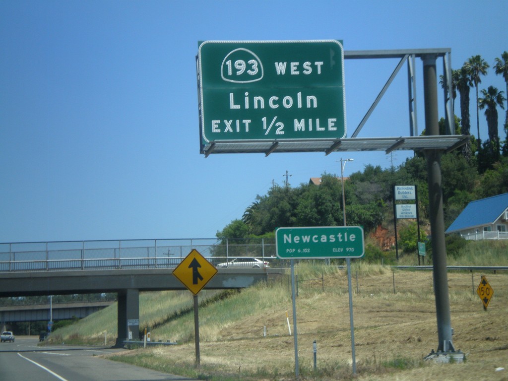
I-80 East Approaching Exit 116
I-80 East approaching Exit 116 - CA-193/Lincoln. Entering the community of Newcastle.
Taken 06-13-2011
 Newcastle
Placer County
California
United States
Newcastle
Placer County
California
United States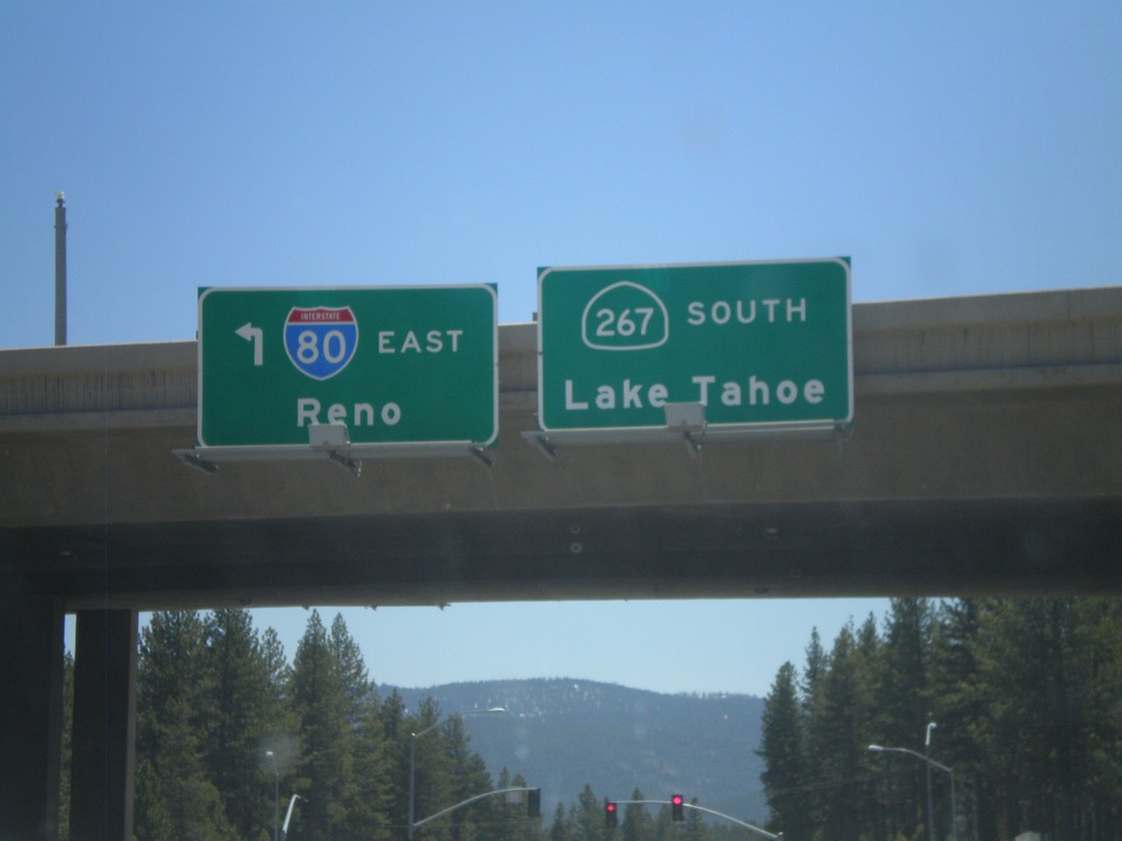
Begin CA-267 East at I-80
Begin CA-267 east at I-80. Turn right for I-80 east to Reno (Exit 188B); continue ahead for CA-267 east to Lake Tahoe.
Taken 06-09-2011

 Truckee
Nevada County
California
United States
Truckee
Nevada County
California
United States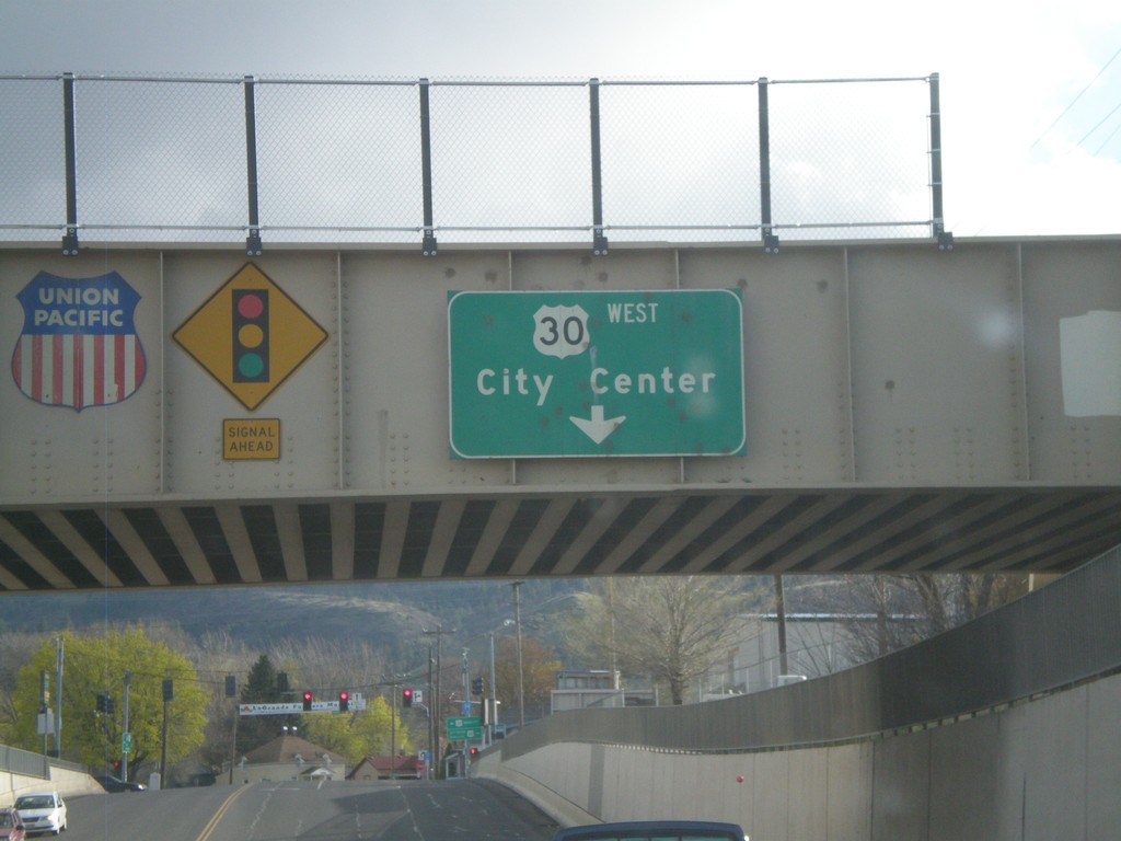
OR-82 West Approaching US-30
OR-82 West approaching US-30 and (La Grande) City Center. The overhead sign is attached to the Union Pacific Railroad overpass.
Taken 04-28-2011

 La Grande
Union County
Oregon
United States
La Grande
Union County
Oregon
United States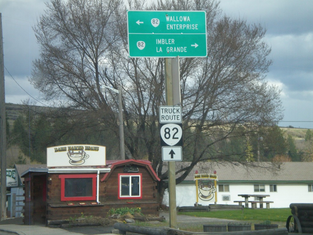
End OR-204 East at OR-82
End OR-204 East at OR-82. Use OR-82 east for Wallowa and Enterprise; use OR-82 west for Imbler and La Grande. For OR-82 truck traffic continue ahead.
Taken 04-28-2011
 Elgin
Union County
Oregon
United States
Elgin
Union County
Oregon
United States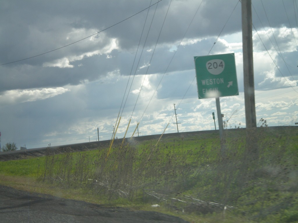
OR-11 South at OR-204
OR-11 South at OR-204 interchange. Use OR-204 east for Weston and Elgin.
Taken 04-28-2011
 Weston
Umatilla County
Oregon
United States
Weston
Umatilla County
Oregon
United States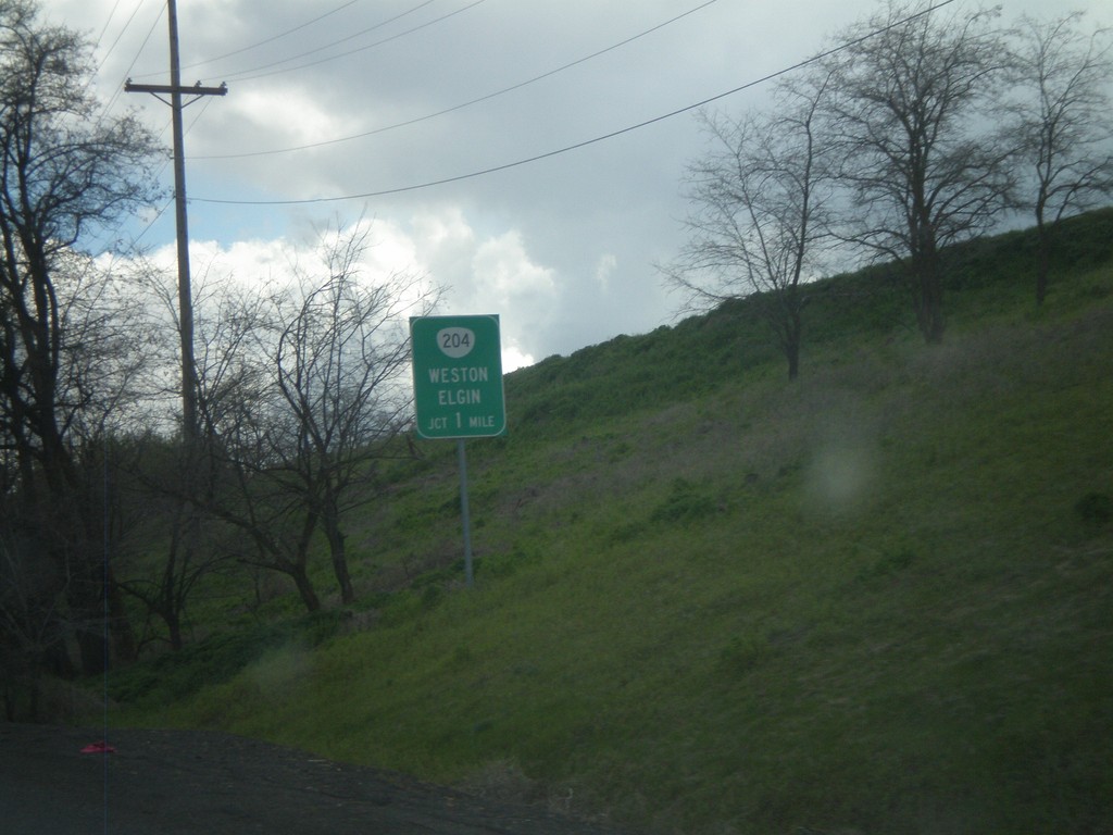
OR-11 South Approaching OR-204
OR-11 South approaching OR-204. Use OR-204 east for Weston and Elgin.
Taken 04-28-2011
Weston
Umatilla County
Oregon
United States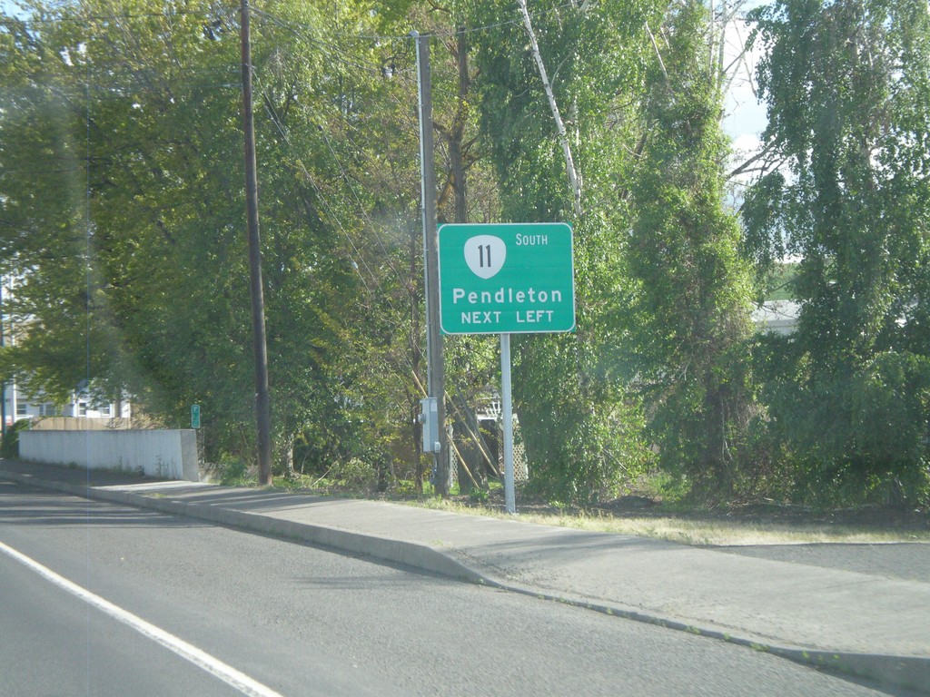
OR-11 - Milton-Freewater
Columbia St. south approaching Main St. in Milton-Freewater. OR-11 turns left onto S. Main St. towards Pendleton.
Taken 04-28-2011
Milton-Freewater
Umatilla County
Oregon
United States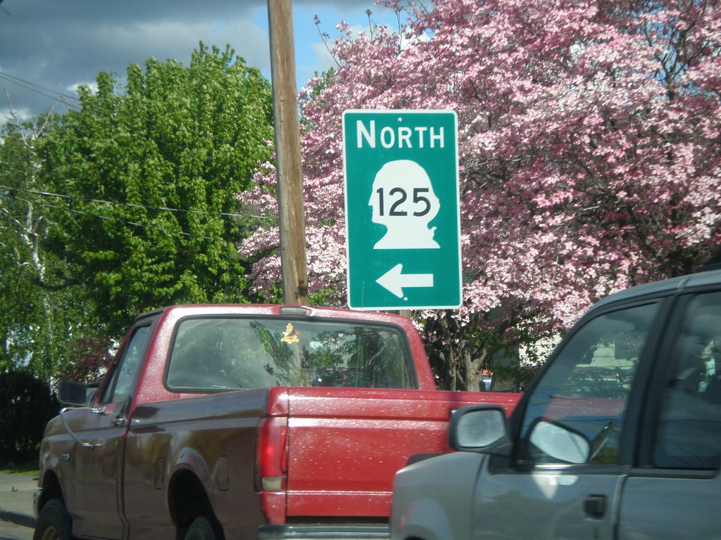
W. Pine St. Approaching WA-125
W. Pine St. Approaching WA-125 in Walla Walla. Turn left on N. 13th Ave. for WA-125 north.
Taken 04-28-2011
 Walla Walla
 County
Washington
United States
Walla Walla
Walla Walla County
Washington
United States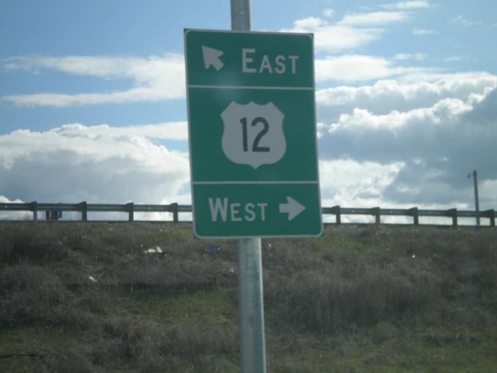
Myra Road Roundabout at US-12
Myra Road roundabout on north side of US-12/To WA-125 interchange. Merge right for US-12 west onramp. Continue through roundabout for US-12 east. Myra Road is part of a short spur that connects US-12 with WA-125.
Taken 04-28-2011
 Walla Walla
 County
Washington
United States
Walla Walla
Walla Walla County
Washington
United States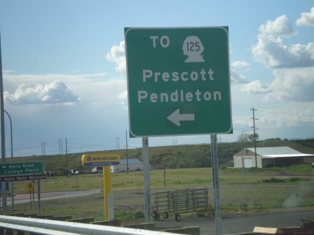
US-12 East at WA-125 Offramp
US-12 East at WA-125 offramp. Merge left onto roundabout for WA-125 (spur) to Prescott and Pendleton (Oregon).
Taken 04-28-2011
Walla Walla
Walla Walla County
Washington
United States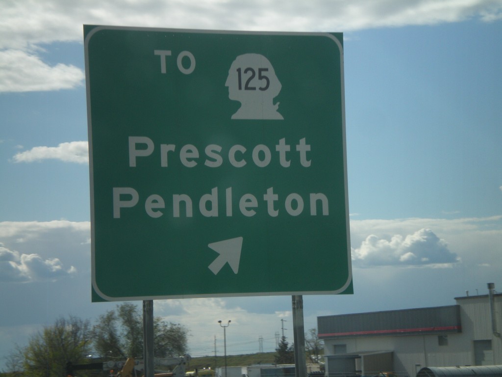
US-12 West at WA-125 Interchange
US-12 West at WA-125 Interchange - To WA-125/Prescott/Pendleton.
Taken 04-28-2011
Walla Walla
Walla Walla County
Washington
United States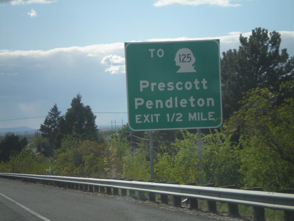
US-12 West Approaching WA-125 Interchange
US-12 West Approaching WA-125 Interchange - To WA-125/Prescott/Pendleton (Oregon).
Taken 04-28-2011
Walla Walla
Walla Walla County
Washington
United States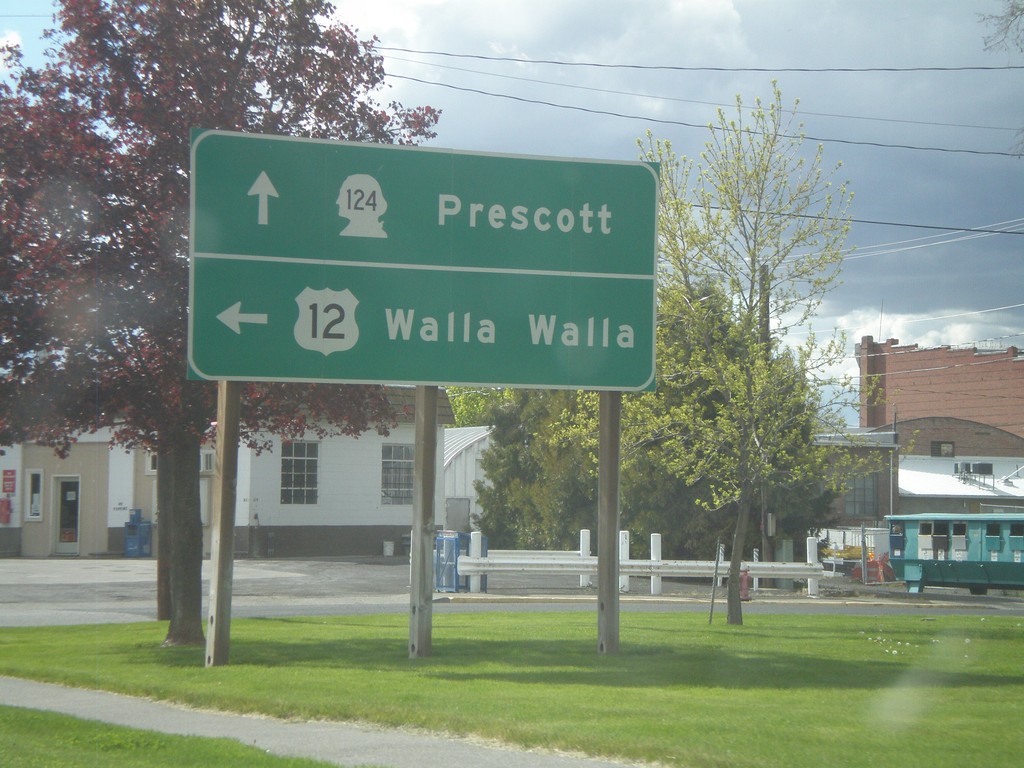
US-12 West at WA-124
US-12 west at WA-124. Continue ahead for WA-124 west to Prescott. Turn left for US-12 west to Walla Walla.
Taken 04-28-2011
 Waitsburg
Walla Walla County
Washington
United States
Waitsburg
Walla Walla County
Washington
United States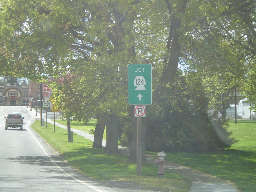
US-12 West Approaching WA-124
US-12 west approaching WA-124 junction in Waitsburg.
Taken 04-28-2011
Waitsburg
Walla Walla County
Washington
United States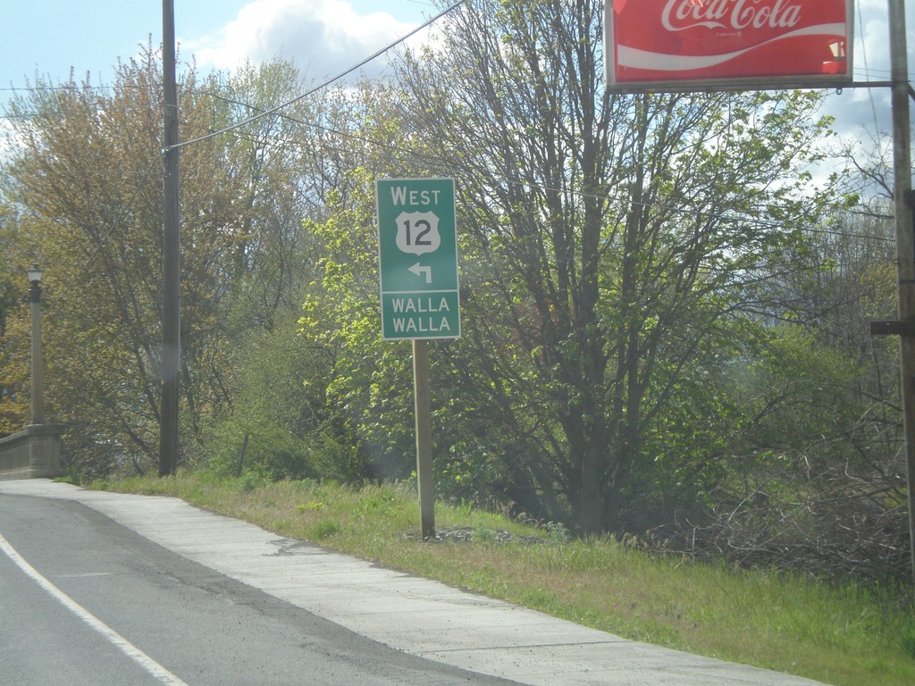
US-12 West Approaching WA-124
US-12 west approaching WA-124 junction in Waitsburg. Turn left at intersection with WA-124 to continue west on US-12 towards Walla Walla.
Taken 04-28-2011
Waitsburg
Walla Walla County
Washington
United States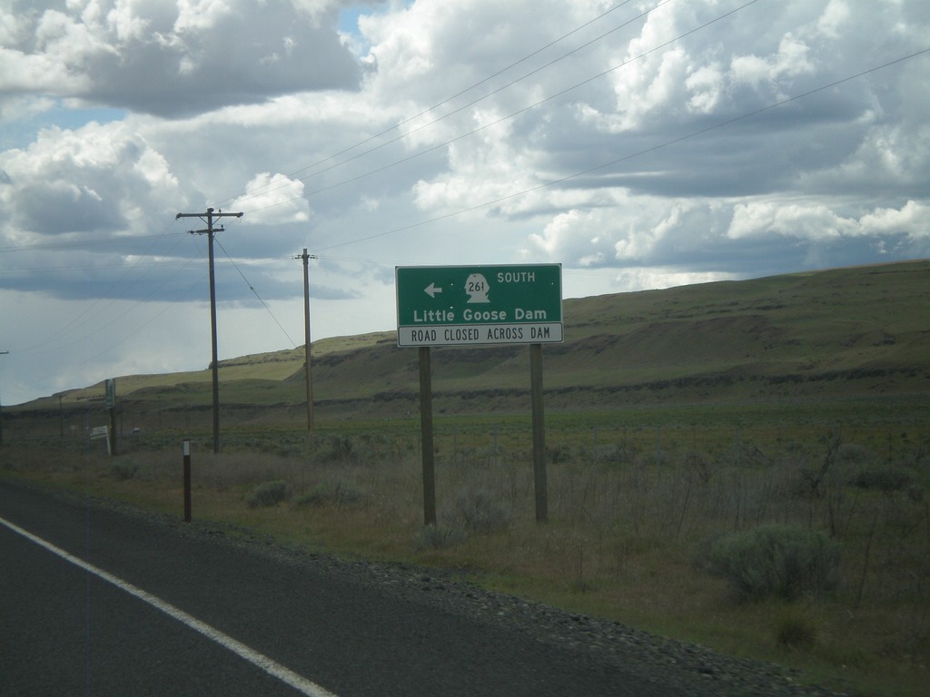
WA-260 West/WA-261 South at Split
WA-260 West/WA-261 South at Split. Turn right to continue south on WA-261 to Little Goose Dam. Currently, the roadway across Little Goose Dam is closed. Little Goose Dam is located on the Snake River in Central Washington.
Taken 04-28-2011

 Washtucna
Franklin County
Washington
United States
Washtucna
Franklin County
Washington
United States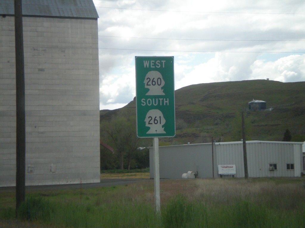
WA-260 West/WA-261 South - Washtucna
WA-260 West/WA-261 South in Washtucna. Green shields like this are common in Washington state, especially for multiplexed routes.
Taken 04-28-2011
Washtucna
Adams County
Washington
United States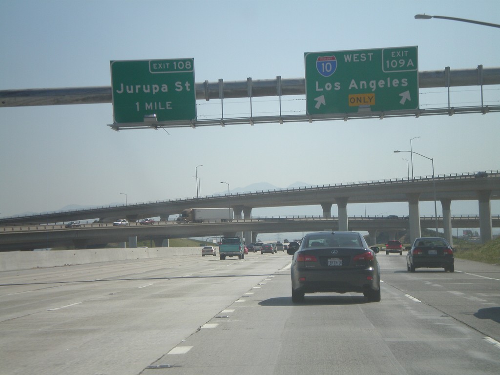
I-15 South at Exits 109A and 108
I-15 south at Exit 109A - I-10 West/Los Angeles. Approaching Exit 108 - Jurupa St.
Taken 02-28-2011

 Ontario
San Bernardino County
California
United States
Ontario
San Bernardino County
California
United States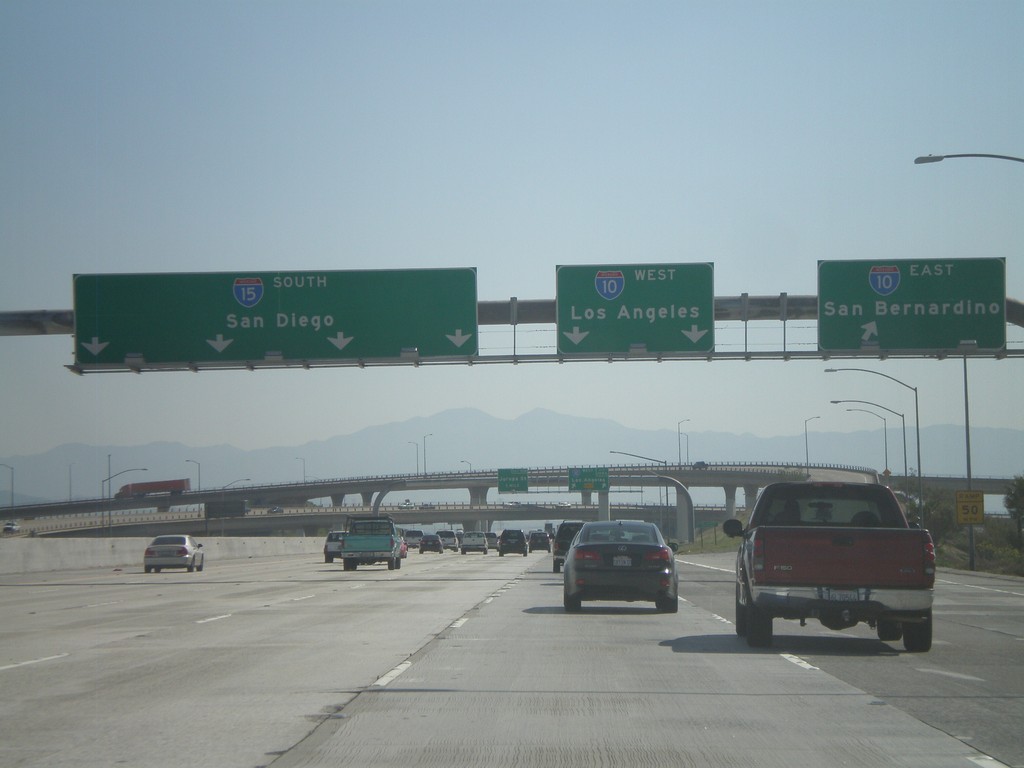
I-15 South - Exits 109B and 109A
I-15 south at Exit 109B - I-10 East/San Bernardino. Approaching Exit 109A - I-10 West/Los Angeles.
Taken 02-28-2011
Ontario
San Bernardino County
California
United States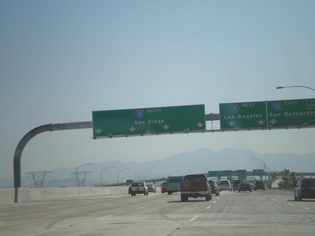
I-15 South Approaching Exit 109
I-15 south approaching Exit 109 - I-10 West/Los Angeles; I-10 East/San Bernardino. Continue on I-15 south for San Diego.
Taken 02-28-2011
Ontario
San Bernardino County
California
United States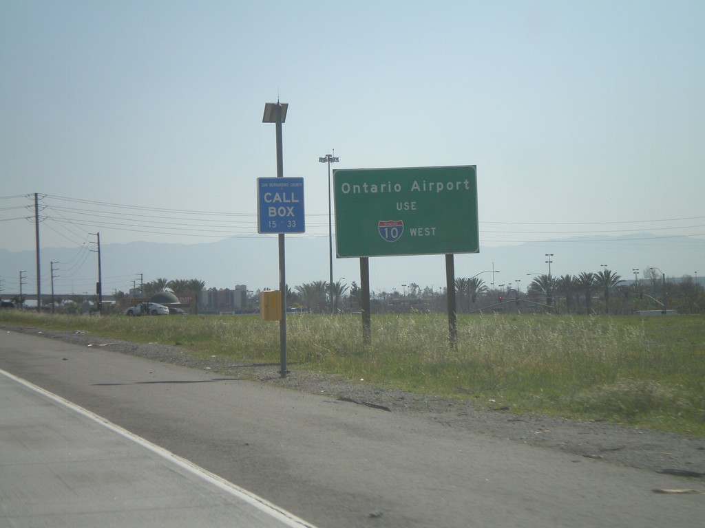
I-15 South - Use I-10 West for Ontario Airport
Use I-10 west for Ontario Airport on I-15 south.
Taken 02-28-2011
Rancho Cucamonga
San Bernardino County
California
United States