Signs Tagged With Shield Inside Sign
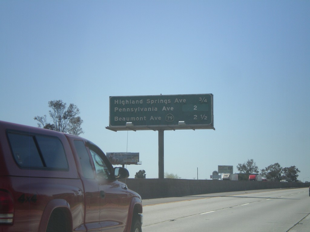
I-10 West - Banning/Beaumont Exits
Banning and Beaumont exits on I-10 west - Highland Springs Ave., Pennsylvania Ave., and CA-79/Beaumont Ave.
Taken 02-28-2011
 Banning
Riverside County
California
United States
Banning
Riverside County
California
United States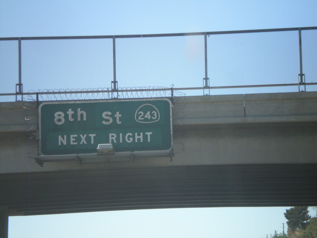
I-10 West Approaching Exit 100
I-10 west approaching Exit 100 - CA-243/8th St.
Taken 02-28-2011
 Banning
Riverside County
California
United States
Banning
Riverside County
California
United States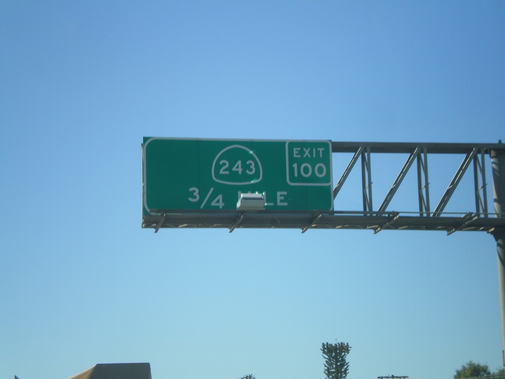
I-10 West Approaching Exit 100
I-10 west approaching Exit 100 - CA-243
Taken 02-28-2011
Banning
Riverside County
California
United States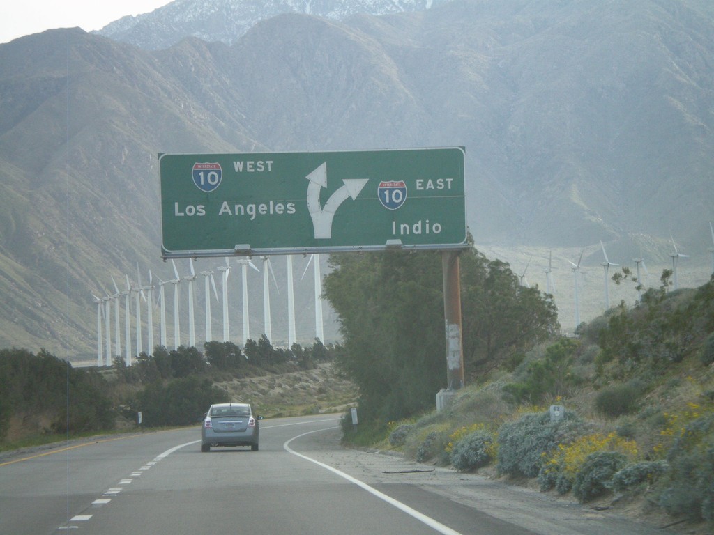
End CA-62 West at I-10
End CA-62 west at I-10. Use I-10 west for Los Angeles; use I-10 east for Indio.
Taken 02-25-2011
 Palm Springs
Riverside County
California
United States
Palm Springs
Riverside County
California
United States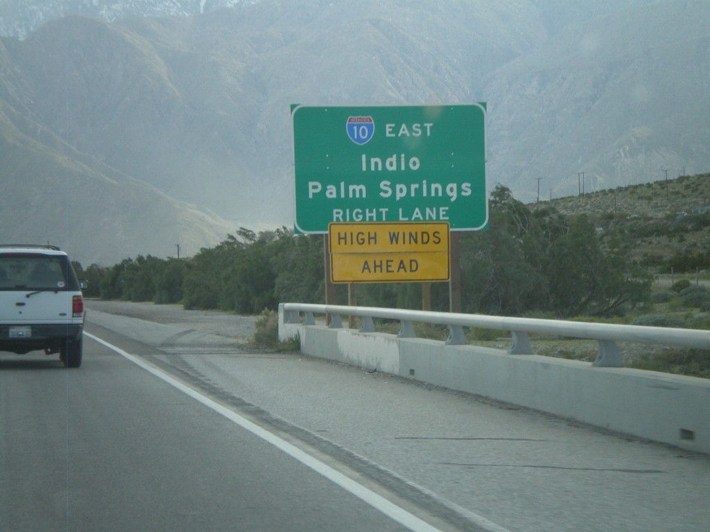
End CA-62 Approaching I-10
Approaching the west end of CA-62 at I-10. Use right lanes for I-10 east for Indio and Palm Springs.
Taken 02-25-2011
Whitewater
Riverside County
California
United States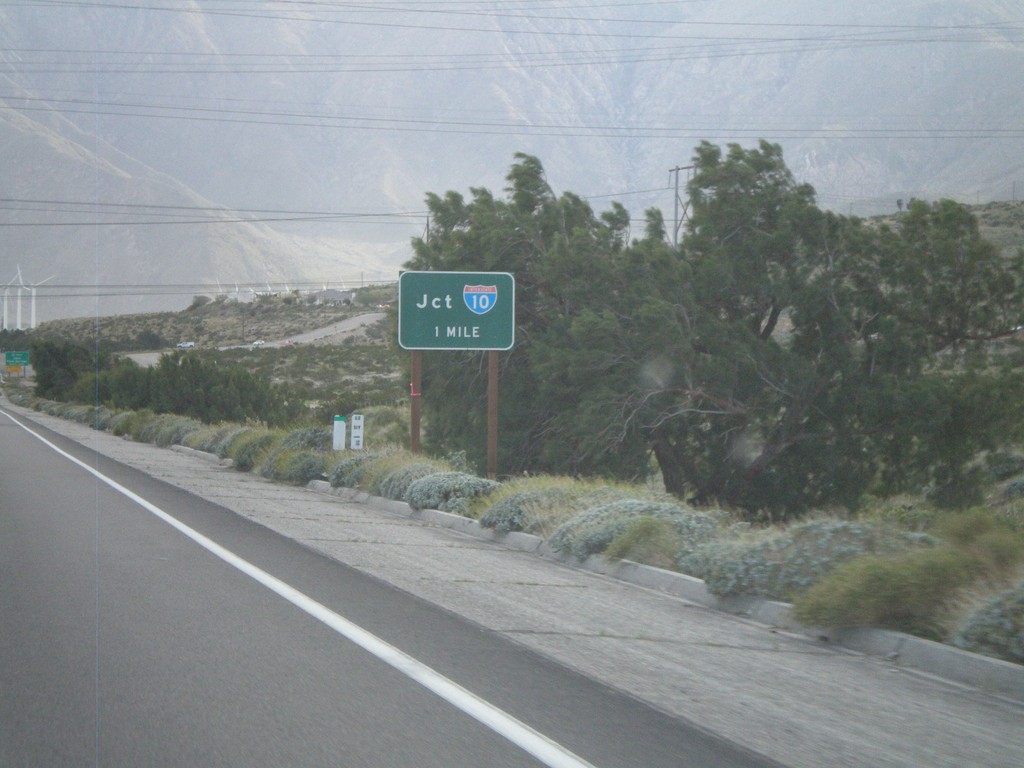
CA-62 West Approaching I-10
Approaching I-10 on CA-62 west.
Taken 02-25-2011
Whitewater
Riverside County
California
United States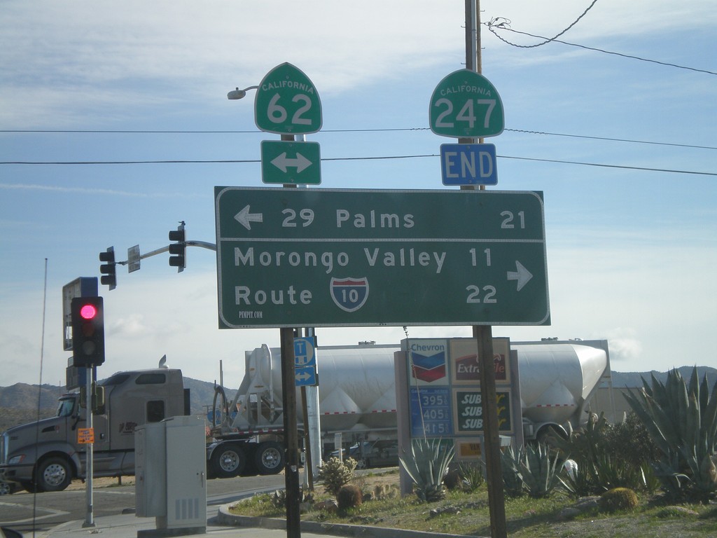
End CA-247 South at CA-62
End CA-247 south at CA-62. Use CA-62 east for 29 Palms; use CA-62 east for I-10 and Morongo Valley.
Taken 02-25-2011
 Yucca Valley
San Bernardino County
California
United States
Yucca Valley
San Bernardino County
California
United States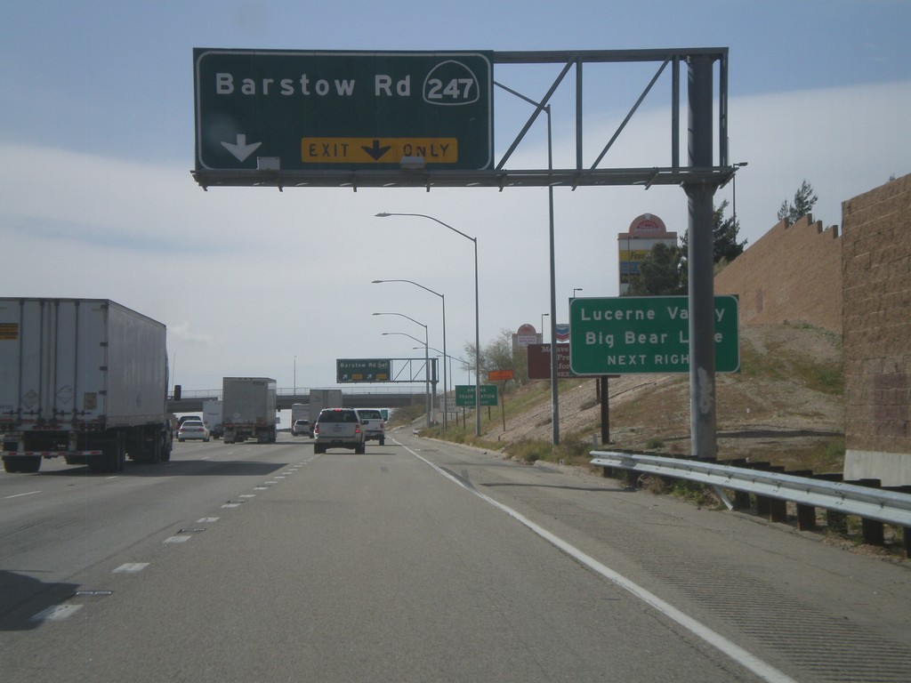
I-15 South - Exit 183
I-15 south at Exit 183 - CA-247/Barstow Road. Use CA-247 south for Lucerne Valley and Big Bear Lake.
Taken 02-25-2011
 Barstow
San Bernardino County
California
United States
Barstow
San Bernardino County
California
United States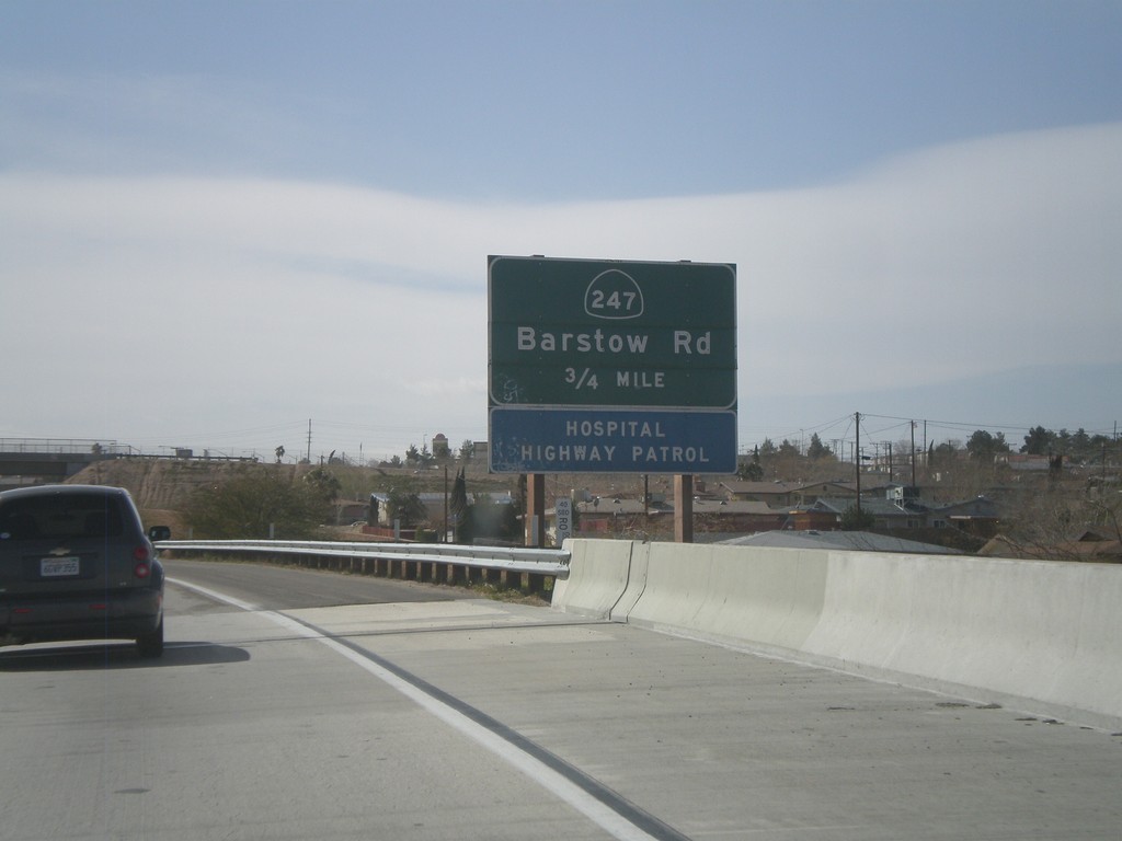
End I-40 West Approaching I-15 Exit 183
End I-40 west at I-15. Approaching I-15 Exit 183 - CA-247/Barstow Road.
Taken 02-25-2011
 Barstow
San Bernardino County
California
United States
Barstow
San Bernardino County
California
United States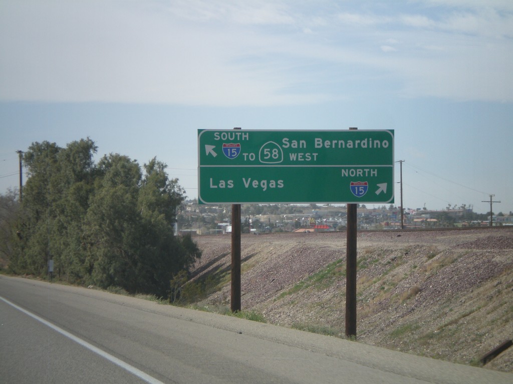
I-40 West - I-15/CA-58 Access
Approaching Exit 1 on I-40 west. There is no direct connection from I-40 west to I-15 north. For I-15 North/Las Vegas access, use Exit 1 (Main St.). For I-15 South/To CA-58 West/San Bernardino continue west on I-40.
Taken 02-25-2011
 Barstow
San Bernardino County
California
United States
Barstow
San Bernardino County
California
United States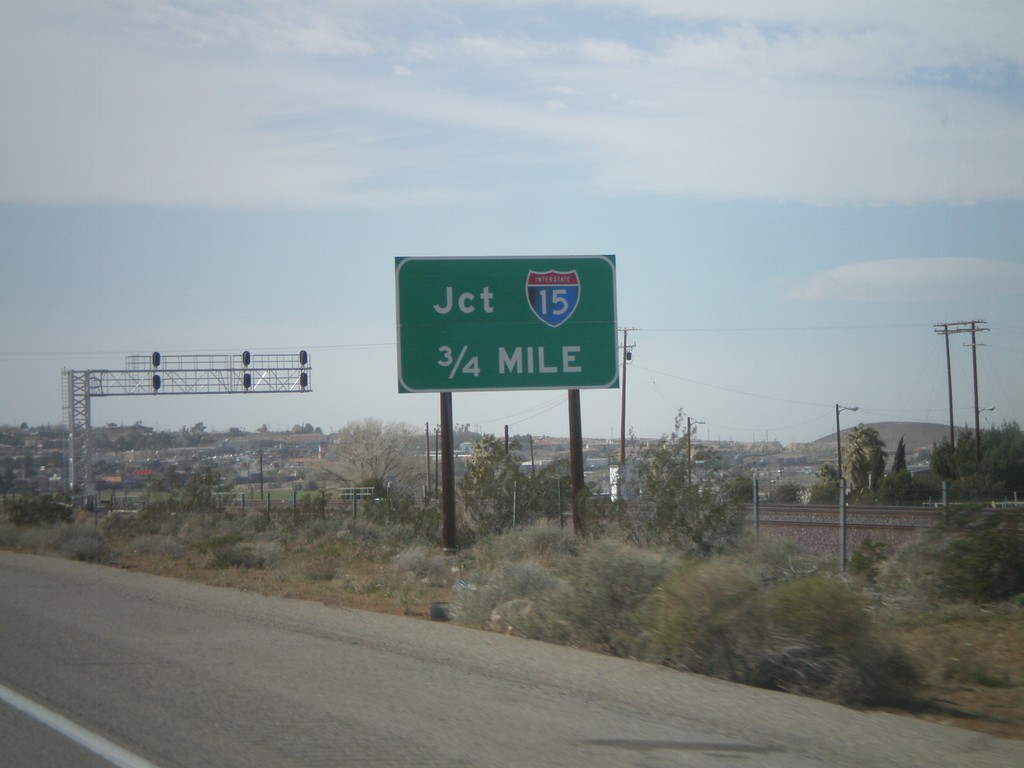
I-40 West Approaching I-15
I-40 west approaching I-15. Use Exit 1 for I-15 north. Continue west on I-40 for I-15 south.
Taken 02-25-2011
Barstow
San Bernardino County
California
United States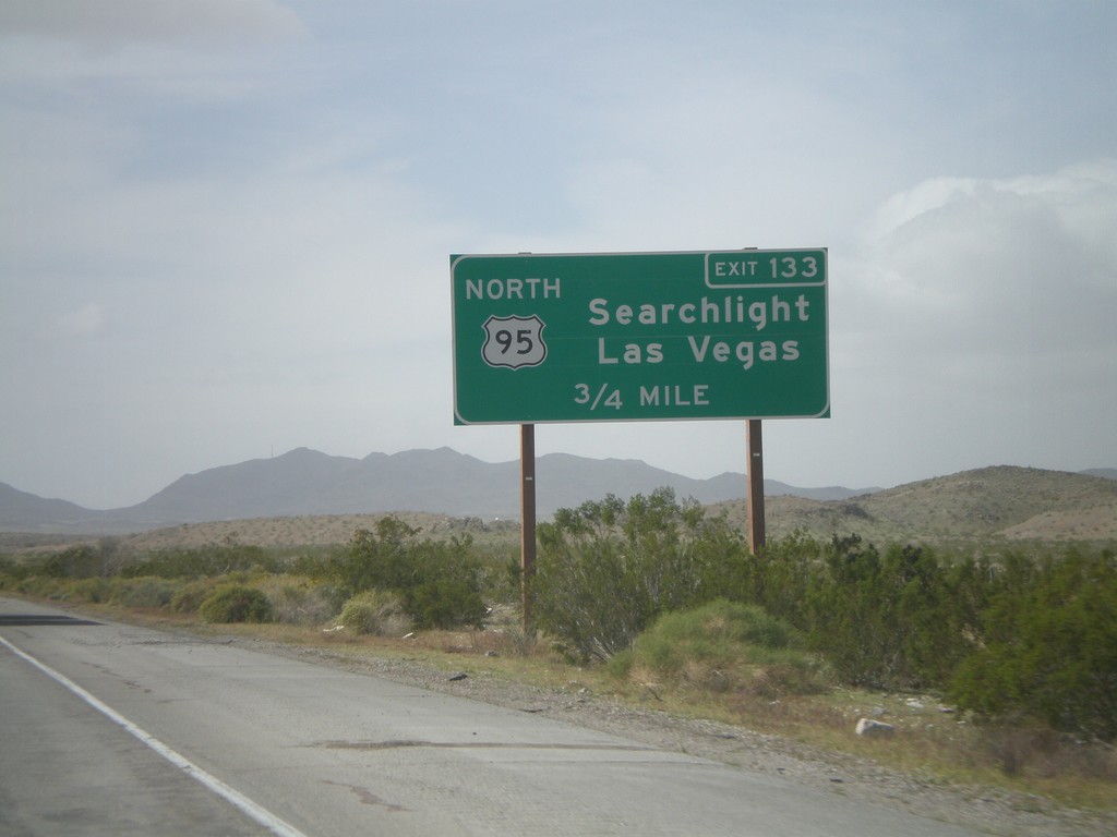
I-40 West Approaching Exit 133
I-40 west approaching Exit 133 - US-95 North/Searchlight/Las Vegas.
Taken 02-25-2011
 Needles
San Bernardino County
California
United States
Needles
San Bernardino County
California
United States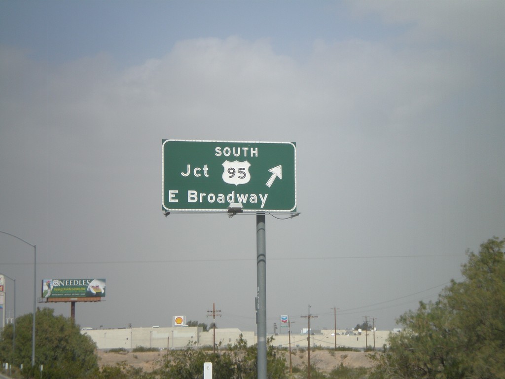
I-40 West - Exit 143
I-40 west at Exit 143 - US-95 South/E. Broadway. US-95 north joins I-40 west through Needles. This is the eastern end of the Needles business loop.
Taken 02-25-2011
 Needles
San Bernardino County
California
United States
Needles
San Bernardino County
California
United States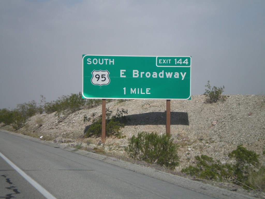
I-40 West Approaching Exit 144
I-40 west approaching Exit 144 - US-95 South/East Broadway.
Taken 02-25-2011
Needles
San Bernardino County
California
United States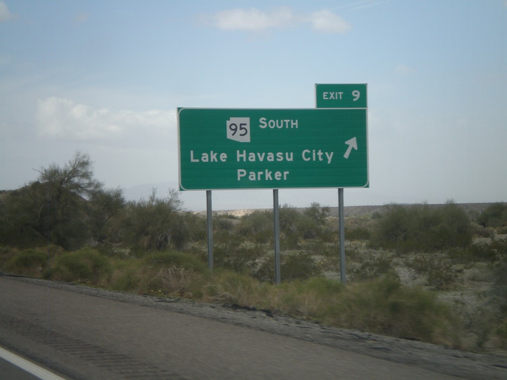
I-40 West - Exit 9
I-40 west at Exit 9 - AZ-95 South/Lake Havasu City/Parker.
Taken 02-25-2011
 Franconia
Mohave County
Arizona
United States
Franconia
Mohave County
Arizona
United States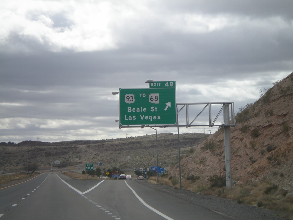
I-40 West - Exit 48
I-40 west at Exit 48 - US-93/To AZ-68/Las Vegas/Beale St. US-93 north leaves I-40 westbound and turns towards Las Vegas. Eastbound, US-93 south joins I-40 through Kingman.
Taken 02-25-2011

 Kingman
Mohave County
Arizona
United States
Kingman
Mohave County
Arizona
United States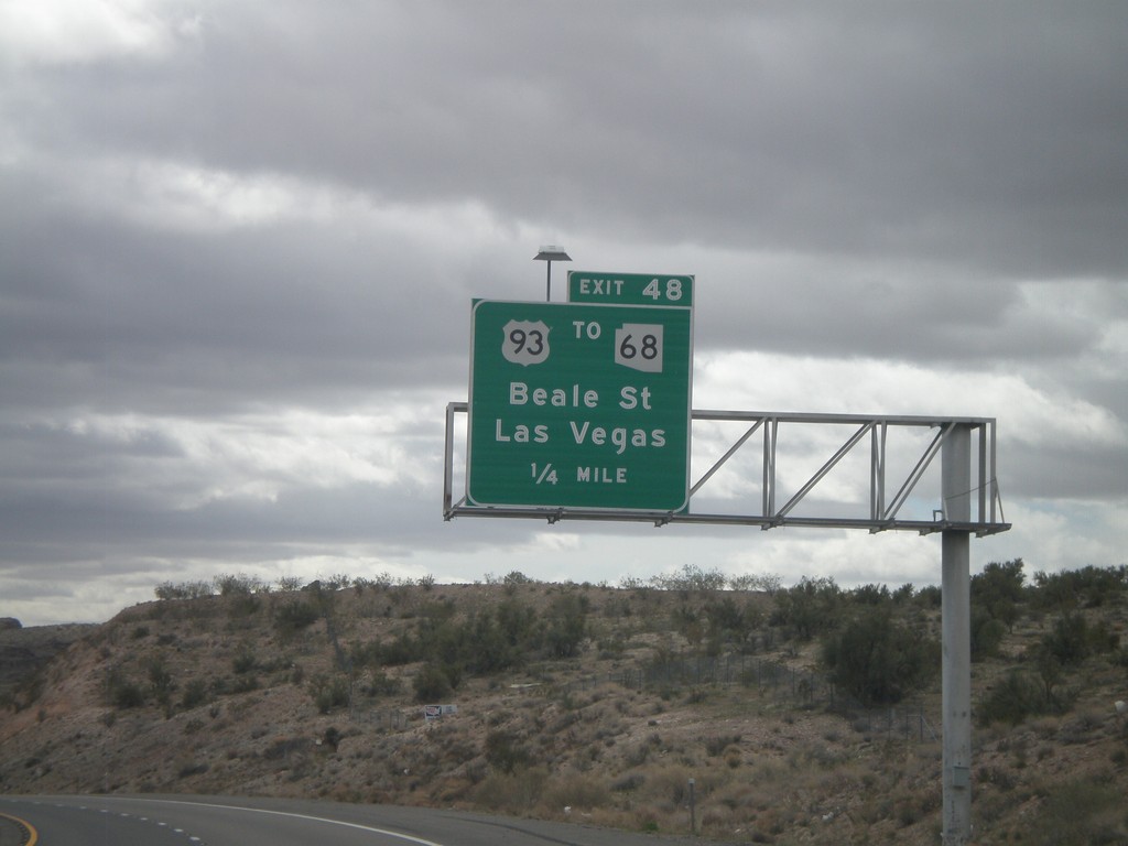
I-40 West Approaching Exit 48
I-40 west approaching Exit 48 - US-93/To AZ-68/Beale st./Las Vegas. AZ-68 leaves US-93 north of Kingman and connects to Bullhead City, Arizona and Laughlin, Nevada.
Taken 02-25-2011
New Kingman-Butler
Mohave County
Arizona
United States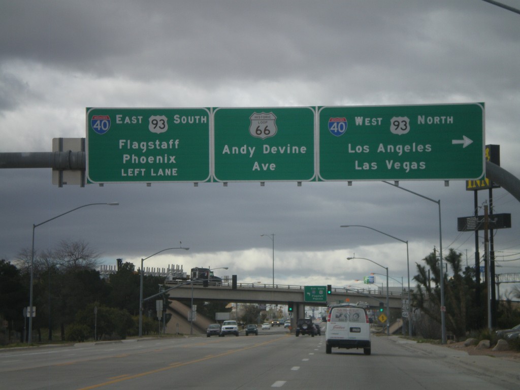
End AZ-66 West At I-40/US-93
End AZ-66 west at I-40/US-93 jct. Use I-40 West/US-93 North for Los Angeles and Las Vegas. Use I-40 East/US-93 South for Phoenix and Flagstaff. Continue straight for Andy Devine Avenue and Historic Loop US-66.
Taken 02-25-2011

 Kingman
Mohave County
Arizona
United States
Kingman
Mohave County
Arizona
United States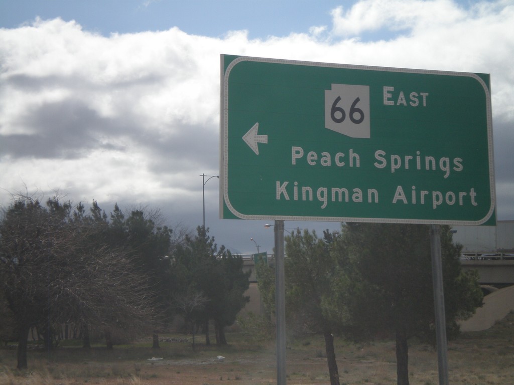
I-40 West at AZ-66
I-40 west at AZ-66 (and Historic Loop US-66) at Exit 53 onramp. Use AZ-66 east for Peach Springs and Kingman Airport.
Taken 02-25-2011
Kingman
Mohave County
Arizona
United States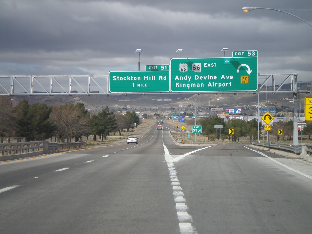
I-40 West - Exits 53 and 51
I-40 west at Exit 53 - Historic Loop US-66/AZ-66 East/Andy Devine Ave./Kingman Airport. Approaching Exit 51 - Stockton Hill Road.
Taken 02-25-2011
Kingman
Mohave County
Arizona
United States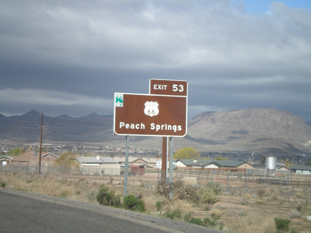
For Historic US-66 Use Exit 53
For Historic US-66 to Peach Springs use Exit 53. The Arizona Scenic Byway symbol is on the top left of this sign. Historic US-66 through Arizona between Topock and Ash Fork is called the Historic Route 66 National Scenic Byway.
Taken 02-25-2011
Kingman
Mohave County
Arizona
United States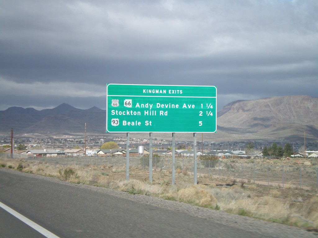
I-40 West - Kingman Exits
Kingman exits on I-40 west: Historic Loop US-66/AZ-66/Andy Devine Ave., Stockton Hill Road, US-93 Beale St.
Taken 02-25-2011
Kingman
Mohave County
Arizona
United States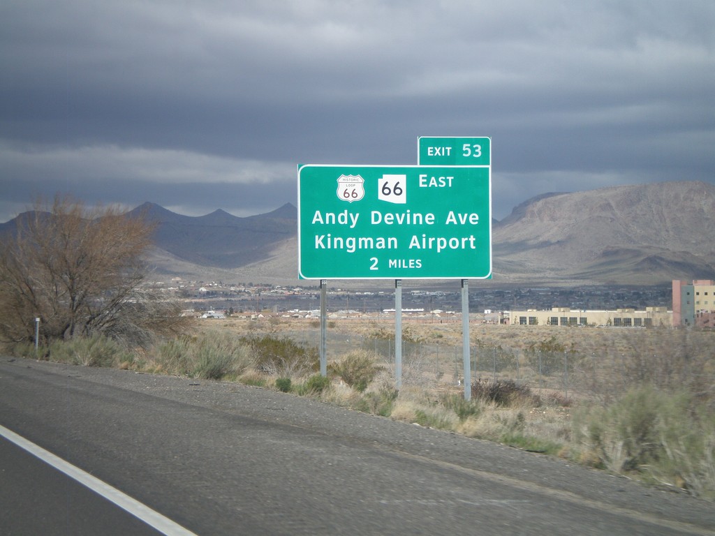
I-40 West Approaching Exit 53
I-40 west approaching Exit 53 - Historic Loop US-66/AZ-66 East/Andy Devine Ave./Kingman Airport.
Taken 02-25-2011
Kingman
Mohave County
Arizona
United States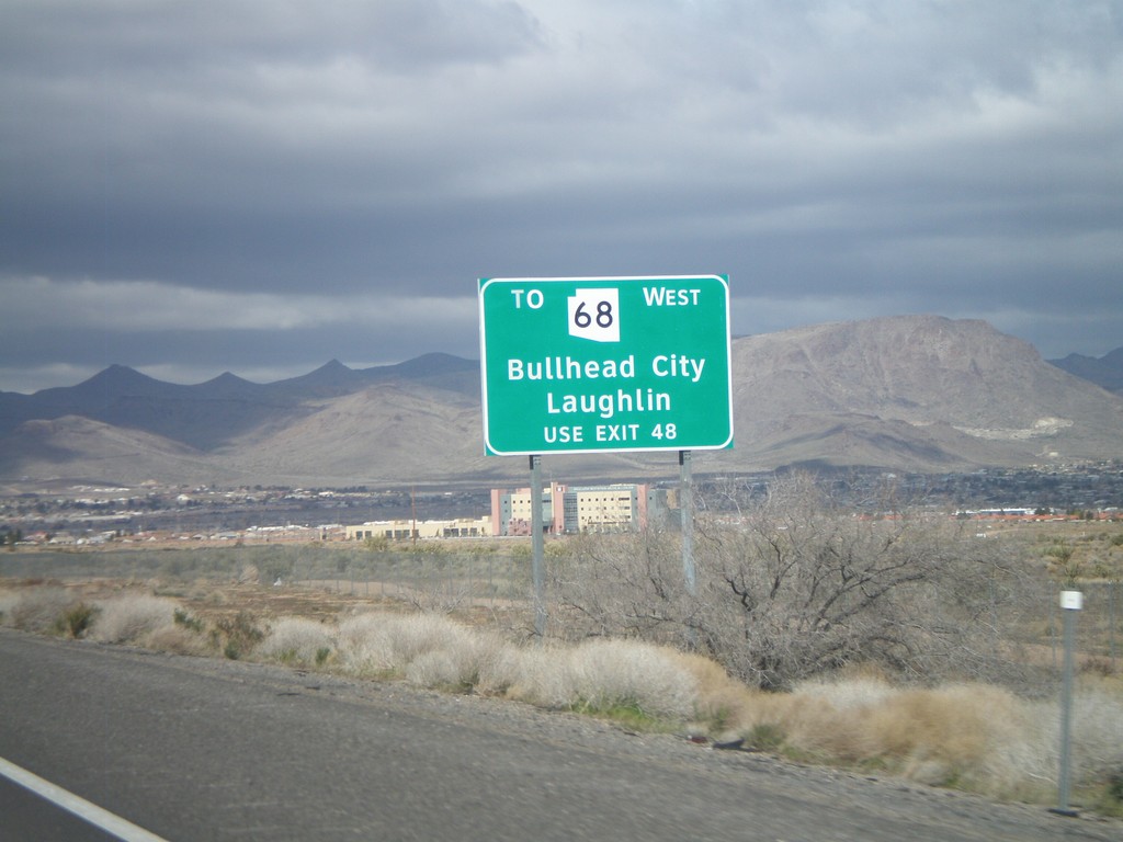
I-40 West - AZ-68 Traffic Use Exit 48
AZ-68 traffic for Bullhead City, and Laughlin (Nevada), use Exit 48. This sign is posted on the east end of Kingman approaching Exit 53.
Taken 02-25-2011
Kingman
Mohave County
Arizona
United States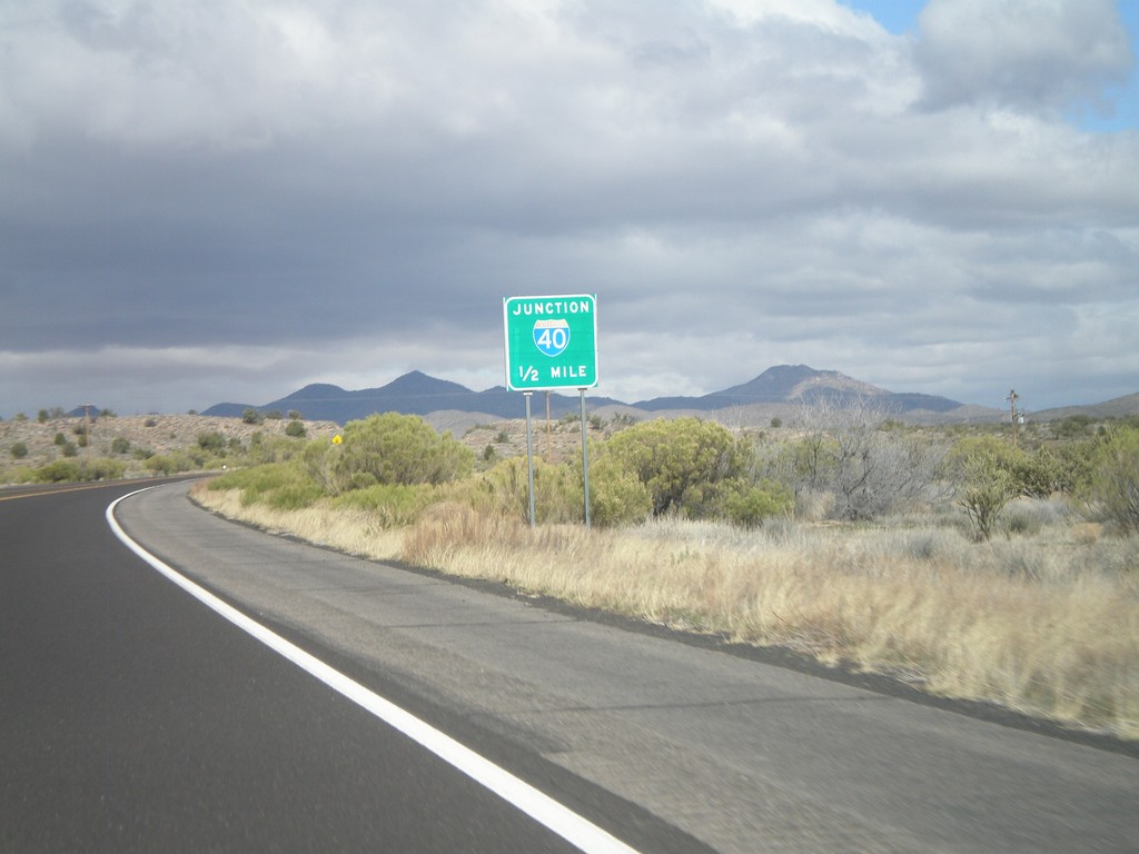
US-93 North Approaching I-40
US-93 north approaching I-40, one-half mile.
Taken 02-25-2011
Kingman
Mohave County
Arizona
United States