Signs Tagged With Shield Inside Sign
US-50 West at NV-207
US-50 west at NV-207/Kingsbury Grade junction in Stateline.
Taken 04-15-2010

 Stateline
Douglas County
Nevada
United States
Stateline
Douglas County
Nevada
United States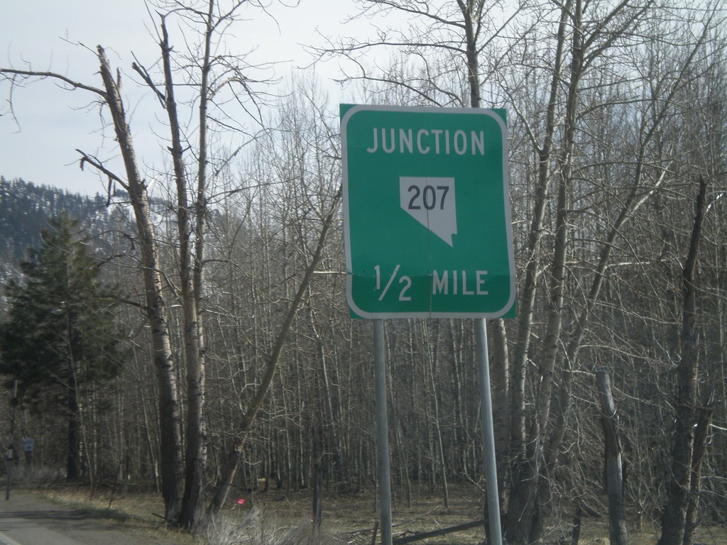
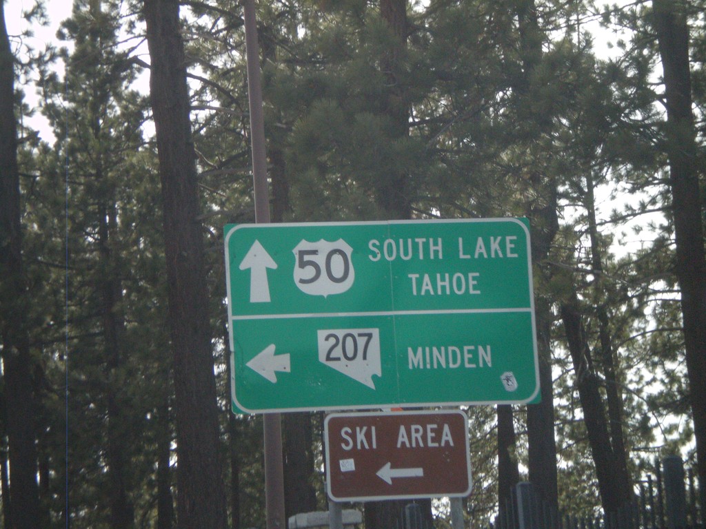
US-50 South Approaching NV-207
US-50 south approaching NV-207 east to Kingsbury Grade and Minden.
Taken 04-15-2010
Stateline
Douglas County
Nevada
United States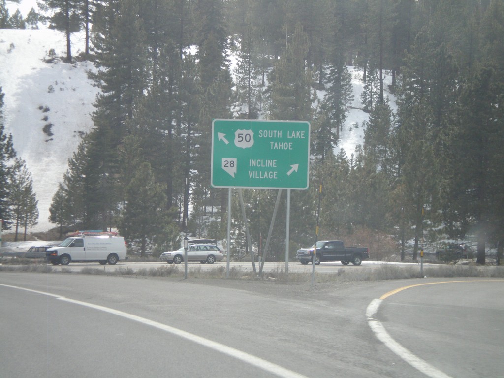
US-50 West at NV-28
US-50 west to South Lake Tahoe, at NV-28 north to Incline Village.
Taken 04-15-2010
 Carson City
Douglas County
Nevada
United States
Carson City
Douglas County
Nevada
United States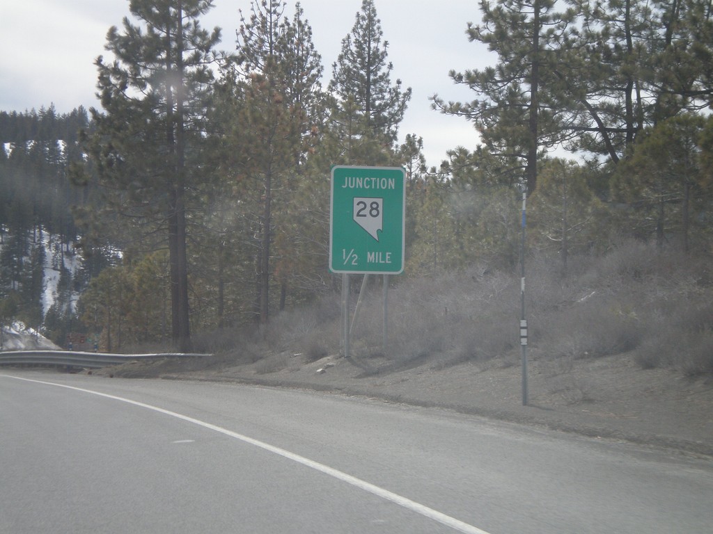
US-50 West Approaching NV-28
US-50 west approaching NV-28
Taken 04-15-2010
Carson City
Douglas County
Nevada
United States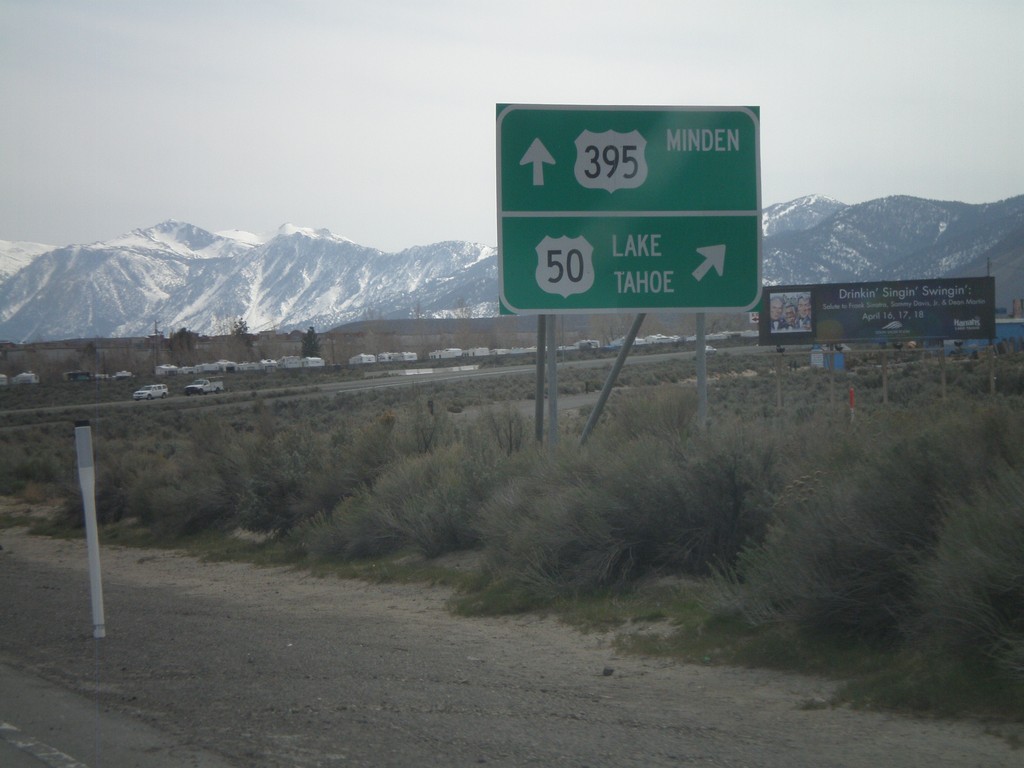
US-395 South/US-50 West at US-50 West
US-395 South/US-50 west at US-50/US-395 split. US-50 turns west towards Lake Tahoe, and Spooner Summit. US-395 continues south to Minden.
Taken 04-15-2010
 Carson City
Nevada
United States
Carson City
Nevada
United States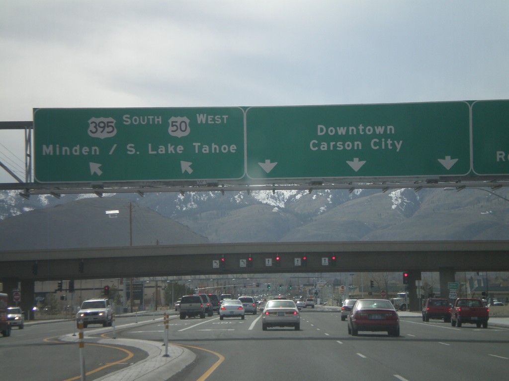
US-50 West Approaching US-395
US-50 west approaching US-395. Use US-395 north for Reno. US-50 west joins US-395 south for Minden and South Lake Tahoe (CA). Continue on William St. for Downtown Carson City.
Taken 04-15-2010
Carson City
Nevada
United States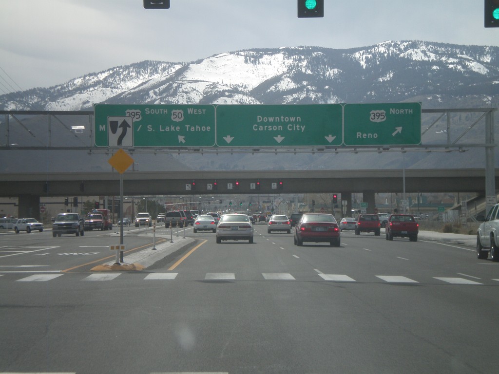
US-50 West Approaching US-395
US-50 west approaching US-395. Use US-395 north for Reno. US-50 west joins US-395 south for Minden and South Lake Tahoe (CA). Continue on William St. for Downtown Carson City.
Taken 04-15-2010
Carson City
Nevada
United States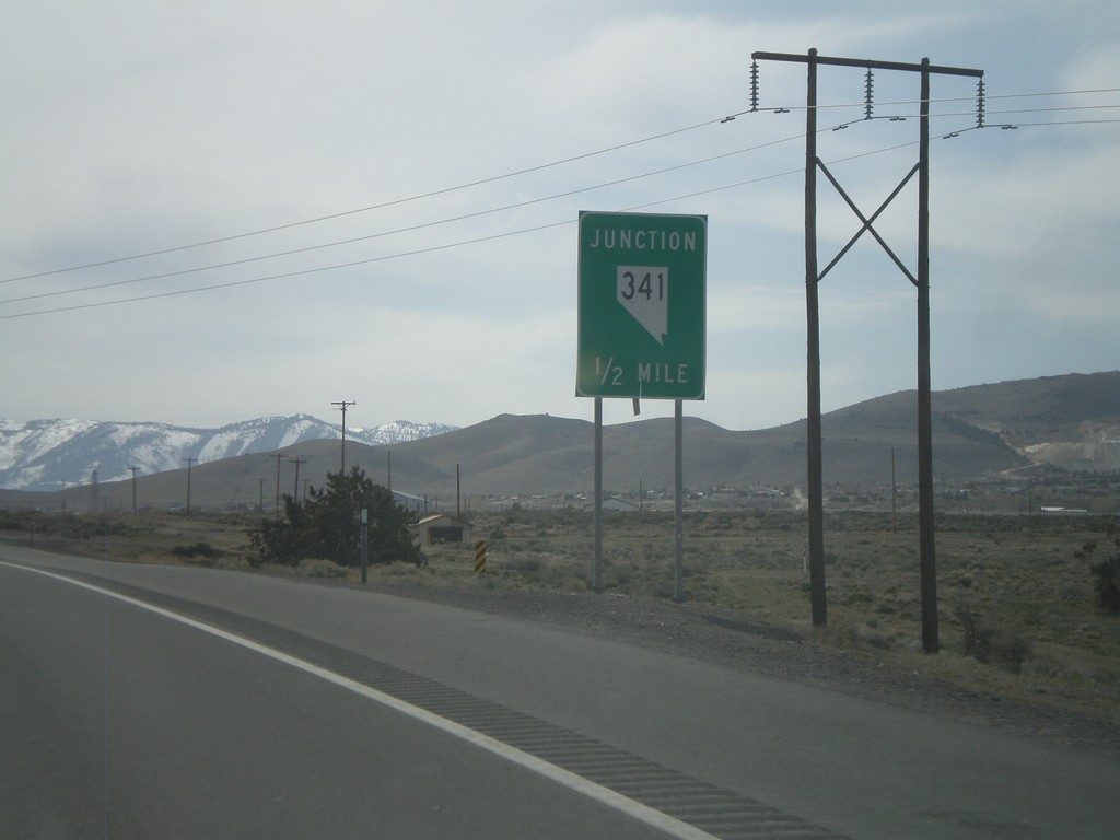
US-50 West Approaching NV-341
US-50 west approaching NV-341
Taken 04-15-2010
 Mound House
Lyon County
Nevada
United States
Mound House
Lyon County
Nevada
United States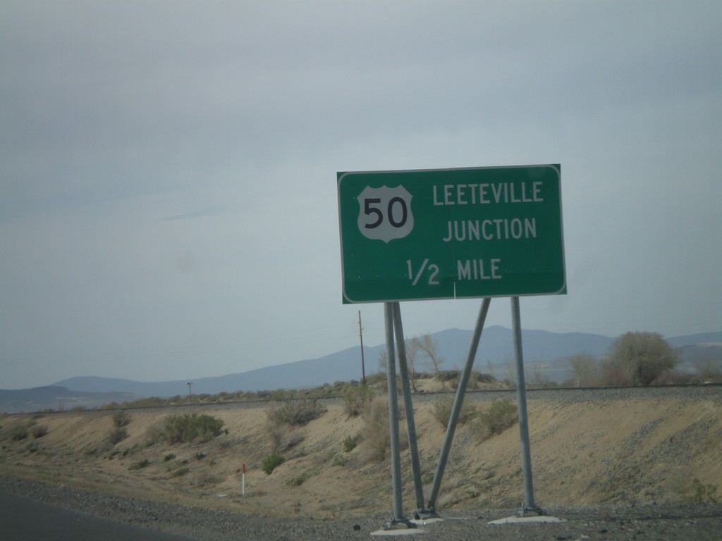
US-50 West - Leeteville Junction
US-50 west approaching Leeteville Junction of US-50 and Alt. US-50.
Taken 04-15-2010
 Fallon
Churchill County
Nevada
United States
Fallon
Churchill County
Nevada
United States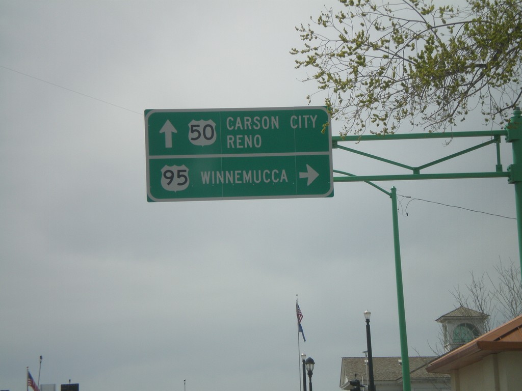
US-50 West at US-95 North
US-50 west at US-95 north to Winnemucca. Continue on US-50 west for Carson City and Reno.
Taken 04-15-2010
 Fallon
Churchill County
Nevada
United States
Fallon
Churchill County
Nevada
United States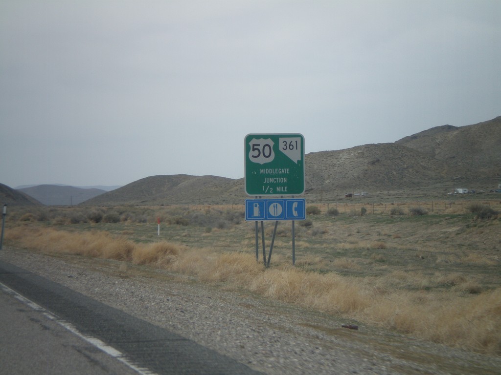
US-50 West Approaching Middlegate Jct.
US-50 west approaching Middlegate Junction (NV-361).
Taken 04-15-2010
 Fallon
Churchill County
Nevada
United States
Fallon
Churchill County
Nevada
United States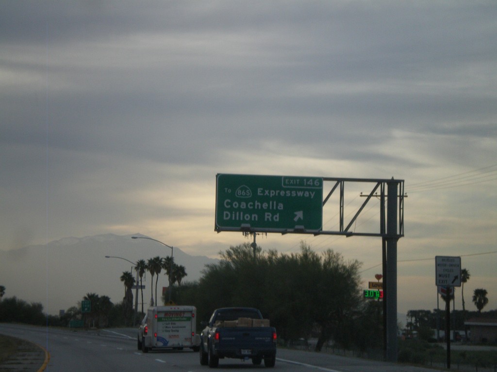
I-10 West - Exit 146
I-10 west at Exit 146 - To CA-86S Expressway/Coachella/Dillon Road. This is the first exit in the Coachella Valley westbound.
Taken 03-22-2010

 Coachella
Riverside County
California
United States
Coachella
Riverside County
California
United States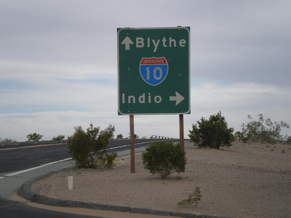
Wileys Well Road at I-10
Wileys Well Road at I-10 (Exit 222). Use I-10 west for Indio. Use I-10 east for Blythe.
Taken 03-22-2010
Blythe
Riverside County
California
United States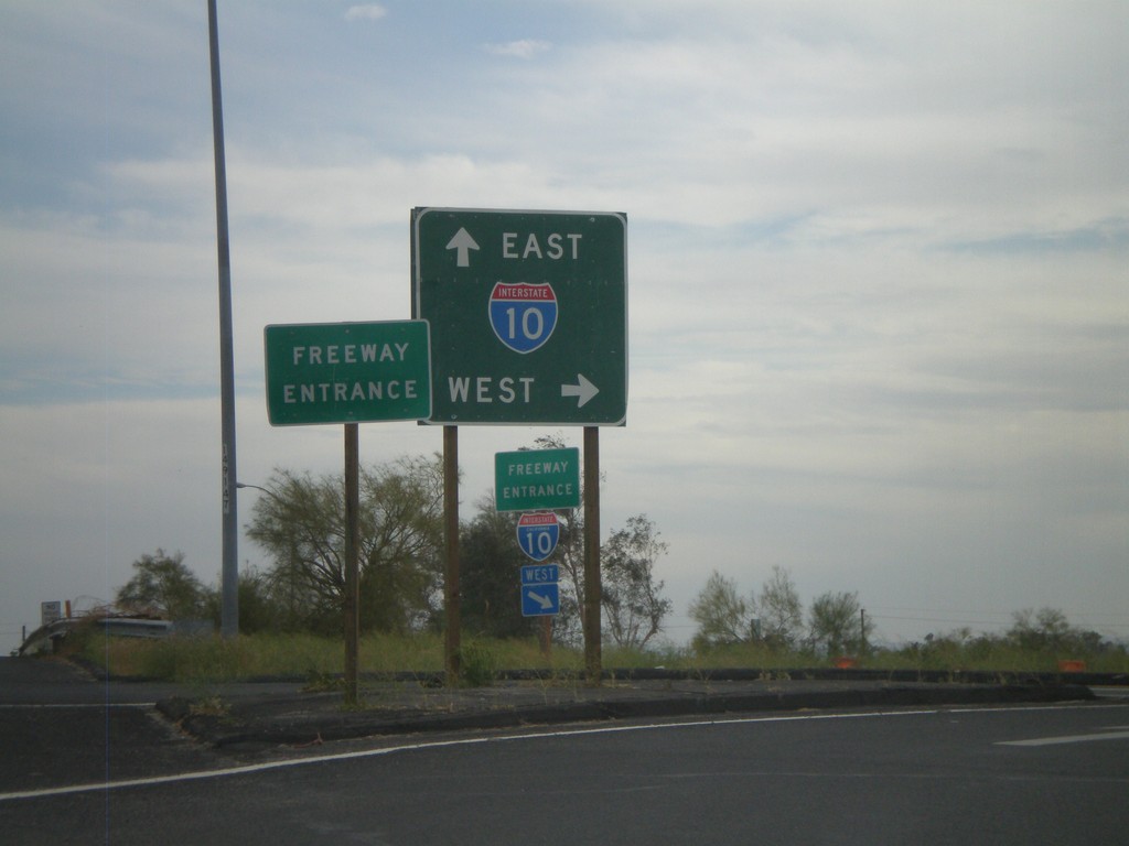
Neighbors Blvd. South at I-10
Neighbors Blvd. south at I-10. BL-10 ends here and CA-78 begins.
Taken 03-22-2010

 Blythe
Riverside County
California
United States
Blythe
Riverside County
California
United States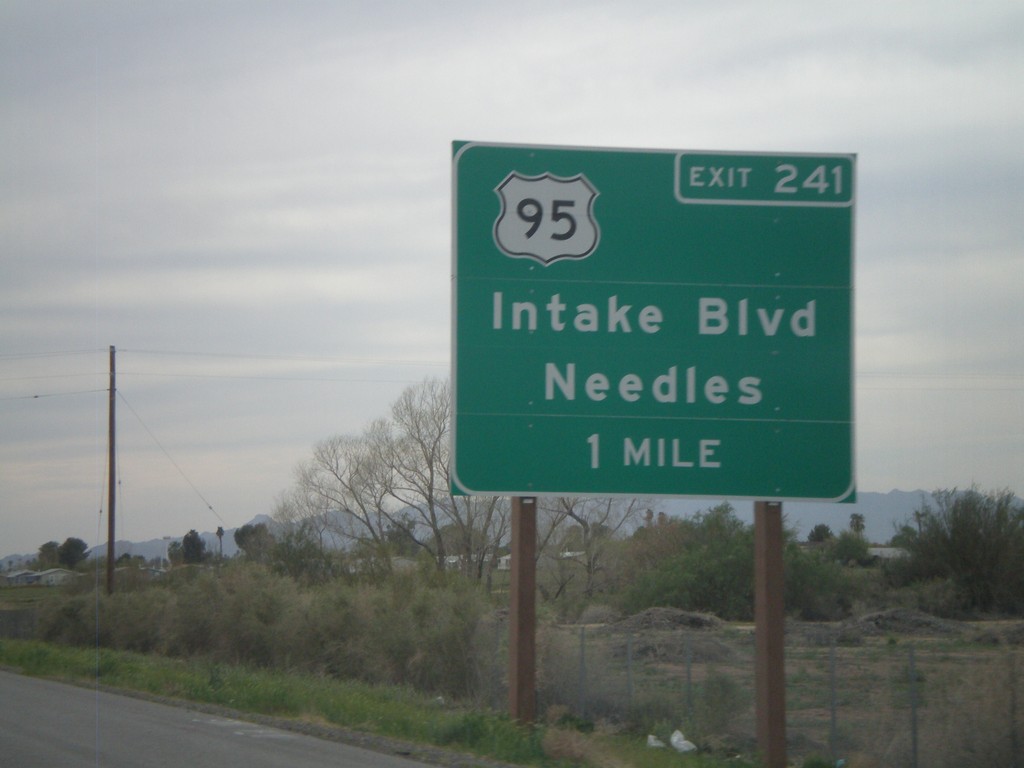
I-10 West Approaching Exit 241
I-10 west approaching Exit 241 - US-95/Intake Blvd/Needles. US-95 north leaves I-10 here. US-95 south joins I-10 east to Quartzsite, AZ.
Taken 03-22-2010
Blythe
Riverside County
California
United States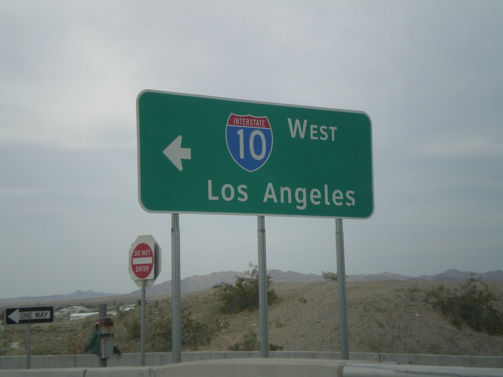
I-10 Exit 1 Onramp
I-10 west onramp to Los Angeles at Exit 1.
Taken 03-22-2010
Ehrenberg
La Paz County
Arizona
United States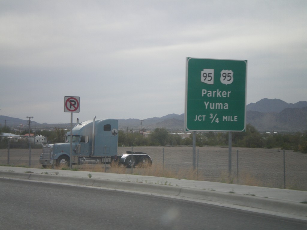
BL-10 West Approaching US-95/AZ-95
BL-10 west approaching US-95 south to Yuma, and AZ-95 north to Parker.
Taken 03-22-2010
 Quartzsite
La Paz County
Arizona
United States
Quartzsite
La Paz County
Arizona
United States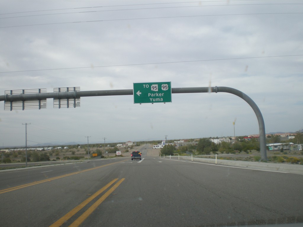
BL-10 West at Main St. - Quartzsite
BL-10 west at Main St. in Quartzsite. Turn left on Main St. for US-95, AZ-95 to Yuma and Parker. Turn left to continue on BL-10.
Taken 03-22-2010
Quartzsite
La Paz County
Arizona
United States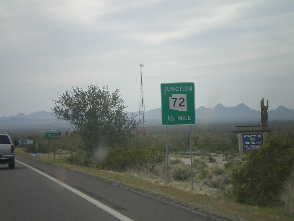
US-60 West Approaching AZ-72
US-60 west approaching AZ-72. Approaching the community of Hope, AZ.
Taken 03-22-2010

 Salome
La Paz County
Arizona
United States
Salome
La Paz County
Arizona
United States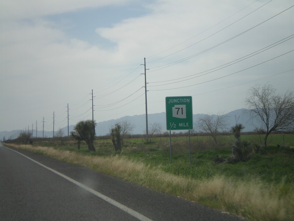
US-60 West Approaching AZ-71
US-60 west approaching AZ-71.
Taken 03-22-2010
 Wickenburg
Maricopa County
Arizona
United States
Wickenburg
Maricopa County
Arizona
United States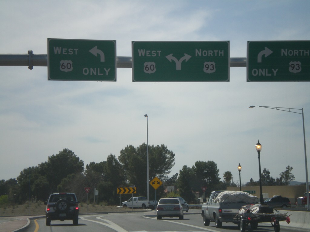
US-60 West at US-93
US-60 west at US-93 roundabout. This is the southern terminus of US-93.
Taken 03-22-2010
 Wickenburg
Maricopa County
Arizona
United States
Wickenburg
Maricopa County
Arizona
United States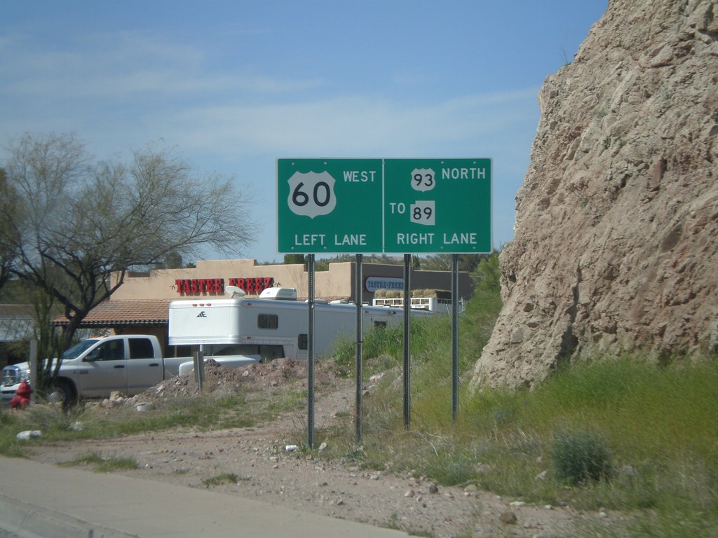
US-60 West Approaching US-93 To AZ-89
US-60 west approaching US-93 North/To AZ-89
Taken 03-22-2010
Wickenburg
Maricopa County
Arizona
United States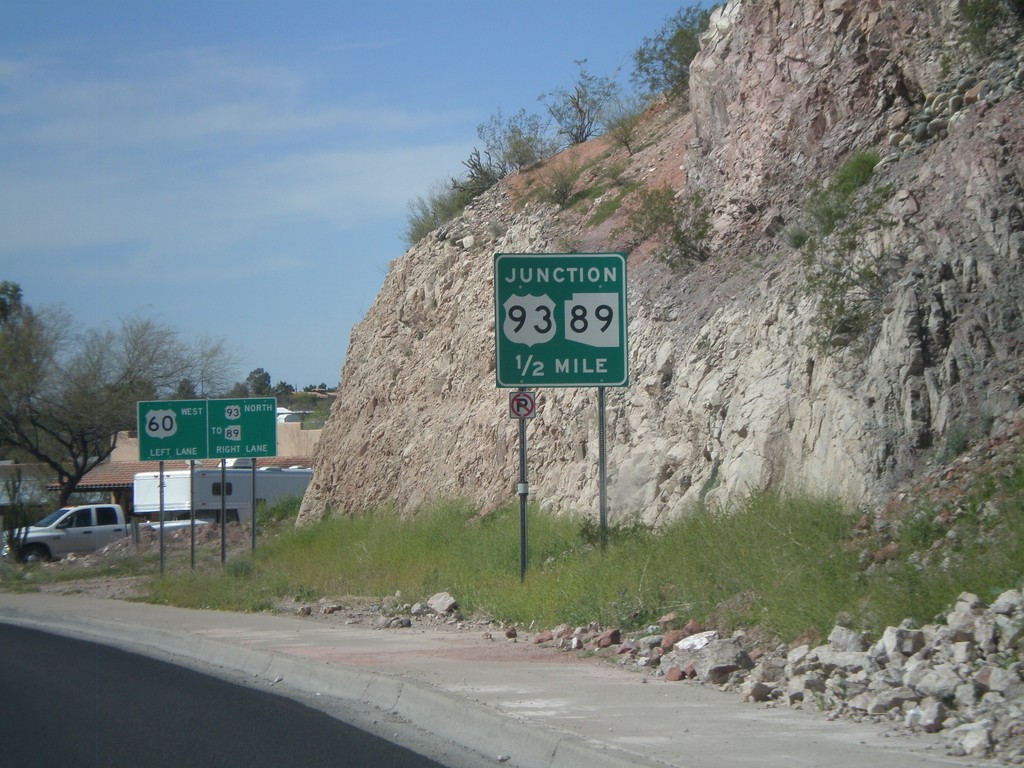
US-60 West Approaching US-93
US-60 west approaching US-93, (To) AZ-89.
Taken 03-22-2010
 Wickenburg
Maricopa County
Arizona
United States
Wickenburg
Maricopa County
Arizona
United States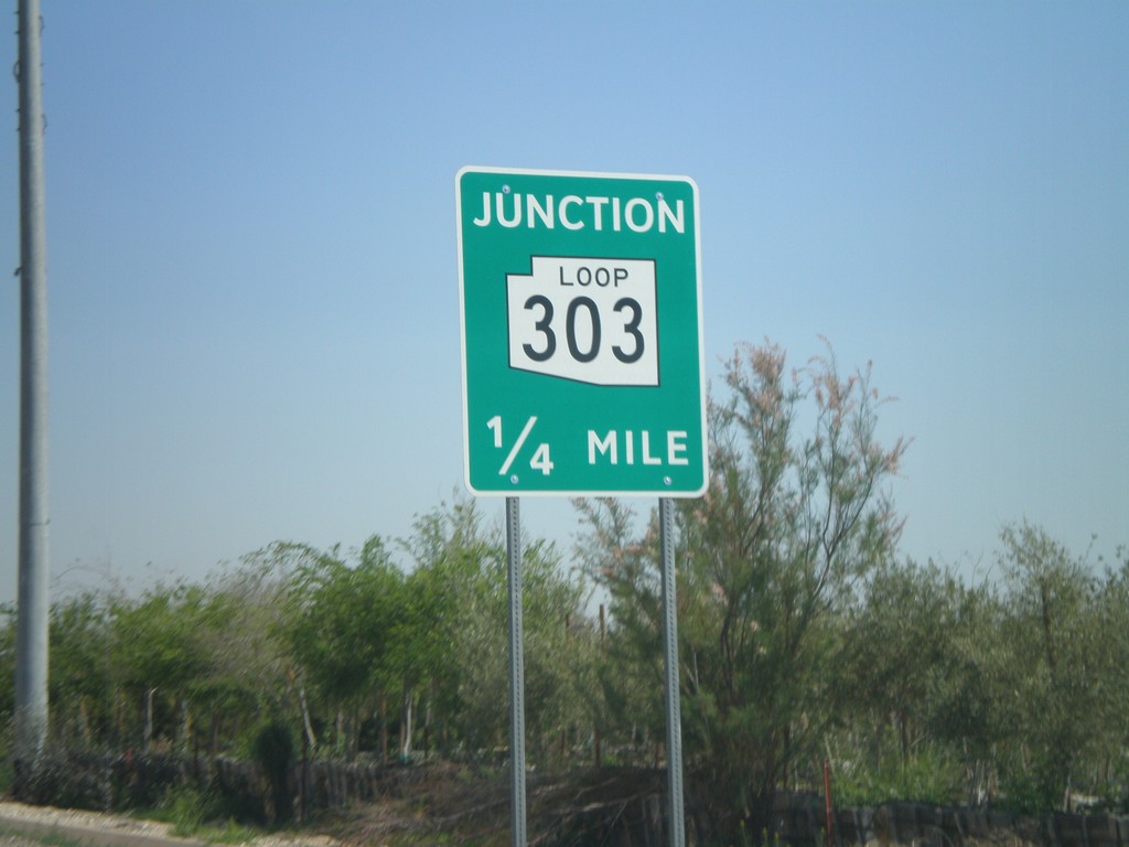
Olive Ave. Approaching AZ-303 Loop
Olive Ave. east approaching AZ-303 Loop.
Taken 03-22-2010
 Waddell
Maricopa County
Arizona
United States
Waddell
Maricopa County
Arizona
United States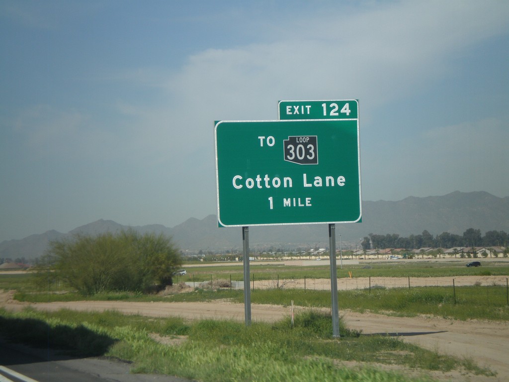
I-10 West Approaching Exit 124
I-10 west approaching Exit 124 - To AZ-303 Loop/Cotton Lane. The AZ-303 Loop shield is black here. All of the Arizona Loop shields had different colors, but they have since been standardized to just black and white.
Taken 03-22-2010
Goodyear
Maricopa County
Arizona
United States