Signs Tagged With Shield Inside Sign
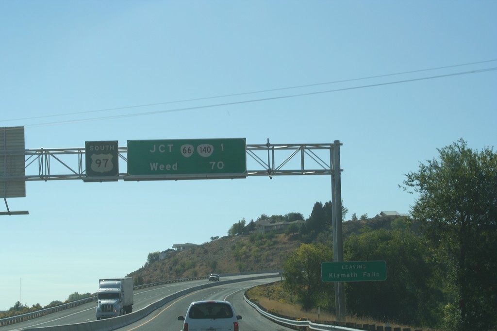
US-97 South Overhead
Distance marker on US-97 south for Weed, and OR-66/OR-140 junction. Leaving the city of Klamath Falls.
Taken 09-25-2010


 Klamath Falls
Klamath County
Oregon
United States
Klamath Falls
Klamath County
Oregon
United States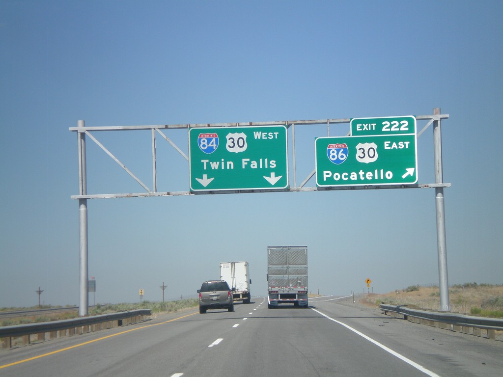
I-84 West - Exit 222
I-84 west at Exit 222 - I-86/US-30 East/Pocatello. This is the western end of I-86 (western segment). I-84 west joins US-30 here.
Taken 08-02-2010


 Cotterel
Cassia County
Idaho
United States
Cotterel
Cassia County
Idaho
United States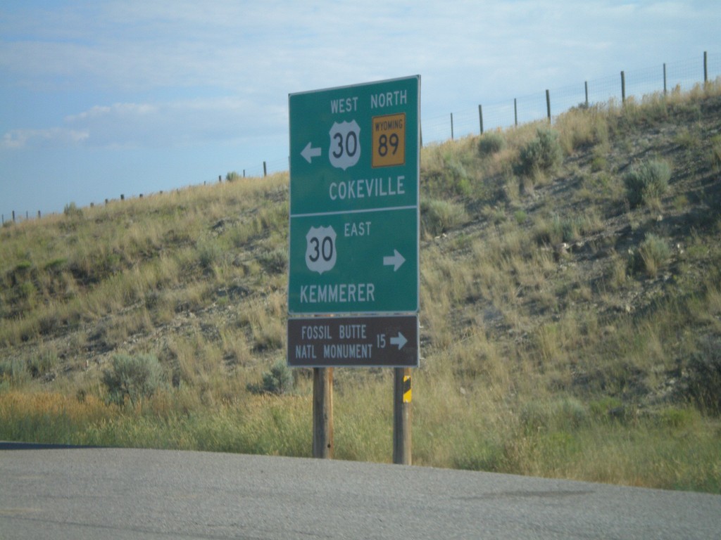
WY-89 North at US-30
WY-89 north at US-30. Use US-30 east for Kemmerer and Fossil Butte National Monument. Use US-30 West/WY-89 North for Cokeville.
Taken 08-02-2010
 Kemmerer
Lincoln County
Wyoming
United States
Kemmerer
Lincoln County
Wyoming
United States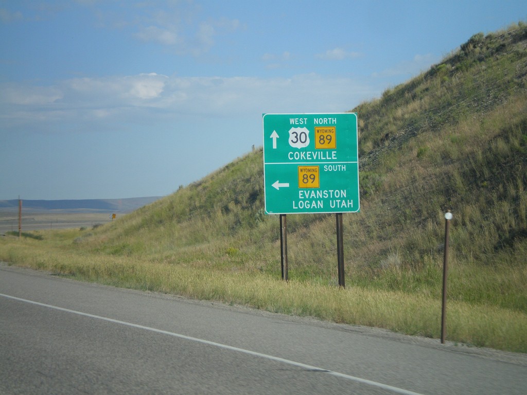
US-30 West at WY-89
US-30 west at WY-89. Use WY-89 south for Evanston and Logan, Utah. Use US-30 east/WY-89 north for Cokeville.
Taken 08-02-2010
Kemmerer
Lincoln County
Wyoming
United States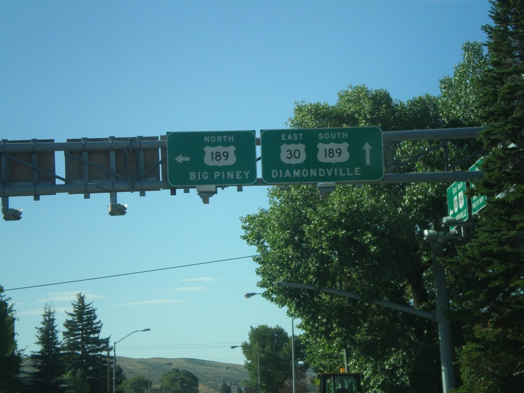
US-30 East at US-189
US-30 east at US-189 north. Use US-189 north for Big Piney. US-189 joins US-30 through Kemmerer towards Diamondville.
Taken 08-02-2010
 Kemmerer
Lincoln County
Wyoming
United States
Kemmerer
Lincoln County
Wyoming
United States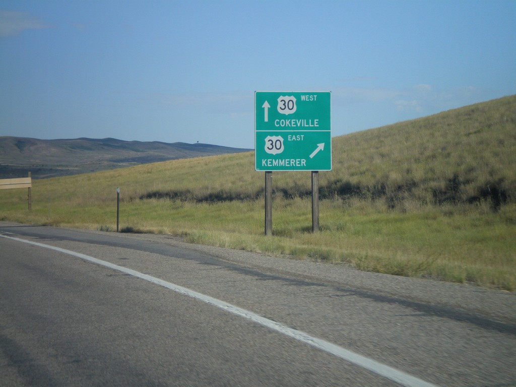
End US-30 By-Pass West at US-30
End US-30 By-Pass west at US-30. Use US-30 west for Kemmerer. Use US-30 east for Cokeville. US-30 By-Pass loops around the south side of Kemmerer and Diamondville.
Taken 08-02-2010
 Kemmerer
Lincoln County
Wyoming
United States
Kemmerer
Lincoln County
Wyoming
United States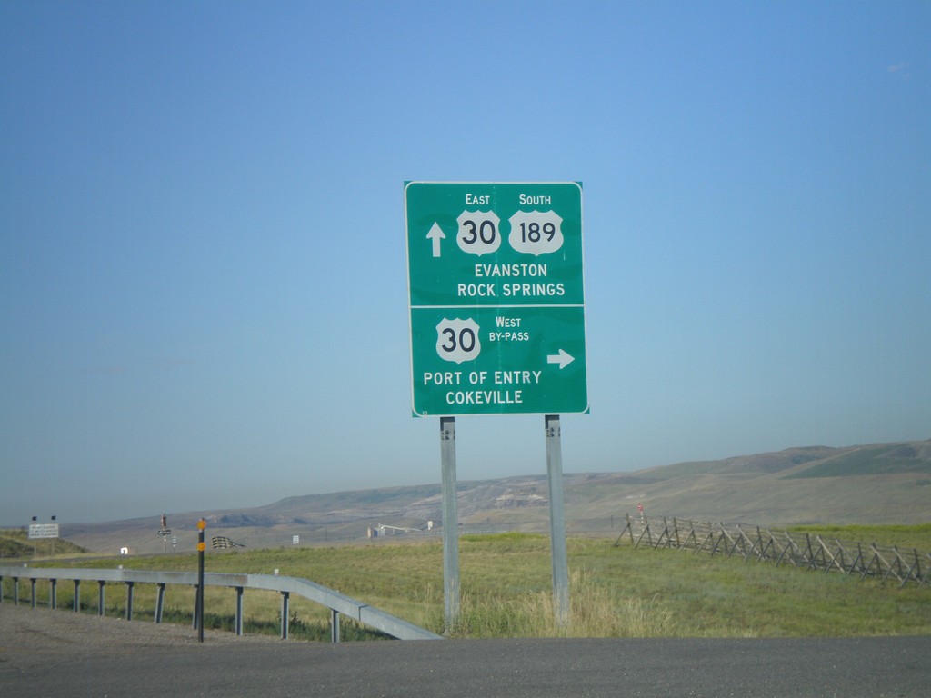
US-30 East/US-189 South at Split
US-30 East/US-189 South at US-30 By-Pass and US-30 ramps. Use US-189 South/US-30 East for Evanston. Turn right for the US-30 By-Pass West onramp for Port of Entry and Cokeville.
Taken 08-02-2010
Kemmerer
Lincoln County
Wyoming
United States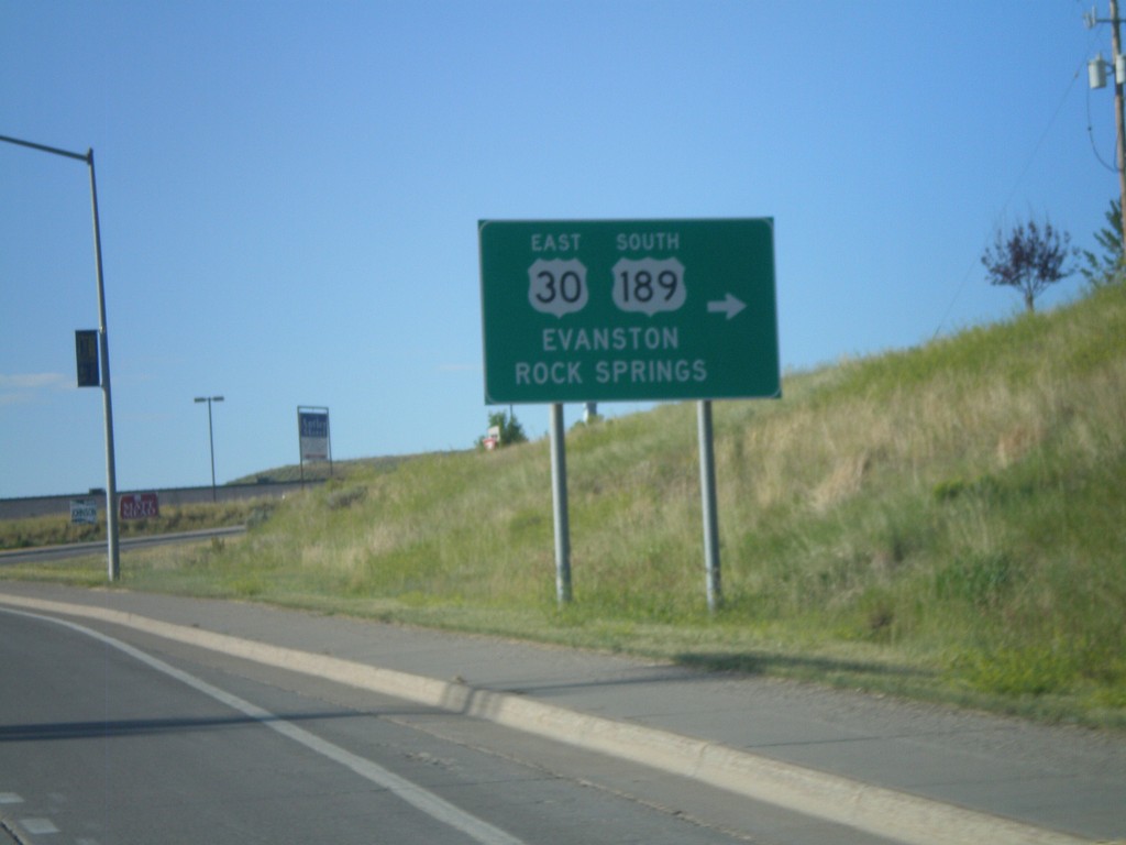
US-30 East/US-189 South - Diamondville
US-30 East/US-189 south in Diamondville. Turn right to continue on US-30 East/US-189 South. Use US-30 East/US-189 south for Evanston and Rock Springs.
Taken 08-02-2010
Kemmerer
Lincoln County
Wyoming
United States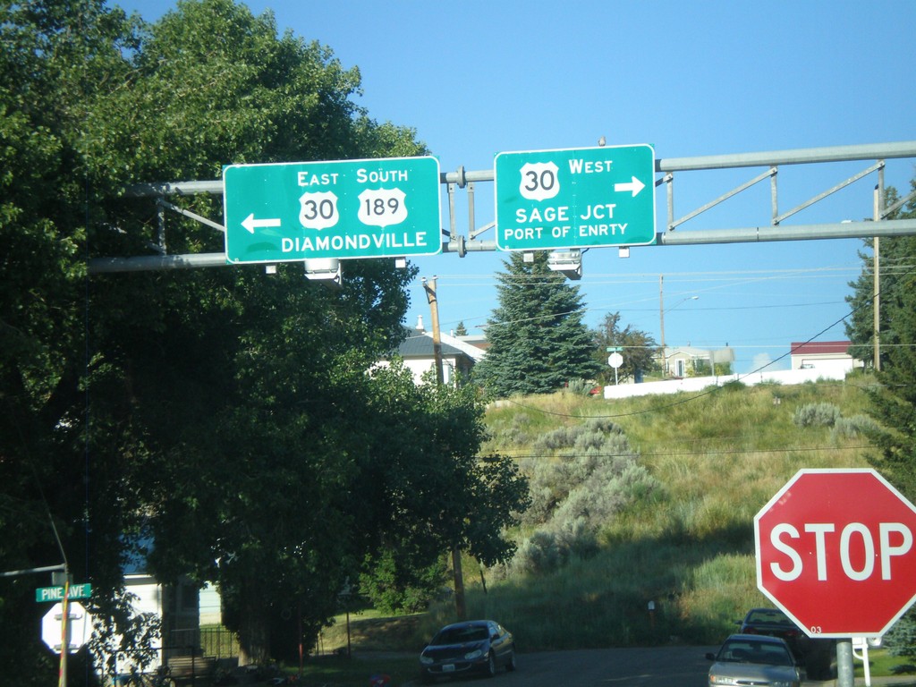
US-189 South at US-30
US-189 south at US-30. Use US-30 west for Sage Jct. and Port of Entry. Use US-30 East/US-189 South for Diamondville. US-189 joins US-30 east through the Kemmerer/Diamondville area.
Taken 08-02-2010
Kemmerer
Lincoln County
Wyoming
United States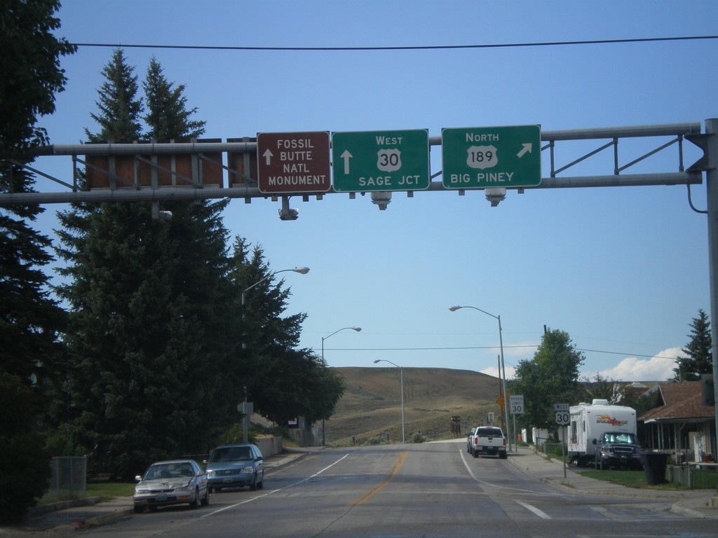
US-30 West at US-189 North
US-30 west at US-189 north. Use US-189 north for Big Piney. Continue west on US-30 for Sage Jct. and Fossil Butte National Monument.
Taken 08-01-2010
Kemmerer
Lincoln County
Wyoming
United States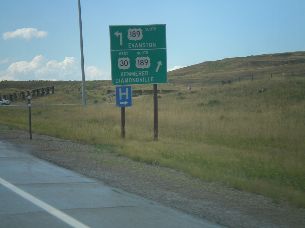
US-30 West at US-189
US-30 west at US-189. Use US-189 south for Evanston. Use US-189 North/US-30 West for Diamondville and Kemmerer. US-30 exits the freeway here, while US-30 Bypass continues west around the south side of Kemmerer.
Taken 08-01-2010
Kemmerer
Lincoln County
Wyoming
United States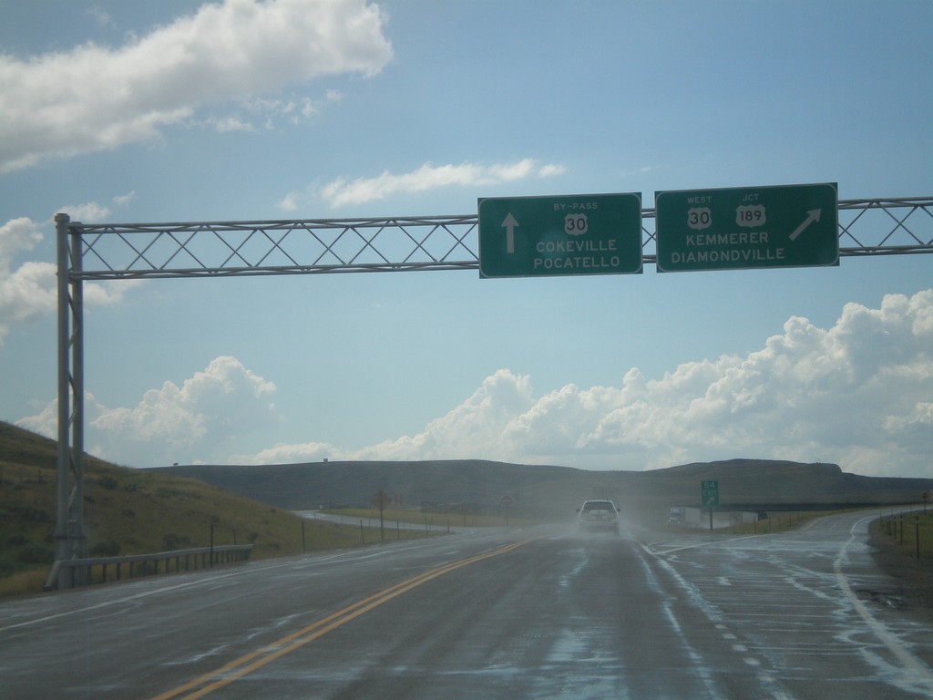
US-30 West Approaching US-189 and US-30 By-Pass
US-30 west approaching US-189 and US-30 By-Pass. Continue ahead for US-30 By-Pass towards Cokeville, and Pocatello (Idaho). Exit for US-30 West/US-189 for Kemmerer and Diamondville.
Taken 08-01-2010
Kemmerer
Lincoln County
Wyoming
United States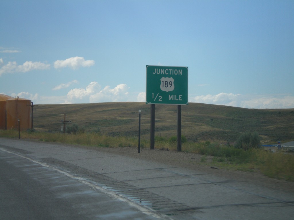
US-30 West Approaching US-189
US-30 west approaching US-189.
Taken 08-01-2010
Kemmerer
Lincoln County
Wyoming
United States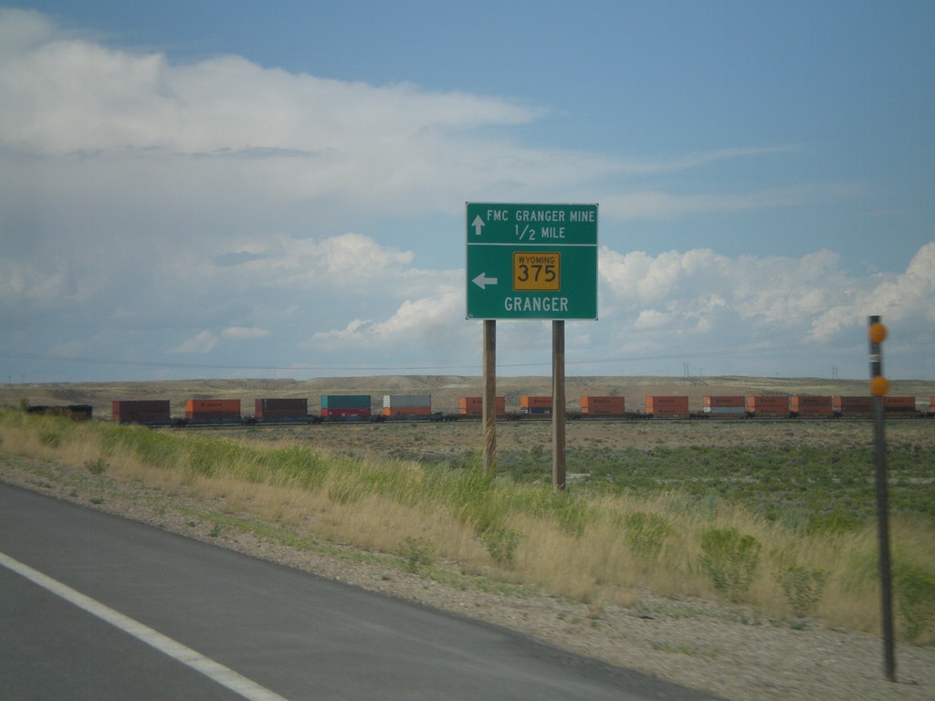
US-30 West Approaching WY-235
US-30 west approaching WY-235. Use WY-235 west for Granger. Continue west on US-30 for FMC Granger Mine.
Taken 08-01-2010
 Granger
Sweetwater County
Wyoming
United States
Granger
Sweetwater County
Wyoming
United States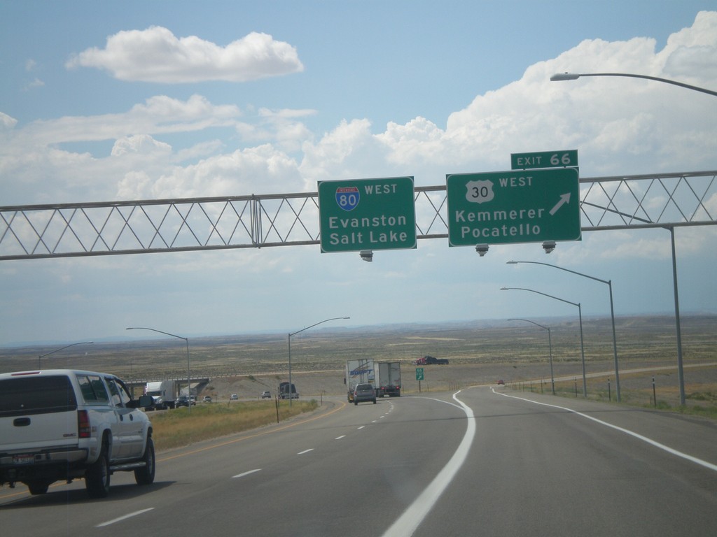
I-80 West - Exit 66
I-80 west at Exit 66 - US-30 West/Kemmerer/Pocatello. US-30 leaves I-80 here and turns towards the northwest.
Taken 08-01-2010
 Little America
Sweetwater County
Wyoming
United States
Little America
Sweetwater County
Wyoming
United States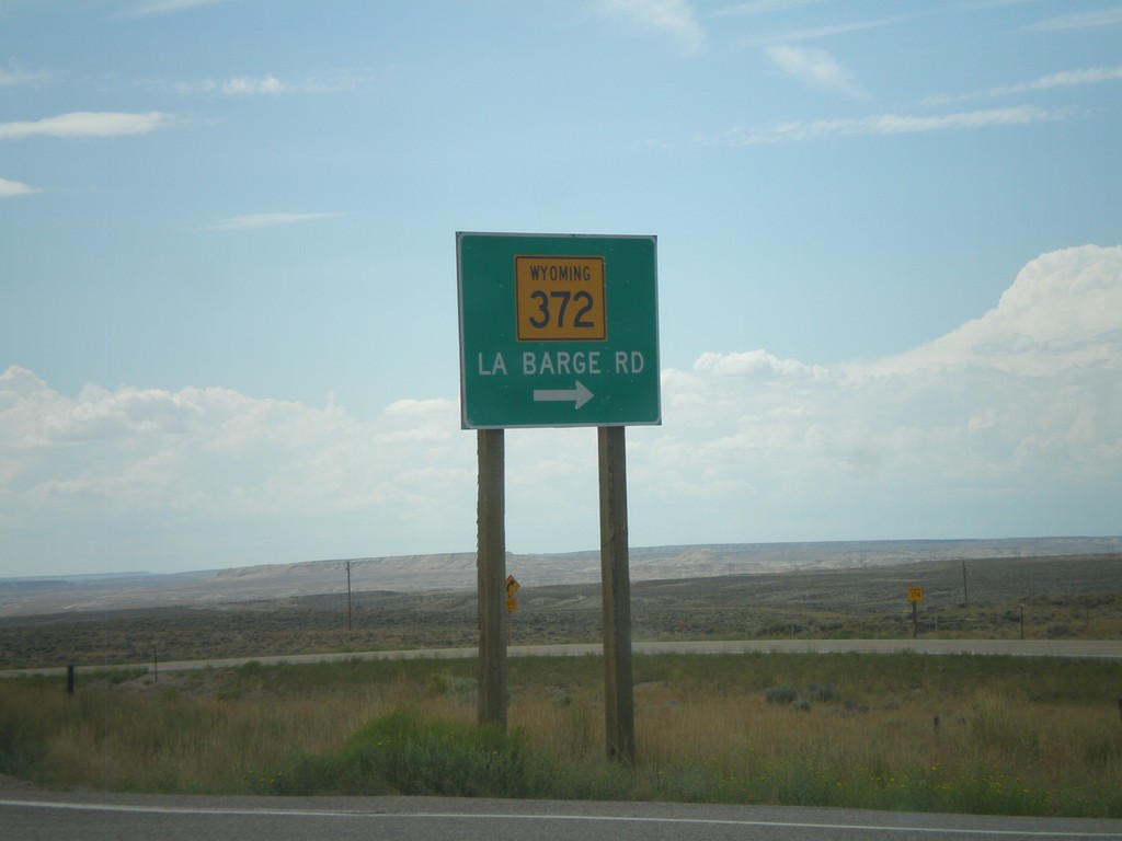
I-80 West Offramp at WY-372
I-80 west Exit 83 offramp at WY-372/La Barge Road.
Taken 08-01-2010
 James Town
Sweetwater County
Wyoming
United States
James Town
Sweetwater County
Wyoming
United States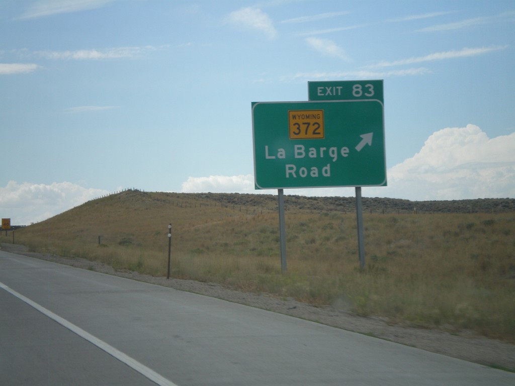
I-80 West - Exit 83
I-80 west at Exit 83 - WY-372/La Barge Road.
Taken 08-01-2010
Green River
Sweetwater County
Wyoming
United States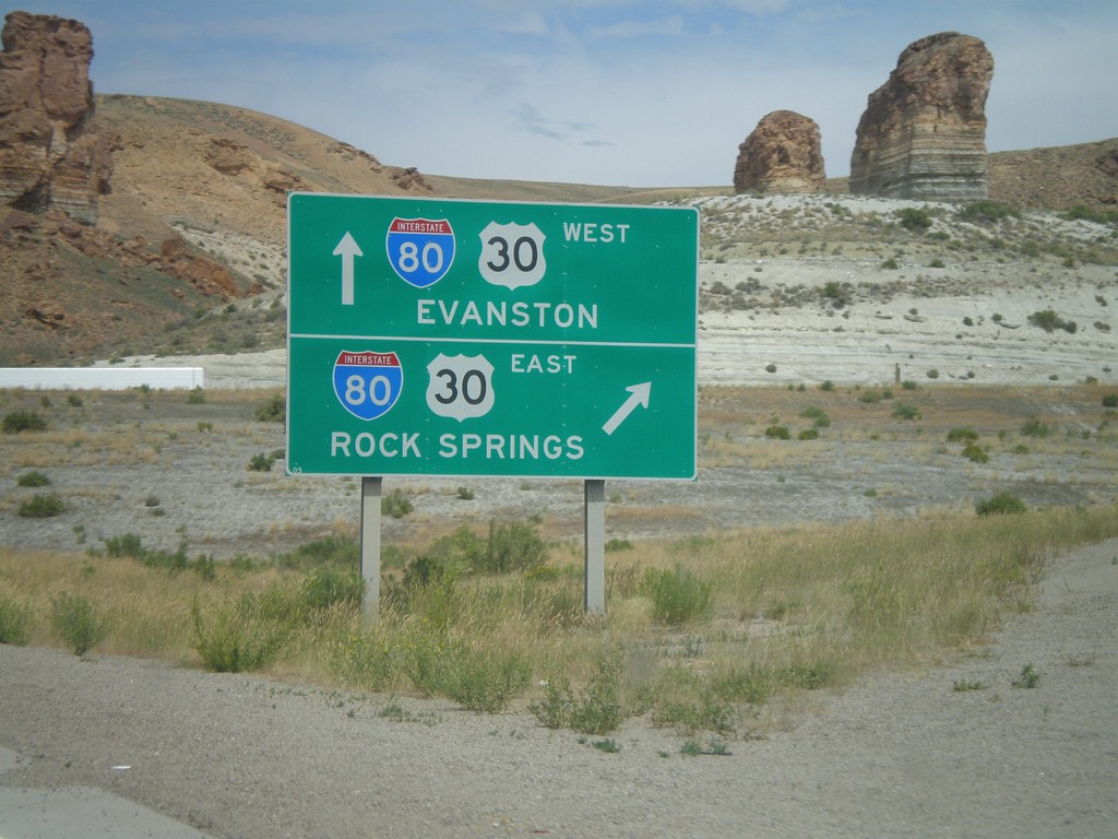
West End of Green River Business Loop
BL-80 West/Bus. US-30 West at I-80 onramps (Exit 89). Use I-80/US-30 West for Evanston. Use I-80/US-30 East for Rock Springs.
Taken 08-01-2010

 Green River
Sweetwater County
Wyoming
United States
Green River
Sweetwater County
Wyoming
United States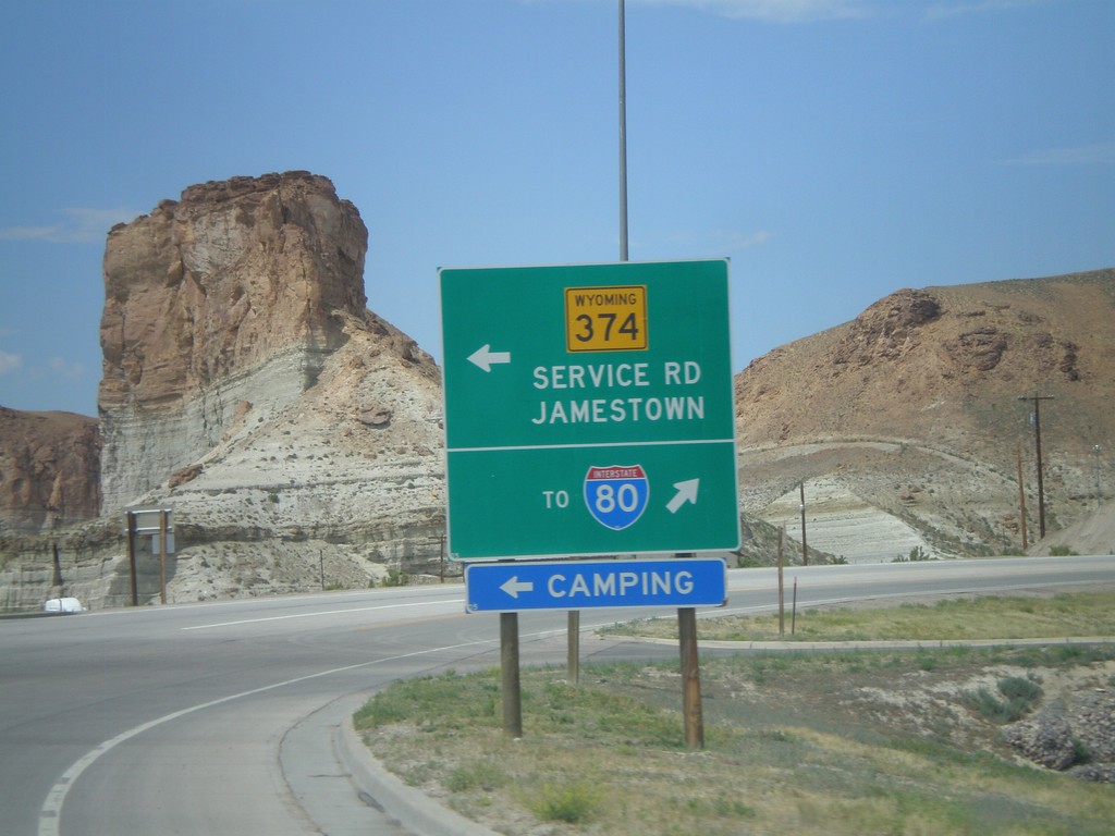
BL-80/Bus. US-30 West at WY-374
BL-80/Bus. US-30 west at WY-374/Service Road to Jamestown. Continue west on Business Loop for I-80.
Taken 08-01-2010
 Green River
Sweetwater County
Wyoming
United States
Green River
Sweetwater County
Wyoming
United States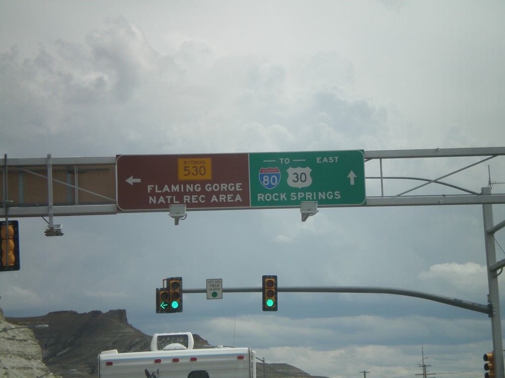
BL-80/Bus. US-30 East at WY-530
BL-80/Bus. US-30 east at WY-530. Use WY-530 south for the Flaming Gorge National Recreation Area. Continue on BL-80/Bus. US-30 east for I-80/US-30 and Rock Springs.
Taken 08-01-2010
 Green River
Sweetwater County
Wyoming
United States
Green River
Sweetwater County
Wyoming
United States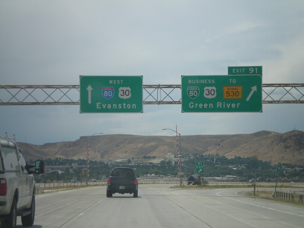
I-80 West - Exit 91
I-80 west at Exit 91 - BL-80/Bus. US-30/To WY-530/Green River. This is the eastern end of the Green River business loop. Continue west on I-80/US-30 for Evanston.
Taken 08-01-2010
Green River
Sweetwater County
Wyoming
United States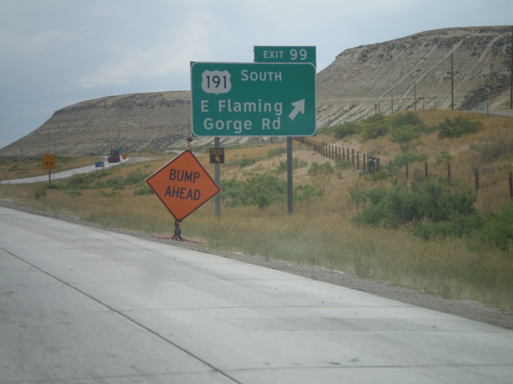
I-80 West - Exit 99
I-80 west at Exit 99 - US-191 South/East Flaming Gorge Road. US-191 south leaves I-80 here and follows the eastern side of Flaming Gorge Reservoir into Utah.
Taken 08-01-2010
 Purple Sage
Sweetwater County
Wyoming
United States
Purple Sage
Sweetwater County
Wyoming
United States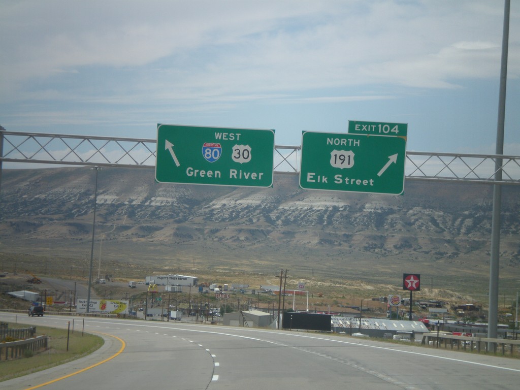
I-80 West - Exit 104
I-80 west at Exit 104 - US-191 North/Elk St. US-191 south joins I-80 to Green River.
Taken 08-01-2010
Rock Springs
Sweetwater County
Wyoming
United States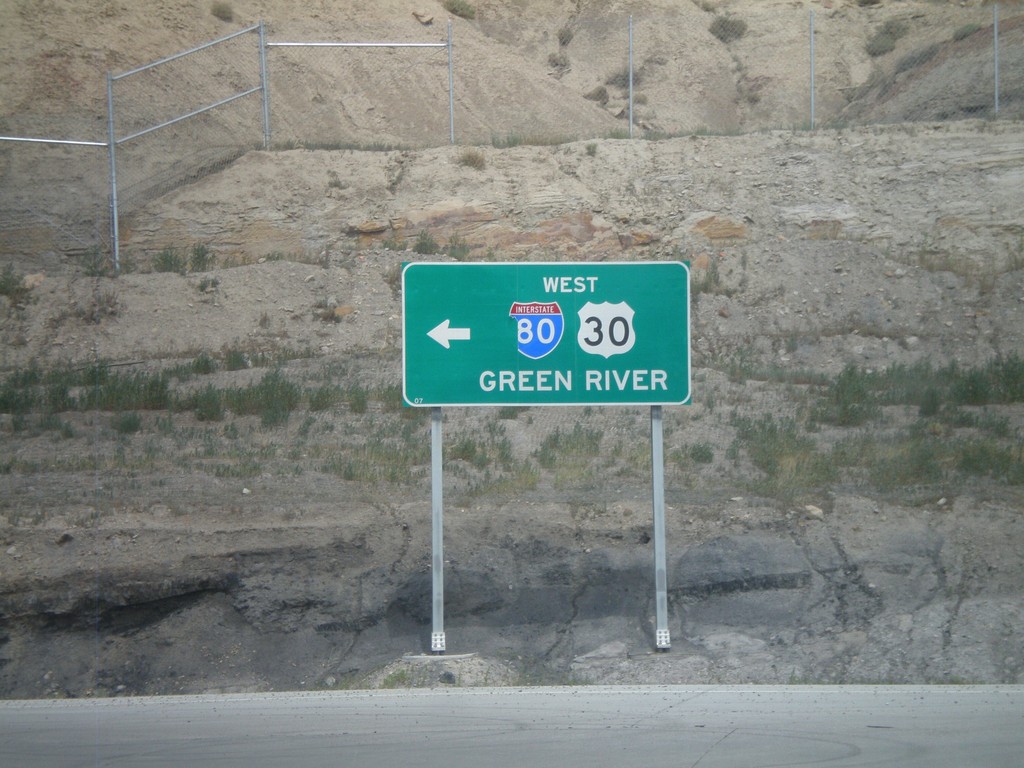
BL-80/Bus. US-30 East at I-80/US-30 West
BL-80/Bus. US-30 East at I-80/US-30 west towards Green River. This is the onramp for Exit 107.
Taken 08-01-2010
Rock Springs
Sweetwater County
Wyoming
United States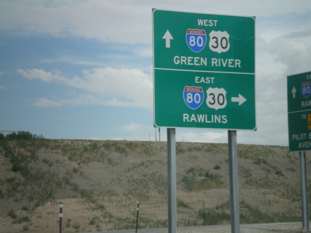
BL-80/Bus. US-30 East at I-80/US-30
BL-80/Bus. US-30 East at I-80/US-30 (Exit 107 onramp). Use I-80/US-30 East for Rawlins. Use I-80/US-30 West for Green River.
Taken 08-01-2010
Rock Springs
Sweetwater County
Wyoming
United States